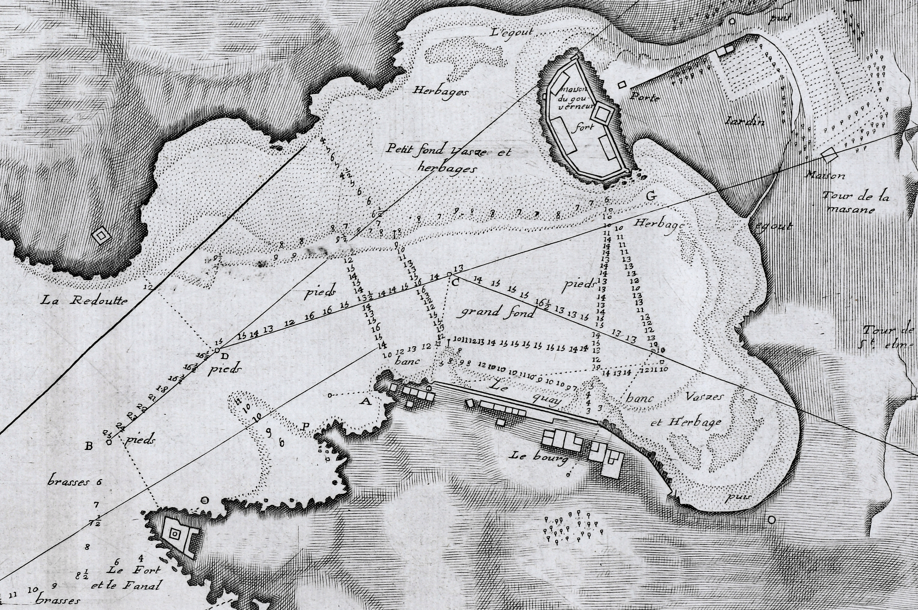
DESCRIPTION: Fine original hydrographic port and harbor chart for Portvendre (Port-Vendres), France by Jacques Ayrouard (Marseilles ca. 1732- 1746). This antique copperplate engraving shows the town of Port-Vendres as it was in 1733 with the adjacent topography in great detail. Noted features include the Devil's Tower- "Tour de Diable", Fort de la Mauresque or "le Fort et le Fanal", "la Redoutte", the "Cote qui va a Cadequie" and "Cote qui va a Colioure., "le bourg", two other towers- "la masane" and "St. Elme", and the "maison du gouvernment". North is oriented to the bottom of the chart.
Ayrouard makes extensive use of depth soundings and variegated stippling for rough depth contour intervals and has laid down sight bearing lines from the above towers to other fixed objects to help mariners navigate the challenging entrance to Port-Vendres.
 View of Port-Vendres, Frances by Ayrouard, 1746. View of Port-Vendres, Frances by Ayrouard, 1746.
Sourced from Ayrouard's scarce sea atlas: "Recueil de Plusiers Plans des Ports et Rades et de Quelque Cartes Particulieres de la Mer Méditerranée." Beautifully engraved by Louis Corne.
Ayrouard was a pilot of the French royal galley, the Reale, based in Marseille, France. The much larger size (18"x11") and extensively shaded topography in this plan are distinctive characteristics of Ayrouard's nautical port plans. Plate 68.
PUBLICATION DATE: 1746
GEOGRAPHIC AREA: France
BODY OF WATER: Mediterranean
CONDITION: Very good.
Bright and clean with no defects. Acceptable margins all around. Slight darkening at center fold.
COLORING: None
ENGRAVER: Louis Corne
SIZE: 18
" x
11 "
ITEM PHYSICAL LOCATION: 8
PRICE: $375
ADD TO CART

|