DESCRIPTION: Early French map of the Valley of Mexico and Mexico City. Shows Mexico City or Tenochtitlán, the island capital of the Aztec state, as it was when encountered by Spanish conquistador Hernán Cortés in 1521. In the copper-plate engraved image Tenochtitlán is located near the southwest end of the "Lac de Mexico" or Lake Texcoco. Tenochtitlán was connected to the Valley of Mexico via several causeways. Includes the larger cities of Pachuca, Tezcuco, Chalco. No mention of Teotihuacan. By French cartographer Nicolas Bellin.
Framed and matted meaures 12" W x 14" H.
Tenochtitlan was largely destroyed by Cortés after a siege in 1521, and modern-day Mexico City now lies over much of its remains.
Published in a French edition of L'Abbe Prevost's "Histoire Générale des Voyages". Tome 12, No. 10.
Jacques-Nicolas Bellin (1703-1772)
Jacques-Nicolas Bellin was a prominent French hydrographer and geographer, recognized for his significant contributions to the development of cartography. For over half a century, Bellin served as the first Ingénieur de la Marine of the Depot des cartes et plans de la Marine (the French Hydrographic Office) and was appointed Official Hydrographer to the French King. His expertise and precision led to the production of thousands of significant nautical charts and maps, enhancing maritime navigation.
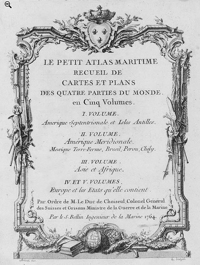
 Petit Atlas Maritime Title Page, 1764 Petit Atlas Maritime Title Page, 1764
One of Bellin's most notable works, "Le Petit Atlas Maritime," was published in 1764, encompassing five volumes of detailed charts and maps covering every part of the world. Bellin's cartographic legacy extends beyond France; his comprehensive maps and atlases were highly influential in shaping European understanding of global geography during the 18th century. His passion for accuracy and vast output have ensured his place in the annals of cartographic history.
PUBLICATION DATE: 1754
GEOGRAPHIC AREA: Mexico
BODY OF WATER: Lake Texcoco
CONDITION: Good.
Appears clean at sight with appropriate age-toning. Not examined out of frame but other similarly-framed maps in the same auction lot were not laid down and they were on laid paper. Frame with a few trivial abrasions.
COLORING: None
ENGRAVER:
SIZE: 6
" x
8 "
ITEM PHYSICAL LOCATION:
PRICE: $300
ADD TO CART

|