DESCRIPTION: Fine mid eighteenth-century birds-eye view map (plan) of Goa and the Port of Goa, on the southwest coast of India, under Portuguese rule from 1510 to 1961. If you look carefully on the beach you can see two elephants, apparently used for heavy work at the docks and shipyard. A fine legend at right, in an elaborate title cartouche, names twenty-nine locations on the plan.
A fine view of Goa as it existed in 1607 by the prolific desk-cartographer J.N. Bellin. The plan is from the 1607 voyage of Admiral Paulus van Caerden, with the Dutch East India Company (VOC). From Prevost's 'Collection of Voyages'.
North is oriented to the bottom. Tome VIII No IX.
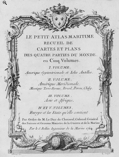
French hydrographer Jacques Nicolas Bellin (1703-1772) was born in Paris and educated as an engineer. In 1741, Bellin became the first Ingénieur de la Marine of the Depot des cartes et plans de la Marine (the French Hydrographical Office) and was named Official Hydrographer of the French King. Bellin's largest and most comprehensive work is the "Petit Atlas Maritime Recueil De Cartes et Plans Des Quatre Parties Du Monde Petit Atlas Maritime".
Jacques-Nicolas Bellin (1703-1772)
Jacques-Nicolas Bellin was a prominent French hydrographer and geographer, recognized for his significant contributions to the development of cartography. For over half a century, Bellin served as the first Ingénieur de la Marine of the Depot des cartes et plans de la Marine (the French Hydrographic Office) and was appointed Official Hydrographer to the French King. His expertise and precision led to the production of thousands of significant nautical charts and maps, enhancing maritime navigation.
 Petit Atlas Maritime Title Page, 1764 Petit Atlas Maritime Title Page, 1764
One of Bellin's most notable works, "Le Petit Atlas Maritime," was published in 1764, encompassing five volumes of detailed charts and maps covering every part of the world. Bellin's cartographic legacy extends beyond France; his comprehensive maps and atlases were highly influential in shaping European understanding of global geography during the 18th century. His passion for accuracy and vast output have ensured his place in the annals of cartographic history.
PUBLICATION DATE: 1750
GEOGRAPHIC AREA: India
BODY OF WATER:
CONDITION: Good.
On strong laid paper with very light age-toning. Wide margins.
COLORING: None
ENGRAVER:
SIZE: 14
" x
8 "
ITEM PHYSICAL LOCATION: 13
PRICE: $325
ADD TO CART

|