DESCRIPTION: SOLD
Very large antique French sea chart published by France's Depot de la Marine to serve whaling interests near Iceland ("pour servir a la peche de la balaine"). After the work of Horrebows and of Knopf. Contains all of Iceland and portions of the Greenland coast, the Faroe Islands, and Jan Mayen Island. A long stretch of the Greenland coast is noted as speculative: "Toute cette coste n'est tracee que sur des conjectures".
At left an inset correction of a part of Iceland's west coast south of Cap Nord (near today's Hornstrandir Nature Reserve) based on the exploration of Kerguelen in 1707. Inset to right contains coastal details of the east coast of Iceland based on Dutch charts. With a very decorative title cartouche and the circular anchor logo of France's Depot de la Marine. Dated 1767 within but printed ca. 1789 - 1799, based of the "R.F." ( République française ) within the logo.
This scarce and highly decorative chart is annotated with information about re-supply points that could have been useful to whalers and other mariners:
- "Ville et port a viande."
- "Ville et port a poisson."
- "Ville et port a viande y a aussi boucherie."
- "Ville et port ou l'on charge du poisson et de la graisse de poisson."
Contains a diagram noting the high magnetic variation experienced in the area (32 degrees west). Interesting detail is the knitted fisherman's cap directly below the North direction arrow.
Jacques-Nicolas Bellin (1703-1772)
Jacques-Nicolas Bellin was a prominent French hydrographer and geographer, recognized for his significant contributions to the development of cartography. For over half a century, Bellin served as the first Ingénieur de la Marine of the Depot des cartes et plans de la Marine (the French Hydrographic Office) and was appointed Official Hydrographer to the French King. His expertise and precision led to the production of thousands of significant nautical charts and maps, enhancing maritime navigation.
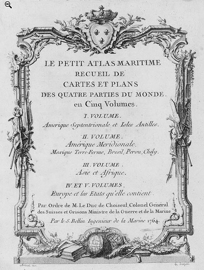
 Petit Atlas Maritime Title Page, 1764 Petit Atlas Maritime Title Page, 1764
One of Bellin's most notable works, "Le Petit Atlas Maritime," was published in 1764, encompassing five volumes of detailed charts and maps covering every part of the world. Bellin's cartographic legacy extends beyond France; his comprehensive maps and atlases were highly influential in shaping European understanding of global geography during the 18th century. His passion for accuracy and vast output have ensured his place in the annals of cartographic history.
PUBLICATION DATE: 1767
GEOGRAPHIC AREA: Iceland
BODY OF WATER: Norwegian Sea
CONDITION: Very Good.
Clean. On heavy paper. Small archivally repaired tears at the centerfold margins as often occur.
COLORING: Beautiful outline and wash hand coloring.
ENGRAVER:
SIZE: 33
" x
22 "
ITEM PHYSICAL LOCATION: 0
PRICE: $
ADD TO CART

|