DESCRIPTION: A very interesting plan of the walled city of Cartagena, Colombia in South America with North oriented to the bottom left. Cartagena was an important hub of the Spanish empire in South America. The plan includes a key at top that identifies the important public buildings, numerous churches, powder magazine, prison and fortifications. Unlike other maps and plans of the period this map provides little detail of the hydrographic nature of the surrounding bay.
Cartagena, a major port, was founded in 1533, and named after Cartagena, Spain, which in turn was named after Carthage in Tunisia. Settlement in the region around Cartagena Bay by various indigenous peoples dates back to 4000 BC. During the Spanish colonial period Cartagena served a key role in administration and expansion of the Spanish empire.
From J.N. Bellin's "Le Petit Atlas Maritime: Recueil de Cartes et de Plans des Quatre Parties du Monde" (Small maritime atlas: collection of maps and charts of the four parts of the world), in five volumes containing 581 maps in total.
Jacques-Nicolas Bellin (1703-1772)
Jacques-Nicolas Bellin was a prominent French hydrographer and geographer, recognized for his significant contributions to the development of cartography. For over half a century, Bellin served as the first Ingénieur de la Marine of the Depot des cartes et plans de la Marine (the French Hydrographic Office) and was appointed Official Hydrographer to the French King. His expertise and precision led to the production of thousands of significant nautical charts and maps, enhancing maritime navigation.
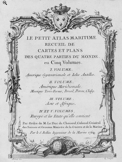
 Petit Atlas Maritime Title Page, 1764 Petit Atlas Maritime Title Page, 1764
One of Bellin's most notable works, "Le Petit Atlas Maritime," was published in 1764, encompassing five volumes of detailed charts and maps covering every part of the world. Bellin's cartographic legacy extends beyond France; his comprehensive maps and atlases were highly influential in shaping European understanding of global geography during the 18th century. His passion for accuracy and vast output have ensured his place in the annals of cartographic history.
PUBLICATION DATE: 1764
GEOGRAPHIC AREA: Colombia
BODY OF WATER: Gulf of Mexico
CONDITION: Good.
Clean and bright with wide margins. On laid paper. Repaired wormhole outside neatline. Compass pointer has been defaced in ink.
COLORING: None
ENGRAVER:
SIZE: 7
" x
9 "
ITEM PHYSICAL LOCATION: 88
PRICE: $250
ADD TO CART

|