DESCRIPTION: SOLD
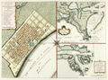
German edition of J.N. Bellin's well-known plan of the city of New Orleans, based on a manuscript document created approximately 15 years after the city was founded along high ground on the east bank of the Mississippi river. This plan from New Orlean's French colonial period, shows the city neatly laid out with streets most residents would recognize today as the French Quarter.
The plan is based on a design initially created by military engineers Adrien de Pauger and Le Blond de la Tour in 1722. That plan envisioned a street grid extending six blocks northward from the Mississippi River, a plan that was likely scaled back in 1729 as a result of the Natchez Indian massacre of settlers at Fort Rosalie near Natchez Mississippi. At that point security became paramount. This plan by Bellin is more similar to an unsigned manuscript plan of New Orleans from 1732, which showed the city extending only 4 blocks north from the river, and partially surrounded by a defensive moat. The new emphasis on security, when the population totaled less than 2000 persons, is reflected in some of the other features found in Bellin's plan: guardhouses, a powder magazine, and a single bridge controlling access across the moat to the city. Those features were absent in Pauger's plan.
This plan was probably published in a German edition of Charlevoix's 'History and General Description of New France' which was originally published in French from Paris during 1744. (Source: Lemmon, Alfred E., John T Magill, and Jason R. Wiese. Charting Louisiana. The Historic New Orleans Collection. 2003).
View this similar, larger map by Isaac Tirion from 1769.
Jacques-Nicolas Bellin (1703-1772)
Jacques-Nicolas Bellin was a prominent French hydrographer and geographer, recognized for his significant contributions to the development of cartography. For over half a century, Bellin served as the first Ingénieur de la Marine of the Depot des cartes et plans de la Marine (the French Hydrographic Office) and was appointed Official Hydrographer to the French King. His expertise and precision led to the production of thousands of significant nautical charts and maps, enhancing maritime navigation.
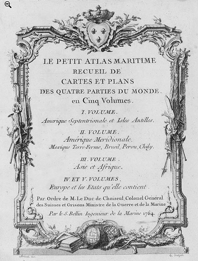 Petit Atlas Maritime Title Page, 1764 Petit Atlas Maritime Title Page, 1764
One of Bellin's most notable works, "Le Petit Atlas Maritime," was published in 1764, encompassing five volumes of detailed charts and maps covering every part of the world. Bellin's cartographic legacy extends beyond France; his comprehensive maps and atlases were highly influential in shaping European understanding of global geography during the 18th century. His passion for accuracy and vast output have ensured his place in the annals of cartographic history.
PUBLICATION DATE: 1744
GEOGRAPHIC AREA: United States
BODY OF WATER: Mississippi River
CONDITION: Very Good
Strong impression. Two vertical folds as issued.
COLORING: None
ENGRAVER:
SIZE: 10
" x
7 "
ITEM PHYSICAL LOCATION: 3
PRICE: $
ADD TO CART

|