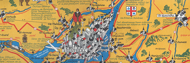
DESCRIPTION: Historical-pictorial map of the Laurentides region of Canada with Montreal by Stanley Francis Turner, 1948. A tourist-oriented map published by Brading Brewery designed to encourage vacationers to visit Montreal and the Laurentides region of Canada.
 Stanley Turner pictorial view of Montreal, Canada. Stanley Turner pictorial view of Montreal, Canada.
Copyright 1948 Bradings Capital Brewery Ltd. Ottawa, Canada. French language.
Stanley Francis Turner
(1883 - 1953 )
Stanley Francis Turner was born in Aylesbury, England, in 1883, and immigrated to Canada where he farmed near Yorkton, Saskatchewan. In 1918 he joined the design and advertising firm of Rous and Mann Press Ltd., and worked under Franklin Carmichael. He received an Eaton scholarship to attend the Ontario College of Art in Toronto.
Turner is known for his etchings of Toronto and Quebec City street scenes, as well as for Japanese-influenced colour woodcuts and for his illustrations in Canadian historical novels and magazines. During WWII Turner was commissioned by The Globe and Mail to prepare illustrated war maps.
PUBLICATION DATE: 1948
GEOGRAPHIC AREA: Canada
BODY OF WATER: St. Lawrence River or Fleuve St-Laurent
CONDITION: Very good.
Bright and clean. Folds as issued with 2 tiny pinholes at a fold.
COLORING: Lithograph.
ENGRAVER:
SIZE: 17
" x
22 "
ITEM PHYSICAL LOCATION: 300
PRICE: $500
ADD TO CART

|