DESCRIPTION: SOLD
Fascinating antique French map records Britain's dominions in the Northeast before the U.S. Revolutionary war. Coverage includes portions of the Canadian provinces of Nunavut, Manitoba, Ontario, and Quebec along with Hudson Bay, the second largest bay in the world after the Bay of Bengal. Noted features include Repulse Bay, James Bay, Labrador, the Isle de Bonne Fortune, Hudson Strait, and Cumberland Bay.
Along the shores of lower James Bay are several forts including Fort Albany, Fort de St. Louis, Fort Rupert. The bay is named after British explorer Henry Hudson who discovered the bay while searching for the Northwest Passage under the auspices of the Virginia Company and the British East India Company. Hudson and a few of his men were set adrift and marooned in Hudson's Bay in June of 1611 by mutineers among the crew of his ship, the Discovery.
This map is from Bellin's Histoire Generale des Voyages.
Jacques-Nicolas Bellin (1703-1772)
Jacques-Nicolas Bellin was a prominent French hydrographer and geographer, recognized for his significant contributions to the development of cartography. For over half a century, Bellin served as the first Ingénieur de la Marine of the Depot des cartes et plans de la Marine (the French Hydrographic Office) and was appointed Official Hydrographer to the French King. His expertise and precision led to the production of thousands of significant nautical charts and maps, enhancing maritime navigation.
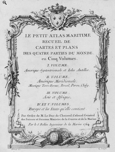 Petit Atlas Maritime Title Page, 1764 Petit Atlas Maritime Title Page, 1764
One of Bellin's most notable works, "Le Petit Atlas Maritime," was published in 1764, encompassing five volumes of detailed charts and maps covering every part of the world. Bellin's cartographic legacy extends beyond France; his comprehensive maps and atlases were highly influential in shaping European understanding of global geography during the 18th century. His passion for accuracy and vast output have ensured his place in the annals of cartographic history.
PUBLICATION DATE: 1757
GEOGRAPHIC AREA: Canada
BODY OF WATER: Hudson's Bay
CONDITION: Good.
Clean with no issues.
COLORING: None
ENGRAVER:
SIZE: 12
" x
9 "
ITEM PHYSICAL LOCATION: 0
PRICE: $
ADD TO CART

|