DESCRIPTION:
 Boston Water Works Map Envelope. Boston Water Works Map Envelope.
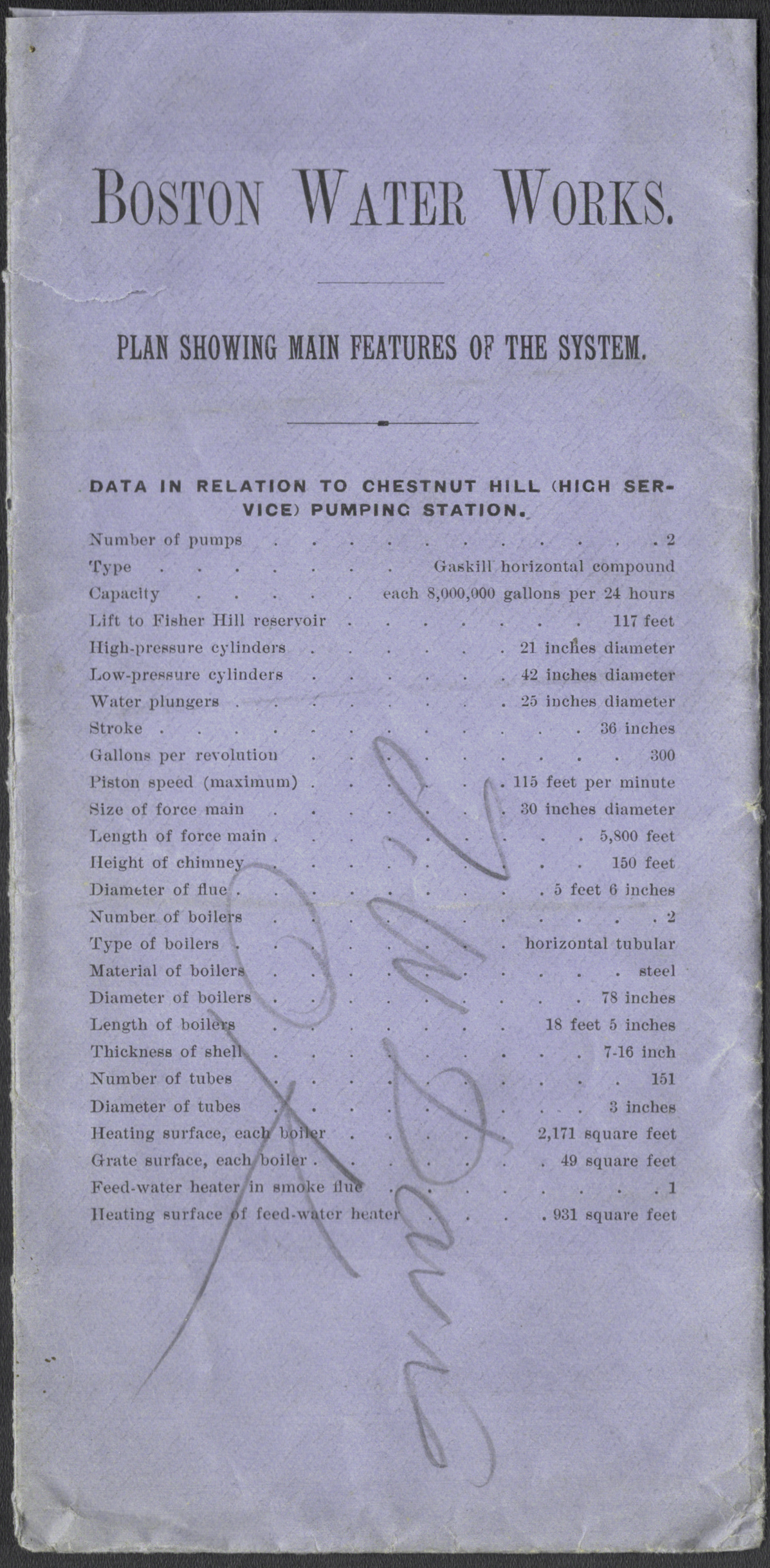
Data in relation to Chestnut Hill High Service Water Station.
The Boston Water Board was established in 1875 as the municipal authority responsible for Boston’s public water supply. It marked a shift to centralized, professional management of construction, operation, and maintenance. The Board reported to city government and was charged with meeting domestic, industrial, and fire protection needs for a rapidly growing population.
Under the Board’s administration, Boston’s water supply expanded into a coordinated regional system drawing from the Cochituate Lake, Sudbury River, and Mystic River watersheds. The Board emphasized quantitative oversight, documenting reservoir capacities, conduit throughput, miles of pipe, and numbers of services and hydrants, reflecting the increasing technical sophistication of late 19th century urban infrastructure management.
By the late 1880s, demand was approaching the limits of city-controlled sources, prompting investigation of more distant supplies. These pressures led to the creation of the Metropolitan Water District in 1895, which absorbed the Board’s functions. The Boston Water Board thus represents the final phase of Boston’s municipally managed water system before regional consolidation.
Map is enclosed in a contemporary envelope titled: Boston Water Works. Plan showing main features of the system. Data in relation to Chestnut Hill High Service Water Station.
PUBLICATION DATE: 1889
GEOGRAPHIC AREA: United States
BODY OF WATER: Charles River
CONDITION: Good
Envelope with small tear upper left. Map strong and clean.
COLORING: Blue
ENGRAVER:
SIZE: 14
" x
10 "
ITEM PHYSICAL LOCATION: 41
PRICE: $375
ADD TO CART

|