DESCRIPTION: An important group of six original pen and ink engineering trace drawings on tracing cloth by the Boston civil engineering firm of Fuller & Whitney, from 1881 and 1882, depicting the development of the Back Bay in 1814, 1836, 1851, 1861, 1871, and 1882. The first five correspond closely to the historical plans published as blueprints in Fuller & Whitney's 1881 A Set of Plans Showing the Back Bay 1814-1881.
The final trace depicts the Back Bay in 1882, rather than 1881 as in the published series, suggesting that the firm's working drawings continued to be revised following publication. Executed on translucent tracing material, the six drawings illustrate successive stages in the engineering and urban development of the Back Bay.
Beginning with the largely undeveloped waterfront of 1814, the sequence traces the construction of the Mill Dam and its associated infrastructure by 1836, the changing configuration of the basin in 1851, and the expanding network of reclaimed land, streets, and building lots depicted in the 1861 and 1871 plans.
The final 1882 plan, titled , presents the developed street grid, Commonwealth Avenue, remaining waterways and marshes, property divisions, and other improvements.
The close correspondence between these traces and the published Fuller & Whitney blueprints strongly suggests that they were working reproduction drawings or masters associated with production and updating of the blueprint series. Together they preserve an unusual record of both the physical creation of Boston's Back Bay and the engineering and cartographic process used by Fuller & Whitney to document its development.
Fuller and Whitney
Back Bay Engineers (1872- 1888)
From 1872 to 1888, Fuller & Whitney Civil Engineers thrived as a partnership between J. Franklin Fuller and William H. Whitney. In 1888, Whitney assumed sole proprietorship, boldly renaming the firm "William H. Whitney" to reflect his visionary leadership.
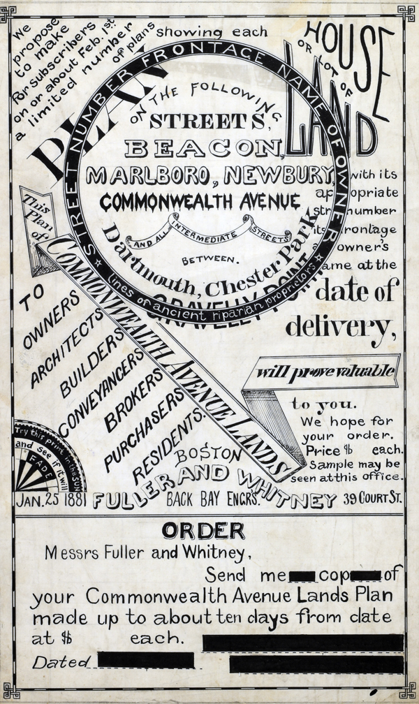 1881 MS Trace Fuller and Whitney Ad and Order Form 1881 MS Trace Fuller and Whitney Ad and Order Form
(not included)
In his autobiography Whitney refers to his work with the latest cutting-edge reprographic technology- blueprinting: “In September 1881 I received a bronze medal at the Massachusetts Charitable Mechanic Association Exhibit for sun or blue prints. I developed a process from the French and used it in illustrating the growth of Back Bay lands. I issued to subscribers monthly schedules and maps showing the changes of ownership, increase in value, improvement by filling and public works.” (The New England Historical and Genealogical Register. Vol 64, January 1910. Number 253. p. lix)
PUBLICATION DATE: 1881
GEOGRAPHIC AREA: United States
BODY OF WATER: Boston Back Bay
CONDITION: Good.
A few small holes. Grubby. Folds in margins.
COLORING:
ENGRAVER:
SIZE:
" x
"
ITEM PHYSICAL LOCATION:
PRICE: $21500
ADD TO CART

|