DESCRIPTION: A very fine and very long (67") folding map of the Columbia River from Portland to the Dalles, Oregon- a straight-line distance of approximately 71 miles as the Google flies. North oriented to the left. Legend at far left end.
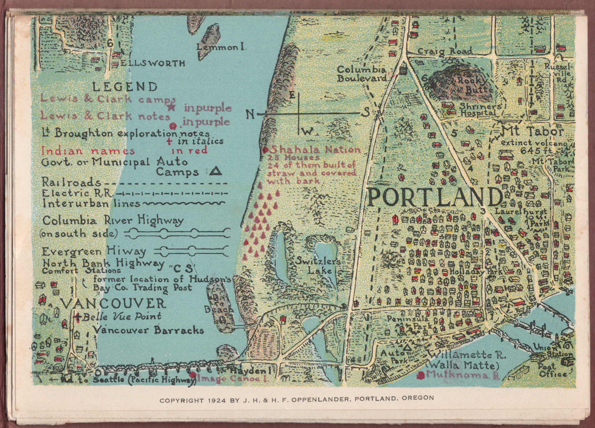
 Portland, Oregon detail. Portland, Oregon detail.
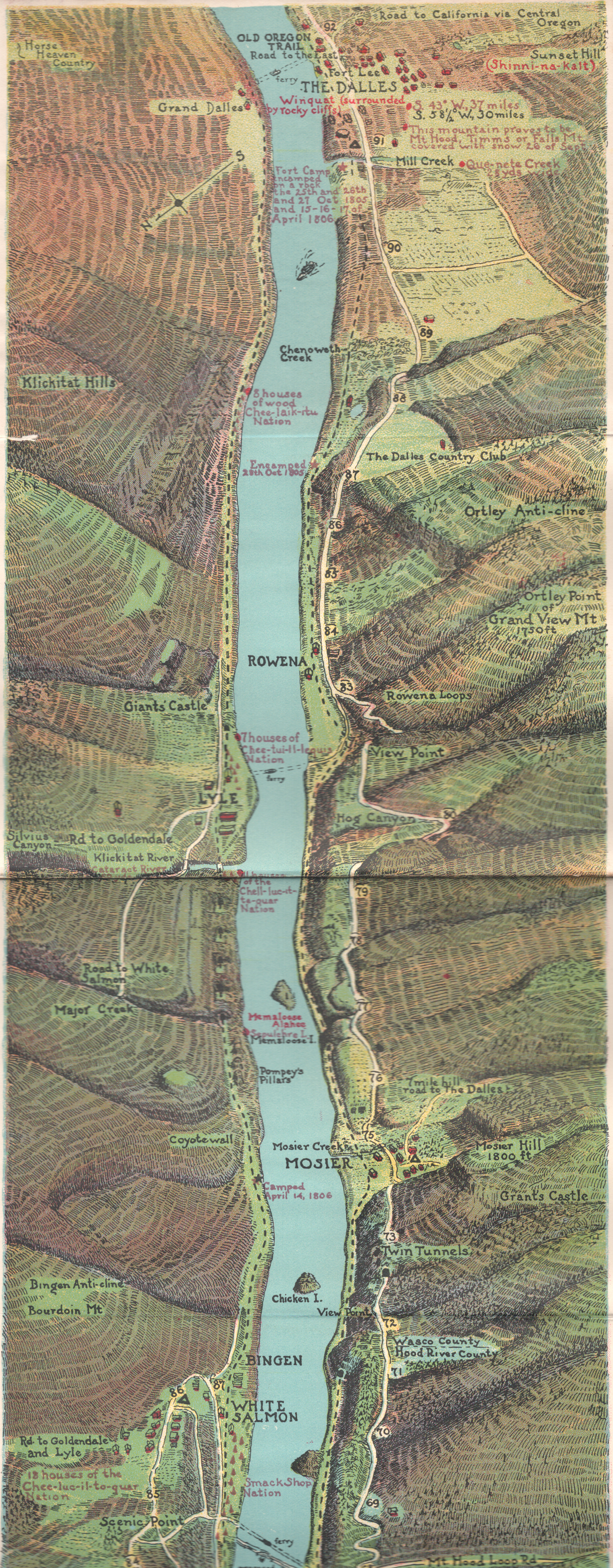
As a collector, beyond all the hachured topography and meticulous colored detail, the map highlights are the numerous Lewis and Clark native-American place names, camps locations, and notes overlaid on the Oppenlanders' 1924 plan of the area.
 The Dalles region detail, 1924. The Dalles region detail, 1924.
The map is carefully folded into a thirty-nine page booklet with text and photographs. From the Penland Guide Series' "The Columbia River Guide and Panorama- from Portland to the Dalles. Myths Legends - History- Geology - Lewis and Clark Notations - Vancouver Expedition Notes". Copyright 1924 by J. H. and H. F. Oppenlander, Portland, Oregon.
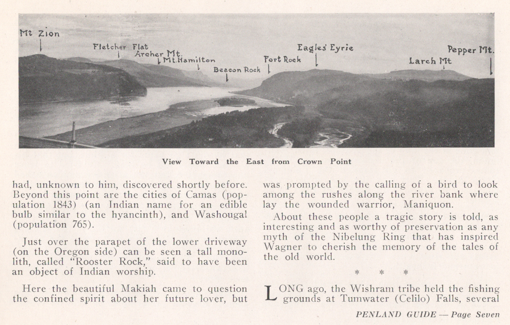
 Looking East from Crown Point. Looking East from Crown Point.
Six institutional holdings are noted in WorldCat (Washington and Oregon) but apparently quite rare on the market.
PUBLICATION DATE: 1924
GEOGRAPHIC AREA: United States
BODY OF WATER: Columbia River
CONDITION: Good.
Pages loose but all present and in good condition. Map contiguous, with the folds having life left in them. Two joined sheets as issued. Manuscript notation on the cover. You will like it!
COLORING: Lithographed color.
ENGRAVER:
SIZE: 6
" x
67 "
ITEM PHYSICAL LOCATION: 400
PRICE: $2000
ADD TO CART

|