| | Thumbnail | | Creator | Date | Title / Author / Date / Location | Price | | | Description |
| 8168 |  | Details | Elliot, Charles D. | 1879 |
| 1879 Wild Harbor Sea Shore Lots - North Falmouth, Cape Cod |
|
Elliot, Charles D. |
|
| 1879 |
| LOC:53 |
| $600.00 | Elliot--Charles-D- | 1879-Wild-Harbor-Sea-Shore-Lots---North-Falmouth--Cape-Cod | An 1879 real estate development plan of Stone & Downers' Sea Shore Lots at Wild Harbor, North Falmouth, Massachusetts. The map presents a proposed seaside subdivision on Buzzards Bay, documenting the promotion of Cape Cod waterfront land for residential development during the late nineteenth century.<br><br>The main plan divides the coastal tract into more than one hundred numbered parcels arranged along curving avenues. Waterfront lots follow the irregular shoreline, while additional lots extend inland around a large undivided central space. Hachures delineate the coastal banks, and beaches, a creek, and the sheltered waters of Wild Harbor establish the property's natural setting. A projecting point at the harbor entrance is encircled by a loop road.<br><br>An inset locates the development in relation to North Falmouth, surrounding roads, ponds, and the railroad, emphasizing access as well as the coastal location. A decorative line border surrounds the sheet. Printed in Boston by the Heliotype Printing Company, whose imprint appears beneath the lower-left border. A detailed record of an early subdivision scheme on the Buzzards Bay shore. The engineering survey was drawn by Charles D. Elliot, Somerville, Massachusetts.<br><br>
The heliotype method of printing is a photographic printing process that was developed in the mid-19th century. The heliotype process involved creating a photographic negative, which was then placed on a specially treated metal or glass plate coated with a light-sensitive emulsion. The plate was exposed to light, and the emulsion hardened in proportion to the amount of light it received. The plate was then washed in a solvent, which removed the unhardened emulsion, leaving behind a durable and detailed plate capable of producing high-quality prints with sharp details and wide tonal variation.<br><br> |
| 5360 | 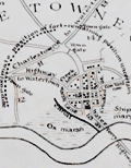 | Details | Elliot, Charles D. | 1880 |
| Rare 1635 [1880] Historical Map of Cambridge, Massachusetts |
|
Elliot, Charles D. |
|
| 1880 |
| LOC: |
| $0.00 | Elliot--Charles-D- | Rare-1635-[1880]-Historical-Map-of-Cambridge--Massachusetts | SOLD<br><br>Very rare original historical map of Cambridge, Massachusetts as it existed in 1635, reconstructed from earlier maps and surveys by Somerville civil engineer and surveyor Charles Darwin Elliot in 1880.
<br></br>
This artifact is the only known original <strong>full-size example</strong> of Elliot's map of Cambridge. In 1901 Elliot's map was reprinted in a reduced format as the frontispiece of the earliest Cambridge town records [1]. All extant copies of the map appear in the reduced size.
<br></br>
Charles D. Elliot (1837-1908) was born in Foxboro, Massachusetts, and studied civil engineering in the offices of W.B. Stearns and Daniel A. Sanborn (mapmaker). During the Civil War Charles D. Elliot served as a topographical engineer in the Army Engineers. Among other assignments during the war, Elliot served in Florida with responsibility for reconnaissance and construction of field fortifications. Elliot's other projects included the Cape Cod Canal and the "Mystic Valley Parkway."
<br></br>
In 1872 Charles D. Elliot became Somerville’s first city engineer. Elliot was also a member of the Somerville Historical Society.
<br></br>
[1] The Records of the Town of Cambridge (Formerly Newtowne) Massachusetts 1630-1703. Cambridge. 1901. Frontispiece. Accessed Online.<br>
<br><br> |