| | Thumbnail | | Creator | Date | Title / Author / Date / Location | Price | | | Description |
| 6759 |  | Details | Clary, A. D. | |
| Pictorial map San Joaquin Power Club Wishon Cove Camp |
|
Clary, A. D. |
|
|
| LOC:89 |
| $250.00 | Clary--A--D- | Pictorial-map-San-Joaquin-Power-Club-Wishon-Cove-Camp | You have heard about "Where's Waldo?" but on this map I ask: "Where's Kilroy?"
<br><br>
An original post-WWII pictorial map of Wishon Cove Camp at Wishon Cove on Bass Lake in Crane Valley, California <b>featuring Kilroy</b> (1). Subtitled "San Joaquin Power Club", apparently this camp was originally a private club for the San Joaquin Power Company. Today the camp is run by the Pacific Service Employees Association.
<br><br>
The map shows hikers, horse-back riders, dancers, hunters, boaters, Boy Scouts, fishermen, and swimmers, all enjoying themselves outdoors on what appears to be some steep slopes. McDougald's store is located next to the shoreline and red-roofed Sam's Place seems to be the local watering hole, surrounded by apartments, dormitories, and numerous outhouses. The camp was named after businessman Arthur Wishon.
<br><br>
Arthur Emory Wishon, often known as A. Emory Wishon, was a pioneering figure in the development of hydroelectric power in California, using Bass Lake water. He served as a chief engineer and later as a vice president for San Joaquin Light and Power Corporation. His work significantly contributed to the construction of multiple dams and power plants in the region.
<br><br> |
| 5163 |  | Details | Mentelle and Chanlaire | |
| Carte de la Caroline Meridionale et Septentrionale et de la Virginie |
|
Mentelle and Chanlaire |
|
|
| LOC:10 |
| $400.00 | Mentelle-and-Chanlaire | Carte-de-la-Caroline-Meridionale-et-Septentrionale-et-de-la-Virginie | Antique engraved map of the Southeast U.S.A. from Mentelle & Chanlaire's "Atlas Universel". Identifies some of the early roads in the Carolinas and Virginia, early western trade routes and settlements. Covers from the Delaware Bay to the Savannah River and inland as far as modern-day Iowa.
<br></br>
This finely engraved original map was published from Paris, France in 1795, shortly after the end of the Revolutionary war. Engraved by Tardieu |
| 5123 |  | Details | Miami Beach Casino | |
| Scarce birds eye view of Miami Beach |
|
Miami Beach Casino |
|
|
| LOC:0 |
| $0.00 | Miami-Beach-Casino | Scarce-birds-eye-view-of-Miami-Beach | SOLD
<br></br>
Two bird's-eye views (airplane views) of Miami Beach on a single folding sheet:
<div class="indenttextblocksingle">
<ul style="list-style-type: circle;">
<li>An airplane view of Miami Beach showing its relation to the adjacent Florida Keys and the mainland. </li>
<li>Miami Beach from an airplane with the Gulf Stream in the distance Belle Isle and Star Island in the foreground.</li>
<ul>
</div>
The views were produced by Meinzinger Studios, Detroit, Michigan. From a promotional booklet by the Miami Beach Casino titled "America's Winter Playground: Mid-winter life at Miami Beach- Miami's ocean front. On the larger view biplanes circle Miami Beach as numerous steamers make their way inbound through the channel.
</br></br>
Advertising copy could not possibly be more favorable to the area. For example:
<div class="indenttextblocksingle">
"Children develop robust physiques and vigorous mentality at Miami Beach because of the ideally equable climate and a constant call to play in the ocean; and cases of illness are almost unknown."
</div> |
| 511 |  | Details | Lochtefeld, John | |
| Tidal River |
|
Lochtefeld, John |
|
|
| LOC:0 |
| $0.00 | Lochtefeld--John | Tidal-River | SOLD<br></br>
Modern 20th/21st century etching in blue ink by Nantucket artist John Lochtefeld. Number 37 of a series of 100 prints.<BR> </BR>
Lochtefeld operates a studio and gallery on the island where he has worked since 1969. Lochtefeld's work is influenced by the architecture, nature and history of Nantucket. Matted. Dimensions with mat are 9"x11". |
| 6467 | 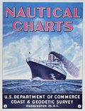 | Details | U.S. Coast and Geodetic Survey | |
| USCGS poster for Nautical Charts |
|
U.S. Coast and Geodetic Survey |
|
|
| LOC:90 |
| $0.00 | U-S--Coast-and-Geodetic-Survey | USCGS-poster-for-Nautical-Charts | SOLD<br><br>Surprisingly scarce poster ca 1970s, originally published in 1959, advertising nautical charts sold by the U.S. Coast and Geodetic Survey in Washington, D. C. A later re-issue published by the National Ocean and Atmospheric Administration (NOAA), National Ocean Service. At one time paper copies of the poster were available by order from the NOAA Distribution Branch but after 2013 products have been only available in PDF print-on-demand delivery.
<br><br>
A map dealer's dream meta-poster!
<br><br>
WorldCat contains only one record of the re-issued poster, at the University of Maryland. No copies of the original 1959 poster are known to me.
<br><br>
Selected dates useful for dating U.S. Coast Survey charts:
<div class="indenttextblocksingle">
<ul style="list-style-type: circle;"></li>
<li>1807 - President Thomas Jefferson establishes Survey of the Coast.</li>
<li>1836 - Survey of the Coast was renamed U.S. Coast Survey. </li>
<li>1878 - U.S. Coast Survey renamed as Coast and Geodetic Survey.</li>
<li>1970 - Coast and Geodetic Survey included within the NOAA and renamed National Geodetic Survey.</li>
<li>2013 - NOAA ends printing of lithographic charts in favor of PDF.</li>
</ul>
</div> |
| 5133 | 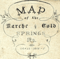 | Details | Anonymous | |
| Manuscript map of the Marche and Cold Springs, Arkansas |
|
Anonymous |
|
|
| LOC:0 |
| $0.00 | Anonymous | Manuscript-map-of-the-Marche-and-Cold-Springs--Arkansas | SOLD
<br></br>
Manuscript map of the Marche and Cold Springs, Arkansas ca. 1890. The map is related to early Polish emigration to the area and was drawn or owned by "Helen Ch." (assumed Helen Choinski). Helen Choinski was the daughter of Timothy Choinski, a Polish nobleman, who founded the community at Warren, Arkansas in 1877. Helen Choinski worked as local Postmistress and telegrapher and in 1894 Helen married M. Schnable who worked for the Cotton Belt Railway. The map shows considerable skill and training in surveying and map making, but there is no indication Helen Choinski possessed such skills.
<br></br>
While in Wisconsin, Count Timothy von Choinski, a nobleman and political refuge from Poland, became concerned with the suffering of many of his fellow Polish immigrants who were residing in the slums of large cities such as New York and Chicago. Choinski wished to improve the working and living condition of these immigrants and began the search for a farming environment that was more familiar to these Poles. After meeting with the land agent for the Little Rock and Fort Smith Railway in March 1877, Choinski purchased 22,000 acres ten miles northwest of Little Rock.
<br></br>
Polish resettlement began in 1877 at Old Warren, Arkansas ten miles north of Little Rock. Later renamed the "Marche" after the French word for market, the community became a magnet for Polish emigres. The settlement of Marche is one of the most successful efforts to resettle immigrants in Arkansas history.
<br></br>
Sources:
https://encyclopediaofarkansas.net/entries/marche-pulaski-county-3295/
</br>
https://honors.uca.edu/wiki/index.php/Marche |
| 6848 | 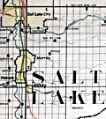 | Details | Utah Railway Chief Engineer | |
| Manuscript engineer's trace |
|
Utah Railway Chief Engineer |
|
|
| LOC:68 |
| $675.00 | Utah-Railway-Chief-Engineer | Manuscript-engineer-s-trace | Singular engineer's presentation trace for the Utah Railway. With this engineer's inked trace map the engineer's office could create numerous blueprint copies for distribution. Produced for the Utah Railway Chief Engineer's office and drawn by Elwood B. Stockman in Feb. 1927. Updated on June 1, 1934. Crisp artwork and lettering. Colors bright.
<br><br>
Shows Salt Lake City with the Salt Lake Base Line at upper left and extends well past Huntington, Utah at bottom right. Shows Park City.
<br><br>
The Utah Railway Company, originally named the Utah Coal Railway, was incorporated on January 24, 1912, and later shortened its name to Utah Railway in May of the same year. The company was founded to transport coal from its mines to Provo, Utah, due to an opening in the competitive landscape caused by dissatisfaction with the existing Denver and Rio Grande Railroad's service and route in the area.
<br><br>
During the 1930s, the Utah Railway faced challenges brought on by the Great Depression, which lowered demand for coal and, consequently, the railroad's business. However, the company managed to maintain its operations and even make some improvements during this difficult period. |
| 4800 |  | Details | Thevet, Andre | 1584 |
| Portrait of the King of Florida Paraousti Satouriona |
|
Thevet, Andre |
|
| 1584 |
| LOC:87 |
| $450.00 | Thevet--Andre | Portrait-of-the-King-of-Florida-Paraousti-Satouriona | Fine antique portrait of Paraousti Satouriona, styled the <b>"King of Florida",</b> and dressed in a thick animal skin, wearing a head-dress made from what is apparently the skull and head of a lynx, with the front legs and claws stylishly knotted about the King's neck.
<BR> </BR>
This scarce engraving comes from "Les vrais pourtraits et vies des hommes illustres grecz, latins et payens" by Andre Thevet. That source contained a collection of over two hundred portraits and biographies of subjects such as Montezuma, Atahualpa, Cortez, Paracoussi "Roy du Platte", and this Paraousti Satouriona the "Roy de La Floride" .
<BR> </BR>
Andre Thevet, born around 1516, became a Franciscan friar and wrote extensively about his travels in both the old world and new, widely embellishing the stories and images with myth and fiction.
<BR> </BR>
French text on verso and recto. Page 661. |
| 512 |  | Details | Ortelius, Abraham | 1598 |
| America sive Novus Orbis |
|
Ortelius, Abraham |
|
| 1598 |
| LOC:0 |
| $0.00 | Ortelius--Abraham | America-sive-Novus-Orbis | SOLD
<br><br/>
Small decorative map of North and South America, from the Philippe Galle edition of the miniature Ortelius atlas, Epitome Theatri Orteliani. Latin text on verso. |
| 5278 | 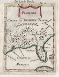 | Details | Mallet, Allain Manesson | 1683 |
| Decorative antique map of the Florida Territory |
|
Mallet, Allain Manesson |
|
| 1683 |
| LOC:11 |
| $250.00 | Mallet--Allain-Manesson | Decorative-antique-map-of-the-Florida-Territory | Unusual and somewhat primitive antique engraved map "Floride" of the eastern Gulf Coast including Florida ca. 1683. From Mallet's "Description de L'Univers". Printed from a copper-plate engraving onto chain-laid paper. Figure 18.
<br></br>
Mallet uses the names of native American Indians as place names. Florida is shown labeled as <b>Tegesta</b>. The Tegesta or Tequesta was a Native American tribe located mainly in southeastern Florida. Explorer, cartographer, and seafarer Bernard Romans used that label on his map of Florida as late as 1794.
<br></br>
Also shown is the area of the SW Florida coast inhabited by the Cossa or Calussa Indians and the area of the Apalachee Indians shown much too far to the north. |
| 3664 |  | Details | van Keulen, Johannes | 1687 |
| Surprising Dutch Chart of the West Indies and Gulf Coast |
|
van Keulen, Johannes |
|
| 1687 |
| LOC:51 |
| $0.00 | van-Keulen--Johannes | Surprising-Dutch-Chart-of-the-West-Indies-and-Gulf-Coast | SOLD
<BR> </BR>
Visually disconcerting and exciting Dutch nautical chart of the Gulf Coast and West Indies. This fine and very collectable sea chart is oriented with north to the right. By Johannes van Keulen. Second state. |
| 880 | 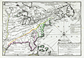 | Details | de Fer, Nicolas | 1702 |
| Nicolas de Fer's Map of Canada and New France |
|
de Fer, Nicolas |
|
| 1702 |
| LOC:0 |
| $0.00 | de-Fer--Nicolas | Nicolas-de-Fer-s-Map-of-Canada-and-New-France | SOLD
<br></br>
First state of two (1702) of Nicolas de Fer's early map of the eastern half of North America ( the second state dates to 1705 ). This antique copper-plate engraved map is characterized by an emphasis on French territories and discoveries. The placement of the <b>Mississippi River</b> is drawn hundreds of miles to the west of its actual geographic location, entering the Gulf of Mexico just above the Rio Grande River ( "Rio Bravo" ). The<b> Louisiana Territory</b> is identified as "la Louisiane" and notably the interior of most of the area west of the Atlantic Coast is labeled "Canada, ou Nouvelle France". The Florida Peninsula is labeled "Presque Isle de Tegeste", a name that dates back at least to 1571 when Velasco referred to the area as "Tequesta" in his "Geografia de las Indias".
<br></br>
Contains detailed locations for native American tribes and villages including the Tunica, Natchez, Iroquois, Algonquin, and Sioux. Numerous French forts that existed in the Mississippi Valley region are identified including Fort du Prudhomme, Fort Sauvage, and Fort de Crevecoer. Cities that de Fer identified include Havana, Cuba; New York, St. Augustine, Port Royal, Jamestown, Quebec, and Boston,
<br></br>
This antique map was produced by the well known French geographer and cartographer, Nicolas de Fer (1646 - 1720) and was published in de Fer's atlas: "L'atlas curieux, ou Le monde réprésenté dans des cartes générales et particulières du ciel et de la terre… et orné par des plans et descriptions des villes capitales et principales ..."
<br></br>
Publication details are found In the lower right corner : <div class="indenttextblock">" A Paris. Chez l'Autheur dans l'Isle du Palais sur le Quay de l'Orloge a la Sphere Royale. Avec Privilege du Roy. 1702. " </div> |
| 6337 |  | Details | Aa, Pieter van der | 1707 |
| Nieuw Engeland in Twee Scheeptogten door Kapitein Johan Smith inde iaren 1614 en 1615 Bestevend |
|
Aa, Pieter van der |
|
| 1707 |
| LOC:78 |
| $1,000.00 | Aa--Pieter-van-der | Nieuw-Engeland-in-Twee-Scheeptogten-door-Kapitein-Johan-Smith-inde-iaren-1614-en-1615-Bestevend | Scarce map of New England, Cape Cod, Nantucket and more after John Smith. "Nieuw Engeland in Twee Scheeptogen door Kapitein Johan Smith inde iaren 1614 en 1615 bestevend". (New England as Described by Captain John Smith in two voyages in 1614 and 1615. By Pieter van der Aa, a Dutch mapmaker and publisher.
<br></br> |
| 2482 | 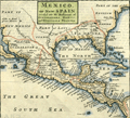 | Details | Moll, Herman | 1709 |
| Mexico, or New Spain With Guadalajara, Guatemala, and Florida |
|
Moll, Herman |
|
| 1709 |
| LOC:3 |
| $500.00 | Moll--Herman | Mexico--or-New-Spain-With-Guadalajara--Guatemala--and-Florida | A map dealer's map!! I love it!
<br></br>
Hermans Moll's classic map of the United States, Caribbean, and Central America. Moll has divided the area into the four provinces of Mexico, Guadalajara Guatemala, and Florida. Pacific Ocean is labeled "The Great South Seas"; the Gulf of Mexico is sub-titled "the Bay of Mexico". Beginning of Chapter VII. Page 214. English text on verso. |
| 1297 | 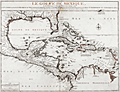 | Details | de Fer, Nicolas | 1717 |
| Scarce antique map of Gulf of Mexico and Caribbean |
|
de Fer, Nicolas |
|
| 1717 |
| LOC:51 |
| $1,950.00 | de-Fer--Nicolas | Scarce-antique-map-of-Gulf-of-Mexico-and-Caribbean | Very interesting and scarce Nicolas de Fer map (1717) of the Gulf Coast of the United States, the Caribbean, Central America, and northern South America. Pleasing appearance with original outline handcoloring. This 300 year-old copper-plate engraved map is full of local place names, historical notes and observations about native American tribes. For example:
<div class="indenttextblock">
<ul style="list-style-type: circle;">
<li>Near the Mississippi River mouth- "Embouchure du Mississippi decouverte in 1685 par M. de la Salle" and a location "Pointe de Mardi Gras".</li>
<li>About the fishing skills of American indians near the Georgia Sea Islands: "Isles de Mosquites Peuples plus adroit por peche de tout l' Amerique".</li>
<li>De Fer locates several native American tribes including "les Natchez", "Village de Apalaches" and "Village de la Mobile". </li>
<li>Locates La Salle's fort ('Fort de Francois') on Matagorda Bay, Texas ('Baye de St. Louis et de St. Bernard').</li>
</ul>
</div>
De Fer's seminal map of the Caribbean "Le Golfe de Mexique..." is a fine adaptation of Guillaume Delisle's 1701 "Carte des environs du Missisipi". The map shows a well-formed Mississippi Delta and Gulf Coast and locates La Salle's fort ('Fort de Francois') on Matagorda Bay, Texas ('Baye de St. Louis et de St. Bernard').
<br></br>
De Fer's "Le Golfe de Mexique" displays Florida correctly as a peninsula rather than as an archipelago, as first depicted by Thomas Nairne in 1711. The 300 year old map is based upon information obtained from the War of Spanish Succession and other contemporary sources. The map is considerably rarer than De L'Isle's contemporary map and more focused on the Caribbean and Gulf Coast regions. |
| 4952 | 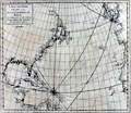 | Details | Cutler and Halley | 1728 |
| Halleys chart Atlantick Ocean on a Globular Projection |
|
Cutler and Halley |
|
| 1728 |
| LOC:65 |
| $1,350.00 | Cutler-and-Halley | Halleys-chart-Atlantick-Ocean-on-a-Globular-Projection | Rare antique chart on a <b>globular projection</b> by scientists <b>Nathaniel Cutler and Edmund Halley</b> (the latter the discoverer of Halley's comet). Shows the western coastline of Europe with a broad expanse of the eastern Atlantic Ocean. Includes North America, East Mexico, the Caribbean Islands (Cuba, Hispaniola, Martinique, Antigua and more), and the East Coast of Europe and of Africa. Greatly exaggerates the length of the Saint John's River in Florida.
<br></br>
From "Atlas Maritimus & Commercialis, or a General View of the World, so Far as Relates to Trade and Navigation …". The sea atlas "Atlas Maritimus" was a collaborative effort of a number of the leading cartographic and scientific names of the era, including English astronomer Sir Edmund Halley, John Senex, Nathaniel Cutler, and Daniel Defoe. The atlas was developed by publishers Senex and Harris to compete with Mount & Page’s English Pilot. Published from London: James and John Knapton et al. |
| 1480 |  | Details | Cutler and Halley | 1728 |
| Halley's Antique Chart with coasts of America Europe and Africa |
|
Cutler and Halley |
|
| 1728 |
| LOC:0 |
| $0.00 | Cutler-and-Halley | Halley-s-Antique-Chart-with-coasts-of-America-Europe-and-Africa | Please view another <a href="https://www.rarecharts.com/ShowDetail/Creator/Cutler-and-Halley/Title/Halleys-chart-Atlantick-Ocean-on-a-Globular-Projection/4952" target="_blank">copper-engraved chart</a> of the Atlantick Ocean by Nathaniel Cutler and Edmund Halley. |
| 4827 |  | Details | Laval, Antoine | 1728 |
| Rare early map of Pensacola for collectors |
|
Laval, Antoine |
|
| 1728 |
| LOC:0 |
| $0.00 | Laval--Antoine | Rare-early-map-of-Pensacola-for-collectors | SOLD
<br></br>
Similar to, but substantially different from Bellin's later chart of Pensacola, Florida. A rare, early (1728) chart of Pensacola Bay and Escambia Bay by Father Antoine Laval. Laval's chart could be considered a foundational map for collectors as it is the first detailed printed chart of the area. The three attributes of the map that differ most between Laval's map of 1728 and Bellin's later 1744 map are:
<div class="indenttextblocksingle">
<ul>
<li>Number of depth soundings. (Laval has many more soundings.)</li>
<li>Number of places named. (Bellin has more names.)</li>
<li>Alignment of Santa Rosa Island. (Laval's chart does not show the curvature that Bellin's later chart proposes.)</li>
</ul>
</div>
This map was included in the report of French astronomer Father Antoine Laval: "Journal d'un voyage de la Louisiane", an account of the 1720 expedition to the Florida and Louisiana coasts led by Valette Laudun. Laval is recorded as mathematician or astronomer on that voyage. The account included astronomical observations taken by Laval from a point on nearby Dauphin Island. (Source: oldmaps.com) From 1718 Laval was a Royal Professor of Hydrography based in the city of Toulon, France.
<br></br>
Boran explains the historical context for viewing Laval’s decision to provide his readers with a map of Pensacola:
<div class="indenttextblocksingle">
"… should be viewed in the light of military and political developments in France during the period 1718-1720. The War of the Quadruple Alliance had broken out in 1718 and Pensacola, was now deemed a strategic target (presumably because of its proximity to their base at Dauphin Island). In May 1719 the Lemoyne brothers ... took the port for the French. The Company of the West … decided to move their headquarters to Pensacola, given its potential as a port." (Boran, Elizabethanne. Travelling to Louisiana in 1720. Online: edwardworthlibrary.ie).</div> |
| 892 |  | Details | Moll, Herman | 1736 |
| Antique Chart of Port Royal Harbor, South Carolina |
|
Moll, Herman |
|
| 1736 |
| LOC:3 |
| $425.00 | Moll--Herman | Antique-Chart-of-Port-Royal-Harbor--South-Carolina | This antique chart of <b>Port Royal Sound</b>, drawn by Herman Moll before 1732, is the earliest obtainable large-scale chart focused on the Port Royal / Beaufort, South Carolina area and one of the earliest to name <b>Hilton Head</b>. With locations identified for two proposed forts guarding the main channel to "Bauford Town" (Beaufort), which was located by Moll on Parris Island ("Port Royal Island"). Other noted features include St. Helena Island, with Phillips Point and St. Michaels Head. Numerous soundings and sandbars are indicated.
<br></br>
Moll added this description of the area below the title block: <div class="indenttextblock">"Port Royal River lies 20 Leagues from Ashley River SW it has a bold entrance 19 or 20 foot at low-water. The Harbor is large, safe, and commodious and runs into ye best country in Carolina. Here ye air is always cleer and agreeable to Europian constitutions".</div>
</br>
This old map of Port Royal, Hilton Head, and Beaufort S.C. is from the 3rd edition of Moll's "Atlas Minor: or a New and Curious Set of Sixty-two Maps", published for Thomas and John Bowles in 1736. |
| 1227 |  | Details | Popple, Henry | 1742 |
| Antique chart of Boston Harbor ca. 1742 |
|
Popple, Henry |
|
| 1742 |
| LOC:0 |
| $0.00 | Popple--Henry | Antique-chart-of-Boston-Harbor-ca--1742 | SOLD
<br></br>
Antique engraved harbor chart of the coastal areas near <b>Boston, Massachusetts</b>. Contains numerous depth soundings, navigation hazards and marked sand banks and sand bars. Popple identifies by name dozens of islands, peninsulas, rivers, and towns.
<br></br>
Key features named on the Popple's map of Boston harbor include:
<div class="indenttextblock">
<ul style="list-style-type: circle;">
<li>A ship channel</li>
<li>Roxbury</li>
<li>Dorchester</li>
<li>Squantum Neck</li>
<li>Hull</li>
<li>Hingham</li>
<li>Charles Town</li>
<li>Hangman's Island</li>
</ul>
</div>
This antique map was originally published by Covens and Mortier in 1742 in "Les Principales Forteresses Ports etc. de L'Amerique Septentrionale" a sheet containing harbor and island maps and plans of the Americas. This map is a fragment trimmed from a large single sheet of 18 maps and plans of islands and harbors was publihed by Covens and Mortier to replace Popple's original large map of 20 sheets with a more manageable six-sheet version. Popple's original map was titled: "A Map of the British Empire in America with the French, Spanish and the Dutch Settlements adjacent thereto". |
| 1226 |  | Details | Popple, Henry | 1742 |
| Antique plan of the Harbor of Charleston South Carolina |
|
Popple, Henry |
|
| 1742 |
| LOC:3 |
| $0.00 | Popple--Henry | Antique-plan-of-the-Harbor-of-Charleston-South-Carolina | SOLD
<br></br>
Scarce antique copper-plate engraved harbor plan of <b>Charleston</b> ( Charles Town ), South Carolina after Herman Moll. This antique map shows the defensive walls and cannon batteries that surrounded Charleston in the early 18th century. Popple identifies by name more than 20 key locations on the map.
<br></br>
Key features named on the map include:
<div class="indenttextblock">
<ul style="list-style-type: circle;">
<li>The Ashley River</li>
<li>Marsh Island</li>
<li>Cooper River</li>
<li>Johnson's Fort</li>
<li>Granville Battery and several other batteries</li>
<li>The Half Moon</li>
<li>Hog Island Creek</li>
<li>Quaker's Meeting Place</li>
</ul>
</div>
Popple's early map Includes named locations of properties and homes of some of the early settlers in the Charleston area including:
<div class="indenttextblock">
<ul style="list-style-type: circle;">
<li>Gilbertson</li>
<li>Underwood</li>
<li>Stobow</li>
<li>Ferguson</li>
<li>Vandros</li>
<li>Garnets</li>
<li>Johnson</li>
</ul>
</div>
This antique map was originally published by Covens and Mortier in 1742 in "Les Principales Forteresses Ports etc. de L'Amerique Septentrionale" a sheet containing harbor and island maps and plans of the Americas. This map is a fragment trimmed from the larger sheet.
<br></br>
That sheet of 18 maps and plans of islands and harbors was publihed by Covens and Mortier to replace Popple's original large map of 20 sheets with a more manageable six-sheet version. Popple's original map was titled: "A Map of the British Empire in America with the French, Spanish and the Dutch Settlements adjacent thereto". |
| 584 |  | Details | Homann Heirs | 1743 |
| Americae Mappa Generalis |
|
Homann Heirs |
|
| 1743 |
| LOC:52 |
| $500.00 | Homann-Heirs | Americae-Mappa-Generalis | Extremely decorative mid 18th-century antique map of North and South America by Homann.
<br></br>
Geographic coverage on this fine old relic includes Western Europe, West Africa, and large portions of both the Atlantic and Pacific Oceans. The territory in the U.S. Pacific Northwest was largely unexplored when the map was created and the area is shown as blank. At the time this map was printed knowledge of U.S. west coast geography had improved past the point in time when California was thought to be an island.
<br></br>
A highly decorative title cartouche at bottom left of this antique map features four native Americans and two erupting volcanos along with a large vessel containing coins.
<br></br>
Published by the firm Homann Heirs. Homann Heirs (also "Homannianis Heredibus" or "Homann Erben" or "Heritiers de Homann") was a company established after the death of German cartographer J.B. Homann to carry on the publishing business of the firm he started in the early 1700's. The designation "Homann Heirs" appears on maps published by that successor firm from about 1730 to 1848. |
| 1057 |  | Details | Bellin, Jacques Nicolas | 1744 |
| Antique chart of the mouth of the Mississippi River |
|
Bellin, Jacques Nicolas |
|
| 1744 |
| LOC:3 |
| $0.00 | Bellin--Jacques-Nicolas | Antique-chart-of-the-mouth-of-the-Mississippi-River | SOLD</br><br>One of the earliest available charts to focus solely on the passes at the mouth of the Mississippi River, then considered by the French to be their overseas possession. The location covered by this chart lies roughly 75 miles southeast of New Orleans, Louisiana which had only been founded in 1718 by the French Mississippi Company, under the leadership of Jean-Baptiste Le Moyne de Bienville.
<br></br>
This is the first and earliest of two small charts by the Depot de la Marine; the later chart appeared in Bellin's 1764 "Le Petit Atlas Maritime". This chart is characterized by numerous descriptions of the hydrography ("recif" or reef; "bancs de vase molle" or soft mudflats; and "le bare") but contains no depth soundings. The southwest pass is particularly interesting for it is labeled "Embouchure par ou les vaisseau entrant" or mouth where vessels enter. Just inside the mouth near two reefs a small ship is depicted aground ("V[aisse]au Echoué"). Further up the channel ("Chenal") is Fort de la Balise (Fr. seamark). At that spot the French constructed a 62 foot high pyramidal wooden tower (the Balise) in 1721.
<br></br>
This chart was undoubtedly based on observations prior to 1740 when the Balise was destroyed by a hurricance. Bellin's later 1764 chart shows no structure at that location, just a mass of debris. |
| 760 |  | Details | Bellin, Jacques Nicolas | 1744 |
| Plan of New Orleans French Quarter German ed. |
|
Bellin, Jacques Nicolas |
|
| 1744 |
| LOC:3 |
| $0.00 | Bellin--Jacques-Nicolas | Plan-of-New-Orleans-French-Quarter-German-ed- | SOLD<BR> </BR>
German edition of J.N. Bellin's well-known plan of the city of New Orleans, based on a manuscript document created approximately 15 years after the city was founded along high ground on the east bank of the Mississippi river. This plan from New Orlean's French colonial period, shows the city neatly laid out with streets most residents would recognize today as the French Quarter.
<BR> </BR>
The plan is based on a design initially created by military engineers Adrien de Pauger and Le Blond de la Tour in 1722. That plan envisioned a street grid extending six blocks northward from the Mississippi River, a plan that was likely scaled back in 1729 as a result of the Natchez Indian massacre of settlers at Fort Rosalie near Natchez Mississippi. At that point security became paramount. This plan by Bellin is more similar to an unsigned manuscript plan of New Orleans from 1732, which showed the city extending only 4 blocks north from the river, and partially surrounded by a defensive moat. The new emphasis on security, when the population totaled less than 2000 persons, is reflected in some of the other features found in Bellin's plan: guardhouses, a powder magazine, and a single bridge controlling access across the moat to the city. Those features were absent in Pauger's plan.
<br></br>
This plan was probably published in a German edition of Charlevoix's 'History and General Description of New France' which was originally published in French from Paris during 1744. (Source: Lemmon, Alfred E., John T Magill, and Jason R. Wiese. Charting Louisiana. The Historic New Orleans Collection. 2003).
<br></br><hr>
<a style="color:#0000EE" rel="nofollow" href= "https://www.rarecharts.com/ShowDetail/Creator/Tirion--Isaac/Title/Maps-of-French-Colonial-New-Orleans-and-the-Mississippi-River/1069">View this similar, larger map by Isaac Tirion from 1769.<br><br/>
<img src="http://www.rarecharts.com/ZoomifyImages/SC_1069/TN.gif"/> </a><BR> </BR><hr> |
| 571 | 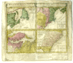 | Details | Homann Heirs | 1745 |
| Dominia Anglorum in America Septentrionali |
|
Homann Heirs |
|
| 1745 |
| LOC:53 |
| $495.00 | Homann-Heirs | Dominia-Anglorum-in-America-Septentrionali | Four early maps of the British colonies in North America on one page made 30+ years before the Revolutionary war, ca. 1745. These antique maps are based on the work of Herman Moll, a London-based cartographer and engraver.
<br></br>
Coverage on this antique copperplate engraving includes Newfoundland and Saint Lawrence Bay in Canada, New York, New England, New Jersey, Pennsylvania, the Carolina and Florida Territories, Virginia, and Maryland including Chesapeake Bay.
<br></br>
The four inset maps are titled as follows:<br>
A. Newfoundland od. Terra Nova S. Laurentii Bay die fisch-bank Acadia… New Schotland.<br>
B. New Engelland, New York, New Jersey, und Pensilvania.<br>
C. Virgina und Maryland<br>
D. Carolina ... Florida
<br></br>
Text below the maps elaborates on the maps, the Iroquois Indians, and provides a brief dictionary of terms translated to German.
<br></br>
By the heirs of J. B. Homann. Homann Heirs (also "Homannianis Heredibus" or "Homann Erben" or "Heritiers de Homann") was a company established after the death of the famous German cartographer Johann Baptist Homann to carry on the map publishing business of the firm he started in the early 1700's. The designation "Homann Heirs" appears on maps published by that successor firm from about 1730 to 1848. |
| 5166 |  | Details | Anville, Jean Baptiste Bourguignon d' | 1746 |
| Antique French map of North America Amerique Septentrionale |
|
Anville, Jean Baptiste Bourguignon d' |
|
| 1746 |
| LOC:53 |
| $460.00 | Anville--Jean-Baptiste-Bourguignon-d- | Antique-French-map-of-North-America-Amerique-Septentrionale | Two joined sheets of D'Anville's four-sheet map of North America and the West Indies from 1746 (dated within). Much blank space west of the Mississippi River reflects the scarcity of information about the geography of Tecas (Texas) and most of the west United States save for that of the Spanish territories around New Mexico. D'Anville names and locates many native American tribes including the Chicachas, Canoatinos, the Cherakis, Iroquois, and Chetimachas (around Bayou Lafourche, Louisiana).
<br></br>
At upper left is an inset of Hudson Bay, Baffin Bay, Labrador, Baffin Bay, and Greenland.
<br></br>
Designed by Gravelot; engraved by Major. |
| 3639 |  | Details | Bellin, Jacques Nicolas | 1747 |
| Scarce antique map of the Mississippi River |
|
Bellin, Jacques Nicolas |
|
| 1747 |
| LOC:10 |
| $800.00 | Bellin--Jacques-Nicolas | Scarce-antique-map-of-the-Mississippi-River | Bellin's fine map from 1747 focusing on the Red River and the Mississippi River. Full of interesting notes (in French) about the rivers, habitations, and native American tribes. Includes an inset of the area surrounding Fort St. Jean [Baptiste] a military post on the Red River in Natchitoches, Louisiana (founded by French Canadians in 1716). Shows the channel upstream of the fort was partially dammed by a tangle of uprooted trees.
<br></br>
Coverage extends southward along the Mississippi River almost as far as Baton Rouge.
<br></br>
French hydrographer Jacques Nicolas Bellin (1703-1772) was born in Paris and educated as an engineer. In 1741, Bellin became the first Ingénieur de la Marine of the Depot des cartes et plans de la Marine (the French Hydrographical Office) and was named Official Hydrographer of the French King. Bellin's largest and most comprehensive work is the Petit Atlas Maritime that covered the coasts and important port cities of the known world. |
| 1323 |  | Details | Vaugondy, Robert de | 1749 |
| Interesting antique map of Florida and the Carolinas |
|
Vaugondy, Robert de |
|
| 1749 |
| LOC:11 |
| $280.00 | Vaugondy--Robert-de | Interesting-antique-map-of-Florida-and-the-Carolinas | Attractive and fascinating map of south-eastern United States with "Virginie, Caroline, Louisiane, and Floride". Named features include Pensacola, the Bahama Islands, Cape Canaveral, St. Augustine, Saint Simons Island, Tybee Island, Savannah, Charleston, Cape Fear, and the "Montagnes de Apalaches". Florida is depicted as an archipelago of islands as some sources believed at the time. Published by the family of Robert Vaugondy in 1749.
<br></br>
This scarce map is an authentic French copper-plate engraving printed ca. 1749 on a larger 11" x 8.5 inch sheet of old chain-laid paper. |
| 1109 | 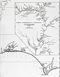 | Details | Anville, Jean Baptiste Bourguignon d' | 1752 |
| Partie Superieur de la Louisiane |
|
Anville, Jean Baptiste Bourguignon d' |
|
| 1752 |
| LOC:10 |
| $315.00 | Anville--Jean-Baptiste-Bourguignon-d- | Partie-Superieur-de-la-Louisiane | The east-most sheet of d'Anville's two-sheet map of the Texas, Louisiana, and Florida Gulf Coast. This sheet would have been joined to the western sheet to provide a complete map- "Carte de la Louisiane".
<br></br>
Coverage on this sheet extends from the Perdido River past Pensacola, Pensacola Bay ( Baye de St, Marie de Galbes ) Santa Rosa ( Sainte-Rose ) Island, St. Andrew Bay ( Baye de St. Andre ) and terminates just past Cape San Blas ( Cabo Escondido ) at the Appalachicola River. Includes part of the Alabama River ( Rio des Alibamons ) with Fort Toulouse (North of Montgomery, Alabama).
<br></br>
Large inset map of the Mississippi River system including the Illinois and Missouri Rivers with several french forts. Identifies locations of numerous native American Indian settlements including the Metchigamias, Caskakias, Osage, Kansez, Tapouchas, Chacchoumas, and Petits Akansas. The town of St. Louis, Missouri, not founded until 1763, is not shown but two references to the Cahokia Indians including an "Ancien Village des Caho." are identified. |
| 4694 |  | Details | Anville, Jean Baptiste Bourguignon d' | 1752 |
| Carte De La Louisiane |
|
Anville, Jean Baptiste Bourguignon d' |
|
| 1752 |
| LOC:53 |
| $1,250.00 | Anville--Jean-Baptiste-Bourguignon-d- | Carte-De-La-Louisiane | Large, scarce antique map by d'Anville of the lower Mississippi, the Arkansas, the Red, the Osage, and lower Missouri rivers as well as much of the coast bordering on the Gulf of Mexico. States included in this copperplate-engraved French antique map are Texas, Louisiana, Mississippi, Alabama and Florida.
<br></br>
Large inset map of the Mississippi River system including the Illinois and Missouri Rivers with several French forts. Identifies locations of numerous native American Indian settlements including the Metchigamias, Caskakias, Osage, Kansez, Tapouchas, Chacchoumas, and Petits Akansas. The town of St. Louis, Missouri, not founded until 1763, is not shown but two references to the Cahokia Indians including an "Ancien Village des Caho." are identified.
<br></br>
This two-sheet map is sometimes found in separate sheets but here both sheets are joined together resulting in a large 37" wide image.
<br></br>
Points of interest include New Orleans, Pascagoula, Mobile, and Pensacola Bay (Baye de Ste. Marie de Galbes), and St. Josephs Bay. |
| 1415 | 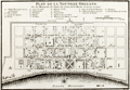 | Details | Bellin, Jacques Nicolas | 1753 |
| Antique Colonial-era Plan of the French Quarter in New Orleans, Louisiana |
|
Bellin, Jacques Nicolas |
|
| 1753 |
| LOC:3 |
| $600.00 | Bellin--Jacques-Nicolas | Antique-Colonial-era-Plan-of-the-French-Quarter-in-New-Orleans--Louisiana | Antique French plan of the city of New Orleans, Louisiana ("la Nouvelle Orleans") from the period of French colonization ca. 1753. This antique city plan of New Orleans by Nicolas Bellin was based on a manuscript map created by Pauger approximately 15 years after the city was founded on the east bank of the Mississippi river.
<BR> </BR>
Bellin's plan shows the city laid out with French Quarter streets most residents would recognize today including Bienville, Bourbon, Chartres, Royale and at the center of the plan- Jackson Square. Note the spelling of the Mississippi River below the town with one "P" as "Fleuve Mississipi".
<BR> </BR>
On this old uncolored, copper-plate engraved map nineteen key points within the city are keyed to a legend on the map just below the title. These important locations within early New Orleans include:
<div class="indenttextblock">
<ul style="list-style-type: circle;">
<li>Prisons</li>
<li>Place d'Armes (today's Jackson Square)</li>
<li> l'Eglise Paroissiale (parish church)</li>
<li>Poudriere (powder magazine)</li>
<li>Magasins du Roi (Royal stores)</li>
<li>Nouvelle Maison du Urselines (or new home for the Ursuline nuns, an important force in early New Orleans)</li>
<li>Forges du Roi (the King's forge or metalworking shop)</li>
<li>Moulin a vent et a Cheval (a mill operated by the wind and horse )</li>
</ul>
</div>
The plan is based on a design initially created by military engineers Adrien de Pauger and Le Blond de la Tour in 1722. That plan envisoned a street grid extending six blocks northward from the Mississippi River, a plan that was likely scaled back in 1729 as a result of the Natchez Indian massacre of settlers at Fort Rosalie near Natchez Mississippi. At that point security became paramount, reflected in some of the other features found in Bellin's plan: guardhouses, a powder magazine, and a single bridge controlling access across the moat to the city. Plate number 19. |
| 1193 | 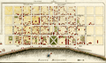 | Details | Bellin, Jacques Nicolas | 1753 |
| Plan de la Nouvelle Orleans (3) |
|
Bellin, Jacques Nicolas |
|
| 1753 |
| LOC:3 |
| $700.00 | Bellin--Jacques-Nicolas | Plan-de-la-Nouvelle-Orleans-(3) | Antique French plan of the city of New Orleans, Louisiana ("la Nouvelle Orleans") from the period of French colonization ca. 1753. This antique city plan of New Orleans was based on a manuscript map created approximately 25 years after the city was founded on the east bank of the Mississippi river. This neat hand-colored, copper-plate engraved map shows the city laid out with French Quarter streets most residents would recognize today including Bienville, Bourbon, Chartres, Royale and at the center of the plan- Jackson Square. Note the spelling of Mississippi below the town with one "P" as "Fleuve Mississipi".
<BR> </BR>
Nineteen key points within the city are keyed to a legend on the map just below the title. These key points within early New Orleans include:
<div class="indenttextblock">
<ul style="list-style-type: circle;">
<li>Prisons</li>
<li>Place d'Armes (today's Jackson Square)</li>
<li> l'Eglise Paroissiale (parish church)</li>
<li>Poudriere (powder magazine)</li>
<li>Magasins du Roi (Royal stores)</li>
<li>Nouvelle Maison du Urselines (or new home for the Ursuline nuns, an important force in early New Orleans)</li>
<li>Forges du Roi (the King's forge or metalworking shop)</li>
<li>Moulin a vent et a Cheval (a mill operated by the wind and horse )</li>
</ul>
</div>
Interestingly, what appears to be a defensive wall around the city is labeled "fosse' plein d'eau". Fosse' is French for "canal". Therefore, even at this relatively early point in its history New Orleans, Louisiana had a canal originating in the vicinity of today's Canal Street. An opening for a gate labeled "St. Jean" would have allowed access to a road leading to Bayou St. John, then an important route to points East. Plate number 19. |
| 591 |  | Details | Bellin, Jacques Nicolas | 1753 |
| Plan de la Nouvelle Orleans |
|
Bellin, Jacques Nicolas |
|
| 1753 |
| LOC:0 |
| $0.00 | Bellin--Jacques-Nicolas | Plan-de-la-Nouvelle-Orleans | <BR></BR>
This plate has been SOLD but please see another <a style="color:#0000EE" rel="nofollow" href="https://www.rarecharts.com/ShowDetail/Creator/Bellin--Jacques-Nicolas/Title/Plan-de-la-Nouvelle-Orleans-(3)/1193">hand-colored engraving of Bellin's plan.</a>
<br><br/>
J.N. Bellin's early plan of the city of New Orleans, Louisiana. |
| 99 |  | Details | Bellin, Jacques Nicolas | 1753 |
| Plan de la Nouvelle Orleans - SOLD |
|
Bellin, Jacques Nicolas |
|
| 1753 |
| LOC:0 |
| $0.00 | Bellin--Jacques-Nicolas | Plan-de-la-Nouvelle-Orleans---SOLD | <BR></BR>
This plate has been SOLD but please see another <a style="color:#0000EE" rel="nofollow" href="https://www.rarecharts.com/ShowDetail/Creator/Bellin--Jacques-Nicolas/Title/Plan-de-la-Nouvelle-Orleans-(3)/1193">hand-colored engraving of Bellin's plan.</a>
<br><br/>
Bellin's famous plan of the city of New Orleans, based on a manuscript map created approximately 25 years after the city was founded along high ground on the east bank of the Mississippi river. Shows the city neatly laid out with streets most residents would recognize today including Bourbon, Chartres, Royale and at the center of the plan- Jackson Square. Number 19.<BR> </BR>
Interestingly, what appears to be a defensive wall around the city is labeled "fosse' plein d'eau". Fosse' is French for "canal". Therefore, even at this relatively early point in its history New Orleans had a canal originating in the vicinity of today's Canal Street. |
| 3596 | 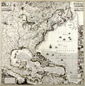 | Details | Popple, Henry | 1755 |
| A Map of the British Empire In America |
|
Popple, Henry |
|
| 1755 |
| LOC:53 |
| $4,200.00 | Popple--Henry | A-Map-of-the-British-Empire-In-America | Beautiful, original hand-colored example of the Covens and Mortier (Dutch) edition of Henry Popple's key map of North America. Made under the auspices of Britain's Lords Commissioners of Trade and Plantations.
<br></br>
The index sheet or key map for Henry Popple's great 20-sheet map, the most important of its time. According to R.V. Tooley "This was the best and most detailed map issued up to this date [1733]." (Tooley, R.V. Maps and Map Makers. p 114.) Published from Amsterdam in 1741 by Covens and Mortier. An important endorsement by Sir Edmund Halley (famous for the eponymous comet) in the bottom right reads in part: <div class="indenttextblock">" I have see the abovementioned map which as far as I am judge seems to have been laid down with great accuracy and to show the position of the different provinces and islands in that part of the globe more truly than any yet extant." </div>
<BR/>
In upper left and right hand corners of Popples key map are insets of Niagara Falls, Mexico City, Quebec and New York City. At right is a column of 18 plans of ports, harbors and islands including Boston, Cartagena, Charleston, Bermuda, New York, and Annapolis. The map is richly embellished with a title cartouche featuring Native Americans, monkeys, a crocodile and a scene of European traders. Numerous ships and sea battles are shown throughout the oceans that are hachured and arrows depict current directionality. Engraved by Johannes Condet.
<br></br>
Popple's personal history is poorly known. McCorkle states <div class="indenttextblock">"… he came from a family whose members had served the Board of Trade and Plantations for three generations, a connection that must have been a factor in his undertaking the map, his only known cartographic work. As Popple had no training or experience as a mapmaker he used available manuscript and printed maps as his sources ... ".</div> |
| 1083 | 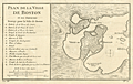 | Details | Bellin, Jacques Nicolas | 1757 |
| Antique French Map and Plan of Boston, Massachusetts |
|
Bellin, Jacques Nicolas |
|
| 1757 |
| LOC:0 |
| $0.00 | Bellin--Jacques-Nicolas | Antique-French-Map-and-Plan-of-Boston--Massachusetts | SOLD
<br></br>
One of the earliest obtainable town plans of <b>Boston, Massachusetts</b>. This antique French plan shows the area as it was 12 years before the American Revolutionary War. This fine copper-plate engraved plan from Bellin's Histoire General des Voyages shows the <b>back bay</b> as a true bay, before it was filled and built up in the 19th century. Includes <b>Charles Town</b> across the bay.
<br></br>
In Boston Bay the key features are an anchorage, Ronde Island, and a single dotted line denoting the navigational channel. Very sparse soundings and hydrographic details. Includes at left an index of 16 locations identified alphabetically on the map.
</br>
<b> These 16 key locations include:</b>
<div class="indenttextblock">
<ul>
<span style="list-style-type: circle;">
<li>2 batterys, each with 25 pieces of cannon </li>
<li> Two Presbyterian churches</li>
<li>A Quaker church </li>
<li>An Anabaptist church</li>
<li>The armory</li>
<li>A wharf </li>
<li>The powder magazine </li>
<li> A "Petit Bassin qui asseche de basse mer" (the Back Bay area)</li>
<li> The fortified and defended city gate</li>
</span>
</ul>
</div> |
| 378 |  | Details | Jefferys, Thomas | 1759 |
| Plan of New Orleans and the Mississippi River |
|
Jefferys, Thomas |
|
| 1759 |
| LOC:0 |
| $0.00 | Jefferys--Thomas | Plan-of-New-Orleans-and-the-Mississippi-River | SOLD
<BR></BR>
Large, early foundational map for the collector of New Orleans cartography. By English cartographer Thomas Jefferys. Stunning and quite scarce plan of New Orleans, Louisiana with insets of the mouth of the Mississippi River and also a long stretch of the river from south of Donaldsonville to the passes. The map of New Orleans's French Quarter is similar to the earlier chart by <a rel="nofollow" href = "http://www.rarecharts.com/creator/Bellin--Jacques-Nicolas/" > Jacques Bellin</a> but contains additional details outside the French Quarter, which was largely marsh land at that time, including a road to Bayou St. John.<BR> </BR>
See <a rel="nofollow" href= "https://www.rarecharts.com/displaybycategory/city/new%20orleans"> other New Orleans items.</a> <BR> </BR>
Attribution and date at bottom: "Nov 1759. Published According to Act of Parliament by T. Jefferys at Charing Cross Price 2d.<BR> </BR> |
| 1111 |  | Details | London Magazine | 1761 |
| A New Map of Louisiana and the River Mississipi from the Sea to Bayagoulas |
|
London Magazine |
|
| 1761 |
| LOC:0 |
| $0.00 | London-Magazine | A-New-Map-of-Louisiana-and-the-River-Mississipi--from-the-Sea-to-Bayagoulas | SOLD<br></br>Detailed antique map of the Mississippi River Delta taken from Thomas Jefferys' larger three-part map of the vicinity of New Orleans. Captures a point in time before subsidence and the rising sea level caused the loss of many hundred thousand acres of Louisiana land to the sea.
<br></br>
Bayou Lafourche is named "Cheimachas River" ; in contemporaneous French documents the waterway, once a distributary stream of the Mississippi River, was called "Bayou Lafourche des Chitimachas" after the Chitimacha Indians who inhabited land near present day Donaldsonville. The map shows the course of the Mississippi from Bayagoulas near the present-day town of Bayou Goula in Iberville Parish, Louisiana to Fort la Balise, which defended the entrance and channel of the river.
<br></br>
Contains very intersting notations including "Forest of Holms Fit for Ship Building" ("holm" refers to evergreen oak trees- probably the southern live oak ) and "Tchaouachas where Marshall de Bellisle had his grant". The latter notation near upper Plaquemine Parish refers to François Simars de Bellisle, first an officer of the French West Indies Company who wandered south-east Texas and Louisiana as a indian captive and slave from 1719 - 1721. In 1753 de Bellisle became a member of the Superior Council of Louisiana and served as town commander of New Orleans.
<br></br>
An important feature of this map is the depiction of the ruins of Fort La Boulaye the First Settlement made in 1700. This fort, located on the eastern bank of the Mississippi River about fifty miles from the Gulf of Mexico, was established by Pierre Le Moyne d'Iberville in 1700 and was abandoned about seven years later. In 1933 the remains of Fort La Boulaye were discovered near present-day Phoenix, Louisiana, in Plaquemines Parish. |
| 4758 |  | Details | Gibson, John | 1761 |
| A Plan of the City of Philadelphia, with the Country Adjacent |
|
Gibson, John |
|
| 1761 |
| LOC:0 |
| $295.00 | Gibson--John | A-Plan-of-the-City-of-Philadelphia--with-the-Country-Adjacent | Early plan of Philadelphia laid out on a grid between the Delaware River and the Schuylkill River. John Gibson engraved this fine original after Scull & Heap's smaller-scale plan of June, 1752 - "Plan of the city and environs of Philadelphia". Numerous homes are identified by name: Maddox, Plumsted, Pemberton, Rouse, Campbell and more. Shows the locations of two ferry's including Daniel Cooper's Ferry
<br></br>
A fine gift for anyone with an interest in Philadelphia, Pennsylvania or early colonial history. Volume 5. Page 20.
<br></br>
Gibson's plan though small, focuses on the city and omits the environs. Gibson has engraved the earliest affordable plan of Philadelphia pre-dating Bellin's work of 1764 by three years. Gibson's engraving clearly predates Faden's later revised edition (1771) of the Scull and Heap plan of Philadelphia. Scull and Heap show the city clearly with the Battery not yet demolished and lacking the numerous additional lots that Faden shows creeping outward near the Delaware River (see red circles).
<img src="/PageImages/c_JCB_Philadelphia_Faden_1771.jpg" alt="Fadens Edition Of Sculls Map" align="top" width="200"> |
| 642 |  | Details | Masi, Tommaso Gio. | 1763 |
| Piano della Citta e Porto di Sant Agostino |
|
Masi, Tommaso Gio. |
|
| 1763 |
| LOC:200 |
| $625.00 | Masi--Tommaso-Gio- | Piano-della-Citta-e-Porto-di-Sant-Agostino | Handsome, pre-revolutionary war (1763) Italian antique copperplate engraved plan of the old town and port of St. Augustine, Florida. Areas and features named on the plan include the Matanzas River, San Marco River, San Sebastian River, Anastasia Island, Castillo de San Marcos ( oldest fort in the U.S.) , and Fort Picolata, built by the Spaniards to protect a ferry landing.
<br></br>
Nicely preserved specimen of one of the earliest available plans of Saint Augustine, the oldest continuously inhabited European settlement in the United States. St. Augustine is depicted with a neatly laid out network of perpendicular streets and surrounded by a high wall with several bastions. On the North and South ends and outside of the walled city are noted "Citta Indiana" or American Indian habitations. Numerous soundings and depictions of sandbanks and other hazards surround the entrance to the port.
<br></br>
The landing place of General James Oglethorpe is identified at the left end of the coastline (Sbarco del Gen. Oglethorpe). The General landed at that spot with an English force in 1740 during the War of Jenkin's Ear.
<br></br>
Originally published in the Gazzetiere Americano, from Livorno, Italy. Engraved by Guiseppe Pazzi and drawn by Viol. Vanni. |
| 3640 | 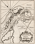 | Details | Bellin, Jacques Nicolas | 1763 |
| Scarce mid eighteenth-century antique map of the Mississippi River passes. |
|
Bellin, Jacques Nicolas |
|
| 1763 |
| LOC:77 |
| $400.00 | Bellin--Jacques-Nicolas | Scarce-mid-eighteenth-century-antique-map-of-the-Mississippi-River-passes- | Very attractive early French maritime map shows the mouth of the "Fleuve St. Louis" or Mississippi River in Louisiana. Noted locations include Passe a la Loutre and Isle de la Fort de Balise.
<br></br>
From J.N. Bellin's <b>Le Petit Atlas Maritime</b> . With soundings at the key passes into the Gulf of Mexico. Lacks latitude and longitude scales. North is oriented to the top left of map. Tome I, No. 38. |
| 5177 |  | Details | Masi, Tommaso Gio. | 1763 |
| Piano del Porto e degli Stabilimenti di Pensacola Uncolored |
|
Masi, Tommaso Gio. |
|
| 1763 |
| LOC:87 |
| $575.00 | Masi--Tommaso-Gio- | Piano-del-Porto-e-degli-Stabilimenti-di-Pensacola-Uncolored | Beautifully engraved antique plan of Pensacola, Florida and the surrounding bays and sounds created in 1763 when Pensacola was not much more than a tiny village. Coverage includes areas of present day Gulf Islands National Seashore, Gulf Breeze, Pensacola Beach, Navarre, Navarre Beach, Blackwater Bay, Escambia Bay, Santa Rosa Sound and Santa Rosa Island.
<br></br>
Two old forts are noted, Fort Santa Rosa, a long-destroyed log fort built by the Spanish on the western end of Santa Rosa Island near present day Fort Pickens, and Fort Santa Maria de Galres (Galves/Galve) , near present day Fort Barrancas. Other features noted that reflect Spanish/Italian place names are "Baia di Santa Maria de Galres" - Pensacola Bay; "Golfo dell Ostriche", now Escambia Bay; "Canale di Santa Rosa" or Santa Rosa Sound; "Fiume del Governatore" and "Fiume del Almirante" - the Yellow and Blackwater Rivers. Siguenca Point at the western tip of Santa Rosa Island is named after Dr. Carlos de Siguenza y Gongora, a member of a Spanish reconnaissance expedition in 1693 who was one of the first to map Pensacola Bay.
<br></br>
Originally published in the Gazzetiere Americano, from Livorno, Italy. Contains many soundings and notations of the composition of the sea bottom, important to navigators who had to rely heavily on lead-line measurements for safe passage. Engraved by Giuseppe Pazzi and drawn by Viol. Vanni. |
| 3584 |  | Details | Masi, Tommaso Gio. | 1763 |
| Piano del Porto e degli Stabilimenti di Pensacola by Masi |
|
Masi, Tommaso Gio. |
|
| 1763 |
| LOC:200 |
| $0.00 | Masi--Tommaso-Gio- | Piano-del-Porto-e-degli-Stabilimenti-di-Pensacola-by-Masi | SOLD <br><br>
Beautifully engraved antique plan of Pensacola, Florida and the surrounding bays and sounds created in 1763 when Pensacola was not much more than a tiny village. Coverage includes areas of present day Gulf Islands National Seashore, Gulf Breeze, Pensacola Beach, Navarre, Navarre Beach, Blackwater Bay, Escambia Bay, Santa Rosa Sound and Santa Rosa Island.
<br></br>
Two old forts are noted, Fort Santa Rosa, a long-destroyed log fort built by the Spanish on the western end of Santa Rosa Island near present day Fort Pickens, and Fort Santa Maria de Galres (Galves/Galve) , near present day Fort Barrancas. Other features noted that reflect Spanish/Italian place names are "Baia di Santa Maria de Galres" - Pensacola Bay; "Golfo dell Ostriche", now Escambia Bay; "Canale di Santa Rosa" or Santa Rosa Sound; "Fiume del Governatore" and "Fiume del Almirante" - the Yellow and Blackwater Rivers. Siguenca Point at the western tip of Santa Rosa Island is named after Dr. Carlos de Siguenza y Gongora, a member of a Spanish reconnaissance expedition in 1693 who was one of the first to map Pensacola Bay.
<br></br>
Originally published in the Gazzetiere Americano, from Livorno, Italy. Contains many soundings and notations of the composition of the sea bottom, important to navigators who had to rely heavily on lead-line measurements for safe passage. Engraved by Giusepe Pazzi and drawn by Viol. Vanni. |
| 643 |  | Details | Masi, Tommaso Gio. | 1763 |
| Piano del Porto e degli Stabilimenti di Pensacola. |
|
Masi, Tommaso Gio. |
|
| 1763 |
| LOC:0 |
| $0.00 | Masi--Tommaso-Gio- | Piano-del-Porto-e-degli-Stabilimenti-di-Pensacola- | SOLD
<br></br>
Beautifully engraved antique plan of Pensacola, Florida. |
| 858 |  | Details | Universal Magazine | 1764 |
| Antique engraved elevation view of Pensacola, Florida |
|
Universal Magazine |
|
| 1764 |
| LOC:3 |
| $360.00 | Universal-Magazine | Antique-engraved-elevation-view-of-Pensacola--Florida | Antique elevation view of Pensacola, Florida and the very few structures that existed 250 years ago just after the end of Spanish rule over the city. A legend at bottom is keyed to six locations on the view including: 1. The Fort. 2. The Church. 3. The Governor's House. 4. The Commandant's House. 5. A Well. 6. A Bungo. (A bungo was a type of boat or canoe used in the southern United States made of a hollowed-out tree.)
<br></br>
This engraving is the earliest available printed view of Pensacola and comes from the January 1764 issue of the Universal Magazine. After Dominic Serres (1719-1793), a French-born painter primarily of nautical or maritime subjects. Serres was assigned to the British expedition to capture Havana, led by Admiral Sir George Pocock. It is possible that Serres visited Pensacola during that cruise. |
| 3641 | 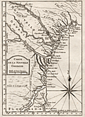 | Details | Bellin, Jacques Nicolas | 1764 |
| Fine mid eighteenth-century antique map of the Georgia coast. |
|
Bellin, Jacques Nicolas |
|
| 1764 |
| LOC:77 |
| $450.00 | Bellin--Jacques-Nicolas | Fine-mid-eighteenth-century-antique-map-of-the-Georgia-coast- | This early French maritime map shows the coast of Georgia in the United States. Coverage ranges from Saint Helena Island in the north to past St. Augustine in the south and includes the road "chemin" linking the two locations. Our copper-plate engraved map includes Augusta, Savannah, Jekyll Island, Talbot Island, Sapelo and Saint Simon's Island in Georgia; and St. Augustine, Florida. Prominently features those rivers which would have been important travel routes to the interior: St. John's River, Altamaha River, Ogeechee River and the Savannah River along with many smaller waterways.
<br></br>
From J.N. Bellin's <b>Le Petit Atlas Maritime</b> . With latitude and longitude scales and a large decorative compass rose with rhumb lines. North is oriented to the top of map. Tome I, No. 38. |
| 3642 |  | Details | Bellin, Jacques Nicolas | 1764 |
| Neat French antique map of St. Augustine, Florida and harbor. |
|
Bellin, Jacques Nicolas |
|
| 1764 |
| LOC:87 |
| $400.00 | Bellin--Jacques-Nicolas | Neat-French-antique-map-of-St--Augustine--Florida-and-harbor- | Fine small French navigation chart of the port and harbour of St. Augustine, Florida ca. 1764 from Bellin's "Petit Atlas Maritime". Anastasia Island, directly offshore the harbor is titled "Isle de Matance ou St. Anastasie". Shows the entrance to the harbor encircled by shallow sand-banks with a tower ("balise") serving as a navigational aid. Other features noted by Bellin include an "Eglise des Indiens" or church for native americans; the fort- Castillo de San Marcos; a monastery; the "Riviere Diego" now the Tolomato River; and "Riviere St. Sebastien" .
<br></br>
From J.N. Bellin's master work <b>Le Petit Atlas Maritime</b> . North is oriented to the top. Uncolored. Tome I, No. 39. |
| 1358 |  | Details | Bellin, Jacques Nicolas | 1764 |
| Antique mid-eighteenth century chart of the harbor of St. Augustine, Florida |
|
Bellin, Jacques Nicolas |
|
| 1764 |
| LOC:11 |
| $475.00 | Bellin--Jacques-Nicolas | Antique-mid-eighteenth-century-chart-of-the-harbor-of-St--Augustine--Florida | Fine small French navigation chart of the port and harbour of St. Augustine, Florida ca. 1764 from Bellin's "Petit Atlas Maritime". Anastasia Island, directly offshore the harbor is titled "Isle de Matance ou St. Anastasie". Shows the entrance to the harbor encircled by shallow sand-banks with a tower ("balise") serving as a navigational aid. Other features noted by Bellin include an "Eglise des Indiens" or church for native americans; the fort- Castillo de San Marcos; a monastery; the "Riviere Diego" now the Tolomato River; and "Riviere St. Sebastien"
<br></br>
Tome I No 39. |
| 2521 |  | Details | Tirion, Isaac | 1765 |
| Fine 18th century map of Lower California, Arizona and Mexico |
|
Tirion, Isaac |
|
| 1765 |
| LOC:10 |
| $750.00 | Tirion--Isaac | Fine-18th-century-map-of-Lower-California--Arizona-and-Mexico | Isaac Tirions's map of the American Southwest reflects the recent explorations of the Jesuit Fathers and others. Named locations include Casa Grande and San Xavier de Bac in the Southwest. Along the Pacific Ocean are noted San Diego, Ensenada and Cabo San Lucas. Numerous, oversized islands are shown along both coasts of the Baja California Peninsula.
<br></br>
Missions are pictorially identified throughout the map and there are two fortifications in Baja at San Jose del Cabo and Loretto.
<br></br>
Isaak Tirion, (1705 - 1765) was a Dutch publisher who produced several atlases and Dutch town plans from the Kalverstraat, in Amsterdam. Tirion produced a total of eight atlases in multiple editions |
| 1369 | 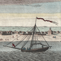 | Details | Tirion, Isaac | 1767 |
| Very early view of Pensacola, Florida from 1767 |
|
Tirion, Isaac |
|
| 1767 |
| LOC:11 |
| $260.00 | Tirion--Isaac | Very-early-view-of-Pensacola--Florida-from-1767 | Antique elevation view of Pensacola, Florida on the Florida Panhandle. This attractive engraved view documents the very few structures that existed in that Gulf of Mexico port 250 years ago just after the end of Spanish rule over the city. German text.
<br></br>
From the English-language edition of this view we learn the names of six objects or locations on the view: 1. The Fort. 2. The Church. 3. The Governor's House. 4. The Commandant's House. 5. A Well. 6. A Bungo. (A bungo was a type of boat or canoe used in the southern United States made of a hollowed-out tree.)
<br></br>
This engraving is the one of the earliest available printed views of Pensacola.
<br></br>
After Dominic Serres (1719-1793), a French-born painter primarily of nautical or maritime subjects. Serres was assigned to the Brtitish expedition to capture Havana, led by Admiral Sir George Pocock. It is possible that Serres visited Pensacola during that cruise. |
| 1069 | 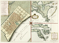 | Details | Tirion, Isaac | 1769 |
| Maps of French Colonial New Orleans and the Mississippi River |
|
Tirion, Isaac |
|
| 1769 |
| LOC:10 |
| $1,175.00 | Tirion--Isaac | Maps-of-French-Colonial-New-Orleans-and-the-Mississippi-River | Scarce early plan of New Orleans, Louisiana with insets of the mouth of the Mississippi River and also a long stretch of the Mississippi river from south of Donaldsonville to the passes. Published less than 50 years after the founding of New Orleans, Tirion's map of New Orlean's French Quarter is derived from an earlier map by Jacques Bellin / Brion de la Tour but contains additional details outside the French Quarter, which was largely marsh land at that time, including a road to Bayou St. John, a key trade route to the city from the east.
<br></br>
The sheet with three views is based on the layout of Thomas Jefferys earlier work (1759), who borrowed the earlier works of Jacques Bellin, of France's Depot de la Marine. Text is in German.
<br></br>
Isaak Tirion, (1705 - 1765) was a Dutch publisher who produced serveral atlases and Dutch town plans from the Kalverstraat, in Amsterdam. Tirion produced eight atlases in multiple editions |
| 6545 | 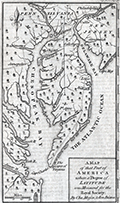 | Details | Mason, Charles and Jeremiah Dixon | 1769 |
| Scarce Chesapeake region map from the survey of Mason and Dixon |
|
Mason, Charles and Jeremiah Dixon |
|
| 1769 |
| LOC:78 |
| $400.00 | Mason--Charles-and-Jeremiah-Dixon | Scarce-Chesapeake-region-map-from-the-survey-of-Mason-and-Dixon | Scarce map of the Chesapeake Bay region with portions of Maryland, Virginia, Delaware, New Jersey and Pennsylvania. The map shows the results of Charles Mason and Jeremiah Dixon's survey of the boundary between the states of Pennsylvania and Maryland. Published in Gentleman's Magazine, 1769.
<br><br>
Surveyors Charles Mason and Jeremiah Dixon spent 58 months establishing the boundaries of Pennsylvania, Maryland, Delaware and West Virginia. The team attained widespread recognition as the creators of the Mason-Dixon Line, the de facto border between the northern and southern United States. Key features include: the Potowmack River, Cape May, Cape Charles, Baltimore, Philadelphia, and Annapolis. Shows several of the key roads in use during the mid 18th-century. |
| 4821 | 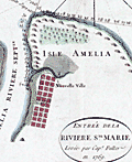 | Details | Jefferys, Thomas | 1770 |
| Rare Original Antique Chart of Amelia Island, Florida and Vicinity |
|
Jefferys, Thomas |
|
| 1770 |
| LOC:61 |
| $4,000.00 | Jefferys--Thomas | Rare-Original-Antique-Chart-of-Amelia-Island--Florida-and-Vicinity | Scarce engraved, hand-colored British navigation chart from 1770 containing three maps of Amelia Island, the Nassau River, Talbot Island and Cumberland Island, Georgia on the same sheet:
<div class="indenttextblocksingle">
<ul style="list-style-type: circle; ">
<li><b>Plan of Amelia Island in East Florida.</b> Based on an earlier survey by military engineer, surveyor, and cartographer John William Gerard de Brahm. De Brahm is known publishing “A Map of South Carolina and a Part of Georgia” in 1857.</b></li>
<li><b>A Chart of the Entrance to the St. Mary's River taken by Captn. W. Fuller.</b></li>
<li><b>A Chart of the Mouth of Nassau River and the Soundings on it taken at Low Water by Captn. W. Fuller.</b></li>
</ul>
</div>
Dedicated to John Earl of Egmont by William Fuller. Published by Thomas Jefferys, London, March 1770. |
| 3647 |  | Details | Vaugondy, Robert de | 1772 |
| Antique map on travels of Captain Cluny |
|
Vaugondy, Robert de |
|
| 1772 |
| LOC:88 |
| $180.00 | Vaugondy--Robert-de | Antique-map-on-travels-of-Captain-Cluny | Map by Vaugondy to illustrate the mythical voyage of Captain Cluny. In 1769 Alexander Cluny published "The American Traveler: or, Observations on the Present State, Culture and Commerce of the British Colonies in America, in a Series of Letters... by an Old and Experienced Trader." The map, based on Cluny's supposed observations depicts North America from above the Arctic Circle, to the Gulf of Mexico, including an early exaggerated depiction of present day Alaska.
<br></br>
The most interesting feature is perhaps Cluny's supposed Northwest Passage extending from Repulse Bay to the mythical Arctic Cape Fowler. To the east is Greenland, Iceland, the western part of the European continent, and the northern portion of Africa.
<br></br>
This map is part of the 10 map series prepared by Vaugondy exploring the mapping of North American and specifically the Northwest Passage. The copper-plate engraved map was part of an early study in comparative cartography. |
| 5171 | 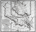 | Details | de Vaugondy, Robert | 1772 |
| Carte de La Californie et des Pays Nord Ouest 1772 |
|
de Vaugondy, Robert |
|
| 1772 |
| LOC:10 |
| $325.00 | de-Vaugondy--Robert | Carte-de-La-Californie-et-des-Pays-Nord-Ouest-1772 | Two maps of the West Coast of North America, from the Strait of Anian to Cabo San Lucas and the southern tip of Baja California in Mexico. The work by Vaugondy consists of comparative geography from two maps derived from Mercator (1612) and Petrus Planicus (1641). The larger map (by Mercator) shows the Strait of Anian, Anian Regnum, Quivira Regnum, the Sierra Nevada mountains, and Nova Albion. Includes over 30 coastal place names, including Cabo Mendocino, San Miguel (San Diego), Cape Fortuna, and Laguna de los Apostolos. On both maps the lower end of the Baja Peninsula, Cabo San Lucas is referred to as "Cabo California" but only on the larger map is northwestern Mexico called "Nova Granada".
<br></br>
The smaller inset map (by Planicus) also shows the Strait of Anian, and depicts an open sea above, suggesting a Northwest Passage in the Arctic Circle. The northwest coastline on North America differs radically, and only Anian Regnum and Quivira Regnum are located, the latter considerably south of the location on the larger map. The smaller map includes a similar number of coastal place names including Cabo Blanco , Cabo de San Francisco and los Farilones (the Farallon islands). |
| 1049 | 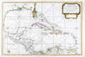 | Details | Depot de la Marine | 1774 |
| Large antique French sea chart of the Caribbean and Gulf of Mexico |
|
Depot de la Marine |
|
| 1774 |
| LOC:61 |
| $1,750.00 | Depot-de-la-Marine | Large-antique-French-sea-chart-of-the-Caribbean-and-Gulf-of-Mexico | Beautiful second edition (1774) of Bellin's important map of the Caribbean, Central America, and Gulf Coast, which is substantially revised and updated from the first edition issued by Bellin in 1749. Most notable feature on this stunning 18th century survivor is that south Florida is depicted as a mass of islands. The concept of the Florida archipelago derives from the work of Father Francois Le Maire, a missionary who arrived in Louisiana in June 1706.
<br></br>
In the title block the date has been partially erased from the original plate, causing some confusion that this chart might date to the 17th year of the French Revolution (1806). This is not the case. The attribution to the Duc du Paslin, the lack of R.F. in the circular Depot logo, and the depiction of Florida as an archipelago are all consistent with the Library of Congress' date for this map of 1774. (Library of Congress Map Diivision. "A List of Maps of America in the Library of Congress". 1901. p. 423. Retrieved online 3/2016) |
| 449 | 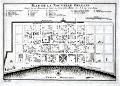 | Details | Bellin, Jacques Nicolas | 1774 |
| Plan de la Nouvelle Orleans (2) |
|
Bellin, Jacques Nicolas |
|
| 1774 |
| LOC:0 |
| $0.00 | Bellin--Jacques-Nicolas | Plan-de-la-Nouvelle-Orleans-(2) | <BR></BR>
This plate has been SOLD but please see another <a style="color:#0000EE" rel="nofollow" href="https://www.rarecharts.com/ShowDetail/Creator/Bellin--Jacques-Nicolas/Title/Plan-de-la-Nouvelle-Orleans-(3)/1193">hand-colored engraving of Bellin's plan.</a>
<br><br/>
A very desirable map and one of the few maps available from the colonial period, Nicolas Bellin's famous plan of the city of New Orleans, Louisiana is based on a manuscript map created approximately 15 years after the city was founded along high ground on the east bank of the Mississippi river. The plan depicts the city neatly laid out with streets most residents would recognize today including Bourbon, Chartres, Royale and at the center of the plan- Jackson Square.
<BR> </BR>
Copies of this map are increasingly difficult to find and prices have increased substantially since Hurricane Katrina. From "Histoire Generale des Voyages ou Nouvelle Collection de Toutes Relations de Voyages par Mer et par Terre". Published by van Harrevelt and Changuion; Amsterdam. Volume 21.
<BR> </BR>
The plan is based on a design initially created by military engineers Adrien de Pauger and Le Blond de la Tour in 1722. That plan envisioned a street grid extending six blocks northward from the Mississippi River, a plan that was likely scaled back in 1729 as a result of the Natchez Indian massacre of settlers at Fort Rosalie near Natchez Mississippi. At that point security became paramount. This plan by Bellin is more similar to an unsigned manuscript plan of New Orleans from 1732, which showed the city extending only 4 blocks north from the river, and partially surrounded by a defensive moat. The new emphasis on security, when the population totaled less than 2000 persons, is reflected in some of the other features found in Bellin's plan: guardhouses, a powder magazine, and a single bridge controlling access across the moat to the city. Those features were absent in Pauger's plan. |
| 1101 | 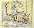 | Details | de Vaugondy, Robert | 1774 |
| Carte de La Californie et des Pays Nord Ouest |
|
de Vaugondy, Robert |
|
| 1774 |
| LOC:0 |
| $0.00 | de-Vaugondy--Robert | Carte-de-La-Californie-et-des-Pays-Nord-Ouest | SOLD, but we have an an additional uncolored similar engraving in stock by Vaugondy.
<br></br>
Two maps of the West Coast of North America, from the Strait of Anian to Cabo San Lucas and the southern tip of Baja California in Mexico. |
| 3592 | 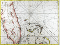 | Details | Jefferys, Thomas | 1775 |
| Antique Chart of the Peninsula and Gulf of Florida. |
|
Jefferys, Thomas |
|
| 1775 |
| LOC:51 |
| $0.00 | Jefferys--Thomas | Antique-Chart-of-the-Peninsula-and-Gulf-of-Florida- | SOLD <br></br>
Fine first edition British navigational chart documents the Peninsula of Florida. Includes portions of the Bahamas with Grand Bahama Island, Great Abaco Island, Eleuthera, Nassau (Providence) and more. Tampa Bay clearly marked.
<br></br>
Much to inspect with a magnifying glass. Correctly shows the current from the Gulf Stream flowing from South to North.
<br></br>
From Sayer's and Bennett's atlas titled: "The West-India Atlas: or a compendious description of the West-Indies: illustrated with forty one correct charts and maps, taken from actual surveys."
<br></br>
Publishers attribution reads: "London. Printed for Rob.t Sayer, Map and Printseller. No 53 Fleet Street as the Act directs 20th Feb.y 1775. According to Rumsey <div class="indenttextblock">
"Sayer and Bennet acquired his [Jefferys'] materials in preparation for this atlas, and published the atlas posthumously under his name (as they did with the American Atlas) in 1775. The heart of this atlas and the most detailed part is the sixteen sheet large chart and index sheet of the whole of the West Indies. (
<a href="http://www.davidrumsey.com/luna/servlet/detail/RUMSEY~8~1~2795~310044:The-coast-of-Yucatan-from-Campeche-" target="_blank">Internet </a>)
</div> |
| 3591 |  | Details | Jefferys, Thomas | 1775 |
| Antique Chart of Coast of West Florida and Louisiana |
|
Jefferys, Thomas |
|
| 1775 |
| LOC:51 |
| $0.00 | Jefferys--Thomas | Antique-Chart-of-Coast-of-West-Florida-and-Louisiana | SOLD<br><br>
Fine antique nautical chart and an important chart for the collector of Gulf Coast history. Geographic coverage on this antique chart extends from Sabine Pass, Texas (Cabo del Norte ) to Apalachicola Bay in the Florida Territory.
<br></br>
This first-edition British copper-engraved navigational chart documents the lack of knowledge about Chandeleur Sound (1775) where a note about the waters inside those barrier islands states "Shallow water with many small islands but very little known". In the later second state (not shown) the depiction of the sound is updated with greater detail (Breton Island, Grand osier Island) and the placename "Bay of Spiritu Santu" fills in what we now call Chandeleur Sound. Bayou Lafourche is labeled "Chetimachas River" after the Chitimacha Indians who were known to inhabit the area near Donaldsonville, La. Barataria Bay is labeled "Lake Ouachas".
<br></br>
A decorative flotilla graces the middle of our chart, highlighting a dashed line from west to southeast. That dotted line, Jeffery noted was, "The Flota's Track from la Vera Cruz [Mexico] to Havanna to avoid the Trade Winds".
<br></br>
Very attractive decorative compass rose.
<br></br>
From Sayer's and Bennett's atlas titled: "The West-India Atlas: or, a compendious description of the West-Indies: illustrated with forty one correct charts and maps, taken from actual surveys."
<br></br>
Publishers attribution reads: "London. Printed for Rob.t Sayer, Map and Printseller. No 53 Fleet Street as the Act directs 20th Feb.y 1775. According to Rumsey <div class="indenttextblock">
"Sayer and Bennet acquired his [Jefferys'] materials in preparation for this atlas, and published the atlas posthumously under his name (as they did with the American Atlas) in 1775. (
<a href="http://www.davidrumsey.com/luna/servlet/detail/RUMSEY~8~1~2795~310044:The-coast-of-Yucatan-from-Campeche-" target="_blank">Internet </a>)
</div> |
| 567 | 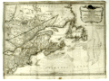 | Details | Sayer, Robert and Bennett, John | 1776 |
| A General Map of the Northern British Colonies in America |
|
Sayer, Robert and Bennett, John |
|
| 1776 |
| LOC:200 |
| $1,750.00 | Sayer--Robert-and-Bennett--John | A-General-Map-of-the-Northern-British-Colonies-in-America | Scarce antique map of the British colonies in North America during the Revolutionary War. Dated August 14, 1776. Coverage includes Maryland, Pennsylvania, New Jersey, New York, Massachusetts, Connecticut, New Hampshire, Maine, and the provinces of what is now Canada. Notes locations of American Indian tribes.
<br></br>
This map has been referred to as the "Beaver map" because of a prominent beaver in the title cartouche as well as some text related to a then unexplored portion of upstate New York: <div class="indenttextblock">"This vast tract of land which is the Antient Couchcachrage one of the four beaver hunting countries of the six nations is not yet surveyed."</div>
</br>
At very top is a second title: "The seat of war in the Northern Colonies containing the province of Quebec, Newfoundland, Nova-Scotia, New England, New York, New Jersey, Pennsylvania, etc.".
<br></br>
This map was originally one of six maps published by Sayer and Bennet in "The American Military Pocket Atlas; Being An Approved Collection of Correct Maps, Both General and Particular, of The British Colonies". David Rumsey notes that this is one of three maps in the atlas that were important to the mapping of the American Revolution. As Rumsey explains:<div class="indenttextblock"> "Nicknamed the 'Holster Atlas' because it was made for the use of British army officers. All maps in outline color, folded and bound into book with paper covered boards and quarter leather with "American Pocket Atlas" stamped in gilt on the spine."</div>
</br>
Watermarked with a shield containing a fleur de lis surmounted with a crown: at the bottom is "GR". Bottom attribution reads: London, Printed for Robert Sayer and John Bennett, Map and Seachart sellers No 53 Fleet Street, as the act directs, 14th Aug. 1776., |
| 748 | 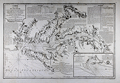 | Details | Depot de la Marine | 1778 |
| 1778 Chesapeake Bay Sea Chart after Anthony Smith |
|
Depot de la Marine |
|
| 1778 |
| LOC:53 |
| $3,900.00 | Depot-de-la-Marine | 1778-Chesapeake-Bay-Sea-Chart-after-Anthony-Smith | Large antique nautical chart from the Revolutionary War period of Chesapeake Bay and associated waterways in Maryland and Virginia. The first state of two in the French edition of Anthony Smith's influential and detailed chart of the Chesapeake Bay, Delmarva Peninsula, and surrounding waterways. Coverage includes the towns of Baltimore, Annapolis, Alexandria, Colchester, and James Town. Noted waterways include the Choptank River, Rappahannock River, Pocomoke ( "Pokomack" ) River, Potomac ( "Pawtomack" ) River, and Patapsco River.
<br></br>
Published by the French Depot de la Marine under the auspices of Antoine de Sartine during a period in which he served King Louis XVI as Secretary of the Navy. Text and notes are in French- for example below the town of Norfolk, Virginia is the note <b>"brule en 1776" </b>. That refers to the bombardment of Norfolk with red-hot shot by British naval forces, led by Lord Dunmore. Due to the shelling, British landing parties, and local British patriot forces, Norfolk was totally destroyed between January 1 - 3, 1776.
<br></br>
This first state is differentiated from the second state by the lack of added scrollwork around many of the text blocks and much less stippling of the land masses than in the second state. These decorative flourishes could have easily been added at a later date.
<br></br>
This chart was likely offered for sale individually but was also available as one of 13 full sheets and 5 half sheets published by the Depot de la Marine in the atlas "Neptune Americo-Septentrional contenant les côtes, les et bancs, iles baies, ports, et mouillages, et les sondes des mers de cette-partie du monde, depuis le Groenland inclusivement, jusques et compris le golfe du Mexique." Contains an inset plan of Herring Bay Maryland. |
| 1379 | 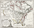 | Details | Vaugondy, Robert de | 1778 |
| Fine Antique Speculative Map of North America |
|
Vaugondy, Robert de |
|
| 1778 |
| LOC:10 |
| $350.00 | Vaugondy--Robert-de | Fine-Antique-Speculative-Map-of-North-America | A good example of Robert de Vaugondy's 1778 map of North America's English Possessions incorporating his speculative geography of the American northwest. The map covers from Hudson Bay to the Gulf of Mexico and from the Atlantic Ocean to Texas, then "Nouveau Mexique".
<br></br>
This map's most interesting features are in the large inset in the upper left quadrant illustrating Vaugondy's speculative geography of the American Northwest. The map features the Sea of the West (Mer de L'Ouest), the discoveries of Admiral de Fonte, the discoveries of Bernarda, the Strait of Anian, and the mythical kingdoms of Quivira and Teguaio.
<br></br>
There is no reliable evidence to authenticate either the existence of Admiral de Fonte himself or of the voyage. The account of de Fonte's voyage, first published in 1708, took the form of a letter by de Fonte in which he described himself as “then Admiral of New Spain and Peru, and now Prince of Chili.” The story is now attributed to the editor of the London Magazine.
<br></br>
Perhaps Vaugondy was attempting a bit of "fake news" and trying to muddy the waters over the English claims to North American territory by including these speculative geographic features into the map.
<br></br>
From Vaugondy's "Nouvel atlas portatif ". Engraved by Dussy. |
| 734 | 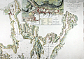 | Details | Le Rouge, George | 1778 |
| Antique Chart of Narragansett Bay with Newport Rhode Island |
|
Le Rouge, George |
|
| 1778 |
| LOC:0 |
| $0.00 | Le-Rouge--George | Antique-Chart-of-Narragansett-Bay-with-Newport-Rhode-Island | SOLD
<br></br>
Scarce original antique sea chart of Narragansett ( Narraganset ) Bay, parts of Rhode Island and Massachusetts. Geographic features include Mount Hope Bay, Bristol Bay, Providence River, and Taunton River. Named towns include Swansea and Dighton, Massachusetts; Bristol, Providence, Warren, Barrington, and East Greenwich, Rhode Island. Fall River, Mass. is not named, but in its place are shown two dwellings atop a hill by the side of the "Fals River ou Riviere des Sauts".
<br></br>
Published by George Le Rouge in Volume 1 of his rare sea-atlas "Pilote Américain Septentrional " (below) from Paris, France in 1778. Large inset plan of Newport, Rhode Island at top center with street and structures shown in great detail and with many key landmarks about Newport described by a legend.
<br></br>
This scarce chart is derived from J.F.W. des Barres’ 1776 chart which was based on surveys made by Charles Blaskowitz on behalf of the British Board of Trade in the early 1770s. Le Rouge's sea-atlas was intended for use by British Navy navigators at sea and few copies have survived that harsh environment.
<img src="/ZoomifyImages/SC_734/PiloteAmericain_400x300.jpg" align="left" style="PADDING-RIGHT: 8px; PADDING-Top: 15px" alt="Title page: Pilote Américain Septentrional." title="Title page for le Rouge's atlas: Pilote Américain Septentrional. Source: www.europeana.eu" width="160"> |
| 1167 | 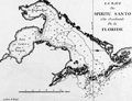 | Details | Le Rouge, George | 1778 |
| Scarce early nautical chart of Tampa Bay, Florida |
|
Le Rouge, George |
|
| 1778 |
| LOC:200 |
| $1,500.00 | Le-Rouge--George | Scarce-early-nautical-chart-of-Tampa-Bay--Florida | Fine and very scarce copper-plate engraved harbor chart of the "Baye du Spiritu Santo" comprised of "Bay de Tampa" and the "Baye de Hillsborough", by George le Rouge, from Paris. Coverage on this fine historic French nautical artifact covers areas in Florida that are today's <b>St. Petersburg, Tampa, Brandon, Bradenton and Sarasota</b>. Only one sale recorded in AMPR, 28 years ago.
<br></br>
Le Rouge noted only a few key features including: two references to "Eau douce" (Trans. 'sweet water'); a location noted as "Black Rocks"; "Egmont Island"; and "Long Island" (today's Longboat Key).
<br></br>
From Pilote américain septentrional by <b>George le Rouge</b>, this is one of the <b>earliest available large-scale nautical charts of Tampa Bay</b> with the entrance to the Gulf of Mexico. Rouge's Pilote américain septentrional drew heavily upon the work of William Faden and Thomas Jefferys. The maps were modified with French nomenclature but their British origin explains why some place names are in English. Latitude is noted but no metrics exist for longitude. Distance scale is in English miles. Manuscript number "27" in upper right. |
| 1172 | 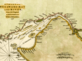 | Details | Gentlemans Magazine | 1779 |
| Revolutionary War era chart of Delaware Bay and River |
|
Gentlemans Magazine |
|
| 1779 |
| LOC:0 |
| $0.00 | Gentlemans-Magazine | Revolutionary-War-era-chart-of-Delaware-Bay-and-River | SOLD
<br></br>
Small antique chart of Delaware Bay and River. Derived from the larger chart of Delaware Bay and River up to Philadelphia, Pennsylvania by Joshua Fisher (1707-1783) in 1776. Shows the location of a Pilot's Town near Cape Henlopen. Identifies the ship channels from Cape May and Cape James up the Delaware River past Salem Mass., Wilmington, Newcastle, and Chester to the small town of Philadelphia, Pennsylvania. Key features include Mud Island, the Schuylkill River, Stony Point, Egg Island Flats, Fortescue's Island, Cold Spring Inlet, Turtle Gut Inlet, and Rehoboth Bay. The mouths of numerous creeks are named including Clark's Ditch, Motherkiln Creek, and Nantuxet Creek.
<br></br>
Published in the "Gentleman's Magazine", July 1779, volume 49, page 369.
<br></br>
Joshua Fisher's early chart of Delaware Bay from the Sea-Coast to Reedy-Island was published during the French & Indian War, and was immediately suppressed by the Assembly, fearing that its falling into enemy hands would make Philadelphia a target of the French navy. Fisher's chart showed the lower part of the bay and was intended to be used as a navigational aid for ships sailing toward Philadelphia. In 1775, Fisher produced an expanded chart that showed the bay and the Delaware River to just beyond Philadelphia. This was the most important map of the bay and river in the 18th century. |
| 568 |  | Details | Ponce, Nicolas. and Godefroy, Francois. | 1784 |
| Époques de l'établissement des Européens dans les États Unis |
|
Ponce, Nicolas. and Godefroy, Francois. |
|
| 1784 |
| LOC:3 |
| $375.00 | Ponce--Nicolas--and-Godefroy--Francois- | Époques-de-l-établissement-des-Européens-dans-les-États-Unis | One of the earliest available United States post-Revolutionary War population thematic maps, ca. 1784. Tabulates the population of the U.S. by state/territory. <br></br>
Shaded geographic areas on this original antique map show the Northeast United States and the extent of the original territories of Georgia, South Carolina, and North Carolina west to the Mississippi River. The shaded areas are tied back to a population table at left that shows the population for each territory. States and territories at the time of publication totaled a meager 3,119,676 persons, just 1% of the total population in 2013. This tabulation pre-dates the first official census that was conducted in 1790. In that earliest census the population was estimated at 3.92 million.<br></br>
At right the major ports for each state are identified and at bottom the authors provide a brief history for each state. All area west of the Mississippi River is labeled "Louisiane".<br></br>
French map published in Paris c. 1784. Source: "Collection d'estampes représentant les évenemens de la guerre, pour la liberté de l'Amérique Septentrionale". |
| 7952 |  | Details | Hill, William | 1786 |
| Rare Headright Plat of Cedar Island Oconee River Georgia |
|
Hill, William |
|
| 1786 |
| LOC:78 |
| $990.00 | Hill--William | Rare-Headright-Plat-of-Cedar-Island-Oconee-River-Georgia | Extremely rare pen and ink manuscript map of Cedar Island, Georgia signed by Thomas McCall (1), Surveyor General of Georgia, just two years before the colony became the fourth state to enter the Union when it ratified the U.S. Constitution on January 2, 1788. The plat survey, conducted March 20, 1786, was related to a warrant issued by Senior Justice Jared Irwin (2), just two years after Washington County was created from land ceded by two treaties with the Creek and Cherokee native Americans in 1783.
<br><br>
The true location of Cedar Island is speculative but, at the top of the document is a drawing of the Cedar Island plat, bisected by a survey line where the two end points were a white oak tree and a cypress tree. The island lies surrounded on all four sides by the Oconee river, and with other properties outside the boundaries, including “Indian Land” at the north. The text reads:
<br><br><div class="indenttextblocksingle">
“Pursuant to a Warrant under the hand of the Honorable Jared Irwin esquire Senior Justice presiding at … court ... in Washington County. Dated March 6,1786. Was Surveyed for Charnill Wallis, who resides in this State a Tract of Land containing Six Hundred Acres in Oconee River called Ceder Island: - Having such form & marks, as are expected in the above plat. Surveyed March 20, 1786 by Jno. Hill D.S. & certified by Saml. Camp pro. b. Surveyor."</div>
<br> |
| 2563 | 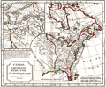 | Details | Vaugondy, Robert de | 1795 |
| Canada. Louisiane. Etats-Unis. |
|
Vaugondy, Robert de |
|
| 1795 |
| LOC:10 |
| $360.00 | Vaugondy--Robert-de | Canada--Louisiane--Etats-Unis- | Uncommon third edition (Delamarche) of Vaugondy's map with changed title cartouche and "corrigés par le Cen.Lamarche son successeur" added to title.
<br></br>
Several changes are notable for this later edition as compared to Vaugondy's 1778 issue. For Florida,new locations are recorded at Saint Augustine and Cape Canaveral. Two maps on one sheet- east and west coasts.
<br></br>
The map of the western part of North America is most notable for it's depiction of Mer de L'Quest or Sea of the West. A great sea, easily the size of the Mediterranean, to flow from the then-known Strait of Juan de Fuca. Shows an opening to the ocean from this great sea at roughly in North California or Oregon and Quivira somewhere in Idaho.
<br></br>
Martha's Vineyard is named as "Martins Viniard". Many Indian Tribes and French Forts located in the Old Northwest and west of the Mississippi. Florida is depicted as an Archipelago.
<br></br>
Dated to 1795, the 3rd year of the French Republic. |
| 815 | 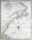 | Details | Malham, John | 1796 |
| A Correct Chart of the East Coast of North America |
|
Malham, John |
|
| 1796 |
| LOC:0 |
| $0.00 | Malham--John | A-Correct-Chart-of-the-East-Coast-of-North-America | SOLD
<br></br>
Antique small-scale copperplate map / chart of the U.S. East Coast published by Spotswood and Nacrede from Boston in September 1796 in Malham's Naval Gazetteer. Indian tribal names are shown, particularly along the St. Lawrence River. These include the Iroquois, Algonkin, and Temiskamings.
<br></br>
Coverage is from the North Coast of Cuba, Florida and Bahamas past the Grand Bank to Labrador. Both latitude and longitude clearly marked as well as numerous rhumb lines. Direction of prevailing current flow for the "Florida Stream" (Gulf Stream) is shown by arrows. Georges Bank is not labeled as such, unlike the later 1801 edition.
<br></br>
This sea chart comes from John Malham's antique nautical gazetteer or geographical dictionary produced first in England and after 1796 in the United States.
<br></br>
Rev. John Malham was a prolific Yorkshire-born author who produced other diverse works that include "Navigation Made Easy and Familiar", "Twenty-Two Sermons on Doctrinal and Practical Subjects" and "The Scarcity of Wheat considered". Malham died near London in 1807. (Gentleman's Magazine, Vol 102, 1807, p. 568). |
| 419 | 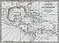 | Details | Malham, John | 1797 |
| A Correct Chart of the West India Islands engraved for Malham's Naval Gazetteer |
|
Malham, John |
|
| 1797 |
| LOC:3 |
| $375.00 | Malham--John | A-Correct-Chart-of-the-West-India-Islands-engraved-for-Malham-s-Naval-Gazetteer | Increasingly scarce on the market. Rev. John Malham's chart of the United States east coast lying south of Charlestown, South Carolina. Covers the Gulf of Mexico, Cuba, Bahamas, Hispaniola, the West Indies, Central America, Columbia, and Venezuela south to the mouth of the Orinoco River. This chart has examples of interesting usage of terms that are today known only from history books: 'Spanish Main' for the southern Caribbean Sea; 'Terra Firma' denotes northern Colombia and Venezuela. Key noted cities include Charleston, Savannah, St. Augustine, New Orleans, Havana, Port Royal, Cartagena, Caracas.
<br></br>
From the rare first American edition of Malham's Naval Gazetteer, published by Spotswood and Nancrede in Boston in 1797. Early U.S. colonial nautical chart engravings are scarce.
<BR> </BR>
This chart comes from an early nautical gazetteer or geographical dictionary produced first in England and after 1796 in the United States by John Malham a prolific Yorkshire-born author who produced other diverse works that include "Navigation Made Easy and Familiar". |
| 5243 | 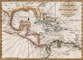 | Details | Malham, John | 1797 |
| A Correct Chart of the West India Islands early Boston published |
|
Malham, John |
|
| 1797 |
| LOC:200 |
| $365.00 | Malham--John | A-Correct-Chart-of-the-West-India-Islands-early-Boston-published | Antique nautical chart showing the east coast of the United States south of Charlestown, South Carolina, the Gulf of Mexico, Cuba, Bahamas, Hispaniola, the West Indies, Central America, Columbia, and Venezuela south to the mouth of the Orinoco River. This chart has examples of interesting usage of terms that are today known only from history books: 'Spanish Main' for the southern Caribbean Sea; 'Terra Firma' denotes northern Colombia and Venezuela. Key noted cities include Charleston, Savannah, St. Augustine, New Orleans, Havana, Port Royal, Cartagena, Caracas.
<br></br>
From the rare first American edition of Malham's Naval Gazetteer, published by Spotswood and Nancrede in Boston in 1797. Early U.S. colonial nautical chart engravings are scarce.
<BR> </BR>
This chart comes from an early nautical gazetteer or geographical dictionary produced first in England and after 1796 in the United States by John Malham. Rev. John Malham was a prolific Yorkshire-born author who produced other diverse works that include "Navigation Made Easy and Familiar", "Twenty-Two Sermons on Doctrinal and Practical Subjects" and "The Scarcity of Wheat considered". Malham died near London in 1807. (Gentleman's Magazine, Vol 102, 1807, p. 568).<BR> </BR> |
| 846 | 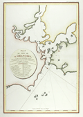 | Details | La Perouse, Jean François Galaup | 1797 |
| Antique French Chart of San Francisco Bay, California |
|
La Perouse, Jean François Galaup |
|
| 1797 |
| LOC:0 |
| $0.00 | La-Perouse--Jean-François-Galaup | Antique-French-Chart-of-San-Francisco-Bay--California | SOLD<br></br>
This antique French chart is the earliest available chart (1797) for collectors of the San Francisco Bay area, in California. The map was produced by Jean François Galaup la Perouse after a 10 day exploration of the San Francisco area in 1786 and published posthumously in 1797. Earlier manuscript charts do exist, by Cañizares in 1776 and 1781, but these are extremely rare and generally not available to collectors.
<br></br>
A legend with 20 items is keyed to locations on the map including "Presidio de San Francisco", Mission de San Francisco", "Ile de Alcatraces" ( Alcatraz Island ), and "Pte. de Reyes". Depth soundings and anchorages are marked generally in the lower bay only.
<br></br>
As a French explorer and naval officer la Perouse (1741-1788?) was tasked by King Louis XVI of France with completing the Pacific exploration begun by British Captain James Cook. Aboard the ships Astrolabe and Boussole, la Perouse and his crew mapped the west coast of North America and Alaska in 1786 and visited Easter Island and the Sandwich Islands ( Hawaii ). After reaching Australia's Botany Bay in 1788 his ships were lost at sea while searching for the Solomon Islands.
<br></br>
This map is from the French edition of the "Atlas du voyage de La Perouse". L. Aubert scripsit. Plate 33. |
| 6800 | 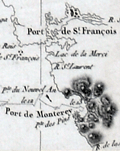 | Details | Dagelet, Joseph Lepaute | 1797 |
| Original antique French nautical chart of the west coast of North America |
|
Dagelet, Joseph Lepaute |
|
| 1797 |
| LOC: |
| $800.00 | Dagelet--Joseph-Lepaute | Original-antique-French-nautical-chart-of-the-west-coast-of-North-America | Original antique nautical chart of the west coast of North America from Mt. St. Elias (1) to Monterey Bay. Shows route of la Perouse. Includes the west coasts of California, Washington, and Oregon. From the atlas of the voyage by Lapérouse. Plate 16.
<br><br>
Jean-François de Galaup, Comte de Lapérouse was a French Naval officer and explorer whose journey started in 1785 under the commission of King Louis XVI. The expedition comprised two ships, the Astrolabe and the Boussole, and a crew of 225. The crew included scientists and artists who were tasked with documenting various aspects of the journey, including geography, wildlife, and indigenous cultures. This expedition aimed to complete the Pacific explorations undertaken by Captain Cook and others. The journey is noted for its tragic disappearance of Laperouse near the end.
<br><br>
The disappearance of Lapérouse's expedition sparked much interest and concern, leading to numerous rescue and search missions. The wreckage of the two ships was finally discovered in 1826 near Vanikoro, an island in the Solomon Islands, but the exact circumstances of the expedition's end remain a mystery.
<br><br>
(1) Mount St. Elias, located on the border between Alaska in the United States and Yukon in Canada, is one of the highest peaks in North America, at an elevation of 18,008 feet. It forms part of the St. Elias Mountain Range, which hosts some of the most extensive ice fields in the world. |
| 721 | 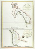 | Details | La Perouse, Jean François Galaup | 1797 |
| Antique 1782 Plan of San Diego, California |
|
La Perouse, Jean François Galaup |
|
| 1797 |
| LOC:63 |
| $800.00 | La-Perouse--Jean-François-Galaup | Antique-1782-Plan-of-San-Diego--California | Two very attractive engraved antique nautical charts on one page of the harbors of <b>San Diego</b>, California (upper half) and San Blas, Mexico in Nayarit State. Locations around San Diego, California that are noted on the chart include: the Presidio de St. Diego, the 'faux port', Pointe des Morts, Rancherie de las Choyas, Pointe St. Augustin, Rancherie ou Village d'Indiens nomme de la Pointe, Pointe St. Joseph, Pointe St. Michel, Petite Port de St Jean, Pointe Guizarros, and Pointe de la Colline. Numerous soundings are included with descriptions of the composition of the sea floor on the approaches to and bottom of the San Diego Bay.
<br></br>
These two charts by Jean-Francois de la Perouse are based on surveys by Juan Pantoja, a captain of the Manila trade for Spain. Derived from Pantoja's manuscript, the charts were published posthumously in the "Atlas du Voyage de la Perouse 1785-1788". Plate 35.
<br></br>
San Blas was used by Spain's Navy as a naval base beginning in 1768 and it served for several decades as a base of operations for Spanish expeditions to the Pacific Northwest. For about twenty years in the late 18th century, San Blas was one of the busiest ports on the Pacific coast of the Americas, rivaling Acapulco. L. Aubert, scripsit.
<br></br>
As a French explorer and naval officer la Perouse (1741-1788?) was tasked by King Louis XVI of France with completing the Pacific exploration begun by British Captain James Cook. Aboard the ships Astrolabe and Boussole, la Perouse and his crew mapped the west coast of North America and Alaska in 1786 and visited Easter Island and the Sandwich Islands ( Hawaii ). After reaching Australia's Botany Bay in 1788 his ships were lost at sea while searching for the Solomon Islands. |
| 3587 | 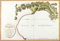 | Details | La Perouse, Jean François Galaup | 1797 |
| Beautiful Antique Chart of Monterey Bay and Carmel Bay, California |
|
La Perouse, Jean François Galaup |
|
| 1797 |
| LOC:10 |
| $950.00 | La-Perouse--Jean-François-Galaup | Beautiful-Antique-Chart-of-Monterey-Bay-and-Carmel-Bay--California | First French edition of this original antique early plan of Monterey Bay, Carmel, and Carmel Bay in California. This map is the earliest obtainable map of the Monterey and Carmel region.
<br></br>
Because this chart is the only one of Perouse's charts based on his own exploration some dealers consider this map to be a foundational map for all collectors of 18th century California cartography.
<br></br>
The fine hand-colored chart shows the very small town of Carmel with the Mission de St. Charles, and the Presidio at a distance. The map makes it possible to understand how the development of local transportation routes was impacted by the area's geography. Locates an anchorage (mouillage"), Pointe du Nouvel-an (New Year Point near Santa Cruz) and the Montagnes de St. Lucie. Rhumb lines in the bay with north oriented to the left. A scarce map of the area.
<br></br>
As a French explorer and naval officer la Perouse (1741-1788?) was tasked by King Louis XVI of France with completing the Pacific exploration begun by British Captain James Cook. Aboard the ships Astrolabe and Boussole, la Perouse and his crew mapped the west coast of North America and Alaska in 1786 and visited Easter Island and the Sandwich Islands ( Hawaii ). After reaching Australia's Botany Bay in 1788 his ships were lost at sea while searching for the Solomon Islands.
<br></br>
This map is from the French edition of the "Atlas du voyage de La Perouse". L. Aubert scripsit. Plate 34. |
| 2548 | 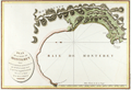 | Details | La Perouse, Jean François Galaup | 1797 |
| Antique French Chart of Monterey Bay and Carmel Bay, California |
|
La Perouse, Jean François Galaup |
|
| 1797 |
| LOC:0 |
| $0.00 | La-Perouse--Jean-François-Galaup | Antique-French-Chart-of-Monterey-Bay-and-Carmel-Bay--California | SOLD, but we have a similar item of Monterey Bay available in stock.
<br></br>
First French edition of this original antique early plan of Monterey Bay, Carmel, and Carmel Bay in California. This map is the earliest obtainable map of the Monterey and Carmel region. |
| 3616 | 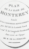 | Details | La Perouse, Jean François Galaup | 1797 |
| Earliest obtainable map of the Monterey and Carmel, California region. |
|
La Perouse, Jean François Galaup |
|
| 1797 |
| LOC:10 |
| $550.00 | La-Perouse--Jean-François-Galaup | Earliest-obtainable-map-of-the-Monterey-and-Carmel--California-region- | The first French edition of the antique early plan of Monterey Bay, Carmel, and Carmel Bay in California is an uncolored and historically significant chart. It is the only chart of La Pérouse's based on his own exploration, making it a foundational map for collectors of 18th-century California cartography. This chart represents the earliest obtainable map of the Monterey and Carmel region.
<br><br>
The hand-colored chart accurately portrays the small town of Carmel, featuring the Mission de St. Charles and the Presidio at a distance. The map provides insight into how the area's geography impacted the development of local transportation routes. It locates an anchorage (mouillage), Pointe du Nouvel-an (New Year Point near Santa Cruz), and the Montagnes de St. Lucie. The bay's rhumb lines are oriented with north to the left, adding to the rarity of the map.
<br><br>
This map is part of the French edition of the "Atlas du voyage de La Perouse," with L. Aubert as the engraver. It appears as Plate 34 within the atlas. Collectors and historians alike treasure this map as a crucial piece of 18th-century California cartography and a testament to La Pérouse's exploration of the Pacific. |
| 1339 |  | Details | Mentelle and Chanlaire | 1798 |
| Fine antique map of the Americas |
|
Mentelle and Chanlaire |
|
| 1798 |
| LOC:0 |
| $0.00 | Mentelle-and-Chanlaire | Fine-antique-map-of-the-Americas | SOLD
<br></br>
Beautifully engraved and hand-colored map of the western hemisphere focused on North America and South America. The combination of the curved map projection and the fine coloring work act synergistically to emphasize the curvature of the earth's surface. The map projection allows the inclusion of Africa and Europe at right, and New Zealand and the Pacific Islands at left.
<br></br>
The date of "An VI" dates the map to the sixth year of the French Revolution or 1798 in the Gregorian calendar. Interesting bit of land shown north of the Arctic Circle outside the neatline.
<br></br>
Political subdivisons shown in red. Published from Paris by French cartographers E. Mentelle and Pierre-Giles Chanlaire. Number 155. |
| 79 | 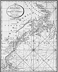 | Details | Malham, John | 1801 |
| A Correct Chart of the East Coast of North America 2nd. Ed. |
|
Malham, John |
|
| 1801 |
| LOC:0 |
| $0.00 | Malham--John | A-Correct-Chart-of-the-East-Coast-of-North-America-2nd--Ed- | SOLD
<br></br>
Antique small-scale copper-plate chart by John Malham. Coverage includes from the North Coast of Cuba, Florida and Bahamas past the Grand Bank to Labrador. Both latitude and longitude are clearly marked as well as numerous rhumb lines. Direction of prevailing current flow of the "Florida Stream" is shown by arrows. This later 1801 version of Malham's 1796 chart includes the label "St. Georges Bank, for that well-known fishing area, a feature missing from the earlier chart.
<br></br>
Rev. John Malham was a prolific Yorkshire-born author. Malham died near London in 1807. (Gentleman's Magazine, Vol 102, 1807, p. 568). |
| 80 | 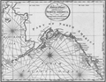 | Details | Malham, John | 1801 |
| A Correct Chart of the West Coast of North America |
|
Malham, John |
|
| 1801 |
| LOC:3 |
| $350.00 | Malham--John | A-Correct-Chart-of-the-West-Coast-of-North-America | Crisp antique copperplate map / chart of Alaska published from Boston in 1801 by Rev. John Malham in Malham's Naval Gazetteer. One of the earliest available maps of Alaska printed in the United States in the early 19th century. Named features include Bristol Bay, Prince William's Sound, Queen Charlotte's Isles, Mt. St. Elias, Cook's River, Bhering's Straits, Port Bukarelli (Bucareli Bay), and Kodiak Island.
<br></br>
The land mass that today we call Alaska is only noted as "Part of North America", and the designation "Alaska" is reserved for the Alaska Peninsula, a narrow body of land separating Bristol Bay from the Pacific Ocean.
<br></br>
This later edition of Malham's map is updated with detailed place names not found in his earlier map of 1796. Mt. St. Elias, today designated Boundary Peak 186, is much more prominently noted. Numerous decorative rhumb lines.
<br></br>
Rev. John Malham was a prolific Yorkshire-born author. Malham died near London in 1807. (Gentleman's Magazine, Vol 102, 1807, p. 568). |
| 1344 | 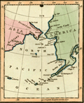 | Details | Luffman, John | 1802 |
| Behrings Strait and Alaska engraved for Luffman's Select Plans |
|
Luffman, John |
|
| 1802 |
| LOC:3 |
| $280.00 | Luffman--John | Behrings-Strait-and-Alaska-engraved-for-Luffman-s-Select-Plans | Scarce and attractive antique copper-plate engraved map of the Bering (Behring) Strait and Gulf of Alaska by John Luffman. This small but fine map extends past 70 degrees north latitude. The Bering Strait is a narrow body of water that links the Arctic Ocean with the Bering Sea and separates the continents of Asia and North America ( Alaska ) at their closest point. Some portions of the Alaska and Asia coasts not well explored at the time are shown with dotted lines, reflecting the uncertainty about their geography.
<br></br>
Key locations noted by Luffman include Bristol Bay, Cook River, Cape Prince of Wales, Cape Stephens, Cape Mulgrave, Cape Lisburn, Round Island, Norton Sound, and Trinity Island at the southern tip of the Kodiak Archipelago (not shown in its entirety).
<br></br>
Bering's strait averages 100 to 165 feet in depth and at its narrowest point is about 53 miles wide. About 20,000 years ago, during the Ice Age, the sea level fell by several hundred feet, making the strait into a land bridge between Asia and North America, over which the migration of plants and animals and humans occurred.
<br></br>
From "Luffman's Select Plans of the Principal Cities, Harbors, Forts etc. in the World". Engraved and published by John Luffman, No. 28 Little Bell Alley, Coleman Street, February, 1802. Volume II; Number 67.
<br></br> |
| 1457 | 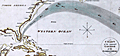 | Details | Gold, Joyce | 1804 |
| Chart of the Supposed Course of the Florida Stream |
|
Gold, Joyce |
|
| 1804 |
| LOC:3 |
| $400.00 | Gold--Joyce | Chart-of-the-Supposed-Course-of-the-Florida-Stream | Graphically arresting thematic chart of the "Florida Stream" or Gulf Stream with its flow northwards up the east coast of the United States, well past Bermuda, and then into the North Atlantic Ocean. Direction of the Gulf Stream current is shown visually by arrows supplemented with written notations indicating the compass direction at several locations across the stream.
<br></br>
The map may be considered to be an example of persuasive cartography. The concept of the Gulf Stream was novel at that time (hence the "supposed"); many mariners had not fully adopted the notion when this map was published. The direction and flow of the Gulf Stream was proposed by Benjamin Franklin in 1770 based on measurements he took during voyages from the U.S. to England and France.
<br></br>
London Published May 31, 1804 by J. Gold, 103 Shoe Lane. |
| 5348 | 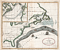 | Details | Anonymous | 1806 |
| Original antique Ben Franklins Chart of the Gulf Stream |
|
Anonymous |
|
| 1806 |
| LOC:11 |
| $0.00 | Anonymous | Original-antique-Ben-Franklins-Chart-of-the-Gulf-Stream | SOLD<br></br>
Decorative antique chart of the Gulf Stream with the Florida East and West Territories. After Benjamin Franklin's original chart, first engraved by James Poupard, published by the American Philosophical Society in 1786.
<br></br>
This chart lacks the written <b>sailing directions</b> in Poupard's engraving or "Remarks upon the navigation from Newfoundland to New York in order to avoid the Gulph Stream on the one hand, and on the other the Shoals that lie to the southward of Nantucket and of St. George's Banks." In those remarks, Franklin notes the time savings mariners can achieve through avoiding the Gulf Stream when westbound from England to the USA :
<div class="indenttextblocksingle">
"The Nantucket captains who are acquainted with this stream, make their voyages from England to Boston in as short a time generally as others take in going from Boston to England, viz. from 20 to 30 days."
</div>
</br>
Source: The Complete Works on Philosophy, Politics and Morals of the Late Dr. Benjamin Franklin, 2nd ed, London 1806. Plate VII. Vol 2. p. 197. Published by Longman, Hurst, Rees, and Orme. London, April 1, 1806. |
| 597 |  | Details | Buache, Jean Nicolas | 1807 |
| Ile de New-York Partie de Long-Island ou de l'Ile Longue |
|
Buache, Jean Nicolas |
|
| 1807 |
| LOC:0 |
| $0.00 | Buache--Jean-Nicolas | Ile-de-New-York-Partie-de-Long-Island-ou-de-l-Ile-Longue | SOLD<br></br>
Detailed topographic map of New York, Long Island and surrounding areas with positions of American and British military forces during the Battle of Brooklyn during August 22-27, 1776. This antique copperplate engraved map is attributed to J.N. Buache and includes many nautical points of interest, as during that period access from the sea was often faster than by land.
<br></br>
Named features include Fort Independence, Fort Lee, Hudson River, York Bay, Oyster Bay, Hell Gate, Governor's Island, the East River, Staten Island, Bergen, Flushing, Brooklyn, East Chester and West Chester. Numerous roads and the position of several named ships are also noted including the Roebuck, the Rose, the Greyhound, and the Thunder.
<br></br>
From John Marshall's "Vie de George Washington". Plate VII. |
| 691 | 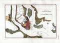 | Details | Buache, Jean Nicolas | 1807 |
| Charleston, South Carolina 1780 |
|
Buache, Jean Nicolas |
|
| 1807 |
| LOC:3 |
| $0.00 | Buache--Jean-Nicolas | Charleston--South-Carolina-1780 | SOLD
<br></br>
Antique engraved map of "Charlestown" ( Charleston, South Carolina ) in 1780 produced ca. 1807 in the French edition of John Marshall's "Life of Washington" (Vie De George Washington). The map depicts the general disposition of forces during the Siege of Charleston (March - May 1780) during the American Revolution . Shows a defensive wall partially surrounding the city and booms placed both at Fort Moultrie and near the Charleston harbor that were designed to deny passage to British naval vessels. Fort Sumter, which today guards the entrance to Charleston Bay and figures prominently in the U.S. Civil War as the site where the first shots were fired, is absent from the map because it was not constructed until 1829.
<br></br>
Noted points of interest identified on this antique map of Charleston include: James Island with Fort Johnson; Fort Moultrie at the West end of Sullivan's Island; Wappoo Creek; Pointe Cummin with a nearby hospital; Shutes Folly, Town Creek; Cooper River; and Hog Island. Fort Moultrie is of special interest as it was one in a series of defensive structures at that location on Sullivan's Island. The original fort built of palmetto logs at that spot inspired both the flag and nickname of South Carolina: "The Palmetto State".
<br></br>
Copper-plate engraved map, 200+ years old in good condition. Publisher: Dentu, Imprimeur-Libraire. Plate XIII. |
| 2571 |  | Details | Schultz, Christian | 1810 |
| Early Original Map of the Ohio River Between Pittsburgh and St. Louis |
|
Schultz, Christian |
|
| 1810 |
| LOC:0 |
| $0.00 | Schultz--Christian | Early-Original-Map-of-the-Ohio-River-Between-Pittsburgh-and-St--Louis | SOLD<br></br>Finely executed original antique map of the Ohio River between Pittsburgh, Pennsylvania and St. Louis, Missouri. This fine antique copper-plate engraved map is one of the earliest maps of the Ohio River published in America. Drawn by Christian Schultz.
<br></br>
Published in 1810 for Christian Schultz's "Travels on an Inland Voyage Through the States of New York, Pennsylvania, Virginia, Ohio, Kentucky and Tennessee, and through the territories of Indiana, Louisiana, Mississippi, and New-Orleans; performed in the years 1807 and 1808…"
<br></br>
Schultz's work is one of the earliest works to give a detailed account of travel and the actual risks and dangers encountered in the western country. Schultz crossed upstate New York and western Pennsylvania, then went down the Ohio and Mississippi rivers to New Orleans, traveling inland along the way. Schultz's book is a compilation of his letters, and was published in direct response to an earlier travel guide written by Englishman Thomas Ashe in 1806. Ashe had traveled on both of these rivers and wrote mostly negative reports, arousing much bitterness among Americans toward British visitors. |
| 3654 |  | Details | Schultz, Christian | 1810 |
| Early Original Map of the Hudson and Mohawk Rivers |
|
Schultz, Christian |
|
| 1810 |
| LOC:0 |
| $0.00 | Schultz--Christian | Early-Original-Map-of-the-Hudson-and-Mohawk-Rivers | SOLD<br></br>
Schultz's very early map of the with the Hudson, Mohawk, Allegheny, and Ohio Rivers. Shows a water-based transportation route from New York City to Pittsburg via the system of rivers and lakes with only a single portage required at the southern portion of Lake Erie.
<br></br>
Includes portions of Lake Ontario and Lake Erie. Follows the rivers' course from New York City and the Hudson River to Lake Ontario, via the Hudson River and Mohawk River; then follows the Ohio River, via Fort Erie and the Allegheny river.
<br></br>
Published in 1810 for Christian Schultz's "Travels on an Inland Voyage Through the States of New York, Pennsylvania, Virginia, Ohio, Kentucky and Tennessee, and through the territories of Indiana, Louisiana, Mississippi, and New-Orleans; performed in the years 1807 and 1808…"
<br></br>
Schultz's work is one of the earliest works to give a detailed account of travel and the actual risks and dangers encountered in the west. Schultz's book is a compilation of his letters. The book was published in direct response to the negative reports in an earlier travel guide written by Englishman Thomas Ashe in 1806. |
| 2576 | 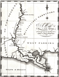 | Details | Schultz, Christian | 1810 |
| Early Original Map of the Mississippi River from Ohio R. to Gulf of Mexico |
|
Schultz, Christian |
|
| 1810 |
| LOC:10 |
| $0.00 | Schultz--Christian | Early-Original-Map-of-the-Mississippi-River-from-Ohio-R--to-Gulf-of-Mexico | SOLD
<br></br>
Finely executed original antique map of the <b>Mississippi River</b> from <b>Fort Jefferson, Kentucky</b>, near the junction with the Ohio River, to the Gulf of Mexico. Fort Jefferson was established in 1780 by George Rogers Clark at the express instruction of the then Governor of Virginia, Thomas Jefferson. The fort was abandoned in June 1781.
<br></br>
The area bounded by Bayou Manchac, Lake Ponchartrain and the Mississippi River is labeled "Island of New Orleans". In 1803 Alexander Hamilton wrote <div class="indenttextblock">"The Island of New-Orleans is in length about 150 miles; its breadth varies from 10 to 30 miles. Most of it is a marshy swamp, periodically inundated by the river. The town of New-Orleans, situated about 105 miles from the mouth of the river, contains near 1300 houses, and about 8000 inhabitants, chiefly Spanish and French. It is defended from the overflowings of the river, by an embankment, or leveé, which extends near 50 miles."(Purchase of Louisiana, [5 July 1803],” Founders Online, National Archives, last modified June 13, 2018, http://founders.archives.gov/documents/Hamilton/01-26-02-0001-0101.) </div>
<br></br>
This fine antique copper-plate engraved map is is one of the earliest maps of the Mississippi River published in America. Drawn by Christian Schultz. Two maps on one sheet.
<br></br>
Published in 1810 for Christian Schultz's "Travels on an Inland Voyage Through the States of New York, Pennsylvania, Virginia, Ohio, Kentucky and Tennessee, and through the territories of Indiana, Louisiana, Mississippi, and New-Orleans; performed in the years 1807 and 1808…"
<br></br>
Schultz's work is one of the earliest works to give a detailed account of travel and the actual risks and dangers encountered in the western country. Schultz's book is a compilation of his letters, and was published in direct response to the negative reports in an earlier travel guide written by Englishman Thomas Ashe in 1806. |
| 6721 |  | Details | Yeager, Joseph | 1817 |
| Battle of New Orleans Engraving Death Packenham |
|
Yeager, Joseph |
|
| 1817 |
| LOC:86 |
| $1,200.00 | Yeager--Joseph | Battle-of-New-Orleans-Engraving-Death-Packenham | This engraved copper-plate print, created in 1817 by Joseph Yeager after William Edward West, depicts the decisive moment in American history when Major General Andrew Jackson led United States forces to a victory over the British Army and Royal Navy near Chalmette, Louisiana in the Battle of New Orleans. This significant triumph marked a turning point in the War of 1812.
<br><br>
The print vividly portrays the intensity and drama of the battle, capturing the heroic victory of the American soldiers over the invading British forces. General Edward Pakenham's death signified the end of the battle.
<br><br>
The print shows the British forces as they advance upon the American earthworks or barricades, which were fiercely defended by Jackson's forces. At the bottom center, a head-and-shoulders portrait of Andrew Jackson, along with American flags and weapons.
<br><br>
Second state issue of the print includes thirteen lettered keys lacking in the first, and also features the figure of Gen. Lambert pointing to the right. In the first state, Lambert is depicted weeping into a handkerchief.
<br><br>
Copper engraving. Printed by Yerkes Saurman (1791- )
<br><br> |
| 1145 | 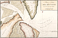 | Details | Direccion Hidrografia | 1818 |
| Boca y Barra Del Rio Nasau |
|
Direccion Hidrografia |
|
| 1818 |
| LOC:200 |
| $1,475.00 | Direccion-Hidrografia | Boca-y-Barra-Del-Rio-Nasau | Rare Spanish nautical chart of the mouth (boca) and bar (barra) in Nassau Sound, Florida in 1818. One of the earliest available large-scale charts of the entrance to the Nassau River and the coastal margins near that waterway which divides Amelia Island from Talbot Island.
<br></br>
From the second part of "Portolano de la America Septentrional Construido en la Direccion Detrabajos Hidrograficos" published in 1818 by Spain's Admiralty department, the
<a href="https://www.rarecharts.com/DireccionHidrografiaBackground.aspx " target="_blank">Dirección de Hidrografía. </a> Plate 326. |
| 4774 | 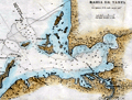 | Details | Direccion Hidrografia | 1818 |
| Scarce antique Spanish chart of Tampa Bay, Florida |
|
Direccion Hidrografia |
|
| 1818 |
| LOC:200 |
| $1,650.00 | Direccion-Hidrografia | Scarce-antique-Spanish-chart-of-Tampa-Bay--Florida | A scarce Spanish antique nautical chart of a large area now encompassing St. Petersburg and Tampa, Florida, and all of Tampa Bay. With anchorages identified, depth soundings, and several Spanish place-names. One unidentified location, "Cayo de Aguada" or Watering Key, remains unknown to me. That location likely would have been very attractive to pirates and privateers as it offered both close proximity to fresh water and to the nearby deeper entrance channels to Tampa Bay.
<br></br>
Contains numerous coastal locations with their second-Spanish period names: Longboat Key ("Id. Larga"), Passage Key ("Cayo del Passage"), Sweetwater Creek ("Rio de Aguadulce"), Little Manatee River ("Rio de Manaties"), Point Pinellas (Punta de Pinar [Sp. pine]). During the research for Spanish place-names our search turned up an exact match for "Punta de Piedras" or Rocky Point on the northeast shore of Old Tampa Bay. Unfortunately, that location for "Punta de Piedras" is on the wrong side of the bay. The search continues.
<br></br>
From the second part of "Portolano de la America...", published in 1818 by Spain's Admiralty department, the Dirección de Hidrografía. In 1809 the Direccion first published this atlas of plans of bays, harbors, and ports from Spain’s New World possessions: "Portolano de la America Septentrional Construido en la Direccion de Trabajos Hidrograficos". Plate 36. |
| 1290 | 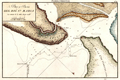 | Details | Direccion Hidrografia | 1818 |
| Scarce Spanish chart of north Amelia Island and St. Marys River bar. |
|
Direccion Hidrografia |
|
| 1818 |
| LOC:200 |
| $1,350.00 | Direccion-Hidrografia | Scarce-Spanish-chart-of-north-Amelia-Island-and-St--Marys-River-bar- | A scarce Spanish nautical chart of the mouth (boca) and bar (barra) of the Saint Mary's River, Florida. A scholarly summary of the map from the University of Miami notes the rarity of this small antique chart:
<div class="indenttextblock">
"This <b>rare map</b> shows the St. Marys River, which is the northern border of eastern Florida. It is from a Spanish portfolio showing harbor areas in its last colony in North America's eastern portion. <b>Very few maps are available that were made by them in the second Spanish Period</b>." <a href="http://scholar.library.miami.edu/floridamaps/view_image.php?image_name=dlp00020000860001001&group=cartographer" target="_blank">Internet. </a>
</div>
No record of the sale of the "Rio Santa Maria" map is reported in the Antique Map Price Record.
<br></br>
Includes portions of Fernandina Beach and north Amelia Island, Florida; Little Tiger Island, Florida; and south Cumberland Island Georgia.
<br></br>
Over 200 years ago, this chart of the bar with depth soundings, would have been very useful to mariner's entering or departing the St. Marys river. Shows "Fort Arruinado" ( Fort William ) on the southern tip of Cumberland Island.
<br></br>
The St. Marys River is a remote blackwater stream, located in southeastern Georgia and northeastern Florida, forming the easternmost border between the two states. The St. Marys serves as critical habitat for numerous rare, threatened or endangered species.
<br></br>
From the second part of "Portolano de la America...", published in 1818 by Spain's Admiralty department, the Dirección de Hidrografía. In 1809 the Direccion first published this atlas of plans of bays, harbors, and ports from Spain’s New World possessions: "Portolano de la America Septentrional Construido en la Direccion de Trabajos Hidrograficos". (Updated in 1818). Plate 40. |
| 1291 |  | Details | Direccion Hidrografia | 1818 |
| Antique Spanish chart of the mouth of St. Johns River, Florida |
|
Direccion Hidrografia |
|
| 1818 |
| LOC:200 |
| $1,325.00 | Direccion-Hidrografia | Antique-Spanish-chart-of-the-mouth-of-St--Johns-River--Florida | A scarce Spanish nautical chart by the Direccion Hidrografia of the mouth (boca) and bar (barra) of the Saint Johns River, Florida near Jacksonville. A scholarly summary by the the University of Miami of a similar map notes the rarity of these early antique Spanish charts:
<div class="indenttextblock">
"It is from a Spanish portfolio showing harbor areas in its last colony in North America's eastern portion. <b>Very few maps are available that were made by them in the second Spanish Period</b>." <a href="http://scholar.library.miami.edu/floridamaps/view_image.php?image_name=dlp00020000860001001&group=cartographer" target="_blank">Internet. </a>
</div>
<br></br>
North is oriented at the upper right.
<br></br>
The St. Johns is the longest river in Florida - 310 miles long. It is one of the few rivers in the United States that flows north. The source of the river is a large marshy area in Indian River County that flows north and turns eastward at Jacksonville, FL to its mouth in the Atlantic Ocean.
<br></br>
From the second part of "Portolano de la America...", published in 1818 by Spain's Admiralty department, the Dirección de Hidrografía. In 1809 the Direccion first published this atlas of plans of bays, harbors, and ports from Spain’s New World possessions: "Portolano de la America Septentrional Construido en la Direccion de Trabajos Hidrograficos". (Updated in 1818). Plate 40. |
| 30 |  | Details | Blondeau, Alexandre | 1820 |
| Carte de la partie de la Cote Nord-Ouest de L'Amerique |
|
Blondeau, Alexandre |
|
| 1820 |
| LOC:63 |
| $400.00 | Blondeau--Alexandre | Carte-de-la-partie-de-la-Cote-Nord-Ouest-de-L-Amerique | French copy of Vancouver's nautical chart of West North American coast from Alaska to Mexico. By Blondeau. Elsewhere attributed to Depot de la Marine but that is doubtful. Tracks of Vancouver's vessels, mountain ranges, missions, anchorages and a few soundings are clearly delineated.<BR> </BR>
Highly detailed (get a magnifier and enjoy) antique chart coverage extends down the coast from Kodiak Island, Alaska though Prince William sound, Port San Francisco and St. Diego California, into Mexico- Baie do Todos Santos, Baie de las Virgines, and ends near a marked anchorage near a mission 'St. Domingo'. California is described as "Nouvelle Albion".<BR> </BR> <BR> </BR>
Engraved and lettered by Blondeau: "Ecrit par M. Blondeau. Grave par Blondeau Rue et Porte St Jacques No 85." |
| 4805 |  | Details | von Kotzebue, Otto | 1821 |
| Kotzebue Chart of Beerings Straits on Mercators Projection |
|
von Kotzebue, Otto |
|
| 1821 |
| LOC:88 |
| $0.00 | von-Kotzebue--Otto | Kotzebue-Chart-of-Beerings-Straits-on-Mercators-Projection | SOLD
<BR> </BR>
Scarce antique map of the <b>Bering Strait (Beering's Strait)</b> from exploration by <b>Otto von Kotzebue</b> (1787-1846) after the exploration of Russian navigator Vitus Bering. Includes the track and dates of Kotzebue's ship, the brig <b>RURIK</b>, as well as numerous named locations including Kotzebue Sound, Cape Krusentern, the St. Lawrence Islands, Cape Lowenstern, Cape Deceit, and Eschholtz Bay. Von Kotzebue was a German officer in the Imperial Russian Navy.
<br></br>
This fine map is based on von Kotzebue's voyage around Cape Horn to Alaska during the early 19th century. After rounding Cape Horn and visiting Chile, Easter Island, Hawaii, and the Marshall Islands, Kotzebue explored the North American west coast and searched unsuccessfully for a passage to the Arctic Ocean. Graff called the expedition, the second Russian scientific expedition into the Pacific, "one of the great early nineteenth-century voyages of discovery."
<br></br>
The Bering Strait is a strait of the Pacific Ocean, which separates Russia and Alaska south of the Arctic Circle.
<br></br>
Scarce. From Otto von Kotzebue's "A Voyage of Discovery into the South Sea and Beering's Straits, for the Purpose of Exploring a North-East Passage, Undertaken in the Years 1815-1818."
London. Longman, Hurst, Rees, Orme & Brown. 1821.
<br></br>
Printed in 1821 in English, Russian, and German editions. |
| 1178 |  | Details | Melish, John | 1822 |
| 1822 Antique map of the New Orleans, Louisiana vicinity |
|
Melish, John |
|
| 1822 |
| LOC:3 |
| $325.00 | Melish--John | 1822-Antique-map-of-the-New-Orleans--Louisiana-vicinity | Scarce (1822) copperplate engraved map of New Orleans by John Melish. Map is uncommon. Coverage includes Bayou St. John, the lower shore of Lake Ponchartrain and a stretch of the Mississippi river below New Orleans. Legend at bottom graphically identifies two types of swamp surrounding New Orleans: "Cypress Swamp" and "Prairie Swamp".
<br></br>
Melish's named features include:
<div class="indenttextblock">
<ul style="list-style-type: circle;">
<li>Fort St. John</li>
<li>Borough of St. John</li>
<li>Suburb of Marigny</li>
<li>Bayou Sauvage and the Road to Chef Menteur</li>
<li>English Turn</li>
<li>Woodsville</li>
<li>Lake Lery</li>
<li>The Ouatchas River</li>
</ul>
</div>
Contains several notes related to the Battle of 1812 with the landing site and route of British forces identified.
<br></br>
From Melish's "A Geographical Description of the United States, with the Contiguous British and Spanish Possessions." Philadelphia, 1822. |
| 5358 |  | Details | Anonymous | 1822 |
| Notable manuscript Louisiana map - early 19th |
|
Anonymous |
|
| 1822 |
| LOC:200 |
| $325.00 | Anonymous | Notable-manuscript-Louisiana-map---early-19th | A notable manuscript map of Louisiana by, according to the seller, "a schoolgirl" in Tallmadge, Ohio. Sold from a lot of other maps, one with the attribution: "Tallmadge [Ohio ?] Febr. 7, 1822". The map is notable for the inaccuracies, archaic place names, and a surprising included waterway.
<br></br>
First, the inaccuracy. The land west of the Sabine River, or Texas, was not a British Dominion. In 1822, after Mexico gained independence from Spain a year earlier, the land was Mexican Texas.
Second, in 1817 the State of Mississippi was admitted to the Union. The Mississippi Territory was divided into the State of Mississippi and State of Alabama (1819).
<br></br>
Finally, it is very surprising to see the Iberville River (Bayou Manchac) on this map. Today, Bayou Manchac is a shallow eighteen mile long Bayou but when the French arrived in Louisiana the waterway was the "rivière d'Iberville", an important channel in the area's transportation network. In 1814 Bayou Manchac was closed to the Mississippi and was no longer navigable. |
| 77 |  | Details | Blunt, Edmund | 1822 |
| Harbour of Annis Squam in Ipswitch Bay |
|
Blunt, Edmund |
|
| 1822 |
| LOC:3 |
| $125.00 | Blunt--Edmund | Harbour-of-Annis-Squam-in-Ipswitch-Bay | Small copperplate engraved antique nautical chart of Annissquam inlet and harbor by Edmund Blunt for an edition of his well-known port and pilot book. With a decorative three-masted sailing vessel depicted underway into the channel marked to the east by the Annissquam lighthouse, established only 20 years earlier. |
| 514 |  | Details | Melish, John | 1822 |
| Charleston and Adjacent Country |
|
Melish, John |
|
| 1822 |
| LOC:0 |
| $0.00 | Melish--John | Charleston-and-Adjacent-Country | SOLD<BR> </BR>
Early (1822) copperplate engraved map of Charleston, South Carolina by John Melish. Coverage includes Kiawah Island, Folly Island, Sullivan's Island, Long Island, Castle Pinckney, Wood Island, Daniel's Island, Goose Creek, Fort Johnson, Fort Moultrie, and numerous rivers and creeks.<BR> </BR>
From Melish's "A Geographical Description of the United States, with the Contiguous British and Spanish Possessions." Philadelphia, 1822. |
| 4888 |  | Details | Melish, John | 1822 |
| Antique map of the Outlet of the Columbia River |
|
Melish, John |
|
| 1822 |
| LOC:13 |
| $325.00 | Melish--John | Antique-map-of-the-Outlet-of-the-Columbia-River | Scarce (1822) copperplate engraved map of the outlet of the Mouth of the Columbia River, near Astoria, Oregon by John Melish. Notes the Chinook and Clatsop Indians, native to the region, along with Cape Disappointment, and Gray's Bay .
<br></br>
From Melish's "A Geographical Description of the United States, with the Contiguous British and Spanish Possessions." Philadelphia, 1822. Engraved by J. Vallance. |
| 1373 |  | Details | Patten, Richard | 1823 |
| A Rediscovered Chart- Sheet 5 from Richard Patten's Block Island Sound to Cuba |
|
Patten, Richard |
|
| 1823 |
| LOC:0 |
| $0.00 | Patten--Richard | A-Rediscovered-Chart--Sheet-5-from-Richard-Patten-s-Block-Island-Sound-to-Cuba | SOLD <br></br>A singular U.S. privately-printed copper-engraved coastal chart on two joined sheets sold by Richard Patten, "Mathematical Instrument Maker", 180 Water Street, NY. (Cartographer unknown). This sheet of Patten's epic chart covers the Florida Keys, Cuba, and Jamaica.
<br></br>
Believed to be sheet 5 and the only known example of any sheet of Patten's 5 sheet chart of the U.S. East Coast extending from Block Island Sound down the US coast to Cuba. orientation.
<br></br>
Features suggesting this is #5 of Patten's large chart include:
<div class="indenttextblock">
<ul style="list-style-type: circle;">
<li>Oblique chart orientation is 30 degrees east of North (unusual). A rough layout drawn to match orientation, proportions, and # sheets confirms potential coverage from Block Island to Cuba in 5 sheets.</li>
<li>Patten's trade card on verso confirms author/seller.</li>
<li>Latitude and longitude scales on both sides and bottom margins. Lack of scale markings at the top margin suggests it was the joined edge.</li>
<li> This sheet lacks title (assumed on Sheet 1).</li>
</ul>
</div>
Holdings: No sheet of Patten's 5 sheet chart are recorded in OCLC, Antique Map Price Record, LOC, Internet, Guthorn. Charts by Richard Patten are rare.
<br></br>
Richard Patten is listed as a mathematical instrument maker in the New York Directories from 1813-1840.
(Smart, The Makers of Surveying Instruments in America since 1700, Vol. I, p. 114)
<br></br>
<div style="margin:auto"><img src="/PageImages/PattenSurveyingCompass.jpg" alt="Smiley face" width="200" > </div>
Surveying compass by Patten with 4 1/4-in. dia. engraved silvered dial signed 'Rich d Patten, New York', engraved star pattern with compass points in block lettering. |
| 4950 |  | Details | Patten, Richard | 1825 |
| Early Richard Patten Sighting Compass |
|
Patten, Richard |
|
| 1825 |
| LOC:0 |
| $1,500.00 | Patten--Richard | Early-Richard-Patten-Sighting-Compass | Richard Patten (1792-1865) theodolite.
<br></br>
Richard Patten is listed as a mathematical instrument maker in the New York Directories from 1813-1840
(Smart, The Makers of Surveying Instruments in America since 1700, Vol. I, p. 114). An early copy of the Philosophical Magazine obtaining the Ladies' and Gentlemen's Diary (1819) lists Richard Patten's New York address as 184 Water Street. By 1834 Patten's business address had changed to 180 Water Street, New York. |
| 566 |  | Details | Blunt, E and G.W. | 1827 |
| Charleston Harbour |
|
Blunt, E and G.W. |
|
| 1827 |
| LOC:0 |
| $0.00 | Blunt--E-and-G-W- | Charleston-Harbour | SOLD
<br><br/>
Small, clean, nautical chart of Charleston Harbor, South Carolina from the 11th edition of the "American Coast Pilot" (1827). One of the earliest obtainable charts of Charleston Harbor by an U.S.-based cartographer. Noted features include Fort Johnson, a lighthouse and beacon, Cooper River, Hog Island, Sullivan's Island, Cummin's point, Colonel River's house, Lambell's house, and the Rattlesnake.
<br><br/>
The American Coast Pilot with other harbor charts, was published by Edmund and George W. Blunt from New York. The Blunts were the most prolific private publisher of navigational charts in the United States at that time.
<br><br/>
With numerous soundings and two profile views annotated with interesting comments regarding using the Charleston church steeples as an aid to navigation. The first profile states: "Charleston Churches appearing to Northward of Sullivan's I. there will be 5 1/2 fathoms on the Rattlesnake" and the lower profile: "Charleston Churches appearing to Southward of Sullivans I. you clear the Rattlesnake." |
| 1386 | 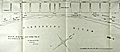 | Details | Pilie, Joseph | 1828 |
| Original Antique Plan of New Orleans Waterfront |
|
Pilie, Joseph |
|
| 1828 |
| LOC:0 |
| $0.00 | Pilie--Joseph | Original-Antique-Plan-of-New-Orleans-Waterfront | SOLD<BR> </BR>
Scarce, early 19th-century engraved plan by city surveyor Gilbert Joseph Pilie depicting the Mississippi (with only one "P") River waterfront with levee and wharfs along New Orleans' French Quarter. Shows the levees, wharves, and a few buildings along the first block fronting the Mississippi River.
<BR> </BR>
Signed by Jh. Pilie, New Orleans, Nov. 15th, 1827. According to "Charting Louisiana" Gilbert Joseph Pilie had been an assistant to Barthelemy Lafon after emigrating to the U.S. from Santo Domingo before 1805. (Lemmon, Magill, and Wiese eds. "Charting Louisiana: Five Hundred Years of Maps". 2003. p. 321.)
<BR> </BR>
Notable features include the water works, Custom House and Market Hall (that site now is home to the famous <s>Morning Call</s> Café du Monde coffee house where tourists line up for beignets and café au lait). Several street names have changed since that time (Iberville Street was then called Custom House Street) and Jackson Square is simply named "Public Square".
<BR> </BR>
From the "Memorial of the Mayor, Aldermen and Inhabitants of New Orleans". 20th Congress, 1st Session. Washington: Gales & Seaton, 1828. |
| 384 |  | Details | Pilie, Joseph | 1828 |
| Plan of the Front Part of the City of New Orleans in 1818. |
|
Pilie, Joseph |
|
| 1828 |
| LOC:0 |
| $0.00 | Pilie--Joseph | Plan-of-the-Front-Part-of-the-City-of-New-Orleans-in-1818- | SOLD … but see <a href="https://www.rarecharts.com/ShowDetail/Creator/Pilie--Joseph/Title/Original-Antique-Plan-of-New-Orleans-Waterfront/1386" target="_blank">another example of Pilie's plan here. </a>
<BR> </BR>
Scarce steel-engraved plan depicting the Mississippi River along New Orleans' French Quarter in 1818. |
| 6544 |  | Details | Thrall, Willis | 1831 |
| Map of the United States Compiled from the Most Authentic Sources |
|
Thrall, Willis |
|
| 1831 |
| LOC:1405 |
| $1,900.00 | Thrall--Willis | Map-of-the-United-States-Compiled-from-the-Most-Authentic-Sources | This scarce "Map of the United States Compiled from the Most Authentic Sources" is a historical map of the United States published in 1831 by Willis Thrall, a cartographer and publisher based in Hartford, Connecticut. Thrall's map includes detailed information about state and territorial boundaries at that time, major cities and towns, rivers, mountains, and other geographical features. The area now containing Texas, Arizona, New Mexico and California is labeled "Internal Provinces of Mexico."
<br><br>
One notable feature of the map is the inclusion of a combined distance table between major cities with population statistics for each in 1820 and 1830. Thrall's map of The United States contains inset maps for: <div class="indenttextblocksingle">
<ul style="list-style-type: circle;"></li>
<li>North America</li>
<li>City of New York and Vicinity</li>
<li>District of Columbia</li>
<li>Boston and its' Vicinity</li>
</ul>
</div>
Bottom of the map contains the statement "Copyright Secured." The United States passed its first copyright law on May 31, 1790, under the Copyright Act of 1790. This law established the legal framework in the United States for protecting the original works of authors, including books, maps, and charts, by granting them exclusive rights to their work for a period of 14 years.
<br><br>
As a native New Orleanian I found it interesting that the map locates a small town north of New Orleans- Madisonville, La. (today pop. < 900). I was unaware that in the 1830s, the area around Madisonville became a very important center for the timber industry. Large sawmills were built along the Tchefuncte River to take advantage of the abundant timber resources in the area, and the town became a hub for shipping timber and other goods to New Orleans. |
| 4759 |  | Details | Baker, Edmund J. | 1831 |
| Very Rare Map of Dorchester and Milton Massachusetts |
|
Baker, Edmund J. |
|
| 1831 |
| LOC:53 |
| $4,500.00 | Baker--Edmund-J- | Very-Rare-Map-of-Dorchester-and-Milton-Massachusetts | Very rare map of Dorchester and Milton Massachusetts published by Edmund J. Baker of Milton, Mass. Very fine condition for such a scarce item.
<br></br>
This original antique map was compiled to comply with a resolution of the Massachusetts Commonwealth that every town and district in Boston should complete an accurate survey of 100 rods to an inch before July 1, 1831. The resolution specified the map record
<div class="indenttextblock">
"...the names, courses, and magnitude of Rivers and smaller Streams; Roads, public and private with their courses; the situation of Houses of Public Worship, Court Houses, and other public buildings, … bridges; ferries; falls; ponds; shores; harbors; islands; mountains; mills and manufactories… shall be inserted, specified, delineated, or described."
</div>
</BR>
According to the Milton Historical Society
<div class="indenttextblock">
"Born in 1804, Baker was a postmaster and historian accorded great respect by his contemporaries. Grandson of both patriot Daniel Vose and chocolate pioneer Dr. James Baker, he had a direct connection to the town's most auspicious 18th century roots. His interest and conversations with that generation, such as Rachel Vose, make him an important source
</div> |
| 5176 |  | Details | Farmer, John | 1831 |
| Plat of the City of Detroit by John Farmer 1830 |
|
Farmer, John |
|
| 1831 |
| LOC:10 |
| $250.00 | Farmer--John | Plat-of-the-City-of-Detroit-by-John-Farmer-1830 | Plat of the City of Detroit, a fine steel-engraved cadastral plan of Detroit, Michigan drawn by John Farmer. The map of Detroit was issued by the US Government in their 'Report of Public Lands' for 1831.
<br></br>
Lacking the volume numbers and printer's attribution to Bowen and Co. that characterize the later edition of 1860, thus 1830. 21st Congress, 2nd Session, Washington, DC.
<br></br>
By cartographer John Farmer (1798-1859 ). In 1844 Farmer published his best known work- "The State of Michigan and the Surrounding Country". Extremely detailed, the map quickly became so popular with the public that prices for used copies of Farmer's map soon exceeded the list price. |
| 5175 |  | Details | Mullett, John | 1831 |
| Plan of Detroit by John Mullett 1830 |
|
Mullett, John |
|
| 1831 |
| LOC:10 |
| $325.00 | Mullett--John | Plan-of-Detroit-by-John-Mullett-1830 | Original fine steel-engraved cadastral map of Detroit, Michigan and one of the earliest obtainable maps of Detroit. The map of Detroit was issued by the US Government in their 'Report of Public Lands' for 1831. Excellent condition. One very interesting feature of the map is the small drawings of local buildings that pepper Mullett's map including the Catholic Church, the Old Market, the Capitol, the Penitentiary, and the U.S. Arsenal.
<br></br>
John Mullett's survey of 1830 is the first map made of Detroit after the Great Fire of 1805. After the fire Territorial Judge Augustus Woodward created a street plan modeled after Washington, D.C with diagonal streets that radiated like the spokes of a wheel. The downtown shows Judge Woodward's plan of the "Grand Circus", the Campus Martius, and the waterfront with new proposed construction shaded at bottom.
<br></br>
John Mullett (1786-1862) was a prominent Detroit surveyor. Mullett served as Deputy Surveyor General of the Northwest Territory from 1822 to 1849. Following Mullett's 1830 "Plan of Detroit" survey, he had two roads in Detroit named after him: Mullet Street (1835) and Catherine Street (1835).
<br></br>
Lacking the volume numbers and printer's attribution to Bowen and Co. that characterize the later edition of 1860, thus 1830. 21st Congress, 2nd Session, Washington, DC. |
| 5212 |  | Details | Mullett, John | 1831 |
| Plan of Detroit |
|
Mullett, John |
|
| 1831 |
| LOC:10 |
| $325.00 | Mullett--John | Plan-of-Detroit | Original fine steel-engraved cadastral map of Detroit, Michigan and one of the earliest obtainable maps of Detroit. Excellent condition. One of three documents related to Detroit issued by the U/S. Government in their 'Report of Public Lands' for 1831.
<br></br>
In this Plan of Detroit there are wider avenues extending over longer distances and many small streets are eliminated. This smaller version of John Mullett's Plan of Detroit labels Michigan Avenue as Michigan Grand Avenue and shows a different layout for buildings proposed to be built at the waterfront. Perhaps the most significant difference between the two maps is the street layout below Michigan Avenue, where Fort Shelby remains in place, and Washington Avenue is projected all the way to the waterfront.
<br></br>
John Mullett (1786-1862) was a prominent Detroit surveyor. Mullett served as Deputy Surveyor General of the Northwest Territory from 1822 to 1849. Following Mullett's 1830 "Plan of Detroit" survey, he had two roads in Detroit named after him: Mullet Street (1835) and Catherine Street (1835).
<br></br>
Lacking the volume numbers and printer's attribution to Bowen and Co. that characterize the later edition of 1860, thus 1830. 21st Congress, 2nd Session, Washington, DC. |
| 1211 |  | Details | Poussin, Guillaume Tell | 1834 |
| Scarce French antique charts of Florida bays, anchorages and ports |
|
Poussin, Guillaume Tell |
|
| 1834 |
| LOC:61 |
| $0.00 | Poussin--Guillaume-Tell | Scarce-French-antique-charts-of-Florida-bays--anchorages-and-ports | SOLD
<br><br>
Ten very scarce antique nautical charts of Gulf Coast bays, passes, and port entrances from Mobile, Alabama past Apalachicola, Florida and the Ochlocknee River. An attractive copperplate-engraved French hydrographic composite chart printed in 1834 by French cartographer Guillaume Tell Poussin. Contains ten insets of north U.S. Gulf Coast ports in Alabama and Florida. These inset charts show soundings and isobaths (contour lines) in English feet. Text in French. Plate # 8. <BR> </BR>
Insets include the following areas: </BR>
Fig. 1. Entrée de la Baie de la Mobile (Entrance to Mobile Bay, Alabama with Dauphin Island and Fort Gaines to the west and Mobile Point with Fort Morgan on the east) </BR>
Fig. 2. Entrée de la Rade de Pensacole (Entrance to Pensacola Bay, Florida with Santa Rosa Island and Fort Pickens to the right. Also noted are Fort Barrancas and a Navy shipyard near Point Tartar) </BR>
Fig. 3. Entrée orientale du Detroit ou Canal de Santa Rosa (Entrance to Santa Rosa sound, Florida from the east side of Santa Rosa Island) </BR>
Fig. 4. Entrees du Detroit de St. Andre </BR>
Fig. 5. Entrée de la Baie ou Rade de St. Joseph </BR>
Fig. 6. Entrée principale du Detroit de St. Georges </BR>
Fig. 7. Entrée du milieu du Detroit de St. Georges </BR>
Fig. 8. Entrée orientale du Detroit de St. Georges </BR>
Fig. 9. Entrée de la Baie d'Appalachicola (Entrances to Apalachicola Bay, Florida and river) </BR>
Fig. 10. Entrée de la Baie d'Ocklockony (Entrance to Ochlocknee Bay, Florida)<BR> </BR>
After a chart by W.H. Swift from 1829.
<BR> </BR>
Published in: "Travaux d 'ameliorations interieures projetes ou executes par le Gouvernement General des Etats-Unis d 'Amerique, de 1824 a 1831"; par Guillaume-Tell Poussin … Atlas. Paris, Anselin, Libraire, pour l 'art militaire, les sciences et les arts, rue Dauphine, No. 36, dans le passage Dauphine. Carilian-Goeury, Libraire, des ponts et chaussees et des mines, Quai des Augustins, No. 41. 1834. |
| 1212 |  | Details | Poussin, Guillaume Tell | 1834 |
| Scarce French antique chart of the Florida Territory with proposed canals |
|
Poussin, Guillaume Tell |
|
| 1834 |
| LOC:0 |
| $0.00 | Poussin--Guillaume-Tell | Scarce-French-antique-chart-of-the-Florida-Territory-with-proposed-canals | SOLD <br></br>Beautiful antique chart of the United States Gulf Coast extending from the Atchafalaya River, past Bayou Lafourche and the Mississippi passes in Louisiana, Mobile Bay, Alabama, to the Florida east coast including most of what was then known as the Florida Territories (1822 - 1845). A scarce engraved French hydrographic chart by French cartographer Guillaume Tell Poussin from 1834.
<br></br>
<u>Insets include the following areas:</u> </BR>
Fig. 1. <b>Entrance to St. John's River.</b> "Entrée du Fleuve St. Jean". (Includes Fort George Island, Talbot Island and a feature noted as "General's Mount".)</BR>
Fig. 2. <b>Vicinity of Fernandina Beach and upper Amelia Island.</b> "Entrée de la Rade et de la Riviere St. Marie". </BR>
Fig. 3. <b>Plan of St. Augustine, Florida .</b> "Entrée orientale du Port St. Augustine". (Includes the Matanzas River and Anastasia Island.)
<BR> </BR>
Noted features include Lake Pontchartrain; New Orleans; Madisonville; Chandeleur Sound; Dauphin Island; Canal du Santa Rosa; Choctawhatchee Bay; Cape San Blas; Apalachicola Bay; Tallahassee; Cumberland Island; Tampa Bay; and Cape Canaveral. Includes boundaries and notations relating to the Seminole American Indian tribe. Dotted lines show the projected route of two proposed canals linking the Gulf and Atlantic coasts. Twin detailed elevation profiles at bottom are keyed alphabetically to the canal routes.
<BR> </BR>
Published in: "Travaux d 'ameliorations interieures projetes ou executes par le Gouvernement General des Etats-Unis d 'Amerique, de 1824 a 1831"; par Guillaume-Tell Poussin … Atlas. Paris, Anselin, Libraire, pour l 'art militaire, les sciences et les arts, rue Dauphine, No. 36, dans le passage Dauphine. Carilian-Goeury, Libraire, des ponts et chaussees et des mines, Quai des Augustins, No. 41. 1834. Text in French. Plate # 7. |
| 1213 | 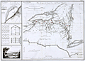 | Details | Poussin, Guillaume Tell | 1834 |
| Early plan of the Erie and Champlain Canals |
|
Poussin, Guillaume Tell |
|
| 1834 |
| LOC:53 |
| $350.00 | Poussin--Guillaume-Tell | Early-plan-of-the-Erie-and-Champlain-Canals | Very scarce original copperplate engraved of the Erie Canal (opened 1825) and the Champlain Canal by French engineer Guillaume Tell Poussin. Begun in 1817 and opened in its entirety in 1825, the Erie Canal is considered the engineering marvel of the 19th Century.
<br></br>
Engraved map. Relief shown by hachures. Includes profile of Erie Canal and Champlain Canal and view of covered bridge.
<br></br>
Plan du trace de Canal Erie et du Canal Champlain. Etat de New-York. // Plan du Port de Presqu'ile et du Barrage construit pour approfondir son entrée. // Détails de construction du pont de Mr. J. Town.
<br></br>
Published in: "Travaux d 'ameliorations interieures projetes ou executes par le Gouvernement General des Etats-Unis d 'Amerique, de 1824 a 1831"; par Guillaume-Tell Poussin … Atlas. Paris, Anselin, Libraire, pour l 'art militaire, les sciences et les arts, rue Dauphine, No. 36, dans le passage Dauphine. Carilian-Goeury, Libraire, des ponts et chaussees et des mines, Quai des Augustins, No. 41. 1834. Imprimerie de Lachevardiere, rue du Colombier, No. 30.<BR> </BR> |
| 405 | 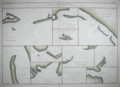 | Details | Poussin, Guillaume Tell | 1834 |
| Plans hydrographiques des baies, rades, ports et detroits des Florides |
|
Poussin, Guillaume Tell |
|
| 1834 |
| LOC:0 |
| $0.00 | Poussin--Guillaume-Tell | Plans-hydrographiques-des-baies--rades--ports-et-detroits-des-Florides | SOLD-
<a href="https://www.rarecharts.com/ShowDetail/Creator/Poussin--Guillaume-Tell/Title/Scarce-French-antique-charts-of-Florida-bays--anchorages-and-ports/1211" target="_blank">See a similar item in stock. </a>
<br></br>
Very scarce antique nautical chart of Gulf Coast bays, passes, and port entrances from Mobile, Alabama past Apalachicola, Florida and the Ochlocknee River. Unusual large copperplate engraved French hydrographic chart by French cartographer Guillaume Tell Poussin from 1834. Contains ten insets of north U.S. Gulf Coast ports in Alabama and Florida. These inset charts show soundings and isobaths (contour lines) in English feet. Text in French. Plate # 8. <BR> </BR>
Insets include the following areas: </BR>
Fig. 1. Entrée de la Baie de la Mobile (Entrance to Mobile Bay, Alabama with Dauphin Island and Fort Gaines to the west and Mobile Point with Fort Morgan on the east) </BR>
Fig. 2. Entrée de la Rade de Pensacole (Entrance to Pensacola Bay, Florida with Santa Rosa Island and Fort Pickens to the right. Also noted are Fort Barrancas and a Navy shipyard near Point Tartar) </BR>
Fig. 3. Entrée orientale du Detroit ou Canal de Santa Rosa (Entrance to Santa Rosa sound, Florida from the east side of Santa Rosa Island) </BR>
Fig. 4. Entrees du Detroit de St. Andre </BR>
Fig. 5. Entrée de la Baie ou Rade de St. Joseph </BR>
Fig. 6. Entrée principale du Detroit de St. Georges </BR>
Fig. 7. Entrée du milieu du Detroit de St. Georges </BR>
Fig. 8. Entrée orientale du Detroit de St. Georges </BR>
Fig. 9. Entrée de la Baie d'Appalachicola (Entrances to Apalachicola Bay, Florida and river) </BR>
Fig. 10. Entrée de la Baie d'Ocklockony (Entrance to Ochlocknee Bay, Florida)<BR> </BR>
Published in: "Travaux d 'ameliorations interieures projetes ou executes par le Gouvernement General des Etats-Unis d 'Amerique, de 1824 a 1831"; par Guillaume-Tell Poussin. |
| 1228 | 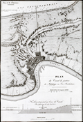 | Details | Poussin, Guillaume Tell | 1834 |
| Antique plan of New Orleans Louisiana ca. 1834 |
|
Poussin, Guillaume Tell |
|
| 1834 |
| LOC:0 |
| $0.00 | Poussin--Guillaume-Tell | Antique-plan-of-New-Orleans-Louisiana-ca--1834 | SOLD
<br></br>
Uncommon antique map or plan of New Orleans, Louisiana comprises the left half of the sheet. By William Tell Poussin (1796 - 1876), French architect, author, engineer, and diplomat.
<BR> </BR>
Detailed antique map of the New Orleans area shows the existing Carondolet Canal, Bienvenue Canal, and Treme Canal. The work also shows the proposed route of a canal to be constructed from the Mississippi River to Lake Ponchartrain running through the Faubourg Marigny along what is today Elysian Fields avenue. The canal was never constructed but in the 1830s the Ponchartrain Railway was built over the same route. The dream of a canal linking the lake with the river was not realized until 1923 with the opening of the Inner Harbor Navigation Canal (INHC), or "Industrial Canal".
<BR> </BR>
Includes a telling longitudinal elevation profile of the proposed canal from the Mississippi river to Lake Pontchartrain. Beginning at its highest point at the Mississippi River levee, the ground elevation along Elysian Fields Avenue declines gradually becoming "Forets inondees" until it crosses the Gentilly Ridge (an old natural levee) and the elevation increases.
<BR> </BR>
Right portion of the sheet contains a map of the Cheasapeake and Delaware Canal with a both a profile of the canal width and the canal length. Title on this half reads: "Plan de trace, situation des Ecluses, Nivellement general et Profile du Canal."
<BR> </BR>
Published in: "Travaux d'ameliorations interieures projetes ou executes par le Gouvernement General des Etats-Unis d'Amerique, de 1824 a 1831"; par Guillaume-Tell Poussin … Atlas. Paris, Anselin, Libraire, pour l'art militaire, les sciences et les arts, rue Dauphine, No. 36, dans le passage Dauphine. Carilian-Goeury, Libraire, des ponts et chaussees et des mines, Quai des Augustins, No. 41. 1834. Imprimerie de Lachevardiere, rue du Colombier, No. 30. |
| 1229 | 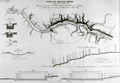 | Details | Poussin, Guillaume Tell | 1834 |
| Antique plan of the Tennessee River with Muscle Shoals Canal |
|
Poussin, Guillaume Tell |
|
| 1834 |
| LOC:0 |
| $0.00 | Poussin--Guillaume-Tell | Antique-plan-of-the-Tennessee-River-with-Muscle-Shoals-Canal | SOLD
<BR> </BR>
Antique plan of the Tennessee River and proposed canal in the vicinity of Muscle Shoals ca. 1834. By William Tell Poussin (1796 - 1876), French architect, author, engineer, and diplomat.
<BR> </BR>
Before the completion of the Wilson Dam in 1924, the Tennessee river was divided by a series of shoals near the Muscle Shoals area where the Tennessee fell over 100′ in approximately 30 miles. Between 1830 and 1890, adjacent to the river and around the shoals, a series of canals and locks were built and improved upon to provide for commercial navigation. This map captures some of the early planning for that work.
<BR> </BR>
Towns shown include Marathon, Tuscombia, Bainbridge, Havana, and Waterloo. Also depicts locations for Brown's Ferry, Lamb's Ferry, Furquhart's Ferry, and Florence Ferry. Other important topographical features include the Elk River, Melton's Bluff and the existing roads to Nashville, Columbus, and Huntsville. With a longitudinal cross section of the proposed canal
<BR> </BR>
Published in: "Travaux d'ameliorations interieures projetes ou executes par le Gouvernement General des Etats-Unis d'Amerique, de 1824 a 1831"; par Guillaume-Tell Poussin … Atlas. Paris, Anselin, Libraire, pour l'art militaire, les sciences et les arts, rue Dauphine, No. 36, dans le passage Dauphine. Carilian-Goeury, Libraire, des ponts et chaussees et des mines, Quai des Augustins, No. 41. 1834. Imprimerie de Lachevardiere, rue du Colombier, No. 30. |
| 4943 | 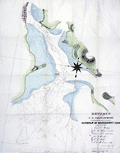 | Details | U.S. Coast and Geodetic Survey | 1835 |
| First chart issued Coast Survey Bridgeport, Conn. |
|
U.S. Coast and Geodetic Survey |
|
| 1835 |
| LOC:53 |
| $0.00 | U-S--Coast-and-Geodetic-Survey | First-chart-issued-Coast-Survey-Bridgeport--Conn- | SOLD<br><br> This "EXTRACT from the U.S. Coast Survey... Harbour of Bridgeport, Conn." <b>is the first navigational chart published by the Coast Survey.</b> It was privately printed in lithography by P. Haas of Washington from the drawing of T.A.M. Craven." (Guthorn. United States Coastal Charts 1783-1861. p. 61.)
<br></br>
Two other charts are notable as early Coast Survey charts printed outside the government: New Haven Harbor (1838) and Newark Bay (1839). Each are distinguished from later printings by the presence of the word "Extract" in the chart's title.
<br></br>
In 1835 the Coast Survey had not fully hit its stride and did not possess printing equipment. This chart was not published in-house but was sent out for printing. It was not until 1844 / 1845 that the Coast Survey printed a chart on their own, that of New York Harbor, in six sheets measuring 63" x 64". Lithographed by P. Haas.</br>
(Burroughs, Charles A. Hassler's First Chart. 1987. https://www.govinfo.gov/content/pkg/GOVPUB-C13-205178772c3ec101c76282e5b214d28e/pdf/GOVPUB-C13-205178772c3ec101c76282e5b214d28e.pdf ) |
| 5282 |  | Details | U.S. Congress | 1837 |
| Antique plat of lands Choctaw Point Lighthouse Mobile Bay Alabama |
|
U.S. Congress |
|
| 1837 |
| LOC:10 |
| $275.00 | U-S--Congress | Antique-plat-of-lands-Choctaw-Point-Lighthouse-Mobile-Bay-Alabama | Scarce plat map of land near Mobile, Alabama from 1837 to support the published opinion of Benjamin Franklin Butler, Attorney General of the United States (1833-1838) in a case dated August 5, 1837. The plat shows the Mobile River at right with Choctaw Point Lighthouse. Lot contains 2 page of legal opinion, supported by the plat, probably from a report to Congress.
<br></br>
Choctaw Point is located on the west bank of the Mobile River about one mile south of downtown Mobile and one mile SW of the U.S.S. Alabama memorial. A brick lighthouse (63' Fixed light), visible for 15 miles, existed at Choctaw Point from 1831 until the beginning of the Civil War. The American Lighthouse Guide of 1845 found the light of little use in navigating the Dog River.
<div class="indenttextblocksingle">
"To mail steamers and bay craft familiar with the shoals, and Choctaw Pass, this light is a valuable aid in dark nights, but of little benefit to strangers. This light is of little utility in consequence of forming too great an angle in its bearing from the courses required through the intricate and narrow channels of the river and passes." (Mills, Robert. The American Light-house Guide: with Sailing Directions, for the Use of the Mariner. 1845. p. 11)
</div>
Among the land holdings near Choctaw Point that are identified in the map are plots belonging to Antoine Espijo, John Forbes & Co., Regist Burnady, Simon Favre, and John Murrill. |
| 751 |  | Details | Blondeau, Alexandre | 1837 |
| Boston and Vicinity |
|
Blondeau, Alexandre |
|
| 1837 |
| LOC:0 |
| $0.00 | Blondeau--Alexandre | Boston-and-Vicinity | SOLD<br></br>
Antique steel engraving titled "Boston et ses Environs" - Boston and vicinity. Includes outlying towns of Roxbury, Dorchester, Cambridge and Charles Town. This early hand-colored map of the city, at that time largely located on only the Shawmut Peninsula, makes it clear just how much of Boston's current land area is the result of landfill and reclamation. It is said that upwards of 65% of Boston's land area did not exist when the city was founded around 1630.
<br></br>
From 1st edition of Jean B.G. Roux de Rochelle's Etats-Unis d'Amérique. Paris: Firmin Didot Freres. Plate number 45. |
| 7921 |  | Details | Nicholson, Francis | 1838 |
| Public squares, parks, and places in the city of New York |
|
Nicholson, Francis |
|
| 1838 |
| LOC: |
| $450.00 | Nicholson--Francis | Public-squares--parks--and-places-in-the-city-of-New-York | Maps of sixteen parks, on one sheet, covering various locales south of 125th Street in Manhattan, New York. Each park map gives dimensions and acreage, shows layout of park walkways and surrounding streets.
<br><br>
From D.T. Valentines manual. 1838. H.R. Robinson, Lith. Compiled and surveyed by Francis Nicholson, City Surveyor. August, 1838.
<br><br>
The 1838 “Manual of the Corporation of the City of New York” is considered a precursor volume to Valentine’s later annual manuals. Compiled when David Thomas Valentine (1841-1870) was Assistant Clerk of the Common Council, it served as an early attempt to assemble civic data, city charters, ordinances, and maps into a single reference work.
This 1838 edition predates the regular annual series and is not always listed among the later “official” manuals (which began in 1841), but bibliographers recognize it as the first appearance of Valentine’s work in this format.
<br><br> |
| 1309 | 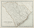 | Details | Bradford, Thomas G. | 1838 |
| 1838 Map of South Carolina by Thomas Bradford |
|
Bradford, Thomas G. |
|
| 1838 |
| LOC:10 |
| | Bradford--Thomas-G- | 1838-Map-of-South-Carolina-by-Thomas-Bradford | SOLD
<br></br>
A fine ante-bellum engraved map of the state of South Carolina with 32 districts ( counties ). Includes hundreds of named geographic features like Kiawah Island, Hilton Head, Folly Island, Charleston, Waccamaw River, Edisto River, Port Beaufort, and more.
<br></br>
A very early map of South Carolina with only one interior railway line, from Charleston to Columbia and Augusta. Displays rivers, Post Offices (e.g. Harley's P.O.; Fulton's P.O.; Beckhamville P.O.) , and numerous swamps (e.g. Hell Hole Swamp; Buck Swamp; Cedar Swamp ... ). Clearly shows the now flooded Santee Canal, opened in 1800, an inland canal linking the Cooper River near Charleston with the Santee River.
<br></br>
Attribution at bottom left reads: "Entered according to Act of Congress in the year 1838 by T.G. Bradford, in the Clerk's office of the District Court of Massachusetts. inland canal linking the Cooper River near Charleston, with the Santee River. Engraved by G.W. Boynton |
| 5295 | 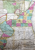 | Details | Hinman and Dutton | 1838 |
| Map of the Settled Part of Wisconsin Territory |
|
Hinman and Dutton |
|
| 1838 |
| LOC: |
| $0.00 | Hinman-and-Dutton | Map-of-the-Settled-Part-of-Wisconsin-Territory | SOLD
<br></br>
Very rare map of the nascent Wisconsin Territory from 1838, published by Hinman and Dutton, Philadelphia: "Map of the Settled Part of Wisconsin Territory compiled from the latest authorities." With an inset map: "The Entire Territory of Wisconsin: as established by act of Congress April 10, 1836." Engraved by J.H. Young.
<br></br>
One distinguishing feature between this map and a later similar map published by Mitchell is (1) the presence here of the Dubuque District (in blue) without county boundaries and (2) the inclusion of land owned and attributed to the Sacks and Foxe Indian tribes west of the Dubuque District, demarcated with "Indian Boundary."
<br></br>
First published "According to an act of Congress in the year 1837 by Hinman and Dutton in the Clerk's office of the District Court of the eastern district of Pennsylvania."
<br></br>
No record of any sale in AMPR. Only six institutional holdings in OCLC. No copies currently offered for sale elsewhere. |
| 4953 |  | Details | U.S. Coast and Geodetic Survey | 1838 |
| First chart issued Coast Survey New Haven Harbour |
|
U.S. Coast and Geodetic Survey |
|
| 1838 |
| LOC:0 |
| $425.00 | U-S--Coast-and-Geodetic-Survey | First-chart-issued-Coast-Survey-New-Haven-Harbour | This "Extract from the U.S. Coast Survey New Haven Harbour" Connecticut is one of the three earliest charts published by the United States Coast Survey. No sale of this chart is recorded in the AMPR.
<br></br>
Taken from a Letter from the Secretary of Treasury transmitting a map of New Haven and its harbor in the state of Connecticut. Doc 25th Congress. 1839. |
| 1223 | 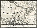 | Details | Anonymous | 1840 |
| Uncommon antique Map of Lake Pontchartrain |
|
Anonymous |
|
| 1840 |
| LOC:3 |
| $200.00 | Anonymous | Uncommon-antique-Map-of-Lake-Pontchartrain | Uncommon and unrecorded version of a lithographed map ca. 1840 of <b>Lake Pontchartrain</b> in Louisiana with three steamboat routes shown: to Madisonville, La., to Mandeville, La. and a mail steamboat route to Mobile, Alabama. Possibly by L. Hirt.
<br></br>
In 1834 it was reported that mail service was provided through three weekly round-trips between New Orleans and Mobile at a total annual cost of <a href="https://books.google.com/books?id=VfcaAAAAYAAJ&pg=PR1&dq=mail+steam+boat+mobile+new+orleans&source=gbs_selected_pages&cad=3#v=onepage&q=mail%20steam%20boat%20mobile%20new%20orleans&f=false" target="_blank">$40,000.</a></a>
<br></br>
This map appears as a vignette in L. Hirt's 1841 " Plan of New Orleans with Perspective and Geometrical Views of the Principal Buildings of the City" from <a href="http://louisdl.louislibraries.org/cdm/ref/collection/p15140coll28/id/76" target="_blank"> The Historic New Orleans Collection.</a> The present map shows signs of being disbound from a smaller volume. Scale: 3 inches to the mile. Louisiana History.
<br></br>
The map features Lake Borgne, Bayou Sauvage, and Bayou Bienvenue. Three steamboat routes terminate at Milneburg, at the north end of the Ponchartrain Rail Road on the south shore of Lake Pontchartrain. The Pontchartrain Rail-Road, the first railway in New Orleans, Louisiana began service in 1831. The route of the railway ran down the center of Elysian Fields Avenue from the Faubourg Marigny to the port of Milneburg, later the Lake Pontchartrain Amusement Park.
<br></br>
This scarce small map shows the city of New Orleans with Bayou St. John, the New Orleans canal, and the Carrolton Railroad. |
| 1224 | 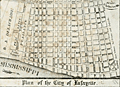 | Details | Anonymous | 1840 |
| Scarce antique map of New Orleans Tenth Ward or the City of Lafayette |
|
Anonymous |
|
| 1840 |
| LOC:3 |
| $250.00 | Anonymous | Scarce-antique-map-of-New-Orleans-Tenth-Ward-or-the-City-of-Lafayette | Unrecorded version of an early wood-cut map of <b>New Orlean's Tenth Ward</b> circa 1840 when it was known as <b>Lafayette City</b>. Earlier, during the French period New Orlean's Tenth Ward was known as the Faubourg Lafayette. Boundaries of Lafayette City include the Mississippi River, Felicity Street, Nayades Street (later known as St. Charles Avenue), and a large tract owned by R. A. Delachaise. Shows the New Orleans and Carrollton Railroad connecting the city of New Orleans to then then distant resort village of Carrollton.
<br></br>
Possibly by L. Hirt, and derived or re-purposed from his larger work. This map appears as a vignette in L. Hirt's 1841 " Plan of New Orleans with Perspective and Geometrical Views of the Principal Buildings of the City" from <a href="http://louisdl.louislibraries.org/cdm/ref/collection/p15140coll28/id/76" target="_blank"> The Historic New Orleans Collection.</a> The present map shows signs of being disbound from a smaller volume. Scale: 3 inches to the mile. Louisiana History.
<br></br>
Faubourg Lafayette was founded with small settlements around steamboat landings in New Orleans. The faubourg became the City of Lafayette, then part of Jefferson Parish and its first parish seat. Lafayette was a separate municipality until it was incorporated into New Orleans, Orleans Parish, in 1852. The present boundaries of the Tenth Ward include St. Charles Avenue, Jackson Avenue, the Pontchartrain Expressway, and Simon Bolivar Avenue. <a href="https://en.wikipedia.org/wiki/Faubourg_Lafayette" target="_blank"> (Source.)</a> |
| 590 | 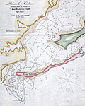 | Details | Blunt, E and G.W. | 1841 |
| Pensacola Harbor |
|
Blunt, E and G.W. |
|
| 1841 |
| LOC:11 |
| $0.00 | Blunt--E-and-G-W- | Pensacola-Harbor | Sold<br><br>Sold<br><br>
Small folding chart / map of Pensacola Harbor, Florida from 1841 published with other maps in Blunt's American Coast Pilot, 14th edition. The map include numerous soundings in feet. Named features on this copper-plate engraved antique chart include: one lighthouse ("revolving") , Santa Rosa Island, Deer Point, Tartar Point, Sandy Point and the very small town of Pensacola, Florida.
<br></br>
Printed by W. Hooker. Published by E. and G.W. Blunt, New York, 1841. Scale is displayed in statute miles. |
| 104 |  | Details | Blunt, E and G.W. | 1841 |
| Plan of Portsmouth Harbour |
|
Blunt, E and G.W. |
|
| 1841 |
| LOC:0 |
| $0.00 | Blunt--E-and-G-W- | Plan-of-Portsmouth-Harbour | SOLD
<br></br>
Antique copperplate nautical chart of Portsmouth, New Hampshire harbor from this renowned American publisher of nautical charts and sailing directions. |
| 1098 | 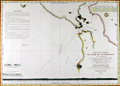 | Details | Depot de la Marine | 1843 |
| Scarce early French sea chart of San Francisco Bay |
|
Depot de la Marine |
|
| 1843 |
| LOC:63 |
| $1,450.00 | Depot-de-la-Marine | Scarce-early-French-sea-chart-of-San-Francisco-Bay | Scarce French sea chart of <b>San Francisco Bay</b> made during a voyage to the Pacific from 1836-39 by Captain Abel Aubert Du Petit-Thouars in command of the French Frigate <b>Venus</b>. The bay is well delineated with soundings and profile views. Shows the route taken in October 1837 by the Hawaiian ship "Kamamalou" (Captain William Sturgis Hinckley) as it ferried a crew from Petit-Thoaurs' Venus, who remained aboard the Venus in Monterrey Bay, to gather water and vegetables. The crew used that trip to reconnoiter the port of San Francisco.
<br ></br>
With several small and one large elevation profile view of the entrance to San Francisco Bay as seen from sea. The largest elevation view, at bottom, shows the coastline as seen from 25 miles offshore. That beautifully engraved profile extends from the <b>Farralon Islands</b> to well past "Cap Blanc" (Point San Pedro). The key feature of Alcatraz Island is labeled "I. aux Oiseaux" (Bird Island).
<br ></br>
A circled "+" between Alcatraz Island and Yerba Buena Island labeled "Basse du Seringapatnam" suggests that this is the site of a wreck of a vessel by that name. Going through the records we find a 398 ton whaling ship "Seragapatam" that sailed from Sydney and arrived in San Francisco on March 18, 1850.
<br ></br>
The motivation behind Petit-Thouars' exploration was France's interest in obtaining territory from the Mexican government in exchange for the millions of dollars worth of loans that the French government had given to Mexico, and which the Mexican government had defaulted on. France sent Captain Du Petit-Thouars to survey the region and see what it offered, as well as to project a French presence to bolster any claims they had in the Pacific.
<br></br>
Circular logo with an anchor from the Depot de la Marine. Plate 6. Number. 1002. |
| 1198 | 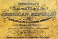 | Details | Mitchell, Samuel Augustus | 1843 |
| Mitchell's National Map of the American Republic first ed. |
|
Mitchell, Samuel Augustus |
|
| 1843 |
| LOC:0 |
| $1,400.00 | Mitchell--Samuel-Augustus | Mitchell-s-National-Map-of-the-American-Republic-first-ed- | Large 1st edition linen-backed hanging map of the eastern United States surrounded with insets of the vicinity of major towns, ports, and harbors. This scarce map features 32 colored insets of United States cites including New Orleans, St. Louis, Nashville, Natchez, Mobile, Savannah, Charleston, Raleigh and many more. Population tables for each county in the different states and territories in 1840. Eastern Kansas and Oklahoma are shown combined and is labeled "Indian Territory" with tribes identified including Omaha's, Kickapoos, Cherokee, and Shawnee. Large Iowa Territory. Minnesota is not yet named foreshadowing the Westward population expansion to follow in later decades.
<br></br>
With an inset map of the Treaty of 1842, also called Webster-Ashburton Treaty settling a border dispute between Maine and New Brunswick.
<br></br>
Samuel Augustus Mitchell Sr. (1792-1868) is one of the pioneers in American cartography of the 19th century and led the conversion of engraved map plates to more affordable lithographic plates. Drawn by James Henry Young (1817-1866) and engraved by J.H. Brightly, both collaborated with Mitchell on this series of maps. Published from 8 1/2 South Seventh Street, Philadelphia. Wall map on linen with wooden scrolls. |
| 5352 |  | Details | South Cove Corporation | 1845 |
| South Cove Boston Massachusetts Auction Plat Rare Antique Map |
|
South Cove Corporation |
|
| 1845 |
| LOC:90 |
| $550.00 | South-Cove-Corporation | South-Cove-Boston-Massachusetts-Auction-Plat-Rare-Antique-Map | Scarce lithographed cadastral map of land filled by the South Cove Corporation in Boston, Massachusetts to be sold at auction on February 18, 1845 by Francis Jackson, agent for the Corporation. Folded into a small 6" x 9" booklet [1] detailing the condition of the dividend (auction) and the dimensions of each lot to be sold.
<br></br>
The land to be sold by the South Cove Corporation was bounded by Albany Street, Harrison Avenue, Erie Street, and Troy Street and Cobb Wharf.
<br></br>
[1] "Catalogue of 132 lots of land in the South Cove with the numbers, dimensions, and contents affixed to each lot. To be divided among the stockholders, by order of the Directors of the South Cove Corporation." Press of Foster and Brewster. Boston. 1845. 8 pages. [Mass., landfill, made land] |
| 1393 | 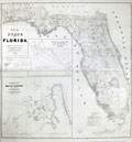 | Details | U.S. War Department | 1846 |
| First Map of the State of Florida |
|
U.S. War Department |
|
| 1846 |
| LOC:0 |
| $0.00 | U-S--War-Department | First-Map-of-the-State-of-Florida | SOLD <br></br>
A very large (40" x 42"), comprehensive, original map of Florida that was published in 1846<b>, one year after Florida gained statehood</b>. An important, and informative map of Florida, one of the first produced after Florida’s admission to the Union on March 3, 1845, carrying much useful military information particularly regarding the <b>Seminole tribe</b>.
<br></br>
This antique map exhibits great detail and precision, especially in the coastline, and gives much information on the physical and cultural geography of the state. Numerous forts and military camps are located. The surveys extend along the coast south of Cape Canaveral, with the majority of the southern interior portion of the state still unsurveyed.
<br></br>
The Florida Everglades are identified along with a notation regarding the land assigned to native Americans: "District assigned to the Seminoles by the arrangement of Gen.' Macomb May 18th 1839." Three large inset maps fill the Gulf of Mexico: "Key West as surveyed February 1829"; "Mouths of Swanee R. and Cedar Keys showing the Western terminus of a proposed railroad"; and "A General Map of part of Florida included between Cedar Keys and St. John's River."
<br></br>
The map was drawn by Joseph Goldsborough Bruff and finely engraved by D. McClelland of the Topographical Engineers. Bruff was a draftsman and cartographer who served as a mapmaker for the Bureau of Topographical Engineers. The Library of Congress notes: <div class="indenttextblock">" … J. Goldsbourough Bruff, was a native of Washington, D.C. At an early age he was admitted to West Point, but after only two years he was forced to leave the prestigious military academy after participating in a duel. He later became a professional cartographer and draftsman, as well as an amateur artist and adventurer. <a href="http://www.loc.gov/exhibits/mapping-a-growing-nation/online-exhibition.html#obj017" target="_blank"> (Internet). </a></div> |
| 1139 | 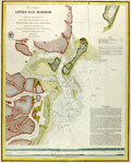 | Details | U.S. Coast and Geodetic Survey | 1846 |
| Antique Rolled Chart of Little Egg Harbor, New Jersey |
|
U.S. Coast and Geodetic Survey |
|
| 1846 |
| LOC:53 |
| $480.00 | U-S--Coast-and-Geodetic-Survey | Antique-Rolled-Chart-of-Little-Egg-Harbor--New-Jersey | Scarce separately issued antique chart (no folds) of <b>Little Egg Harbor, New Jersey</b> published on heavy paper in 1846 by the U.S. Coast Survey. Contains sailing directions, and two long elevation views of the entrance to Little Egg Harbor as seen from sea. Key features include: the New Inlet, Round Shoal, Tucker's Island (with <b>Reuben Tucker's boarding house</b> shown as a triangulation point), Brigantine Channel, Brigantine Beach, Great Thoroughfare, Hunt's Shoals, Anchoring Island, and Hatfield's store.
<br></br>
With numerous depth soundings , anchorages, shoals, and notes on the composition of the sea floor. Electrotype copy no. 2 by Mathiot. Under magnification fine detail is visible assuring the buyer of it's origin as an copperplate (electrotype) engraving. Price when issued was 15 cents.
<br></br>
Little Egg Harbor township is a township in Ocean County, New Jersey. Originally part of Burlington County, Little Egg Harbor took its name from the portion of a bay called Egg Harbor by Dutch sailors for the eggs found in nearby gull nests. The first known account of the town was made by Captain Cornelius Jacobsen May in 1614.
<br></br>
This is a scarce, separately issued, rolled nautical chart of Little Egg Harbor, NJ on heavy paper, not the more common folded version on thin, issued with other charts in an annual report to Congress .
<br></br>
This chart was printed in 1846 from an electrotype copy of the original hand-engraved copper plate, a process the U.S. Coast Survey newly adopted in mid century. As a soft medium, copper plates could only withstand print runs of perhaps 200 copies before the plates wore down. To enable larger print runs, a mold of the original plate was created in wax or another soft medium. Then, using an electro-chemical process ( electrotyping ), the mold was coated with a metal layer, typically copper. Printers were then able to produce output from the new electrotype copper copy, while preserving the original. |
| 1038 |  | Details | Blunt, E and G.W. | 1847 |
| Newport Harbor, Rhode Island |
|
Blunt, E and G.W. |
|
| 1847 |
| LOC:0 |
| $0.00 | Blunt--E-and-G-W- | Newport-Harbor--Rhode-Island | SOLD<br></br>
Antique nautical chart of Newport Harbor, Rhode Island from the Blunts in their 16th edition of the American Coast Pilot, dated within to 1847. Noted features include Fort Adams, Castle Hill, Miantinomy Hill, Government Islands, and Lime Rocks.
<br></br>
The American Coast Pilot with other harbor charts and sailing directions, was published by Edmund and George W. Blunt from New York. The Blunts were the most prolific private publisher of navigational charts in the United States at that time. 179 Water Street New York. |
| 1235 | 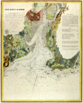 | Details | U.S. Coast and Geodetic Survey | 1847 |
| Antique chart of New Haven, Connecticut and New Haven Harbor |
|
U.S. Coast and Geodetic Survey |
|
| 1847 |
| LOC:53 |
| $550.00 | U-S--Coast-and-Geodetic-Survey | Antique-chart-of-New-Haven--Connecticut-and-New-Haven-Harbor | Rare, rolled, separately issued antique nautical chart of <b>New Haven, Connecticut</b> and harbor on the northern shore of Long Island Sound. Includes West Haven, and Fair Haven. Numerous depth soundings, aids to navigation and navigational hazards are noted such as Savin Rocks, New Haven Light, Quixes Ledge, Round Rock, and Sandy Point. Key features include Fort Wooster, Fort Hale, Farm River, Morris Cove, Mill River, and the Quinnipiac River.
<br></br>
Extensive sailing directions are included at right beginning:
<div class="indenttextblock">
"Bring the Light House to bear E.N.E. and run for it until Fort Hale is in range with the larger of two Church Spires next each other in the village of Fair Haven. You will then be about 1/2 of a mile from the light in 3 fathoms water and a short distance from the buoy upon Adams Fall Ledge. S. 1/2 E. you will see the buoy on the S.W. ledge and still further to the Eastward the beacon on Quixes Ledge. Run into the harbor upon the above mentioned range (Fort Hale and the Spire) until the Light House bears S. by E. when you will be in 2 fathoms soft bottom. Then steer …"
</div>
<br />
Price when issued 15 cents. Triangulation by James Ferguson and Edmund Blunt in 1833.
<br></br>
This chart was printed ca. 1847 from an electrotype copy of the original hand-engraved copper plate, a process the U.S. Coast Survey adopted around that time. As a soft medium, copper plates could only withstand print runs of perhaps 200 copies before the plates wore down. To enable larger print runs, a mold of the original plate was created in wax or another soft medium. Then, using an electro-chemical processs ( electrotyping ), the mold was coated with a metal layer, typically copper. Printers were then able to produce output from the new electrotype copper copy, preserving the original. Electrotype copy no. 3. |
| 5164 |  | Details | U.S. Coast and Geodetic Survey | 1848 |
| Antique Map of Galveston Bay and City Bolivar Survey Progress |
|
U.S. Coast and Geodetic Survey |
|
| 1848 |
| LOC:3 |
| $0.00 | U-S--Coast-and-Geodetic-Survey | Antique-Map-of-Galveston-Bay-and-City-Bolivar-Survey-Progress | SOLD
<br></br>
Small antique hand-colored map of southern Galveston Bay showing the progress of an early triangulation survey of the area around Galveston, Texas. The composition of the lines show which lines were between occupied vs. unoccupied survey stations and lines between primary versus secondary stations.
<br></br>
Coverage of this Galveston survey map includes Galveston City, Bolivar Point, Smith's Point, Edward's Point, Highland Bayou, Heron Grove, Parr's Grove and more locations. |
| 169 |  | Details | Anonymous | 1849 |
| SOLD Reconnaissance of Pensacola and Perdido Bays |
|
Anonymous |
|
| 1849 |
| LOC:0 |
| $0.00 | Anonymous | SOLD-Reconnaissance-of-Pensacola-and-Perdido-Bays | SOLD<BR> </BR>
Small coastal survey chart of Florida from Bonsecour Bay to the East end of Santa Rosa Island. |
| 3651 |  | Details | Imray, James | 1849 |
| Fine gold-rush era blueback chart of California |
|
Imray, James |
|
| 1849 |
| LOC:1409 |
| $3,900.00 | Imray--James | Fine-gold-rush-era-blueback-chart-of-California | California gold-rush era blueback chart of the West Coast from the harbor of San Blas in Mexico heading north past San Francisco Bay. Coverage includes the Gulf of California and the Baja Peninsula. A wide nautical chart in landscape orientation.
<br></br>
Includes six insets and eight stunning coastal views. The insets include: "Entrance of San Francisco Harbour"; "Harbour of San Francisco By Capn. F.W. Beechey R.N. F.R.S."; and "Bay of Monterey By M. de Tessan of the French Navy." Also, Magdalen Bay, Mazatlan, and Guaymas.
<br></br>
Published by James Imray, Chart and Nautical Book Publisher 102, Minories. 1849.
<br></br>
During the 1800's there was a trend toward publication of very large small-scale charts with large-scale insets of key passages and harbors. The practice was driven as much by economics as any other reason. One chart could replace a dozen smaller charts. James Imray and Son was one of a handful of British publishers who specialized in these charts which were often backed with canvas or linen cloth or heavy blue paper in order to help them withstand the frequent use and abuse aboard ship, hence the term "blueback chart". |
| 3618 |  | Details | U.S. Coast and Geodetic Survey | 1849 |
| Reconnaissance of Pensacola and Perdido Bays |
|
U.S. Coast and Geodetic Survey |
|
| 1849 |
| LOC:11 |
| $120.00 | U-S--Coast-and-Geodetic-Survey | Reconnaissance-of-Pensacola-and-Perdido-Bays | Small coastal survey chart of Florida from Bonsecour Bay to the east end of Santa Rosa Island. Includes Pensacola Bay, Escambia Bay, Garcon Point, Blackwater River, Perdido Beach, Mast Bay, Forster's Island, and Fort Pickens. <strong>Price includes hand coloring.</strong>
<br><br>
Chart shows the triangulation network employed in an early survey conducted by the U.S. Coast [and Geodetic] Survey in 1849. Changes in topography inland are indicated by hachuring.
<br></br>
In surveying, triangulation is the process of determining the location of a point by measuring only angles to it from known points at either end of a fixed baseline. The point can then be fixed as the third point of a triangle with one known side and two known angles. Surveying error is minimized if first a mesh of triangles is created at the largest appropriate scale. Then points inside the triangles can all then be accurately located with reference to the triangulation network. |
| 3623 |  | Details | Ringgold, Cadwalader | 1850 |
| Antique Chart of the Entrance to San Francisco Bay |
|
Ringgold, Cadwalader |
|
| 1850 |
| LOC:63 |
| $1,100.00 | Ringgold--Cadwalader | Antique-Chart-of-the-Entrance-to-San-Francisco-Bay | Cadwalader Ringgold's detailed, chart of the approach and entrance at San Francisco Bay, California from 1850. Includes Yerba Buena island, Alcatraces (Alcatraz Island), Sausalito Bay, Aspinwall Bay, and much more. Attractive elevation profile view of a square rigged sailing vessel set against a backdrop of the coastline at San Francisco. Constructed, projected and drawn by Fred D. Stuart.
<br ></br>
Ringgold (1802-1867) was a officer in the U.S. Navy who had served aboard the brig Porpoise with the U.S. Exploring Expedition during Wilkes' surveys of the area in 1841 . Ringgold was promoted to Commander in July, 1849 and began his groundbreaking survey of the San Francisco Bay region, suddenly important because of the discovery of gold in the area. The survey began in August 1849, with Ringgold commanding the chartered brig Col. Fremont. Peter Guthorn notes Ringgold's use of Beechy's earlier survey in his charts:
<div class="indenttextblock">"Ringgold's charts and sailing directions employed material extracted from the account by Fredrick William Beechy, the British explorer and naval officer whose narrative of the voyage to the Pacific and Behring Sea was published in 1831." (Guthorn, Peter. "U.S. Coastal Charts 1783-1861." Schiffer Publishing. 1984. p. 195)</div> |
| 1039 |  | Details | Blunt, E and G.W. | 1850 |
| Charleston Harbor, South Carolina |
|
Blunt, E and G.W. |
|
| 1850 |
| LOC:0 |
| $0.00 | Blunt--E-and-G-W- | Charleston-Harbor--South-Carolina | SOLD
<br></br>
Antique harbor chart (1850) for Charleston, South Carolina from the <b>Blunt's "American Coast Pilot" </b>. Noted features include Sullivan's Island, Rebellion Road, Light House Island, and Breach Inlet. Numerous beacons, depth soundings and contour lines are recorded.
<br></br>
<hr />
Special attention is due <b>Castle Pinckney</b> on Shutes Folly island shown between Charleston and Hog Island. "Fort Pinckney", the original log and earthen fort, named after the Revolutionary War hero Charles Pinckney, was built beginning in 1797 and was intended to protect the city from a possible naval attack. The log fort was destroyed by a severe hurricane in September 1804. A replacement brick-and-mortar structure called "Castle Pinckney" was erected in 1809 and was garrisoned throughout the War of 1812, but it saw no action.
<br></br>
By the late 1850s, Castle Pinckney was part of a array of defensive positions in the harbor, which included the strategically placed Forts Sumter and Moultrie, and other, smaller fortifications. In 1860, Castle Pinckney's artillery included fourteen 24-pounders, four 42-pounders, four 8-inch howitzers, and one 10-inch mortar.
<br></br>
On December 27, 1860, one week after South Carolina seceded from the Union, the fort was surrendered to South Carolina (S.C.) militia by its small U.S. Army garrison, which retired to Fort Sumter to join Major Robert Anderson. Castle Pinckney became the first Federal military installation seized forcefully by a Southern state government.
<hr />
<br />
The American Coast Pilot with other harbor charts and sailing directions, was published by Edmund and George W. Blunt from New York. The Blunts were the most prolific private publisher of navigational charts in the United States at that time. 179 Water Street New York. |
| 813 |  | Details | Blunt, E and G.W. | 1850 |
| Boston Harbour Chart |
|
Blunt, E and G.W. |
|
| 1850 |
| LOC:0 |
| $0.00 | Blunt--E-and-G-W- | Boston-Harbour-Chart | SOLD
<br><br/>
Small, clean, nautical chart of Boston Harbor, Massachusetts from the 1850 edition of the "American Coast Pilot" 16th Edition. Numerous soundings, marked aids-to-navigation, and anchorages would have made this a useful tool for navigators attempting to navigate in the area, one of the few mass-produced, affordable charts of the area that were available at that time.
<br><br/>
The American Coast Pilot with other harbor charts, was published by Edmund and George W. Blunt from New York. The Blunts were the most prolific private publisher of navigational charts in the United States at that time. The chart is based on earlier surveys by A.S. Wadsworth around 1818 and of Joseph Frederick Wallet Des Barres (1721-1824) during the American Revolutionary War. |
| 960 |  | Details | Blunt, E and G.W. | 1850 |
| Portsmouth Harbor, New Hampshire |
|
Blunt, E and G.W. |
|
| 1850 |
| LOC:3 |
| $75.00 | Blunt--E-and-G-W- | Portsmouth-Harbor--New-Hampshire | Antique nautical chart of Portsmouth Harbor, New Hampshire from the Blunts in their 16th edition of the American Coast Pilot, published in 1850.
<br></br>
The American Coast Pilot with other harbor charts and sailing directions, was published by Edmund and George W. Blunt from New York. The Blunts were the most prolific private publisher of navigational charts in the United States at that time. 179 Water Street New York. |
| 966 |  | Details | Blunt, E and G.W. | 1850 |
| Antique chart of the Isles of Shoals in Massachusetts and New Hampshire |
|
Blunt, E and G.W. |
|
| 1850 |
| LOC:0 |
| $0.00 | Blunt--E-and-G-W- | Antique-chart-of-the-Isles-of-Shoals-in-Massachusetts-and-New-Hampshire | SOLD<br></br>
Antique antebellum nautical chart of the islands comprising the <b>Isles of Shoals</b> offshore the town of Portsmouth, New Hampshire. Published by well known American publisher's of nautical charts and sailing directions, Edmund and George Blunt. Dated within the bottom attribution at 1850. Blunt's chart is probably the earliest hydrographic chart to focus solely on the Isles of Shoals.
<br></br>
There are nine islands that make up the Isles of Shoals, not all are named in Blunt's chart. In Maine the islands are: <b>Appledore ("Hog Island")</b>, Duck, Lunging ("Londoners"), Malaga (not named by Blunt), Smuttynose, and Cedar. In New Hampshire there are Seaveys (not named by Blunt), Star, and White.
On Star Island, <b>Gosport</b> (not named by Blunt) is shown as simply three structures and a church, but the chart does show the breakwater built in 1821 between Smuttynose and Cedar Islands.
<br></br>
From the 16th edition of the American Coast Pilot with other harbor charts, published by Edmund and George W. Blunt from New York. The Blunts were the most prolific private publishers of navigational charts in the United States in the mid 19th century. Page 41. |
| 965 |  | Details | Blunt, E and G.W. | 1850 |
| Antique chart and plan of Cape Ann Harbor and Gloucester, Massachusetts |
|
Blunt, E and G.W. |
|
| 1850 |
| LOC:3 |
| $140.00 | Blunt--E-and-G-W- | Antique-chart-and-plan-of-Cape-Ann-Harbor-and-Gloucester--Massachusetts | Antebellum nautical chart of Gloucester ("Glocester"), MA. and Cape Ann Harbor from well known American publisher's of nautical charts and sailing directions, Edmund and George Blunt, and dated within to 1850. Noted features on this antique chart include <b>Ten Pound Island</b>, Ten Pound Island Ledge, Five Pound Island, Fort Point, Black Bess, Flat Point, and Norman's Woe Point with the nearby Norman's Woe Island. Includes numerous depth soundings, hazards, and aids to navigation as expected on a navigational chart. Shows a square fort at Fort Point near the Gloucester inner harbor but shows no structure in the location of Stage Point Fort.
<br></br>
The lighthouse on Ten Pound Island is shown near the mouth of the Gloucester inner harbor. The Ten Pound Island Light Station, originally a stone tower, was constructed on the island in 1821. That tower was replaced by the present cast-iron tower in 1881.
<br></br>
Topographic detail surrounding the harbor is shown through the use of light hachuring; numerous structures are shown scattered throughout that area.
<br></br>
The American Coast Pilot with other harbor charts, was published by Edmund and George W. Blunt from New York. The Blunts were the most prolific private publisher of navigational charts in the United States in the mid 19th century. |
| 814 |  | Details | Blunt, E and G.W. | 1850 |
| Entrance to The Chesapeake Bay |
|
Blunt, E and G.W. |
|
| 1850 |
| LOC:0 |
| $0.00 | Blunt--E-and-G-W- | Entrance-to-The-Chesapeake-Bay | SOLD<br></br>
Pre Civil-war chart of the channels, banks, shoals, flats, and anchorages of the lower Chesapeake Bay between Mob Jack Bay and a line through Cape Henry and Cape Charles. The chart, created by Edmund Blunt, is from the 1850 edition of the "American Coast Pilot". 16th Edition.
<br></br>
Coverage includes: York River, James River, Hampton Roads, Lyn-Haven Roads, Fort Calhoun, and Smith's island. With numerous depth soundings and aids-to-navigation.
<br></br>
The American Coast Pilot with other harbor charts, was published by Edmund and George W. Blunt from New York. The Blunts were the most prolific private publisher of navigational charts in the United States at that time. The chart is based on earlier surveys by Adams and other members of the U.S. Navy.
<br><br/> |
| 957 |  | Details | Blunt, E and G.W. | 1850 |
| Doboy Sound and Sapello Island, Georgia |
|
Blunt, E and G.W. |
|
| 1850 |
| LOC:3 |
| $75.00 | Blunt--E-and-G-W- | Doboy-Sound-and-Sapello-Island--Georgia | Antique nautical chart of the entrance to Doboy Sound, Georgia from the Blunts, renowned American publisher's of nautical charts and sailing directions. Noted features include Sapello Island, Marsh Island, Cabarita Island, and Pelican Shoals with nearby north and south breakers at the far right. Numerous depth soundings and descriptions of the sea floor composition.
<br></br>
On the south end of Sapelo Island, structures are identified as those of Thomas Spalding, Esq. Spalding, of St. Simons Island, purchased the land from his father-in-law, Richard Leake, in 1802.
<br></br>
Blunt placed a "Ruin at Wolf Island" across from a "Ruin of Little Wolf Island". The history of these ruins are unknown but perhaps they are among the 1000 archaeological sites of native Americans that dot the area.
<br></br>
The American Coast Pilot with other harbor charts, was published by Edmund and George W. Blunt from New York. The Blunts were the most prolific private publisher of navigational charts in the United States in the mid 19th century. |
| 958 |  | Details | Blunt, E and G.W. | 1850 |
| Delaware Bay |
|
Blunt, E and G.W. |
|
| 1850 |
| LOC:0 |
| $0.00 | Blunt--E-and-G-W- | Delaware-Bay | SOLD<BR></BR>
Antique nautical chart of Delaware Bay from the Blunts in their 16th edition of the American Coast Pilot, published in 1850. This old chart is a reduced size version of a hydrographic chart originally published by the U.S. Coast Survey.
<br></br>
Extends from Reedy Point at the north end of Delaware Bay (near Salem, NJ) to Hen and Chickens shoal offshore of Cape Henlopen and Cape May, New Jersey.
<br></br>
The American Coast Pilot with other harbor charts, was published by Edmund and George W. Blunt from New York. The Blunts were the most prolific private publisher of navigational charts in the United States at that time. |
| 5205 |  | Details | Morris | 1850 |
| Manuscript Map of North America |
|
Morris |
|
| 1850 |
| LOC:3 |
| $300.00 | Morris | Manuscript-Map-of-North-America | Fascinating antique manuscript map of North America, ca. 1850 by "Morris". Carefully drawn and lettered, this map clearly reflects the work of a dedicated draughtsman with fine penmanship at a very small size. It is difficult to imagine that anyone would be able to work in finer detail than on this small map.
<br></br>
Among the named features, a few help narrow the date when the map was drawn:
<div class="indenttextblocksingle">
<ul style="list-style-type: circle;">
<li>Shows the old West Florida Territory extending westward into Louisiana suggesting a date for the map between 1822 and 1845.</li>
<li>Shows Alaska as "Russian America" a term applied between 1733 and 1867 when Russia sold the Russian colony to the United States of America.</li>
<li>Shows Milledgeville, Georgia, the capital of that state from 1804 to 1868.</li>
<li>The map shows the boundaries of the New Mexico Territory, established in 1850</li>
</ul>
</div> |
| 959 | 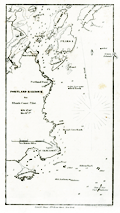 | Details | Blunt, E and G.W. | 1850 |
| Portland Harbor, Maine |
|
Blunt, E and G.W. |
|
| 1850 |
| LOC:3 |
| $75.00 | Blunt--E-and-G-W- | Portland-Harbor--Maine | Antique nautical chart of Portland Harbor, Maine from the Blunts in their 16th edition of the American Coast Pilot, published in 1850. Includes: the docks and wharves of Portland along the Fore River; Halfway River; Great Hog Island; Peaks Island; Bangs Island; Ram Island; Fort Preble; Portland Point Lighthouse; Richmond's Island; the Observatory; and Cape Elizabeth (with fixed revolving lights). Contains numerous depth soundings and fixes several offshore rocks and reefs including Bell Rock, Old Anthony, Alden's Rock, Taylor's Reef, Broad Cove Rock, and a set of rocks known as "Hue and Cry".
<br></br>
The American Coast Pilot with other harbor charts and sailing directions, was published by Edmund and George W. Blunt from New York. The Blunts were the most prolific private publisher of navigational charts in the United States at that time. 179 Water Street New York. |
| 1138 |  | Details | U.S. Coast and Geodetic Survey | 1850 |
| Antique Rolled Chart of Hyannis Harbor, Massachusetts |
|
U.S. Coast and Geodetic Survey |
|
| 1850 |
| LOC:200 |
| $0.00 | U-S--Coast-and-Geodetic-Survey | Antique-Rolled-Chart-of-Hyannis-Harbor--Massachusetts | SOLD
<br></br>
Fine and quite scarce antique chart of the Harbor of <b>Hyannis, Massachusetts</b> published in 1850 by the U.S. Coast Survey on heavy paper. Contains a list of dangers, a tide table, sailing directions, and two long elevation views of the East and West entrances to Hyannis Harbor as seen from sea. Key features include: Bishop and Clerks Rocks, Point Gammon, Gazette Rock, Gallatin Rocks, Senator Shoal, and Harbor Bluff. With numerous depth soundings and fine topographical detail on the coastal margins. Electrotype copy no. 2 by Mathiot.
<br></br>
Hyannis is the largest of seven villages comprising the town of Barnstable on <b>Cape Cod</b>. The town is best known as the presidential retreat for the Kennedy clan who spent any available downtime at the family compound in Hyannis Port.
<br></br>
This is a scarce, separately issued, rolled nautical chart of Hyannis, MA. on heavy paper, not the more common folded version on thin, trimmed paper that was issued with other charts in an annual report to Congress from the Coast Survey.
<br></br>
Under magnification fine detail is visible assuring the buyer of it's origin as an copperplate (electrotype) engraving. This chart was printed by the U.S. Coast Survey in 1850 from an electrotype copy of the original hand-engraved copper plate, a process the U.S. Coast Survey newly adopted in mid-century and that resulted in incredibly fine detail without the work of re-engraving after every few hundred copies.
<br></br>
As a soft medium, copper plates could only withstand print runs of perhaps 200 copies before the plates wore down. To enable larger print runs, a mold of the original plate was created in wax or another soft medium. Then, using an electro-chemical process ( electrotyping ), the mold was coated with a metal layer, typically copper. Printers were then able to produce output from the new electrotype copper copy, while preserving the original. |
| 1458 |  | Details | U.S. Coast and Geodetic Survey | 1851 |
| Antique Preliminary Nautical Chart of Key West, Florida |
|
U.S. Coast and Geodetic Survey |
|
| 1851 |
| LOC:0 |
| $0.00 | U-S--Coast-and-Geodetic-Survey | Antique-Preliminary-Nautical-Chart-of-Key-West--Florida | SOLD
<br></br>
See another copy of this chart in stock now.
<br></br>
Detailed first-edition original antique hydrographic survey chart of the vicinity of Key West, Florida. |
| 3645 |  | Details | U.S. Coast and Geodetic Survey | 1851 |
| First Edition Antique Nautical Chart of Key West, Florida |
|
U.S. Coast and Geodetic Survey |
|
| 1851 |
| LOC: |
| $0.00 | U-S--Coast-and-Geodetic-Survey | First-Edition-Antique-Nautical-Chart-of-Key-West--Florida | SOLD
<br></br>
Detailed first-edition original antique hydrographic survey chart of the vicinity of Key West, Florida. Includes extensive sailing directions with landmarks, courses, bearings and instructions for entering Key West via several channels. This antique chart, based on a thorough trigonometrical survey, was released by the U.S. Coast Survey in 1851. Contains literally hundreds of depth soundings.
<br></br>
A trigonometrical survey of a portion of the earth's surface is conducted by measuring a single base distance, and connecting it with various points in the tract surveyed by a series of triangles, the angles of which are carefully measured. Relative positions and distances of all parts are computed from these data.
<br></br>
Includes a tide table and very interesting cross-sectional views of elevation of coral heads, (water depth) recorded across several lines on the chart at Sand Key and the reefs at the East Channel. Other noted points include Fleming's Key, Francfort Bank, East Crawfish Key, West Crawfish Key, Mangrove Keys, and Raccoon Key.
<br></br>
With extensive sailing directions for several approaches to Key West, Florida including: the East Channel, the Main Ship Channel ("At Night. Bring the North Stat to range after Key West Light House and stand for it when Sand Key (or Sound Key Light Boat bears S.W. by W. S. 62 degrees W) a vessel drawing over 16 feet of water had better anchor and wait for a pilot".); Rock Key Channel; Sand Key Channel; West Channel; and North West Channel. |
| 3619 | 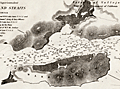 | Details | U.S. Coast and Geodetic Survey | 1851 |
| Early U.S. Coast Survey Chart of Mare Island Vallejo California |
|
U.S. Coast and Geodetic Survey |
|
| 1851 |
| LOC:3 |
| $85.00 | U-S--Coast-and-Geodetic-Survey | Early-U-S--Coast-Survey-Chart-of-Mare-Island-Vallejo-California | Antique U.S. Coast Survey chart of the Mare Island Strait. Includes Mare Island and Vallejo, California. Topographic detail is rendered through elegant and informative hachuring. Scale 1 / 30,000. |
| 1007 |  | Details | U.S. Coast and Geodetic Survey | 1851 |
| Coast Survey Atlas (Sketches for the 1851 Annual Report) |
|
U.S. Coast and Geodetic Survey |
|
| 1851 |
| LOC:0 |
| $400.00 | U-S--Coast-and-Geodetic-Survey | Coast-Survey-Atlas-(Sketches-for-the-1851-Annual-Report) | About 57 nautical charts (many folded) in a single volume showing the hydrographic sketches and preliminary surveys of the U.S. East and West Coast. Bookplate: "With the compliments of A.D. Bache", Alexander Dallas Bache (1806-1867), then the superintendent of the United States Coast Survey.
<br></br>
Inserted, loose list of "Coast Survey Charts Published" dated within at March 15, 1853. Lists charts, sketches and preliminary charts, free sketches, and the names and residences for agents selling Coast Survey charts. Size: 9" x 22". On better paper. |
| 970 | 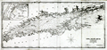 | Details | Blunt, E and G.W. | 1851 |
| Antique antbellum chart of Long Island Sound |
|
Blunt, E and G.W. |
|
| 1851 |
| LOC:0 |
| $0.00 | Blunt--E-and-G-W- | Antique-antbellum-chart-of-Long-Island-Sound | SOLD
<br></br>
Antique antebellum nautical chart of the coasts and islands comprising <b>Long Island Sound.</b> Coverage includes parts of the coasts of New York, Connecticut, and Rhode Island. Key features include Block Island, Fisher Island, <b>Mystic</b>, New London, New Haven, Darien, Stamford, Oyster Bay, Great Peconie Bay, Sag Harbor, Gardiners Bay, and Montauk Point. With numerous soundings, aids to navigation and, navigational hazards. Dated within at 1851.
<br></br>
With an inset map at upper right of New York City with <b>Manhattan</b>, the North River and East River.
<br></br>
From the 16th edition of the American Coast Pilot with other harbor charts, published by Edmund and George W. Blunt from New York. The Blunts were the most prolific private publishers of navigational charts in the United States in the mid 19th century. Page 41. |
| 2487 |  | Details | Anonymous | 1851 |
| Mount Auburn Cemetery |
|
Anonymous |
|
| 1851 |
| LOC:0 |
| $0.00 | Anonymous | Mount-Auburn-Cemetery | SOLD
<br></br>
Mount Auburn Avenues and Paths. Boston 1851 Vintage Map. Collectible. Fabric Bkg |
| 179 | 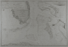 | Details | Depot de la Marine | 1851 |
| Carte des Canaux de la Providence et de Bahama |
|
Depot de la Marine |
|
| 1851 |
| LOC:0 |
| $0.00 | Depot-de-la-Marine | Carte-des-Canaux-de-la-Providence-et-de-Bahama | <BR> </BR>
SOLD
<BR> </BR>
Fine antique nautical chart from 1851 of Southern Florida and the Keys to Cuba including the Bahamas to Eleuthera. This scare old chart after a work by Edmund Blunt in 1847 was produced by the French Depot-General de la Marine and includes the circular imprint of that organization. Points of interest include "Havane" (Havana, Cuba) and Fort Dallas (est. 1836), at the mouth of the Miami River. Notably absent is any mention of the towns of Miami, Palm Beach or any other population center in that area. Insets at upper right and upper left contain profiles of topographic features. <BR> </BR> <BR> </BR>
Old maps of Florida by the Depot de la Marine are uncommon and should be prized both by the collector and by those interested in their use as nautical décor. |
| 466 | 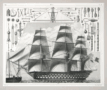 | Details | Heck, Georg | 1851 |
| Sailing Ship and Rigging |
|
Heck, Georg |
|
| 1851 |
| LOC:0 |
| $0.00 | Heck--Georg | Sailing-Ship-and-Rigging | <br><br><b>SOLD</b>, but see <a href="https://www.rarecharts.com/ShowDetail/Creator/Heck--Georg/Title/19th-century-engraving-sailing-ship-and-rigging/6459" target="_blank">another example of the map</a> now in our inventory.
<br></br>
Antique steel-plate engraving depicting a triple-decked ship-of-the-line with its related rigging and equipment. |
| 6459 |  | Details | Heck, Georg | 1851 |
| 19th-century engraving sailing ship and rigging |
|
Heck, Georg |
|
| 1851 |
| LOC:78 |
| $140.00 | Heck--Georg | 19th-century-engraving-sailing-ship-and-rigging | Steel-plate line engraving depicting a triple-decked ship-of-the-line and some of the rigging and equipment with special emphasis on blocks, tackle, and armament. From Georg Heck's "Iconographic Encyclopedia" published by Rudolph Garrigue in New York in 1851. Cool! |
| 6531 | 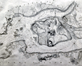 | Details | U.S. Coast and Geodetic Survey | 1851 |
| Rare engraved chart of Hell Gate and its approaches New York City |
|
U.S. Coast and Geodetic Survey |
|
| 1851 |
| LOC:68 |
| $1,550.00 | U-S--Coast-and-Geodetic-Survey | Rare-engraved-chart-of-Hell-Gate-and-its-approaches-New-York-City | Rolled, antique navigational and hydrographic chart of Hell Gate at the East River of New York City, 1851. Original and scarce. With sailing directions and numerous depth soundings. Copper-plate engraving with very fine detail. Not an electrotype copy. Triangulation by Edmund Blunt.
<br><br>
This chart encompasses what was previously a dangerous area to navigate. According to the NOAA website, during the 18th and early 19th century, strong currents and submerged rocks made Hell Gate <a target="_blank" style="color:#9BAFCB" href=" http://celebrating200years.noaa.gov/new_york_charts/hell_gate.html"> "a graveyard for ships"</a>. This chart shows Hell Gate in 1851, the year when the U.S. Army began blasting underwater rocks and obstructions to make the channel safe for marine traffic.
<br></br>
Visible plate mark with ink smudges outside the neatline confirm usage of the intaglio printing method from an engraved copper plate. A separately issued chart, not a marked as a 'survey' or 'preliminary' chart on thin paper issued in the annual reports to Congress. Contains the circular stamp of the U.S. Coast Survey Office. |
| 1097 |  | Details | Ringgold, Cadwalader | 1851 |
| Antique U.S. Navy Chart of the Entrance to San Francisco Bay |
|
Ringgold, Cadwalader |
|
| 1851 |
| LOC:63 |
| $1,250.00 | Ringgold--Cadwalader | Antique-U-S--Navy-Chart-of-the-Entrance-to-San-Francisco-Bay | Cadwalader Ringgold's detailed, hand-colored chart of San Francisco Bay from 1851, extending up the Sacramento river at top right to Sacramento, Sutterville, and Boston, CA and to Stockton, Stanislaus City and San Joaquin at bottom right. Along Napa Creek Ringgold drew the plan of the small town of Vallejo which he refers to as "Capitol of the State". Other town plans include Suisun City, Martinez, New York, and Benicia. The map carries a dedication to William H. Aspinwall, Esq. of New York City, a merchant and ship owner.
<br ></br>
Published two years after the beginning of the 49'er gold rush, this most interesting lithographed chart is notable for the fine detail shown along California's rivers, which include names for a number of islands and regions which had never before appeared on commercial maps. The Webster or Russian Embarcadero is shown, as is Presidio, Washington, Indian Villages, Doaks Ferry, Martins, Table Hill, Petaluma Creek, Mount Diablo and many smaller islands, creeks, points and other features. Alcatraz island is labeled simply "Alcatraces".
<br ></br>
Ringgold (1802-1867) was a officer in the U.S. Navy who had served aboard the brig Porpoise with the U.S. Exploring Expedition during Wilkes' surveys of the area in 1841 . Ringgold was promoted to Commander in July, 1849 and began his groundbreaking survey of the San Francisco Bay region, suddenly important because of the discovery of gold in the area. The survey began in August 1849, with Ringgold commanding the chartered brig Col. Fremont. Of the sources used to compile the map Guthorn notes:
<div class="indenttextblock">"Ringgold's charts and sailing directions employed material extracted from the account by Fredrick William Beechy, the British explorer and naval officer whose narrative of the voyage to the Pacific and Behring Sea was published in 1831." (Guthorn, Peter. "U.S. Coastal Charts 1783-1861." Schiffer Publishing. 1984. p. 195)</div> |
| 601 |  | Details | U.S. Coast and Geodetic Survey | 1851 |
| Hell Gate and its Approaches |
|
U.S. Coast and Geodetic Survey |
|
| 1851 |
| LOC:0 |
| $0.00 | U-S--Coast-and-Geodetic-Survey | Hell-Gate-and-its-Approaches | <br><br>This item is <b>SOLD</b> but we have found another example of this item that is <a href="https://www.rarecharts.com/ShowDetail/Creator/U-S--Coast-and-Geodetic-Survey/Title/Rare-chart-of-Hell-Gate-and-its-approaches-New-York-City/6531" target="_blank">now in our inventory.</a>
<br></br>
Rolled, antique navigational and hydrographic chart of Hell Gate at the East River of New York City.
With sailing directions and numerous depth soundings. Copper-plate engraving with fine detail. |
| 1245 |  | Details | Bill, Henry | 1852 |
| Early birds-eye view of San Francisco |
|
Bill, Henry |
|
| 1852 |
| LOC:0 |
| $0.00 | Bill--Henry | Early-birds-eye-view-of-San-Francisco | SOLD
<br></br>
An attractive and desirable birds-eye view of San Francisco, California published in 1852 during the height of the California Gold Rush. In that year gold exports exceeding $45,587,000 were reported. Also, poles for the first magnetic telegraph service were installed at Montgomery and Merchant streets. The telegraph was to connect San Francisco with San Jose, Stockton, Sacramento and Marysville.
<br></br>
A legend at bottom of the lithograph identifies 13 points of interest. Among these important locations in and around San Francisco are:
<div class="indenttextblock">
<ul style="list-style-type: circle;">
<li>Marine Telegraph</li>
<li>Contra Costa</li>
<li>California Exchange</li>
<li>North Bay</li>
<li>Yerba Buena island</li>
<li>Leonards Warehouse</li>
<li>Market Street Pier</li>
<li>Central Wharf</li>
<li>Anjill Island (Angel Island)</li>
</ul>
</div>
Noted in the lower margin: "Entered according to Act of Congress, District of Connecticut in 1852"
<br></br>
This fine lithographed print is from Volume II of Henry Bill’s History of the World |
| 27 |  | Details | Blunt, Edmund | 1852 |
| North East Coast of North America (Blueback) |
|
Blunt, Edmund |
|
| 1852 |
| LOC:0 |
| $0.00 | Blunt--Edmund | North-East-Coast-of-North-America-(Blueback) | SOLD
<br></br>
Large, small-scale ante-bellum antique blueback nautical chart of northeast U.S. coast by E & G.W. Blunt. This 158 year old well-used blueback chart of U.S. northeast coast reveals a long and full life. <BR> </BR>
Coverage from Nova Scotia past New York city including Georges Shoal and Little Georges. Coastal detail shown with fine lines. Copious soundings off coasts of New Jersey and NYC. One faint manuscript calculation on this blueback chart that could easily be erased.
<BR> </BR>
For more information on the evolution of blueback charts we recommend this book by Susanna Fisher:
<a target="_blank" href="http://www.regattapress.com/The_Makers_of_the_Blueback_Chart.html">The Makers of Blueback Charts.</a> |
| 4921 |  | Details | Owen, David Dale | 1852 |
| Map Bad Lands Mauvaises Terres Nebraska |
|
Owen, David Dale |
|
| 1852 |
| LOC:13 |
| $350.00 | Owen--David-Dale | Map-Bad-Lands-Mauvaises-Terres--Nebraska | Map Showing the Position of the Bad Lands ( Badlands) or Mauvaises Terres of Nebraska.
<br></br>
After David Dale Owen's "Geological Map of Wisconsin, Iowa and Minnesota ... Constructed from observations by the United States Geological Corps ... 1851. Published by Lippincott, Grambo & Co., Philadelphia. |
| 1454 |  | Details | U.S. Coast and Geodetic Survey | 1852 |
| Antique Chart of Key West, Florida |
|
U.S. Coast and Geodetic Survey |
|
| 1852 |
| LOC:0 |
| $0.00 | U-S--Coast-and-Geodetic-Survey | Antique-Chart-of-Key-West--Florida | SOLD
<br></br>
Very cool hydrographic survey chart of the vicinity of Key West, Florida long before any bridges. This antique chart, based on a trigonometrical survey, was released by the U.S. Coast Survey in 1852. Includes a tide table and very interesting cross-sectional views of elevation of coral heads, (water depth) recorded across several lines on the chart at Sand Key and the reefs at the East Channel. Other noted points include Fleming's Key, Francfort Bank, East Crawfish Key, West Crawfish Key, Mangrove Keys, and Raccoon Key.
<br></br>
A trigonometrical survey of a portion of the earth's surface is conducted by measuring a single base distance, and connecting it with various points in the tract surveyed by a series of triangles, the angles of which are carefully measured. Relative positions and distances of all parts are computed from these data.
<br></br>
With extensive sailing directions for several key approaches to Key West including: the East Channel, the Main Ship Channel ("At Night. Bring the North Stat to range after Key West Light House and stand for it when Sand Key (or Sound Key Light Boast bears S.W. by W. S. 62 degrees W) a vessel drawing over 16 feet of water had better anchor and wait for a pilot".); Rock Key Channel; Sand Key Channel; West Channel; and North West Channel. Second Edition. |
| 7936 |  | Details | Anonymous | 1852 |
| Manuscript investment prospectus for the Brunswick Canal Company |
|
Anonymous |
|
| 1852 |
| LOC:41 |
| $0.00 | Anonymous | Manuscript-investment-prospectus-for-the-Brunswick-Canal-Company | SOLD<br><br>This manuscript private letter to the Proprietors of the City of Brunswick, Georgia signed by D. L. Martin and Charles L. Muir, belongs to the final stage of the long and troubled effort to complete the Brunswick Canal in Georgia. It was written at a moment when the work was nearly finished but paralyzed for lack of money. The six-page document pleads with northern and local investors to cooperate, arguing that the city’s real-estate holdings and the canal’s success were inseparable. Without the canal, Brunswick’s fine harbor and well-laid streets remained idle capital; with it, the authors promised, the town would spring to life and the stock of both companies would rise to par.
<br><br>
The letter fits precisely with newspaper reports from 1852 describing a new bond issue for the Brunswick Canal and Rail Road Company. Those public notices named D. Randolph Martin, president of the Ocean Bank of New York, as trustee for $100,000 in second-mortgage seven-percent bonds. In the private appeal, “D. L. Martin” is almost certainly the same man, acting both as financial organizer and trustee. His participation through Ocean Bank linked the Georgia enterprise to New York capital markets, where southern infrastructure bonds were commonly sold under northern trusteeship to reassure investors.
<br><br>
Technically, the canal was a modest work—about nine miles long, four feet deep, and fifty feet wide—but its promoters claimed it would open four thousand miles of interior river navigation, connecting the Altamaha system to the Atlantic at Brunswick. They argued that it would unleash trade in timber, cotton, and naval stores, and they projected annual revenues of up to seventy-five thousand dollars. The letter describes contracts already arranged with Dr. Robert Collins of Macon to finish the remaining excavation at thirty cents per cubic yard, estimating that thirty-five thousand dollars would complete the job.
<br><br |
| 1155 | 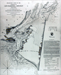 | Details | U.S. Coast and Geodetic Survey | 1853 |
| Antique Rolled Chart of Cape Fear, North Carolina |
|
U.S. Coast and Geodetic Survey |
|
| 1853 |
| LOC:0 |
| $0.00 | U-S--Coast-and-Geodetic-Survey | Antique-Rolled-Chart-of-Cape-Fear--North-Carolina | SOLD
<br></br>
Scarce separately issued rolled antique chart (no folds) from 1853 of <b>Cape Fear, North Carolina</b> with extensive sailing directions. Coverage on this fine old engraving includes "Smith's Island", now Bald Head Island; "Smithville", now <b>Southport, NC</b>; Federal Point; Champagne Creek; Zeek's Island, Battery Island and Striking Island. Numerous small waterways are charted including Dozier's Creek, Elizabeth Creek, Dutchman Creek, and Price's Creek.
<br></br>
Depicts <b>Fort Caswell</b> on Oak Island protecting the entrance to the Cape Fear River. That pentagonal shaped structure, completed in 1836, was designed to house 61 cannon. Fort Caswell was named for Governor Richard Caswell, a North Carolina hero of the American Revolution. A lawyer and surveyor by training, Caswell represented North Carolina in the Continental Congress of 1774 and 1775. As a Patriot officer in the American Revolutionary War, Caswell led North Carolina militiamen in the Battle of Moore's Creek Bridge.
<br></br>
The chart would have facilitated navigation from the Atlantic Ocean past Cape Fear though the Main Ship Channel to the Cape Fear River and Wilmington through its use of numerous depth soundings, buoy locations, sandbars, isobaths, and bearing lines.
<br></br>
This is a scarce, separately issued, rolled nautical chart of Cape Fear, NC on heavy paper, not the more common folded version on thin, trimmed paper that was issued by the Coast Survey with other charts in an annual report to Congress. With the circular logo of the Coast Survey Office. Price when issued was 15 cents.
<br></br>
Very fine detail on the chart and lack of attribution to electrotype reproduction suggest that this chart is based on the Coast Survey's original hand-engraved copper plate . |
| 853 | 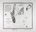 | Details | U.S. Coast and Geodetic Survey | 1853 |
| Antique engraved nautical chart of the entrance to San Diego, California |
|
U.S. Coast and Geodetic Survey |
|
| 1853 |
| LOC:0 |
| $0.00 | U-S--Coast-and-Geodetic-Survey | Antique-engraved-nautical-chart-of-the-entrance-to-San-Diego--California | SOLD<br></br>
Engraved antique nautical chart of the entrance to San Diego Bay, in California on a large sheet of heavy paper with no folds . Noted features include Point Loma, Ballast Point, Zuniga Shoal, and "La Playa" the original harbor where goods were transferred to and from ships calling at the port. At right is a sketch of the wider area including the San Diego Bay area and extending to the Coronados Islands, four islands belonging to Mexico between 15 and 20 miles south of San Diego.
<br></br>
Considered to be one of the best natural harbors on the west coast of North America, San Diego was colonized by Spain beginning in 1769 and served as base headquarters of major ships of the United States Navy in the Pacific until just before the United States entered World War II.
<br></br>
Early electrotype copy. Never folded, this is a separately issued chart of the harbor with 4" wide margins and a prominent platemark. Total size is 21" x 18".
<br></br>
Relief shown by hachures; soundings in feet. Includes sailing directions. In upper margin "Presented under authority of an act of Congress of the United States of June 3d 1844 by direction of the Treasury Department, A.D. Bache Superintendent Coast Survey." "J No. 4."
<br></br>
Electrotype copy number 1 by Mathiot. |
| 382 |  | Details | Anonymous | 1853 |
| Lake Pontchartrain Harbour and Breakwater |
|
Anonymous |
|
| 1853 |
| LOC:10 |
| $225.00 | Anonymous | Lake-Pontchartrain-Harbour-and-Breakwater | Fascinating plan of the southern shore of Lake Ponchartrain in New Orleans, Louisiana from 1853. During that era both Bayou St. John and the New Canal (the present <a rel="nofollow" target="_blank" href="http://en.wikipedia.org/wiki/17th_Street_Canal">17th Street Canal</a>) were navigable to small vessels; a lighthouse is shown at the mouth of each canal. The plan shows projected construction of wooden breakwaters in the lake that were designed "to furnish safe anchorage in front of the termini of the Pontchartrain Railroad, Bayou St John, and New Canal…".<BR> </BR>
Other depicted features include Milneburg, then a suburb of New Orleans connected to it by the Pontchartrain Railroad, two lighthouses, and the Jefferson and Lake Pontchartrain Railroad in what is now Jefferson Parish. Construction details of the wooden breakwater are shown in profile and elevation. <BR> </BR>
Today neither of the two railroad lines linking New Orleans to the Lakefront exist. Neither Bayou St. John nor the 17th Street Canal (a large drainage ditch) are navigable. In fact a section of the 17th Street Canal failed after Hurricane Katrina and was responsible for flooding a large part of New Orleans and at least 31 deaths. The deadly breach in the canal can be located on the plan near the bottom of the shaded high land directly adjacent to the New Canal. <BR> </BR>
Dated October 30th, 1853. Printed by Wagner and Mc Guigan Lithographers, Philadelphia. For reference see: |
| 1447 | 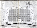 | Details | Pittman, Philip | 1853 |
| Uncommon lithographed map of New Orleans |
|
Pittman, Philip |
|
| 1853 |
| LOC:3 |
| $285.00 | Pittman--Philip | Uncommon-lithographed-map-of-New-Orleans | Uncommon lithographed map ca. 1853 of New Orleans, Louisiana as it appeared in 1770, based upon the reconnaissance of Captain Philip Pittman, a British army engineer. This lithographed mid 19th-century map is the earliest easily obtainable copy of Pittman's 1770 engraved map.
<br></br>
Lithographed by Sarony & Major. Sarony and Major were well known New York lithographers 1846-1853.
<br></br>
Pittman's book was the first English book on the topography, settlements, and inhabitants of the region. In 1764, he traveled the Mississippi River to New Orleans with Major Arthur Loftus.
<br></br>
The map was first printed as an engraved plate in Pittman's "The Present State Of The European Settlements On The Mississippi; with A Geographical Description of that River Illustrated by Plans and Draughts" (J. Nourse, London 1770).
<br></br>
About the site of New Orleans Pittman wrote:
<div class="indenttextblock">
NEW ORLEANS stands on the east side of the river, it has a very easy communication with the northern parts of Louisiana (now West Florida) by means of the Bayou of St. John, a little creek, which is navigable for small vessels drawing less than six feet water, six miles up from the lake Ponchartain, where there is a landing-place, at which the vessels load and un load ; and this is about two miles from the city.
</div>
Pittman described the area around Jackson Square, and St. Louis Cathedral, perhaps New Orleans best-known locations (café du Monde, street artists, carriage rides):
<div class="indenttextblock">
The parade is a large square, in the middle of that part of the town which fronts the river ; in the back part of the square is the church dedicated to St. Louis, a very poor building, framed with wood ; it is in so ruinous a condition that divine service has not been performed in it since the year 1766, one of the king's store houses being at present used for that purpose.
</div> |
| 665 |  | Details | U.S. Coast and Geodetic Survey | 1853 |
| Northwest Coast of Washington State |
|
U.S. Coast and Geodetic Survey |
|
| 1853 |
| LOC:0 |
| $0.00 | U-S--Coast-and-Geodetic-Survey | Northwest-Coast-of-Washington-State | SOLD
<br><br/>
Attractive original chart of the Olympic Peninsular coast of the Washington territory in the year it was established - 1853. The Washington territory was not admitted to the Union until 1889. Includes coastline both along the Pacific Ocean and the Strait of Juan de Fuca. Very fine condition.
<br><br/>
Detailed soundings and hydrographic detail of the Washington coast including Gray's Harbor, Cape Flattery, Fresh Water Bay, False Dungeness, Protection Island, Point Hudson, Callam Bay, and Admiralty Inlet. These additional areas are shown in outline only : Vancouver Island, Victoria Harbor, Haro Strait, San Juan Island, Port San Juan, Lopez Island, Rosario Strait, and Smith's Island.
<br><br/>
With finely engraved inset views of these features: Duncan's Rock, Tatoosh Island, Cape Flattery, Flattery Rocks, White Rock, Destruction Island, Sail Rock, Pt. Grenville.
<br><br/>
This antique chart should not be confused with those similar copies issued with dozens of other maps as part of a Report to Congress, most on thin paper with folds that often show condition issues. This original mid 19th century survivor is a large, separately issued chart on thick wove paper that has been stored either rolled of flat with no folds.
<br><br/>
Engraved by McCoy, Woodward, and Smith. Includes sailing directions. With the circular logo of the Coast Survey Depot. |
| 664 |  | Details | U.S. Coast and Geodetic Survey | 1853 |
| City of San Francisco, California |
|
U.S. Coast and Geodetic Survey |
|
| 1853 |
| LOC:63 |
| $1,400.00 | U-S--Coast-and-Geodetic-Survey | City-of-San-Francisco--California | Antique electrotype engraved plan of the booming town of San Francisco, California made in 1853 during the California gold rush. On a 25" x 33" sheet of heavy paper, never folded. Key named features include: Tonquin Shoal, Wreck of the Tonquin, Blossom Rock, Mission Rock, Point San Quentin, Mission de Dolores, Rincon Point, Mission Bay, Steamboat Point, Cunningham's Wharf, Law's Wharf, Broadway Wharf, Pacific Wharf, and Portsmouth Square.
<br></br>
The town is shown laid out into blocks with individual buildings. Numerous streets are identified including Market Street, Pine Street, Lombard Street and Broad Way. Includes numerous soundings and contour lines.
<br><br/>
This antique chart should not be confused with those similar copies that were issued with dozens of others as part of a Report to Congress, most on thin paper with folds that often show condition issues. This original mid 19th century survivor is a large, separately issued example on thick wove paper that has been stored either rolled of flat with no folds. Price 50 Cents. Verified I.I. Stevens . Outlines and Topography engraved by Max. F.O. Strobel; Lettering by E.F. Woodward. With the circular logo of the Coast Survey Depot. Number 627. |
| 606 |  | Details | U.S. Coast and Geodetic Survey | 1853 |
| Western Coast of U.S. San Francisco to San Diego 1853 |
|
U.S. Coast and Geodetic Survey |
|
| 1853 |
| LOC:0 |
| $0.00 | U-S--Coast-and-Geodetic-Survey | Western-Coast-of-U-S--San-Francisco-to-San-Diego-1853 | SOLD <br></br>
Antique chart focused on the coastline between San Francisco and San Diego, California. Produced by the U.S. Coast Survey in 1853, a time when the United States Pacific coastal states were lightly populated. Scarce, separately issued, electrotype copy. A rolled chart of the California coast, not one of the common folded versions on thin paper that were issued with other charts in an annual report from the U.S. Coast Survey to Congress. |
| 1268 |  | Details | U.S. Coast and Geodetic Survey | 1853 |
| Antique rolled U.S. Coast Survey chart from San Francisco to San Diego |
|
U.S. Coast and Geodetic Survey |
|
| 1853 |
| LOC:0 |
| $0.00 | U-S--Coast-and-Geodetic-Survey | Antique-rolled-U-S--Coast-Survey-chart-from-San-Francisco-to-San-Diego | SOLD<br></br>
Attractive antique nautical chart of the western coast of California focused on the coastline between <b>San Francisco</b> and <b>San Diego</b>, California. Includes Los Coronados (Coronado Islands), San Clemente Island, Alcatraz Island, San Nicholas Island, Point Loma, Point Conception and many other geographic locations.
<br></br>
This is a scarce, separately issued, rolled chart of the California coast, not one of the common folded versions on thin paper that were issued with other charts in an annual report to Congress from the Coast Survey.
<br></br>
The antique chart was produced by the U.S. Coast Survey in 1853, a time when the United States Pacific coastal states were lightly populated (by settlers). In fact, one of the settlements noted above San Diego in a wide coastal plain is referred to on the map as <b>"El Pueblo de Los Angeles". </b> That settlement had been created by the Spanish only in 1781.
<br></br>
Noted habitations include Monterrey, the Mission of Carmel, San Diego, and San Francisco. The chart is decorated with 17 decorative nicely-engraved coastal profile views including Catalina Harbor, Moro Rock, Point Sur, and the Entrance to San Francisco Bay.
<br></br>
This antique chart was printed in 1853 from an electrotype copy of the original hand-engraved copper plate, a process the U.S. Coast Survey adopted around 1850. As a soft medium, copper plates could only withstand print runs of perhaps 200 copies before the plates wore down. To enable larger print runs, a mold of the original plate was created in wax or another soft medium. Then, using an electro-chemical processs ( electrotyping ), the mold was coated with a metal layer, typically copper. Printers were then able to produce output from the new electrotype copper copy, while preserving the original. Electrotype copy no. 10. Sheet size 30"x30". Scale 1 / 1,200,000. |
| 1026 |  | Details | U.S. Coast and Geodetic Survey | 1853 |
| Western Coast of U.S. San Francisco to San Diego |
|
U.S. Coast and Geodetic Survey |
|
| 1853 |
| LOC:0 |
| $0.00 | U-S--Coast-and-Geodetic-Survey | Western-Coast-of-U-S--San-Francisco-to-San-Diego | SOLD
<br><br/>
Fascinating old antique nautical chart of the western coast of California focused on the coastline between <b>San Francisco</b> and <b>San Diego</b>, California. Includes Los Coronados (Coronado Islands), San Clemente Island, Alcatraz Island, San Nicholas Island, Point Loma, Point Conception and many other geographic locations.
<br></br>
The antique chart was produced by the U.S. Coast Survey in 1853, a time when the United States Pacific coastal states were lightly populated (by settlers). In fact, one of the settlements noted above San Diego in a wide coastal plain is referred to on the map as <b>"El Pueblo de Los Angeles". </b> That settlement had been created by the Spanish only in 1781.
<br></br>
Noted habitations include Monterrey, the Mission of Carmel, San Diego, and San Francisco. The chart is decorated with 17 decorative nicely-engraved coastal profile views including Catalina Harbor, Moro Rock, Point Sur, and the Entrance to San Francisco Bay.
<br></br>
This is a scarce, separately issued, rolled chart of the California coast, not one of the common folded versions on thin paper that were issued with other charts in an annual report to Congress from the Coast Survey.
<br></br>
This antique chart was printed in 1853 from an electrotype copy of the original hand-engraved copper plate, a process the U.S. Coast Survey adopted around 1850. As a soft medium, copper plates could only withstand print runs of perhaps 200 copies before the plates wore down. To enable larger print runs, a mold of the original plate was created in wax or another soft medium. Then, using an electro-chemical processs ( electrotyping ), the mold was coated with a metal layer, typically copper. Printers were then able to produce output from the new electrotype copper copy, while preserving the original. Electrotype copy no. 10. Sheet size 30"x30". Scale 1 / 1,200,000. |
| 5448 |  | Details | U.S. Coast and Geodetic Survey | 1854 |
| Antique chart of Pass Fourchon Lafourche Parish Louisiana |
|
U.S. Coast and Geodetic Survey |
|
| 1854 |
| LOC:78 |
| $200.00 | U-S--Coast-and-Geodetic-Survey | Antique-chart-of-Pass-Fourchon-Lafourche-Parish-Louisiana | Antique lithographed chart of Pass Fourchon, Louisiana, at the mouth of Bayou Lafourche [1] where it entered the Gulf of Mexico in 1854. Shows Bird Island at bottom left and Lake Champagne to the right, today after erosion, no longer inland- called Bay Champagne. The pass shown on the chart no longer exists, it is closed and maritime traffic utilizes Belle Pass which lies to the west of the Pass Fourchon. The old Pass Fourchon channel is used to access Port Fourchon.
<br></br>
Port Fourchon is located about 60 miles SSW of New Orleans, Louisiana. The port is the marine support base for more than 90% of the Gulf of Mexico's deep-water oil production.
<br></br>
Drawn by F.W. Gerdes. Engineered by Bartle and Bradley. Lithographed by Bien and Sterner, New York.
<br></br>
[1] In 1854 Bayou Lafourche was an active distributary of the Mississippi River. Bayou Lafourche has not been navigable from the Mississippi River since 1905 when a dam was built at Donaldsonville, La. but prior to that time the portion of the Bayou north of the ICWW served as an important commercial artery to New Orleans and other points on the Mississippi River.
<br></br>
<div>
<img src="/ZoomifyImages/SC_993/SC_993_400x300.jpg" alt="" width="300" align="bottom" style="margin: 0px 10px 10px 0"/>
<span style="vertical-align: middle;">
<br>
<a href="https://www.rarecharts.com/ShowDetail/Creator/Anonymous/Title/Steamboat-Bill-of-Lading-for-Valence-Plantation/993" target="_blank">Steamboat Bill of Lading for Valence Plantation on Bayou Lafourche</a>
</span>
</div> |
| 2565 | 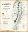 | Details | U.S. Coast and Geodetic Survey | 1855 |
| Preliminary Chart of Florida Reefs from Key Biscayne |
|
U.S. Coast and Geodetic Survey |
|
| 1855 |
| LOC:200 |
| $475.00 | U-S--Coast-and-Geodetic-Survey | Preliminary-Chart-of-Florida-Reefs-from-Key-Biscayne | Fine antique hydrographic survey chart of <b>Biscayne Bay</b>, Florida and surrounding area. Hundreds, perhaps thousands of depth soundings.
<br></br>
Miami, Florida is distinctly noted at the very top while a lighthouse is noted at the southern tip of Cape Florida. Other named features include: Old Rhodes Bank, Caesars Creek Bank, Elliott's Key, Triumph Reef, and Virginia Key.
<br></br>
Recommended reference for <b>treasure hunters</b>. Shows some locations of wrecks, dangerous reefs and banks.
<br></br>
Includes a list of abbreviations used to denote the sea floor composition (ex: S for Sand , C for clay).
<br></br>
A preliminary reduced-format hydrographic survey chart from a U.S. Coast Survey atlas with the U.S.C.G.S. circular winged logo. On thin paper with folds as issued. |
| 1090 |  | Details | Robiquet, Aime | 1856 |
| Rare Antique French Chart of the California Coast and Baja Peninsula |
|
Robiquet, Aime |
|
| 1856 |
| LOC:68 |
| $3,000.00 | Robiquet--Aime | Rare-Antique-French-Chart-of-the-California-Coast-and-Baja-Peninsula | Very rare engraved chart of the California coast from Shelter Cove south to Mazatlan, Mexico: "Carte des Côtes de Californie de Mazatlan à San Francisco d'Après les derniers Travaux Amércains Par Robiquet, Hydrographe Rue Pavée Saint Andre No.2. Paris 1856". This large chart is particularly interesting for its collection of numerous inset plans of North American West Coast ports and bays during the late California Gold Rush.
<br></br>
Coverage includes the <b>Baja Peninsula</b> or "Vieille Californie" with Cabo San Lucas ("Cap St. Lucas") at the end. Contains inset plans of the bays and ports at Guaymas, Ballena, St. Bartholomé, Pulpito, San Quentin, San Diego, San Pedro, Monterey, San Francisco, and Bodega Bay.
<br></br>
Scarce and detailed map of California's coastline, with much detail for navigation and a few inland landmarks. Printed in Paris by French hydrographer and publisher Louis Antoine Robiquet. Presumably from Robiquet's "Atlas Hydrographique" of 1856, but this printing with separate price (4 francs) and publisher's blind stamp in bottom right margin. Only one institutional copy is recorded in WorldCat.
<br></br>
Inset plans include: (1): Baie Bodega Levé en 1839 par Ed. Belcher. (2): Plan de la Baie de Monterey Levé en 1837 par Mr. De Tessan, Ingr. Geographe. (3): Entrée du Port de San Francisco par Cadwalader Ringgold. (4): San Pedro par James Alden 1852. (5): Entrée de San Diego par R.D. Cutts et G. Davidson. (6): Port San Quentin Levé in 1839 par Ed. Belcher. (7): Port St. Bartholomé Levé par le Cape. H. Kellet en 1847. (8): Mouillage Pulpito par le Cape. H. Kellet. (9): Port Balleno par le Cape. H. Kellet. (10): Guaymas Levé par Mr. Fisquet en 1840.
<br></br>
No. 61. Paris - Imp. Louis |
| 4934 |  | Details | Britton and Rey | 1858 |
| Map of the City of San Francisco |
|
Britton and Rey |
|
| 1858 |
| LOC:0 |
| $2,200.00 | Britton-and-Rey | Map-of-the-City-of-San-Francisco | Fine lithographed map of San Francisco, California with red overprinted circles at 1/4 mile intervals bound into the annual report described below. Stated by another dealer as "rare" and "one of the earliest maps of San Francisco published in the city."
<br/><br/>
Only 2 sales of these rare antebellum Britton & Rey lithographed maps are recorded in AMPR, only one previous sale of the red-overprinted edition. 2nd. ed. Originally issued in 1846, but not dated within; comparison to the first edition shows no differences except for red over-printing. Neither sale included the bound report. Britton & Rey were located on Montgomery Street at the corner with Commercial Street between 1854 and 1858 (Peters, California on Stone, p. 162).
<br/><br/>
Frontispiece shows a plan, "Diagram of the Chamber of the Board of Supervisors, 1863. H.P. Coon, President
<br/><br/>
The gilt-edged report into which the map is bound: " San Francisco Municipal Reports for the Fiscal Year 1862-'63" published at the orders of the Board of Supervisors. San Francisco: Printed at Charles F. Robbins & Company. No 417 Clay Street, between Sansome and Battery. 1863. Contains reports from City Auditors, City Surveyor and other department heads and city officials. 6" W x 9" H. Binding tight. Original covers with binders identification inside the front cover at top left: Bartling & Kimball, Binders, 505 Clay Street, San Francisco.
<br/><br/>
Spine (poor with 1" missing) reads: Municipal Reports, San Francisco 1862-663. Cover (good) reads: "Presented by the City of San Francisco." |
| 2564 |  | Details | Anonymous | 1858 |
| Map of the Florida Peninsula |
|
Anonymous |
|
| 1858 |
| LOC:87 |
| $180.00 | Anonymous | Map-of-the-Florida-Peninsula | Very attractive antique map of the Florida Peninsula from 1858. Shows status of surveys below the 2nd basis parallel conducted to that date. |
| 1099 |  | Details | U.S. Coast and Geodetic Survey | 1859 |
| Entrance to San Francisco Bay California 1859 |
|
U.S. Coast and Geodetic Survey |
|
| 1859 |
| LOC:0 |
| $2,500.00 | U-S--Coast-and-Geodetic-Survey | Entrance-to-San-Francisco-Bay-California-1859 | Superb, large, antique U.S. Coast Survey chart of <b>San Francisco Bay</b>, the city of San Francisco, California, and lower Marin County, California on heavy paper with no folds. Laid down nicely to board. Produced just 10 years after the beginning of the California Gold Rush it shows numerous soundings and aids to navigation including Fort Point Light, Point Bonita Light, Yerba Buena Light, and Alcatraz Light.
<BR> </BR>
Coverage includes San Francisco and Sausalito and the surrounding areas and is the original 1859 electrotype edition not a later corrected version. Like later editions, the bottom of the chart contains two views of the bay- both inbound and outbound the port showing both steam and sail-powered vessels underway and at anchor. This 1859 edition contains a third engraved view not found in later editions- <b>"View of the Entrance to San Pablo Bay from near Angel Island"</b>. In later editions that view was removed to make room for notes and tables.
<BR> </BR>
Named points of interest include the Presidio, Oakland, Cliff House, Ocean House, Sausalito, Alcatraz Island, Mission Bay, San Leandro, Yerba Buena Island, Mission de Delores, Table Mountain, Brooklyn, Alameda, and of course the Golden Gate (with no bridge).
<BR> </BR>
This chart was printed in 1859 from an electrotype copy of the original hand-engraved copper plate, a process the U.S. Coast Survey adopted around 1850. As a soft medium, copper plates could only withstand print runs of perhaps 200 copies before the plates wore down. To enable larger print runs, a mold of the original plate was created in wax or another soft medium. Then, using an electro-chemical processs ( electrotyping ), the mold was coated with a metal layer, typically copper. Printers were then able to produce output from the new electrotype copper copy, while preserving the original. Electrotype copy no. 2. With the circular stamp of the U.S. Coast Survey. |
| 4909 |  | Details | Anonymous | 1859 |
| Antique manuscript plat Queens, New York deBevoise |
|
Anonymous |
|
| 1859 |
| LOC:200 |
| $500.00 | Anonymous | Antique-manuscript-plat-Queens--New-York-deBevoise | One of a kind manuscript map ca. 1859 of a plat of land in the city of Newtown, borough of Queens, New York. Newtown was founded as Middenburgh by the Dutch in 1652. In the 17th century Dutch colony of New Netherland, Newtown was a suburb of New Amsterdam, and was renamed "Elmhurst" in 1897.
<br></br>
Shows a tract of woodlands, owned by farmer Abraham de Bevoise. Contains surveyors' field notes including the metes and bounds [1] of the plat relating it to land owned by Theodorus Kolyer (d. 1854). A fine, piece with a simple, pastoral view of the woodlands owned by de Bevoise, totaling two acres and 4 perches. A perch is a unit of area equal to 1/160 of an acre.
<br /> <br />
Abraham de Bevoise (1819 - 1887) was a farmer originally of French Huguenot ancestors.
<br /> <br />
<div class="indenttextblocksingle">
[1] The term "metes" refers to a boundary defined by the measurement of each straight run, specified by a distance between the terminal points, and an orientation or direction. A direction may be a simple compass bearing, or a precise orientation determined by accurate survey methods. The term "bounds" refers to a more general boundary description, such as along a certain watercourse, a stone wall, an adjoining public road way, or an existing building. (Online Source: https://definitions.uslegal.com/m/metes-and-bounds/)
</div> |
| 6738 |  | Details | Soule, George | 1859 |
| Very Rare Antebellum New Orleans advertisement Soule Commercial College |
|
Soule, George |
|
| 1859 |
| LOC:150 |
| $6,500.00 | Soule--George | Very-Rare-Antebellum-New-Orleans-advertisement-Soule-Commercial-College | Very rare New Orleans imprint antebellum broadsheet advertisement or "Balance Sheet Circular" produced by George Soule to advertise Soule's Commercial College, established 1856 at the corner of Camp Street and Common Street, in New Orleans, Louisiana. A finely detailed lithograph featuring exquisite calligraphy, numerous inset views of commercial activities, and four example financial statements, including at bottom right, "Statement of Steamer Eclipse Trip No. 8 T.R. Winn Master."
<br><br>
An online search found only one copy of Soule's "Balance Sheet Circular", at the Historic New Orleans Collection.
<br><br>
<div id="6738" align="center">
<a title=""></a>
<img id="6738" src="/ZoomifyImages/SC_6738/SC_6738_400x300.jpg" alt=" Antebellum advertisement for Soule's Commercial College, established 1856 in New Orleans, LA." width="340"/> <br><br> <font size="-2">Soule's Commercial College Balance Sheet Circular</font>
</div><br>
Lithographed by J. Manouvrier. (2) This fine lithograph with beautiful calligraphy was printed in New Orleans in 1859, just after Soule opened the College at Camp and Common Streets. Between 1856 and 1860 Soule's Commercial College graduated a total of more than 275 students. By 1905 the school could boast 1000 students enrolled, 20 teachers, and over 19,000 former students. The school operated in New Orleans continuously, except for a few years during the Civil War, until 1983 when it finally closed.
<br><br>
<div id="6738_2" align="center">
<a title=""></a>
<img id="6738_2" src="/ZoomifyImages/SC_6738/SC_6738_Detail_2.jpg" alt=" Antebellum advertisement for Soule's Commercial College, a view of Jackson Square." width="340"/> <br><br> <font size="-2">Early View of Jackson Square, New Orleans</font>
</div> |
| 1426 |  | Details | Mitchell, Samuel Augustus | 1860 |
| Antebellum Map of New Orleans, Louisiana |
|
Mitchell, Samuel Augustus |
|
| 1860 |
| LOC:0 |
| $0.00 | Mitchell--Samuel-Augustus | Antebellum-Map-of-New-Orleans--Louisiana | NOT AVAILABLE
<br></br>
Attractive antique map from 1860 of New Orleans, Louisiana with 11 of its 17 wards. On the West Bank of the Mississippi River three early neighborhoods are identified by their old (current) name: Algiers (Algiers Point); MacDonough (McDonogh), and Belle Ville (Whitney). Most of the boundaries of Wards 1 through 11 were drawn in 1852 when the city was reorganized into one centralized political entity. <a href="https://en.wikipedia.org/wiki/Wards_of_New_Orleans" target="_blank">Online. </a>
<br></br>
This neat, colorful old map clearly shows several early canals which evolved for both drainage and transport over a long period. For example the Carondelet Canal or Old Basin Canal, was a canal in New Orleans, operating for almost 135 years- from 1794 into the 1920s. The canal started at Bayou St. John, which connected with Lake Pontchartrain, and went inland to what was then the back edge of New Orleans, in the Tremé neighborhood. The two-acre turning basin at the head of the Canal inspired the naming of Basin Street in New Orleans.
<br></br>
Attribution at bottom reads: Entered according to Act of Congress, in the year 1860 by S. Augustus Mitchell Jr. in the clerks office of the District Court of the U.S. for the eartern District of Pennsylvania. Number 33.
<br></br>
Samuel Augustus Mitchell Sr. (1792-1868) is one of the pioneers in American cartography of the 19th century and led the conversion of engraved map plates to more affordable lithographic plates. |
| 4918 |  | Details | Corporation of the City of New-York | 1860 |
| Antebellum Plans for all New York City-owned Real Estate |
|
Corporation of the City of New-York |
|
| 1860 |
| LOC:2001 |
| $2,000.00 | Corporation-of-the-City-of-New-York | Antebellum-Plans-for-all-New-York-City-owned-Real-Estate | Quarto volume with 12 tabular lists and 12 engraved maps of all 281 parcels of real estate owned by the Corporation of the City of New York. Part of a report issued by New York City Comptroller Robert T. Haws in 1860. No holdings in World Cat; no sales recorded in AMPR.
<br></br>
Nearly one hundred years ago, in 1920, Anderson Galleries of Park Avenue, New York noted the scarcity of this volume:
</ br>
<div class="indenttextblock">
"No records of this exceedingly important volume. The lists are of every piece of land and every building owned by the city, to a total of 281. The maps are 12 very large and fine folding engraved plates showing the location, size, and frontage of every Park, Police property, Market, Fire Department building, School, Court building, Hospital;, Prison, Correctional institution, Island, Common land and Leased Property, and every other piece of real estate belonging to the corporation. Probably no other similar historical and topographical record is in existence. No doubt the volume was issued in a very small number of copies for a very few officials, and has thus never come to the attention of those interested in the past records of the city."</div>
<br />
Plates are all dated within to January 1, 1860. Maps by George F. Nesbitt and Company. Stationers & Printers. 165, 167, 169 171, Pearl Street cor. of Pine.
<div class="indenttextblocksingle">
<ul style="list-style-type: circle;">
<li>No. 1 LOTS subject to leases 18"Wx15"H</li>
<li>No. 2 COMMON LANDS</li>
<li>No. 3 COMMON LANDS</li>
<li>No. 4 SUNDRY LOTS</li>
<li>No. 5 IN USE BY ALMS HOUSE DEPARTMENT</li>
<li> No. 6 In use by BOARD OF EDUCATION</li>
<li>No. 7 In use by BOARD OF EDUCATION</li>
<li>No 8. In use by FIRE DEPARTMENT</li>
<li>No 9. In use by FIRE DEPARTMENT</li>
<li>No 10. In use for MARKETS</li>
<li>No 11 In use by POLICE DEPARTMENT</li>
<li>No 12. In use as SQUARES AND PARKS</li>
</ul>
</div> |
| 4718 |  | Details | Blunt, George W. | 1860 |
| Rare trade card- NY Pilot Boat 11 the George W. Blunt |
|
Blunt, George W. |
|
| 1860 |
| LOC:41 |
| $500.00 | Blunt--George-W- | Rare-trade-card--NY-Pilot-Boat-11-the-George-W--Blunt | Very rare and desirable antebellum trade card for Pilot Boat No. 11, the George W. Blunt (G.W. Blunt) of the New York harbor pilots. Named after one of three sons of Edmund Blunt, who was one of the most important figures in U.S. nautical cartography during the first half of the 19th century. This scarce Civil-war era artifact should have strong interest for collectors of 19th-century maritime nautical cartography, the history of New York harbor, or civil-war era nautical artifacts.
<br></br>
The George W. Blunt was a 76 ton wooden schooner for the New York Pilot Commission, acquired by the U.S. Navy and commissioned in December 1861. She served with the South Atlantic Blockading Squadron through mid 1864. This trade card dates to before 1861 when the Pilot Commissioners' office was located at 69 South Street, Corner of Pine Street. In 1875 the G. W. Blunt was lost on the Long Island shore about thirty miles from the Sandy Hook light vessel (1).
<br></br>
G. W. Blunt, the third son of Edmund M. Blunt was born in Newburyport, Mass in 1802 (2). The elder Blunt prepared and composed a work entitled "The American Coast Pilot" which described every port on the coast of the United States, the publication went through 18 successive editions beginning in 1796.
<br></br>
George W. Blunt served as a member of the New York Board of Pilot Commissioners, from 1845 to 1877. and owned the New York pilot boat Moses H. Grinnell (3). At his death G.W. Blunt held the office of Secretary of the Board of Pilot Commissioners.
<br></br> <i>
(1) Pilot lore; from sail to steam. United New York and New Jersey. Sandy Hook Pilots Benevolent Associations. 1922. Online.
</BR>
(2) http://nyscu.org/Archives/
</BR>
(3) Cunliffe, Tom. ed. Pilots: Pilot Schooners of North America and Great Britain. Wooden Boat Publications. Brooklin, Maine. 2001.
</i> |
| 3668 |  | Details | U.S. Coast and Geodetic Survey | 1860 |
| Fine antique chart of Drake's Bay, California |
|
U.S. Coast and Geodetic Survey |
|
| 1860 |
| LOC:63 |
| $650.00 | U-S--Coast-and-Geodetic-Survey | Fine-antique-chart-of-Drake-s--Bay--California | Very attractive scarce antique engraved chart of Drake's Bay, California on the Pacific Ocean just northwest of San Francisco. Coverage extends southward as far as Duxbury Reef. Includes sailing directions, notes on dangers, soundings and abbreviations, and tide table.
<br><br/>
A surviving survey file copy from the U.S. Geological Survey Library. With an oval faded ink stamp from that agency. Map number in MS at bottom corners as typical for surveyor's file copies.
<br><br/>
Now a part of Point Reyes National Seashore, the area covered by this old chart includes detailed topographical information and is generally devoid of named features. "Breakers" are noted in numerous areas all along the beaches. Numerous depth soundings.
<br><br/>
This antique chart should not be confused with those similar copies that were issued with dozens of others as part of a Report to Congress, most on thin paper with folds that often show condition issues. This original mid 19th century survivor is a large, separately issued example on crisp, strong paper that has been stored rolled with a NO FOLDS. Price 20 cents. NO logo of the Coast Survey Office. Number 629. |
| 427 |  | Details | Gildersleave, Charles F. | 1860 |
| Steam Ship Commodores and United States Mail Contractors |
|
Gildersleave, Charles F. |
|
| 1860 |
| LOC:0 |
| $0.00 | Gildersleave--Charles-F- | Steam-Ship-Commodores-and-United-States-Mail-Contractors | SOLD<br></br>
Pre-civil war lithographed political cartoon on the topic of awarding contracts to carry the mail by steamboat from New York to San Francisco via Nicaragua. Many of the references in the cartoon are now opaque but in the 1850's contracts to carry the U.S. Mail were the subject of great controversy and competition. This cartoon reflects that competition in the context of the leading-edge technologies of that time.<BR> </BR>
At center a gas-filled balloon labeled "California Mail Balloon via Nicaragua" rises above the sea. Mail transport by balloon was first attempted in the United States in 1859 by John Wise aboard the balloon 'Jupiter'. Not a commercial success, nevertheless it was doubtless a major topic of conversation in that period. <BR> </BR>
Below another figure balances two steamboats (Star of the West and Moses Taylor) on a pole as he walks a high-wire strung between two steamships shaped as rocking horses. One ship is labeled U.S.M. (U.S. Mail Steamship Company) and the other Cornelius Vanderbilt's Independent Line steamer 'Northern Light' which operated between Nicaragua and New York City.
At left, aboard the ship 'Baltic' a gentleman in top hat (Edward Knight Collins ?) watches through a telescope. The 'Baltic' a 282 foot wooden-hulled sidewheel steamboat was owned by the American Collins Line, a competitor to Vanderbilt, and was for five years the fastest steamship in the Atlantic.
Ships mentioned include: 1) The 'San Francisco' a 280 foot steamship owned by the Pacific Mail Steamship Company . 2) S.S. Moses Taylor owned by the U.S. Mail Steamship Company. 3) The 'Star of the West' , a paddlewheel steamer owned by Cornelius Vanderbilt (known as the 'Commodore') one of the richest men in the United States with extensive interests in steamboats. The vessel was launched in 1852 and from July 1853 to March 1856 was operated on a mail route between New York City and San Juan de Nicaragua.<BR> </BR> |
| 682 |  | Details | U.S. Coast and Geodetic Survey | 1860 |
| Albemarle Sound North Carolina |
|
U.S. Coast and Geodetic Survey |
|
| 1860 |
| LOC:52 |
| $675.00 | U-S--Coast-and-Geodetic-Survey | Albemarle-Sound-North-Carolina | Original, antique rolled U.S. Coast Survey chart of the Western portion of Albemarle Sound published in 1860. Produced under the supervision of A.D. Bache, Superintendent of the Survey of the Coast of the United States. Within a mile or so of the riverine margins each building, field, and plot of land are drawn in fine detail. With sailing directions and an explanation of navigation using the ranges. Based on triangulation and hydrography executed between 1847 - 1849.
<br></br>
Coverage of this fine antique chart include the towns of Plymouth, Edenton, Columbia, Hertford, Nixonton, and Elizabeth City, North Carolina; the Cashai (Cashie) River; Pocosson Swamp; Roanoke River; Chowan River; Bull Bay; Scuppernong River; Perquamons (Perquimans) River; Bear Garden Point; Little River; Redbank Land; and Truebloods Point.
<br></br>
This antique navigation chart should not be confused with those similar copies issued as part of a Report to Congress, most on thin paper with folds that often show condition issues. This original mid 19th century survivor is a large, separately issued example on thick paper that has been stored either rolled of flat with no folds.
<br></br>
Numerous soundings, lighthouses, and other aids to navigation are noted. With the logo of the Coast Survey Office. Price $1.50 when issued. |
| 4890 |  | Details | Prince, George | 1860 |
| Antique Map Georges River Adjacent Islands Explored Waymouth 1860 |
|
Prince, George |
|
| 1860 |
| LOC:0 |
| $500.00 | Prince--George | Antique-Map-Georges-River-Adjacent-Islands-Explored-Waymouth-1860 | A scarce lithographed map and booklet of Maine documenting a carto-analytic discovery by George Prince. Based on the exploration by English explorer George Waymouth (1585-1612) in 1605. Published from Bath, Maine.
<br></br>
Map by George Prince based on Rosier, locally available printed maps and one manuscript map he saw. Prince knew the area well: "Having been since my earliest childhood been acquainted with the Georges River, its entrance and all the islands." Upsetting common beliefs of the time, Rosier was able to determine that Waymouth had explored the Georges River, not the Kennebec or Penobscot rivers as many believed.
<br></br>
Rosier's narrative reminds us that our near ancestors were to say the least, "not PC". Rosier describes the capture of 3 Native Americans for transport back to England with their canoas (canoes) as a "matter of great importance."
<div class="indenttextblocksingle">
It was as much as five or sixe of us could do to get them into the light horseman [their boat]. For they were strong and so naked as our best hold was by their long haire on their heads; and <b>we would have beene very loath to do them any hurt, which of necessity we had beene constrained to have done if we had attempted them in a multitude, which we must and would, rather than to have wanted them, being a matter of great importance for the full accomplement of our voyage.</b>"
</div>
<br></br>
Booklet: With remarks by George Prince and "Rosier's Narrative of Waymouth's Voyage to the Coast of Maine in 1605" by James Rosier, chronicler of Waymouth's .
<br></br>
Scarce. Title page. Bookplate for William H. Hahn (Friendship, Maine) and MS signature (not Hahn) inside title page. 45 pages text. 1 folding map. Bath, Maine: Eastern Times Press. 1860. Reprinted from Collections of the Massachusetts Historical Society, 1843, 3d series, v. 8. |
| 4948 |  | Details | City of Elizabeth, New Jersey | 1860 |
| Broadside for Rising Sun Property Elizabethport, NJ. |
|
City of Elizabeth, New Jersey |
|
| 1860 |
| LOC:53 |
| $800.00 | City-of-Elizabeth--New-Jersey | Broadside-for-Rising-Sun-Property-Elizabethport--NJ- | Rare lithographed broadside for a Sheriff's sale of the Rising Sun Property, consisting of 1000 lots in Elizabethport, New Jersey along the Elizabeth River (13 miles SW of Lower Manhattan). The land for sale is apparently the Rising Sun Farm, one of Thomas Gibbon's extensive land holdings in New Jersey. Gibbons was an early employer and partner with Cornelius Vanderbilt.
<br></br>
Quite a bit of land to the north of the Rising Sun tract is associated with Captain J.S. Spencer. Captain John Smythe Spencer (1745-1826), son of Colonel Thomas Spencer, was a British Army officer who lived in Elizabeth, New Jersey at an estate aptly named "Edgemoor". Spencer married Julia Radcliffe who produced two children: John Cotton Smith Spencer and Maria Spencer.
<br></br>
Two sailing vessels are shown plying the waters of Elizabethtown Creek; significant in that neither ship shows any evidence of steam power.
<br></br>
Streets named include: Atlantic, Baltic, Caspian, Delaware, Erie , Florida, Geneva ,Second, Butler, Smith, First, and Water Street. Avenues named include: Fourth, Third , Second, First, and Elizabeth Avenue.
<br></br>
Noted points of interest include: Old Point Road, Elizabethtown Creek, J. C. Fairbank & Company Rope Walk, Staten Island Sound, Whitmore & Jones Wheel Factory, Eagle Hotel, Price's Creek, Elizabethport & New York Ferry Dock, Voorhees and Bacon's Coal Yard, and the C. H. Waterbury Oil Manufactory.
<br></br>
Lithographed by William Faust, 59 Fulton Street, New York. An 1860 entry for Faust in Trow's New York City Directory lists his address as 59 Fulton Street. Stamped by James S. Vosseller. Purchased from a lot of similar Voseller surveys and sales broadsides dated 1857 - 1874.
<br></br>
The City of Elizabeth, N.J. was created in March, 1855 combining and replacing both Elizabeth Township and Elizabeth Borough. With the creation of the City of Elizabeth, Elizabeth Township was dissolved. |
| 5456 |  | Details | Elliot and Ames | 1861 |
| Antique Civil-war era map of Charleston Harbor and fortifications |
|
Elliot and Ames |
|
| 1861 |
| LOC:53 |
| $0.00 | Elliot-and-Ames | Antique-Civil-war-era-map-of-Charleston-Harbor-and-fortifications | Sold
<br></br>
Rare early Civil War era map of Charleston Harbor, South Carolina and vicinity with local harbor defenses including a "Battery Erected By Secessionists" at the north side of Morris Island. Compiled by Elliot & Ames from U.S. government surveys, the plan was published by A. Williams & Co., Boston in 1861. Lithographed by C.D. Andrews.
<br></br>
This map was published in the same year as the bombardment of Fort Sumter on April, 12th, 1861. It depicts the main ship channel into Charleston, at the confluence of the Ashley and Cooper Rivers and shows Hog Island and Sullivan Island, many channels and low-water marks, and a street map of the city of Charleston, South Carolina. South Carolina was the first state to secede from the Union in December, 1860. |
| 6435 |  | Details | Weiss, Jacob | 1861 |
| Map of Charleston Harbor |
|
Weiss, Jacob |
|
| 1861 |
| LOC:10 |
| $2,150.00 | Weiss--Jacob | Map-of-Charleston-Harbor | Unrecorded edition of "Map of Charleston Harbor [South Carolina] showing the location of forts ..." printed by Jacob Weiss at 600 Chestnut Street, Philadelphia in 1861. Inset elevation or perspective view of Charleston at top.
<br><br>
My interpretation of the map suggests Weiss printed the map between December 27, 1860, when the Union surrendered Shutes Folly/Castle Pinckney to the S.C. militia but before April 12, 1861 when the Confederacy began bombardment of Union forces at Fort Sumter. During this period the public had an intense interest in the building conflict.
<br><br>
Shows the main channel from the Atlantic Ocean to Charleston docks. Circles represent the range of cannon fire from forts and batteries in vicinity of Charleston Harbor, Charleston, South Carolina. Key features include:
<div class="indenttextblocksingle">
<ul style="list-style-type: circle;"></li>
<li>Shutes Folly Island with Castle Pinckney</li>
<li>Rebellion Road [2]</li>
<li>US Arsenal</li>
<li>Customs House</li>
<li>Mount Pleasant</li>
<li>Sullivan's Island</li>
<li>Drunken Dick Breakers</li>
<li>Fort Johnson and Fort Sumter</li>
</ul>
</div>
WorldCat shows only two similar institutional holdings - Hagley Museum & Library, and University of Michigan Clements Library. This edition is similar to the edition at the U. Michigan Clements Library but lacks the price, and the Clements copy lacks both the decorative border, and the "Perspective View of the Harbor and City of Charleston" at top.
<br><br> |
| 8077 |  | Details | Unknown Union Source | 1862 |
| The Port Royal Experiment Manuscript Civil War Map Beaufort SC |
|
Unknown Union Source |
|
| 1862 |
| LOC:89 |
| $4,500.00 | Unknown-Union-Source | The-Port-Royal-Experiment-Manuscript-Civil-War-Map-Beaufort-SC | This Civil War–era manuscript map of Beaufort, South Carolina and its surrounding waterways documents the region at the birth of Reconstruction ca. 1862. The map is perhaps the earliest record during what became known as the <b>Port Royal Experiment</b>, when Union occupation, emancipation, and continued military conflict unfolded at the same time. The map shows inland roads, ferries, and navigable rivers, identifies numerous named plantations, and records Union and Confederate picket positions, defensive rifle pits near Beaufort, the battlefield at Port Royal Ferry, and notations of Confederate shelling. It reflects a landscape under Union control but still actively contested.<br><br>The most striking feature of the map is the large number of plantations recorded and the size of the text used to describe plantation ownership vs the military detail. After Union forces captured the Beaufort area in late 1861, most plantation owners fled, leaving more than ten thousand emancipated Gullah people on intact estates without pay, supplies, or legal protection. Beginning in 1862, Northerners arrived to address immediate problems: preventing starvation, organizing paid work, starting schools, and safeguarding newly won freedom for the formerly enslaved. For teachers, missionaries, Treasury agents, and Army officers, a map like this was a working tool. It showed where people lived, where food and cotton were stored, how plantations were connected by roads and waterways, and which routes could be traveled with relative safety. |
| 4729 |  | Details | Prang, Louis | 1862 |
| War Telegram Marking Map |
|
Prang, Louis |
|
| 1862 |
| LOC:53 |
| $1,000.00 | Prang--Louis | War-Telegram-Marking-Map | Original 1862 <b>Civil War</b> Telegram Marking Map by Louis Prang showing the Civil War territories of Virginia Pennsylvania, and Washington. The "War Telegram Marking Map", a large antique lithograph, was published by L. Prang, Boston, Massachusetts in 1862 during the second year of the great rebellion.
<br></br>
Louis Prang & Co. of Boston, Mass took advantage of both lithography and the immediacy of news provided by the telegraph to create this large <b>War Telegram Marking Map</b>. Prang produced these for the Northern public to see where the troops were and to follow along and mark the map up with optional colored pencils as the action was reported. As the map explains, one was to
<div class="indenttextblock">
“mark the change of positions of the UNION FORCES in RED PENCIL and the REBEL FORCES in BLUE, on the receipt of EVERY TELEGRAM from the seat of war.”
</div>
</BR>
Dated within to 1862. Lithographed with attractive brown ink. As advertised in the Burlington (Vermont) Sentinel on Friday August 29, 1862:
<div class="indenttextblock">
"A new war map and just the thing for present use has been published by L Prang & Co. No. 109 Washington Street, Boston called "War Telegram Marking Map" of the seat of War in Virginia. It gives a large and distinct view of the country and places where our armies and those of the rebels are now maneuvering, and is furnished with pencils, red and blue, with which to mark the positions and progress of the respective forces. It is handsomely printed in light brown colors and will be sent by mail on receipt of price: 25 cents for the map and 12 cents for the pencils".
</div>
</BR>
Source: “War Telegram Marking Map,” The News Media and the Making of America, 1730-1865, accessed January 2, 2019. |
| 6362 |  | Details | Stephen, Louis H. | 1862 |
| Civil War era satirical cartoon related to secession and loyalty |
|
Stephen, Louis H. |
|
| 1862 |
| LOC:1 |
| $50.00 | Stephen--Louis-H- | Civil-War-era-satirical-cartoon-related-to-secession-and-loyalty | Civil War era satirical cartoon related to secession and loyalty. Lampoons politically well-connected but inept John Floyd, considered to have been a traitor to the Union (1).
<br></br>
<br>
<div class="indenttextblocksingle">
<ul style="list-style-type: none;">
<div style="text-align: Left;font-size:125%;font-weight: bold;">An Old Friend, With a New Face
</div>
<br>
<br>
<li>Aesop tells of a man who drained.</li>
<li>His cup of avarice to the dregs;</li>
<li>Staked what he had to what he wished,</li>
<li>And lost his golden eggs.</li>
<br>
<li>Thus rashly acts the ambitious south,</li>
<li>In discontent without excuse;</li>
<li>Take warning and mind that ye </li>
<li>ARE SOUND UPON THE GOOSE.</li>
</ul>
</div>
<br></br>
(1) John Buchanan Floyd (1806 – 1863) 31st Governor of Virginia, U.S. Secretary of War, and Confederate general in the Civil War. Floyd lost the Battle of Fort Donelson. |
| 1349 |  | Details | Wells and Smith | 1863 |
| Civil War era map of states bordering the Gulf of Mexico |
|
Wells and Smith |
|
| 1863 |
| LOC:0 |
| $0.00 | Wells-and-Smith | Civil-War-era-map-of-states-bordering-the-Gulf-of-Mexico | SOLD<br></br>Neat map from 1863 of the southern states bordering the Gulf of Mexico with Florida, Georgia, Mississippi, Alabama, and Texas. Numerous bays, rivers, and cities are identified including Charlotte Harbor, Key West, Indian River Inlet, Galveston, New Orleans, Madisonville, Pensacola, Tampa, Amelia Island, St. Simons Island, and Port Royal. Inset at bottom includes and extension for south Floria and the Keys.
<br></br>
Locations of key forts include: Fort St. Philip, Fort Barrancas, Fort Pike, Fort Pickens, Fort Morgan, Fort Dade, Fort Clinch, Fort Taylor, Fort Jefferson (Tortugas).
<br></br>
Publisher's attribution at bottom reads: "Entered according to act of Congress AD 1863 by Virtue Yorston & co. in the clerk's office of the district court of the United States for the Southrn. Dist. Of N. York." |
| 4923 |  | Details | Anonymous | 1863 |
| Grand Gas-light Combination of the Metropolis of America |
|
Anonymous |
|
| 1863 |
| LOC:13 |
| $550.00 | Anonymous | Grand-Gas-light-Combination-of-the-Metropolis-of-America | Map representing five gas-light companies that served New-York City in 1863:
<div class="indenttextblocksingle">
<ul style="list-style-type: circle;">
<li>Harlem Gas Light Company</li>
<li>Metropolitan Gas Light Company</li>
<li>Manhattan Gas Light Company</li>
<li>New York Gas Light Company</li>
<li>Citizens' Gas-light Company</li>
</ul>
</div>
Published in the American Gas Light Journal, March 2, 1863. p. 265 |
| 5308 |  | Details | Anonymous | 1863 |
| Civil War era map Santa Rosa Island and Pensacola Florida |
|
Anonymous |
|
| 1863 |
| LOC:11 |
| $175.00 | Anonymous | Civil-War-era-map-Santa-Rosa-Island-and-Pensacola-Florida | Small hand-colored map of Santa Rosa Island and Pensacola Bay, Florida. Published before the end of the U. S. Civil War.
<br></br>
This fine map illustrates the fall of Pensacola to Rebel forces in "The History of the Civil War in America …" by John S. C. Abbott. Published in 1863 from Springfield, Massachusetts. Volume 1. Page 359.
<br></br>
<b>Includes the noted locations of these key features:</b>
<div class="indenttextblocksingle">
<ul style="list-style-type: circle;">
<li>Pensacola, Florida</li>
<li>Gulf of Mexico</li>
<li>Fort Barrancas </li>
<li>Fort McRae</li>
<li>Fort Pickens</li>
<li>Fort St. Miguel</li>
<li>Navy Cove</li>
<li>Warrington, Florida</li>
<li>Woolsey, Florida</li>
<li>Deer Point</li>
<li>Fair Point</li>
<li>Foster's Island</li>
<li>Pensacola Bay</li>
<li>Santa Rosa Island</li>
<li>Santa Rosa Sound</li>
<li>Bayou Chico</li>
<li>Bayou Grande</li>
<li>Grand Lagoon</li>
</ul>
</div>
Fort Pickens, located on the western tip of Santa Rosa Island in the Florida Panhandle, played a significant role in the United States' coastal defense system during the period from 1850 to 1870. The fort's strategic location allowed it to control the entrance to Pensacola Bay .
<br><br>
During the Civil War (1861-1865), Fort Pickens remained under Union control, despite Florida's secession from the United States in 1861. On January 12, 1861, just days before Florida officially seceded from the Union, a group of Florida state troops and local militia demanded the surrender of the Pensacola Navy Yard. The Union commander, Commodore James Armstrong, surrendered the yard to the Confederates without a fight. The Union forces, however, maintained control over Fort Pickens, located on Santa Rosa Island, which guarded the entrance to Pensacola Bay. Fort Pickens served as a base for Union operations along the Gulf Coast, and its presence helped to disrupt Confederate shipping and supply lines. |
| 649 |  | Details | Merrill, Capt. William E. | 1863 |
| Jasper, Tennessee Field Map Printed by Margedant's Quick Method |
|
Merrill, Capt. William E. |
|
| 1863 |
| LOC:0 |
| $0.00 | Merrill--Capt--William-E- | Jasper--Tennessee-Field-Map-Printed-by-Margedant-s-Quick-Method | SOLD<br></br>
Very rare and important Union Civil War "black map" or "sun map" printed in the field with a photographic process utilizing a mobile laboratory and darkroom. The map is centered on Jasper, Tennessee, which lies 19 miles west of Chattanooga. Less than one half dozen copies of "black maps" are recorded that were printed with Margedant's (then) revolutionary photographic process. Only one other copy of this field map of Jasper and Vicinity is recorded (University of Michigan).
<br></br>
This rare civil-war era field map was produced in support of the Chickamauga Campaign preceding the Battle of Chickamauga fought September 19-20, 1863. The battle was fought between the Army of the Cumberland under Major General William Rosecrans and the Confederate Army of Tennessee under General Braxton Bragg, and was named for Chickamauga Creek, which curves near the battle area.
<br></br>
William Margedant's photographic process (today we would call it a "contact print") was employed early in the war by a team of topographical engineers and draftsmen to provide commanders with maps that could be updated frequently using: <div class="indenttextblock"> ..."a fac-simile photo-printing device invented by Captain Margedant, chief assistant. This consisted of a light box containing several India-rubber baths, fitting into one another, and the proper supply of chemicals. Printing was done by tracing the required map on thin paper and laying it over a sheet coated with nitrate of silver. The sun's rays passing through the tissue paper blackened the prepared paper except under the ink lines, thus making a white map on black ground. … The process, however, was expensive, and did not permit the printing of a large number of copies ; therefore these maps were only issued to the chief commanders. " (Van Horne, Thomas B., History of the Army of the Cumberland. Cincinnati: Robert Clarke & Co., 1875, vol. 2, p. 456 -8. ) </div> |
| 4915 |  | Details | Anonymous | 1863 |
| MS Civil War map St. Augustine Florida |
|
Anonymous |
|
| 1863 |
| LOC:0 |
| $0.00 | Anonymous | MS--Civil-War-map-St--Augustine-Florida | SOLD
<br></br>
Manuscript map of St. Augustine Florida ca. 1863. The lighthouse is the old light, not used after 1874.
<br></br>
Under magnification, notations on the map identify positions of Union forces- the 7th Connecticut near the Hospital, and the 7th New Hampshire volunteers at the entrenchments where the full description reads “Entrenchments thrown up by the 7th N.H. Vol.” With online sources we can tie the seventh New Hampshire to St Aug from September 3, 1862 to May 10, 1863. The Seventh Connecticut was in St. Aug from April 13, 1863 to August 2, 1863. |
| 607 |  | Details | U.S. Coast and Geodetic Survey | 1864 |
| Western Coast of U.S. from Umpqua River to the Boundary Uncolored |
|
U.S. Coast and Geodetic Survey |
|
| 1864 |
| LOC:63 |
| $475.00 | U-S--Coast-and-Geodetic-Survey | Western-Coast-of-U-S--from-Umpqua-River-to-the-Boundary-Uncolored | Rare, rolled, separately issued antique nautical chart ( 1864 ed. ) of the western coast of California focused on the Pacific coastline between the Umpquah River, Oregon north to the Canadian border. Noted with several habitations including Seattle, Astoria, and Olympia, Washington; Victoria, British Columbia; and Fort Langley. Many of the San Juan Islands are identified by name including Vancouver Island, San Juan, Lopez, Fidalgo, and <b> Guemes Island</b>.
<br></br>
This antique sea chart is enlivened with eight attractive engraved inset coastal profile views including: the Entrance to Columbia River / Cape Disappointment, Tatoosh Island, Flattery Rocks, Destruction Island, Tillamook Head, Cape Perpetua, and Cape Lookout.
<br></br>
The chart was first produced by the U.S. Coast Survey in 1855, a point in time when A.D. Bache was Superintendent.
<br></br>
This is a scarce, separately issued, rolled nautical chart of the area, not the more common folded version on thin paper that was issued with other charts in an annual report to Congress from the Coast Survey.
<br></br>
This chart was printed in 1864 from an electrotype copy of the original hand-engraved copper plate, a process the U.S. Coast Survey adopted around 1850. As a soft medium, copper plates could only withstand print runs of perhaps 200 copies before the plates wore down. To enable larger print runs, a mold of the original plate was created in wax or another soft medium. Then, using an electro-chemical process ( electrotyping ), the mold was coated with a metal layer, typically copper. Printers were then able to produce output from the new electrotype copper copy, while preserving the original. Electrotype copy no. 6, corrected to 1864." Scale 1 / 1,200,000. |
| 1269 |  | Details | U.S. Coast and Geodetic Survey | 1864 |
| Western Coast of U.S. from Umpqua River to the Boundary |
|
U.S. Coast and Geodetic Survey |
|
| 1864 |
| LOC:63 |
| $0.00 | U-S--Coast-and-Geodetic-Survey | Western-Coast-of-U-S--from-Umpqua-River-to-the-Boundary | SOLD<br></br>
Rare, rolled, separately issued antique nautical chart ( 1864 ed. ) of the western coast of California focused on the Pacific coastline between the <b>Umpquah River, Oregon</b> north to the Canadian border. Noted with several habitations including Seattle, Astoria, and Olympia, Washington; Victoria, British Columbia; and Fort Langley. Many of the San Juan Islands are identified by name including Vancouver Island, San Juan, Lopez, Fidalgo, and <b> Guemes Island</b>.
<br></br>
This antique sea chart is enlivened with eight attractive engraved inset coastal profile views including: the Entrance to Columbia River / Cape Disappointment, Tatoosh Island, Flattery Rocks, Destruction Island, Tillamook Head, Cape Perpetua, and Cape Lookout.
<br></br>
The chart was first produced by the U.S. Coast Survey in 1855, a point in time when A.D. Bache was Superintendent.
<br></br>
This is a scarce, separately issued, rolled nautical chart of the area, not the more common folded version on thin paper that was issued with other charts in an annual report to Congress from the Coast Survey.
<br></br>
This chart was printed in 1864 from an electrotype copy of the original hand-engraved copper plate, a process the U.S. Coast Survey adopted around 1850. As a soft medium, copper plates could only withstand print runs of perhaps 200 copies before the plates wore down. To enable larger print runs, a mold of the original plate was created in wax or another soft medium. Then, using an electro-chemical processs ( electrotyping ), the mold was coated with a metal layer, typically copper. Printers were then able to produce output from the new electrotype copper copy, while preserving the original. Electrotype copy no. 6, corrected to 1864. Sheet size 30"x30". Scale 1 / 1,200,000. |
| 4947 |  | Details | U.S. War Department | 1865 |
| Military Map Marches of General Sherman Forces |
|
U.S. War Department |
|
| 1865 |
| LOC:53 |
| $850.00 | U-S--War-Department | Military-Map-Marches-of-General-Sherman-Forces | Fine original lithographed map showing the marches of the United States Forces under command of Major General W.T. Sherman U.S.A. during the years 1863, 1864, 1865.
<br></br>
Drawn by Captain William Kossak in St. Louis MO and printed by the American Photo Lithographic Company of New York using "Osborne's process." [1] The map was compiled by order of General Sherman under the direction of Brevet. Major W.L.B. Jenney. It covers the region bounded by Mobile in the south, Washington and St. Louis in the north, Chesapeake Bay to the east and to the west by Little Rock, Arkansas.
<br></br>
[1] Osborne's process was a photo-lithographic process based on a large copy camera and photo-sensitized transfer paper made from photo negatives. By 1866 the American Photolithographic Company operated a massive copy camera with a 14 foot platform at its Brooklyn plant. The huge apparatus was capable of reproducing drawings up to forty-eight by sixty inches. (Reps, John William. Views and View makers of Urban America: Lithographs of Towns and Cities in the United States … University of Missouri Press. 1984. pp 36, 37.) |
| 5126 |  | Details | Pomeroy, S.T. | 1865 |
| Manuscript early map of Pennsylvania Oil Fields |
|
Pomeroy, S.T. |
|
| 1865 |
| LOC:200 |
| $3,750.00 | Pomeroy--S-T- | Manuscript-early-map-of-Pennsylvania-Oil-Fields | A hand-drawn antique map, a historical cartographic artifact related to the early days of oil production along the Allegheny River in the U.S.A. An unrecorded foundational map for U.S. oil production created by S.T. Pomeroy six years after oil was first commercially produced in Pennsylvania. The main focus of the oil-field map seems to be a series of leases (in yellow) along Pine Run Creek.
<br></br>
This one-of-a-kind pen and ink manuscript map of oil fields in Pennsylvania was created during a time of great speculative excitement just six years after Edwin L. Drake struck "rock oil" at Titusville, Pennsylvania in Oil Creek Valley in 1859. Drawn by hand by Pomeroy in 1865, near the end of the Civil War, coverage includes lands, leases, wells, and waterways beginning about 8 miles south of Titusville.
<br></br>
Shows the Allegheny River and Clarion Rivers and the significant tributaries of Oil Creek, Pit Hole Creek, East Sandy Creek, Pine Hill Run, Big Sandy, and Hemlock Creek. With newly developed Oil City, Franklin, and President, Pennsylvania as well as a clear route for the turnpike linking Oil City, Sandy, and Franklin. One well near the confluence of the Allegheny River and East Sandy Creek is shown as producing 250 barrels daily, quite a prolific output in those days.
<br></br>
The Pomeroy name was somewhat common in Pennsylvania during that time period, but details on the map of islands in the Allegheny River and the wells along the rivers and creek suggest a nautical connection. Pomeroy's Oil Creek Boat Express operated a river-barge, the "Pomeroy Express" along Oil Creek.
<br></br>
(Sketches in Crude Oil: Some Accidents and Incidents of the Petroleum …) https://books.google.com/books |
| 4901 | 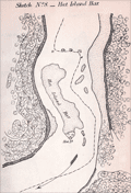 | Details | U.S. Coast and Geodetic Survey | 1865 |
| Antique Mississippi River Charts of Shoals and Sand Bars |
|
U.S. Coast and Geodetic Survey |
|
| 1865 |
| LOC:2001 |
| $500.00 | U-S--Coast-and-Geodetic-Survey | Antique-Mississippi-River-Charts-of-Shoals-and-Sand-Bars | Rare, separately published charts (23) of critical navigational areas on the Mississippi River and the Ohio River. A supplement of charts to accompany the <b>"Letter of the Secretary of the Navy communicating the report of the commission appointed under the joint resolution of Congress, approved June 30, 1864," </b> (Source: Online) <div class="indenttextblock"> "to select the most approved site for a navy yard or naval station on the Mississippi River or upon one of its tributaries and recommending a appropriation to cover the expenses of said commission." </div> The maps were not of proposed locations for the new Navy yard but of shoal or shallow areas of the Mississippi River. These shallow sand bars and narrow channels could impede the movement of vessels of vessels to the new yard:
<div class="indenttextblock">
"A series of topographical sketches of some of the difficult places of navigation on the Mississippi between Carondolet and Memphis and in the Ohio between Cairo and Cincinnati. They will have a value in furnishing means of comparison in future studies of the beds of these rivers."
</div>
<br>
Twenty-one charts (sketches) for the Mississippi River and two charts for the Ohio River including:
<div class="indenttextblocksingle">
<ul style="list-style-type: circle;">
<li>Sketch No. 1 Jefferson Barracks Bar</li>
<li>Sketch No. 3 Widow Beard's Island</li>
<li>Sketch No. 5 Penitentiary Shoal</li>
</ul>
</div>
The surveys were conducted by a Coast Survey party attached to the command of Admiral Lee, headed by F.H. Gerdes Chief of the Mississippi squadron topographical engineers.
<br></br>
The expenses of the commission included a whopping $870 to G.W. Blunt, $10 per diem from November 10, 1864 to February 4, 1865. From this expense we know that Blunt also was actively involved in the survey's that produced these maps. |
| 993 |  | Details | Anonymous | 1866 |
| Steamboat Bill of Lading for Valence Plantation |
|
Anonymous |
|
| 1866 |
| LOC:1 |
| $500.00 | Anonymous | Steamboat-Bill-of-Lading-for-Valence-Plantation | Rare post civil war shipping document, a "Bill of Lading", for the steamboat <b>Belle Ida</b> to transport items from New Orleans, Louisiana to Valence Plantation, along Bayou Lafourche, in Assumption Parish. <b>Valence Plantation</b> was most likely located near the current-day town of Supreme, just a few miles south of the well-known Madewood Plantation and Naploeonville, Louisiana. Dated within to February 9th, 1866. The bill of lading was filled in by hand at time of shipping and is addressed to J.B. Savage, Valence Plantation, Bayou Lafourche.
<br></br>
Bayou Lafourche has not been navigable from the Mississippi River since 1905 when a dam was built at Donaldsonville, La. but prior to that time the waterway served as an important commercial artery.
<br></br>
The Belle Ida was likely a stern-wheel steamboat built in 1861 (Wooldridge Steamboat List. <a href="https://www.umsl.edu/mercantile/collections/pott-library-special-collections/assets/pdf/collections/Woold_Ridge_Steamboat_list.pdf" target="_blank">Internet </a>). With a stock logo of a side-wheel steamboat by T. Fitzwilliam, Stationer and Printer, 76 Camp Street, N.O.
<br></br>
Symonds, Courtney and Co. were Tobacco Factors and General Forwarding and Commission Merchants located at No. 35 Natchez Street, New Orleans, LA. With a glued 2 cent stamp within. Addressed on verso.
<br></br>
The items shipped from New Orleans by Symonds Courtney and Co. included:
<ul style="list-style-type: none;">
<li>1 sack of harnesses</li>
<li>1 bundle of bridles</li>
<li>5 cases of sundries</li>
<li>10 head of mules</li>
<li>1 horse</li>
<ul/> |
| 1272 |  | Details | Anonymous | 1866 |
| Antique Birds Eye View of the Mississippi Basin |
|
Anonymous |
|
| 1866 |
| LOC:0 |
| $0.00 | Anonymous | Antique-Birds-Eye-View-of-the-Mississippi-Basin | SOLD
<br></br>
Unusual post-war antique wood engraving of a birds eye view of the <b>Mississippi basin</b> with numerous rivers, roads and cities identified by name. With this image the viewer looks at the landscape from a new perspective with South at the top of page. Attractive.
<br></br>
<div class="indenttextblock"> "Wood engraving is a printmaking and letterpress printing technique, in which an artist works an image or matrix of images into a block of wood. Functionally a variety of woodcut, it uses relief printing, where the artist applies ink to the face of the block and prints using relatively low pressure. By contrast, ordinary engraving, like etching, uses a metal plate for the matrix, and is printed by the intaglio method, where the ink fills the valleys, the removed areas. As a result, wood engravings deteriorate less quickly than copper-plate engravings, and have a distinctive white-on-black character." (Source: <a href="https://en.wikipedia.org/wiki/Wood_engraving" target="_blank">INTERNET</a> )
</div>
<BR/>
Coverage extends from St. Louis to the Gulf of Mexico and beyond with dozens of cities and town noted including Austin, Texas; Key West, Florida; New Orleans, Louisiana; Brownsville, Galveston, Montgomery, Jackson, Knoxville, Charleston, Savannah, Vicksburg, Natchez and many more.
<br></br>
Includes the Mississippi River, Missouri River, Ohio River, Arkansas River, Savannah River, Chattahoochee River, Escambia River, and the upper Gulf of Mexico. Published in 1866 by Harpers for the "Pictorial History of the Civil War" part 1. |
| 542 |  | Details | U.S. Coast and Geodetic Survey | 1866 |
| New York Bay and Harbor. Chart 20. |
|
U.S. Coast and Geodetic Survey |
|
| 1866 |
| LOC:0 |
| $0.00 | U-S--Coast-and-Geodetic-Survey | New-York-Bay-and-Harbor---Chart-20- | SOLD<br><br>Detailed, antique, original folding harbor chart on linen of Manhattan, New York Bay, and surrounding areas published immediately after the U.S. Civil War. Coverage includes Staten Island, the Hudson River, Newark Bay, and the Rockaway Peninsula. Produced under the direction of A.D. Bache, a great-grandson of Benjamin Franklin (Guthorn, 1984). The chart is based on triangulation of J. Ferguson and E. Blunt.
<br></br>
This chart is even more scarce and unusual because of its provenance and because it is a folding chart. The chart was dissected into 8 sections and mounted to linen at the time it was issued. Folded the chart measures 8" x 14". Separately issued by the U.S. Coast Survey in 1866 for use at sea, this chart is NOT the commonly found Coast Survey sketch/chart on thin paper.
<br><br/>
This chart has an interesting provenance as it carries the manuscript signature of Charles DW Brownell, Bristol, Rhode Island on the inside front cover. Charles deWolf Brownell (1822 - 1909) was born in Providence Rhode Island, educated in the law, and later settled on a career as an artist for health reasons. Brownell travelled widely to Cuba, the Caribbean and Europe. He is best known for his landscapes but produced several paintings of maritime subjects including "The Burning of the Gaspee". Brownell lived in New York City from 1860 - 1865. <br><br/>
With well-worn embossed black boards and manuscript notation on verso- "New York Harbor". |
| 3578 |  | Details | U.S. Coast and Geodetic Survey | 1867 |
| Point Sal, California |
|
U.S. Coast and Geodetic Survey |
|
| 1867 |
| LOC:63 |
| $375.00 | U-S--Coast-and-Geodetic-Survey | Point-Sal--California | Rare U.S. Coast Survey chart of Point Sal, California. For the collector of California cartography, a special chart of Point Sal which lies on California's Pacific Coast somewhat midway between Santa Barbara and San Luis Obispo. Original copper-plate engraved chart 14" x 17" on a huge sheet of crisp surveyor's paper in total 20" x 26". Assumed to be the first edition.
<br></br>
Not an electrotype copy. This engraving was printed from the original hand-engraved copper plate. Evidence of a wide platemark. Price 15 cents when issued.
<br></br>
This chart of Point Sal is unlike most Coast Survey charts we have handled. It is on quality oversize paper and has not been folded into a Coast Survey atlas (nor was it printed for that purpose). The chart does not carrry the caveat at upper right "Electrotype Copy No. X". Based on that as well as by the markings on other items purchased in the same sales lot we feel there is a high probability that the chart was a surplus proof and or reference file copy of the U.S.G.S. The date appears at bottom left along with the map number "660", both to facilitate searching a the files. Chart no. 660. |
| 3583 | 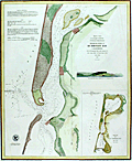 | Details | U.S. Coast and Geodetic Survey | 1867 |
| Humboldt Bay, California |
|
U.S. Coast and Geodetic Survey |
|
| 1867 |
| LOC:63 |
| $475.00 | U-S--Coast-and-Geodetic-Survey | Humboldt-Bay--California | Rare and extremely attractive U.S. Coast Survey separately-published chart of Humboldt Bay, California. For the collector of California cartography, a very special chart of Humboldt Bay which lies on the Pacific Coast of California just below the town of Eureka, CA. With a elevation profile view of Red Bluff Entrance to Humboldt Bay as it then appeared from 2 1/2 miles offshore and a small-scale chart of the entire Humboldt Bay environs. Second edition. Dated 1852 but probably printed around 1867. MS chart number in margin "632".
<br></br>
Towns shown include Humboldt, Eureka and Bucksport. Other features include the site of a proposed lighthouse and a beacon, Elk River, Indian Island, and Howard House in Humboldt.
<br></br>
This plate is not from the common 1867 Report of the Superintendent of the United States Coast Survey. The chart is an original copper-plate engraved chart 14" x 17" on a huge sheet of crisp surveyor's paper 20" x 26". Not an electrotype copy. This engraving was printed from the original hand-engraved copper plate. Evidence of a wide platemark. Price when issued 15 cents.
<br></br>
This chart of Humboldt Bay is unlike most Coast Survey charts we have handled. It is on crisp oversize paper and has not been folded into a Coast Survey atlas (nor was it printed for that purpose). The chart does not carry the caveat at upper right "Electrotype Copy No. X". Based on that as well as by the markings on this chart and other items purchased in the same sales lot we feel there is a high probability that the chart was a surplus proof and or reference file copy of the U.S.G.S. |
| 3667 | 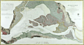 | Details | U.S. Coast and Geodetic Survey | 1867 |
| Fine antique chart of Suisun Bay, California |
|
U.S. Coast and Geodetic Survey |
|
| 1867 |
| LOC:63 |
| $800.00 | U-S--Coast-and-Geodetic-Survey | Fine-antique-chart-of-Suisun-Bay--California | Very attractive scarce antique engraved chart of Suisun Bay, California northwest of San Francisco Bay. Key features include Grizzly Island, Van Sickle's Island, Chipp's Island, Sherman Island, the Carquines Straits, and the towns of Antioch, Benicia and Martinez.
<br></br>
Rare U.S. Coast Survey separately published chart of Suisun Bay, California. For the collector of California cartography, a very special chart of Suisun Bay which lies at the confluence of the Sacramento and San Joaquin Rivers, forming the entrance to the Sacramento–San Joaquin River Delta. Dated within to 1867. With fine detail of interior topography. Assumed to be the first edition.
<br></br>
The map covers from Benicia and the Karquines Strait in the west as far as Sherman Island in the east and from Grizzly Island south to the San Joaquin River. Includes countless depth soundings in feet, detailed notes on tides. Several towns and cities are identified, including Martinez, Benicia, and Collinsville.
<br></br>
This plate is not from the common 1867 Report of the Superintendent of the United States Coast Survey. The chart is an original copper-plate engraved chart 32" x 17" on a huge sheet of crisp surveyor's paper 30" x 40". Not an electrotype copy. This engraving was printed from the original hand-engraved copper plate. Evidence of a wide platemark. Price 75 cents when issued.
<br></br>
This chart of Suisun Bay is unlike most Coast Survey charts we have handled. It is on crisp oversize paper and has not been folded into a Coast Survey atlas (nor was it printed for that purpose). The chart does not carry the caveat at upper right "Electrotype Copy No. X". Based on that as well as by the markings on this chart and other items purchased in the same sales lot we feel there is a high probability that the chart was a surplus proof and or reference file copy of the U.S.G.S. |
| 840 | 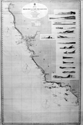 | Details | British Admiralty Hydrographical Office | 1868 |
| Antique Admiralty Nautical Chart of San Diego Bay to Cape Mendocino California |
|
British Admiralty Hydrographical Office |
|
| 1868 |
| LOC:63 |
| $3,000.00 | British-Admiralty-Hydrographical-Office | Antique-Admiralty-Nautical-Chart-of-San-Diego-Bay-to-Cape-Mendocino-California | Large antique British Admiralty sea chart of the California coast extending from Humboldt Bay and Cape Mendocino in the North, trending southeast past San Francisco Bay and Monterey Bay to San Diego, California. Lighthouses are picked out with red dots highlighted in yellow.
<br></br>
Contains fifteen coastal elevation views with some of the most stunning coastal scenery in the world including the Big Sur area. These carefully engraved coastal elevations include: Cape Mendocino, Point Arena, Pt. Reyes, Entrance to San Francisco Bay, Point Piedras, Point Ano Nuevo, South Farallon Lighthouse, Point Sur, Moro Rock, Point Arguilla, Pt. Conception, Point Loma, Catalina Harbor, and the Point of Boundary between the United States and Mexico.
<br></br>
First published by the Admiralty from London in April 1858 under the superintendence of Royal Navy Hydrographer Captain Washington. This edition of the scarce nautical chart was printed with corrections to July 1868.
<br></br>
Sold by J.D. Potter Agent for The Admiralty, 31 Poultry and 11 King Street Tower Hill. |
| 1027 |  | Details | Woolsey, W.B. | 1869 |
| Lithograph of the Union Naval Gunboat Nipsic |
|
Woolsey, W.B. |
|
| 1869 |
| LOC:0 |
| $0.00 | Woolsey--W-B- | Lithograph-of-the-Union-Naval-Gunboat-Nipsic | SOLD<br></br>
Color lithograph of the 836-ton U.S. Navy screw gunboat Nipsic, launched June 1863 at Portsmouth Naval Yard in Kittery, Maine. In late 1863 and early 1864 Nipsic engaged in operations against Murrell's Inlet and Georgetown, South Carolina. In June 1864, she captured a sailing blockade runner.
</br></br>
From Charles Boynton's "The History of the Navy during the Rebellion". Printed by Major and Knapp Engraving, Manufacturing, and Lithograph Company, 71 Broadway, New York. |
| 1028 |  | Details | Woolsey, W.B. | 1869 |
| Lithograph of the U.S. Naval Frigate Wabash |
|
Woolsey, W.B. |
|
| 1869 |
| LOC:0 |
| $0.00 | Woolsey--W-B- | Lithograph-of-the--U-S--Naval-Frigate-Wabash | SOLD<br></br>
Attractive color lithograph of the 4808-ton U.S. Navy steam screw frigate Wabash. The Wabash was launched from Philadelphia Navy Yard in October 1855. During 1861 Wabash blockaded the Confederacy's Atlantic Coast and engaged in the capture of Hatteras Inlet, North Carolina, and Port Royal, South Carolina. The Wabash was flagship of the South Atlantic Blockading Squadron, an active force in the Blockade of Charleston, S.C., in 1862-64. She paricipated in the December 1864 and January 1865 assaults on Fort Fisher, North Carolina.
</br></br>
From Charles Boynton's "The History of the Navy during the Rebellion". Printed by Major and Knapp Engraving, Manufacturing, and Lithograph Company, 71 Broadway, New York. |
| 834 | 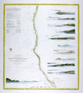 | Details | U.S. Coast and Geodetic Survey | 1869 |
| Western Coast of U.S. from San Francisco to Umpquah (Umpqua) River |
|
U.S. Coast and Geodetic Survey |
|
| 1869 |
| LOC:63 |
| $675.00 | U-S--Coast-and-Geodetic-Survey | Western-Coast-of-U-S--from-San-Francisco-to-Umpquah-(Umpqua)-River | Very attractive antique nautical chart of the <b>western coast of California</b> focused on the Pacific coastline between <b>San Francisco, California</b> and the Umpqua River, Oregon. This scarce, rolled, separately issued chart, corrected to 1869, was first published in 1854 by the U.S. Coast Survey. Noted habitations and geographical features include Empire City, Koos Bay, and Port Orford or Ewing Harbor, Oregon; Crescent City, Reddings Rock, Eureka, Mendocino City, Haven's Anchorage, Bodega Bay, Pt. Reyes, Alcatraz Island, Oakland, Alameda, Union City and San Francisco Bay, California. Numerous soundings, navigational hazards, and aids to navigation are identified.
<br></br>
This antique sea chart is enlivened with twelve attractive hand-colored <b>inset coastal elevation views</b> including: the Entrance to San Francisco Bay, Point Arena, Mendocino City Cove, Trinidad Head and City, Cape Mendocino, Red Bluff Entrance to Humboldt Bay, Point St. George, Mack's Arch and Reef, Rogues River, Cape Blanco, and Cape Gregory.
<br></br>
This is a scarce, separately issued, rolled nautical chart of the U.S. West Coast, not the more common folded version on thin paper that was issued with other charts in an annual report to Congress from the Coast Survey.
<br></br>
This chart was printed in 1869 from an electrotype-printed copy of the original hand-engraved copper plate. Electrotype printing is a process the U.S. Coast Survey adopted around 1850. As a soft medium, copper plates could only withstand print runs of perhaps 200 copies before the plates wore down. To enable larger print runs, a mold of the original plate was created in wax or another soft medium. Then, using an electro-chemical process ( electrotyping ), the mold was coated with a metal layer, typically copper. Printers were then able to produce output from the new electrotype copper copy, while preserving the original. Electrotype copy no. 6 by Mathiot. |
| 6693 | 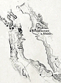 | Details | U.S. Coast and Geodetic Survey | 1869 |
| Western Coast of U.S. San Francisco to Umpquah Umpqua River |
|
U.S. Coast and Geodetic Survey |
|
| 1869 |
| LOC:68 |
| $350.00 | U-S--Coast-and-Geodetic-Survey | Western-Coast-of-U-S--San-Francisco-to-Umpquah-Umpqua-River | This is an finely detailed antique coastal nautical chart of the <b>western coast of California</b>, which focuses on the Pacific coastline between <b>San Francisco, California</b> and the Umpqua River, Oregon. It is a scarce, rolled, separately issued chart, corrected to 1869, and was first published by the U.S. Coast Survey in 1854. Notable habitations and geographical features on the chart include Empire City, Koos Bay, and Port Orford or Ewing Harbor, Oregon, as well as Crescent City, Reddings Rock, Eureka, Mendocino City, Haven's Anchorage, Bodega Bay, Pt. Reyes, Alcatraz Island, Oakland, Alameda, Union City, and San Francisco Bay, California. The chart identifies numerous soundings, navigational hazards, and aids to navigation.
<br></br>
This antique sea chart features twelve detailed <b>inset coastal elevation views</b>, including the Entrance to San Francisco Bay, Point Arena, Mendocino City Cove, Trinidad Head and City, Cape Mendocino, Red Bluff Entrance to Humboldt Bay, Point St. George, Mack's Arch and Reef, Rogues River, Cape Blanco, Cape Gregory, and Point Reyes. It is a scarce, separately issued, rolled nautical chart of the U.S. West Coast, not the more common folded version on thin paper that was issued with other charts in an annual report to Congress from the Coast Survey.
<br></br>
The chart was printed in 1869 from an electrotype-printed copy of the original hand-engraved copper plate. The U.S. Coast Survey adopted electrotype printing around 1850 because copper plates, being a soft medium, could only withstand print runs of about 200 copies before the plates wore down. To allow for larger print runs, a mold of the original plate was created in wax or another soft medium. Then, using an electro-chemical process (electrotyping), the mold was coated with a metal layer, usually copper. Printers were then able to produce output from the new electrotype copper copy while preserving the original. Electrotype copy no. 6 was done by Mathiot. |
| 3597 |  | Details | Multiple Authors | 1870 |
| Lot 1. MULTIPLE 19th C. survey lot and street plans CAMBRIDGE, Massachusetts |
|
Multiple Authors |
|
| 1870 |
| LOC:0 |
| $14,650.00 | Multiple-Authors | Lot-1---MULTIPLE-19th-C--survey-lot-and-street-plans-CAMBRIDGE--Massachusetts | A lot consisting of twenty-five lot and street plans from Cambridge, Massachusetts and nearby areas. An opportunity for a serious collector to expand his collection with items he cannot find elsewhere. <a href="https://www.rarecharts.com/Content/Lot_1_Cambridge_Survey_Artifacts_Locked.pdf" target="_blank">See full detailed lot description.</a>
<br></br>
These plans represent surveys performed in the 1840’s through the 1900’s by local Cambridge area surveyors and engineers William A. Mason, Joseph Whitney, J.G. Chase, E.F. Bowker, W.S. Barbour, and Alex Wadsworth. Artifacts include manuscript surveys, manuscript survey traces, and rare 19th century cyanotype (blueprints). Many of the items in this lot are unrecorded and for the others the few known holdings are in institutions. Condition and size vary by item.
<br></br>
The lot highlight is:
SC_Cam_1. Osgood Carleton [after]. PLAN OF THE CAUSEWAY OVER THE MARSH IN CAMBRIDGE EXHIBITING THE NAMES OF THE OWNERS AND THE QUANTITY OF LAND THROUGH WHICH IT PASSES INCLUDING MR JARVIS’S UPLAND SURVEYED AND PLATTED (by a scale of one chain to an inch) NOV 12TH 1792 BY OSGOOD CARLETON. COPIED FROM THE ORIGINAL BY W.A. MASON & CO. DEC. 20, 1855. MS ink surveyor’s collation number “1637”.
Unrecorded antebellum manuscript cadastral plan of great historical value after an earlier plan in 1793 by well-known Boston surveyor Osgood Carleton. This is the best and only available detailed plan of the West Boston Bridge causeway from the Charles River to Pelham island. This is Mason’s true signed MS surveyor’s copy from a survey made by Osgood Carleton contemporaneously with the Causeway construction. Numerous and detailed pencil notations of ownership record based on Carleton's original survey. Measurements recorded in chains and links.
<br></br>
A very rare plan of the old Causeway stretching 3344 feet over wet marshland largely owned by Leonard Jarvis. |
| 4833 |  | Details | Erie Railway Company | 1870 |
| Rare manuscript Erie Railway trace map Jersey City |
|
Erie Railway Company |
|
| 1870 |
| LOC:53 |
| $500.00 | Erie-Railway-Company | Rare-manuscript-Erie-Railway-trace-map-Jersey-City | One-of-a-kind post civil-war inked manuscript map of the Erie Railway Company and Long Dock Co. property [1] in Jersey City, New Jersey from 1870. On surveyor's tracing cloth, this artifact was likely used as the master copy for producing other cyanotype (blueprint) maps [2].
<br></br>
The map extends from the Hackensack River to the Hudson River south of 11th Street, including land now occupied by the Holland Tunnel approaches. To the south, the map ends roughly at Newark Avenue.
<br></br>
Shows the Long Dock Company Tunnel (Bergen Tunnel) built in 1861. The new tunnel was used by the Erie Railway to reach the Pavonia Depot on the Hudson River. Copious explanation of the lands, railroads, docks and piers; and improvements. Scale 400 feet to one inch. Title states "Made in compliance of an Act of the Legislature of the State of New Jersey. Approved March 17, 1870.
<br></br>
Made during a period of great change and great fortunes made by railroad speculators such as Jay Gould who attempted to take control of the Erie Railway in 1873. In fact it was just one year before this map was made that Gould and partner James Fisk caused financial devastation with a scheme to control the gold market.
<br></br>
[1] The property of the Long Dock Company was operated by Erie Railway Company and its receivers Jan. 1, 1861 to May 31, 1878. The Long Dock Company was incorporated by special act of the State of New Jersey in 1856,for the purpose of constructing a railroad within the limits of Hoboken and Jersey City, N. J. with docks, piers, and bulkheads and establish a ferry at or near Pavonia Avenue, Jersey City, N. J.<br/>
[2]A blueprint was created by overlaying the traced map (as we have here) onto a piece of paper treated with a photo-sensitive compound. After exposure to sunlight the paper was washed and dried with the end product a blue negative copy of the trace. |
| 7940 |  | Details | Boell, William | 1870 |
| Lithographic broadside advertising the services of W. Boell, Philadelphia |
|
Boell, William |
|
| 1870 |
| LOC:41 |
| $0.00 | Boell--William | Lithographic-broadside-advertising-the-services-of-W--Boell--Philadelphia | SOLD<br><br>This ornate 19th-century lithographic broadside ca. 1870 advertises the services of W. Boell, a "practical lithographer" based at 311 Walnut Street in Philadelphia. Surrounded by elaborate scrollwork and allegorical figures symbolizing industry and liberty, the document showcases Boell’s expertise in producing detailed lithographic drawings, including machinery, factories, certificates, architectural plans, and decorative commercial printing such as diplomas, billheads, and cards. The imagery and typography emphasize precision, artistic skill, and industrial pride, reflecting both the aesthetics and business ambitions of America’s printing trades during the post-Civil War era.
<br><br> |
| 5093 |  | Details | Meyer, Ernest L. | 1871 |
| Unrecorded map of Elizabeth, New Jersey 19th Century |
|
Meyer, Ernest L. |
|
| 1871 |
| LOC:1409 |
| $4,650.00 | Meyer--Ernest-L- | Unrecorded-map-of-Elizabeth--New-Jersey-19th-Century | Unrecorded map of Elizabeth, New Jersey by Ernest L. Meyer and W.F. Wonneberg from 1871. Single sheet, apparently the bottom half of a two-sheet map. Published two years before an earthquake, in September 1873, caused a panic that led to a recession. Ernest L. Meyer C.E. was City Surveyor for Elizabeth, N.J.
<br></br>
Not in LOC, WorldCat, or AMPR. Not found online, nor mentioned anywhere.
<br></br>
Engraved by J. Schedler. No. 60 Fulton Street, N.Y. Entered according to Act of Congress in the year 1871 by Ernest L. Meyer and W.F. Wonneberg in the Office of the Librarian of Congress at Washington D.C.
<br></br>
Meyer also published a "Map of Elizabethtown, N.J. at the time of the Revolutionary War"; a smaller "Map of the City of Elizabeth, N.J.", 1856; and with P. Witzel in 1862, the "Topographical Map of Union County, New Jersey".
<br></br>
Includes two ink stamps: John G. Saurwein, Attorney at Law, Elizabeth, N.J.; and James Vosseller. |
| 1283 |  | Details | Robiquet, Aime | 1871 |
| Carte de la Cote des Etats-Unis Comprise Entre la Nouvelle-Ecosse et la Floride |
|
Robiquet, Aime |
|
| 1871 |
| LOC:0 |
| $1,350.00 | Robiquet--Aime | Carte-de-la-Cote-des-Etats-Unis-Comprise-Entre-la-Nouvelle-Ecosse-et-la-Floride | Fine chart of the east coast of North America. A scarce privately-published chart by Robiquet from Paris in 1871. Chart coverage includes Prince Edward Island and the Bay of Fundy, coastal Nova Scotia, Maine, New Hampshire, Massachusetts, Connecticut, Rhode Island, New Jersey, New York, Delaware, Virginia, North Carolina, Bermuda, South Carolina, Georgia and Florida. Numerous depth soundings and lighthouses higlighted in yellow.
<br></br>
At the bottom a paste-on stamp from the seller, the very cool "Librairie des Navigateurs" in Bordeaux, France. Four detailed inset charts include:
<div class="indenttextblock">
<ul style="list-style-type: circle;">
<li>Baie de New York</li>
<li>Charleston, S.C.</li>
<li>Carte de la Baie Delaware</li>
<li>The Florida Peninsula or "Complement de la Partie Meridionale des Etats-Unis"</li>
</ul>
</div>
This large nautical chart was published privately by hydrographer Aime Robiquet in 1871. Rue Pavée Saint-André des Artes No. 2, Paris, France. Printed by Louis Antoine. Number 44 |
| 581 |  | Details | British Admiralty Hydrographical Office | 1871 |
| Albemarle Sound to Cape Fear |
|
British Admiralty Hydrographical Office |
|
| 1871 |
| LOC:0 |
| $720.00 | British-Admiralty-Hydrographical-Office | Albemarle-Sound-to-Cape-Fear | Antique, rolled, British Admiralty sea chart of the coast of North Carolina ( NC ). This lithographed chart, although issued by the Admiralty Hydrographic Office in London, is based on work by the U.S. Coast Survey ca. 1847 and is dated to the edition of 1871. Numerous soundings, aids to navigation, inlets, rivers, and hazards are noted.
<br></br>
Coverage extends from Currick Sound / Elizabeth City, N.C. south to Little River Inlet at the border with South Carolina. A sampling of the many noted points of interest include: Cape Fear, Cape Lookout, Cape Hatteras, Albemarle Sound, Pamplico Sound, Core Sound, Holden Beach, Neuse River, Ocracoke Inlet and Ocracoke Island, Beaufort, Wilmington, Elizabeth City, and at the very bottom, Frying Pan Shoals.
<br></br>
This antique sea chart was first published at the Admiralty in London on November 30, 1861 under the superintendence of Captain Washington, R.N.: F.R.S. Hydrographer. Sold by J.D. Potter, agent for the Admiralty Charts. 31 Poultry and 11 King Street Tower Hill (London). Number 2826. Price when issued was half a crown. |
| 1041 |  | Details | British Admiralty Hydrographical Office | 1871 |
| 1871 Chart of the Outer Banks, Albemarle Sound to Cape Fear |
|
British Admiralty Hydrographical Office |
|
| 1871 |
| LOC:53 |
| $1,600.00 | British-Admiralty-Hydrographical-Office | 1871-Chart-of-the-Outer-Banks--Albemarle-Sound-to-Cape-Fear | Antique, British Admiralty sea chart of the North Carolina Outer Banks in outstanding condition. Although issued by the Admiralty Hydrographic Office in London, this chart is based on work by the U.S. Coast Survey ca. 1847 and is dated with corrections to May, 1871. Numerous soundings, aids to navigation, inlets, rivers, and hazards are noted, particularly in Onslow Bay, Raleigh Bay, and the coastal inlets.
<br></br>
Coverage extends from Currick Sound / Elizabeth City, N.C. south to Little River Inlet at the border with South Carolina. A sampling of the many noted points of interest include: Cape Fear, Cape Lookout, Cape Hatteras, Albemarle Sound, Pamplico Sound, Core Sound, Holden Beach, Neuse River, Ocracoke Inlet and Ocracoke Island, Beaufort, Wilmington, Elizabeth City, and at the very bottom, Frying Pan Shoals.
<br></br>
This antique sea chart was first published at the Admiralty in London on November 30, 1861 under the superintendence of Captain Washington, R.N.: F.R.S. Hydrographer. Sold by J.D. Potter, agent for the Admiralty Charts. 31 Poultry and 11 King Street Tower Hill (London). Number 267. |
| 3605 |  | Details | Eldridge, George | 1872 |
| Early Eldridge Harbor Chart of Salem, Beverly, Marblehead, Manchester, Gloucester, Rockport |
|
Eldridge, George |
|
| 1872 |
| LOC:53 |
| $650.00 | Eldridge--George | Early-Eldridge-Harbor-Chart-of-Salem--Beverly--Marblehead--Manchester--Gloucester--Rockport | Scarce and early Eldridge coastal chart of Massachusetts from LYNN to HALIBUT POINT. Shows George Eldridge's (the founder) bold and distinctive style that mariners came to appreciate for its utility.
<br></br>
Includes the towns of Lynn, Swampscott, Salem, Beverly, Marblehead, Manchester, Gloucester, Cape Ann, Rockport, and Annisquam. Includes extensive sailing directions.
<br></br>
Dated within to 1872. Published by S. Thaxter & Son, 125 State Street, Boston.
<br></br>
George Eldridge (1821-1900) was a fisherman, coastal pilot, and cartographer who published charts and coast pilots, some with his son George W., from the mid 1800's until his death . The Eldridges published their own charts in competition with the U.S. Coast Survey. |
| 226 |  | Details | Helffricht, William | 1872 |
| Helffricht Trade Card - Philadelphia |
|
Helffricht, William |
|
| 1872 |
| LOC:14 |
| $25.00 | Helffricht--William | Helffricht-Trade-Card---Philadelphia | Scarce, small 19th-century antique nautical trade card or stamp for <b>William Helffricht's</b> NAUTICAL STORE, in Philadelphia, Pennsylvania. Helffricht sold charts, nautical books, and nautical instruments from their Front Street location.
<br></br>
From the "American Ephemeris and Nautical Almanac" for the year 1873. An item for collectors interested in maritime, nautical, or cartographic Victorian-era trade cards. |
| 944 |  | Details | British Admiralty Hydrographical Office | 1872 |
| Antique British sea chart of Mobile Bay and Dauphin Island |
|
British Admiralty Hydrographical Office |
|
| 1872 |
| LOC:53 |
| $1,350.00 | British-Admiralty-Hydrographical-Office | Antique-British-sea-chart-of-Mobile-Bay-and-Dauphin-Island | Attractive, scarce antique British nautical chart of Mobile Bay, Alabama and Dauphin ("Dauphine") Island. With Isle aux Herbes and Bayou la Batre. On <b>Dauphin Island</b> the noted features include Fort Gaines, Heron Bayou, Second Bayou, Gravline Bay, Bayou Aloe, Chitgae Point, Drury Pass, Little (and Big) Margaret Pass, and Bayou Matagua. Opposite Dauphin Island, Bonsecours Bay, Mobile Point, Pilot Town and Fort Morgan are noted with a separate quarters building and three large umbrella pines, e.g. "West Umbrella tree" that are referenced as range markers in the sailing directions of Blunt's contemporary "American Coast Pilot" (Blunt, Edmund M. 21st ed. 1867. pp. 399-400.)
<br></br>
This is a large rolled nautical chart on heavy paper. Not the folded preliminary survey on weak paper that is often found in Reports to Congress.
<br></br>
North end of Mobile Bay includes a street plan of Mobile, Alabama with nearby features including Pole Cat Bay, Chicasaw Bayou, Chacaloochee Bay, Apalachee River, and Minetta Bay. Good detail of the east bay including Weeks Bay, Blakely River, Point Clear, <b>D'Olives Bay, D'Olives Creek</b>, (<i>near present-day Daphne, Al.</i> ), Alabama City, and Newport.
<br></br>
Inset sailing directions carry this warning:
<div class="indenttextblock"> "Caution: Sand and Pelican Is. are increasing in length and Pelican Channel is getting narrower every year… Pelican Bay is available only for vessels drawing less than 12 feet water. The entrance from outside should not be attempted without a pilot, nor can the state on the main channel be considered as permanent."</div>
</br>
Scale 1/80,000. Number 2344.
<br></br>
Publisher's attribution reads :<div class="indenttextblock"> "London, Published at the Admiralty 12th March 1862 under the Superintendence of Captn. Washington R.N.F.R.S. Hydrographer. Corrections Feb 72. Sold by J.D. Potter Agent for the Admiralty Charts 31 Poultry and 11 King Street Tower Hill."</div> |
| 4866 |  | Details | Rose, Edwin | 1872 |
| Manuscript cadastral map of Snow Shipyard Portland, Maine. |
|
Rose, Edwin |
|
| 1872 |
| LOC:0 |
| $1,675.00 | Rose--Edwin | Manuscript-cadastral-map-of-Snow-Shipyard-Portland--Maine- | Large manuscript map by Edwin Rose of the Snow Farwell and Company property in Rockland, Maine dated within to July 5th, 1872. A rare and informative map of the waterfront at south Rockland, Maine with a detailed record of shoreline and structures as they existed 150 years ago.
<br></br>
A few of the key features Rose noted include Mechanic Street, two marine railways and a marine railway wharf, apparently part of Snow Farwell & Co. The two octagonal building above the railways are almost certainly sheds for horse-powered winches. At bottom left a wharf surrounds
<br></br>
Snow Shipbuilding was founded in 1862 by Captain Israel Snow. It was located at the end of Mechanic Street, adjacent to the Cobb, Butler yard. The Snow family sold it to General Seafoods after WWII. The western half is now the Sail, Power and Steam Museum, while the eastern half is still active as Rockland Marine.
<br></br>
Location fronts on Owl's Head Bay; West Penobscot Bay. Surveyed by Edwin Rose Esq. Drawn by L.L. Buckland. Scale 50 feet to 1 inch. |
| 3627 |  | Details | U.S. Coast and Geodetic Survey | 1873 |
| Antique Chart of Trinidad Harbor, California Humboldt County |
|
U.S. Coast and Geodetic Survey |
|
| 1873 |
| LOC:10 |
| $200.00 | U-S--Coast-and-Geodetic-Survey | Antique-Chart-of-Trinidad-Harbor--California-Humboldt-County | Rare harbor chart of Trinidad Harbor, in Humboldt County, California. With an attractive coastal elevation view of Trinidad Head, Prisoner's Rock and the entrance to the harbor as seen from offshore. Contains sailing directions, tide tables, notes and more. We are unable to find this item online or on AMPR!
<br></br>
Manuscript notations and ink stamp by the U.S. Geological Survey are unusual and point to the authenticity and age of this chart. |
| 5402 |  | Details | Wadsworth, George | 1873 |
| Unrecorded First Map of the Town Of Everett Massachusetts |
|
Wadsworth, George |
|
| 1873 |
| LOC:53 |
| $4,500.00 | Wadsworth--George | Unrecorded-First-Map-of-the-Town-Of-Everett-Massachusetts | Unrecorded original lithographed map of Everett, in Middlesex County, Massachusetts published in October 1873, three years after the town of Everett separated from the city of Malden, Mass. on March 9, 1870. Originally part of Charlestown and later Malden, this is <strong>the first printed map solely of the town of Everett (1873)</strong> after the separation.
<br></br>
The cost of potable water was one of the key factors motivating the separation of Everett (South Malden) from Malden. In 1870 Everett was an agricultural community with a population of 2,152 inhabitants. The needs of what was then South Malden diverged from the northern part of Malden, particularly with respect to the need for a water source. Despite a near unanimous vote of South Malden, which could draw water from the Mystic River, Malden voted to source water from Spot Pond. Everett's charter in 1870 contained a clause that exempted the new town from the onerous debt Malden incurred in sourcing their water supply.
<br></br>
No holdings of this rare map are recorded anywhere online including the LOC and Leventhal Library.
<br></br>
Created by and based on the surveys of George Wadsworth, civil engineer and surveyor in Everett, and others.
Published and lithographed by J. Mayer and Co. 4 State Street, Boston. |
| 398 |  | Details | Freeman, Josiah | 1873 |
| Bark Ashore at Surfside |
|
Freeman, Josiah |
|
| 1873 |
| LOC:14 |
| $220.00 | Freeman--Josiah | Bark-Ashore-at-Surfside | Stereoview photo by Nantucket photographer Joseph Freeman of the sailing bark Minmaneuth aground near Miacomet Pond on Nantucket's south shore. The vessel was enroute from Rio de Janiero to Boston with 4000 bags of coffee when she came ashore. The Minmaneuth was lightened of its load and refloated. The grounding had a positive result in that it prompted construction of a lifesaving station at Surfside beach. The stereoview shows passengers, shaded by parasols, sitting atop bags of coffee as they wait for the rest of the cargo to be unloaded. <BR> </BR>
The Nantucket Historical Association describes Freeman as the first of three great 19th century Nantucket photographers including Henry Wyer and Harry Platt. Josiah Freeman first opened a shop with David Coffin on the island in 1864 and remained in business until retirement in 1892. ( Historic Nantucket, Vol 35, no. 2 (Oct. 1987), p. 12-14) |
| 896 |  | Details | Depot de la Marine | 1873 |
| Antique French Chart of the Straits of Florida and Bahamas |
|
Depot de la Marine |
|
| 1873 |
| LOC:1111 |
| $900.00 | Depot-de-la-Marine | Antique-French-Chart-of-the-Straits-of-Florida-and-Bahamas | Attractive antique French navigation chart covers the <b>Strait of Florida</b>, Grand Bahama Bank, Little Bahama Bank, and much of Cuba. Originally released in 1865 this edition was printed with updates in 1873 by France's Depot de la Marine. Includes the Florida Keys, the Tortugas, Great Abaco Island, Grand Bahama Island, Andros Island, and the Bahamian island chain as far south as Great Inagua Island. Named habitations include Tampa, Florida, and Havana, Cuba.
<br></br>
Perhaps the most significant feature of the map is the lack of settlements along Florida's east coast. Hydrographic features on the lower east coast include the Indian River, Jupiter Inlet, Biscayne Bay, and Hillsboro Inlet ("Entre de Hillsboro") but the sole settlement is <b>Fort Dallas</b>, established on Key Biscayne by the U.S. Navy in 1836 to prevent trade between the indigenous Seminole Indians and traders from Cuba and the West Indies.
<br></br> Chart is a lithograph, based on U.S. and Spanish precursor charts, produced in 1873 by France's Depot de Cartes et Plans de la Marine, their official hydrographic agency. |
| 4925 |  | Details | U.S. Geological Survey | 1873 |
| Pair of mining maps for Slate Creek Basin, California |
|
U.S. Geological Survey |
|
| 1873 |
| LOC:13 |
| $270.00 | U-S--Geological-Survey | Pair-of-mining-maps-for-Slate-Creek-Basin--California | Two rare original antique mining maps of the northern and southern part of Slate Creek Basin in Sierra County California. Both maps show placer mine (stream-bed mining) locations with company names, Chinese mining camps, tunnel locations, hydraulic mines, dwelling houses, waterways and proposed tunnels.
<br /><br />
Shows many ditches and labeled wagon roads including the "wagon road from La Port to Queen City."
<br /><br />
Mining companies include Yankee Hill Placer Mines, Maria Hartman Company, Alturas Gold Mining Company, Indian Queen Company, and Poverty Point Placer Mines. |
| 5303 |  | Details | Colvin, Verplanck | 1873 |
| First map Hudson River headwater Lake Tear of The Clouds |
|
Colvin, Verplanck |
|
| 1873 |
| LOC:53 |
| $350.00 | Colvin--Verplanck | First-map-Hudson-River-headwater-Lake-Tear-of-The-Clouds | This gem is the first published map of the ultimate headwater for the Hudson River- <b>Lake Tear of the Clouds</b> (near Keene, NY) by Verplanck Colvin. A fine topographic map with 100 foot contour intervals from Colvin's 1873 Adirondacks Survey Report. Plate 6. Lithographed by Weed, Parsons and Company, Albany, N. Y. Scarce.
<br></br>
One thousand feet below the summit of Mt. Marcy on the southwest slope, Lake Tear of the Clouds is the highest pond in the state of New York. Verplanck Colvin and William Nye were the first white men to discover Lake Tear of the Clouds and to take the time to explore and document its flow to the south to the Hudson River.
<br></br>
Verplanck Colvin (1847–1920) was a lawyer and topographical engineer whose understanding and appreciation for the environment of the Adirondack Mountains was born exploring the Adirondack wilderness as a teenager. Colvin saw first hand how over-logging of the Adirondack wilderness reduced the water supply for downstream rivers, streams, and canals. He realized that the effects of this ecological mismanagement threatened the water supply of the Erie Canal, important to the economy of New York State.
<br></br>
Colvin's observations and relentless enthusiasm led the legislature to name him Superintendent of the New York state land survey and later to the establishment of Adirondack Forest Preserve in 1885.
Contour interval 100 feet. |
| 2527 |  | Details | Whitman and Breck | 1874 |
| Plan of land in Orient Heights - Beachmont in Revere, Mass. |
|
Whitman and Breck |
|
| 1874 |
| LOC:53 |
| $2,400.00 | Whitman-and-Breck | Plan-of-land-in-Orient-Heights---Beachmont-in-Revere---Mass- | Unrecorded heliotype plan or plat of land for sale in 1874 by the Boston Land Company in Orient Heights, Revere, Massachusetts- today's Beachmont neighborhood. Orient Heights is Boston's northernmost and northeastern most neighborhood.
<br></br>
This early antique lot plan of Beachmont, is an unrecorded plan found nowhere else online. Bordered at the east by the Atlantic Ocean, the platted land lies with an area bounded by Endicott Avenue and Winthrop Avenue. Includes Bradstreet Avenue, Dudley Street, Sales Street, Cross Street, Crest Avenue, Bellingham Avenue and Leverett Avenue.
<br></br>
Other notable features include a proposed Boston Revere Beach and Lynn Railroad track and depot; the Orient Café surrounded by a small park; Sales Creek and a sand ridge. For each lot square footage and lot number are shown.
<br></br>
In upper right an inset small-scale map of other holdings of the Boston Land Company in Revere, Mass. with major roads, waterways and rail lines.
<br></br>
Surveyed by Whitman and Breck, 16 Water Street, Boston. Heliotype printed. A heliotype is a print produced by a “photomechanically produced plate for pictures or type made by exposing a gelatin film under a negative, hardening it with chrome alum, and printing directly from it.” (Source: https://www.thefreedictionary.com/heliotype) |
| 663 |  | Details | U.S. Coast and Geodetic Survey | 1874 |
| The Harbor of Annapolis |
|
U.S. Coast and Geodetic Survey |
|
| 1874 |
| LOC:53 |
| $0.00 | U-S--Coast-and-Geodetic-Survey | The-Harbor-of-Annapolis | SOLD
<br></br>Fine original electrotype copperplate engraved nautical chart of Annapolis, Maryland and vicinity first published in 1846. On strong, thick paper with no folds. Coverage extends from Forked Creek and the Narrows at the North past Annapolis and terminates near Oyster Creek and the modern community of "Arundel on the Bay". Numerous soundings, lighthouses, buoys, and navigational hazards are noted. Electrotype copy no. 3 by G. Mathiot U.S.C.S.
<br></br>
Key named features include the Severn River, Kent Island, Greensberry's Neck, Annapolis, Fort Nonsense, Fort Madison, Mount Misery, Sullivan's Cove, Round Bay, Mt. Pleasant, St. Helena Island, Weem's Creek, Graveyard Creek, St. John's College, Spa Creek, Windmill Point, Horn Point, Cat Hole Creek, Black Walnut Creek, Thomas' Point, Price's Point, Whitehall Poplars, Whitehall Creek, Goose Pond, Sandy Point.
<br></br>
With sailing directions, tidal notes, and four attractive inset coastal profile panoramic views of the approaches to Annapolis featuring the state house as the primary point of reference.
<br></br>
This chart was printed in 1874 from an electrotype copy of the original hand-engraved copper plate, a process the U.S. Coast Survey adopted around 1850. As a soft medium, copper plates could only withstand print runs of perhaps 200 copies before the plates wore down. To enable larger print runs, a mold of the original plate was created in wax or another soft medium. Then, using an electro-chemical process ( electrotyping ), the mold was coated with a metal layer, typically copper. Printers were then able to produce output from the new electrotype copper copy, while preserving the original.
<br><br/>
This antique chart should not be confused with those similar copies issued as part of an annual Report to Congress, most on thin paper with folds that often show condition issues. With the circular stamp of the U.S. Coast Survey Depot. Number 385. |
| 578 |  | Details | British Admiralty Hydrographical Office | 1875 |
| Savannah River and Calibogue Sound |
|
British Admiralty Hydrographical Office |
|
| 1875 |
| LOC:53 |
| $1,250.00 | British-Admiralty-Hydrographical-Office | Savannah-River-and-Calibogue-Sound | A large antique British Admiralty nautical chart of the Savannah River area, Georgia first issued in 1855 and corrected in 1862. This lithographed chart, although issued by the Admiralty Hydrographic Office in London, is based on work by the U.S. Coast Survey and is dated at bottom left to the edition of 1875. Numerous soundings, aids to navigation, and hazards are noted.
<br></br>
Named features on this antique nautical chart include Hilton Head Island, Daufuskie ( Daufuski ) Island, Tybee Island, Wilmington Island, McQueens Island, Cockspur Island, Argyle Island, Onslow Island, Hutchnison and Fig Islands; the towns/settlements of Savannah, Wassaw, Bonaventure; fortresses of Fort Jackson, Fort Pulaski, and Fort Thunderbolt; and the locations of Opossum Point, Stoddards House, Mongens House, and Spanish Wells.
<br></br>
The chart was first published at the Admiralty in London on July 1, 1861 under the superintendence of Captain Washington, R.N.: F.R.S. Hydrographer. Sold by J.D. Potter, agent for the Admiralty Charts. 31 Poultry and 11 King Street Tower Hill (London). Number 2826. Price when issued was half a crown. |
| 5322 |  | Details | S. B. Cushing and Company | 1875 |
| Antique manuscript map Seekonk or Pawtucket River Rhode Island |
|
S. B. Cushing and Company |
|
| 1875 |
| LOC:300 |
| $350.00 | S--B--Cushing-and-Company | Antique-manuscript-map-Seekonk-or-Pawtucket-River-Rhode-Island | Scarce historic manuscript pen and ink surveyor's plat map of several tracts of land owned by Phanuel E. Bishop at what is now called "Bishop Point" in Pawtucket, Rhode Island. North is oriented to the bottom. The land, about one mile north of the Phillipsdale Historic District, is bordered to the south and west by the Seekonk (Pawtucket) River, by Bishop Street to the north, and bordered by Charlton Street to the east. The plat, comprised of tracts totaling about 20 acres, shows the line of the high water mark at the boundary of the Pawtucket River.
<br></br>
<img src="https://digitalcollections.uhv.edu/digital/api/singleitem/image/p16791coll2/3342/default.jpg" alt="Phanuel E. Bishop in uniform ca. 1862" width="120" align="left" style="margin: 0px 20px">
Captain Phanuel Euclid Bishop (1844 - 1890) served during the War of the Rebellion in Company H. Ninth Rhode Island Infantry from May 1862 to September 1862. Bishop entered the 1867 class at Brown University where he studied for one year. Bishop then served in Company B, First Battalion Fourteenth Regiment of the Rhode Island Heavy Artillery during 1864 and left the army in October 1865 with the rank of Captain.
<br></br>
The map is a manuscript trace on surveyor's tracing cloth paper by S. B. Cushing and Company Rhode Island. A true copy dated October 9, 1878 signed by Lewis Pearce, Town Clerk.
<br></br>
See online: Chenery, William H. The Fourteenth Regiment Rhode Island Heavy Artillery (Colored,) in the war to preserve the Union 1861 - 1865. Providence. Snow & Farnham. 1898. p. 301. |
| 8047 |  | Details | Little, N. Jr. | 1875 |
| Map of mining lands at Newbury, near Newburyport, Essex County, Massachusetts |
|
Little, N. Jr. |
|
| 1875 |
| LOC:41 |
| $950.00 | Little--N--Jr- | Map-of-mining-lands-at-Newbury--near-Newburyport--Essex-County--Massachusetts | An original late 19th century survey map titled "Map of Mining Lands at Newbury, Near Newburyport, Essex County, Massachusetts", formally entered according to Act of Congress in 1875. Issued separately in a small covered booklet. Drawn by N. Little Jr., the sheet presents a large-scale depiction of the marshlands, waterways, and adjoining uplands of the lower Merrimack and Parker River region. Not much is known about Little but several parcels of land on the map are attributed to N. Little Jr. making the author a very interested stakeholder in the maps' creation and publication.
<br><br>
Executed at a scale of 125 rods to one inch, the map delivers a level of practical detail associated with cadastral and engineering surveys rather than general town mapping. A decorative compass rose anchors the composition at left, while clearly defined town boundaries identify West Newbury, Newbury, Rowley, and Georgetown, with Newburyport situated prominently along the Merrimack River corridor.<br><br>
The map is especially informative in its integration of natural geography, transportation infrastructure, and parcel-level land division. The Merrimack River spans the upper portion of the sheet with the Newbury Flats labeled along the riverfront, while the eastern extent reaches to the Plum Island River, Plum Island, and the Atlantic Ocean, including Salisbury Beach. The Parker River winds through the lower right quadrant, fed by numerous named creeks and surrounded by finely stippled marshland drainage. Two railroad lines, the Eastern Railroad and the Boston and Maine Railroad, are clearly drawn and labeled, reinforcing the economic context of the survey. Throughout the central and southwestern areas, dense subdivision lines and owner-name annotations document individual parcels within the designated mining lands, confirming the map’s function as a legal and developmental instrument rather than a purely descriptive view of the region.<br><br> |
| 3626 |  | Details | U.S. Coast and Geodetic Survey | 1875 |
| Early charts of ports on Adak and Amchitka in Aleutian Islands, Alaska |
|
U.S. Coast and Geodetic Survey |
|
| 1875 |
| LOC:0 |
| $0.00 | U-S--Coast-and-Geodetic-Survey | Early-charts-of-ports-on-Adak-and-Amchitka-in-Aleutian-Islands--Alaska | SOLD
<br></br>Interesting original US Coast Survey charts of harbors on two islands in Alaska, Adak and Amchitka, way out in the Bering Sea near the end of the Aleutian Island chain. Reason for publishing this scarce chart is likely because each harbor contains an indicated Astronomical Station.
<br></br>
Manuscript marginal notations in blue wax pencil. Rare to find old Coast Survey charts of this remote an area on such heavy paper. Chart is believed to be a file copy. |
| 931 |  | Details | James Imray and Son | 1876 |
| Gulf of Mexico New Orleans to Tampico Mexico |
|
James Imray and Son |
|
| 1876 |
| LOC:1409 |
| $4,800.00 | James-Imray-and-Son | Gulf-of-Mexico-New-Orleans-to-Tampico-Mexico | A spectacular, huge (6' foot) antique British privately-published blueback nautical chart of the western Gulf of Mexico in very fine condition. Scarce to find this chart, especially an example kept in such great shape as this one. Chart coverage includes United States coastal areas from New Orleans, Louisiana trending west and then south to Tampico, Mexico. Contains the oval blue inked over-stamp that reads "James Imray and Son, 1876, London."
<br></br>
<b>Note:</b> Because of its large size the photo is stitched together from 2 halves. Some abberations in the image may appear.
<br></br>
This old chart is dotted with numeous inset large-scale charts of key ports and important bays, rivers and harbors including: Galveston, Texas; Atchafalya Bay, Louisiaana, Sabine Pass, Matagorga Bay, Rio Grande, and Tampico, Mexico.
<br></br>
During the 1800's there was a trend toward publication of very large small-scale charts with large-scale insets of key passages and harbors. The practice was adopted as much for economics as any other reason. James Imray and Son was one of a handful of British publishers who specialized in these charts which were often backed with canvas or linen cloth or heavy blue paper in order to help them withstand the frequent use and abuse aboard ship, hence the term "blueback chart".
<br></br>
Outer blue paper contains yellow a large seller's label with the logo of James Imray amd Son.
Price when sold 10 s. |
| 5173 |  | Details | Wierman Jr., T. T. | 1876 |
| Map Showing the Canals Belonging to the Pennsylvania Canal Company. |
|
Wierman Jr., T. T. |
|
| 1876 |
| LOC:200 |
| $1,150.00 | Wierman-Jr---T--T- | Map-Showing-the-Canals-Belonging-to-the-Pennsylvania-Canal-Company- | Manuscript thematic surveyor's map from 1876 detailing the visible hydrographic features of east central Pennsylvania with numerous rivers, creeks and canals. The map's theme is the canals belonging to the Pennsylvania Canal Company.
<br></br>
The map was probably used to generate blueprint copies and dates to the beginning of the decline of the Pennsylvania Canal System. In 1867, the Pennsylvania Railroad formed the Pennsylvania Canal Company using their canals to haul freight. By 1900 most Pennsylvania canal were unused, a victim of the significant financial advantage provided by the railroads
<br></br>
With a finely drawn compass rose with a fleur de lis skewered by a gaily festooned pointer. Also contains much detail about railroads, bridges and towns, a reflection of the company's ownership by a railroad company.
<br></br>
Portions of the waterways are labeled as :
<div class="indenttextblocksingle">
West Branch Division
Juniata Division Penna Canal
Wyoming Division Pennsylvania Canal
Pennsylvania Canal
Union Canal
</div>
The map contains all or part of the following Pennsylvania counties: Blair, Center, Clynton, Huntingdon, Mifflin, Snyder, Juniata, Perry, Cumberland, York, Lancaster, Dauphin, Northumberland, Montou, Columbia, Luzerne, Lycom, Centre.
<br></br>
Drawn by T. T. Wierman Jr. Assistant Engineer. |
| 3680 |  | Details | James Imray and Son | 1876 |
| West Coast of North America from San Blas to San Francisco |
|
James Imray and Son |
|
| 1876 |
| LOC:0 |
| $2,400.00 | James-Imray-and-Son | West-Coast-of-North-America-from-San-Blas-to-San-Francisco | Spectacular and large blueback nautical chart from <b>California's post Gold-Rush era</b> . Published five years before the establishment of the San Francisco Stock Exchange at 312 California Street, this antique sea-faring chart documents all the ports, harbors, and towns along the west coast of North America from Mendocino City, CA. to past Cabo Corrientes, Mexico and includes the Baja Peninsula with full coverage of all the areas surrounding <b>Cabo San Lucas</b> and <b>Mazatlan</b>, MX.
<br></br>
This blueback chart contains numerous inset charts including: San Francisco Bay; Santa Barbara; Bodega Bay; San Diego Bay; Ballena Bay; Mangles Road; San Jose del Cabo Bay; Tamales Bay; Magdalena Bay; San Lucas Bay; Mazatlan.
<br></br>
Verso consists of the original blue-paper backing as issued to strengthen the chart for its expected hard life at sea. Also on the verso is the original yellow publisher's label from the Imray firm that reads "COAST OF CALIFORNIA. James Imray and Son. London. Chart 135."
<br></br>
Due to changing conditions charts could become outdated quickly and it was important for mariners to understand the accuracy of their navigational charts. The British Admiralty and later the U.S. Coast Survey responded by recording the dates of each update on the map, in some cases maintaining a historical record of updates spanning many decades. Private publishers of sea charts fulfilled the same need by providing the date of the last update with an inked over stamp. |
| 5321 |  | Details | Price, R. M. | 1876 |
| Antique Map Of The South Mountain And Boston Rail Road and Connections |
|
Price, R. M. |
|
| 1876 |
| LOC:53 |
| $350.00 | Price--R--M- | Antique-Map-Of-The-South-Mountain-And-Boston-Rail-Road-and-Connections | Hand-colored, antique lithographed thematic map showing the route of the South Mountain and Boston Rail Road across the states of New York, New Jersey, Pennsylvania, and Massachusetts. Colored regions of the map are labeled with names of the metals, fossil fuels or other natural resources in the vicinity of the SM&BRR route. These resources include:
<div class="indenttextblocksingle">
<ul style="list-style-type: circle;">
<li>Coal</li>
<li>Bituminous Coal</li>
<li>Anthracite</li>
<li>Iron</li>
<li>Zinc</li>
<li>Petroleum</li>
<li>Lumber</li>
</ul>
</div>
Incorporated in 1854, the company suffered during the Panic of 1873 and began to auction off its property between 1877 and 1880. Includes a fine large decorative title vignette showing a puffing SM&BRR locomotive pulling passenger cars out of a dark tunnel.
<br></br>
The map was produced by R.M. Price Jr, Chief Engineer for the railroad. Published by Reading Publishing House in 1876.
<br></br>
Title: "Map Of The South Mountain And Boston Rail Road & Connections showing territory passed through rail-roads and canals crossed or connected with together with mineral and geographical features of country passed through."
<br></br>
Inset map of the SM&BRR bridge over the Hudson River: "Bridge by which the South Mountain & Boston R.R. is to cross the Hudson River at Poughkeepsie, N.Y. A short, direct railroad route from New England to the coal, oil, and slate regions of Pennsylvania and to the west and south."
<br></br>
Verso includes two Pennsylvanian township maps- Washington and Heidelburg townships. Neat pencil notation on verso: John Strauss, Mrs. Strauss |
| 6833 |  | Details | Van Ingen, Snyder, Gillett | 1876 |
| Pictorial Map of the International Exhibition Grounds First U.S. Worlds Fair |
|
Van Ingen, Snyder, Gillett |
|
| 1876 |
| LOC:86 |
| $975.00 | Van-Ingen--Snyder--Gillett | Pictorial-Map-of-the-International-Exhibition-Grounds-First-U-S--Worlds-Fair | Unrecorded variant edition "Pictorial Map of the International Exhibition Grounds", the first "World's Fair" held in the United States (1876) the same year the Statue of Liberty began construction in France. Along with the technological innovations and displays of American natural resources the Centennial Exhibition is notable as the location where two works of the renowned sculptor Frederic Auguste Bartholdi were on display- the right hand and torch of the Statue of Liberty and the Bartholdi Fountain.
<br><br>
<div class="indenttextblocksingle">
"In May of 1876, Bartholdi constructed the right arm bearing the torch, realizing it could stand alone if financing for the entire project failed. The torch’s display at the Centennial Exhibition in Philadelphia from August to November 1876 was a definite highlight with the fair’s approximately ten million visitors. Many scaled the 42-foot tall display for a fee of 50 cents."
</div><br> |
| 4896 |  | Details | Woodruff, James G. | 1877 |
| The Woodruff Scientific Expedition that Never Was |
|
Woodruff, James G. |
|
| 1877 |
| LOC:2001 |
| $200.00 | Woodruff--James-G- | The-Woodruff-Scientific-Expedition-that-Never-Was | First edition prospectus, the "Final Announcement" of the failed Woodruff Scientific Expedition Around the World (with map of the intended route), originally planned for 1877-1879. Two hundred paying students at $2,500 each were needed to fund the study-abroad adventure but subscriptions fell far short of the expedition's needs and the project failed. Woodruff abandoned the expedition project in May 1878 and died shortly thereafter. Despite efforts to revive the expedition for 1880-1882, it again failed to move forward.
<br><br />
The statement below from the brochure thoroughly document it's content:
<div class="indenttextblocksingle">
Final Announcement of the Woodruff Scientific Expedition Around the World starting October 1877 and Returning October 1879 giving plan of organization, management, faculty, financials, details, route and approximate dates and stoppages, description of vessel, equipment, and character of command, map of route, letters of approval, cadet class and other information necessary for a full understanding of this enterprise.
</div>
<br />
Includes two separate insert sheets:
<div class="indenttextblocksingle">
<ul style="list-style-type: circle;">
<li>A note (5"x7") from the Secretary of the Navy R.W. Thompson three months before the planned departure. Thompson gave faint, hedged support for the expedition: <b>" … if it shall prove successful ..." and "… there is at this time a fair prospect of this result."</b></li>
<li>A 2 page sheet (9"x12") issued from the St. Nicolas Hotel in New York City with a composite-woodblock engraving of the Woodruff Expedition Steamship "Ontario." Verso with a title and an expedition summary.</li>
</ul>
</div>
Printed at Riverside Press. Cambridge, Massachusetts. 1877. |
| 388 |  | Details | Bell, Richard | 1877 |
| Cruise of the U.S. Flagship Richmond |
|
Bell, Richard |
|
| 1877 |
| LOC:0 |
| $450.00 | Bell--Richard | Cruise-of-the-U-S--Flagship-Richmond | Large antique lithographed naval poster, a memento from the Atlantic and Pacific cruise of the U.S. <b>wooden steam-sloop Richmond</b> during 1872 to 1877. This poster-sized lithograph documents the crew and ports of call for the Richmond from the time it was put on commission at the Philadelphia Navy Yard on November 18, 1872 until it was decommissioned at the Boston Navy Yard in September 1877. <BR> </BR>
The Richmond had a long history of heroic service from the time it was launched in 1860. The sloop saw much action during the Civil War as part of the <b>Gulf Blockading Squadron</b> at the head of passes in the Mississippi River. The sloop was damaged during several engagements including an attack by David Farragut's squadron against Mobile bay, and an attack on Port Hudson. The valor of the crew on that vessel resulted in awards of the Medal of Honor to 32 marine guard and crew members, more than any other Union vessel in the Civil War. <BR> </BR>
Lists the crew, officers, and marine guard by name and rate. The print also contains a description of the ship's armaments and statistics: 259 feet length overall, draft 17.6 feet, engine, and much more. <BR> </BR>
We have been unable to locate another copy anywhere of this print that was apparently designed as a souvenir for the ship's crew. Probably very few copies were printed as the officers, marine guard and crew totaled only about 300.<BR> </BR>
Bottom section lists the numerous ports visited during the entire cruise of 60,583 1/4 miles with both arrival and departure dates. The cruise included a transit of the Strait of Magellan and visits to San Francisco and many other Pacific ports of call on the west coast of South and Central America. Compiled by Richard Bell, Yeoman. Printed by Rand, Avery and Company. Boston.<BR> </BR> |
| 520 |  | Details | U.S. Coast and Geodetic Survey | 1877 |
| Entrance to San Francisco Bay California |
|
U.S. Coast and Geodetic Survey |
|
| 1877 |
| LOC:0 |
| $0.00 | U-S--Coast-and-Geodetic-Survey | Entrance-to-San-Francisco-Bay-California | SOLD
<BR> </BR>
Stunning, large, antique rolled chart of San Francisco Bay on heavy paper. Coverage includes San Francisco and surrounding area as it existed in 1859, reprinted in 1881 with corrections to the aids to navigation. Very good condition. Bottom of chart contains two views of the entrance to the bay from the south and the north showing both steam and sail-powered vessels underway and at anchor. Noted points of interest include Oakland, Sausalito, Alcatraz Island, Yerba Buena Island, the Presidio, Mission de Delores, Table Mountain, San Leandro, Brooklyn, Alameda, and of course the Golden Gate (no bridge).<BR> </BR>
Produced under the supervision of A.D. Bache, Superintendent of the U.S. Coast Survey. Electrotype copy 3. |
| 5239 |  | Details | U.S. Army Engineers | 1878 |
| Early U.S. Flow Map Tonnage Chart of Coastwise Commerce |
|
U.S. Army Engineers |
|
| 1878 |
| LOC:3 |
| $320.00 | U-S--Army-Engineers | Early-U-S--Flow-Map-Tonnage-Chart-of-Coastwise-Commerce | Scarce thematic <b>flow map</b> of the United States west coast: California, Oregon, and Washington. An early institutional example of a "flow map" used for the U. S. Government. The flow map was first used less than 40 years earlier by Charles-Joseph Minard after his earlier formative use line width to display the attrition of French troops during Napoleon's Russian campaign of 1812.
<br></br>
<div class="indenttextblocksingle">
The chart shows the volume (tonnage) of maritime trade from all points south of San Francisco to ports along the U.S. West Coast. The use for the chart was to support the decision-making process for selecting a new harbor of refuge and breakwater on the Pacific Ocean between the Strait of Juan de Fuca and San Francisco.
<br></br>
Tonnage Chart of Coastwise Commerce North of San Francisco -California
<br></br>
From "Harbor of Refuge on the Pacific Coast Appendix PP of the Annual report to the Chief of Engineers for 1881. Washington: Government Printing Office. 1881. |
| 426 |  | Details | U.S. Army Engineers | 1878 |
| Water Routes from Norfolk to the Cape Fear River |
|
U.S. Army Engineers |
|
| 1878 |
| LOC:0 |
| $0.00 | U-S--Army-Engineers | Water-Routes-from-Norfolk-to-the-Cape-Fear-River | SOLD
<BR> </BR>
Attractive map of the Virginia and North Carolina coasts including the Outer Banks. This 130 year-old hand-colored lithograph from the Army Corps of Engineers accompanied the Chief Engineer's report to the U.S. 46th Congress. Key cities and features include Pamlico Sound and River (spelled Pamplico), Wilmington, Cape Lookout, Cape Hatteras, Washington D.C., Albemarle Sound, the Dismal Swamp Canal, Norfolk, and the entrance to Chesapeake Bay. Numerous lighthouses and inlets dot this 15" x 22" late 19th century chart. <BR> </BR>
With a table of distances in statute miles. Senate Document Number 73. Surveyed under the direction of Captain Charles B. Phillips. Drawn by G.P. Strums. |
| 2504 |  | Details | Rogers, Peet and Company | 1879 |
| Birdseye view of New York City |
|
Rogers, Peet and Company |
|
| 1879 |
| LOC:3 |
| $280.00 | Rogers--Peet-and-Company | Birdseye-view-of-New-York-City | Antique 19th century oblique-angle bird’s-eye view of New York City centered prominently on Manhattan. This original small folding map depicts the Brooklyn Bridge, the Peet company’s building on Broadway, hundreds of boats and ships (sail and steam) in the Hudson and East Rivers. Contains a key to 24 different points of interest including Castle Garden, Washington Square, Cooper Union, Central Park, and Long Island Sound.
<br></br>
The map was a promotional vehicle for the clothing company of Rogers, Peet & Co. Verso contains a "Strangers’ Guide to New York." Top margin and right margin with alpha-numeric symbols keyed to the map legend.
<br></br>
Drawn by J.W. Williams and copyrighted 1879 by Root & Tinker. Printed with Mather's inks. Folded brochure measures 3.0 x 5.5". |
| 1160 |  | Details | Inman Steamship Company | 1880 |
| Trade card for Inman Steamship Company |
|
Inman Steamship Company |
|
| 1880 |
| LOC:0 |
| $110.00 | Inman-Steamship-Company | Trade-card-for-Inman-Steamship-Company | Late 19th-century lithographed trade card for the <b>Inman Steamship Company</b> ca. 1880. Three of the vessels depicted on the card carry the Inman Company flag. Along with the steamship which also flies the U.S. flag, one steam screw tug and one steam sidewheel tug show the Inman flag, with its red background, and a black diamond within a white quadrant at upper left.
<br></br>
Inman Steamship was one of the three largest 19th-century British passenger shipping companies on the North Atlantic ocean, along with the White Star Line and Cunard Line. Peter Wright and Sons were the line's general agent.
<br></br>
On the back of the card is information about the company and its ships, with a large portion of text aimed toward the <b>steerage</b> section. These five ships were in the Inman fleet at the time of printing
<div class="indenttextblock">
<ul style="list-style-type: circle;">
<li>City of Chicago</li>
<li>City of Berlin</li>
<li>City of Richmond</li>
<li>City of Chester</li>
<li>City of Montreal</li>
</ul>
</div>
No mention of the steamship "City of New York" suggests a date between 1875 and 1888.
<br></br>
By embracing new technology, the Inman Line was the first to show that unsubsidized ocean liners could profitably operate on the North Atlantic. With its first steamer, City of Glasgow of 1850, Inman led the drive to replace wood-hulled paddle steamers with iron-hulled ships equipped with screw propulsion. In 1852, Inman established that steerage passengers could be transported in steamships. Inman's City of Paris of 1866 was the first screw liner that could match the speed of the paddlers. |
| 1164 |  | Details | Anonymous | 1880 |
| Antique trade card for the sloop yacht Emma Wicks |
|
Anonymous |
|
| 1880 |
| LOC:0 |
| $0.00 | Anonymous | Antique-trade-card-for-the-sloop-yacht-Emma-Wicks | SOLD
<br></br>
Rare antique lithographed trade card for the sloop yacht "Emma Wicks" ca. 1880. Captain Charles Adams & Jason Wicks advertised that "parties desiring a pleasant sail on the ocean or bays or to Cape May, or Long Beach will be cheerfully accommodated."
<br></br>
The illustration is of a moonlit night regatta of small gaff-rigged <b>catboats</b> off Long Island Light, Boston Harbor. Catboats are characterized by their simplicity, ease of handling, shallow draft, and large capacity. Historically, the origin of the catboat type was in New York around 1840. Cat-rigged boats were used for fishing and transport in the coastal waters around Cape Cod, Narragansett Bay, New York and New Jersey. Size is about 3 1/2" x 2 1/2". Verso blank. |
| 452 |  | Details | Anonymous | 1880 |
| Chart of Portions of Beaufort River |
|
Anonymous |
|
| 1880 |
| LOC:0 |
| $0.00 | Anonymous | Chart-of-Portions-of-Beaufort-River | SOLD
<BR> </BR>
Corps of Engineers hydrographic chart of several portions of the Beaufort River, near Beaufort S.C., the second oldest city in South Carolina, behind Charleston. Noted features include Battery Creek, the "site of old fort", and "site of Fort Charlotte". With depth contours and numerous soundings. Archivally matted with total size approximately 25" x 27".<BR> </BR>
Accompanied Senate doc. 195, 46th Cong., 2nd Sess. |
| 210 | 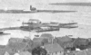 | Details | Freeman, Josiah | 1880 |
| Stereoview- Nantucket. |
|
Freeman, Josiah |
|
| 1880 |
| LOC:14 |
| $100.00 | Freeman--Josiah | Stereoview--Nantucket- | Stereoview ca 1870-80 by Josiah Freeman of Nantucket. Scene looking out over Nantucket rooftops and gardens with a steam paddle wheeler rounding Brant Point Light House in the distance.<BR> </BR>
The Nantucket Historical Association describes Freeman as the first of three great 19th century Nantucket photographers including Henry Wyer and Harry Platt. Josiah Freeman first opened a shop with David Coffin on the island in 1864 and remained in business until retirement in 1892. ( Historic Nantucket, Vol 35, no. 2 (Oct. 1987), p. 12-14) |
| 5369 |  | Details | Whitman and Breck | 1880 |
| Plan of Section A in Orient Heights - Boston, Mass. |
|
Whitman and Breck |
|
| 1880 |
| LOC:53 |
| $2,400.00 | Whitman-and-Breck | Plan-of-Section-A-in-Orient-Heights---Boston---Mass- | Unrecorded plat of lands, ca. 1880, belonging to the Boston Land Company under the name Orient Heights, Section A. Shows the shoreline along the west side of Chelsea Creek.
<br></br>
Includes Summit Avenue, Orient Avenue, Terrace Avenue, Elm Street, Ashley Avenue, Chelsea Avenue, Saratoga Street, Breed Street, and Butler Avenue. Shows the proposed railroad tracks and depot for the Boston, Revere Beach and Lynn Railroad and the <b>Winthrop Horse Railroad</b>.
<br></br>
Verso with a statement by A.P. Blake, General Manager:
<div class="indenttextblocksingle">
"The within 'Section A' of the Boston Land Company's Property under the general name of ORIENT HEIGHTS, comprises about one-eights of its landed Estate all located in the City of Boston and is one of the most delightful tracts of Land east of the channel of Boston Harbor, and a very large percentage within the limits of this section is available for immediate building, and a great majority of the sites have either a southeastern, southwestern, or southern aspect, from which a charming view of Massachusetts Bay, and looks directly upon the whole Harbor of Boston, and the sites and towns with which it is surrounded, opening up for the first time to the forty-thousand people of East Boston the opportunity for rapid Expansion and assuring to them the building up of suburban surroundings equal, if not surpassing anything that has been done during the last twenty years of vigorous growth in the southerly and westerly direction, from the deep water of Boston Harbor."
</div> </br>
Surveyors index collation numbers: "11045 (4261)".
<br></br>
Surveyed by Whitman and Breck Civil Engineers and Surveyors, 16 Water Street, Boston, Massachusetts. Heliotype. A heliotype is a print produced by a “photomechanically produced plate for pictures or type made by exposing a gelatin film under a negative, hardening it with chrome alum, and printing directly from it.” (Source: https://www.thefreedictionary.com/heliotype) |
| 5300 |  | Details | Liverpool, J. | 1880 |
| Quackery trade card Charlestown map Dr. J. Liverpool, Great Indian Herb Doctor |
|
Liverpool, J. |
|
| 1880 |
| LOC:300 |
| $2,500.00 | Liverpool--J- | Quackery-trade-card-Charlestown-map-Dr--J--Liverpool--Great-Indian-Herb-Doctor | Exceedingly rare and desirable trade card, in the form of a fan, ca. 1880 for Dr. J. Liverpool "The Great Indian Herb Doctor" with a map of Charlestown, Mass. - "Official Plan Battle of Bunker Hill" on verso. An advertisement for quack cures and treatments.
<br></br>
No other example found anywhere on this planet.
<br></br>
Advertising trade card in the form of a octagonal fan, mounted to a handle. <br></br>
Recto: <br></br>
<div class="indenttextblocksingle" style="text-align: center;">
"The Wonder of the World Dr. J. Liverpool Office and Laboratory 81 Green Street Boston, Mass. <br></br>
Where he may be consulted daily free of charge.<br></br>
Office hours 9 a.m. to 9 p.m. <br></br>
Sunday 10 a.m. to 3 p.m. For the benefit of the laboring class. <br></br>
All chronic diseases treated with nature's own remedies, ROOTS, HERBS, BARKS <br>Use no more poisonous drugs.<br></br>
GO AT ONCE AND SEE HIM!<br></br>
Delays are Dangerous.<br></br>
Your disease may be curable to-day - not tomorrow - therefore do not delay. He has cured thousands where others have failed."
<br></br>
</div>
Verso:<br></br>
<div class="indenttextblocksingle" style="text-align: center;">
"Official Plan Battle of Bunker Hill<br></br>
June 17, 1775<br></br>
Manufactured and Printed by L.F. Lawrence & Co.<br></br>
161 & 171 Devonshire and 30 & 32 Arch Streets, BOSTON."
</div>
<br></br>
Note: Dr. Liverpool's address at 81 Green Street, Charlestown, Mass, was one block from Bunker Hill Street and four blocks from the Bunker Hill Monument. Newspaper advertisements in 1882 for Dr. J. Liverpool recorded his address as 833 Tremont Street. |
| 1240 |  | Details | Cincinnati and New Orleans Passenger Line | 1880 |
| Trade card for Steamboat Charles Morgan |
|
Cincinnati and New Orleans Passenger Line |
|
| 1880 |
| LOC:0 |
| $180.00 | Cincinnati-and-New-Orleans-Passenger-Line | Trade-card-for-Steamboat-Charles-Morgan | Very interesting and rare antique trade card for the side-wheel <b>steamboat Charles Morgan</b> of the Cincinnati and New Orleans Passenger Line. Built in 1873 and burned in Cincinnati in 1886, the Charles Morgan is well known for having Samuel Clemens a.k.a. Mark Twain as a passenger in 1882 when Clemens took a nostalgic tour to revisit places along the Mississippi River that he had visited in his previous occupation as a riverboat pilot.
<br><br/>
Front of the card contains an image resembing the steamer Charles Morgan. Verso contains the names and distances for approximately 100 of the steamboat stops along the route from Cincinnati to New Orleans, a total. distance of 1440 miles.
<br><br/>
The Charles Morgan was named for its owner, shipping tycoon Charles Morgan (1795-1878). Morgan moved to New York City at the age of fourteen and began a ship chandlery and import business which lead to investments in merchant shipping and ironworks and to management of several lines of sailing and steam packets trading with the South and the West Indies. He was also both partner and rival of Cornelius Vanderbilt in attempts to establish an isthmian transit across Nicaragua in the 1850s.
<br><br/>
Morgan City, Louisiana was named after Charles Morgan. |
| 7948 |  | Details | Cosgrove, John | 1880 |
| Trade Card for John Cosgrove Poydras Market New Orleans |
|
Cosgrove, John |
|
| 1880 |
| LOC:41 |
| $150.00 | Cosgrove--John | Trade-Card-for-John-Cosgrove-Poydras-Market-New-Orleans | Antique trade card advertising for John Cosgrove, a wholesale and retail dealer in fish, turtle, shrimps, crabs, pompano, red fish, snapper, and other seasonal fish at Poydras Market in New Orleans. Date is estimated as circa 1880.
<br><br>
The Poydras Market was a major public food market in 19th-century New Orleans, strategically located on Poydras Street near the Mississippi River and just west of the French Quarter. It was part of a network of municipal markets established to supply the city’s growing population with fresh produce, meats, and seafood. Its proximity to the riverfront made it an ideal site for offloading goods brought in by boat, especially the bounty of the Gulf—shrimp, crabs, pompano, redfish, turtle, and snapper were staples of the stalls.
<br><br>
The market was a bustling commercial hub where independent vendors, such as John Cosgrove, rented numbered stalls to sell seasonal goods. These vendors catered to a diverse clientele that included chefs, homemakers, and restaurateurs, all drawn by the variety and freshness of the offerings. The open-sided structure, typical of Southern markets, allowed for good airflow in the subtropical climate and fostered a lively, communal atmosphere filled with the sounds and scents of everyday commerce.
<br><br>
By the early 20th century, however, changes in transportation, refrigeration, and shopping habits began to erode the dominance of public markets. Poydras Market gradually declined and was eventually demolished—likely by the mid-20th century—as downtown New Orleans transformed into a modern commercial district. While the physical market is long gone, its name and legacy endure in the city’s culinary memory and in rare trade ephemera like this advertising card. |
| 861 |  | Details | U.S. Coast and Geodetic Survey | 1880 |
| Antique Nautical Chart of Penobscot Bay with Camden and Rockport, Maine |
|
U.S. Coast and Geodetic Survey |
|
| 1880 |
| LOC:0 |
| $0.00 | U-S--Coast-and-Geodetic-Survey | Antique-Nautical-Chart-of-Penobscot-Bay-with-Camden-and-Rockport--Maine | SOLD<br></br>
Antique hydrographical chart of Penobscot Bay in Maine by the U.S. Coast and Geodetic Survey published in 1880. This 19th century chart "is the first complete chart of Penobscot Bay published by the U.S. Government". (Penobscot Maritime Museum, "Penobscot Bay Chart 1880", Internet. Accessed 7/21/2015.) Although it was published 4 years earlier by the USCS, chart number 293 only contains the central part of the bay.
<br></br>
This old nautical chart covers an area in the State of Maine including West Penobscot Bay, East Penobscot Bay, Isle au Haut Bay, Deer Isle, Vinalhaven Island, Cape Rozier, and South Long Island. Towns in Maine that are covered by the chart include Rockland, Belfast, Searsport, Stockton, Rockport, Camden, and Castine
<br></br>
This old chart was made less than 20 years after the end of the U.S. Civil War and contains thousands of details including numerous islands, depth soundings, aids to navigation, and navigation hazards.
<br></br>
Printed by the electrotype method which was adopted by the Coast Survey in the mid-1800's to support increased production volumes with high quality charts very similar to a hand-engraved copper plate engraving. Electrotype copy number 3. Scale 1/80,000. |
| 5360 | 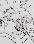 | Details | Elliot, Charles D. | 1880 |
| Rare 1635 [1880] Historical Map of Cambridge, Massachusetts |
|
Elliot, Charles D. |
|
| 1880 |
| LOC: |
| $0.00 | Elliot--Charles-D- | Rare-1635-[1880]-Historical-Map-of-Cambridge--Massachusetts | SOLD<br><br>Very rare original historical map of Cambridge, Massachusetts as it existed in 1635, reconstructed from earlier maps and surveys by Somerville civil engineer and surveyor Charles Darwin Elliot in 1880.
<br></br>
This artifact is the only known original <strong>full-size example</strong> of Elliot's map of Cambridge. In 1901 Elliot's map was reprinted in a reduced format as the frontispiece of the earliest Cambridge town records [1]. All extant copies of the map appear in the reduced size.
<br></br>
Charles D. Elliot (1837-1908) was born in Foxboro, Massachusetts, and studied civil engineering in the offices of W.B. Stearns and Daniel A. Sanborn (mapmaker). During the Civil War Charles D. Elliot served as a topographical engineer in the Army Engineers. Among other assignments during the war, Elliot served in Florida with responsibility for reconnaissance and construction of field fortifications. Elliot's other projects included the Cape Cod Canal and the "Mystic Valley Parkway."
<br></br>
In 1872 Charles D. Elliot became Somerville’s first city engineer. Elliot was also a member of the Somerville Historical Society. He published numerous articles related to the history of Somerville in the <strong>Historic Leaves of the Somerville Historical Society</strong> and in 1896 published "Somerville's History" [2].
<br></br>
[1] The Records of the Town of Cambridge (Formerly Newtowne) Massachusetts 1630-1703. Cambridge. 1901. Frontispiece. Accessed Online.<br>
[2] Elliot, Charles D. "Somerville's History" in "Illustrated Souvenir of the City of Somerville". Edward Samuels and Henry Kimball. 1896. |
| 3598 |  | Details | Anonymous | 1880 |
| 19th century cadastral survey of lands near Lake Weir, Florida |
|
Anonymous |
|
| 1880 |
| LOC:0 |
| $0.00 | Anonymous | 19th-century-cadastral-survey-of-lands-near-Lake-Weir--Florida | SOLD<br></br>
19th century manuscript cadastral survey map of lands near Lake Weir and Ocklawaha, Florida, about 16 miles southeast of Ocala. Ocklawaha, on the north coast of Lake Weir is notorious as the location where the Barker-Karpis gang also known as the <b>Ma Barker gang maintained a hideout</b> at 3250 East Highway C-25. On January 16, 1935 the FBI opened fire on the house killing Ma Barker and her son Fred. The house has recently been moved off the property.
<br></br>
Surveys of the Florida Peninsula from this era are scarce.
<br></br>
Named locations on this old survey include nearby Little Lake Weir, Bower Lake, Hamock Pond, Coon Pond, Silver Lake, Fig Lake, Saddleback Lake, Prospect Lake, and a railroad depot. Ocklawaha is not named. Dates on this MS map including 1880 and 1898 suggest usage of the map over a long period. Names of property owners include Mitchell, Cooper, Taylor, Williams, and many more.
<br></br> |
| 4927 |  | Details | U.S. Coast and Geodetic Survey | 1880 |
| Scarce antique Chart of Monterey Harbor California |
|
U.S. Coast and Geodetic Survey |
|
| 1880 |
| LOC:63 |
| $750.00 | U-S--Coast-and-Geodetic-Survey | Scarce-antique-Chart-of-Monterey-Harbor-California | Electrotype copy of the chart of Monterey Harbor with a fine engraved coastal elevation view of Point Pinos from 5 miles seaward. Includes sailing directions. Chart number 5491. First issued 1852 but ca. 1880.
<br></br>
This is a scarce, separately issued, rolled hydrographic chart of the California coast, first published in 1852, not one of the common folded versions on thin paper that were issued with other charts in an annual report to Congress from the Coast Survey.
<br></br>
This antique chart was printed from an electrotype copy of the original hand-engraved copper plate, a process the U.S. Coast Survey adopted around 1850. As a soft medium, copper plates could only withstand print runs of perhaps 200 copies before the plates wore down. To enable larger print runs, a mold of the original plate was created in wax or another soft medium. Then, using an electro-chemical process ( electrotyping ), the mold was coated with a metal layer, typically copper. Printers were then able to produce output from the new electrotype copper copy, while preserving the original.
<br></br>
Electrotype copy no. 3. Sheet size 27"x24". Logo of the Coast Survey Office. Price when issued 15 cents. |
| 5463 |  | Details | Neuman, L.E. | 1880 |
| Antique cigar box label Key West brand birds-eye view |
|
Neuman, L.E. |
|
| 1880 |
| LOC:14 |
| | Neuman--L-E- | Antique-cigar-box-label-Key-West-brand-birds-eye-view | SOLD
<br></br>
Original, antique, colorful lithographed label for the "Key West" brand of cigars ca. 1880. Shows an oblique-angle birdseye view of Key West with sailing and steam-powered ships underway nearby.
<br></br>
Removed from a Victorian-era scrapbook. Scarce, no copy of this edition is found online.
<br></br>
Key West, Florida was once the largest producer of Cuban cigars – until a devastating fire in 1886 spread through town. |
| 8023 | 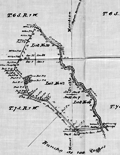 | Details | Lewis, William J. | 1880 |
| MS Copy Plat of El Potrero Land Grant Santa Clara California Silicon Valley |
|
Lewis, William J. |
|
| 1880 |
| LOC:89 |
| $0.00 | Lewis--William-J- | MS-Copy-Plat-of-El-Potrero-Land-Grant-Santa-Clara-California-Silicon-Valley | SOLD<br><br>Extremely rare manuscript copy of the official plat of the 1,939-acre Rancho El Potrero de Santa Clara, a Mexican land grant in what is now Silicon Valley. This certified true copy preserves the text and certification sequence of the 1860 survey approved by U.S. Surveyor General J.W. Mandeville and Deputy Surveyor Wm. J. Lewis, documenting the boundaries of the rancho during the adjudication of Mexican-era land claims. <br><br>Drawn in brown iron-gall ink on translucent tracing cloth, it records acreage, boundary statements, and the approvals from the Surveyor General’s Office in San Francisco. Shows the Santa Clara Mission (established 1777) and the Alameda or road between Santa Clara and San Jose. At bottom center, the circled “L.S.” marks the <i>locus sigilli</i>, indicating where the Surveyor General’s seal belonged. Clerks routinely added this symbol on vellum and tracing-cloth copies, confirming the sheet’s status as an officially certified government plat.<br><br>
Although the certifications date to 1861, this is not the original field survey but an office copy produced as the Land Office worked to finalize Mexican land-grant case files. Beginning in the 1870s, earlier surveys were systematically recopied onto durable tracing cloth so blueprint-ready masters could be archived, filed with county recorders, and used in issuing land patents. Paper and thin-linen plats deteriorated quickly; tracing cloth provided a stable medium suited to long-term preservation and reproduction.<br><br>
Physical features confirm the tracing dates to the early 1880s rather than 1861: the fine red marginal ruling at far right, smooth machine-finished cloth, oxidized iron-gall ink, and the narrow Land Office folding pattern adopted after about 1878. |
| 6706 |  | Details | Taylor, H. E. | 1881 |
| Manuscript topographic map of Roque Island Archipelago, Maine |
|
Taylor, H. E. |
|
| 1881 |
| LOC:9999999 |
| $0.00 | Taylor--H--E- | Manuscript-topographic-map-of-Roque-Island-Archipelago--Maine | SOLD<br><br>
An unrecorded finely-executed pen and ink manuscript map of Roque Island, Maine by surveyor H.E. Taylor of Machias, Maine. A presentation-quality survey with careful lettering and light wash hand-color laid to linen and edged with red selvage.
<br><br>
The survey was probably commissioned by Gilbert Longfellow (1), as it credits assistance from H.W. Longfellow, who was most likely Henry, Gilbert's son. Additionally, the map was made less than a year before the Longfellow family sold Roque Island to the Gardner family. Numerous features are noted including:
<div class="indenttextblocksingle">
<ul style="list-style-type: circle;"></li>
<li>the "old tide mill dam"</li>
<li>"old camp , shell heaps" on Romney Point</li>
<li>"Inspiration Point"</li>
<li>"burial ground"</li>
<li>"Devil's stairway"</li>
<li>"Clam Cove</li>
<li>"Great Beach"</li>
<li>"Roaring Cavern"</li>
<li>"Indian Landing"</li>
</ul>
</div>
This is the earliest large-scale map of the Roque Island Archipelago I have been able to locate. No holdings of this map are recorded in WorldCat or elsewhere online. At Harvard there is another similar map by Taylor from 1881- "Longfellows Island (formerly Shorey's): with adjacent islands and part of Englishmans River Neck".
<br><br>
Note: The full title of the Roque Island map is: "Topographical Map of Roque Island, Maine area 1274 acres and including barred islands 1309.3 acres Surveyed August 1881 with assistance of H.W. Longfellow & J. U. Chandler. By H. E. Taylor Civil Engineer and Surveyor."
<br><br> |
| 521 |  | Details | U.S. Coast and Geodetic Survey | 1881 |
| Narragansett Bay from a Trigonometrical Survey |
|
U.S. Coast and Geodetic Survey |
|
| 1881 |
| LOC:0 |
| $0.00 | U-S--Coast-and-Geodetic-Survey | Narragansett-Bay-from-a-Trigonometrical-Survey |
SOLD, but see another <a href="http://www.rarecharts.com/ShowDetail/Creator/U-S--Coast-and-Geodetic-Survey/Title/Antique-chart-of-Cuttyhunk-to-Block-Island-with-Narragansett-Bay/980"_blank">similar item</a> |
| 1035 |  | Details | U.S. Coast and Geodetic Survey | 1881 |
| Narragansett Bay |
|
U.S. Coast and Geodetic Survey |
|
| 1881 |
| LOC:0 |
| $0.00 | U-S--Coast-and-Geodetic-Survey | Narragansett-Bay | SOLD<br></br>
Large, antique rolled nautical chart of Narragansett Bay on heavy paper. Includes the surrounding bays, rivers, and islands of Connecticut, Massachusetts, and Rhode Island. This scarce, detailed chart is comprised of two conjoined sheets. Price has been adjusted for known condition issue.
<BR> </BR>
First produced in 1873, this chart was reprinted in 1881 with corrections to the aids to navigation. Contains great detail of topographic and hydrographic features with hundreds of soundings and numerous aids to navigation. The chart is finely engraved and will display beautifully.
<BR> </BR>
Noted points of interest include Providence, Fall River, Bristol, Warren, Newport, Wickford, East Greenwich, Apponaug, and the Old Colony and Newport RR. At bottom of the chart is a profile view of Narragansett Bay, Beavertail Light bearing N by E. With the circular stamp of the United States Coast and Geodetic Survey. Electrotype copy No. 2. Price 75 cents when issued. |
| 354 |  | Details | Naval War Records Office | 1881 |
| Mouths of Roanoke River |
|
Naval War Records Office |
|
| 1881 |
| LOC:0 |
| $0.00 | Naval-War-Records-Office | Mouths-of-Roanoke-River | SOLD<br></br>Old nautical map from 1881 depicting Union defenses near Plymouth N.C. on the Roanoke River during the attack of Confederate ironclad gunboats in 1864. Notable features Batchelor's Bay, Warren Neck, Fort Gray, Fort Wessells, Fort Williams, and the location of the wreck of the USS Southfield.<BR> </BR>
From "Official Records of the Union and Confederate Navies in the War of the Rebellion". United States. Naval War Records Office, United States. Printed by The Norris Peters Co., Photo-Litho, Washington, D.C. |
| 353 |  | Details | Naval War Records Office | 1881 |
| Order of Battle and Plan of Attack Nov. 7th 1861 |
|
Naval War Records Office |
|
| 1881 |
| LOC:0 |
| $0.00 | Naval-War-Records-Office | Order-of-Battle-and-Plan-of-Attack-Nov--7th-1861 | SOLD
<BR> </BR>
Antique map from 1881 depicting Fort Walker on Hilton Head Island and Fort Beauregard on St. Helena Island as U.S. Navy forces attacked in 1861, one of the earliest naval battles of the Civil War. With a summary of the disposition of both Union and Rebel naval forces and their movements. Other notable features include Paris (Parris) Island, Daw Island, Pinckney Island, and Capers Island, the Beaufort, Broad, and Chechessee Rivers
<BR> </BR>
From "Official Records of the Union and Confederate Navies in the War of the Rebellion". United States. Naval War Records Office, United States. Printed by The Norris Peters Co., Photo-Litho, Washington, D.C. |
| 731 |  | Details | U.S. Coast and Geodetic Survey | 1881 |
| Entrance to San Francisco Bay California 1877 |
|
U.S. Coast and Geodetic Survey |
|
| 1881 |
| LOC:0 |
| $0.00 | U-S--Coast-and-Geodetic-Survey | Entrance-to-San-Francisco-Bay-California-1877 | SOLD<BR> </BR>
Superb, large, antique U.S. Coast Survey chart of San Francisco Bay, the city of San Francisco, and lower Marin County, California on heavy paper. Shows numerous soundings and aids to navigation including Fort Point Light, Point Bonita Light, Yerba Buena Light, and Alcatraz Light.
<BR> </BR>
Coverage includes San Francisco and Sausalito and the surrounding areas as existed in 1859. This chart was reissued in October 1877 with corrections to the aids to navigation made in 1881. Very good condition. Bottom of chart contains two views of the entrance to the bay from the south and the north showing both steam and sail-powered vessels underway and at anchor. Named points of interest include the Presidio, Oakland, Cliff House, Ocean House, Sausalito, Alcatraz Island, Mission Bay, San Leandro, Yerba Buena Island, Mission de Delores, Table Mountain, Brooklyn, Alameda, and of course the Golden Gate (with no bridge).
<BR> </BR>
This antique chart should not be confused with those similar copies issued as part of an annual Report to Congress, most on thin paper with folds that often show condition issues. This issue is very large, rolled, and on heavy paper with no folds. With the circular stamp of the U.S. Coast Survey. Produced under the supervision of A.D. Bache, Superintendent of the U.S. Coast Survey first published in 1859. Electrotype copy 3. |
| 946 |  | Details | James Imray and Son | 1881 |
| West Coast of North America San Blas San Francisco |
|
James Imray and Son |
|
| 1881 |
| LOC:0 |
| $0.00 | James-Imray-and-Son | West-Coast-of-North-America-San-Blas-San-Francisco | SOLD, but have an <a href="https://www.rarecharts.com/ShowDetail/Creator/James-Imray-and-Son/Title/West-Coast-of-North-America-from-San-Blas-to-San-Francisco/3680" target="_blank" >earlier example </a> (1876) of the same chart. Spectacular blueback nautical chart from <b>California's post Gold-Rush era</b> in superb condition. |
| 1162 |  | Details | New York and Sea Beach Railroad | 1881 |
| Antique Schedule for the New York and Sea Beach Railroad |
|
New York and Sea Beach Railroad |
|
| 1881 |
| LOC:0 |
| $90.00 | New-York-and-Sea-Beach-Railroad | Antique-Schedule-for-the-New-York-and-Sea-Beach-Railroad | Scarce antique folding trade card / schedule for 1881, the inaugural year for service by Iron Steamboat to Coney Island. With a purple ink hand-stamp: <b>"1881. IRON BOATS. 1881."</b>. Front cover contains a drawing of Sea Beach Palace, the terminus of the New York and Sea Beach Railroad at <b>Coney Island</b>. Back cover with a colorful scene of Bay Ridge Landing with the steamboat "Idlewild" docked.
<br></br>
The <b>Iron Steamboat Company of New Jersey</b> (1881-1932) provided ferry service between Manhattan and Coney Island in the late 19th and early 20th centuries. The original fleet consisted of seven iron-hulled, multi-deck, coal-fired sidewheel steamboats, divided into twelve watertight compartments. Each boat was named after a constellation--the Cygnus, the Cepheus, the Cetus, the Pegasus, the Perseus, the Sirius and the Taurus. An early advertisement for the fleet boasted "They Cannot Burn – They Will Not Sink".
(Cudahy, Brian J.<a href="https://books.google.com/books?id=FtUzg07N0wwC" target="_blank"> "How we Got to Coney Island". </a>Fordham University Press. 2002.)
<br></br>
Folded card with 4 sections. Printed by Donaldson Brothers, Five Points, New York. |
| 133 |  | Details | Anonymous | 1882 |
| Track Chart Norddentsher Lloyd, Bremen |
|
Anonymous |
|
| 1882 |
| LOC:0 |
| $0.00 | Anonymous | Track-Chart--Norddentsher-Lloyd--Bremen | SOLD
<br></br>
Small ship's track chart / nautical map of Atlantic Ocean produced by the Norddentsher Lloyd shipping company that was used by a passenger to track his progress on a Transatlantic cruise. Details the daily position and miles made good on a voyage from Sandy Hook, New Jersey to England between August 31 and September 8, 1887 with a Captain Richler. With an inset of a steamer underway. |
| 2546 |  | Details | Fuller and Whitney | 1882 |
| Rare blueprint cadastral plan Boylston Street, Boston Back Bay |
|
Fuller and Whitney |
|
| 1882 |
| LOC:0 |
| $650.00 | Fuller-and-Whitney | Rare-blueprint-cadastral-plan-Boylston-Street--Boston-Back-Bay | This fine single leaf with printing on two sides is a rare early example of the adoption and adaptation of a new printing technology (blueprinting). William Whitney's use of blueprinting enabled his firm to publish works contemporaneously with the ongoing land making in Boston's Back Bay, thus reducing cycle time and gaining greater control over his firm's publication of cadastral data. Using blueprints Fuller and Whitney could research, design, create artwork, and print their own works.
<br></br>
Original blueprint of Boylston Street in Boston, Massachusetts east of Massachusetts Avenue (Ex. West Chester Park) to Dartmouth Street. During the Back Bay Land making Project of the mid-19th century fill averaging 20 feet in depth was added to 450 acres of mud flats that lay to the west of Boston's Public Garden. Proceeding from east to west, by 1870 the land was filled as far as Exeter Street and land making was completed to West Chester Park by 1882.
<br></br>
Blueprint on the recto consist of a plan of Boylston Street from Fuller and Whitney's 1882 issue of "Schedule of Sales Commonwealth Avenue Lands, 1882. With Plan." On the verso a table of data as above. No. 7.
<br></br> |
| 6827 |  | Details | Fuller and Whitney | 1882 |
| Rare manuscript surveyors cadastral plan of Commonwealth Avenue in Boston Mass |
|
Fuller and Whitney |
|
| 1882 |
| LOC: |
| $850.00 | Fuller-and-Whitney | Rare-manuscript-surveyors-cadastral-plan-of-Commonwealth-Avenue-in-Boston-Mass | If you collect antique Boston paper or you are looking for an original, unique, one-of-a-kind gift for someone then consider this rare piece of Boston history:
<br><br>
This is a manuscript or hand drawn plan, a cadastral map of Commonwealth Avenue in Back Bay, Boston, Mass. from January, 1882. The map was the source map, a master map, a base map, for blueprint copies made around 1882 by the Civil Engineering firm of Fuller and Whitney who styled themselves "Back Bay Engineers". Fuller and Whitney tracked the owners name, lot width and lot number on Commonwealth during the fill and development of Boston's Back Bay in the latter half of the 19th century. Covers five blocks on Commonwealth Ave. between Dartmouth Street and West Chester Park, now called Massachusetts Ave.
<br><br>
Fuller and Whitey regularly used this master copy to publish beautiful blueprints tracking the progress of the Boston Back Bay project in the 1880's. To produce a blueprint they would lay a sheet of tracing paper across this master page and have a draftsman neatly trace and letter the plan in water-soluble ink. When that trace was complete they laid the trace across a sheet of unexposed blueprint paper and placed both sheets under the bright sun for several minutes to expose it, just like an old style contact photograph. The exposed print was then washed to develop it.
<br><br>
Although multiple blueprints may have been produced (I don't know of any) this is the only master manuscript source plan. They aren't making any more of these.
<br><br>
What a conversation piece! Includes notes from the engineers about the how the owner's names were put on the map and about lot widths.
<br><br>
Fuller and Whitey's document index file numbers 741 and 858.
<br><br>
<b>Other Boston manuscript maps are available. Contact us for more information.</b> |
| 5397 |  | Details | Fuller and Whitney | 1882 |
| Rare Manuscript Foundational Map of the Middlesex Fells Massachusetts |
|
Fuller and Whitney |
|
| 1882 |
| LOC: |
| $0.00 | Fuller-and-Whitney | Rare-Manuscript-Foundational-Map-of-the-Middlesex-Fells-Massachusetts | SOLD<br><br>A recently uncovered landmark in early American conservation history, this 1882 map is the earliest known unified depiction of the Middlesex Fells and a nationally significant artifact from the birth of forest and open-space preservation in the United States. Created in the same year that Massachusetts enacted the first public-domain conservation law, the map captures the moment when advocates began to view the Fells as a single landscape worthy of protection. It also appears to be the earliest known use of the then cutting-edge blueprinting process for a conservation map, underscoring its pioneering role in both environmental advocacy and cartographic technology.
<br><br>
Compiled in November 1882—three years after Sylvester Baxter introduced the name “Middlesex Fells,” two years after Elizur Wright and Wilson Flagg founded the Middlesex Fells Association, and only six months after passage of the Public Domain Act (Chapter 255, Acts of 1882)—the map’s title closely mirrors the statutory language authorizing preservation of forests and water supply. Fuller & Whitney describe land “designed to be set apart as a Public Domain for the preservation and production of Forest Trees and the Water Supply of many Cities & Towns,” echoing the Act almost verbatim. Issued in immediate response to this new legal authority, the 1882 sheet stands as a deliberate visual expression of the law’s intent and a foundational document in America’s earliest forest-preservation movement.
<br<br>Manuscript master surveyor's ink trace map on tracing cloth. MS pencil index notation bottom right: “973 – 974.<br><br>Possibly unpublished. The map predates the Appalachian Mountain Club map by four years and the Topographical Map of Middlesex Fells Reservation by thirteen.
<br><br> |
| 2517 |  | Details | Boston Photo Electro. Co. | 1883 |
| An Exact Draught of Bostone harbour |
|
Boston Photo Electro. Co. |
|
| 1883 |
| LOC:3 |
| $380.00 | Boston-Photo-Electro--Co- | An-Exact-Draught-of-Bostone-harbour | Late 19th century facsimile of a very rare map of Boston attributed to Cyprian Southack. This facsimile is itself a scarce item and represents the best available copy of Southack's survey. Names many of the islands in Boston Harbour.
<br></br>
Depicts trees, buildings, the encampment on Noddle Island and ships in Boston Harbour pictorially. Boston Neck depicted as a very thin strip of land connecting the Shawmut peninsula to the mainland.
<br></br>
Note at bottom left reads: "Entered according to an Act of Congress in the year 1883 by A.O. Crane in the office of Librarian of Congress at Washington." |
| 5023 |  | Details | British Admiralty Hydrographical Office | 1883 |
| Scarce large Admiralty nautical chart of the Entrance to Pensacola Bay Florida |
|
British Admiralty Hydrographical Office |
|
| 1883 |
| LOC:0 |
| $0.00 | British-Admiralty-Hydrographical-Office | Scarce-large-Admiralty-nautical-chart-of-the-Entrance-to-Pensacola-Bay-Florida | SOLD<br></br>
Scarce large rolled sea chart on heavy paper of the entrance to Pensacola Bay, Florida (after the U.S. Coast Survey 1857) published at the Admiralty on May 30, 1861 under the superintendence of Captain Washington, R.N. Last correction 1883. No folds.
<br></br>
Not a preliminary chart. Full-size nautical charts on heavy paper of the Entrance to Pensacola Bay are very scarce, whether by the U.S. Coast Survey or the Admiralty.
<br></br>
Sold by J.D. Potter. Engraved by J & C Walker. Chart number 2820. |
| 86 |  | Details | Eldridge, George | 1883 |
| Eldridge's Coast Pilot |
|
Eldridge, George |
|
| 1883 |
| LOC:0 |
| $0.00 | Eldridge--George | Eldridge-s-Coast-Pilot | This item has been sold
<BR> </BR>
536 pages of sailing directions from Chatham around the tip of Florida into the Gulf of Mexico as far as Rio Grande River. No charts or illustrations save an advertising supplement. Several corrections inserted on yellow paper. Final pages includes meager sailing directions for the Mississippi River passes, Barataria Bay, Timbalier Bay, Atchafalaya Bay, and Galveston Bay. <BR> </BR>
Includes a 45 page supplement from The American Ship Windlass Company that includes numerous fine steel engravings of anchor windlasses. |
| 559 | 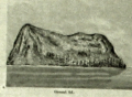 | Details | U.S. Coast and Geodetic Survey | 1883 |
| Pacific Coast Pilot Alaska Part I |
|
U.S. Coast and Geodetic Survey |
|
| 1883 |
| LOC:0 |
| $495.00 | U-S--Coast-and-Geodetic-Survey | Pacific-Coast-Pilot-Alaska-Part-I | U.S. Coast Pilot of a portion of the Alaskan coast c 1883. An increasingly scarce late 19th century volume. With 16 folding lithographed charts and 13 folding sheets of views on thin onion-skin type paper all in excellent nearly pristine condition. Total of 331 pages includes over 200 pages of detailed sailing directions, several indexes, notes on name pronunciation, meteorological tables and sailing distances. <br><br/>
Manuscript fly page inscription dated July 22, 1887 by Edwin H. Abbot, Milwaukee, Wis. Original half leather with marbled boards and gold embossed spine. Boards cleanly detached but still present. U.S. Coast and Geodetic Survey. J.E. Hilgard, Superintendent. Washington 1883. |
| 1265 | 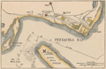 | Details | Leslie, Frank | 1884 |
| Antique map of south Pensacola, Florida and Navy Yard |
|
Leslie, Frank |
|
| 1884 |
| LOC:0 |
| $0.00 | Leslie--Frank | Antique-map-of-south-Pensacola--Florida-and-Navy-Yard | SOLD
<br></br>
Antique map ''The United States Navy Yard. Pensacola Bay, Fla. Santa Rosa Island, and the Gulf of Mexico and Bay Forts''. This very attractive old map features the south <b>Pensacola</b> area during the Civil War, showing Fort McRae, Fort St. Carlos de Barrancas ( Barancas ), and <b>Fort Pickens</b>, barracks, marine hospital, cemetery, and U.S.Navy Yard. Shows the nearby communities of Warrington and Woolsey and a single road following the coastline to Pensacola.
<br></br>
Cartography after an earlier 1861 map published in Harper's Weekly. This later, updated map shows the Marine Hospital built in 1870. Source is Frank Leslie's <b>The Soldier in our Civil War</b>, one of the most lavish pictorial histories of the Civil War ever published.
<br></br>
The Pensacola Navy Yard was a shipyard at the site of present-day Naval Air Station (NAS) Pensacola. Originally constructed in 1826, it was decommissioned in 1911. The site was reopened three years later as Naval Air Station Pensacola.
<br></br> |
| 1390 | 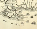 | Details | Lane, Walter A. | 1884 |
| Antique Civil War era map of the Gulf Coast |
|
Lane, Walter A. |
|
| 1884 |
| LOC:0 |
| $0.00 | Lane--Walter-A- | Antique-Civil-War-era-map-of-the-Gulf-Coast | SOLD
<br></br>
Neat decorative original antique map of the southeast Gulf Coast during the U.S. Civil War. Includes locations and features in Texas, Louisiana, Mississippi, Alabama, Florida and the surrounding states. Shows key forts including Fort Pike, Fort Pickens, Fort Jackson, Fort St. Philip and Fort McComb. Includes numerous railroad lines, the key to rapid re-supply. Lane shows and names all the Mississippi River passes (ex. "Pass a Loutre") and fills the empty space in the Gulf of Mexico with depictions of six sailing vessels, some with obvious smoke stacks signifying the use of steam power to assist the sails.
<br></br>
From "The Soldier in Our Civil War" by Frank Leslie. Text and wood-cut images on verso. Dotted line shows the path of Grierson's raid, an attack by 1700 Union cavalry on Baton Rouge, Lousiana in 1863 over routes no Union soldier had traveled prior to the raid. |
| 158 | 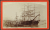 | Details | Mugnier, George Francois | 1884 |
| Lower Levee, Shipping |
|
Mugnier, George Francois |
|
| 1884 |
| LOC:0 |
| $0.00 | Mugnier--George-Francois | Lower-Levee--Shipping | SOLD <BR> </BR>
Handsome, detailed, antique albumen cabinet card by New Orleans photographer George Francois Mugnier, taken early in his career circa 1884. Subjects are several 3-masted sailing vessels docked at a New Orleans wharf. Vessel closest to the wharf has sails partially unfurled, possibly to allow them to dry. Also, in the far background a sailor is seen climbing the rigging of another ship. <BR> </BR>
The ship farthest from the wharf can be identified under magnification as the "Glen Grant". On the Canadian Heritage on-line reference library we find 5 voyages by a vessel named "Glen Grant" (official # 69115) to the U.S. Gulf Coast including a round-trip voyage from England to a single Gulf port, unnamed, departing September 1882, returning March 1883. It is possible that this photo was taken during that voyage by Mugnier. <BR> </BR>
Bottom of photo reads: "Mugnier, Photographer Exchange Place N.O. La." Mugnier (1855-1936) achieved fame as a photographer with his 1885 photographs of the World's Industrial and Cotton Centennial Exposition in New Orleans. Number 538. Blank, pinkish verso. |
| 5137 | 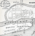 | Details | Bloomfield, Max | 1884 |
| Bloomfield's Map of St. Augustine Fla. and its Environs |
|
Bloomfield, Max |
|
| 1884 |
| LOC:11 |
| $250.00 | Bloomfield--Max | Bloomfield-s-Map-of-St--Augustine-Fla--and-its-Environs | Antique map of St. Augustine, Florida from "Bloomfield's Illustrated Historical Guide Embracing an Account of the Antiquities of St. Augustine, Florida." Fine detail shows the coquina quarries, Fort Marion, the Matanzas River, Anastasia Island and both the new lighthouse and the location of the old lighthouse. A shell road is shown entering the city past the city gates.
<br></br>
Published in 1884 by Max Bloomfield, Bookseller, News dealer and Stationer of St. Augustine, Florida. Copyrighted. At right a list of references in the City of St. Augustine including the old Spanish graveyard, the Huguenot Cemetery, the old slave market, and a monument to the Confederate dead.
<br></br>
North oriented to right. |
| 5134 |  | Details | Andreas, S. T. | 1885 |
| Antique birds eye view of the Battle of Shiloh Tennessee |
|
Andreas, S. T. |
|
| 1885 |
| LOC:88 |
| $0.00 | Andreas--S--T- | Antique-birds-eye-view-of-the-Battle-of-Shiloh-Tennessee | SOLD<br></br>
Circular lithographed bird's-eye view of the U.S. Civil War Battle of Shiloh, Tennessee on April 6 and 7, 1862. The fine, detailed view is based on a large painted panorama of the battle designed by French panorama artist Theophile Francois Henri Poilpot (1848-1915). The panorama was commissioned by A. T. Andreas and displayed in Chicago in 1885.
<br></br>
From the Manual of the Panorama of the Battle of Shiloh published in 1885 by A.T. Andreas, 602 Opera House. Topographic survey for the panorama was conducted by M.B. Hewson and F.J. McIntosh, Civil Engineers and Surveyors. The Manual was given out to visitors who viewed the panorama in Chicago during the summer of 1885. |
| 4874 |  | Details | Whitman and Breck | 1885 |
| Plan Sea Shore Lots Revere Beach Land Company Revere Massachusetts |
|
Whitman and Breck |
|
| 1885 |
| LOC:53 |
| $2,400.00 | Whitman-and-Breck | Plan-Sea-Shore-Lots-Revere-Beach-Land-Company-Revere-Massachusetts | Unrecorded heliotype plan or plat of lots for sale in today's Beachmont neighborhood with Crescent Beach and Revere Beach. Published in 1885 by the Revere Beach Land Company in Revere, Massachusetts. Large inset with a large-scale map of Winthrop Highlands, Revere, Beachmont and Crescent Beach
<br></br>
Surveyed by Whitman and Breck, 35 Devonshire St. Street, Boston.
<br></br>
Heliotype printed. A heliotype is a print produced by a “photomechanically produced plate for pictures or type made by exposing a gelatin film under a negative, hardening it with chrome alum, and printing directly from it.” (Source: https://www.thefreedictionary.com/heliotype) |
| 6836 |  | Details | Swan, Benjamin and Robert Henly | 1885 |
| Rare plan of Kerr City, Florida |
|
Swan, Benjamin and Robert Henly |
|
| 1885 |
| LOC: |
| $475.00 | Swan--Benjamin-and-Robert-Henly | Rare-plan-of-Kerr-City--Florida | Plat map of Kerr City, Florida in Ocala National Forest. A folding sales brochure produced by the town's founders- J.J. Swan (Tecumseh, Michigan) and Robert Henly (Carthage, Indiana) in 1885. Recorded in Ocala, Florida April 2, 1885.
<br><br>
Kerr City is on the National Register of Historic Places.
<br><br>
Rare, no example of this map is found in WorldCat or the Library of Congress.
<br><br> |
| 2537 |  | Details | Fuller and Whitney | 1885 |
| Antique blueprint surveyor's plan of Boston's Back Bay Fens |
|
Fuller and Whitney |
|
| 1885 |
| LOC:0 |
| $500.00 | Fuller-and-Whitney | Antique-blueprint-surveyor-s-plan-of-Boston-s-Back-Bay-Fens | Scarce original cadastral blueprint plan (#6) of a portion of the Boston' Back Bay area west of Massachusetts Avenue less than 30 years after the area was created through land making. This plan provides a good representation of Olmsted's original vision for the Back Bay Park. Antique blueprint maps and plans from the 1889's are scarce as the technology to create blueprints was only widely adopted after 1870.
<br></br>
The area for this blueprint in Boston, Massachusetts is bounded on three sides by the Charles River, West Chester Park (now Massachusetts Avenue) and Boylston Street. Charlesgate East and Charlesgate West are named Ipswich Street and Jersey Street respectively. Verso is blank.
<br></br>
During the period 1872 to 1888 Fuller & Whitney Civil Engineers, was conducted as a partnership between J. Franklin Fuller and William H. Whitney with offices at 39 Court Street, Boston, Mass. Whitney assumed sole control of the firm in 1888 and changed the name to William H. Whitney.
<br></br>
In his autobiography Whitney refers to his work with the latest cutting-edge reprographic technology- blueprinting: <div class="indenttextblock">“In September 1881 I received a bronze medal at the Massachusetts Charitable Mechanic Association Exhibit for sun or blue prints. I developed a process from the French and used it in illustrating the growth of Back Bay lands. I issued to subscribers monthly schedules and maps showing the changes of ownership, increase in value, improvement by filling and public works.” (The New England Historical and Genealogical Register. Vol 64, January 1910. Number 253. p. lix).</div>
Fuller and Whitney are best know for their work documenting Back Bay land making activity, particularly a six-sheet set of blueprints: "A SET OF PLANS FOR THE BACK BAY 1814-1881 ILLUSTRATING THE RAPID PROGRESS IN THE DEVELOPMENT OF THE TERRITORY FOR ITS PRESENT AND PROPOSED USE." (Boston, 1881). |
| 2540 | 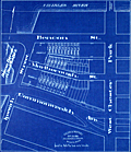 | Details | Fuller and Whitney | 1885 |
| Antique blueprint engineer's plan of Boston's Charlesgate East area |
|
Fuller and Whitney |
|
| 1885 |
| LOC:86 |
| $375.00 | Fuller-and-Whitney | Antique-blueprint-engineer-s-plan-of-Boston-s-Charlesgate-East-area | Original rare cadastral blueprint plan from September 22, 1885 providing detail for a portion of Boston's Back Bay on Beacon Street, Marlborough Street, and Commonwealth Avenue west of West Chester Park (Massachusetts Avenue) and east of Ipswich Street (Charlesgate East). At center left the reader will find the Beacon Entrance to Back Bay Park.
<br></br>
This blueprint, and perhaps other like it, were the end product created from <a href="https://www.rarecharts.com/ShowDetail/Creator/Fuller-and-Whitney/Title/Antique-manuscript-engineers-traced-plan-of-Boston-s-Charlesgate-East-area/2543" target="_blank">a manuscript trace document</a> by William H. Whitney.
</div>
Verso is blank.
<br></br>
During the period 1872 to 1888 Fuller & Whitney Civil Engineers, was conducted as a partnership between J. Franklin Fuller and William H. Whitney with offices at 39 Court Street, Boston, Mass. Whitney assumed sole control of the firm in 1888 and changed the name to William H. Whitney.
<br></br>
In his autobiography Whitney refers to his work with the latest cutting-edge reprographic technology- blueprinting: <div class="indenttextblock">“In September 1881 I received a bronze medal at the Massachusetts Charitable Mechanic Association Exhibit for sun or blue prints. I developed a process from the French and used it in illustrating the growth of Back Bay lands. I issued to subscribers monthly schedules and maps showing the changes of ownership, increase in value, improvement by filling and public works.” (The New England Historical and Genealogical Register. Vol 64, January 1910. Number 253. p. lix).</div> |
| 6519 | 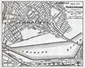 | Details | Fuller and Whitney | 1885 |
| Charles River Basin and Harvard Bridge Economic Studies |
|
Fuller and Whitney |
|
| 1885 |
| LOC:300 |
| $1,900.00 | Fuller-and-Whitney | Charles-River-Basin-and-Harvard-Bridge-Economic-Studies | Manuscript surveyors-trace economic option studies for road approaches and the proposed West Chester Park Bridge (now, Harvard Bridge, MIT Bridge, or Massachusetts Avenue Bridge). Eight surveyors' trace documents to support civil engineering and economic options for the placement of the Harvard Bridge, spanning the Charles River between Boston and Cambridge, Massachusetts. General plans for the new bridge were approved in July 1887; the bridge opened in September 1891.
<br><br>
The lot consists of eight MS pen and ink traces (for blueprint production) consisting of two base maps of Boston and Cambridge as well as six MS trace sheets with street and bridge options. The two base maps show the Charles River Basin with the existing West Boston Bridge (Longfellow Bridge) and road network. One map has much greater detail on street names and improved larger lettering.
<br><br>
Six map overlays:<br>
<div class="indenttextblocksingle">
<ul style="list-style-type: circle;">
<li>No 1. Shows the proposed new route as well as text and tabular information for the gain or loss of time over the proposed new route.</li>
<li>No. 2 Shaded area shows lands of the Charles River Embankment Company (proposed Esplanade),
proposed approaches to the Charles River Esplanade and proposed West Chester Park Bridge (aka Harvard Bridge)</li>
<li>No. 3 Approaches for the proposed West Chester Park Bridge (east of the final location)</li>
<li>No. 4 Second option. Bridge located at West Chester (aka Massachusetts Avenue) but terminated slightly more to the east.</li>
<li>No. 5 Third option. Bridge at West Chester, and a proposed wide avenue extending to the end of Commonwealth in Cambridge.</li>
<li>No. 6 Fourth option. No Esplanade </li>
</ul>
</div>
Scale 1650 feet to one inch. |
| 2543 | 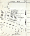 | Details | Fuller and Whitney | 1885 |
| Antique manuscript engineers traced plan of Boston's Charlesgate East area |
|
Fuller and Whitney |
|
| 1885 |
| LOC:86 |
| $500.00 | Fuller-and-Whitney | Antique-manuscript-engineers-traced-plan-of-Boston-s-Charlesgate-East-area | William H. Whitney was a very early adopter of the "blue process" or blueprinting . Both this trace and the <a href="https://www.rarecharts.com/ShowDetail/Creator/Fuller-and-Whitney/Title/Antique-blueprint-engineer-s-plan-of-Boston-s-Charlesgate-East-area/2540" target="_blank">blueprint produced from this trace</a> were created by Whitney just 4 years after the earliest recorded use of blueprints for his Boston-based civil engineering firm.
<br><br>
This rare artifact is the original manuscript cadastral ink trace on tracing cloth from September 22, 1885 providing plan detail for a portion of the Boston Back Bay on Beacon and Marlborough Streets and Commonwealth Avenue west of West Chester Park (Massachusetts Avenue) and east of Ipswich Street (Charlesgate East). This trace would have been used as the reproducible master source to create one or more blueprints, then a new reprographic technology.
<br><br>
With Fuller & Whitney's ink oval over stamp. MS number in pencil at bottom right: "1277".
<br></br>
</div> |
| 3613 |  | Details | Multiple Authors | 1885 |
| Lot 2. MULTIPLE antique surveyors plans BACK BAY, BOSTON , Massachusetts |
|
Multiple Authors |
|
| 1885 |
| LOC:0 |
| $6,200.00 | Multiple-Authors | Lot-2---MULTIPLE-antique-surveyors-plans-BACK-BAY--BOSTON---Massachusetts | A lot consisting of twenty lot and street plans from Boston, Massachusetts generally from the decade of the 1880's. Most items by surveyors and engineers William H. Whitney or the firm of Fuller and Whitney, Back Bay Engineers. An opportunity for a serious collector of Boston cartography to expand his collection with items he cannot find except in institutions. <a href="https://www.rarecharts.com/Content/Lot_2_Boston_Survey_Artifacts_Locked.pdf" target="_blank">See full detailed lot description.</a>
<br></br>
From the mid 1850’s through 1890 Boston conducted the most ambitious land-making of the era in the U.S. by transporting and placing gravel, ashes, and sand in an area that was previously a tidal marsh of the Charles River. The landfill of Boston’s Back Bay was fueled by a shortage of suitable land for new construction and the desire to remediate water pollution resulting from earlier bad decisions that placed profit ahead of citizen’s health and welfare.
<br></br>
Over a period of 35 years more than 450 acres of new land was added to Boston by filling the Back Bay with an average of 20 feet of fill. Much of this land was purchased by well-to-do Bostonians and today the Back Bay remains one of the most prestigious locations within that city.
<br></br>
We have been able to obtain 20 rare late 19th century artifacts that document the last decade of the 35 year land-making project in Boston’s Back Bay, for an area from Charlesgate Park to past Kenmore Square.
<br></br>
These maps and plans shed light on some of the decision-making factors and design options for Boston real-estate developers. These artifacts in this lot are of three types: hand-drawn or manuscript survey maps, manuscript traces of those surveys, and blueprints. The artifacts represent a very early application and adaptation of a cutting-edge technology: blueprinting. |
| 1377 | 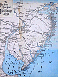 | Details | Pennsylvania Railroad | 1885 |
| Early Pictorial Map of New Jersey Ocean Resorts and Railroads |
|
Pennsylvania Railroad |
|
| 1885 |
| LOC:0 |
| $190.00 | Pennsylvania-Railroad | Early-Pictorial-Map-of-New-Jersey-Ocean-Resorts-and-Railroads | Interesting map evoking seaside dreams of an earlier age at the Jersey shore.
<br></br>
Matted and framed pictorial map from 1885 to accompany the Pennsylvania Railroad Summer Excursion routes publication. Size with frame 17" x 21". This old survivor shows numerous resorts, beaches, parks, coast and bays covered with decorative ship traffic heading in every direction, most of the vessels under sail or sail with steam assist. Lithograph. Includes New York City at top, Coney Island, Asbury Park, Manasquan, Barnegat, Atlantic City, Cape May, Philadelphia, Delaware Bay and River and Rehoboth Beach at bottom. Very decorative. $45 packing and shipping.
<br></br>
Railroad lines shown include: the Camden and Atlantic Railroad, West Jersey Railroad, Pennsylvania Railroad, New York and Long Branch R.R., the Cumberland and Maurice Railroad and many more. Shows little trains of four or five commuter cars with a steam engine puffing along ahead. The age of steam! Great for the man cave. |
| 5458 | 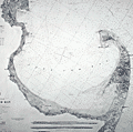 | Details | U.S. Coast and Geodetic Survey | 1885 |
| Original antique nautical chart Cape Cod Bay and Provincetown Massachusetts |
|
U.S. Coast and Geodetic Survey |
|
| 1885 |
| LOC:1403 |
| $850.00 | U-S--Coast-and-Geodetic-Survey | Original-antique-nautical-chart-Cape-Cod-Bay-and-Provincetown-Massachusetts | Original rolled, antique U.S. Coast Survey Chart no. 10 of Cape Cod Bay with the Cape Cod Peninsula first published in 1872. Numerous locations from Duxbury to Pochet Island and aids to navigation are highlighted and/or annotated in manuscript pen and ink (e.g. Nauset Beach Beacons, Wood End Light) Includes Provincetown and Provincetown Harbor. Three inset coastal recognition views as seen from offshore.
<br></br>
This is a scarce, separately issued, rolled hydrographic chart of the Massachusetts Coast from 1872, not one of the common folded versions on thin paper from annual report of the U.S. Coast Survey to Congress. This edition issued 1880 by C.P. Patterson. Updates to aids-to-navigation date the print to 1885. The price of this chart when first issued was 40 cents. Electrotype copy #2 [1].
<br></br>
[1] Artifact of the electrotype reprographic technique to create a intaglio copy of the original hand-engraved copper plate, a process the U.S. Coast Survey adopted around 1850. As a soft medium, copper plates could only withstand print runs of perhaps 200 copies before the plates wore down. To enable larger print runs, a mold of the original plate was created in wax or another soft medium. Then, using an electro-chemical process ( electrotyping ), the mold was coated with a metal layer, typically copper. Printers were then able to produce intaglio output from the new electrotype copper copy, while preserving the original hand-engraved plate.
<br></br>
Logo. |
| 1404 |  | Details | Negus, T.S and J.D. | 1886 |
| 19th Century Printers Plate for a Course Protractor |
|
Negus, T.S and J.D. |
|
| 1886 |
| LOC:0 |
| $550.00 | Negus--T-S-and-J-D- | 19th-Century-Printers-Plate-for-a-Course-Protractor | Extremely rare copper <b>relief-method</b> printing plate for a 19th century <b>Course Protractor</b> (Patent applied for) sold by T.S. and J.D. Negus. Dated within to Aug. 31, 1886.
<br><br/>
The plate contains a fancy fleur-de-lis at north and three levels of markings for courses comprising the full 32 point of the compass for example (moving clockwise from North) : "NbE" (North by East), "NNE" (North North East), "NEbN" (North East by North), "NE" (North East), "NEbE" (North East by East), and so on around the compass finishing with "NbW". <b>"Boxing the Compass"</b> was a basic skill of any sailor, being the ability to repeat all 32 points of the mariner's compass.
<br><br/>
Negus' catalog described the purpose of their Course Protractor:
<div class="indenttextblock">
<ul style="list-style-type: circle;">
<li>1st. Instead of Parallel Rulers to find on charts courses and bearings and positions from cross bearings.</li>
<li>2nd. As an inspection table, to turn compass courses into true courses and vice versa.</li></ul>
</div>
The Negus firm's 1899 illustrated catalog and price list advertises their trade as "Chronometer Manufacturers, Compass Adjusters and Navigation Warehouse. 140 Water Street, New York." Negus' catalog contains a compass-like "Improved Transparent Course Protractor".
<br><br/>
This antique copper plate plate would have been used to print 360 degrees of marks unto the paper or isinglass substrate used for the main body of the protractor. Isinglass is a kind of gelatin obtained from the air bladders of fish, especially sturgeon.
<br><br/>
Plate 6.5" square with 6" diameter circle. The copper plate is mounted to several wooden blocks for use in a printing press.
<a href="
https://library.si.edu/digital-library/book/illuscatnautopti00negurich" target="_blank">(Online p. 83) </a>
<hr>
</BR>
Call for additional 19th century Negus compass-card printing plate sizes, pricing and availability. |
| 2556 | 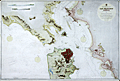 | Details | British Admiralty Hydrographical Office | 1886 |
| 19th Century Chart of San Francisco Harbour by the British Admiralty |
|
British Admiralty Hydrographical Office |
|
| 1886 |
| LOC:0 |
| $0.00 | British-Admiralty-Hydrographical-Office | 19th-Century-Chart-of-San-Francisco-Harbour-by-the-British-Admiralty | SOLD <br></br>
Large and striking antique chart of San Francisco Bay and harbor by the British Admiralty. This scarce old chart is after the U.S. Coast Survey chart of the area. Coverage includes San Francisco and surrounding area as it existed in 1877, reprinted in 1886 with corrections. Top of chart contains two views of the entrance to the bay from the south and the north showing both steam and sail-powered vessels underway and at anchor.
<BR> </BR>
Noted points of interest include Oakland, Sausalito, Alcatraz Island, Yerba Buena Island, the Presidio, Mission de Delores, Table Mountain, San Leandro, Brooklyn, Alameda, and of course the Golden Gate (no bridge).
<BR> </BR>
London. Published at the Admiralty 1st Feb. 1883 Under the Superintendence of Captain Sir Frederic J. Evans R.N., K.C.B., F.R.S. Hydrographer.
<BR> </BR>
With the British Admiralty logo. Number 591. Last corrections 1886. |
| 5318 |  | Details | Fuller and Whitney | 1886 |
| Fenway Park land manuscript engineering studies Boston Back Bay |
|
Fuller and Whitney |
|
| 1886 |
| LOC:1000 |
| $0.00 | Fuller-and-Whitney | Fenway-Park-land-manuscript-engineering-studies-Boston-Back-Bay | One of a kind engineer's manuscript trace map and planning studies in the Back Bay of Boston, Massachusetts for land that now includes the site for <b>Fenway Park</b>. This is an important record for the development of the Boston Back Bay that provides insight into Back Bay land making project priorities and planning at the end of the 19th century.
<br></br>
The base map with associated eight planning studies encompass an area bounded by Brookline Avenue, the Boston and Albany railroad right-of-way, and Audubon Road. In 1886 Fenway Park (built in 1912) was not yet planned, therefore all the land was considered for residential purposes. An engineering study that includes a ball park does not exist.
<br></br>
One manuscript pen and ink master map on 'surveyors cloth' paper with nine manuscript overlays- one reflecting land ownership as it was and eight studies or future design options for alternate land plat options on 'surveyors cloth'. Each overlay 'study' presents an alternative layout for platting the land. With each study the waste percentage is prominently displayed next to the index number for the study. The inferred reason is that the purpose of the studies was to arrive at a configuration that minimized land waste.
<br></br>
No blueprints of the finished product are known to exist nor are there any other copies of this planning study.
<br></br>
Manuscript pen and ink with blue outline under color to provide dimension for the Back Bay Fens on the finished product for which this trace was intended- blueprint copies.
<br></br>
Fuller and Whitney's MS surveyor's index number in pencil: "1335" at lower left.
<br></br>
Note on photographs: (1) Shows the base map on which the 9 overlays could be placed. (2) Shows the base map with the overlay for the existing cadastral plat in 1886. (3) Shows the base map, original plat, and the eight planning studies arrayed around the base map. |
| 2541 | 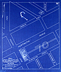 | Details | Fuller and Whitney | 1886 |
| Antique blueprint plan of Boston near Huntington and Massachusetts Avenues |
|
Fuller and Whitney |
|
| 1886 |
| LOC: |
| $300.00 | Fuller-and-Whitney | Antique-blueprint-plan-of-Boston-near-Huntington-and-Massachusetts-Avenues | Original cadastral blueprint plan from Jan. 1, 1886 of a portion of the Boston' Back Bay east of Massachusetts Avenue. The area includes the current location of the Boston Philharmonic Orchestra at 236 Huntington Ave. In the upper portion of the plan an artifact of the blueprint process reveals where a piece of lint or vegetation landed between the surveyor's trace and blueprint paper during exposure of the paper to sunlight.
<br></br>
The area for this blueprint in Boston, Massachusetts is bounded on three sides by Falmouth Street, West Chester Park (now Massachusetts Avenue) and St. Botolph Street. Verso is blank. Sheet is labeled "M". |
| 5375 |  | Details | Louisville and Nashville Railroad | 1886 |
| Birds Eye View of Gulf Coast Louisville and Nashville Railroad |
|
Louisville and Nashville Railroad |
|
| 1886 |
| LOC: |
| $725.00 | Louisville-and-Nashville-Railroad | Birds-Eye-View-of-Gulf-Coast-Louisville-and-Nashville-Railroad | </br>"The Great Through Car Line Between the North and South."</br>
"Unrivaled in Speed, Construction and Equipment."
<br></br>
Fine bird's eye view of the central Gulf Coast highlighting the route of the Louisville and Nashville Railroad from Mobile, Alabama, through Mississippi, to New Orleans, Louisiana. The route includes Bay St. Louis, Ocean Springs, Pass Christian, Mississippi City, Biloxi, Pascagoula. Numerous steam-powered and wind-powered vessels are shown plying the waters of the Gulf of Mexico, Lake Ponchartrain and the Mississippi River.
<br></br>
Six-panel folding map, neatly folded inside a 64-page pamphlet (4.5 " x 7.25") titled "The Gulf Coast". With the ink stamp of Sam. B. Jones, General Agent, New York. Published by the passenger department of the Louisville and Nashville R.R.
<br></br>
Printed in Louisville, KY by the Press of the Courier-Journal Job Printing Company. |
| 1361 |  | Details | Depot de la Marine | 1886 |
| Antique chart of the United States West Coast |
|
Depot de la Marine |
|
| 1886 |
| LOC:2001 |
| $550.00 | Depot-de-la-Marine | Antique-chart-of-the-United-States-West-Coast | Large folding nautical chart of the West Coast of the United States from past San Diego, California in the South to Queen Charlotte Sound and Moresby Island in British Columbia, Canada. Published by France's Depot de la Marine in 1862 but this edition with essential corrections dates to 1886.
<br></br>
With owners overstamps from the Library of Canadian Energy, Mines, and Resources Department in 1969 and 1976. Chart Number 1979. |
| 1130 |  | Details | Ocean Steamship Company of Savannah | 1886 |
| Antique Trade Card for the Ocean Steamship Company of Savannah Georgia |
|
Ocean Steamship Company of Savannah |
|
| 1886 |
| LOC:41 |
| $270.00 | Ocean-Steamship-Company-of-Savannah | Antique-Trade-Card-for-the-Ocean-Steamship-Company-of-Savannah-Georgia | Rare trade card for the <b>Ocean Steamship Company of Savannah</b>. This antique trade card records the names of steamships and their sailing dates for this Savannah, Georgia based shipping company.
<br></br>
The Ocean Steamship Company of Savannah was founded in 1872 with passenger and cargo service between the cotton export port of Savannah, Georgia and the northern export ports of New York and Boston. This company was a subsidiary of the Central of Georgia Railway and was integral in moving cotton from Georgia and Alabama to New York and Boston, Massachusetts over the next seventy years.
<br></br>
Steamships listed on the card include:
<div class="indenttextblock">
<ul style="list-style-type: circle;">
<li>City of Augusta</li>
<li>Chattahoochee></li>
<li>Tallahassee></li>
<li>City of Savannah></li>
</ul>
</div>
Sailing dates listed on the back of the card are for routes from New York to Savannah, GA. during November 1886. |
| 8039 |  | Details | Mason, W.A. | 1887 |
| Unrecorded Manuscript Trace Cambridgeport Lands Frederick Lothrop Ames |
|
Mason, W.A. |
|
| 1887 |
| LOC:1401 |
| $2,750.00 | Mason--W-A- | Unrecorded-Manuscript-Trace-Cambridgeport-Lands-Frederick-Lothrop-Ames | A large, unrecorded pen and ink trace map on tracing cloth depicting lands on the Charles River Flats then held by the estate of Frederick Lothrop Ames (1) and associated owners, on the site now occupied by the Massachusetts Institute of Technology. The map was copied by William H. Whitney after Mason in the same month that the Massachusetts Legislature passed legislation that forced the cities of Cambridge and Boston to build the Harvard Bridge and share costs (2). Some portion of the map is attributed in pencil to a blueprint in Ames' possession, likely by W. A. Mason. Verso with the oval blue ink overstamp of William H. Whitney and index number 313.
<br><br>
The map was prepared in 1887, at a moment when the Charles River Embankment Company had begun construction of its granite seawall and was actively filling the Charles River Flats with dredged material from the river. It shows significant detail of the hydrography of the area including height in feet above low water at spring tide and the course of several small waterways including a detailed survey of Goff's Cove.
<br><br>Using the west line of the proposed Main Street extension, later realized as the Harvard Bridge, as a fixed boundary, and reading the notation on the mapped boundary, it appears Ames had already deeded lands west of this line to the Embankment Company. This drawing would have served as the working basis for negotiations over the remaining eastern portion of the Flats still under his ownership.
<br><br>
The sheet approximately covers the Charles River Flats from the navigable canal on the east to Goff's Cove on the west, and from the Boston and Albany Branch Railroad south to the planned 200 foot parkway along the riverbank. Detailed annotations at center record precise parcel boundaries totaling more than 2.3 million square feet and specify the fractional ownership interests of four parties, including Ames and the Charles River Embankment Company. Scale 80 feet to 1 inch.
<br><br> |
| 8060 | 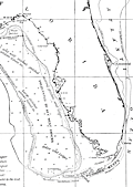 | Details | Goode, G. Brown | 1887 |
| Late 19th Century Map of Gulf Coast Fishing Grounds |
|
Goode, G. Brown |
|
| 1887 |
| LOC: |
| $165.00 | Goode--G--Brown | Late-19th-Century-Map-of-Gulf-Coast-Fishing-Grounds | An early federal fisheries chart of the northern Gulf of Mexico titled <i>Fishing Grounds of the Gulf Coast of the United States</i> (Chart No. 16), covering the coast from the Mississippi Delta and Mobile Bay east to the Florida Keys and Cape Canaveral. The map plots depth soundings in fathoms and outlines key offshore banks and ledges, with dotted boundaries marking the reported limits of the red snapper and grouper fishing grounds. Notes identify the operating ranges of Gulf fishing smacks and indicate principal fishery localities along the shore, capturing a working geography of the region at the height of nineteenth century commercial sail fisheries.<br><br>
Issued as part of the U.S. Fish Commission publication <i>The Fishery Industries of the United States</i> (Section III), the sheet is significant as an early attempt to translate fishermen's local knowledge into a standardized, survey-like document. It helped define where high value reef and bottom fisheries were concentrated relative to depth and distance offshore, information central to the expansion of long range Gulf fishing and the emerging national seafood trade. Today it also serves as a baseline record of fishing grounds and practices before twentieth century industrialization, making it valuable for historians of American maritime economy and for long term environmental comparison.
<br><br>
"The Fishery Industries of the United States". 1887. Section 3. Page 62.<br><br> |
| 3610 |  | Details | O'Neal, Robert | 1887 |
| Unusual antique cadastral map of St. Andrews Bay, Florida |
|
O'Neal, Robert |
|
| 1887 |
| LOC:0 |
| $0.00 | O-Neal--Robert | Unusual-antique-cadastral-map-of-St--Andrews-Bay--Florida | SOLD<br></br>
Early, scarce cadastral map of St. Andrews Bay and lands owned by the St. Andrews Bay Rail Road and Land Company. Florida related. Noted features include Spanish Shanty Point, two mills, a hotel, Redfish Point, Pearl Bayou, Laughton's Bayou, Grand Lagoon, Hurricane Isle, and a "Road to Chipley".
<br></br>
A report by Pamela Brown for the University of Florida’s Soil and Water Department notes:
<div class="indenttextblock">
"A Cincinnati mail-order company, the Saint Andrew Bay Railroad, Lands, and Mining Co., bought property in the Saint Andrew Bay area, and started nationally advertising 25 feet x 82 feet lots for $1.25. The advertisement attracted a lot of people and started a settlement boom as over 300,000 lots were sold. As the price for lots increased to $8.00, the company went bust." <a href="https://soils.ifas.ufl.edu/media/soilsifasufledu/sws-main-site/pdf/technical-papers/Brown--Pamela-Sue.pdf" target="_blank">Online, p. 46)</a>
</div>
</br>
Oyster bars shown with " |||| " symbols. Additional manuscript compass rose. Scale 1 inch = 1 mile. Copyrighted by Robert O'Neal May 27th, 1887.
<br></br>
Map is accompanied with an early Warranty Deed issued by the St. Andrews Bay Railroad, Land, and Mining Co. in 1877 for a lot in a specified Block, Township, and Range on the map. Price for the lot in 1887 was $1.25. |
| 980 |  | Details | U.S. Coast and Geodetic Survey | 1887 |
| Antique chart of Cuttyhunk to Block Island with Narragansett Bay |
|
U.S. Coast and Geodetic Survey |
|
| 1887 |
| LOC:53 |
| $1,250.00 | U-S--Coast-and-Geodetic-Survey | Antique-chart-of-Cuttyhunk-to-Block-Island-with-Narragansett-Bay | Large, original, antique nautical chart of the New England coast (1887) including Narragansett Bay. Superb condition. Coverage includes the northern tip of Block Island and extends from Perrysville/Point Judith/Wakefield westward to past the <b>Hen and Chickens light vessel</b> and <b>Cuttyhunk Lighthouse</b>. This original navigation chart includes the surrounding bays, rivers, and islands of Connecticut, Massachusetts, and <b>Rhode Island</b>. Manuscript notations in ink on the verso indicate this chart was one of two purchased in 1887 for the ship "Asia". The old maritime chart shows fine detail and will display beautifully.
<BR> </BR>
Key geographic features include Fall River, Sakonnet River, Conanicut Island, East Tern Passage, and Mt. Hope Bay. Noted points of interest include Providence, Bristol, Warren, Newport, Wickford, East Greenwich, Apponaug, the Old Colony and Newport RR, and Brenton's Reef Light Vessel. Contains a table of lighthouses and a tide table as well as notations about lightships, soundings, and bottom abbreviations.
<BR> </BR>
First produced by the U.S. Coast and Geodetic Survey in 1876, this chart was reprinted in 1887 with corrections to the aids to navigation. Contains great detail of topographic and hydrographic features with hundreds of soundings and numerous aids to navigation.
<BR> </BR>
With the circular logo of the United States Coast and Geodetic Survey. Chart number 113. Electrotype copy No. 9. Price 40 cents when issued. |
| 5060 | 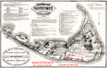 | Details | Old Colony Railroad Company | 1887 |
| Historical Map of Nantucket Surveyed and Drawn by the Rev. F. C. Ewer. D. D. 1869 |
|
Old Colony Railroad Company |
|
| 1887 |
| LOC:0 |
| $0.00 | Old-Colony-Railroad-Company | Historical-Map-of-Nantucket-Surveyed-and-Drawn-by-the-Rev--F--C--Ewer--D--D--1869 | NOT AVAILABLE <br></br>Map of Nantucket Island, 1887 after Reverend F.C. Ewer in 1869. Printed on very thin paper with a section of Nantucket Island identified in red as property of the <b>Nantucket Surf Side Land Co.</b>
<br></br>
Historical Map of Nantucket Surveyed and Drawn by the Rev. F. C. Ewer. D. D. Produced by Old Colony Line "the shortest, quickest, best and only direct route between Boston or New York and Nantucket and Martha's Vineyard." With red ink notations advertising the Nantucket Surf Side Land Company, 46 School Street, Boston, Massachusetts, offering for sale lots for $10 and upwards.
<br></br>
Contains three columns of historical information about Nantucket, arranged chronologically for the seventeenth, eighteenth, and nineteenth centuries. Latest entry is for 1886:
<div class="indenttextblock">
Cable communication with Nantucket by the U.S. Signal Service. Consolidation of the N. & C. C. Steamboat Company with the N. B., V. & Nant. Steamboat Co. with corporate name "New Bedford, Martha's Vineyard and Nantucket Steamboat Company." Steamer Nantucket built by the same Company, and placed upon the route in July.
</div> |
| 3590 | 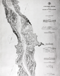 | Details | U.S. Coast and Geodetic Survey | 1888 |
| Chart of Columbia River with Washington Oregon Kalama |
|
U.S. Coast and Geodetic Survey |
|
| 1888 |
| LOC:63 |
| $350.00 | U-S--Coast-and-Geodetic-Survey | Chart-of-Columbia-River-with-Washington-Oregon-Kalama | Rolled chart of the Columbia River from Kalama to Fales Landing. Includes portions of both Oregon and Washington states; St. Helen, Columbia City. With tables of authorities, buoys, river lights, abbreviations. Sheet number 5 of the series. Individually published and priced. Heavy paper consistent with the expected use for navigation onboard river vessels.
<br></br>
No mention of the use of the electrotype process. Presumed printed with original plate.
<br></br>
With the circular logo of the United States Coast and Geodetic Survey. Scale 1/40,000. Chart number 641. Issued May 1888. Price when issued: 25 cents. |
| 3630 | 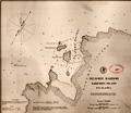 | Details | U.S. Coast and Geodetic Survey | 1888 |
| Early chart of St. John Harbor, Zarembo Island, Alaska |
|
U.S. Coast and Geodetic Survey |
|
| 1888 |
| LOC:10 |
| $300.00 | U-S--Coast-and-Geodetic-Survey | Early-chart-of-St--John-Harbor--Zarembo-Island--Alaska | Early chart of St. John Harbor on Zarembo Island in S.E. Alaska. Printed by the U.S. Coast and Geodetic Survey as a separately issued harbor chart for a price of 15 cents at the time.
<br></br>
Zarembo Island is an island in the Alexander Archipelago of southeastern Alaska, United States. It lies directly south of Mitkof Island and northwest of Etolin Island.
<br></br>
Rare to find old Coast Survey charts of this remote an area on such heavy paper. With red stamp of the U.S. Geological Survey library. Chart is believed to have been an institutional file copy. |
| 5312 |  | Details | Rogers, P. D. | 1888 |
| Antique cyanotype cadastral map Harwood Volusia County Florida Old Kings Road |
|
Rogers, P. D. |
|
| 1888 |
| LOC:53 |
| $0.00 | Rogers--P--D- | Antique-cyanotype-cadastral-map-Harwood-Volusia-County-Florida-Old-Kings-Road | SOLD<br><br>Rare early cyanotype (blueprint) cadastral plat map of the subdivision of <b>Harwood</b> in Volusia County, Florida (near Bulow Creek State Park), bounded to the west by the <b>Old King's Road</b>. Only known cadastral map that locates the failed "Harwood" settlement. The plat is the oldest of two known reference sources for the location of the Old King's Road in Volusia County. A valuable historic reference, the map shows land use: marsh, hammocks, islands, and groves.
<br></br>
The Harwood settlement was planned by orange grower Norman B. Harwood who in 1880 purchased 4,000 acres in Volusia County, including the Ormond Plantation "Damietta" [1]. The Harwood settlement was a failure. Deeply in debt, Norman Harwood died in May, 1885.</b>
<br></br>
During the second Spanish occupation of Florida, Spain granted large tracts of land in the Tomoka basin to settlers as an inducement to move to the region. These settlers included the Ormonds, Bulows [2], McHardys [3], and Dummitts [4].
<br></br>
Surveyed in 1888 by Civil Engineer P. D. Rogers of Daytona, Florida. North oriented at right. Manuscript notations.
<br></br>
The plat shows the tomb of James Ormond II who died September 30, 1829 (now Ormond Tomb State Park). Includes an inset context map of the Florida coast from Jacksonville to Mosquito Inlet with the St. Johns River. The context map shows the settlement of Harwood prominently near the coast just north of Ormond, Fla.
<br></br>
<b>NOTES:</b><br>
[1] The landmark Fairchild Oak and the Ormond Tomb (see plat) are both located on land shown on this plat. The Spanish granted sea captain James Ormond 2,000 acres in 1807.<br>
[2] Bulow Creek bounds the property to the northeast alongside a now lost "Atlantic Avenue".<br>
[3] Robert Mc Hardy, a surveyor, received a Spanish grant of 1,100 acres in 1808. <br>
[4] Dummitt Plantation, directly south of this plat, was the site of the first steam-powered sugar mill in the area. |
| 6687 | 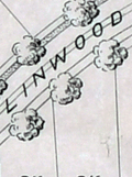 | Details | Olmsted, F. L. and Company | 1889 |
| F.L. Olmsted heliotype landscape plan Linwood Lynn Massachusetts |
|
Olmsted, F. L. and Company |
|
| 1889 |
| LOC:50 |
| $875.00 | Olmsted--F--L--and-Company | F-L--Olmsted-heliotype-landscape-plan-Linwood-Lynn-Massachusetts | Rare finely-detailed heliotype (1) plat and landscape plan by Frederick Law Olmsted for the Linwood development, in Lynn, Massachusetts, 1889. WorldCat lists only one copy, at Harvard. Heliotype Printing Co., Boston. R.R. Jones, del.
<br><br>
<div class="indenttextblocksingle">
"John Charles and Frederick Law Olmsted developed the Linwood subdivision on the estate of Philip Tapley, a hilltop property with views of striking features like Breed’s Pond and Lynn Harbor. With the site's steep topography, the pair faced challenges and had to make strategic design choices to maximize space on the hilltop plateaus. Plans show that roughly 218 lots were mapped to house large single-family homes. Unfortunately, Linwood was never developed (1).
<br>
</div>
<br>
In 1889, F. L. Olmsted designed Linwood, a neighborhood in Lynn, Massachusetts. The Linwood neighborhood was a unique project at the time, as it was one of the earliest examples of a planned suburban community. Olmsted was hired by the developers of the Linwood project, the Lynn Land Company, to design the landscape and street plan for the neighborhood. Olmsted's plan for Linwood included winding streets, spacious lots, and plenty of green space. He also designed a park in the center of the neighborhood, which he called "The Park at Linwood."
<br><br>
September, 1889. F. L. Olmstead & Co. Landscape Architects. Brookline, Mass. 1889. and Isaac K. Harris, Engineer. Lynn, Mass.
<br><br> |
| 3589 | 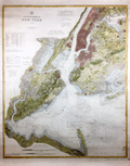 | Details | U.S. Coast and Geodetic Survey | 1889 |
| Huge antique chart of New York Bay and Harbor |
|
U.S. Coast and Geodetic Survey |
|
| 1889 |
| LOC:1401 |
| $3,250.00 | U-S--Coast-and-Geodetic-Survey | Huge-antique-chart-of-New-York-Bay-and-Harbor | A spectacular, large (48" high) antique nautical chart of New York Bay and Harbor from 1889. Beautiful hand coloring enhances the attractiveness of this scarce and fine engraving. Two sheets professionally joined.
<br></br>
This chart was printed in 1889 from an electrotype copy of the original hand-engraved copper plate, a process the U.S. Coast Survey adopted around 1850. As a soft medium, copper plates could only withstand print runs of perhaps 200 copies before the plates wore down. To enable larger print runs, a mold of the original plate was created in wax or another soft medium. Then, using an electro-chemical process ( electrotyping ), the mold was coated with a metal layer, typically copper. Printers were then able to produce output from the new electrotype copper copy, while preserving the original. Electrotype copy number 3.
<br></br>
With the circular logo of the United States Coast and Geodetic Survey. Tables of lighthouses and lightships. Two inset coastal elevation views. Scale 1/40,000. Chart number 369. Published August, 1889. Plate number 1987. Price when issued: 75 cents. |
| 8058 |  | Details | Boston Water Board | 1889 |
| Boston Water Works Blueprint Plan 1889 Sudbury Cochituate Mystic Water Supply Diagram |
|
Boston Water Board |
|
| 1889 |
| LOC:41 |
| $375.00 | Boston-Water-Board | Boston-Water-Works-Blueprint-Plan--1889-Sudbury-Cochituate-Mystic-Water-Supply-Diagram | |
| 206 |  | Details | Anonymous | 1889 |
| Brochure- Boston Gloucester Steamboat Co. |
|
Anonymous |
|
| 1889 |
| LOC:0 |
| $0.00 | Anonymous | Brochure--Boston-Gloucester-Steamboat-Co- | SOLD
<br><br/>
Highly decorative and collectible antique folding coastal map / brochure from the Boston and Gloucester Steamboat Company 1889 season. Colorful, quaint map with ships wheel decoration (far right) is a full 7" x 15" when folded out from the brochure and would frame beautifully. Map covers the coast between Boston and Portland Maine including Salem, Marblehead, Newburyport, and Cape Ann. Includes steamer schedule and pier locations. <BR> </BR>
Front cover page contains a picturesque view of a steamboat with sails underway. Two pages include descriptions of sights along the route: Swampscott, Nahant, Marblehead… One-page advertisement for a new residential development near the Gloucester harbor- Eastern Point. |
| 1218 |  | Details | Anonymous | 1889 |
| Boston and Gloucester Steamboat Company pass for 1888 |
|
Anonymous |
|
| 1889 |
| LOC:0 |
| $70.00 | Anonymous | Boston-and-Gloucester-Steamboat-Company-pass-for-1888 | An antique Boston and Gloucester Steamboat Company annual pass for the year 1888. On green card stock. Issued as number 116. Valid until January 1, 1889. Ship's wheel decoration with the date "1888".
<br></br>
Boston and Gloucester Steamboat company began year round service in 1870 and continued operating between Boston and Gloucester until 1926 when they ceased operations. Steamboats from the line included the "Ella Knight", "George Chaffee", "City of Gloucester", and the "Cape Ann" a steel-hulled propeller driven vessel of 171 feet in length.
<br></br>
Text on the verso of this antique pass with rules and stipulation for use of the pass. |
| 108 |  | Details | Anonymous | 1889 |
| Goat Island Ledge |
|
Anonymous |
|
| 1889 |
| LOC:0 |
| $45.00 | Anonymous | Goat-Island-Ledge | Corps of Engineers survey map shows Goat Island, Great Island, and Seavy's Island and a marked 'sailing course' through the nearby waters. Land areas identified through neat orange hachuring. |
| 1140 |  | Details | Boston and Lockport Block Company | 1890 |
| Late 19th Century Trade Catalog of Ships Blocks |
|
Boston and Lockport Block Company |
|
| 1890 |
| LOC:0 |
| $255.00 | Boston-and-Lockport-Block-Company | Late-19th-Century-Trade-Catalog-of-Ships-Blocks | Early trade catalog of ships blocks (pulleys) from a well-known U.S. manufacturer, the Boston and Lockport Block Company ca. 1890.
<br></br>
List of contents from the index includes:
<div class="indenttextblock">
<ul style="list-style-type: circle;">
<li>Blocks for rope straps</li>
<li>Dead eyes</li>
<li>Fiddle blocks for yachts</li>
<li>Jib sheet blocks for yachts</li>
<li>New style yacht blocks with wooden cheeks</li>
<li>Snatch blocks for yachts</li>
<li>Wood dock blocks</li>
<li>Wrought iron blocks</li>
</ul>
</div>
Boston and Lockport used a star as their brand mark. Many of the pages in the catalog are overprinted in yellow with a star and the phrase "Star Brand". 47 pages plus index. |
| 1219 |  | Details | Thaxter, Samuel and Son | 1890 |
| Samuel Thaxter and Son, Boston, trade card |
|
Thaxter, Samuel and Son |
|
| 1890 |
| LOC:0 |
| $325.00 | Thaxter--Samuel-and-Son | Samuel-Thaxter-and-Son--Boston--trade-card | Scarce trade card for the Boston, Massachusetts firm of <b>Samuel Thaxter and Son</b>. Samuel Thaxter was an importer and manufacturer of nautical and optical instruments. Thaxter was the publisher of Eldridge's charts and coast pilots, and an agent for U.S. Coast Survey charts and books. During this period, they operated from a store at 125 State Street, Boston.
<br></br>
Samuel Thaxter and Sons sold sextants, charts, compasses, binnacles, levels, and other nautical items that occasionally are found on the antiques market today.
<br></br>
Absence of red overprinting of a new address at bottom of card suggests a date between 1880 and 1900. Verso carries the following historical information about the firms' genesis:<br></br>
<div class="indenttextblock">
<b>One Hundred Years Under One Sign</b>
<br></br>
(From the Boston Evening Transcript, February 2d 1873.)
<br></br>
In 1779 William Williams carried on the Nautical-Instrument business in King, now State Street, having as a sign an image called "Admiral Vernon". In 1794 Samuel Thaxter, who married his niece, succeeded him and carried on the business in his own name thirty years. Then, taking his son a partner, the style of the firm was changed to S. THAXTER & SON, under which name it has continued the last fifty-one years at 125 State Street, corner Broad Street. Samuel Thaxter Cushing, grandson of S. Thaxter has been connected with the business thirty-eight years, and for the last thirty-three years, the only surviving partner. For all that time the "Admiral" with his quadrant has stood guard and stands guard now, on State Street, fit prototype of the smart little image displayed by Walter's uncle as chronicled in "Dombey & Son".</div> |
| 1423 |  | Details | Anonymous | 1890 |
| 19th-Century Map of North America |
|
Anonymous |
|
| 1890 |
| LOC:0 |
| $55.00 | Anonymous | 19th-Century-Map-of-North-America | Two 19th-century maps on a single sheet. On recto is a bold, colorful map of North America. On the verso a map of the eastern Hemisphere. |
| 1077 |  | Details | Anonymous | 1890 |
| Patriotic American Frontispiece with Berghaus's Star Projection |
|
Anonymous |
|
| 1890 |
| LOC:0 |
| $0.00 | Anonymous | Patriotic-American-Frontispiece-with-Berghaus-s-Star-Projection | SOLD<br></br>
Interesting small print reflecting the USA's perceived importance to the world. An American bald eagle hovers above a map of the world shown with Berghaus's Star Projection.
<div class="indenttextblock">
A variation of Petermann's map, Hermann Berghaus's star projection (1879) reduced the number of appendages to five uniform lobes, with boundary meridians at 160°W, 88°W, 16°W, 56°E and 128°E. Of all major land masses, Australia and Antarctica are interrupted. This design became much more popular than Petermann's, appearing in atlases and in the logo of the Association of American Geographers. (Retrieved 5/18/2016.
<a href="http://www.progonos.com/furuti/MapProj/Normal/ProjInt/ProjStar/projStar.html" target="_blank">Internet </a>)
</div>
<br></br>
Below the image is a ribbon with the motto of the United States: "e pluribus unum". Probably published in the last two decades of the 19th century. |
| 6559 |  | Details | de Witt, Simeon | 1890 |
| Unusual manuscript trace map of New York state after Simeon de Witt 1802 |
|
de Witt, Simeon |
|
| 1890 |
| LOC:141 |
| $350.00 | de-Witt--Simeon | Unusual-manuscript-trace-map-of-New-York-state-after-Simeon-de-Witt-1802 | One of a kind finely detailed manuscript blue ink trace of sheet 6 from "A Map of State of New York" after Simeon de Witt, 1802. On tracing cloth. This map represents an exceptional effort that likely took days for the anonymous creator to lay down. With a few manuscript notes at bottom right that suggest the trace was created from the copy of de Witt's map held at the New York Public Library (1). Estimated date of creation ca. 1890.
<br><br>
A fine gift for collectors of New York cartography or of rare cartographic oddities.
<br><br>
From an estate with three similar manuscript traced maps of foundational New York State maps by David H. Burr, and <a href="https://www.rarecharts.com/ShowDetail/Creator/Hawkes--W--and-Barber--J-/Title/Manuscript-isodistance-map-of-the-New-York-City-area-after-Hawkes-and-Barber/6560" target="_blank">Hawkes and Barber. </a> Some hydrographic and marshy features in green ink, red ink for roads and highways, brown for political boundaries. Simeon de Witt's original map did not use color to identify these features. At bottom right, in manuscript, a copy of the original title cartouche that was not originally placed on sheet 6, demonstrating the tracer's access to multiple sheets of de Wits map.
<br><br>
(1) Lionel Pincus and Princess Firyal Map Division, The New York Public Library. "Map of the state of New York" The New York Public Library Digital Collections. 1802. https://digitalcollections.nypl.org/items/510d47df-f4d8-a3d9-e040-e00a18064a99 |
| 6560 |  | Details | Hawkes, W. and Barber, J. | 1890 |
| Manuscript isodistance map of the New York City area after Hawkes and Barber |
|
Hawkes, W. and Barber, J. |
|
| 1890 |
| LOC:141 |
| $700.00 | Hawkes--W--and-Barber--J- | Manuscript-isodistance-map-of-the-New-York-City-area-after-Hawkes-and-Barber | Very unusual and one-of-a-kind manuscript traced map ca. 1890 (on tracing cloth) of the area around New York City- after Hawkes and Barber's "The Country twenty five miles round New York" (1777). Text below the map contains a list of important events during the U.S. Revolution in 1776. A key feature of the map is the early use of <b>isodistances</b>, concentric circles at increasing five-mile intervals centered on the city of New York.
<br><br>
This map represents an exceptional effort that likely took days for the anonymous creator to trace. Fine attention to detail and careful execution suggest that the copy was created for research purposes, or possibly for the purpose of producing blueprints from this master trace document. With a few manuscript notes at bottom right that suggest the trace was created from the copy of Hawkes and Barber's map held at the New York Public Library (1).
<br><br>
A fine gift for collectors of New York cartography or of rare cartographic oddities.
<br><br>
From an estate with three similar manuscript trace maps of foundational New York State maps by <a href="https://www.rarecharts.com/ShowDetail/Creator/de-Witt--Simeon/Title/Unusual-manuscript-trace-map-of-New-York-state-after-Simeon-de-Witt-1802/6559"" target="_blank"> Simeon de Witt </a> and David H. Burr. Riverine features in green ink, red ink for highways and roads, brown for political boundaries and for isodistances.
<br><br>
(1) Lionel Pincus and Princess Firyal Map Division, The New York Public Library. "The Country twenty five miles round New York" The New York Public Library Digital Collections. 1777-01-01. https://digitalcollections.nypl.org/items/510d47da-ee36-a3d9-e040-e00a18064a99 |
| 5365 |  | Details | Anonymous | 1890 |
| Surveyors manuscript trace plat of Little Nahant Island, Massachusetts |
|
Anonymous |
|
| 1890 |
| LOC:13 |
| $750.00 | Anonymous | Surveyors-manuscript-trace-plat-of-Little-Nahant-Island--Massachusetts | Very rare unrecorded, manuscript surveyors' trace plat map of lots on Little Nahant Island, Massachusetts which lies north-east of Boston in Nahant Bay. The pen and ink trace, on supple surveyor's "tracing cloth" would have been used as a master to create blueprint copies.
<br></br>
Carries pencil surveyor's collation number 2013. Includes a fine late 19th century compass rose at bottom right. Estimated date ca. 1885.
<br></br>
Anonymous trace map but stylistically similar to those of W. H. Whitney from the 1890's. |
| 5394 |  | Details | Whitney, William H. | 1890 |
| Historical map of Watertown |
|
Whitney, William H. |
|
| 1890 |
| LOC: |
| | Whitney--William-H- | Historical-map-of-Watertown | A lot of three (3) artifacts related to William Whitney's unpublished historical map of Watertown.
1) Blueprint map and MS ownership notes after Henry Bond.
2) Blueprint
3) Surveyor's trace "Whitney's Watertown Historical Map" 1000' = 1"
In 1751 Henry Bond published his <strong> Map of the original allotments of land and the ancient topography of Watertown (proper) [1]</strong> Ownership on Whitney's map matches Bond's map but Whitney notes only a fraction of the total of the place names Bond documented. |
| 4801 |  | Details | Rathbun, Frank A. | 1890 |
| Early Cyanotype Advertisement for Rathbun's Wagon Jack and Wrenches |
|
Rathbun, Frank A. |
|
| 1890 |
| LOC:10 |
| $560.00 | Rathbun--Frank-A- | Early-Cyanotype-Advertisement-for-Rathbun-s-Wagon-Jack-and-Wrenches | A rare 19th-century <b>cyanotype print folk-art advertisement</b> ca. 1890 for F.A. Rathbun's wagon jack and wrenches. No other copy of any advertisement for Rathbun or his equipment is found online. The blueprint (cyanotype) photographic process, invented in 1842, was not adopted widely as a business document reproduction technology until after 1880.
<br></br>
With two cartoon-like drawings illustrating the "Worst Way" and the "Best Way" to change a wheel on a buggy or wagon (no mention of automobiles). The best way according to the author is Rathbun's Wagon Jack and Wrenches. Compliments of F.A. Rathbun Beloit, Wisconsin.
<br></br>
With an additional 3" x 7" cyanotype print of a large wrench labeled "F.A. Rathbun Beloit Wis."
<br></br>
The ad copy reads:
<div class="indenttextblock">
"Compliments of F.A. RATHBUN. BELOIT WIS. Manufactuer [sic] of his celebrated Wagon Jacks & Wrenches. By the use of which any one can grease thier [sic] wagon or buggy in less then one half the time required by the use of any other jack and wrench in the market without soiling hands or clothes. The pecular [sic] construction of the jack and manner in which it is used, recommmends its-self to all who know the trouble usually experienced with all jacks that have to be used under the buggy. This is the only jack that can be used at the end of the axle so that the wheel can be slid out on it for support. The 'wrench' also recommends itself to all who would avoid geting [sic] themselves greasy and dirty or straws and dirt on the nut to be scraped off or remain on to wear out the spindle. It is always ready. Never slips, and is quickly and easily operated. All who have used them recommed [sic] them to others. Liberal discount, to the trade and agents."
</div>
In April 1887 Frank A. Rathbun a machinist of Beloit Wis. assigned a patent he held on a wheeled scraper to F.W. Kimball of Milwaukee, Wis. However there is no mention of a patent on Rathbun's wagon jack. |
| 4856 |  | Details | Danforth, Frederic | 1890 |
| Manuscript Belfast, Maine Water Company Plan for Robert Elwell |
|
Danforth, Frederic |
|
| 1890 |
| LOC:0 |
| $1,150.00 | Danforth--Frederic | Manuscript-Belfast--Maine-Water-Company-Plan-for-Robert-Elwell | Original four-foot wide manuscript survey of Water Reservoir Number 1 at Belfast, Maine. "Plan of Land of the Belfast Water Company Made for Robert Elwell." By Frederic Danforth C.S. Dated within at October, 1890. Laid to linen.
<br></br>
The Belfast Water Company was founded in 1887 after two major fires (1865, 1871) demonstrated the existing water supply was insufficient. Construction began on the reservoir with a 175 foot long dam near the mouth of Little River. Scale 1 inch = 80 feet.
<br></br>
The water district discontinued using the Little River reservoir in 1980. Today the brick pump house on the north side of the dam serves as the offices of the Belfast Water District.
<br></br>
<div class="indenttextblocksingle">
Frederick Danforth, son of Judge Charles Danforth, was born in 1848. He graduated from Dartmouth College, specializing in civil engineering. After graduation Danforth settled upon the career of railroad engineering. In 1876, after an engagement with the European and North American railway Danforth established an office in Gardiner, and in 1891 he was elected a member of the American Society of Civil Engineers. (Online: http://files.usgwarchives.net/me/kennebec/gardiner/history/
kingsbury/gardiner/kengard.txt.)
</div> |
| 2578 |  | Details | Mobile Chamber of Commerce | 1890 |
| Antique Map Demonstrating Mobile's Suitability as a Gateway for Trade |
|
Mobile Chamber of Commerce |
|
| 1890 |
| LOC:88 |
| $165.00 | Mobile-Chamber-of-Commerce | Antique-Map-Demonstrating-Mobile-s-Suitability-as-a-Gateway-for-Trade | Small booklet ca. 1890 with a map of the Gulf Coast and Caribbean Sea showing distances for water-borne commerce. Addressed to "The Honorable Senators and Representatives of the Congress of the United States, Washington, D.C.".
<br></br>
The booklet contains an eight page section of text explaining the argument in favor of Mobile, as a shipping hub to the Caribbean, Mexico, and South America. According to the text a circle 600 miles in diameter with St. Louis at its center at that time contained a population of over 15,000,000 million persons and the richest area for production of agricultural products and livestock. Further, the authors argued that
<div class="indenttextblock">"Mobile, Alabama, by existing lines of railway, is 244 miles nearer the center of the circle (St. Louis) than any port upon the Atlantic Ocean and 50 miles nearer that any other port upon the Gulf of Mexico."</div> Printed by T. Fitzwilliam and Company, New Orleans. |
| 7918 |  | Details | Anonymous | 1890 |
| Early surveyor's trace map of a portion of Houston near Buffalo Bayou |
|
Anonymous |
|
| 1890 |
| LOC: |
| $425.00 | Anonymous | Early-surveyor-s-trace-map-of-a-portion-of-Houston-near-Buffalo-Bayou | A rare artifact from Houston, Texas. This manuscript ink cadastral map shows the subdivisions of one-third of a league originally granted to William Perkinson, located on the north side of Buffalo Bayou, several miles west of Houston, Texas. On translucent "tracing cloth", the artifact dates ca. 1890 and was a master copy to be used for reproducing the map via blueprinting. The map identifies property owners including Settegast, Hillendahl, Harden, Bauer, and Williams, along with Turkey Creek and Cedar Island, the former a tributary of Buffalo Bayou. The tract layout includes railroad lands and State School Lands, indicating later 19th-century subdivisions.
<br><br>
The Settegast and Hillendahl families were among the earliest German settlers in the Spring Branch area near Houston. By 1848, members of these families organized one of the first Lutheran services for what became St. Peter Church in Spring Branch. Today, the area depicted lies near the Memorial neighborhood of Houston, where Turkey Creek joins Buffalo Bayou, approximately a mile south of Interstate 10 and North Eldridge Parkway.
<br><br>
Surveyor’s note at lower margin read<i>s: “Map of the subdivisions of 1/3 of a league originally granted to Wm. Perkinson situated on the North side of Buffalo Bayou about ___ miles westwardly from the City of Houston.”</i>
<br><br>Verso is inscribed with the surveyor’s catalog number “311.” |
| 3663 |  | Details | Anonymous | 1891 |
| Antique lot plan of Coronado Heights in San Diego County |
|
Anonymous |
|
| 1891 |
| LOC:88 |
| $210.00 | Anonymous | Antique-lot-plan-of-Coronado-Heights-in-San-Diego-County | Plat map of Coronado Heights Subdivision in San Diego County, California produced a year after Coronado residents voted to incorporate. Shows the grounds for the Hotel de Coronado, completed in 1888, at that time the largest resort hotel in the world.
<br></br>
Includes a boulevard to Coronado Beach as well as the tracks for the Coronado Railway, a street railway system to carry a 50-seat excursion car and steam locomotive. With notes indicating the size of blocks and street width. |
| 4791 |  | Details | Ferbrache and Welton | 1891 |
| Unrecorded antique real estate map for Chicago Heights addition |
|
Ferbrache and Welton |
|
| 1891 |
| LOC:88 |
| $350.00 | Ferbrache-and-Welton | Unrecorded-antique-real-estate-map-for-Chicago-Heights-addition | Unrecorded map and advertisement from 1891 for Ferbrache and Welton's new addition near the nascent Chicago Heights development, then under construction, located to the south of Chicago, Illinois. No other copy of this map and sales advertisement is located anywhere.
<br></br>
A group of Chicago developers led by Charles Wacker established the Chicago Heights development in the 1890's as an industrial suburb. Wacker bought up much of the land around the two railroads. Developers convinced residents to change the name to “Chicago” to associate it with its booming neighbor to the north and “Heights”because the location is one of the highest in the county.
<br></br>
Key features on the map include Elgin, Joliet and Eastern Railway (or Outer Belt RR), , Michigan Central Railroad, Rolleston, the New Stock Yards, Joliet, Evanston, Waukegan, Lake Michigan.
<br></br>
Recto with a map of the Chicago area and the location of the new addition highlighted in red ink; Chicago Heights in black ink. Verso with a comparison of the Chicago Heights development vs. Ferbrache and Welton's new development that highlights the large profits investors could expect by buying in the addition where land was less expensive than in Chicago Heights. A list of reasons investors could make money by purchasing in 1891 include:
<div class="indenttextblock">
<ul style="list-style-type: circle;">
<li>The highest ground in Cook County.
<li>Railroads running over 100 trains per day.
<li>Abundant water supply…
</ul>
</div>
The ad concludes with a financial incentive that sounds too good to be true:
<div class="indenttextblock">
"You will attend the World's Fair of course [Opened May 1, 1893]. Then provide for all your expenses by buying a lot in this Subdivision and <b>we will guarantee to sell it for you by that time at a profit of over One Hundred Dollars ($100).</b>"
</div>
George H. Welton, Manager, 1008 Chamber of Commerce. |
| 8053 |  | Details | Appalachian Mountain Club | 1891 |
| Map of the Country About Worcester Compiled by Appalachian Mountain Club |
|
Appalachian Mountain Club |
|
| 1891 |
| LOC: |
| $1,100.00 | Appalachian-Mountain-Club | Map-of-the-Country-About-Worcester-Compiled-by-Appalachian-Mountain-Club | A scarce regional map of central Massachusetts titled <i>Map of the Country About Worcester</i>, published in 1891 by the Appalachian Mountain Club. The map is a sister publication to the Club’s <i>Map of the Country About Boston</i>, issued a year earlier in 1890, and extends AMC coverage westward from the Boston basin into the uplands and river valleys of interior Massachusetts. Only six institutional holdings are recorded in WorldCat, underscoring the map’s scarcity.<br><br>
The maps were compiled from multiple U.S. Geological Survey quadrangle sheets and reduced to a uniform scale. Together, the two sheets extend the Appalachian Mountain Club’s regional mapping beyond the Boston basin into central Massachusetts. Their production reflects the Appalachian Mountain Club’s effort to adapt official government mapping into practical regional maps suitable for recreational, educational, and reference use.<br><br>
The Worcester map appeared in 1891, the same year that <i>The Trustees of Public Reservations</i> was founded, marking a pivotal moment in Massachusetts conservation history. Both initiatives were closely associated with Charles Eliot, an early member of the Appalachian Mountain Club who became its Councilor of Topography in 1890 and was a leading advocate for systematic landscape preservation.<br><br>
As stated in the imprint, the map was “Published by the Appalachian Mountain Club from the proofs of the State map with the permission of the director of the United States Geological Survey and the Commissioners of the Topographic Survey of Massachusetts.” The sheet was lithographed by George S. Harris and Sons, with sales agents W. B. Clarke and Company of Boston and Putnam and Davis, Booksellers, Worcester. |
| 611 |  | Details | Stebbins, Nathaniel L. | 1891 |
| First Edition Stebbins' Illustrated Coast Pilot - 1891 |
|
Stebbins, Nathaniel L. |
|
| 1891 |
| LOC:0 |
| $465.00 | Stebbins--Nathaniel-L- | First-Edition-Stebbins--Illustrated-Coast-Pilot---1891 | FIRST EDITION of this antique, late 19th century landmark in coastal navigation from the famous Boston-based marine photographer Nathaniel Stebbins. An interesting late 19th century artifact that combined the (then) new technology of photography with the oldest known form of recorded navigational instructions- the <a href="https://en.wikipedia.org/wiki/Periplus">periplus</a> or book of written sailing directions.
<br></br>
Stebbins's fascinating antique coast pilot first demonstrated the practical application of photography to navigation, a field long dominated by man-made representations of coastal features. Contains numerous photographs of key landmarks and navigational aids accompanied by textual sailing directions. Among the hundreds of photographs are Stepping Stones lighthouse, Execution Rocks lighthouse, Stamford Harbor lighthouse, Bartlett Reef light vessel, Newport Harbor lighthouse, Hen and Chickens light vessel, Vineyard Sound light vessel, Hyannis wharf and range lights, Great Round Shoal light vessel (appears to be a decrepit wreck of a sailing vessel), Nantucket lighthouses at Brant Point and Great Point, and the Boston and Marblehead lighthouses. <BR> </BR>
Includes numerous interesting nautical advertisements. Covers the United States northeast from New York to Maine. <BR> </BR>
We are not aware of an earlier coast pilot containing photographic coastal images. Already scarce, this overlooked volume with a sea-worthy canvas cover belongs in the collection of all those interested in 19th century U.S. coastal charts. Numerous nautical-related advertisements scattered throughout. The author describes this internal advertising as an effort to hold down the cost to the reader. Boston. 1st ed. |
| 5094 |  | Details | U.S. Congress | 1891 |
| Map supplement showing boundaries of congressional districts in 1891 |
|
U.S. Congress |
|
| 1891 |
| LOC:2001 |
| $300.00 | U-S--Congress | Map-supplement-showing-boundaries-of-congressional-districts-in-1891 | Scarce volume of maps and population statistics for 1880 and 1890 published as a supplement to the congressional directory. Maps show counties/parishes and boundaries of congressional districts.
<br></br>
With exceptions noted below, 43 maps show all the states admitted to the Union as of 1890. The following states are not mapped as they had not been admitted to the Union: Arizona, New Mexico, Utah, Oklahoma, District of Columbia, Alaska, Hawaii.
<br></br>
By W.H. Michael, Clerk of Printing Records. Washington. Government Printing Office. 1891. 123 pages. |
| 340 |  | Details | U.S. Geological Survey | 1892 |
| Mouth of the Mississippi River |
|
U.S. Geological Survey |
|
| 1892 |
| LOC:0 |
| $0.00 | U-S--Geological-Survey | Mouth-of-the-Mississippi-River | SOLD
<BR> </BR>
Small antique lithographed chart of the Mouth of the Mississippi River. The chart, from the U.S. Geological Survey, is derived from a U.S. Coast Survey chart and overlaid with hachured topographic details. Lighthouses, soundings, life saving stations and navigational aids are shown. Water shown in blue. Some of the features shown include Lake Ponchartrain, Timbalier Pass, Bayou Lafourche, Pass Fourchon, Chandeleur Islands, Biloxi, and Pass Christian. <BR> </BR>
Produced for the U.S. Geological Survey Thirteenth Annual Report. Produced by George S. Harris Lithographers, Philadelphia. Plate 22. |
| 4913 |  | Details | New York, Providence and Boston Railroad | 1892 |
| Antique Chart New York, Providence and Boston Railroad |
|
New York, Providence and Boston Railroad |
|
| 1892 |
| LOC:62 |
| $550.00 | New-York--Providence-and-Boston-Railroad | Antique-Chart-New-York--Providence-and-Boston-Railroad | A foundational organizational diagram / map for collectors of ephemera related to the New York, Providence and Boston Railroad.
<br /><br/>
Very rare and very unusual cyanotype (blueprint) document showing the railroad and steamship lines, as of 1892, that comprised the New York, Providence and Boston Railroad (N.Y.P. & B.R.R.). Includes unusually-presented notes about dates of construction and leasing of the various component lines of the railroad within circular icons.
<br /><br />
A fine example of the use of the cyanotype process to create a map not intended for navigation but rather to inform the reader about the history of the railroad and its affiliated Providence and Stonington Steamship Company.
<br /><br />
Produced from Providence, Rhode Island by the Chief Engineer's Office in March, 1892. |
| 341 |  | Details | U.S. Geological Survey | 1892 |
| Turtle Harbor Florida |
|
U.S. Geological Survey |
|
| 1892 |
| LOC:3 |
| $75.00 | U-S--Geological-Survey | Turtle-Harbor-Florida | Small lithographed antique chart of Key Largo and Turtle Harbor Florida. The chart, from the U.S. Geological Survey, is derived from a U.S. Coast Survey chart and overlaid with hachured topographic details. Lighthouses, soundings, and navigational aids are shown. Water shown in blue. Some of the features shown include Pumpkin Key, Carysfort Reef, Angelfish Key, and Palo Alto Key. <BR> </BR>
Produced for the U.S. Geological Survey Thirteenth Annual Report. Produced by George S. Harris Lithographers, Philadelphia. Plate 36. |
| 342 |  | Details | U.S. Geological Survey | 1892 |
| Marquesas Keys (Florida) |
|
U.S. Geological Survey |
|
| 1892 |
| LOC:0 |
| $0.00 | U-S--Geological-Survey | Marquesas-Keys-(Florida) | SOLD
<br></br>
Small lithographed chart of Marquesas Keys, Florida. This antique chart, from the U.S. Geological Survey, is derived from a U.S. Coast Survey chart (no. 70) and overlaid with hachured topographic details. Soundings, and navigational aids are shown. Water shown in blue. Some of the features shown include Couch Key and Round Island. <BR> </BR>
Produced for the U.S. Geological Survey Thirteenth Annual Report. Produced by George S. Harris Lithographers, Philadelphia. Plate 36. |
| 343 |  | Details | U.S. Geological Survey | 1892 |
| Delta at Caesars Creek (Florida) |
|
U.S. Geological Survey |
|
| 1892 |
| LOC:3 |
| $75.00 | U-S--Geological-Survey | Delta-at-Caesars-Creek-(Florida) | Small lithographed antique chart of the area around Caesars Creek, on the southeast coast of Florida. The chart, from the U.S. Geological Survey, is derived from a U.S. Coast Survey chart (no. 66) and overlaid with hachured topographic details. Soundings, and navigational aids are shown. Water shown in blue. Some of the features shown include Elliott Key, Rubicon Key, Tottens Key, and Reids Key, Adams Key. <BR> </BR>
Produced for the U.S. Geological Survey Thirteenth Annual Report. Produced by George S. Harris Lithographers, Philadelphia. Plate 42. |
| 6757 |  | Details | U.S. Coast and Geodetic Survey | 1892 |
| Scarce original antique nautical chart of Pensacola, Florida |
|
U.S. Coast and Geodetic Survey |
|
| 1892 |
| LOC:11111 |
| $0.00 | U-S--Coast-and-Geodetic-Survey | Scarce-original-antique-nautical-chart-of-Pensacola--Florida | SOLD<br><br>Quite scarce original nautical chart of the entrance to Pensacola Harbor, Florida. The map was first published by the United States Coast and Geodetic Survey (U.S.C.G.S.) in 1859 but this updated edition dates from May, 1892. The map shows Big Lagoon, ruins of Fort McRee, Fort Pickens on Santa Rosa Island, Woolsey, Warrington, and English Navy Cove. Pensacola is depicted laid out in a grid pattern while the entire tip of Fairpoint Peninsula including Gulf Breeze is shown forested as "United States Live Oak Plantations".
<br><br>
Rare. Over the last decade a resurgent interest in nautical charts and in Floridiana has made this chart increasingly difficult to obtain. 31" x 25" inside the neatlines.
<br><br>
Price of this chart when issued was 25 cents. Electrotype Copy No. 5. (1) U.S.C.G.S. Chart No. 490.
<br><br>
(1) Electrotyping is a reprographic printmaking method that was especially important in the 19th century, as it allowed for high-quality, high-volume reproduction of texts and images. Electrotype printing involves creating a metal plate via electroplating for printing. The process starts by forming a mold of the original work with a soft material like wax. This mold is dusted with graphite powder for conductivity, then submerged in a copper sulfate solution. An electric current is applied, causing copper ions to deposit onto the mold. The process continues until a sufficient copper layer forms. The new copper shell or 'electrotype' is separated from the mold and its back is filled with a type metal like lead for strength.
<br><br>
After cooling, the electrotype is finished and trimmed for use. It is inked and pressed against paper to produce prints of the original plate. This process was significant in the 19th century for high-quality, high-volume reproduction. |
| 337 |  | Details | U.S. Geological Survey | 1892 |
| Provincetown Harbor |
|
U.S. Geological Survey |
|
| 1892 |
| LOC:0 |
| $0.00 | U-S--Geological-Survey | Provincetown-Harbor | SOLD
<br><br/>
Small antique lithographed nautical chart of northern Cape Cod, Provincetown, Massachusetts and the harbor derived from U.S. Coast Survey chart No. 10 and overlaid with topographic details. Lifesaving stations, lighthouses, soundings, and navigational aids are shown. Water shown in blue. Features include Race Point, Wood End Light, Long Point Light, and Peaked Hill Bar lifesaving station. <BR> </BR>
Produced for the U.S. Geological Survey Thirteenth Annual Report. Produced by George S. Harris Lithographers, Philadelphia. Plate 35. |
| 339 |  | Details | U.S. Geological Survey | 1892 |
| Entrance to San Francisco Bay |
|
U.S. Geological Survey |
|
| 1892 |
| LOC:3 |
| $140.00 | U-S--Geological-Survey | Entrance-to-San-Francisco-Bay | Small antique lithographed chart of the Entrance to San Francisco Bay. The chart, from the U.S. Geological Survey, is derived from a U.S. Coast Survey chart and overlaid with hachured topographic details. Lighthouses, soundings, life saving stations and navigational aids are shown. Water shown in blue. Some of the features include the Golden Gate (entrance to the bay), Ballenas Bay, Alcatraz Island, San Bruno, Point Lobos, and Pt. San Pedro. <BR> </BR>
Produced for the U.S. Geological Survey Thirteenth Annual Report. Produced by George S. Harris Lithographers, Philadelphia. Plate 45. |
| 8006 |  | Details | McClintock, John N. | 1892 |
| 1st Edition Topo Survey Map of Lynn Woods Massachusetts |
|
McClintock, John N. |
|
| 1892 |
| LOC: |
| $0.00 | McClintock--John-N- | 1st-Edition-Topo-Survey-Map-of-Lynn-Woods-Massachusetts | SOLD<br><br>Rare first-edition topographical survey of Lynn Woods, produced in 1892 when the reservation was first mapped with scientific accuracy. McClintock's survey is the earliest to depict the entire Lynn Woods area with true contour intervals (set here at 10 feet), replacing the hachured and sketch-based plans of the previous decades. The sheet documents carriage roads, footpaths, ponds, hills, and the internal structure of the reservation with the accuracy suited to modern municipal water-supply and forest management at a moment just before creation of the Metropolitan Park Commission.
<br><br>
This map reflects the conservation principles advanced by landscape architect Charles Eliot, who emphasized that sound public decisions must rest on accurate knowledge of the land. As he stated, "We must first know the character of the land if we are to judge wisely concerning its future use." Eliot also pointed to Lynn Woods as an early example of successful municipal action, observing that "Lynn has taken steps which other towns would do well to study." The survey represents that period in regional planning when detailed documentation of terrain, water, and forest formed the basis for long-term preservation efforts.<br><br>Two editions of McClintock's map exist: this original 1892 survey and a second 1910 revised edition updated by Charles A. Lawrence. The later edition shows added carriage roads, wood roads, and footpaths, including routes into areas previously shown as inaccessible, such as "The Island" in Tomlin's Swamp.
<br><br>
By 1910 a forester's house and an access road near Dog Hill appear, while the Belt Line Railway Station and track at the end of Park Avenue, present in 1892, are gone. These changes illustrate Lynn Woods' shift from a watershed landscape to a more formally managed public reservation.
<br><br>
The only other recorded example of this map in WorldCat is held by the Harvard Library. Inset map showing the location of Lynn Woods.<br><br> |
| 5317 |  | Details | Campbell, H. J. | 1892 |
| Antique manuscript cadastral map Fernandez Grant Reddick Florida |
|
Campbell, H. J. |
|
| 1892 |
| LOC:1402 |
| $750.00 | Campbell--H--J- | Antique-manuscript-cadastral-map-Fernandez-Grant-Reddick-Florida | Manuscript ink cadastral plat map ca. 1892 of a portion of the Fernandez Grant near Reddick, Florida in Marion County. Made by engineer H. J. Campbell during a period of intensive agricultural growth, facilitated by numerous railroads in the area. The plat is dotted with numerous small unnamed lakes and sinkholes, a product of Florida's' limestone Karst topography. Hand drawn plat on tracing cloth- the map would have been used to generate blueprints on cyanotype paper. Scale 1 inch = 400 feet.
<br></br>
Top of map shows Reddick (established 1882) as a small settlement with a portion of the right of way for the Florida Southern Railroad. The Florida Southern Railway stopped in Reddick as early as 1881. The line went into receivership on March 19, 1890 and when it emerged in 1892 it was acquired by Henry B. Plant as part of his Plant System and reorganized as the Florida Southern Railroad, which stretched from Gainesville through Reddick to Ocala and then to Punta Gorda.
<br></br>
Starting in 1790, Spain offered land grants to encourage settlement to the sparsely populated and vulnerable Florida colony. When the United States assumed control of Florida, it agreed to honor any valid land grants. Portions of the map include lands near Reddick, Florida granted to Stephen Fernandez in 1817 or 1818.
Engineer H.J. Campbell drew a number of town plats in the Marion County area including Stanton and South Lake Weir. The earliest record of Campbell places him in Gainesville, Florida and in 1884 Campbell moved his office to Palatka, Florida. |
| 5370 |  | Details | Stevens, Walter C. | 1892 |
| Manuscript presentation plan for Melrose Common in Melrose Massachusetts |
|
Stevens, Walter C. |
|
| 1892 |
| LOC: |
| $2,500.00 | Stevens--Walter-C- | Manuscript-presentation-plan-for-Melrose-Common-in-Melrose-Massachusetts | Unrecorded hand-colored manuscript presentation plan for the Melrose Common in Melrose, Massachusetts by Walter C. Stevens. 1892. Pen and ink plan of the Common surrounded by Second Street, Sixth Street, Third Street, and Larrabee Street. Scale 20 ft = 1 inch.
<br></br>
According to the History of Melrose, the Melrose Common was developed on land purchased and set aside by D.W. Gooch and Walter Littlefield in 1856 as part of a tract known as "The Home Association Lands." The land lay undeveloped for many years. As late as 1902 the Melrose Common was described:
<div class="indenttextblocksingle">
"... remains in a somewhat primeval state. Year by year, it is being utilized more and more as the place for the City's Fourth of July celebrations, display of fireworks, etc. It is hoped that some day the City will appropriate sufficient money to make of this a beautiful and healthful breathing spot and play ground." </div>
</br>
Two small lakes are shown on the plan. At left a lake contains a circular land area labeled "Maple Island". At right a large, bridged lake features a fountain.
<br></br>
By Walter C. Stevens, Civil Engineer and Surveyor from Melrose, Massachusetts. In 1894 Stevens was listed as "civil engineer for the town of Melrose."
<br></br>
Dated within to 1892. Red crayon surveyor's index collation number "2949". |
| 5014 |  | Details | Healey, Charles T. | 1893 |
| Scarce map of Catalina Island after Coast Survey |
|
Healey, Charles T. |
|
| 1893 |
| LOC:77 |
| $0.00 | Healey--Charles-T- | Scarce-map-of-Catalina-Island-after-Coast-Survey | SOLD <br></br>
Scarce topographical Map of the Island of Santa Catalina in part from the U.S. Coast and Geodetic Survey 1893. Map is glued down to cover.
<br></br>
Folded on thin paper. Part of a scarce photo brochure "Souvenir of Catalina Island, California ca. 1895. Binding secured by ribbon through two punched holes at left.
<br></br>
With the route for Wilmington Transportation Company's Steamship Line. |
| 5001 |  | Details | Jacksonville St. Augustine and Indian River Railwa | 1893 |
| Map of Florida Railroads by Jacksonville St. Augustine and Indian River Railway |
|
Jacksonville St. Augustine and Indian River Railwa |
|
| 1893 |
| LOC:0 |
| $0.00 | Jacksonville-St--Augustine-and-Indian-River-Railwa | Map-of-Florida-Railroads-by-Jacksonville-St--Augustine-and-Indian-River-Railway | SOLD
<br></br>
Rare large railway map of Florida from 1893: "Peninsula of Florida and Adjacent Islands published by the Jacksonville St. Augustine and Indian River Railway and Connections. East Coast Line. The St. Augustine Route."
<br></br>
Inset map of the Bahama Islands and a larger context map of the Caribbean Basin, Central America and South America presented in a large scroll-work inset map at bottom.
<br></br>
Early Florida railway route map supported increasing interest in trade with Cuba, and the Caribbean Sea. Printed by the Matthews Northrup Co, Buffalo, NY. Limited holdings at only 4 institutions according to WorldCat. |
| 2509 |  | Details | Stebbins, Nathaniel L. | 1893 |
| Stebbins' Illustrated Coast Pilot First Edition SECOND STATE |
|
Stebbins, Nathaniel L. |
|
| 1893 |
| LOC:2001 |
| $400.00 | Stebbins--Nathaniel-L- | Stebbins--Illustrated-Coast-Pilot-First-Edition-SECOND-STATE | Very rare SECOND STATE of the FIRST EDITION of this antique, late 19th century landmark in coastal navigation from the notable Boston-based marine photographer Nathaniel Stebbins. An interesting late 19th century artifact that combined the (then) new technology of photography with the oldest known form of recorded navigational instructions- written sailing directions. (See second state differences at bottom).
<br></br>
Stebbin's fascinating antique coast pilot first demonstrated the practical application of photography to navigation, a field long dominated by man-made representations of coastal features. Contains numerous photographs of key landmarks and navigational aids accompanied by textual sailing directions. Among the hundreds of photographs are Stepping Stones lighthouse, Execution Rocks lighthouse, Stamford Harbor lighthouse, Bartlett Reef light vessel, Newport Harbor lighthouse, Hen and Chickens light vessel, Vineyard Sound light vessel, Hyannis wharf and range lights, Great Round Shoal light vessel (appears to be a decrepit wreck of a sailing vessel), Nantucket lighthouses at Brant Point and Great Point, and the Boston and Marblehead lighthouses. <BR> </BR>
We are not aware of an earlier coast pilot containing photographic coastal images.
<BR> </BR>
This second state of the first edition differs from the first state as follows (see photographs):
<div class="indenttextblock">
<ul style="list-style-type: circle;">
<li>Cover title contains additional "Part I".</li>
<li>For photographs some are annotated with a purple ink overstamp: "For changes see end of book."</li>
<li>Supplement (4 pages) added near end of volume: "Corrections, additions, and changes to March 1st, 1892."</li>
<li>Single page added as the final page: "Corrections to January 1st, 1893."</li>
</ul>
</div> |
| 383 |  | Details | U.S. Army Engineers | 1893 |
| Barataria and Lake Borgne Levee Districts 1893 |
|
U.S. Army Engineers |
|
| 1893 |
| LOC:0 |
| $0.00 | U-S--Army-Engineers | Barataria-and-Lake-Borgne-Levee-Districts-1893 | SOLD
<BR> </BR>
Draftsman-style map of the lower Mississippi River from New Orleans to the Mississippi River passes. Depicts the levees constructed along the Mississippi River in the 1892-1893 season. The map names levee improvements circa 1893 in Orleans, St. Bernard, Jefferson and Plaquemines parishes with Mississippi river mileage from Cairo, Illinois shown at 5 mile intervals. New Orleans is shown as it existed in 1893 with the northern half of the city to Lake Ponchartrain yet to be developed. <BR> </BR>
Key points along the river that are identified include Southwest Pass, the Jump, Tropical Bend, Devils Plate, Fort Jackson and English Turn. Lines of latitude and longitude. Plate VII. Dated June 1, 1893. <BR> </BR> |
| 1478 |  | Details | U.S. Army Engineers | 1894 |
| Barataria and Lake Borgne Levee Districts 1894 |
|
U.S. Army Engineers |
|
| 1894 |
| LOC:0 |
| $90.00 | U-S--Army-Engineers | Barataria-and-Lake-Borgne-Levee-Districts-1894 | Draftsman-style map of the lower Mississippi River from New Orleans to the Mississippi River passes. Depicts the levees constructed along the Mississippi River from June 1894. The map names levee improvements circa 1894 in Orleans, St. Bernard, Jefferson and Plaquemines parishes with Mississippi river mileage from Cairo, Illinois shown at 5 mile intervals. New Orleans is shown as it existed in 1894 with the northern half of the city to Lake Ponchartrain yet to be developed.
<BR> </BR>
Key points along the river that are identified include Southwest Pass, the Jump, Tropical Bend, Devils Plate, Fort Jackson and English Turn. Lines of latitude and longitude. Plate VII. Dated June, 1894. <BR> </BR> |
| 4804 |  | Details | U.S. Coast and Geodetic Survey | 1894 |
| Antique MS engineering drawing of screw-pile day-mark beacon |
|
U.S. Coast and Geodetic Survey |
|
| 1894 |
| LOC:55 |
| $450.00 | U-S--Coast-and-Geodetic-Survey | Antique-MS-engineering-drawing-of-screw-pile-day-mark-beacon | Fine late 19th-century manuscript engineering drawings of a screw-pile day-beacon designed for the Tobago Middle Ground shoal in the Rappahannock River, Virginia. Probably a product of the U.S. Coast and Geodetic Survey. Dated within to 1894. Baltimore, Maryland.
<br></br>
Manuscript pencil notations: "Not used" and "Historical".
<br></br>
In a 1896 letter to Congress transmitting estimates of appropriations from the Secretary of the Treasury is a line item for $3,000 for "Establishing a day beacon on or near the Tobago Middle Ground, Rappahannock River, Virginia." A note below the item states: "The middle ground has but four feet of water on it. A prominent mark would be a valuable aid in the navigation of that part of the river." Apparently this request derived from the Lighthouse Board who proposed to build a screw-pile beacon at Tobago as early as 1893.
<br></br>
Our drawing, from 1894, is annotated with the words "not used". That may very well be because a less expensive solution was adopted. According to the U.S. Coast and Geodetic Survey Notice to Mariners in 1903 "a black spar buoy, without number, was placed in 15 feet of water on the edge of the shoal opposite the upper end of Tobago Middle Ground." |
| 704 |  | Details | Mississippi River Commission | 1894 |
| The Mississippi River near St. James, Louisiana |
|
Mississippi River Commission |
|
| 1894 |
| LOC:0 |
| $450.00 | Mississippi-River-Commission | The-Mississippi-River-near-St--James--Louisiana | Large, very scarce, rolled survey chart or map of the Brilliant Point and College Point portions of the Mississippi River from 1894. Coverage on this antique map stretches across St. James Parish and documents numerous plantations, cultivated fields, and individual land holdings, including many with French surnames: Bonnecaze, Dernier, Bourgeois, Braud, Fabre, and Plaisance.
<br></br>
An inset index chart identifies the area as belonging to the Brilliant Point and College Point stretches of the Mississippi River, but may be more familiar as that portion of the river between Baton Rouge and New Orleans that includes the area near St. James, Louisiana and Oak Alley Plantation. No copy of this chart or any from the series are currently known to be available for sale.
<br></br>
On the North bank of the Mississippi are 3 towns: College, Donnelson, Wilton, and Hester; a race track, Jefferson College, and Sacred Heart Convent, Numerous plantations are mapped including St. Belmont Plantation, Homestead Plantation, Oneida Plantation, Uncle Sam Plantation, Wilton Plantation, Helvetia Plantation, St. Rose Plantation, St. Michael Plantation.
<br></br>
On the river's South bank lies St. Emma and a settlement referred to as "Free Town". Identified plantations on the South bank include Oak Alley Plantation, St. James Estate, Felicite Plantation, St Joseph Plantation, Home Place Plantation, Jefferson Plantation, Pikes Peak Plantation, Cabanocey Plantation, Rich Bend Plantation, Bonsecour Plantation, M.B.C. Plantation, St. Cecile Plantation, Sydney Plantation, La Pice Plantation, and St. Claire Plantation.
<br></br>
Photo lithograph produced by Julius Bien and Company. From a two volume set of 78 sheets produced by the Mississippi River Commission ca. 1896 . Detailed soundings from bank to bank at approximately 400 - 500 foot intervals. Railroads and numerous benchmarks are identified. Number 71. |
| 5475 |  | Details | George W. Walker Lithograph and Publishing Co | 1895 |
| Vineyard Haven birds eye view 1893 1895 |
|
George W. Walker Lithograph and Publishing Co |
|
| 1895 |
| LOC:10 |
| $0.00 | George-W--Walker-Lithograph-and-Publishing-Co | Vineyard-Haven-birds-eye-view-1893-1895 | ON APPROVAL
<br></br>
Original lithographed bird's-eye view of Vineyard Haven and Vineyard Haven Harbor on the Island of Martha's Vineyard. Second state of this view, ca. 1895, by George W. Walker, lithographer, first issued in 1893 [1]. Looking east, Walker's view takes in the wharf, the waterfront, and the harbor with many sailing vessels. Measures 18" x 14" within the neat lines.
<br></br>
This view is quite scarce on the market. No sales recorded in AMPR; no holdings in WorldCat.
<br></br>
Vineyard Haven, is a working harbor village in the town of Tisbury, Massachusetts a year-round port for Martha’s Vineyard island. Locations in Vineyard Haven that Walker included in his list of references include: the East Chop light; Mansion House; Windmill; sailor's free reading room; and Lagoon Heights. Walker also identifies by name the homes of important Vineyard Haven residents including Dr. William Leach, Captain Benjamin C. Cromwell, Captain Clough, Captain P.L. Smith, and Captain Owens.
<br></br>
The second state of Walker's view of Vineyard Haven is easily identified as it contains two additional location names on the bottom roll of the scroll of references: 'Grove Hill House' and 'Association Hall'. Also, in the upper right quadrant there are numerous street additions and deletions as compared to the first edition. The second edition also contains marginal text denoting the four compass directions.
<br></br>
[1] Online. Vineyard Haven bird's-eye view. 1st. Walker. 1893. |
| 2503 |  | Details | Plant Steamship Line | 1895 |
| Plant Steamship Line (Tampa) brochure with route map |
|
Plant Steamship Line |
|
| 1895 |
| LOC:0 |
| $0.00 | Plant-Steamship-Line | Plant-Steamship-Line-(Tampa)-brochure-with-route-map | SOLD<br></br>
Late 19th century brochure for the Plant System of railroads and steamboats with its terminus in Tampa, Florida. Henry Bradley Plant, began his early career as deckhand and mate on a steamboat out of New York City. Late a railroad magnate, hotelier, businessman, and founder of the Plant System, Plant brought the railroad to Tampa, Florida in 1884. Plant’s railroad connected downtown Tampa to the rest of the east coast and to Port Tampa, where people could board a Plant steamship to Havana, Jamaica, New Orleans, New York, Bermuda, or other destinations.
<br></br>
Verso with a large advertisement for for Plant's flagship Tampa Bay Hotel. Map is set within the larger brochure which unfolds to a full 32"W x 16"H. |
| 1232 |  | Details | Colby, C. H. | 1895 |
| Antique Cabinet Card of Steamboat Okeehumkee at Silver Springs, Florida |
|
Colby, C. H. |
|
| 1895 |
| LOC:0 |
| $175.00 | Colby--C--H- | Antique-Cabinet-Card-of-Steamboat-Okeehumkee-at-Silver-Springs--Florida | Large antique cabinet card of the steamer Okeehumkee docked at the Silver Springs' Florida landing, moss-covered trees in the background. The Okeehumkee, also known as "Queen of the Ocklawaha River," was a 84' x 21'river steamboat that provided transportation along Florida rivers in the late 19th century. The Okeehumkee was equipped with a paddle wheel positioned in the lower stern part of the boat which allowed it to traverse narrow and shallow rivers.
<br></br>
The steamer Okeehumkee was built in 1873 by Hubbard Hart, founder of the Ocklawaha Navigation Company's Hart's Line, at his East Palatka Hart's Point shipyard. It was named after a Native American chief from the area of the Ocklawaha lakes. The boat was outfitted with shutters on the windows to keep tree branches out and a livestock pen at the rear of the boat, on the upper deck. The boat was altered several times throughout its service lifetime. In 1893, a second deck of cabins was added. In 1919, Hart's Line ceased operation and the Okeehumkee was moored at Hart's Point shipyard in East Palatka.
<br></br>
In 1883 Lady Duffus Hardy published a <a href="https://books.google.com/books?id=-Iw-AAAAYAAJ&printsec=frontcover&dq=inauthor:%22Lady+Duffus+Hardy%22&hl=en&sa=X&ved=0ahUKEwjJvM-_nNHTAhXQZiYKHWdED4sQ6AEIJzAA#v=onepage&q&f=false" target="_blank">vivid account</a> of her trip aboard the Okeehumkee on the Oklawaha River from Silver Springs, Florida to Palatka. Lady Hardy relates how pine logs were burned in a large cauldron at the top of the vessel to provide illumination at night. "Now the blue flame flashes up to the great tree tops, then darts downward like a fiery serpent, and up some winding water lane, and for a second, a thousand weird forms float before our eyes, and change and fade and melt into nothingness." |
| 4979 |  | Details | Washington Map and Blueprint Company | 1895 |
| Cyanotype map of San Juan County, Washington state |
|
Washington Map and Blueprint Company |
|
| 1895 |
| LOC:88 |
| $475.00 | Washington-Map-and-Blueprint-Company | Cyanotype-map-of-San-Juan-County--Washington-state | Early blueprint (cyanotype) map of the San Juan Islands including Stuart Island, Waldron Island, Orcas Island, Shaw Island, Blakely Island, Lopez Island, San Juan Island and many more. Numerous water features include the Canal de Haro, San Juan Channel, President Channel, Rosario Strait, Strait of Juan de Fuca, and Thatcher Passage. Manuscript notations in red for several parcels of land on Orcas Island and Lopez Island.
<br></br>
Scarce. With detached fragmentary front cover of map. Price when issued 50 cents.
<br></br>
By the Washington Map and Blueprint Company, 607-11 Pacific Block, Seattle, Washington. That company was the successor to the O.P. Anderson Map and Blueprint Company, Engineers and Draughtsmen. Established 1885.
<br></br>
Printed by Lowman and Hanford Stationery and Printing Company. |
| 4920 |  | Details | Ruger, General Thomas H. | 1895 |
| Manuscript plans of Harbor Defenses, U.S. Department of the East |
|
Ruger, General Thomas H. |
|
| 1895 |
| LOC:0 |
| $6,000.00 | Ruger--General-Thomas-H- | Manuscript-plans-of-Harbor-Defenses--U-S--Department-of-the-East | One lot with 19 pen and ink manuscript plans (7" x 11.5") of U.S. harbor defenses with artillery at various ports from Portland, Maine to the Mississippi River including Pensacola, Key West, and Charleston. Data on the artillery includes the location and type of armament including the 16″ BLR (breech loading rifle), 12″, 10″, 8″ BLR, Dynamite Guns, 12″ Mortars, and quick loading guns. From a collection of the papers of General Thomas Ruger, late in his career.
<br></br>
In 1886 the Board of Fortifications, led by Secretary of War William C. Endicott, issued a report (Endicott Report) on the need for changes to the armament along the coastal forts of America. The use of mortared brick walls and smoothbore cannon were outdated.
<br></br>
Endicott era forts were constructed with concrete walls that concealed large, breech-loading rifled artillery guns mounted on "disappearing carriages". These carriages allowed the new, rifled cannons to be raised above the walls, aimed, and fired, and then quickly retrieved back into position. (Source: https://www.nps.gov/gate/learn/historyculture/endicotteradefenses.htm)
<br></br>
Along with the 19 charts are six spreadsheets containing tabular compilations of the count and size of artillery at each location. Includes a personal letter to Ruger from his papers.
<br></br>
Thomas H. Ruger (1833-1907) was born in New York and grew up in Wisconsin. Ruger graduated the U.S. Military Academy in 1854. He was commissioned in the Wisconsin Volunteers during the Civil War; wounded at the Battle of Antietam and participated in eastern battles such as Chancellorsville and Gettysburg, before being transferred to Sherman’s Army and the famous march to the sea. Following the Civil War, Ruger was military governor of Georgia, Superintendent at West Point, and commanding general of the Department of the East from 1895-1897.
<br></br>
See Endicott Report online : https://babel.hathitrust.org/cgi/pt?id=njp.32101059089340&view=1up&seq=7 |
| 1168 |  | Details | Simpson, Thomas I. | 1895 |
| Antique Thomas I. Simpson Nautical Hardware Catalog |
|
Simpson, Thomas I. |
|
| 1895 |
| LOC:0 |
| $165.00 | Simpson--Thomas-I- | Antique-Thomas-I--Simpson-Nautical-Hardware-Catalog | Antique nautical hardware catalog and price list for Thomas I. Simpson a company located at 94 John Street, New York. U.S.A. Factory at Lynbrook, Long Island. The back of the title page reads " MANUFACTURER OF Sail Makers', Awning Makers', Ship Chandlery and Marine HARDWARE.
<br></br>
Contains hundreds of useful drawings and references for collectors of nautical or whaling antiques. 272 pages plus index.
<br></br>
By Thomas I. Simpson, The wide range of inventory includes:
<div class="indenttextblock">
<ul style="list-style-type: circle;">
<li>Jib sheet blocks for rope strap (Oak or lignumvitae)</li>
<li>Never-sink cork jackets</li>
<li>Galvanized iron screws</li>
<li>Fishing smack signals</li>
<li>Harpoons and toggle irons</li>
<li>Boat cleats</li>
<li>Patent adjustable leg irons and handcuffs (Polished or nickel plated)</li>
<li>Wooden mast balls, gilded</li>
</ul>
</div>
Printed by W. J. PELL PRINT, 92 JOHN ST., NEW YORK. |
| 1394 |  | Details | Stebbins, Nathaniel L. | 1896 |
| Stebbins' Illustrated Coast Pilot 2nd. Ed. |
|
Stebbins, Nathaniel L. |
|
| 1896 |
| LOC:0 |
| $0.00 | Stebbins--Nathaniel-L- | Stebbins--Illustrated-Coast-Pilot-2nd--Ed- | SOLD
<br></br>
Important, late 19th century landmark in coastal navigation from the well-known Boston-based marine photographer Nathaniel Stebbins. Remarkable for a total absence of maps or charts, Stebbins provides sailing directions and plentiful photographs of key landmarks, lighthouses, and navigational aids.
<BR> </BR>
Full coverage of U.S. East Coast and marginal coverage of the United States Gulf Coast. We are not aware of an earlier Coast Pilot containing photographic coastal images. This book demonstrated the practical application of photography to navigation, a field long dominated by man-made representations of coastal features. 249 pages. 2nd ed.
<BR> </BR>
Scarce, this overlooked volume with a sea-worthy canvas cover belongs in the collection of all those interested in 19th century U.S. coastal charts. Numerous nautical-related advertisements scattered thoughout. The author describes this internal advertising as an effort to hold down the cost to the reader.
<BR> </BR>
Nathaniel Livermore Stebbins (1847 - 1922) was a well-known American marine photographer, whose photographs documented the technological and social changes during a pivotal era in the development of American maritime activities. Stebbin's photography appeared in such well-known magazines as The Rudder and Yachting. Stebbin's maritime works include:
<div class="indenttextblock">
<ul style="list-style-type: circle;">
<li>American & English Yachts (Charles Scribner's Sons, 1887)</li>
<li>Yacht Portraits of the Leading American Yachts (Boston, 1887)</li>
<li>The Yachtsman's Album (1896)</li>
<li>Illustrated Coast Pilot with Sailing Directions: The Coast of New England from New York to Eastport, Maine, including Bays and Harbors (1891, 1st. Ed.)</li>
</ul>
</div> |
| 776 |  | Details | Stebbins, Nathaniel L. | 1896 |
| The Yachtsman's Album 1896 |
|
Stebbins, Nathaniel L. |
|
| 1896 |
| LOC:0 |
| $0.00 | Stebbins--Nathaniel-L- | The-Yachtsman-s-Album-1896 | SOLD
<br><br>
Scarce volume of photographic images of sail and power yachts at the end of the 19th century by American marine photographer Nathaniel L. Stebbins (1847-1922). The pictured yachts represent the toys of America's super-rich of that era: the Corsair- J. Pierpont Morgan; Nourmahal - John Jacob Astor IV; Alicia - Henry M. Flagler. Other notables include members of families with names that are recognizable even today: Dows, DuPonts, Carnegies, and Vanderbilts.
<br></br>
With two tabular lists: 'Steam Yachts', and 'Sail Yachts' both containing these data fields describing each of the pictured yachts: page; name; owner; K or CB [Note: for sail yachts only]; length overall; waterline length; beam; draft; designer; builder; date. Contains 240 images, 4 to a single page, printed on the recto only. Versos are blank.
<br></br>
N.L. Stebbins was a Boston-based photographer specializing in maritime subjects. Among Stebbins' other works are : 'The New Navy of the United States' (1896) and 'Illustrated Coast Pilot with Sailing Directions: The Coast of New England from New York to Eastport, Maine, including Bays and Harbors' (1891). |
| 94 |  | Details | Pratt, William | 1896 |
| American Coast Pilot |
|
Pratt, William |
|
| 1896 |
| LOC:0 |
| $85.00 | Pratt--William | American-Coast-Pilot | 217 pages plus appendix. Manuscript signature on back blank page: "Manual V Silva, Provincetown Mass." Includes an advertisement at end for "Samuel Thaxter & Son, Manufacturers and Importers of Nautical and Optical Instruments. Charts and Nautical Books." Copyright 1883, rev.1896. Two plates. |
| 635 |  | Details | Stebbins, Nathaniel L. | 1896 |
| Stebbins' Illustrated Coast Pilot with Sailing Directions |
|
Stebbins, Nathaniel L. |
|
| 1896 |
| LOC:0 |
| $0.00 | Stebbins--Nathaniel-L- | Stebbins--Illustrated-Coast-Pilot-with-Sailing-Directions | SOLD<BR> </BR>Important, late 19th century landmark in coastal navigation from the well-known Boston-based marine photographer Nathaniel Stebbins. Stebbins provides sailing directions and plentiful photographs of key landmarks and navigational aids. Full coverage of U.S. East Coast and marginal coverage of the United States Gulf Coast. We are not aware of an earlier Coast Pilot containing photographic coastal images. This book demonstrated the practical application of photography to navigation, a field long dominated by man-made representations of coastal features. 249 pages. 2nd ed.<BR> </BR>
Already scarce, this overlooked volume with a sea-worthy canvas cover belongs in the collection of all those interested in 19th century U.S. coastal charts. Numerous nautical-related advertisements scattered throughout. The author describes this internal advertising as an effort to hold down the cost to the reader. |
| 2508 |  | Details | Stebbins, Nathaniel L. | 1896 |
| Stebbins' Illustrated Coast Pilot 2nd ed. |
|
Stebbins, Nathaniel L. |
|
| 1896 |
| LOC:0 |
| $275.00 | Stebbins--Nathaniel-L- | Stebbins--Illustrated-Coast-Pilot-2nd-ed- | Important, late 19th century landmark in coastal navigation from the well-known Boston-based marine photographer Nathaniel Stebbins. Stebbins provides sailing directions and plentiful photographs of key landmarks and navigational aids, but not one map. Full coverage of U.S. East Coast and marginal coverage of the United States Gulf Coast. For the Gulf Coast a few images are actually not photographs, but drawings.
<BR> </BR>
Second scarce edition of the first Coast Pilot containing photographic coastal images. This book demonstrated the practical application of photography to navigation, a field long dominated by man-made representations of coastal features. 249 pages. 2nd ed.
<BR> </BR>
Already scarce, this overlooked volume with a sea-worthy canvas cover belongs in the collection of all those interested in 19th century U.S. coastal charts. Numerous nautical-related advertisements scattered thoughout. The author describes this internal advertising as an effort to hold down the cost to the reader. |
| 201 |  | Details | Stebbins, Nathaniel L. | 1896 |
| Stebbins' Illustrated Coast Pilot |
|
Stebbins, Nathaniel L. |
|
| 1896 |
| LOC:0 |
| $0.00 | Stebbins--Nathaniel-L- | Stebbins--Illustrated-Coast-Pilot | SOLD<br></br>
Important, late 19th century landmark in coastal navigation from the Boston-based marine photographer Nathaniel Stebbins. We are not aware of an earlier coast pilot containing photographic coastal images. This book demonstrated the practical application of photography to navigation, a field long dominated by man-made representations of coastal features. Photographs of key landmarks and navigational aids accompanied by textual sailing directions. Full coverage of U.S. East Coast and marginal coverage of the United States Gulf Coast . 2nd ed.<BR> </BR>
Already scarce, this overlooked volume with a sea-worthy canvas cover belongs in the collection of all those interested in 19th century U.S. coastal charts. Numerous nautical-related advertisements scattered throughout. The author describes this internal advertising as an effort to hold down the cost to the reader. |
| 5345 |  | Details | Snyder, Antes | 1896 |
| Antique blueprint map of Lancaster, Pennsylvania with railroads |
|
Snyder, Antes |
|
| 1896 |
| LOC:300 |
| $1,220.00 | Snyder--Antes | Antique-blueprint-map-of-Lancaster--Pennsylvania-with-railroads | Fine unrecorded 19th century cyanotype or blueprint map of Lancaster, Pennsylvania by the Pennsylvania Railroad Company . This original, large (34" x 24") blueprint from 1896 shows Lancaster, PA streets along with the route of the Philadelphia and Columbia Railroad passenger line and the Lancaster cut off freight line, both owned by the Pennsylvania Railroad Company. Additional key features include the Lancaster PRR station, the city limits, Big Conestoga Creek (Conestoga River), Dillersville, and two reservoirs.
<br></br>
The Pennsylvania Railroad (PRR) was established in 1846, with headquarters in Philadelphia, Pennsylvania. By 1882, the Pennsylvania Railroad had become the largest railroad by traffic and revenue, and the largest corporation in the world. Its budget was second only to the U.S. government.
<br></br>
Drawn under the direction of Antes Snyder, Right of Way Engineer, P.R.R. Blairsville, Indiana County, Pennsylvania. J. V. Kilgore, draftsman. 1896. Scale 400 feet = one inch. North is oriented to top. [Penn., railway] |
| 5469 |  | Details | Hance Brothers and White | 1897 |
| Unrecorded anthropomorphic map human circulatory system quack cure |
|
Hance Brothers and White |
|
| 1897 |
| LOC:300 |
| $0.00 | Hance-Brothers-and-White | Unrecorded-anthropomorphic-map-human-circulatory-system-quack-cure | SOLD<br></br>Unrecorded persuasive advertisement for quack cure-alls using a map of the human circulatory system. It superimposes the image of a human with red veins and capillaries over a map of the United States. This cover image crosses several collecting categories- medicine, cartography, advertising, and quackery.
<br></br>
The ad, from 1897, comprises the cover of vol. 2 no. 3 of "The Frog", a pamphlet targeted at druggists and proprietors of soda fountains. The "Red Blood Frog" edition of "The Frog", printed entirely in red ink, was published in 1897 by Hance Brothers & White, pharmaceutical chemists, a manufacturer of other cure-all remedies including "Frog in your Throat" lozenges. Philadelphia. Dated within at 1897.
<br></br>
The cover and content of the Red Blood Frog issue was part of a advertising campaign by Hance Brothers & White to promote their line of "blood making goods". These product included sarsaparilla, beef wine and iron, <strong>coca wine</strong>, and elixir celery compound. Wholesale purchasers could even re-brand the product by purchasing custom printed product labels (all in red ink) bearing their own trade information.
<br></br>
By 1906 Congress moved to restrict quack cures like those promoted in this Red Blood Frog edition by passing the Pure Food and Drug Act, which prohibited transportation of impure or contaminated food and drugs in interstate commerce and required truthful product labeling. |
| 1072 |  | Details | George W. Walker Lithograph and Publishing Co | 1897 |
| 1897 Birds-eye View of Boston Harbor |
|
George W. Walker Lithograph and Publishing Co |
|
| 1897 |
| LOC:200 |
| $0.00 | George-W--Walker-Lithograph-and-Publishing-Co | 1897-Birds-eye-View-of-Boston-Harbor | SOLD<br><br>Bird's-eye folding pocket map of Boston Harbor and surrounding region to the east. Numerous steamers and sailing ships are shown underway in the waters offshore Boston, Massachusetts; Winthrop and Squantum .
<br><br>Very fine condition makes this a desirable addition to your collection. The map extends from the coastal area of East and South Boston across the water to the main ship channel and the Boston Light. It locates Winthrop, Thompson's Island, Moon Island, Deer Island, Nahant, Green Island, the Brewster Islands, Strawberry Hill, Fort Warren, Hough's Neck and much more. Several key steets are identified within Boston: Atlantic Avenue, Summer Street, Broadway, Dorchester Street, and State Street to name a few.
<br></br>
Copyright 1897 by George H. Walker and Company, Harcourt Street, Boston MA.. Shows steamer routes to Nantasket Beach, Nahant, Winthrop and more. On the inside cover is an list of railroad maps; a list of road maps is on the back.
<br></br>
Single-color chromolithograph. It folds into paper covers titled "Bird's-Eye View of Boston Harbor." Walker's maps were often sold as advertising maps under another name, most notably by the Union News Co. Map is attached to the cover as issued. |
| 6602 |  | Details | Lindenkohl, A. | 1897 |
| Map of Washington's Birthplace by Coast and Geodetic Survey |
|
Lindenkohl, A. |
|
| 1897 |
| LOC:1404 |
| $300.00 | Lindenkohl--A- | Map-of-Washington-s-Birthplace-by-Coast-and-Geodetic-Survey | Fine map of Washington's birthplace published by the U.S. Coast and Geodetic Survey based on a survey by Adolph Lindenkohl in 1879, but 1897. Photo-lithograph by Andrew B. Graham. Scarce, <b>only one copy of the survey map was located in WorldCat and no copies in the AMPR.</b>
<br><br>
George Washington was born in 1732 on Pope's Creek Plantation in Westmoreland County, Virginia.
<br><br>
Price when issued was 20 cents (upper left) but that price is crossed out and replaced in manuscript with "30". Note at bottom right: "Location of Monument and other data added in 1897."
<br><br>
Map # 3081. Scale 1/10,000 |
| 2532 |  | Details | Gignilliat, Robert D. | 1898 |
| Manuscript Map of Sea Islands of Georgia and South Carolina [after U.S. Coast Survey] |
|
Gignilliat, Robert D. |
|
| 1898 |
| LOC:0 |
| $0.00 | Gignilliat--Robert-D- | Manuscript-Map-of-Sea-Islands-of-Georgia-and-South-Carolina-[after-U-S--Coast-Survey] | SOLD<br></br>
R.D. Gignilliat's personal manuscript map of the Sea Islands of Georgia and Sea Islands of South Carolina made during the Spanish-American war, ca. 1898, after U.S. Coast Survey charts. MS ink on surveyor's tracing cloth, also known as "tracing linen"
<br></br>
This MS map shows a novel focus on the Sea Islands as a distinct entity, with the group consisting of two parts, the Georgia and South Carolina Sea Islands on a single sheet but vertically stacked rather than linearly. Although each of the two maps were published separately the vertically stacked format employed here was an enhancement conceived by Gignilliat. On Tybee Island the structure labeled "Tower" by the Coast Survey is updated to a more descriptive "Omatello" or "Matello Tower"- local pronunciation of Old Martello Tower. This additional information on Tybee Island matches with the work history of Gignilliat. Inked stamp bottom left corner for "????? Engr Roadway".
<br></br>
Robert Deas Gignilliat, a civil engineer with experience in concrete construction, was born in McIntosh county, Georgia, 1873. Gignilliat managed work on fortifications at Fort Screven, <b>Tybee Island, Georgia</b>, (among the Sea Islands) which were in construction immediately preceding and during the war with Spain in 1898. Gignilliat worked constantly to ensure these important outposts could make an effective defense of the city of Savannah if it were attacked by the Spanish fleet. Preceding and following this public service, he was actively engaged in river, harbor, and railroad related work. (http://files.usgwarchives.net/ga/mcintosh/bios/gbs492gignilli.txt)
<br></br>
Not found listed in OCLC or the AMPR. Owner's name written in script hastily near the title block for each sub-chart reads Robt. D. Gignilliat. |
| 595 |  | Details | Allen, Lane, and Scott | 1898 |
| New Jersey Ocean Resorts on the Pennsylvania Railroad |
|
Allen, Lane, and Scott |
|
| 1898 |
| LOC:0 |
| $0.00 | Allen--Lane--and-Scott | New-Jersey-Ocean-Resorts-on-the-Pennsylvania-Railroad | SOLD
<br></br>
Antique lithographed birds-eye view / map of the area between Delaware Bay and New York city with a focus on the many beaches, coastal towns and inlets of New Jersey. Numerous connecting rail lines are shown in red, radiating from Philadelphia to the New Jersey beaches and outlying cities.
<br></br>
Dozens of towns and beaches and lighthouses are identified. Key noted features and many nautical points of interest along the coast include: Cape Henlopen, Cape May, Smile Beach, 7 Mile Beach, Ludlan's Beach, Peck's Beach, Absecon Beach, Atlantic City, Long Beach, Island Beach, South Beach, Little Egg Harbor Bay, Barnegat Bay, Manasquan, Sandy Hook, Staten Island, Brooklyn, Jersey City, Coney Island, Dover and Princeton.
<br></br>
This original antique foldout map originally accompanied the Pennsylvania Railroad's annual excursion route guide: "Summer Excursion Routes". This interesting and scarce map is a documentary artifact for the railroad's enduring impact on the area. According to a <a target="_blank" style="color:#9BAFCB" href="http://www.libraries.rutgers.edu/rul/exhibits/nj_railroads/njrr.php"> Rutger's University Exhibition on Railroads and New Jersey 1812-1930:</a> <i>"Overall, the success of New Jersey’s modern billion-dollar tourism industry owes a debt to patterns established by railroads in the 19th century".</i>
<br></br>
Decorative features on the map include a large inset of small gaff-rigged sailboats and smaller views of numerous small commercial and pleasure craft under sail and power in the waters of Raritan Bay and Delaware Bay.
<br></br>
Matted and framed in old quarter-sawn oak mission-style picture frame in good condition. 2" mitered, beveled frame shows evidence of age on the back; front with one small chip as the only issue. Size framed is 19"Wx23"H. |
| 477 |  | Details | Yacht Racing Assn. of Massachusetts | 1898 |
| Racing Rules and Chart |
|
Yacht Racing Assn. of Massachusetts |
|
| 1898 |
| LOC:0 |
| $0.00 | Yacht-Racing-Assn--of-Massachusetts | Racing-Rules-and-Chart | SOLD<br></br>
Small hard-back book and map published by the Yacht Racing Association of Massachusetts (YRAM) in 1898. Contains association by-laws and racing rules for yachts 35 feet and under along with plates of YRAM burgees, schedules of races, many photographs of club yachts, and dozens of nautical-related advertisements. 134 pages.<BR> </BR>
Attached at back of the book is a folded nautical chart of Boston Harbor in near-mint condition measuring 11" W x 12" H published by S. Thaxter and Son, 125 State Street, Boston. Coverage includes Boston, north to Nahant and south to Hingham. Numerous soundings and navigational aids would have made this a useful chart for the local yachtsman. Map is on medium weight stock, with no flaws whatsoever. Nice! |
| 2499 |  | Details | Cram, George F. | 1898 |
| Antique Sacramento, California steet map |
|
Cram, George F. |
|
| 1898 |
| LOC:3 |
| $60.00 | Cram--George-F- | Antique-Sacramento--California-steet-map | An interesting and detailed late 19th-century map of Sacramento, California. This map of Sacramento shows the major streets, rivers, parks, cemeteries, railroads and more. Named points of interest include Lake Sutter, the Old Channel, Agriculture Park, Capitol Park, East Park, City Cemetery, Catholic Cemetery, Helvetia Cemetery, and Snowflake Park. Most of the city east of 32nd street and north of Y Avenue was undeveloped at that time.
<br></br>
From Cram's 1898 Universal Atlas - Geographical, Astronomical and Historical. |
| 2525 |  | Details | Bowker, E.F. | 1899 |
| Antique blueprint plan of the Coffin Estate, Watertown, Mass |
|
Bowker, E.F. |
|
| 1899 |
| LOC:0 |
| $475.00 | Bowker--E-F- | Antique-blueprint-plan-of-the-Coffin-Estate--Watertown--Mass | Rare late 19th-century blueprint of house lots for sale just northwest of Mt. Auburn Cemetery. A fine antique plat of the Coffin Estate in Watertown Massachusetts. Previously unrecorded plat with no copies found anywhere. The area covered in this blueprint is bounded by Arlington Street and Prentiss Street at cross streets of Dewey St., Sampson Street, and Keenan St., now E-W rather than N-S as shown. Data included for each lot includes lot dimensions, total square feet, and lot number.
<br></br>
19th century blueprints are generally scarce as blueprinting had only been invented in the 1870's and by 1899 was beginning to become widely adopted as a quick method of reproducing maps, plans, and architectural diagrams.
<br></br>
By E.F. Bowker, Engineer and Surveyor, 671 Massachusetts Ave. Cambridgeport, Mass. MS surveyor's number "1809" in corners. Dated within at January 9, 1899. |
| 5340 |  | Details | U.S. Army Engineers | 1899 |
| Chart of the Mouth of the Columbia River |
|
U.S. Army Engineers |
|
| 1899 |
| LOC:88 |
| $275.00 | U-S--Army-Engineers | Chart-of-the-Mouth-of-the-Columbia-River | Antique hand-colored chart of the mouth of the Columbia River. From a survey made June 1899 by the U.S. Army Corps of Engineers. Includes Astoria, Oregon; Youngs Bay, Clatsop Spit, Sand Island, Chinook River, Cape Disappointment, and Fort Stevens. Emphasis of the chart is on the south jetty (built 1884) near Clatsop Spit with hundreds of depth soundings at the Columbia River bar and just beyond there offshore.
<br></br>
The Columbia River comprises most of the border between the U.S. states of Washington and Oregon. At 1,243 miles long the Columbia is the largest river in the Pacific Northwest. The Columbia River bar is very dangerous with over 2,000 wrecks recorded since 1792. The U.S. Coast Guard operates a National Motor Lifeboat School at Cape Disappointment to the north of the Columbia River mouth. |
| 5070 |  | Details | Spaulding, Leonard. H. | 1899 |
| Antique Plan of Cottage Lots on Ash Point West Harpswell Maine |
|
Spaulding, Leonard. H. |
|
| 1899 |
| LOC:89 |
| $500.00 | Spaulding--Leonard--H- | Antique-Plan-of-Cottage-Lots-on-Ash-Point-West-Harpswell-Maine | Antique surveyor's plat on thin folding paper of Cottage Lots on Ash Point in West Harpswell, Maine. Ash Point is a peninsula jutting into Casco Bay with Basin Cove to the West and Ash Point Cove to the East. Dated within to September 1899.
<br></br>
Shows a proposed steamboat pier at the end of Ash Point, and the existing boat house and cottage of
L. H. Spaulding. Streets shown include Aucocisco Avenue and Ocean Avenue.
<br></br>
Map folded in a brochure 5" x 7" with photographs and text advertising the benefits of living in Harpswell and in particular the joy of owning property on Ash Point.
<br></br>
Drawn by John T. Desmond, Civil Engineer and Surveyor. |
| 4887 |  | Details | Stewart, John Frew | 1900 |
| Four manuscript survey plats of Kentucky land. |
|
Stewart, John Frew |
|
| 1900 |
| LOC:13 |
| $250.00 | Stewart--John-Frew | Four-manuscript-survey-plats-of-Kentucky-land- | One lot of four manuscript plats of Kentucky real estate on surveyors' tracing cloth from ca. 1900. Attributed to John Frew Stewart of Paintsville, Kentucky. Includes a MS list of other maps sent out by Stewart in 1900.
<br></br>
John Frew Stewart (1833-1906) studied law at the office of Moore and Gallup at Louisa, and obtained a license to practice law in 1860. He was elected county attorney for Lawrence County, Kentucky in August, 1862. The next month Frew joined the Union army as a private and swiftly obtained the rank of Second Lieutenant in the Thirty-ninth Kentucky volunteers and again as major of his regiments in November, 1864.
Stewart held several government positions including Deputy Collector for the Internal Revenue, county school commissioner, and county judge.
<br></br>
Proceeding clockwise from upper left the maps include:
<div class="indenttextblocksingle">
<ul style="list-style-type: circle;">
<li>Adam Harmon Farm, 600 acres situated on a branch of the Stillwater River in Wolfe County, 5 miles from Campton. Size: 9" X 8"</li>
<li>Plat of 131 3/4 acres tract on a branch of Gladys Creek. Rowan County, KY.</li>
<li>Signed list of maps and plots</li>
<li>Plat of land of 139 acres on the Tire Branch of White Oak Creek in Mugoffin, Co. Kentucky</li>
<li>Plat of 250 acres on the left fork of Craney Creek, Morgan County, KY.</li> |
| 652 |  | Details | George W. Walker Lithograph and Publishing Co | 1900 |
| New Bedford And Vicinity |
|
George W. Walker Lithograph and Publishing Co |
|
| 1900 |
| LOC:0 |
| $265.00 | George-W--Walker-Lithograph-and-Publishing-Co | New-Bedford-And-Vicinity | Early folding antique lithographed map of New Bedford, Massachusetts on thin paper. With cardboard cover, graced by views of whaling ships, attached to map as issued. Locations covered by the map include Buzzards Bay, the Elizabeth Islands, NW Martha's Vineyard, Westport, Dartmouth, Mattapoisett, Fall River, Acushnet, Naskatuckett Bay, Sippican Harbor, and West Falmouth, Massachusetts.
<br></br>
Published by H.S. Hutchinson and Company. Copyright 1892 by George W. Walker, lithographers. Precise publication date is unknown but must have been after 1899 as the map shows the New Bedford - Fairhaven Bridge that was completed in 1899. |
| 5247 |  | Details | Webster Canning Company | 1900 |
| Bird's eye view of the Chesapeake Bay |
|
Webster Canning Company |
|
| 1900 |
| LOC:77 |
| $250.00 | Webster-Canning-Company | Bird-s-eye-view-of-the-Chesapeake-Bay | Folding advertising broadside. A scarce decorative pictorial bird's eye view of the Delmarva Peninsula and Chesapeake Bay. Shows produce produced on the Virginia portion of the peninsula. Published by G.L. Webster Canning Company, Cheriton, Virginia. Verso with a view of the Cheriton, VA cannery. Printed by Everett Wadley Co. Richmond, Virginia. |
| 5416 |  | Details | Merrill, Phinehas | 1900 |
| Rare restrike plan of Exeter New Hampshire engraved by Peasley |
|
Merrill, Phinehas |
|
| 1900 |
| LOC:90 |
| $850.00 | Merrill--Phinehas | Rare-restrike-plan-of-Exeter-New-Hampshire-engraved-by-Peasley | Very scarce plan of Exeter, New Hampshire by Phinehas Merrill engraved and first printed in 1802. This artifact is likely a later re-strike from the original plate ca. 1900. The engraving is in excellent condition with a strong impression, evident platemark, ample margins, and matches the 1802 edition in size and all other features.
<br></br>
The plan is printed to fine laid paper with a watermark "Little Chart England", a characteristic of paper made at the Ford Paper Mill in the village of Little Chart. Beginning in 1876 Joseph Batchelor (ex. Whatman) rented the mill and began producing fine handmade paper at the Ford Mill.
<br></br>
A plan of the compact part of the town of Exeter, at the head of the southerly branch of Piscataqua River |
| 742 |  | Details | Thaxter, Samuel and Son | 1900 |
| Trade card of Samuel Thaxter and Son |
|
Thaxter, Samuel and Son |
|
| 1900 |
| LOC:0 |
| $0.00 | Thaxter--Samuel-and-Son | Trade-card-of-Samuel-Thaxter-and-Son | SOLD .
<a href="https://www.rarecharts.com/ShowDetail/Creator/Thaxter--Samuel-and-Son/Title/Samuel-Thaxter-and-Son--Boston--trade-card/1219" target="_blank">See an earlier card by Thaxter in stock.</a>
<br><br/>
Very scarce trade card for the Boston, Massachusetts firm of Samuel Thaxter and Son. Samuel Thaxter sold sextants, charts, compasses and other nautical items that occasionally are found on the antiques market today.
<br></br>
Overprinting in red at bottom of card suggests a date of approx 1900. Verso carries the following historical information about the firms' genesis:<br></br>
<div class="indenttextblock">
<b>One Hundred Years Under One Sign</b>
<br></br>
(From the Boston Evening Transcript, February 2d 1873.)
<br></br>
In 1779 William Williams carried on the Nautical-Instrument business in King, now State Street, having as a sign an image called "Admiral Vernon". In 1794 Samuel Thaxter, who married his niece, succeeded him and carried on the business in his own name thirty years. Then, taking his son a partner, the style of the firm was changed to S. THAXTER & Son, under which name it has continued the last fifty-one years at 125 State Street, corner Broad Street. Samuel Thaxter Cushing, grandson of S. Thaxter has been connected with the business thirty-eight years, and for the last thirty-three years, the only surviving partner. For all that time the "Admiral" with his quadrant has stood guard and stands guard now, on State Street, fit prototype of the smart little image displayed by Walter's uncle as chronicled in "Dombey & Son".</div> |
| 1149 | 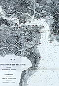 | Details | F.O. Ellery | 1900 |
| Chart of Portsmouth, New Hampshire harbor including historical points and landmarks |
|
F.O. Ellery |
|
| 1900 |
| LOC:0 |
| $0.00 | F-O--Ellery | Chart-of-Portsmouth--New-Hampshire-harbor-including-historical-points-and-landmarks | SOLD
<BR></BR>
Scarce folding chart of the harbor of Portsmouth, New Hampshire printed about 1900 in Boston by Skinner, Kidder & Co. Overprinted in large red numerals keyed to a legend below with 25 key points including:
<div class="indenttextblock">
<ul style="list-style-type: circle;">
<li>Badger's Island</li>
<li>Kittery, Maine</li>
<li>The United States Navy Yard</li>
<li>Fort Washington on Pierce Island</li>
<li>Seavey's Island</li>
<li>New Castle</li>
<li>Fort Constitution and the Portsmouth Lighthouse</li>
<li>Champernowne Hotel</li>
<li>Gerrish Island</li>
<li>Pocahontas Hotel</li>
<li>Whale's Back Light</li>
<li>Jaffrey's Point</li>
<li>U.S. Life Saving Station</li>
<li>Hotel Wentworth</li>
<li>Odiorne's Point, first place settled in New Hampshire</li>
</ul>
</div>
With numerous soundings and navigational features identified. Good detail of the near-shore margins. Includes a very small inset map of the Isle of Shoals. Folds into a heavy paper cover at 4.5" x 6". Cover contains ads for local businesses. Price when issued 10 cents. Copyrighted by F.O. Ellery. |
| 1405 |  | Details | Negus, T.S and J.D. | 1900 |
| Lot of 5 Antique Printers Plates for Compass Cards |
|
Negus, T.S and J.D. |
|
| 1900 |
| LOC:0 |
| $140.00 | Negus--T-S-and-J-D- | Lot-of-5-Antique-Printers-Plates-for-Compass-Cards | A lot of 5 rare metal <b>relief-method</b> printing plates for late 19th-century or early 20th century <b>compass cards</b> sold by T.S. and J.D. Negus. New York. These plates have diameters ranging between 4.75 to 2.25 inches. On some plates the engraver has replaced the "E" for East with "O" for Ost, the German word for East. These plates document Negus's participation in foreign sales of its compasses and other similar navigation instruments. One plate appears to be a variant of Negus' patented course protractor. The largest plate contains an attractive fleur-de-lis emblem at North. Each plate is tacked to a solid wooden block for use in letterpress.
<br><br/>
The Negus firm's 1899 illustrated catalog and price list advertises their trade as "Chronometer Manufacturers, Compass Adjusters and Navigation Warehouse. 140 Water Street, New York." Negus' 1899 catalog and price list contains pocket compasses, dry compasses, tell-tale and transparent compasses as well as a pelorous, a compass-like navigation device used by a ship's pilot for maintaining a bearing on a distant ship or shore-based object. <a href="
https://library.si.edu/digital-library/book/illuscatnautopti00negurich" target="_blank">(Online p. 83) </a>
<br><br/>
These printer's plates would have been used to print circular compass cards divided into points of the compass, degrees clockwise from north. A compass card, with magnets mounted below, would be suspended from a pivot within the compass so as to rotate freely. In their catalog, Negus' dry card compasses are offered with card sizes of 3", 4", 6.75", 7.75", and 9" at prices ranging from $4 to $20.
<hr>
</BR>
Call for additional 19th century Negus compass-card printing plate sizes, pricing and availability. |
| 5281 |  | Details | U.S. Coast and Geodetic Survey | 1900 |
| Scarce nautical chart Apalachee Bay to St. Georges Sound Florida |
|
U.S. Coast and Geodetic Survey |
|
| 1900 |
| LOC:1403 |
| $0.00 | U-S--Coast-and-Geodetic-Survey | Scarce-nautical-chart-Apalachee-Bay-to-St--Georges-Sound-Florida | Sold
<br></br>
Scarce, very large antique rolled nautical chart of the northern Florida coast from Apalachee Bay to St. Georges Sound, Florida. Published by the U.S. Coast and Geodetic Survey. Date of first publication 1883 but this electrotype edition is updated with corrections to 1900. Notable features include Ocklockonee Bay, St. James Island, Oyster Bay, St. Marks and Port Leon, Florida.
<br></br>
Not a preliminary chart. Full-size antique nautical charts on heavy paper of Apalachee Bay are very scarce, whether by the U.S. Coast Survey or by any other publisher
<br></br>
Chart number 182. Price when issued 50 cents. J.E. Hilgard, (Washington, DC: United States Coast and Geodetic Survey, 1883)
<br></br>
This antique chart of the north Florida coast was printed in 1900 from an electrotype copy of the original hand-engraved copper plate, a process the U.S. Coast Survey first adopted around 1850. As a soft medium, copper plates could only withstand print runs of perhaps 200 copies before the plates wore down. To enable larger print runs, a mold of the original plate was created in wax or another soft medium. Then, using an electro-chemical process ( electrotyping ), the mold was coated with a metal layer, typically copper. Printers were then able to produce output from the new electrotype copper copy, while preserving the original. Electrotype copy no. 1. |
| 5138 |  | Details | Boston and Maine Railroad | 1901 |
| Map of railway lines for the Boston and Maine Railroad |
|
Boston and Maine Railroad |
|
| 1901 |
| LOC:10 |
| $150.00 | Boston-and-Maine-Railroad | Map-of-railway-lines-for-the-Boston-and-Maine-Railroad | Official corporate map of railway and steamship lines for the Boston and Maine Railroad. Lithograph on thin paper.
<br></br>
Printed and included in the "Sixty-eighth Annual Report of the Directors of the Boston and Maine Railway to the Stockholders for the Year Ended June 30, 1901." Printed at Boston, Massachusetts in 1901 by Rand Avery Supply Company.
<br></br>
Red lines designate Boston & Maine lines and leased lines operated by the railroad. Purple lines show lines controlled by the Boston and Maine R.R. Includes steamship routes owned and operated by the company shown offshore with black or purple dotted lines. Margins about 1/4" on all sides. |
| 1096 |  | Details | Pacific Steam Whaling Company | 1901 |
| Pacific Steam Whaling Company's Map of Alaska |
|
Pacific Steam Whaling Company |
|
| 1901 |
| LOC:0 |
| $0.00 | Pacific-Steam-Whaling-Company | Pacific-Steam-Whaling-Company-s-Map-of-Alaska | SOLD <br></br>
Antique map of Alaska featuring the routes of steamers, canneries, and whaling stations belonging to the <b>Pacific Steam Whaling Company</b>. The map served as a promotional tool for the firm with numerous notations (in red) designed to appeal to speculators and fortune seekers for example: "Gold", <b>"Gold Placer Diggings"</b>, "Gold and Copper Deposits", "Silver Ahead" and "Cape Nome Gold Field".
<br></br>
Published by the Pacific Steam Whaling Company, 30 California Street, San Francisco and Corner of 1st Ave and Yesler Way, Seattle.
<br></br>
According to the cover the coverage includes "Nome, Teller City, Behring City, Golofnin, Western Alaska, Cooks Inlet and Copper River gold diggings." Manuscript ink annotation with "Valdez" and a circle just below the town of Valdez.
<br></br>
Routes include the whaling steamer's route to Port Clarence,; the mail steamer's route to Cape Nome from Unalaska; routes to <b>Bristol Bay</b>, Prince William's Sound, and Seattle to Unalaska.
<br></br>
Folding map of Alaska unfolds to its full extent of 22" W x 17" H. |
| 5371 |  | Details | Daily Picayune | 1901 |
| The Picayune's Map of New Orleans |
|
Daily Picayune |
|
| 1901 |
| LOC:90 |
| $400.00 | Daily-Picayune | The-Picayune-s-Map-of-New-Orleans | Scarce lithographed map of New Orleans, Louisiana published by The Picayune [1] newspaper in 1901. Shows both the West End Railroad and the Ponchartrain Railroad, both now long gone.
<br></br>
The Mississippi River is shown devoid of bridges but with <b>nine ferry crossings</b>. The first bridge across the Mississippi in Louisiana was not built until 1935. Several paddlewheel steamboats are shown underway in the river
<br></br>
The Picayune newspaper was started in 1837 in New Orleans, Louisiana. In 1914 The Picayune merged with the Times-Democrat to form the Times-Picayune.
<br></br>
[1] The Picayune was named after a Spanish coin used in Florida and Louisiana worth about six and one-half cents in the 1850s. |
| 4946 |  | Details | Lighthouse Board of the United States | 1901 |
| Report of the United States Light-house Board. 1901. |
|
Lighthouse Board of the United States |
|
| 1901 |
| LOC:2001 |
| $475.00 | Lighthouse-Board-of-the-United-States | Report-of-the-United-States-Light-house-Board--1901- | Scarce annual report of the United States Light-house Board for the fiscal year ending June 30, 1901. Folds to 6" x 9".
<br></br>
Contents include:
<div class="indenttextblocksingle">
<ul style="list-style-type: circle;">
<li>Index chart of all lighthouse districts approximately 15" x 18" inside the neatline.</li>
<li>Seventeen colored folding charts of individual lighthouse districts. Unfolded, each chart measures approximately 15" x 18" inside the neatline.</li>
<li>Eleven black and white plates.</li>
</ul>
</div>
</div>
Washington. Government Printing Office. Treasury Department. Document No. 2228. Office of Lighthouse Board. |
| 1476 |  | Details | Eldridge, George W. | 1901 |
| Massachusetts Bay and Coast from Chatham to Gloucester 2 |
|
Eldridge, George W. |
|
| 1901 |
| LOC:0 |
| $300.00 | Eldridge--George-W- | Massachusetts-Bay-and-Coast-from-Chatham-to-Gloucester-2 | Chart D Massachusetts Bay and the Coast from Chatham to Gloucester, published by George W. Eldridge in 1901, is a navigational chart that accurately depicts the coastline, harbors, and navigational hazards along Massachusetts Bay, from Chatham in the south to Gloucester in the north.
<br><br>
The chart is highly detailed and includes information on soundings (water depth measurements), tides, currents, and other navigational data. It shows the location of lighthouses, buoys, beacons, and other aids to navigation, as well as the location of rocks, shoals, and other navigational hazards.
<br><br>
In addition to navigational aids, the chart also shows the names and locations of towns, cities, and other landmarks along the coast, providing a useful reference for sailors navigating the area. Coverage includes the coastal margins near the towns of Provincetown, Truro, Wellfleet, Brewster, Yarmouth, Plymouth, Scituate, Cohasset, Marblehead, Salem, Gloucester, and the town and harbor of Boston, Massachusetts. The chart was designed to be used by sailors and navigators, and its accuracy and level of detail made it an essential tool for safe navigation along the Massachusetts Bay.
<br><br>
Date printed in blue stamp "1901". Note: Price is discounted for condition. |
| 5174 |  | Details | Hettinger, C. F. | 1901 |
| Cyanotype blueprint floor plan for 1901 Boston Brew-master's convention |
|
Hettinger, C. F. |
|
| 1901 |
| LOC:62 |
| $550.00 | Hettinger--C--F- | Cyanotype-blueprint-floor-plan-for-1901-Boston-Brew-master-s-convention | Original one-of-a-kind cyanotype, or blueprint, floor plan for the 1901 Brew-Master's Convention to be held in the Massachusetts Charitable Mechanic Association Building, Boston Mass. The 13th annual convention of the <b>United States Brewmaster's Association</b> was held in Boston during the week beginning on September 23, 1901.
<br></br>
The plan distinguishes between two areas in the building- the Convention Hall and the Exhibition Hall. The Exhibition Hall was a new feature of the convention:
<div class="indenttextblocksingle">
"… it has been thought desirable to make special arrangements for facilities for demonstrating and exhibiting all classes of machines and supplies adapted to brewer's use …" [1]
</div>
</br>
The Charitable Mechanics Association built the Mechanic's Hall in 1881 on Huntington Avenue, at West Newton Street near Copley Square. Architect William Gibbons Preston designed the hall which featured an auditorium, sometimes referred to as the Grand Hall. The hall was demolished in 1958.
<br></br>
Drawn and printed by C. F. Hettinger & Co. Engineers & Architects. 1140 Columbus Ave. Boston, Mass.
<br></br>
[1] Online: Gindele, William J. American Brewers' Review. Wahl and Henius eds. 1900-1901. p.282.
<br></br>
(beer, brewing, brew, craft beer, brewery, hops, tipsy, hopped up, loaded, drunk, shit-faced, sdfngd) |
| 689 |  | Details | U.S. Coast and Geodetic Survey | 1901 |
| Casco Bay, Maine |
|
U.S. Coast and Geodetic Survey |
|
| 1901 |
| LOC:0 |
| $0.00 | U-S--Coast-and-Geodetic-Survey | Casco-Bay---Maine | SOLD.
<br></br>
Original old, rolled antique sea chart of the inside passages for Casco, Bay Maine that has seen usage afloat based on the light pencil course plot lines. This large old navigation chart on heavy paper, first published in 1870 by the U.S. Coast and Geodetic Survey, carries the patina of age while retaining almost all its original beauty. Numerous lights and aids to navigation are captured along with a host of nautical hazards: Temple's Ledge, Ram Island Ledge, Halibut Rocks, Dick's Shoal, Sisters Ground, and many more. Lots of opportunity to run aground… or worse.
<br></br>
Coverage includes the geographical features of Cape Elizabeth, Peak's Island, Cushing Island, Luckse's Sound, Presumpscot River, Fort Gorges, Fort Preble, Fort Scammel, Portland Head Light, Whaleboat Island, Great Chebeague Island, Quahog Bay, Crotch Island, Cape Small, Maquoit Bay, Bald Head, Sebascodegan Island, Harpswell Neck, New Meadows River. Population centers include: Portland, Maine, Falmouth Corner, Yarmouth, Freeport Landing, and South Freeport. Chart number 315.
<br></br>
This chart (Electrotype copy No. 2) was printed on or after 1901 from an electrotype plate of the original hand-engraved copper plate, a process the U.S. Coast Survey adopted around 1850. As a soft medium, copper plates could only withstand print runs of perhaps 200 copies before the plates wore down. To enable larger print runs, a mold of the original plate was created in wax or another soft medium. Then, using an electro-chemical process ( electrotyping ), the mold was coated with a metal layer, typically copper. Printers were then able to produce output from the new electrotype copper copy, while preserving the original. |
| 5224 |  | Details | Eldridge, George W. | 1901 |
| Eldridges Antique Harbor Chart of New Haven, Connecticut |
|
Eldridge, George W. |
|
| 1901 |
| LOC:10 |
| $250.00 | Eldridge--George-W- | Eldridges-Antique-Harbor-Chart-of-New-Haven--Connecticut | Early 1901 harbor chart of the port of New Haven, Connecticut by George W. Eldridge. Key features noted include the Southwest Ledge Light, several breakwaters, Five Mile Point, Fort Hale, Sandy Point, Morris Cove, West Haven, and Fair Haven. Numerous aids to navigation, anchorages, and depth soundings.
<br></br>
Much useful information including soundings, anchorages, ranges, buoys, and bottom composition are presented by Eldridge in a clear graphic style that would have been helpful to mariners. The chart is printed with bold black coastal outlines that would have been much easier to read under poor lighting conditions. Lighthouses, buoys, and other aids to navigation are highlighted in red. Bottom composition is presented according to an attached table of abbreviations.
<br></br>
Attribution reads: 'AUTHORIZED and PUBLISHED By Geo. W. Eldridge, Vineyard Haven, Mass. and 152 State Street, Boston. Copyright by Geo. W. Eldridge 1901.' Number 17 in Eldridge's book of harbor charts. |
| 4859 |  | Details | U.S. Army Engineers | 1901 |
| Antique charts of Lakes Tohopekaliga Hatcheneha and Cypress Florida |
|
U.S. Army Engineers |
|
| 1901 |
| LOC:0 |
| $0.00 | U-S--Army-Engineers | Antique-charts-of-Lakes-Tohopekaliga-Hatcheneha-and-Cypress-Florida | SOLD
<br></br>
One page with three charts of Lake Tohopekaliga, Cypress lake, and Lake Hatcheneha (Hatchineha) Florida. This antique chart was produced by the U.S. Engineer's Office Tampa, Florida December 14, 1901.
<br></br>
The three lakes are part of a larger chain of lakes and canals known as the Kissimmee Waterway. Boaters can travel the 56-mile long waterway connecting Lake Tohopekaliga to the north to Lake Okeechobee to the south, passing through Cypress Lake and Lake Hatchineha and along the Kissimmee River through a series of canals and man-made locks. Lakes in the Waterway’s upper basin are fairly shallow with average depths ranging from 6 to 13 feet. (https://www.sfwmd.gov/sites/default/files/documents/kisswaterway.pdf)
<br></br>
The chart of Lake Tohopekaliga (Tohopeka) includes numerous soundings and identifies key locations including:
<br></br>
<div class="indenttextblocksingle">
<ul style="list-style-type: circle;">
<li>Edgewater Landing</li>
<li>Shingle Creek</li>
<li>Town of Kissimmee</li>
<li>Fish Lake Canal North Branch</li>
<li>St. Elmo Landing</li>
<li>St. Cloud Canal</li>
<li>McCool's Landing</li>
<li>Poorhouse Landing</li>
<li>Lee's Landing</li>
<li>Southport Canal</li>
<li>Edgewater Landing</li>
<li>Paradise, Flemings, and Cypress Islands</li>
</ul>
</div>
Date and initials at bottom left within "W.F.J. 10-25-90 (1890)" |
| 1362 |  | Details | Depot de la Marine | 1902 |
| Antique nautical chart of southern Alaska, Prince of Wales Island, Juneau |
|
Depot de la Marine |
|
| 1902 |
| LOC:2001 |
| $1,200.00 | Depot-de-la-Marine | Antique-nautical-chart-of-southern-Alaska--Prince-of-Wales-Island--Juneau | Fine nineteeth-century folding Gold-Rush era nautical chart of southwest Alaska from Graham Island/Dixon Entrance past Prince of Wales Island, and terminating with Glacier Bay. Large, separately issued French chart of the Alaska Panhandle and the inside passage. Includes part of the route used by modern cruise ships visiting Juneau or Haines or Skagway, Alaska. Inset of "Extremite nord du Canal Lynn".
<br></br>
Published first in 1893, this edition contains corrections to 1902. Early charts of Alaska are scarce. No copies of this antique chart are listed in OCLC/WorldCat or in the Antique Map Price Record.
<br></br>
Some of the many named features on this fine chart include Admiralty Island, Cross Sound, Baranoff Island, Dall Island, and Wrangell Island, Chatham Canal, Port Protection (of TV fame), Haines, and the Skagway River. Numerous mountains with elevation details as well as many glaciers are identified and named.
<br></br>
With owners overstamps from the Library of Canadian Energy, Mines, and Resources Department in 1969 and 1976. Number 4553. |
| 706 | 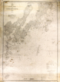 | Details | U.S. Coast and Geodetic Survey | 1902 |
| St. George River and Muscle Ridge Channel, Maine |
|
U.S. Coast and Geodetic Survey |
|
| 1902 |
| LOC:0 |
| $225.00 | U-S--Coast-and-Geodetic-Survey | St--George-River-and-Muscle-Ridge-Channel--Maine | Antique nautical chart issued in 1902 covers from Thomaston, Maine southwestward along the St. George River past St. George, Maine and Tennant Harbor, the Marshall Point Lighthouse to Burnt Island and from a line drawn through those areas to the east, covering the island-strewn Maine Atlantic coast. Coastal areas covered by this old sea chart encompass Two Bush Channel and these islands: Rackliff's, Andrew's, Hewell's, Hooper's, Metlinik, Ash, Sheep, Grafton, Pleasant, Sprucehead, Whitehead, Munroe, and Alleni Islands.
</br>
Other points of interest noted on this old chart include South Thomaston, Friendship and Port Clyde, Maine; Fort St. George, Maple Juice Cove, Hart's Neck, Mosquito Head, Cutter's Nubble, Old Woman Ledge, Owl's Head Light, and Fog's Hill.
<br></br>
Date of first publication was 1873. This antique chart bears a stamp at the bottom in purple ink that identifies this edition as later: "Aids to navigation corrected with information received Jul 13, 1902."
<br></br>
This chart was printed from an electrotype copy of the original hand-engraved copper plate, a process the U.S. Coast Survey adopted around 1850. As a soft medium, copper plates could only withstand print runs of perhaps 200 copies before the plates wore down. To enable larger print runs, a mold of the original plate was created in wax or another soft medium. Then, using an electro-chemical process ( electrotyping ), the mold was coated with a metal layer, typically copper. Printers were then able to produce output from the new electrotype copper copy, while preserving the original. This print run is electrotype copy number 2. Chart number 312. Price when issued 25 cents. |
| 694 |  | Details | U.S. Coast and Geodetic Survey | 1902 |
| Kennebec and Sheepscot Rivers, Maine |
|
U.S. Coast and Geodetic Survey |
|
| 1902 |
| LOC:0 |
| $165.00 | U-S--Coast-and-Geodetic-Survey | Kennebec-and-Sheepscot-Rivers--Maine | Large, rolled, antique nautical chart of the southern reaches of the Kennebec and Sheepscot Rivers in Maine first issued in 1868 with corrections to 1902. This old chart covers the numerous bays, coves, and idyllic islands that dot the coast to the south and to the east of Bath, Maine.
<br></br>
Two interesting features add value to the chart. The first is a location defined as "Ancient Augusta 1717 - 1721" but near the mouth of Cape Small Harbor well south of present-day Augusta, Maine. The second interesting feature, identified as "Ancient Fort George", lies directly to the west of Fort Popham, in the area of Sabino Head. That reference to Fort George is apparently Fort St. George, part of a very early English colonial settlement of Popham recently 'rediscovered' in 1994. The colony (also called the Sagadahoc Colony) was founded in 1607, 13 years before the Plymouth Colony and it has been called "the cornerstone in the foundation of English America". ( Reference: www.smithsonianmag.com/history/maines-lost-colony-106323660/?no-ist=&page=1 )
<br></br>
Geographical features include: Merry Meeting Bay, Georgetown Island, Linekins Bay, Montseag Bay, Southport Island, Seguin Island, Hockomock Bay, Mount Pisgah, and Robin Hood Cove. Noted population centers include: Bath, Woolwich, Winnegance, Drummore Mills, Phillipsburg Center, Parker's Head Village, Wicasset, and Boothbay Harbor, Maine. Bottom of chart contains 3 inset profile coastal views of various approaches to the Kennebec River.
<br></br>
On heavy paper, this chart (Electrotype copy No. 3) was printed on or after 1902 from an electrotype plate of the original hand-engraved copper plate, a process the U.S. Coast Survey adopted around 1850. Numerous soundings, aids to navigation and hazards are noted. Rubber stamp imprint at bottom reads: "Aids to navigation correct from information received to Aug 4 1902." Number 314. |
| 5180 |  | Details | Fiske, John | 1902 |
| Sketch of the earliest map of Florida coast by Fiske after Cantino |
|
Fiske, John |
|
| 1902 |
| LOC:11 |
| $135.00 | Fiske--John | Sketch-of-the-earliest-map-of-Florida-coast-by-Fiske-after-Cantino | Sketch of the Florida coast, a sketch of the earliest image of Florida known from an anonymous Portuguese manuscript portolan map of the world: The Cantino Planisphere. Martin Waldseemuller's 1507 map is derived from the Cantino Planisphere.
<br></br>
In 1501 Alberto Cantino commissioned a Portuguese official to make a map with all the latest discoveries known to the Portuguese. That large map incorporated discoveries made by several explorers in the first decade of the 16th century and revealed unpublished details of Portuguese trade routes.
<br></br>
This bookplate sketch of a portion of Cantino's map is from "The Discovery of America" by John Fiske, 1892. |
| 1080 |  | Details | George W. Walker Lithograph and Publishing Co | 1902 |
| Stunning Birds Eye View of Mt. Washington, New Hampshire |
|
George W. Walker Lithograph and Publishing Co |
|
| 1902 |
| LOC:40 |
| $0.00 | George-W--Walker-Lithograph-and-Publishing-Co | Stunning-Birds-Eye-View-of-Mt--Washington--New-Hampshire | SOLD
<br><br>
Stunning bird's-eye view from <b>Mt. Washington New Hampshire</b> in exquisite condition. The view centers on the summit of Mt. Washington, depicting the famous “Tip Top House” and other structures. The summit is shown surrounded by a ring of clouds that sets it apart from the other peaks. Shown in concentric circles falling away from Mt. Washington are the other major peaks of New Hampshire, Maine and Vermont, with numerous small towns and villages snuggled in the valleys. This colorful lithographed view of Mt. Washington is considered by many to be the most beautiful of all the birds-eye views published near the beginning of the 20th century.
<br></br>
Almost unused condition and still attached to its original folder. Very rare to find this view and cover in such fine condition. Photographs and text on the verso of the view about the history of Mount Washington, e.g.
<div class="indenttextblock"> … , the ancient "Agiochook" (mountain with snowy forehead) of the Indians
is the highest point of land in eastern North America. .."
</div>
<br></br>
Created by George W. Walker, Boston, MA.and issued ca. 1902 by the passenger department of the Boston and Maine Railroad. Numerous legend entries are keyed numerically to 189 locations are identified on the view.
<br></br>
<b>Key features (among 189 listed) include:</b>
<div class="indenttextblock">
<ul>
<span style="list-style-type: circle;">
<li> Mt. Washington R.R. Train</li>
<li>Summit House</li>
<li>Mount Eastman</li>
<li>Mount Doublehead</li>
<li>Mount Pleasant, Maine</li>
<li>Isle of Shoals, New Hampshire</li>
<li>Sebago Lake, Maine</li>
<li>Mount Madison</li>
<li>Baldface Mountain</li>
<li>Carter Dome</li>
<li>Mount Mansfield, Vermont</li>
<li>Connecticut River</li>
<li>Killington Peaks, Vermont</li>
<li>Lake Winnipesaukee</li>
<li>Mount Wachusett, Massachusetts</li>
<li>Squam Lake</li>
<li>Lake Sunapee</li>
</span>
</ul>
</div> |
| 8016 |  | Details | Bower, N. E. | 1902 |
| Map of the U.S. Military Reservation, Fort Sill, Oklahoma Territory |
|
Bower, N. E. |
|
| 1902 |
| LOC:130 |
| $2,400.00 | Bower--N--E- | Map-of-the-U-S--Military-Reservation--Fort-Sill--Oklahoma-Territory | Unrecorded and important 1902 blueprint map documents the entire U.S. Military Reservation at Fort Sill, Oklahoma Territory, just five years before Oklahoma statehood and one year after the last Indian lands in Oklahoma opened for settlement. Compiled and drawn under the supervision of 2nd Lt. N. E. Bower, Corps of Engineers, the map was prepared for a Board of Officers convened on November 6, 1902 to review and verify the reservation’s boundaries, fences, roads, streams, and terrain. It presents the reservation in three components -- the Original Reservation, the Western Addition, and the Eastern Addition -- with detailed Public Land Survey System grids, contour lines, drainage, and the developed cantonment near Medicine Bluff Creek.<br><br>With the frontier gone and the cavalry mission fading, the fort shifted toward a new role as artillery units arrived, including the formation of the 39th Field Artillery Battery in 1902. This transition ultimately saved the fort from closure, and with the last cavalry regiment departing in May 1907, Fort Sill was firmly on the path to becoming the home of U.S. Army Field Artillery.<br><br>This map captures that transition with precision, drawing on General Land Office surveys, U.S. Engineer triangulations, earlier post maps, and contemporary field notes. Today the blueprint stands as an important visual record of the boundaries and landscape of one of the nation’s most significant western military posts, known as the later home of the Field Artillery School and the final residence of the Apache prisoners of war, including Geronimo.<br><br> |
| 1188 | 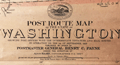 | Details | US Post Office Department | 1903 |
| Rare Post Route Map of the State of Washington |
|
US Post Office Department |
|
| 1903 |
| LOC:0 |
| $1,500.00 | US-Post-Office-Department | Rare-Post-Route-Map-of-the-State-of-Washington | Rare official U.S. Postal Service map of Washington State, complete with an oval vignette of a Pony Express rider and a steam locomotive with the motto of the US Post Office--"with Celerity, Certainty and Security". A rolled map with no folds. Should frame brilliantly.
<br></br>
Legend at bottoms shows "Explanation of Mail Service." keyed to colored lines on the map showing frequency of delivery. Also noted are railroads, beginning and end of delivery routes, mail messenger routes, Post Offices, discontinued Post Offices, and rural free delivery (RFD) routes.
<br></br>
Published September 1903 by order of Postmaster General Henry C. Payne, under the direction of A. von Haake, Topographer P.O. Department. |
| 730 | 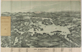 | Details | George W. Walker Lithograph and Publishing Co | 1903 |
| Birdseye View of Lake Winnipesaukee, New Hampshire |
|
George W. Walker Lithograph and Publishing Co |
|
| 1903 |
| LOC:0 |
| $0.00 | George-W--Walker-Lithograph-and-Publishing-Co | Birdseye-View-of-Lake-Winnipesaukee--New-Hampshire | SOLD <br></br>
Attractive antique birds-eye view map of Lake Winnipesaukee, New Hampshire from 1903. Sidewheel steamers puff along at center with the snowy peak of Mount Washington at the background framed by Carter Dome, Mount Lafayette, Mount Passaconaway, Mount Paugus and many others in the White Mountain Range. Named towns include Lakeport, Belknap Point, Lakeshore Park, Springhaven, Alton Bay, Wolfboro, Moultonboro, Center Harbor, Ashland. Shows two branches of the Boston and Maine Railroad and contains a legend at bottom with names of 59 islands and 26 mountains displayed on the map. Noted islands include Rattlesnake, Red Head, Kenniston, Stone Dam, and Long Island.
<br></br>
Original two stone lithograph folding map from 1903 published by George H. Walker of Boston, who also published similar birdseye view maps of Casco Bay, Boston Harbor, Narragansett Bay and other locations in the Northeast.
<br></br>
Still attached to a brown card cover as issued, this map folds to a compact 3.5 x 6.6 inches. |
| 4941 |  | Details | Boston and Maine Railroad | 1903 |
| Boston and Maine Railroad Summer Excursions with five maps |
|
Boston and Maine Railroad |
|
| 1903 |
| LOC:2001 |
| $350.00 | Boston-and-Maine-Railroad | Boston-and-Maine-Railroad-Summer-Excursions-with-five-maps | Rare booklet from the Boston and Maine Railroad (1903) with Summer Excursions, rates, stage and steamer connections. Includes five maps and birds-eye views on thin paper. 88 pages. Thin card covers. 4" x 8" overall.<br></br>
"Boston and Maine Railroad Summer Excursions to the White Mountains, Mount Desert, Adirondacks, Catskills, Montreal and Quebec, Winnipesaukee, Memphremagog, Champlain, Rangeley and Moosehead lakes and the New England Beaches."
<div class="indenttextblocksingle">
<ul style="list-style-type: circle;">
<li>1) "Bird's Eye Map of the White Mountains reached by Boston and Maine." Birds-eye view map of the White Mountains in New Hampshire. </li>
<li>2) Map of Lake Winnipesaukee and Vicinity Reached by Boston and Maine and Steamer Mt. Washington. Printed by Rand, Avery Supply Co,. Engineers and Printers, Boston.<.li>
<li>3) Lake Memphremagog and About There. Boston and Maine Railroad. Printed by Rand Avery Supply Company, Boston, Mass.</li>
<li>4) Fishing and Hunting Resorts reached by Boston and Maine Railroad Connections.</li>
<li>5) Map of Lake Sunapee and Vicinity Reached by Boston and Maine Railroad. Rand, Avery Supply Co,. Engineers, Boston, Mass.</li>
</ul>
</div>
Issued by the Passenger Department, Boston and Maine Railroad. 1903. Boston City Ticket Office: 322 Washington Street Cor. Of Milk Street |
| 705 | 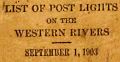 | Details | U.S. Department of Commerce and Labor | 1903 |
| List of Post Lights on the Western Rivers |
|
U.S. Department of Commerce and Labor |
|
| 1903 |
| LOC:0 |
| $165.00 | U-S--Department-of-Commerce-and-Labor | List-of-Post-Lights-on-the-Western-Rivers | Small, antique, pocket size book of lights on all the U.S. Western Rivers corrected to September 1903. Lights are grouped into three sections by Lighthouse District each with a sectional title page. The 3 book sections are:
<div class="indenttextblock"><ul>
<li>Fourteenth District: List of Lights on the Ohio, Kanawa, and Tennessee Rivers.</li>
<li>Fifteenth District: List of Lights on the Mississippi (above Cairo, Ill.) Missouri, and Illinois Rivers.</li>
<li>Sixteenth District: List of Lights on the Mississippi (Below Cairo, Ill.) and Red Rivers.</li></ul></div>
Format is the same throughout: the left page header contains the river name and the starting point from which river channel mileage is measured. Detail columns on left pages capture the light number, official light name, distance from the starting point, side of channel, and color of light. Right facing pages are ruled and blank for use of the reader to record notes; the header reads: "Remarks, Changes, Etc."
<br></br>
Each sectional title page bears a request to readers for help in identifying lights with usability issues: <div class="indenttextblock">"Pilots and all masters are particularly requested to report to the Light-House Inspector at Cincinnati, Ohio, lights which are out or dim or burning during the day; also changes in location of lights required, using the official name and number of the light. Pilots are also requested to blow their whistles when a light is out to notify the keeper."</div>
The Ohio River distances are measured from Pittsburg, Pennsylvania; Kanawa River distances from Point Pleasant; Tennessee River Distances from Paducah, Kentucky; Upper Mississippi River distances from St. Paul, Minnesota; Lower Mississippi River distances are measured starting from Cairo, Illinois.
<br></br>
A few user manuscript pencil entries of birthdays and other notes on the first few notes pages. 253 pages total. |
| 289 |  | Details | Providence, Fall River and Newport Steamboat Co. | 1904 |
| Brochure- Providence , Fall River and Newport Steamboat Co |
|
Providence, Fall River and Newport Steamboat Co. |
|
| 1904 |
| LOC:0 |
| $165.00 | Providence--Fall-River-and-Newport-Steamboat-Co- | Brochure--Providence---Fall-River-and-Newport-Steamboat-Co | Scarce antique eight-page brochure and map for the Providence, Fall River and Newport Steamboat Company, 136 Dyer Street, Providence, Rhode Island. This small brochure, dated internally to 1904, contains time tables, descriptive information on each port and sightseeing tips and advertisements from local businesses and resorts.
<BR> </BR>
Contains a list of the eight steamers comprising the company's fleet and their passenger capacity:
<div class="indenttextblock">
<ul style="list-style-type: circle;">
<li>Mount Hope - 2000 persons</li>
<li>Warwick - 2000 persons</li>
<li>Richard Borden - 1500 persons</li>
<li>City of Newport - 1100 persons</li>
<li>Favorite - 1100 persons</li>
<li>What Cheer - 750 persons</li>
<li>Squantum - 850 persons</li>
<li>Baltimore - 500 persons</li>
</ul>
</div> |
| 3617 |  | Details | Millspaugh, Charles F. | 1904 |
| Field Chartbook of an Early Botanical Survey of the Florida Keys |
|
Millspaugh, Charles F. |
|
| 1904 |
| LOC:0 |
| $0.00 | Millspaugh--Charles-F- | Field-Chartbook-of-an-Early-Botanical-Survey-of-the-Florida-Keys | SOLD <br></br> Field chartbook of the Florida Keys owned by Charles Frederick Millspaugh (1854-1923) a botanist, and from 1894 curator of the Department of Botany for the Field Museum of Natural History, Chicago, Illinois. Used during the research season of 1904.
<br></br>
The chartbook is organized with a small-scale fragment overview of the entire Florida Keys, a neatly typed 3-page index, followed by 34 sections each neatly labeled in manuscript. Each section contains a rectangular chart fragment dissected from a chart(s) of the Florida Keys, a page of ruled paper, and a sheet of tracing paper that likely was intended as an overlay onto which the field researcher could trace map notations. Some few manuscript notes occur scattered throughout.
<br></br>
Millspaugh's personal chart book for use during a research trip during February, 1904 to the West Florida Keys by O.E. Lansing, Jr. During that trip Lansing conducted a survey of the flora of selected islands. In 1907 results of the fieldwork were published as distribution maps. The charts in this volume would have guided the researcher between sites on the generally low islets.
<br></br>
In the index of our chartbook several MS checkmarks next to the names of keys correspond to the specific keys that Millspaugh notes Lansing explored.
<div class="indenttextblock">Mr. Lansing faithfully carried out his instructions, making a thorough investigation of each islet, during which he collected each species … together with his comprehensive notes and maps made on the spot, form the basis of the detailed consideration of the islets in the following pages". (Millspaugh, Charles F. Flora of the Sand Keys of Florida. Field Columbian Museum. Pub 118. Vol 2. No 5. February, 1907.)
</div>
<BR/>
Though the volume was once a part of the library of the Field Museum where Millspaugh worked, the front cover contains a ink stamp in blue proving the volume was deaccessioned ("withdrawn") from the Field Museum. |
| 8049 | 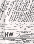 | Details | Chamberlain, Edward G. | 1904 |
| Rare Panoramic Map of the View from Great Blue Hill Milton Massachusetts |
|
Chamberlain, Edward G. |
|
| 1904 |
| LOC:41 |
| $0.00 | Chamberlain--Edward-G- | Rare-Panoramic-Map-of-the-View-from-Great-Blue-Hill-Milton-Massachusetts | SOLD<br><br>An extraordinary and rare panoramic view, recording the visible landscape from the summit of Great Blue Hill, one of the most prominent observation points south of Boston, Massachusetts. Drawn by the singular Edward G. Chamberlain, the heliotype-printed sheet presents a full 360 degree horizon broken into directional bands, identifying mountains, towns, rivers, railroads, and landmarks across eastern Massachusetts and beyond. This panorama and others Chamberlain produced have not been matched since. <br><br>
<div id="0" align="center">
<a title=""></a>
<img id="8049" src="/ZoomifyImages/SC_8049/SC_8049_Cover.jpg" alt="Cover photo of Guide to View from Great Blue Hill Milton by E. G. Chamberlain" width="140"/> <br><br> <font size="-2">Great Blue Hill Guide Cover</font>
</div>
<BR>
The panorama exemplifies Chamberlain’s distinctive method of what is now often described as concentric or radial cartography. From a single observation point, the surrounding landscape is organized outward by bearing, distance, and elevation, creating a systematic visual inventory of the terrain. Peaks as far away as New Hampshire, including Mount Monadnock, Barrett and KIdder, are placed in measured relationship to nearer hills, river valleys, and coastal features. Vertical scales are intentionally exaggerated to aid identification, a candid acknowledgment of the limits of human vision and atmospheric conditions. <BR><BR>Compiled between 1872 and 1886 (but 1904) during Chamberlain’s long association with the Appalachian Mountain Club, this map reflects the club’s early emphasis on careful observation, measurement, and documentation of the New England landscape. Chamberlain revised and refined such panoramas over decades, treating them as cumulative records rather than fixed compositions. Examples like this were distributed among fellow club members and used for route planning, lectures, and comparative study. Surviving sheets are scarce. |
| 6649 |  | Details | Perkins, T.C. | 1905 |
| 1905 Connecticut Valley Electric Transit Route Pictorial |
|
Perkins, T.C. |
|
| 1905 |
| LOC:41 |
| $250.00 | Perkins--T-C- | 1905-Connecticut-Valley-Electric-Transit-Route-Pictorial | Birds'-eye view pictorial map of the Connecticut Valley, following the Connecticut River. Shows the Electric Transit Trolley Route from Hartford, Connecticut To Greenfield, Massachusetts. The route includes the towns of Hartford, Chicopee, Springfield, Holyoke, Greenfield, and Turner Falls with population centers shown pictorially in profile.
<br><br>
The Connecticut Valley Electric Transit Route was a trolley line that operated in the early 20th century, specifically from 1905 to 1926, in the Connecticut River Valley region of Massachusetts. The line was a part of the Springfield Street Railway Company, which was one of the largest electric streetcar systems in the United States at the time.
<br><br>
The Connecticut Valley Electric Transit Route ran from Springfield to Holyoke, Northampton, and Amherst, and it was an important transportation link for people living in those areas. The trolley line connected these towns and allowed for easy travel between them, which was especially important for college students attending schools in the region, such as Amherst College and Smith College.
<br><br>
Mount Tom is a mountain located in Holyoke, Massachusetts, in the Connecticut River Valley region. The mountain has an elevation of 1,202 feet (366 meters) and offers sweeping views of the surrounding area.
In the early 20th century, Mount Tom was a popular tourist destination, and it was a common stop on the Connecticut Valley Electric Transit Route. The trolley line had a station at the base of the mountain, and visitors could take a funicular railway up Mount Tom. Once at the top of Mount Tom, visitors could enjoy a range of activities, including hiking, picnicking, and even a zoo. The mountain was also home to a popular amusement park, which featured a roller coaster, a Ferris wheel, and other rides and attractions.
<br><br>Published by T.C. Perkins Hartford, Connecticut 1905. E.A. Sherman del. |
| 6814 | 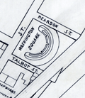 | Details | Whitney, William H. | 1905 |
| Manuscript engineers trace map of Cambridgeport Massachusetts |
|
Whitney, William H. |
|
| 1905 |
| LOC: |
| $500.00 | Whitney--William-H- | Manuscript-engineers-trace-map-of-Cambridgeport-Massachusetts | Original manuscript trace map by the civil engineering firm of William H. Whitey, Boston. A traced pen and ink map on tracing cloth of an area in Cambridgeport, Massachusetts bounded by the Charles River to the south and Erie Street to the North and from Magazine Street at the west to roughly where Briggs Field now stands. This manuscript trace would have been used to create numerous blueprint copies for Whitney's clients. Whitney was a very early adopter of blueprinting to support his map-making and design business.
<br><br>
The map shows the location of the Boston University Bridge across the Charles River then under construction as well as the proposed location for an additional bridge downstream.
<br><br>
Includes Washington Square, a soap works of J. Reardon and Sons, Hastings Square, Morse School, Captain's Island Playground, Baptist home, and Lammson Memorial Building. By William H. Whitney, Boston Civil Engineer. |
| 1141 |  | Details | Murphy, John F. | 1905 |
| Early Birds Eye View of Boston Harbor and the South Shore |
|
Murphy, John F. |
|
| 1905 |
| LOC:0 |
| $0.00 | Murphy--John-F- | Early-Birds-Eye-View-of-Boston-Harbor-and-the-South-Shore | SOLD <BR> </BR>Original 1905 folding harbor birds-eye of South Boston, Nantasket Beach, Hough's Neck, South Bay, Plymouth Bay, Pleasure Bay, Boston Harbor, Dorchester Bay, Quincy Bay, Hingham, Squantum, and Cape Cod Bay to Provincetown, Massachusetts. Verso is blank. Index on inside cover with 35 points of interest is keyed to locations on the map. With its simple cover still attached, <b>the map is in excellent condition</b> with bright colors.
<BR> </BR>
This colorful lithographed chart is the earlier, and more scarce portrait bird's eye view of the area and not the more common landscape view published later by the Union News Corp. The view is also distinguished as an earlier edition of the same view printed later in 1915 with more detail. This very early birds-eye view of Boston bears a copyright attribution: <div class="indenttextblock"> "Copyright 1905 by the Federal Engraving and Publishing Co., Boston, Mass."</div>
Shows steamship routes to coastal towns and identifies many nearby islands including: Moon Island, Pleasure Bay, Governor's Island, Thompson Island, Deer Island, Lovell's Island, Peddock's Island, Georges Island, and Long Island.
<BR> </BR>
This informative map could have been purchased by passengers aboard any steamboat plying the routes shown on the attached map. Published by John F. Murphy, South Station, Boston. That firm is listed on the cover as: " News Agent Eastern District, N.Y.N.H & H.R.R. and Fall River Line Steamers and ROWES WHARF". Price is noted on the front cover as "10 cents". |
| 5039 |  | Details | Southern Pacific Company | 1906 |
| San Francisco The Imperishable map 1906 earthquake fire |
|
Southern Pacific Company |
|
| 1906 |
| LOC:63 |
| $450.00 | Southern-Pacific-Company | San-Francisco-The-Imperishable-map-1906-earthquake-fire | Single page folding booklet about the Great San Francisco Fire and Earthquake of 1906. Scarce. With a map of the burned area by Allan Dunn and two panoramic photographs on the verso. Map size is 10" x 15". Published by Southern Pacific Company, Passenger Department.
<br></br>
One source states that the booklet was an instance of disinformation.
<div class="indenttextblock">
"Southern Pacific Railroad Co. was aggressive in its attempt to rewrite the history of the San Francisco earthquake and fire. As part of that campaign, the publicity department of the railroad churned out hundreds of articles like this to highlight the damage from fire, and minimize the effects of the earthquake; to "set the record straight," as one piece of SP literature put it."
<br></br>
"Note how his article casually dismisses the earthquake in San Francisco and surrounding communities, and stresses that the worst results from the tremor were outside the city. " (Source: Virtual Museum of the City of San Francisco. http://www.sfmuseum.org/conflag/imperish.html)
</div> |
| 646 |  | Details | George W. Walker Lithograph and Publishing Co | 1906 |
| Birdseye View of Casco Bay, Portland, Maine and Surroundings |
|
George W. Walker Lithograph and Publishing Co |
|
| 1906 |
| LOC:0 |
| $0.00 | George-W--Walker-Lithograph-and-Publishing-Co | Birdseye-View-of-Casco-Bay--Portland--Maine-and-Surroundings | SOLD
<br></br>
Large antique lithographed map of coastal Maine north of Portland, including Casco Bay. Original, not a re-print. This folding birds eye view published ca. 1906 by Walker shows dozens of islands, coves, lighthouses, railroad and ferry routes, and other points of nautical interest. Bright colors. Folds to 3 3/4" x 7".
<br></br>
Named features include Cape Elizabeth, Portland Head light, Fort Preble, Cushing Island, Great Diamond Island, Long Island, Great Chebeague Island, Presumpscot River, Mt. Washington, Sebago Lake, Falmouth, Underwood, Harraseeket River, Casco Castle, Cousins Island, Bailey's Island, Harpswell Harbor, Maquoit Bay, Freeport Landing, Brunswick and Lewiston. Routes of the Casco Bay Lines shown in solid black. Lines for the Maine Central R.R. and other railroads shown in solid red lines.
<br></br>
Simple, brown cardboard cover with green title printing. Published by Walker Lithography and Publishing Company, Lithographers. 400 Newberry Street, Boston, Mass. |
| 5314 |  | Details | Ranson, Robert | 1906 |
| Antique map of Cracker Swamp drainage Hastings, Florida FEC |
|
Ranson, Robert |
|
| 1906 |
| LOC:87 |
| $800.00 | Ranson--Robert | Antique-map-of-Cracker-Swamp-drainage-Hastings--Florida-FEC | Cyanotype (blueprint) cadastral plat map of the vicinity around Hastings, Florida, the "Potato Capital of Florida", featuring a proposed drainage canal from the St. Johns River to Hawhead at the northernmost point of what is today referred to as "Cracker Swamp" . This early plat of the area in Volusia County, is from an auction lot of maps related to Wetumpka Fruit Company. The map was published in 1906 just 16 years after Hastings was founded by Thomas Hastings [1] at the urging of his cousin <b>Henry Morrison Flagler</b>. Hastings, northeast of East Palatka, Florida, in St. Johns County, had a population of about 1,200 in 1910.
<br></br>
With a graphed depth profile (at left) of the proposed canal running from the vicinity of May Road (Mays Cove Road) on the St. Johns River to Hawhead. Depth measurements are provided every 400 feet.
<br></br>
Shows the tracks of the Florida East Coast Railroad curving through Hastings, a portion of the <b>Huertas Grant</b> [2], East Palatka, and across Deep Creek. Other noted features include: Leonard Tract, White Towers, Buncombe Island (inside the "Cracker Swamp"), orange mills, Florida Vegetable Company Boulevard; and two short branches off Deep Creek- Wilkinson Branch and Cracker Branch.
<br></br>
[1] In 1889 Henry Flagler convinced his cousin Thomas H. Hastings to develop a farm nearby Flagler's railroad in order to supply vegetables to Flagler's St. Augustine resort hotels.<br>
[2] Spanish Governor Sebastien Kindelan granted St. Augustine, Florida resident Antonio Huertas 10,000 acres west of St. Augustine in 1813. |
| 4902 |  | Details | Monticello Steamship Company | 1907 |
| Antique Birdseye View of San Francisco and Napa Valley Monticello Steamship Company |
|
Monticello Steamship Company |
|
| 1907 |
| LOC:41 |
| $350.00 | Monticello-Steamship-Company | Antique-Birdseye-View-of-San-Francisco-and-Napa-Valley-Monticello-Steamship-Company | A shaded relief promotional map illustrating the Bay of San Francisco and Napa Valley, emphasizing overland routes and steamship connections operated by the Monticello Steamship Co., linking San Francisco with Vallejo and the Napa River corridor. Scarce with this view.
<br></br>
Copyright 1907 by Monticello Steamship Company.
<br></br>
With steamship routes and electric railroad routes to and through:
Vallejo
The U.S. Navy Yard
Mare Island
Napa Valley Route
<br></br>
Card cover and four inner pages. With Information on fares, steamship and electric Railroad Routes
Size closed: 4" x 9 1/2". By Sierra Art and Engineering Co. S.E. |
| 716 |  | Details | George W. Walker Lithograph and Publishing Co | 1907 |
| Boston Harbor and the North Shore |
|
George W. Walker Lithograph and Publishing Co |
|
| 1907 |
| LOC:0 |
| $260.00 | George-W--Walker-Lithograph-and-Publishing-Co | Boston-Harbor-and-the-North-Shore | Original antique birdseye view folding map of Boston Harbor by George Walker shows ferry routes, steamer routes and railroad lines between Boston and points both within Boston Harbor and to outlying towns. This fascinating old lithographed map differs from other birdseye-view maps we are aware of from this era because it includes Marblehead, Lynn, Salem and extends north-eastwards to Gloucester, Massachusetts. We can date the map with confidence because it clearly shows the Wonderland Amusement Park at Revere Beach which failed after five years, operating exclusively between 1906 and 1911. Wonderland, served by the Revere Beach and Lynn Railroad, was modeled along the lines of the World's Fairs of that era and included roller coasters, technological exhibits, theaters and a boardwalk.
<br></br>
Noted points of interest include Charlestown, Point of Pines, Magnolia, Baker's Island, Thompson's Island, "the Pumping Station", Dorchester Bay, Squantum, Norfolk Downs, Quincy Bay, Hough's Neck, Hingham Harbor, Winthrop, Beachmont, Great Head, Peddock's Island, Nantasket Beach, Port Allerton, the town of Hull with Fort Revere, George's Island with Fort Warren, Deer Island, Lovell's Island, Lynn, Swampscott, Thatcher's Island, Strawberry Hill, and many more. Captures several local lighthouses and aids to navigation including Boston Light, Long Island Light, Fawn Bar Beacon, Graves Light, and far out the bay - a whistling buoy.
<br></br>
Original lithograph by George W. Walker, lithographer of Boston in landscape format is in very good condition for a 105+ year old map. Was originally folded into a card cover but the front half has disappeared leaving the map attached to the back cover, as issued.
<br></br> |
| 5030 |  | Details | Florida East Coast Railway | 1907 |
| Scarce Florida Railway and East Coast Hotel Co Point of Sale Advertisement |
|
Florida East Coast Railway |
|
| 1907 |
| LOC:0 |
| $0.00 | Florida-East-Coast-Railway | Scarce-Florida-Railway-and-East-Coast-Hotel-Co-Point-of-Sale-Advertisement | SOLD<br></br>
Rare point-of-sale advertising placard for Henry Flagler's Florida East Coast Railway (FEC) and the Florida East Coast Hotel Company with a map of Florida ca. 1905 - 1912. The map shows the locations of Flagler's hotel properties and the FEC railway system Flagler built that linked, by 1912, linked Jacksonville to Key West, Florida. The significance of this scarce placard is that Henry Flagler's contribution to the state of Florida was to open Florida's east coast through building a series of fine hotel properties supported by his railway network, the Florida East Coast Railway. Two sides on hard stock with red edging.
<br></br>
Legend on the map shows the railway segment between Homestead, and Key West as "under construction" dating the map between 1904, when the United States took over the Panama Canal project from France (that act gave Flagler confidence to expand to Key West), and 1912 when the Overseas Highway was completed. Copyright date of 1907 for a photo on the verso confirms the date.
<br></br>
Map shows the routes of steamers of Flagler's Peninsular and Occidental Steamship Company from Key West to Havana, Cuba, Miami, and Nassau. By 1912, rail passengers could go from NY to Key West in 3 days, then board a steamer to Cuba.
<br></br>
Verso with advertisement and photos for the Delaware and Hudson Railroad (to the Adirondacks, Lake Champlain, Montreal, etc.) No map on the verso. |
| 5440 |  | Details | Lone Star Immigration Company | 1908 |
| Original antique advertisement map for Texas immigrants MKT |
|
Lone Star Immigration Company |
|
| 1908 |
| LOC:53 |
| $0.00 | Lone-Star-Immigration-Company | Original-antique-advertisement-map-for-Texas-immigrants-MKT | SOLD<br><br>Scarce thematic map of the state of Texas ca. 1908, an advertisement aimed at immigrants. No copy of this edition of the MK &T map of Texas is found online.
<br></br>
The map shows the lines of the Missouri, Kansas and Texas Railway as well as regional crops typically produced in each part of the state and yearly rainfall amounts. The purpose of the map was to encourage settlement in Texas, in this case to lands in the Lower Rio Grande Valley near Brownsville that were owned by the Lone Star Irrigation Company of Kansas City, Missouri.
<br></br>
The Missouri, Kansas and Texas Railway (MKT) was established in 1865. Commonly referred to as the K-T railway, the name evolved into "Katy". Following the route of an old cattle trail, the Katy became the first railroad to cross Indian Territory, now the state of Oklahoma, and enter Texas from the north. By 1904, the MKT system had over 1,110 miles of track in Texas. The railroad carried passengers and transported cattle, cotton, and other crops to market. |
| 2553 |  | Details | Eldridge, George W. | 1908 |
| Antique Chart of Portsmouth, New Hampshire |
|
Eldridge, George W. |
|
| 1908 |
| LOC:10 |
| $145.00 | Eldridge--George-W- | Antique-Chart-of-Portsmouth--New-Hampshire | Elegant, simple and useful early 20th-century antique nautical chart of Portsmouth, New Hampshire harbor and entrance. Nearby points of interest include Kittery, Seaveys Island, Gerrishes Island, Cutts Island, Newcastle Island, Little Harbor, Sagamore Creek and much more. By George W. Eldridge.
<br></br>
Much useful information including soundings, anchorages, ranges, buoys, and bottom composition are presented by Eldridge in a clear graphic style that would have been appreciated by and helpful to mariners. For instance, these charts are printed with bold black coastal outlines that would have been much easier to read under poor lighting conditions.
<br></br>
Attribution reads: 'AUTHORIZED and PUBLISHED By Geo. W. Eldridge, Vineyard Haven, Mass and 132 State St. Boston.' Number 56 from Eldridges book of harbor charts. Price 30 cents. |
| 3608 |  | Details | British Admiralty Hydrographical Office | 1908 |
| Large Chart of Mississippi River from the Passes to New Orleans |
|
British Admiralty Hydrographical Office |
|
| 1908 |
| LOC:53 |
| $1,050.00 | British-Admiralty-Hydrographical-Office | Large-Chart-of-Mississippi-River-from-the-Passes-to-New-Orleans | Fine British Admiralty chart of the Mississippi River from Nine Mile Point above New Orleans, south to the Mississippi River passes. Bold dark lithographed print retains the cartographic look and style of late 19th century Admiralty charts.
<br></br>
New Orleans shown with the mid-city area only partially built out. Virtually no development on the West Bank. Well before the bridges were built.
<br></br>
Later edition of a British Admiralty chart first engraved and published from London in 1903, and updated with corrections after that. From the copper plate engraved by Davies & Co. Sold by J.D. Potter. Dated to 1908 by the note regarding magnetic variation.
<br></br>
Logo of the British Hydrographical Office at top of the title block. Published from London on Nov 6, 1903 . Number 3382. |
| 5285 |  | Details | Oregon Railroad and Navigation Company | 1908 |
| Route map T. J. Potter Steamer between Portland and North Long Beach |
|
Oregon Railroad and Navigation Company |
|
| 1908 |
| LOC:10 |
| $575.00 | Oregon-Railroad-and-Navigation-Company | Route-map-T--J--Potter-Steamer-between-Portland-and-North-Long-Beach | Two rare, unrecorded advertising maps on a single sheet:<br>
1) Route of the Oregon Railroad and Navigation Company's Excursion Steamer "T. J. Potter" between Portland and North (Long) Beach. Contains an inset drawing of the Steamer T. J. Potter with a domed wheelhouse and flagpole.<br>
2) Map of the Oregon Railroad and Navigation Company Along the Columbia River, Portland to Celilo Falls. One half-page on verso.
<br></br>
Undated but ca. 1908 based on a advertisement for the excursion steamer T.J. Potter on the six-hour summer run (every day except Sunday) on the Columbia River between Portland, Oregon and North Beach, Washington promoted as "One of the Most Attractive Beach Resorts on the North Pacific Coast."
<br></br>
The T. J. Potter was a wooden side-wheel paddle steamer owned by the Oregon Railway and Navigation Company. The Potter operated on the Columbia River and Puget Sound between 1888 and 1916, and was considered for a time to be the fastest side-wheel steamer in the Northwest U. S. A. Rebuilt in 1901, the Potter then sported a dome with a flagpole instead of a flat roof. By the 1920's the Potter had been withdrawn from passenger service and was used as a quarter boat for construction crews before she was abandoned near Astoria, Washington. |
| 777 |  | Details | Eldridge, George W. | 1908 |
| Antique Chart of Gloucester Harbor and of Sandy Bay, Massachusetts |
|
Eldridge, George W. |
|
| 1908 |
| LOC:0 |
| $125.00 | Eldridge--George-W- | Antique-Chart-of-Gloucester-Harbor-and-of-Sandy-Bay--Massachusetts | Separately issued nautical charts of Gloucester Harbor and of Sandy Bay on the Cape Ann peninsula in Massachusetts. Includes the Massachusetts towns of Rockport and Gloucester. Other key features include Fresh Water Cove, Ten Pound Island, Southeast Harbor, Eastern Point, Thatcher's Island, Milk Island, Loblolly Cove, Whale Cove, Straitsmouth Island, The Rockport Granite Company, and Andrews Point. Much useful information including soundings, ranges, buoys, and bottom composition are presented in a clear graphic style that would have been appreciated by and helpful to mariners. For instance, these charts are printed with bold black coastal outlines that would have been easier to read under poor lighting conditions.
<br></br>
Attribution reads: 'AUTHORIZED and PUBLISHED By Geo. W. Eldridge, Vineyard Haven, Mass and 132 State St. Boston.' Price when issued was 30 cents. |
| 6843 |  | Details | Titcomb, J. P. | 1908 |
| Rare reverse-image blueprint or cyanotype of St. Petersburg Florida |
|
Titcomb, J. P. |
|
| 1908 |
| LOC: |
| $0.00 | Titcomb--J--P- | Rare-reverse-image-blueprint-or-cyanotype-of-St--Petersburg-Florida | SOLD<br><br>Introducing an extraordinary piece of cartographic history, this rare 1908 mirror-image blueprint cadastral map of St. Petersburg, Florida, showcases the city's early waterfront development, with the railroad running through the heart of the city along First Avenue. In 1908, a non mirror-image edition of this map could be purchased for just $1.00, either directly from its creator, J.P. Titcomb, or at the local pharmacy owned by W. A. Holhouser.
<br><br>
Today, this particular instance of Titcomb's mirror-image blueprint is an exceptionally rare find, with the only other known copy presumably in a large Florida institution. This map would have served as the input for a photo-reprographic process, such as photo-lithography, to create a series of smaller copies featuring black lines on a white background.
<br><br>
<div id="0" align="center">
<a title=""></a> |
| 5065 |  | Details | Plumb, Arthur W. | 1908 |
| Scarce Maplewood Hotel Pittsfield, Massachusetts Advertisement |
|
Plumb, Arthur W. |
|
| 1908 |
| LOC:400 |
| $325.00 | Plumb--Arthur-W- | Scarce-Maplewood-Hotel-Pittsfield--Massachusetts-Advertisement | Rare point-of-sale advertising placard for the Maplewood Hotel in the Berkshire Mountains, ca. 1908.
<br></br>
Edges of the placard contain manuscript advertising copy:
<div class="indenttextblocksingle">
"One of the automobile road maps will be mailed free to anyone sending their names to A.W. Plumb, Pittsfield, Mass.
<br></br>
The most picturesque auto. trip in America is up through the Berkshire Hills via Lenox, Pittsfield and Manchester, Vt."
</div>
</br>
The Maplewood Hotel opened in 1887, converted from the Pittsfield Young Ladies Institute. The girl's school had operated on the site since 1841. Later, the school was known as the Maplewood Institute which has historical connections to the world of intercollegiate athletics.
<div class="indenttextblocksingle">
"… the school hosted the country’s <b>first intercollegiate baseball game</b>, with rival schools Amherst College and Williams College playing here on July 1, 1859. The game drew large numbers of Maplewood girls, who watched Amherst win 73-32 in 26 innings, in a game that bore little resemblance to today’s game." (Source: http://lostnewengland.com/2017/02/maplewood-pittsfield-mass-1/)
</div> |
| 4980 |  | Details | Barrow, John | 1909 |
| Official map of Covington, La. St Tammany by K.H. Barrow, City Engineer |
|
Barrow, John |
|
| 1909 |
| LOC:13 |
| $0.00 | Barrow--John | Official-map-of-Covington--La--St-Tammany-by-K-H--Barrow--City-Engineer | SOLD
<br></br>
Rare, unrecorded official map of Covington, Louisiana in St. Tammany Parish. The map taken from surveys by K.H. Barrow, City Engineer. No copies found in the AMPR or WorldCat. A very attractive, fresh map from 1909 with delicate hand coloring. Attractive. Copyrighted 1909 by J.I. Sanford.
<br></br>
This historical duo includes an 1886 copy of the charter for the town of Covington, Louisiana: "Charter of the Town of Covington as passed by the Legislature of the State of Louisiana and approved April 2d 1832 and March 16th 1870." Printed at Covington by St. Tammany Farmer Printers, 1886.. Both items inside newer simple card stock cover.
<br></br>
Features on this rare map of Covington, La. Include railroads, several churches, the Tchefuncta (Tchefuncte) River, Abita Bayou, Bogufalaya River, Courthouse, convent, City Park, Mandeville Road, Dixon Academy, Ozone Rest Cure, and the cemetery. Colored sections of the map delineate the area for several subdivisions, specifically: New Covington, Donnolley Addition, Sulphur Springs Addition, Oak Ridge Addition (has very strange street alignment), Division of St. John, Division of Spring, Weaver Addition, Wayside Addition, and the Sommer Addition.
<br></br>
Online sources list the following contact details for Barrow: K. H. BARROW. Surveying, Engineering and Mapping. Member Louisiana Engineering Society. Office-526 Whitney Bldg. Phone Main 1481. |
| 3693 |  | Details | Hunter, T.B. | 1909 |
| Large antique blueprinted map of Pebble Beach, California |
|
Hunter, T.B. |
|
| 1909 |
| LOC:1408 |
| $1,800.00 | Hunter--T-B- | Large-antique-blueprinted-map-of-Pebble-Beach--California | Fine large rolled 5' original antique cyanotype (blueprint) map (20 sq. ft.) of Pebble Beach, CA made in 1909, almost ten years before the opening of the famed Pebble Beach golf course. The earliest reasonably obtainable and the largest cyanotype cadastral map of Pebble Beach, CA.
<br></br>
Ironically, on this map the area now partly occupied by the golf course is marked "Reserved for Public Use". Pebble Beach Lodge is shown centered within Lot 123, a parcel of 9.487 acres. Locations that are shown but not named include Arrowhead Point, Pescadero Canyon, and Stillwater Cove.
<br></br>
Data for each lot include the lot number, metes and bounds (bearing and length of all lines bisecting each physical property marker stake), and acreage.
<br></br>
Includes Seventeen-Mile Drive and Carmel Bay. Monterey County. Shows topography with contour intervals of 10 feet.
<br></br>
Surveyed by T.B. Hunter, C.E. and drawn by T.F. Rogers.
<br></br>
North is oriented to upper right.
<br></br>
(Note: Yellow straight-edge rules shown are 48" long.) |
| 6829 |  | Details | Bettis, R. F. | 1909 |
| Large engineers map of Hillsborough and Pinellas Counties Florida |
|
Bettis, R. F. |
|
| 1909 |
| LOC: |
| $0.00 | Bettis--R--F- | Large-engineers-map-of-Hillsborough-and-Pinellas-Counties-Florida | SOLD
<br><br>Large, very rare lithographed map of Hillsborough County and Pinellas County, Florida including the coastal margins and islands along the Gulf of Mexico. The map was compiled and copyrighted November, 1909 by engineer R. F. Bettis. Drawn by Percy Rigsbee and Guy Platt Johnson. Scale 1" = 1 mile.
<br><br>
<div id="image-container" align="center">
<a title="Reference to Jules Verne from Bettis' 1909 map of Hillsborough County, Florida"></a>
<img id="6829" src="/ZoomifyImages/SC_6829/SC_6829_JulesVerne.jpg" alt="" width="340"/>
<div class="title">Earliest Florida map to reference Jules Verne's trip to the moon?</div>
</div>
<br>
This is a large-format map (21" x 32"), covering a larger surface area, but similar in concept and execution to several smaller examples in the Touchton Map Library (14" x 14"). This fine example extends westward to range 14 and includes not only Hillsborough County but also Pinellas County and St. Petersburg, where the Touchton examples extend westward only to range 17 east and lacks Pinellas County.
<br><br>
No example is found in WorldCat.
<br><br>
Includes St. Joseph Sound, Hog Island, Sand Key, Clearwater Bay, Long Key, St. Petersburg, Hillsborough Bay, St. Joseph Sound, Boca Ciega Bay, and all of Tampa Bay. Shows steamship routes and routes for Long's Boat Line from the Port of Tampa to St. Petersburg and to Green Springs.
<br><br>
An inset advertisement for Bettis at bottom left corners states:
<div class="indenttextblocksingle">
"My business is compile maps- survey and subdivide lands. Send me your land number and I will tell you its character. I neither buy nor sell land. Reference any efficient business man or bank in Tampa. R. F. Bettis, Engineer, Tampa"
</div> |
| 5431 |  | Details | Osborn, Frank | 1909 |
| Plat sales map of Sea Girt New Jersey Atlantic Ocean |
|
Osborn, Frank |
|
| 1909 |
| LOC:90 |
| $125.00 | Osborn--Frank | Plat-sales-map-of-Sea-Girt-New-Jersey-Atlantic-Ocean | Original lithographed plat map of Sea Girt, New Jersey in Monmouth County by Frank Osborn. The maps reflects sales of residential lots as early as 1909 but the Borough of Sea Girt was formed by an act of the New Jersey Legislature later, in March, 1917.
<br></br>
The features depicted on the map include the state military encampment including a "Governor's Cottage"; Crescent Park, Edgemere Park, Sea Girt Inlet and the Sea Girt Station- apparently used by several railroads including the New York and Long Branch Railroad. Also shows the route for a trolley line snaking through the settlement to other N.J. communities including Spring Lake, Belmar, Ocean Grove, and Asbury Park.
<br></br>
Title includes the name of the real estate agent selling the property: E.V. Patterson Jr. on Washington Boulevard in Sea Girt NJ. Interestingly, the map does not show the Sea Girt Lighthouse which has occupied a corner at Ocean Avenue and Beacon Boulevard since 1896.
<br></br>
North is oriented to the upper right. |
| 6841 |  | Details | Northwest Publishing Company | 1909 |
| Plat Book of St. Louis County Missouri |
|
Northwest Publishing Company |
|
| 1909 |
| LOC: |
| $2,400.00 | Northwest-Publishing-Company | Plat-Book-of-St--Louis-County-Missouri | A complete cadastral plat book or atlas of St. Louis County, Missouri. This large atlas contains 105 pages of plats, 5 pages of photographs, misc. other maps and pages of local business-card size advertisements, a patron's directory, and an outline map of St. Louis County. Published in 1909 by Northwest Publishing Company, J. R. Dunham compiler and draftsman.
<br><br>
Cities and towns include:
<div class="indenttextblocksingle">
<ul style="list-style-type: circle;">
<li>Brentwood</li>
<li>Black Jack</li>
<li>Clayton</li>
<li>Creve Couer</li>
<li>Ferguson</li>
<li>Gumbo</li>
<li>Kirkwood</li>
<li>Manchester</li>
<li>Spanish Lake</li>
<li>University City</li>
<li>Valley Park</li>
<li>Webster Groves</li>
</ul>
</div> |
| 1299 |  | Details | Eldridge, George W. | 1909 |
| Fine antique navigation chart for Martha's Vineyard and Nantucket MA |
|
Eldridge, George W. |
|
| 1909 |
| LOC:0 |
| $0.00 | Eldridge--George-W- | Fine-antique-navigation-chart-for-Martha-s-Vineyard-and-Nantucket-MA | <br><br>This item is <b>SOLD</b> but we have found another example of this item that is <a href="https://www.rarecharts.com/ShowDetail/Creator/Eldridge--George-W-/Title/G--W--Eldridge-navigation-chart-for-Martha-s-Vineyard-and-Nantucket-MA/6562" target="_blank">now in our inventory.</a>
<br></br>
George W. Eldridge's very desirable "Chart C" including both Martha's Vineyard and Nantucket in Massachusetts.
<br></br>
This large linen-backed chart includes the following ports and towns: Edgartown, Siasconset, Woods Hole, Nantucket town and more. The chart shows numerous coastal islands including Chappaquiddick Island, Cuttyhunk Island, Nashawena Island, Pasque Island, Naushon Island, No Man's Land, Tuckernut Island, Muskeget Island, and Monomoy Island. |
| 2514 |  | Details | George W. Walker Lithograph and Publishing Co | 1910 |
| Birds-eye view of Provincetown, Massachusetts. |
|
George W. Walker Lithograph and Publishing Co |
|
| 1910 |
| LOC:200 |
| $0.00 | George-W--Walker-Lithograph-and-Publishing-Co | Birds-eye-view-of-Provincetown--Massachusetts- | SOLD<br><br>A fine panoramic birds-eye view of Provincetown, Mass. With Cape Cod Bay and the Atlantic Ocean in the background. Throughout Provincetown Harbor large ships and smaller sailing craft sail about; Long Point at bottom left corner. At the far horizon, barely visible at a distance are: Plymouth, Sunset Light, Standish Monument, Wireless Station - Duxbury, Blue-Hills, Boston, Boston Light, Minot's Light, and the Boston Light Ship. Folds to 3" x 5". Cover is still attached to the back of the lithograph, as issued.
<br></br>
Very fine condition for an antique folding lithographed map. Copyright 1910 by Walker Lithograph, Newbury Street, Boston, Massachusetts. |
| 1143 |  | Details | George W. Walker Lithograph and Publishing Co | 1910 |
| Walker's Bird's Eye Map Boston to St. John, New Brunswick |
|
George W. Walker Lithograph and Publishing Co |
|
| 1910 |
| LOC:0 |
| $0.00 | George-W--Walker-Lithograph-and-Publishing-Co | Walker-s-Bird-s-Eye-Map-Boston-to-St--John--New-Brunswick | SOLD
<br></br>
This scarce antique bird's eye map extends from Nantucket Sound north and includes portions of the Canadian provinces of Quebec, Nova Scotia, New Brunswick and Prince Edward Island. Locates Portsmouth, Portland and Cape Elizabeth, Deer Island, East Port, St. John, and Charlottetown on the distant horizon. Includes Cape Cod Bay, Bay of Fundy, and Northumberland Strait. The map extends inland as far as Lake Champlain, including all of Vermont, New Hampshire, Maine and Massachusetts, as well as parts of Connecticut and Rhode Island. Shows Worcester, Montpelier, Lewiston, Augusta, Bangor, St. Albans, Burlington, Rutland, Concord, Springfield, Hartford, and Providence.
<br></br>
Chromolithograph bird's eye view map sold by the Union News Company of Boston ca. 1910. The pocket map folds into paper covers with title: "Bird's-Eye View Map of Boston to St. John, N.B. Showing all Steamboat Routes. Price 10 cents."
<br></br>
Ferry and ship routes are shown from Boston to points north including routes for these lines:
<div class="indenttextblock">
<ul style="list-style-type: circle;">
<li>Eastern Steamship Company (routes shown to Portland, Bangor and Eastport)</li>
<li>Dominion Atlantic Line (routes shown to Digby, St. John and Yarmouth</li>
<li>Plant Line (route to Halifax, Nova Scotia)</li>
</ul>
</div>
On the inside cover is an extensive list of maps available from Walker Lithograph & Publishing Company, 400 Newbury Street, Boston. George H. Walker was a Boston based publisher of books, views, and maps active in the late 19th and early 20th centuries. Walker began publishing in 1878 when he partnered with an unknown New York Firm. Two years later, Walker brought the operation in house by partnering with his brother, Oscar W. Walker, in the opening of a lithography studio at 81 Milk Street, Boston. The Walker brothers produced a large corpus of works, most of which focused on travel and tourism in New England. |
| 5482 |  | Details | Anonymous | 1910 |
| Copper Belt of Alaska Manuscript Copper Mining |
|
Anonymous |
|
| 1910 |
| LOC:90 |
| $700.00 | Anonymous | Copper-Belt-of-Alaska-Manuscript-Copper-Mining | Intriguing pen and ink manuscript map related to early copper mining in Alaska ca. 1910 in the area of the Wrangell Mountains, east of Anchorage. Shows an area spanning about 100 miles E-W with the Hanagita Trail, Tonsina Station (est. 1903), and the properties of the New York-Alaska Copper Co, Copper River Mining Co., and White River Mining Co. Does not show the lines for the Copper River and Northwestern Railway (est. 1911) and most important the Kennecott Mines or townsite (ca. 1911).The map would have been used to produce multiple blue-printed copies (cyanotypes).
<br></br>
Shows the McClellan trail taken by parties led by R.F. McClellan (Chittyna Exploration Company) in 1898 and 1899 to the Copper River and then on eastward along the Chitina River where large copper lode discoveries were made exploited by the Bonanza Mine and the Nicolai Mine. Some of the parties disputed the ownership of the finds, formed a separate entity (Copper River Mining Company) and brought suit against Chittyna Exploration in 1902. The suit was decided in favor of McClellan and his partners of the Chittyna Exploration Company. In 1903 Stephen Birch consolidated 21 claims as "Alaska Copper and Coal Company", enlisted the help of J.P. Morgan and Daniel Guggenheim, and founded the Kennecott Copper Company.
<br></br>
Includes key features: Bonanza Mine, Nickolai Mine, Skolai Pass, Wrangell Glacier, Long Glacier, and Mount Wrangell.
<br></br>
Manuscript trace map on surveyor's tracing cloth (paper). N |
| 5249 |  | Details | Anonymous | 1910 |
| Cyanotype blueprint map Shaw Ranch Webb County Texas |
|
Anonymous |
|
| 1910 |
| LOC:10 |
| $0.00 | Anonymous | Cyanotype-blueprint-map--Shaw-Ranch-Webb-County-Texas | SOLD
<br></br>
Rare cyanotype or blueprint map of the Shaw Ranch along the Rio Grande River in Webb County, Texas. Date est ca. 1910 (possibly 19th C.). Includes the Huajolote (Guajolote) Ranch and pasture of 24,481 acres (near center), the Antonio Guerra tract of 13,000 acres and the Loza pasture of 15,942 acres.
<br></br>
At lower right a context or key map shows the location of the Shaw Ranch with respect to Texas' boundaries and to the town of San Antonio.
<br></br>
The Shaw ranch was originally the property of Felix Motlow Shaw (1859 - 1908) a trail driver, rancher, and cattleman. Shaw was known as one of two cattlemen who introduced shorthorn bulls to the Carizzo Springs area. After Felix Shaw's death in 1908, Shaw's wife, Florence Terry Shaw, took over and successfully managed the ranch, expanding her holdings to over 100,000 acres.
<br></br>
Remarried, Florence Terry Griswold (1875 – July 7, 1941) was the first woman delegate of the Texas Cattle Raisers Association and for several years the only female delegate. She was a staunch supporter of women's equality, worked as a suffragist for many years and later fought for equal pay for women. Florence T. Griswold is best known as the founder of the Pan-American Round Tables in 1916. |
| 5284 | ![Manuscript trace of the earliest map of Erving's Grant, 1788 [1910].](../../ZoomifyImages/SC_5284/TN.GIF?v=2) | Details | Avery, F. Deane | 1910 |
| Manuscript trace Erving's Grant Massachusetts Map by Metcalf |
|
Avery, F. Deane |
|
| 1910 |
| LOC:10 |
| $1,100.00 | Avery--F--Deane | Manuscript-trace-Erving-s-Grant-Massachusetts-Map-by-Metcalf | Rare decorative ink manuscript trace map ca. 1910 made by F. Deane Avery (1876 - 1940) of an earlier 1788 [1] map of Erving's Grant, Massachusetts by surveyor Joseph Metcalf in Orange, MA. April 21, 1788 (copied by John ? Pope, Boston, August 11, 1788). The text describing Metcalf's map is in a decorative calligraphic style as might have been used in the late 18th century. The only available true copy of Metcalf's survey of Erving's Grant. [2]
<br></br>
In 1920 Avery, self-described as an "Engineer and Architect", published a short article describing his method of indexing survey artifacts [3]. By 1924 F. Deane Avery was employed as County Engineer in Greenfield, Massachusetts. With Avery's index number "5B-20" at lower right corner.
<br></br>
[1] On February 6, 1788 Massachusetts became the sixth state to ratify the U.S. Constitution and was admitted to the Union.<br>
[2] On the map the land is described as lying in Hampshire County, but today the land lies in Franklin County, Massachusetts.<br>
[3] Avery, F. Deane. "A simple system of indexing notes and plans: Filing by location preferred to other methods- key has numbered areas- loose leaf ledger used". Engineering News-Record. Vol. 85 p. 155. |
| 5102 |  | Details | Anonymous | 1910 |
| Key West, Florida Bird's-eye View from Lighthouse Showing the Harbor. |
|
Anonymous |
|
| 1910 |
| LOC:0 |
| $0.00 | Anonymous | Key-West--Florida-Bird-s-eye-View-from-Lighthouse-Showing-the-Harbor- | SOLD
<br></br>
Scarce, framed color panoramic photograph ca. 1910 "Key West, Florida Bird's-eye View from Lighthouse, Showing the Harbor." Shows Key West homes before they were electrified. A horse and buggy are shown driving down Whitehead Street. Not examined out of frame but believed to be a scarce, 3-panel folding postal card, never folded.
<br></br>
In period bubble-glass and wood frame with original black backing and seller's label for Babberger Studio, Canon City, Colorado. Babberger's photography studio in Colorado burned on December 14, 1915, destroying all the contents [1]. William Babberger was a noted bee keeper whose apiary was featured in the January 1913 edition of the American Bee Journal.
<br></br>
Not found for sale online.
<br></br>
[1] Source: Online. Bulletin of Photography, Volume 17. p. 793. |
| 4882 | 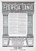 | Details | Sutherland, McConnel and Co. | 1911 |
| Fine Original Broadside for Florida Land Speculators |
|
Sutherland, McConnel and Co. |
|
| 1911 |
| LOC:61 |
| $695.00 | Sutherland--McConnel-and-Co- | Fine-Original-Broadside-for-Florida-Land-Speculators | <br></br>
<div style="text-align: center;font-size:125%;">
"Successful Men Do It Now - <br />Failures Wait Until Tomorrow"
</div>
<BR />
An original antique advertising broadside from the early Florida land boom. A fine, surviving 18" x 24" lithographed copy on thin paper, touting the opportunity that awaited the investor in Florida real estate, including 27,000 acres ("the best tract for farming") near Jacksonville, in Duval County. A fine piece of ephemera that supports and extends any collection of Florida cartography or the history of the Southeast.
<br></br>
The artifact could be considered as the "poster child" of antique Florida ephemera as the two tear-out coupons strongly suggest the broadside was not expected to have a long life and would be discarded after use.
<br></br>
"Virgin Soil", "Pure Water", "1,000,000 Acres to Choose From", "Healthful Climate", "Big Crops".
<br></br>
Offered at prices from $12.50 to $30.00 per acre by the Colonization Department of the partnership of Sutherland, McConnel & Co. of Jacksonville, Florida, Clifford Greve, General Manager. The Auck Brothers of Bucyrus, Ohio were appointed as "Special Agents" for the sale. |
| 4881 |  | Details | Seattle Municipal Plans Commission | 1911 |
| Seattle Harbor Island Waterfront District Antique Plan |
|
Seattle Municipal Plans Commission |
|
| 1911 |
| LOC:88 |
| $60.00 | Seattle-Municipal-Plans-Commission | Seattle-Harbor-Island-Waterfront-District-Antique-Plan | Antique plan of the Harbor Island Waterfront District in Seattle, Washington. Coverage extends from the proposed Outer Harbor Line to west Spokane Street and then south of Whatcom Avenue. Harbor Island is an artificial island in the mouth of the Duwamish River. When Harbor Island was completed in 1909 it was the largest (350 acres) artificial island in the world.
<br></br>
Includes two 750 foot wide slips and numerous tracks for the railways. At least 4 slips for ferry boats are shown just inside the inner harbor line.
<br></br>
The map fronts on Elliott Bay and includes features of the Duwamish East Waterway, Duwamish West Waterway, Harbor island, and the northern portion of the West Industrial District.
<br></br>
By Virgil G. Bogue, engineer. Date within to September, 1911. Map number 6. |
| 1120 | 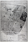 | Details | Bull, W.H. | 1911 |
| Antique Birdseye View Map of San Francisco |
|
Bull, W.H. |
|
| 1911 |
| LOC:41 |
| $675.00 | Bull--W-H- | Antique-Birdseye-View-Map-of-San-Francisco | Scarce large antique map or bird's-eye view of San Francisco, California showing the street layout as it existed in 1911. A search of the Internet finds no map with by Bulland title. Suggest you verify.
<br></br>
Key at bottom lists 31 points of interest including the Union Ferry Depot, the Southern Pacific Depot, St. Francis Hotel, Mission Dolores and locations of nine churches. Other labeled features include the Presidio, Fort Miley Park, Golden Gate Park, Buena Vista Park, Twin Peaks, Cliff House, and Telegraph Hill. Ferry routes are shown from the Union Ferry Depot to numerous points including Sacramento, Alameda, Oakland, and Berkeley, California.
<br></br>
Published after the great earthquake and subsequent fire of 1906 the map was issued by the California General Committee of the 13th International Sunday School Convention (June 20-27, 1911) to registrants at the convention. Verso contains photos and descriptions of regional points of interest.
<br></br>
San Francisco commercial artist William Howell Bull (1861-1940) was a Bull’s colorful illustrations graced the pages of books and magazines of the early 1900s. His work can also be found in the pages of the University of California yearbook, the Blue and Gold via Anthony Bruce and Facebook.
<br></br>
Bull moved to California from New York in the late 1800s. In 1893, Bull organized a trip with three other men to explore and sketch the south fork of Kings River. In 1901, Bull became a resident of San Mateo where he lived for the rest of his life and a year later co-founded the California Society of Artists as an alternative to the earlier established San Francisco Art Association. Around 1915, he worked as a commercial artist for the Southern Pacific Railroad, and also provided illustrations to Pacific Electric, Sunset magazine, and Stanford University. Bull’s rare landscape paintings typically feature scenic areas in Northern California. |
| 6429 |  | Details | Holmes, Bradford Butterick | 1911 |
| Four cyanotype sketches for a concealed five shot revolver |
|
Holmes, Bradford Butterick |
|
| 1911 |
| LOC:300 |
| $380.00 | Holmes--Bradford-Butterick | Four-cyanotype-sketches-for-a-concealed-five-shot-revolver | Set of four original antique cyanotype or blueprint inventor's sketches for a concealable revolver. The revolver was designed by Bradford Butterick Holmes in 1911. In December, 1912 Holmes was granted US patent #1,047,054 on the revolver. It was Bradford Holmes' first patent, but not his last.
<br><br>
<div id="1" align="center">
<a title="Holmes' Revolver."></a>
<img id="1" src="/ZoomifyImages/SC_6429/SC_6429_400x300.jpg" alt="" width="250"/> <br><small>Fig. 1. Holmes concealed revolver</small>
</div><br>
The first sheet of four (Fig. 1.) shows an actual size depiction of the revolver concealed within the user's fist, only the short barrel extending beyond the fingers of a hand stretched from a cuff-linked shirt. Sheets 2, 3, and 4 are double size renderings of the revolver's mechanical details. The sketches are dated October 11, 1911 and witnessed by Ruth Vickery Holmes (Bradford's wife) and Hilma Christenson.
<br><br>
In 1903 Bradford Butterick Holmes is recorded as a first year student at the Massachusetts Institute of Technology with his home town listed as Mare Island, California. Apparently Bradford Holmes wed Ruth in May 1909 and together they had two children, Elizabeth and Robert.
<br><br>
Bradford Holmes was a prolific inventor. Between 1912 and 1952 Holmes was granted over 70 patents, some for Bendix Aviation, his presumed employer. In addition to the revolver Holmes' inventions include:
<div class="indenttextblocksingle">
<ul style="list-style-type: circle;"></li>
<li>Automatic steering device for dirigible craft (US1640896A) </li>
<li>Pressure breathing regulator (US2544991A) </li>
<li>Demand valve control mechanism (US2608971A)</li>
<li>Electric timing system (US2080273A) </li>
<li>Windshield wiper and fluid motor therefor (US1731048A)</li>
</ul>
</div>
Ruth Holmes is named as a co-inventor on eight of Bradford's patents, largely from the 1930's, related to a dirigible steering mechanism. |
| 5261 |  | Details | Marden, Edwin R. | 1911 |
| Unrecorded sales plat map Villa Park Washington D.C. |
|
Marden, Edwin R. |
|
| 1911 |
| LOC:10 |
| $1,650.00 | Marden--Edwin-R- | Unrecorded-sales-plat-map-Villa-Park-Washington-D-C- | A rare, unrecorded sales plat map of Villa Park, Villa Park Heights, and Sherwood subdivisions in Washington, District of Columbia by Edwin R. Marden (d. 1914). Marden owned the National Co-operative Realty Company. Dated within to July 2, 1911.
<br></br>
Recto with a map of the entire District showing Villa Park in its geographical context and with the prices per sq. foot for other developments in the District of Columbia. The Villa Park subdivision lay just across the border from Mount Rainier, Maryland.
<br></br>
Verso with a detailed plat map and a price list for hundreds of lots with price per square foot ( $.15 to $.60 ) and the total price. The Villa Park development was generally bounded by 20th Street, Rhode Island Avenue, and Eastern avenue.
<br></br>
The detailed plat map shows <b>McKinley Circle</b> in the location of Barnard Hill Park. Apparently the feature was never developed. Land for Barnard Hill Park was acquired by the National Capital Park Commission around 1930. The park was named after Brigadier General John G. Barnard who supervised the construction of the forts protecting Washington, D.C. during the Civil War.
<br></br>
Includes four half-tone photographs of new housing at these intersections:
<div class="indenttextblocksingle">
<ul style="list-style-type: circle;">
<li>Corner Rhode Island Avenue and 22nd Street (Verso)</li>
<li>Jackson Street looking west from 20th Street (Recto)</li>
<li>Kearny Street between 20th and 22nd Streets (Recto)</li>
<li>22nd Street looking north from Kearny Street (Recto)</li>
</ul>
</div> |
| 6817 |  | Details | Schussler, Hermann | 1911 |
| San Francisco Twin Peaks Tunnel maps and proposal |
|
Schussler, Hermann |
|
| 1911 |
| LOC: |
| $0.00 | Schussler--Hermann | San-Francisco-Twin-Peaks-Tunnel-maps-and-proposal | SOLD
<br><br>
This lot is a report: "The Twin Peaks Tunnel Problem", produced by Civil Engineer Hermann Schussler on June 1, 1911, one of five competing proposals for the San Francisco Twin Peaks Tunnel that were considered by the San Francisco Board of Supervisors in 1912. Schussler's report consists of a two-page text summary of his tunnel plan along with three lithographed maps, all disbound but in excellent condition, along with the original report cover. Rare on the market.
<br><br>
The Twin Peaks Tunnel is a 2.27-mile-long light rail/streetcar tunnel in San Francisco, California built over a three-year period beginning in 1914. The tunnel was constructed in order to support the growth of San Francisco by developing roughly 5,000 acres in the southwest part of the county that were then lightly inhabited.
<br><br>
The three fine lithographed maps in Schussler's report are:<br>
1. Rapid Transit Tunnel System. (Birdseye topographic map of San Francisco with Schussler's proposed route). 20' contour intervals. 16" x 13". <br>
2. Plan for Rapid-Transit System which, while closely connecting the Mission with Golden Gate Park, - at the same time connects both, jointly with the easterly part of Richmond and the Westerly part of the Western Addition,- with Ocean Avenue, Sloat Boulevard, and Great Highway. 39" x 26". <br>
3. Continuation of #2. Details of Construction of open cuts, tunnels, and of transfer station under crossing of 17th and Shrader streets, etc. 27" x 24". <br> |
| 5437 |  | Details | Durham Iron and Coal Company | 1911 |
| Unrecorded blueprint railroad freight map southeast United States |
|
Durham Iron and Coal Company |
|
| 1911 |
| LOC:1401 |
| $315.00 | Durham-Iron-and-Coal-Company | Unrecorded-blueprint-railroad-freight-map-southeast-United-States | Very large unrecorded cyanotype (blueprint) map, a decision maker's document, showing the railroad network and rates for freight on bituminous coal shipments across the southeastern USA. The map from 1911, by the Durham Iron and Coal Company, has been marked up in manuscript to show the rail lines for several railroad companies in six groups:
<div class="indenttextblocksingle"><ul style="list-style-type: circle;">
<li>Seaboard Airline Railway</li>
<li>Atlantic Coastline Railroad</li>
<li>Southern and M. O. </li>
<li>Louisville and Nashville; Nashville, Chattanooga and St. Louis Railroad; W and A </li>
<li>Queen and Crescent; A.G.S. N.O. N. E. </li>
<li>Illinois Central, Central of Georgia</li>
</ul>
</div> |
| 6634 |  | Details | Oregon and Western Colonization Company | 1911 |
| Oregon military road land grant map |
|
Oregon and Western Colonization Company |
|
| 1911 |
| LOC:53 |
| $0.00 | Oregon-and-Western-Colonization-Company | Oregon-military-road-land-grant-map | SOLD
<br><br>
Lithographed map of Oregon grant lands featuring land grants available to settlers. Issued in 1911 as an advertising/marketing publication by the Oregon and Western Colonization Company, St. Paul, Minnesota. Scarce map. Shows several railroad lines including the Oregon Trunk Railway, Great Northern Railway, and the Oregon Electric Railway.
<br><br>
The Washington State University library concisely summarizes the history of this Military Road Land Grant:
<div class="indenttextblocksingle">
"A group of pioneers bent on constructing an east-west military wagon road across Oregon were, in 1866, awarded land grants consisting of alternate sections of land within six miles on either side of their road. The Santiam Wagon Road, as it became known, was reported finished in 1868 and opened that year as a toll road. After the grant lands passed through several hands, the Oregon & Western Colonization Co. purchased the rights to this land in 1908, and began selling the land shortly thereafter." (1) </div>
<br>
Dated within 3-11-11. Number 5307.
<br><br>
The area of the land grants include the summit of an extinct volcano- Three Fingered Jack and the towns of:
<div class="indenttextblocksingle">
<ul style="list-style-type: circle;">
<li>Lebanon, </li>
<li>Sisters,</li>
<li>Prineville</li>
<li>Paulina,</li>
<li>Burns, and</li>
<li>Skullspring.</li>
</ul>
</div>
(1) Online. Washington State University. https://content.libraries.wsu.edu/digital/collection/maps/id/659/
Accessed (January, 2023). |
| 8081 |  | Details | Cape May Beach Land Company | 1911 |
| Birds eye view of Cape May showing tract developed by Cape May Beach Land Company |
|
Cape May Beach Land Company |
|
| 1911 |
| LOC:141 |
| $0.00 | Cape-May-Beach-Land-Company | Birds-eye-view-of-Cape-May-showing-tract-developed-by-Cape-May-Beach-Land-Company | SOLD<br><br>Bird's-Eye-View of Cape May Showing Tract Developed by Cape May Beach Land Company is an early 20th century promotional bird's-eye map (1911) illustrating planned seaside development at Cape May Point, New Jersey. Drawn from an elevated offshore perspective, the map depicts the Atlantic Ocean to the east and Delaware Bay to the west, with the narrow peninsula rendered as a carefully organized landscape of streets, blocks, and shoreline frontage. The view emphasizes proximity to the ocean and bay, reinforcing the site's appeal as a coastal resort and real estate investment.<br><br>
The map clearly identifies the holdings of the Cape May Beach Land Company, with proposed streets, lot divisions, and key features such as Lighthouse Lake, Lake Lily, and the Cape Island Turnpike. Existing hotels, cottages, and infrastructure are selectively illustrated, while open land is subdivided into regular parcels intended for sale. Nautical elements, sailing vessels, and shoreline details add visual interest while reinforcing the maritime setting and leisure-oriented character of the development.<br><br>
Issued as a sales and promotional piece, the map includes contact details for the land company, underscoring its role as a speculative development advertisement. As an example of American bird's-eye cartography used for real estate promotion, the map documents the planned expansion of Cape May Point during a period of active coastal resort development, blending persuasive imagery with practical layout information for prospective buyers.<br><br> Verso with a detailed plan of lots for sale within the development. |
| 5400 |  | Details | Marsh, Frederick Dana | 1912 |
| F.D. Marsh original mosaic design with a 1600s Manhattan view |
|
Marsh, Frederick Dana |
|
| 1912 |
| LOC:3 |
| $0.00 | Marsh--Frederick-Dana | F-D--Marsh-original-mosaic-design-with-a-1600s-Manhattan-view | SOLD
<br><br>
Original decorative pencil and watercolor design "New Netherlands" by famed artist Frederick Dana Marsh. Initialed F.D.M. on the recto and stamped on the verso "Fred Dana Marsh | Wykagyl Park | New Rochelle, N.Y."
<br></br>
This sketch ca. 1913 is likely an early conceptual design for one of six terracotta (15 feet wide and 10 feet tall) murals installed during 1912 in the Marine Grill of the McAlpin Hotel in Herald Square, New York City [1]. The murals are now displayed near the William Street entrance of New York's Fulton Street Subway Station [2].
<br></br>
<FIGURE>
<IMG SRC="/ZoomifyImages/SC_5400/FDMarshMural.gif" width="200" alt="Marsh's McAlpin Hotel mural.">
<FIGCAPTION ><small>Marsh's McAlpin Hotel 'New Amsterdam' mural.</small></FIGCAPTION>
</FIGURE>
</br>
<FIGURE>
<img SRC="/ZoomifyImages/SC_5400/Marsh_stamp.jpg" width="200" alt="Frederick Marsh's ink stamp for Wykagyl Park">
<FIGCAPTION ><small>Marsh's ink stamp on verso.</small></FIGCAPTION>
</FIGURE>
</br>
Seller stated that provenance of the art is from the collection of Fred J. Johnson.
<br></br>
[1] https://tilesinnewyork.blogspot.com/2018/09/a-possible-early-sketch-for-one-of.html </br>
[2] https://www.atlasobscura.com/places/the-marine-grill-murals-of-the-mcalpin-hotel-new-york-new-york |
| 202 |  | Details | Stebbins, Nathaniel L. | 1912 |
| The New Navy of the United States |
|
Stebbins, Nathaniel L. |
|
| 1912 |
| LOC:0 |
| $0.00 | Stebbins--Nathaniel-L- | The-New-Navy-of-the-United-States | <BR> </BR>
SOLD
<BR> </BR>
Black and white photographic record of U.S. Navy vessels published in 1912 by the noted Boston marine photographer Nathaniel Stebbins. Contains roughly 200 photographs that capture a transitional period in naval architecture and shows how some remnants of sailing ship design lingered well into the era of steam-power. Brief technical descriptions beneath each photo capture key dimensions and armament of each ship. <BR> </BR>
Contains a supplement and photographs on the Revenue Cutter Service by Capt. Preston Uberroth. Three years after the publication of this work the Revenue Cutter Service was merged with the Lifesaving Service to form the new United States Coast Guard. |
| 4751 |  | Details | British Admiralty Hydrographical Office | 1912 |
| Antique chart of Galveston Bay to the San Bernard River, Texas |
|
British Admiralty Hydrographical Office |
|
| 1912 |
| LOC:63 |
| $525.00 | British-Admiralty-Hydrographical-Office | Antique-chart-of-Galveston-Bay-to-the-San-Bernard-River--Texas | A fine early 20th-century British Admiralty chart of <B>Galveston Bay, Bolivar Peninsula, San Bernard River, and Galveston Island, Texas</b> made long before the massive development we see today. This chart, published by the Hydrographic Office is based on existing U.S. Coast Survey charts of the area from 1855 - 1858.
<br></br>
Coverage includes all of Galveston Bay extending as far north as San Jacinto Bay and Turtle Bay. Numerous named features include Quintana, Bastrop Bayou, San Luis Pass, Texas City, Clear Lake, the Trinity River, Fort Anahuac, and Bolivar Point. Shows existing and proposed dredged navigation channels. Inset large-scale charts for Clopper's Bar and Redfish Bar.
<br></br>
Published at the Admiralty under the Superintendence of Captn. Washington R.N. F.R.S. Hydrographer. Sold by J.D. Potter Agent for the Admiralty. Numerous small and large corrections; the last correction being in 1912.
MS notations on verso identifying the chart collation number "68" in large red letters. Number 2831. |
| 5190 |  | Details | Anonymous | 1912 |
| Saloon Map of New Haven Connecticut |
|
Anonymous |
|
| 1912 |
| LOC:200 |
| $400.00 | Anonymous | Saloon-Map-of-New-Haven-Connecticut | Very scarce thematic map related to the temperance movement: "Saloon Map of New Haven, Connecticut" where red dots indicate the location of saloons within the city. Left side with statistics unfavorable to the consumption of alcohol which link alcohol to many of the ills besetting New Haven at the beginning of the twentieth century. For example:
<div class="indenttextblocksingle">
<ul style="list-style-type: circle;">
<li>One saloon to every 349 inhabitants.</li>
<li>42 percent of New Haven's arrests are for drunkenness.</li>
<li>44 percent of New Haven inmates of jail are there for drunkenness</li>
<li>60 percent of New Haven children in local public institutions in 1911 due to drunkenness of parents.</li>
</ul>
</div>
[ alcohol, temperance, prohibition, bar, pub, drinking, intoxication ] |
| 6425 |  | Details | Hope Mining, Milling, and Leasing Company | 1912 |
| Aspen Colorado Hope Mining Lease Map Brochure |
|
Hope Mining, Milling, and Leasing Company |
|
| 1912 |
| LOC: |
| $625.00 | Hope-Mining--Milling--and-Leasing-Company | Aspen-Colorado-Hope-Mining-Lease-Map-Brochure | Map of the property of the Hope Mining, Milling, and Leasing Company of Aspen, Colorado ca. 1912. An optimistic four-panel folding promotional brochure designed for potential investors. The Hope mine lies about four miles due south of the town of Aspen, Colorado at an altitude of 10,259 feet. The map is found on the verso flanked by two striking full-panel images of local mountainous mining scenes in a style somewhat similar to a wood-block print. The verso will make a very-attractive presentation when framed.
<br><br>
The recto contains three photographic images of the Aspen, Colorado area and of the Hope mine:
<div class="indenttextblocksingle">
<ul style="list-style-type: circle;"></li>
<li><i>"Aspen, The Crystal City of the Rockies"</i></li>
<li><i>"Portal of the Tunnel"</i></li>
<li>A larger two-panel image with the caption: <i>"You are looking at the power plant in the foreground. The boarding house is on the hillside in the rear. The winding road leads down to Castle Creek which will be the source of our hydro-electric power when we "strike" it."</i></li>
</ul>
</div>
Folded 4" x 9". Unfolded 14" x 8 within the neatlines.
<br><br>
In October 1911 the Crystal City (Aspen, Colorado) Boosters Association organized a local mining company the "Hope Mining, Milling, and Leasing Company" with initial capitalization of $50,000. The Association secured ten-year leases on the Little Annie Group of Mines, the Little Annie Tunnel, and the Famous Tunnel. [1]
<br><br>
[1] "Hope Mining, Milling, and Leasing Company: Read and 'Get Wise' to what the Crystal City Boosters are doing for Aspen and the 'Get In' the bandwagon and boost." The Aspen Democrat-Times. Aspen, CO. March 6, 1912. |
| 5294 |  | Details | Sanborn Map Company | 1913 |
| Insurance Atlas for Jacksonville Florida Vol. 2 |
|
Sanborn Map Company |
|
| 1913 |
| LOC: |
| $0.00 | Sanborn-Map-Company | Insurance-Atlas-for-Jacksonville-Florida-Vol--2 | SOLD
<br></br>
Sanborn's Insurance Atlas Volume two for Jacksonville, Florida with 1913 copyright date and pasted updates from 1920's, 1940's - 1950's. The manuscript correction record shows 12 sets of corrections between April 1949 and April 1960, but earlier updates appear to have been made. A very heavy atlas published by Sanborn Map Company, Broadway New York.
<br></br>
Volume two coverage includes downtown north Jacksonville with almost all important river frontage along the St. John's River south of Long Branch Creek. A quick sampling of features includes Jacksonville Memorial Stadium- the GATOR BOWL, City Hall, Jacksonville Gas Company, Sinclair Refining Company storage plant, Merrill-Stevens Dry Dock and Repair.
<br></br>
Pages have not been counted or checked for completeness but the sheets are generally in good condition with linen binder's tabs still holding all tightly in place in the metal binder. Built to last! Many sheets are original to 1913 (see bottom right corner) with pasted updates; some sheets have been replaced over time.
<br></br>
Numerous (hundreds) of pasted updates over five decades make this an invaluable cartographic researcher's reference source for Jacksonville, Florida in the first half of the 20th century. In some cases entire new updated sheets are pasted over old sheets. It is possible, in theory, to perform an "archaeological" unpasting all the way down to the original base maps from 1913. For example sheets 171 and 172 show pasted overlays of an new East Expressway laid over the original 1913 base maps, potentially providing a clear picture of urban renewal in action. |
| 7903 |  | Details | Green, Lewis Henry | 1913 |
| Early Plat of Royal Park Palm Beach Florida |
|
Green, Lewis Henry |
|
| 1913 |
| LOC:500 |
| $0.00 | Green--Lewis-Henry | Early-Plat-of-Royal-Park-Palm-Beach-Florida | SOLD<br><br>Brochure (9" x 8") with a detailed plat of the Royal Park addition in Palm Beach, Florida. The Royal Park addition was one of the earliest planned developments in Palm Beach, Florida, developed starting around 1908, three years before Palm Beach was incorporated, in 1911. Royal Park was developed by Elisha Newton "Cap" Dimick, Palm Beach's first mayor, and early developers who had previously worked on the development of the Palm Beach Inn (later known as The Breakers hotel).
<br><br>
Dimick and his business partners marketed Royal Park as an exclusive residential community, featuring large lots, ocean to lake access, and Mediterranean Revival style architecture. In 1913, Lewis Henry Green, a wealthy Mexican-born real estate agent and investor from California, started working for the Royal Park subdivision in Palm Beach, Florida. He employed a game plan of splashy advertising, auctions, and prize giveaways for buyers. Green's dubbing of Royal Park as "the Millionaire's Playground" sparked significant interest in the development.
<br><br>
Tours of the "playground" were handled by W.E. Watson, a businessman who helped promote the project with two 24-seat vehicles that made the rounds. Green offered prizes daily at afternoon auctions held three days a week on Royal Palm Way, opposite the new bridge. At the first auction, 600 to 800 people attended, buying lots at around $375 each.
<br><br>
Royal Park sold out by 1917. Completed and settled a year later with eclectic bungalows, gabled Victorians, and front-porch cottages, the subdivision's burgeoning prominence would shift the town's center southward, paving the way for the 1920s dawn of Worth Avenue. |
| 6732 |  | Details | Goldthwait, James Walter | 1913 |
| Topographical map region five miles Dartmouth campus |
|
Goldthwait, James Walter |
|
| 1913 |
| LOC:68 |
| $0.00 | Goldthwait--James-Walter | Topographical-map-region-five-miles-Dartmouth-campus | SOLD<br><br>Unrecorded diazotype blueline map of the area within a five-mile radius of the campus of Dartmouth University, in Hanover, New Hampshire. The Connecticut River bisects the map. This 1913 Second Edition map is annotated in manuscript with colors reflecting local geological features including granite, sand, gneiss, trap and hornblende schist, described below the map in a manuscript hand-colored index. Contour interval is 20 feet. Scale 2.5 inches = one mile. The base map, described below, is credited to James Walter Goldthwait (1) and was drawn by R. E. Pritchard.
<br><br>
Similar to a copy from January 1913 in the library at Dartmouth. This November, 1913 edition is updated with a significant amount of new topographic detail that was lacking in the edition of January, 1913 found at the Dartmouth Library (2).
<br><br>
<div class="indenttextblocksingle">
"The map is based upon the Hanover and Strafford Quadrangles of the U.S. Geological Survey. Incorporated into it are detailed stadia-survey maps of the districts near Hanover Village and the Reservoir by members of Thayer School of Civil Engineering. The topography of the eastern part of the region was done by J.W. Goldthwait and R.W. Tobey in 1911 - 1912." Title description.
</div>
<br><br>
(1) James Walter Goldthwait (1880-1947) was Dartmouth College, Geology Professor and Curator of the Dartmouth College Museum from 1912 to 1928. Hanover, New Hampshire. Goldthwait authored the well regarded "The Geology of New Hampshire", published by Rumford Press, Concord, N.H. in 1925.
<br><br>
(2) Another edition, lithographed, at the Dartmouth Library from 1915, show concentric circles at one mile intervals around the center. Walker Lith & Pub Co., Boston. (Online: https://hoodmuseum.dartmouth.edu)
<br><br>
(3) https://collections.dartmouth.edu/archive/... |
| 6562 |  | Details | Eldridge, George W. | 1913 |
| G. W. Eldridge navigation chart for Martha's Vineyard and Nantucket MA |
|
Eldridge, George W. |
|
| 1913 |
| LOC:1406 |
| $0.00 | Eldridge--George-W- | G--W--Eldridge-navigation-chart-for-Martha-s-Vineyard-and-Nantucket-MA | SOLD<br><br>
A fine intact antique example of Eldridge's very desirable "Chart C" including the islands of Martha's Vineyard and Nantucket in Massachusetts. Once relatively plentiful, this splendid lithographed nautical chart by George Washington Eldridge is becoming increasing hard to find for sale.
<br><br>
Copyright by George W. Eldridge, 1912.
<br><br>
A very "user friendly" nautical chart that would have been appreciated by mariners in the early 20th century who lacked today's electronic navigational aids. This large linen-backed chart includes the following ports and towns: Edgartown, Siasconset, Nantucket town, Vineyard Haven, Oak Bluffs, Falmouth, Cotuit, Osterville, Hyannis, West Dennis, Harwich Port, and Chatham.
<br></br>
Shown numerous islands along the coast including Chappaquiddick Island, Cuttyhunk Island, Nashawena Island, Pasque Island, Naushon Island, No Man's Land, Tuckernut Island, Muskeget Island, and Monomoy Beach, now Monomoy Island.
<br></br>
Dotted with interesting comments and observations including:
<div class="indenttextblocksingle">
<ul style="list-style-type: circle;">
<li>"In passing Chatham in thick weather or night time bound to the Northward or Southward make use of the lead and do not go into less than 7 or 8 fathoms of water to avoid the bars that are rapidly extending from the shore and are dangerous."</li>
<li>"Vessels passing Nobska in either direction displaying signals will be reported by telegraph to the Boston Chamber of Commerce."</li>
<li>About the Nantucket Head of Harbor entrance: "Strangers should enter this place with caution as it changes with every storm from seaward."</li>
</ul>
</div>
Charles C. Hutchinson 152 State Street Boston General Agent. |
| 6669 |  | Details | Empire Tours Accociation | 1913 |
| 1915 Empire Tours map Native American Adirondack Iroquois and Onondaga Trails |
|
Empire Tours Accociation |
|
| 1913 |
| LOC:86 |
| $100.00 | Empire-Tours-Accociation | 1915-Empire-Tours-map-Native-American-Adirondack-Iroquois-and-Onondaga-Trails | Empire Tours thematic tours map issued by the Empire Tours Association in 1913. Map shows three colored auto-tourism routes in New York State: the Adirondack Trail, Iroquois Trail, and Onondaga Trail all routes associated with Native American tribes and. Numbers opposite the tour routes referred to corresponding route numbers in Volume 1 of the Automobile Blue Book.
<br><br>
Copyright Empire Tours Association. Compiled by Official Automobile Blue Book Publishing Company. Comprises eight panels of a 12-panel brochure.
<br><br>
Overall, the Empire Tours map issued by the Empire Tours Association in 1913 provides a fascinating glimpse into the early days of auto tourism in New York and the United States, and highlights the important role that organizations like the Empire Tours Association played in promoting travel and tourism in the region.
<br><br>
During the early 20th century, the advent of the automobile brought about a new era of travel and exploration, as more and more people began to hit the road in search of adventure and new experiences. To help these travelers navigate the often-unfamiliar territory they encountered on their journeys, publishers began producing auto tour road maps, which provided detailed information about road conditions, landmarks, and other useful information.
<br><br>
Circa 1910-1920, these road maps were an essential tool for any auto tourist, as they helped drivers plan their routes, find accommodations, and locate important sites and attractions along the way. Many of these maps were produced by established publishers, such as the Official Automobile Blue Book Publishing Company and Rand McNally, and featured colorful illustrations, detailed descriptions, and helpful tips for travelers.
<br><br> |
| 5273 |  | Details | Beck, George W. | 1914 |
| Scarce map of the route of the Overland Westerners. |
|
Beck, George W. |
|
| 1914 |
| LOC:14 |
| $95.00 | Beck--George-W- | Scarce-map-of-the-route-of-the-Overland-Westerners- | Map ca. 1914 documenting a 20,352 mile horse-back ride across the United States (1912-1915) that visited the state capitols in each of the 48 contiguous states. Map on one panel of a an unused folding postcard with photographs of the four riders who made the journey: C. C. Beck, J. B. Ransom, G. W. Beck, and R. G. Rayne.
<br></br>
The four riders set out from Shelton. Washington on May 1, 1912 and sold promotional calendars and postcard along the way to pay for their expenses. On May 24, 1915 the four reached their final state capitol at Sacramento, California and they ended the trip at the Panama-Pacific International Exposition in San Francisco on June 1, 1915. Unfolded the card measures 7" x 5.5". |
| 557 | 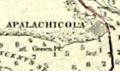 | Details | U.S. Coast and Geodetic Survey | 1914 |
| 1914 Inside Route Pilot Key West to New Orleans |
|
U.S. Coast and Geodetic Survey |
|
| 1914 |
| LOC:2001 |
| $400.00 | U-S--Coast-and-Geodetic-Survey | 1914-Inside-Route-Pilot-Key-West-to-New-Orleans | Very scarce, intact 1914 Coast Pilot with six strip charts and sailing directions for what is now the Gulf Intracoastal Waterway, from Key West, Florida heading north and then west to New Orleans, Louisiana. Published by the U.S. Coast and Geodetic Survey. Contains 93 pages of text plus an index.
<br><br/>
In its early history some portions of the 'inside route' were owned and dredged by private entities who charged a toll to vessels for passage, sometimes by stringing a chain across narrow passages to restrict traffic flow. After 1919 Congress mandated that the entire passage should be turned over to the Federal government and the tolls were eliminated.
<br><br/>
The sailing directions for Bayou St. John describe a moment in time that New Orleans residents can only imagine today: <dir class="indenttextblock">The channel at the entrance is protected by training walls on each side. Spanish Fort is a pleasure resort at the mouth of Bayou St. John and is connected with New Orleans by an electric car line... Small craft of all kinds use the bayou as far as Esplanade Street, about 2 3/4 miles above the entrance, but pleasure boats rarely go above that point." </dir>
Size of each chart when folded is approximately 8" x 5". The pilot's lithographed working navigational charts capture the full extent of the southern U.S. Inside Route in detail. Chart sections include roughly these areas and chart sizes: (fully opened, height is 10" and width is listed below). <br>
1. Key West to Matanzas Pass - 24"<br>
2. Matanzas Pass to Clearwater - 23"<br>
3. Clearwater to Tampa - 27"<br>
4. Tampa to St. Andrews Sound - 24"<br>
5. St. Andrews Sound to Bay St. Louis - 36"<br>
6. Bay St. Louis to New Orleans. - 23"<br>
<br><br/>
If they were placed end to end, the charts would extend over 13 feet long. Original price 20 cents. Published by the Government Printing Office in Washington DC in 1915. |
| 3588 | 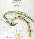 | Details | Eldridge, George W. | 1914 |
| Iconic Antique Chart of Provincetown, Mass. |
|
Eldridge, George W. |
|
| 1914 |
| LOC:10 |
| $450.00 | Eldridge--George-W- | Iconic-Antique-Chart-of-Provincetown--Mass- | Elegant, simple and useful early 20th-century antique nautical chart of Provincetown, Massachusetts on the island of Cape Cod, Mass. Very attractive hand coloring. Features include Race Point, Wood End Bar, North Truro, Clapp's Pond, Herring Cove, Shank Painter Pond; and the Highland, Crow Hill, and Peaked Hill Life Saving Stations.
<br></br>
Much useful information including soundings, anchorages, ranges, buoys, and bottom composition are presented by Eldridge in a clear graphic style that would have been appreciated by and helpful to mariners. For instance, this chart of Provincetown, MA. is printed with bold black coastal outlines that would have been much easier to read under poor lighting conditions. Lighthouses, buoys, and other aids to navigation are highlighted in red. Bottom composition is presented according to an attached table of abbreviations.
<br></br>
Published by Wilfrid O. White of Boston, Massachusetts. White was G. W. Eldridge's son-in-law who continued to sell Eldridge's charts after his death until 1932.
<br></br>
Attribution reads: 'AUTHORIZED and PUBLISHED By Geo. W. Eldridge, Kelvin & Wilfrid O. White Co. 112 State Street, Boston. 38 Water Street, New York ' Number 49 in Eldridge's book of harbor charts. |
| 2558 | 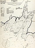 | Details | Eldridge, George W. | 1914 |
| Antique Harbor Chart of Stamford Connecticut |
|
Eldridge, George W. |
|
| 1914 |
| LOC:10 |
| $350.00 | Eldridge--George-W- | Antique-Harbor-Chart-of-Stamford-Connecticut | Early 20th-century antique nautical chart of Stamford, Connecticut harbor and channels ca. 1914. Noted features and locations include Stamford Yacht Club House, Shippan Point, Peck's Point, Davenport Point, Pine Island, and Stamford Light. Printed on strong, watermarked paper "Resolute Ledger".
<br></br>
Much useful information including numerous rocks, soundings, anchorages, ranges, buoys, and bottom composition near Stamford are presented by Eldridge in a clear graphic style that would have been appreciated by mariners. For instance, this chart of Stamford Ct. is printed with bold black coastal outlines that would have been much easier to read under poor lighting conditions. Lighthouses, buoys, and other aids to navigation are highlighted in red or green.
<br></br>
Published by Wilfrid O. White of Boston, Massachusetts. White was Eldridge's son-in-law who continued to sell Eldridge's charts after his death until 1932.
<br></br>
Attribution reads: 'AUTHORIZED and PUBLISHED By Geo. W. Eldridge, Kelvin & Wilfrid O. White Co. 112 State Street, Boston. 38 Water Street, New York '. Number 10 in Eldridge's book of harbor charts. |
| 6361 | 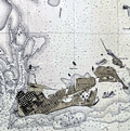 | Details | U.S. Coast and Geodetic Survey | 1914 |
| Key West Harbor 1914 |
|
U.S. Coast and Geodetic Survey |
|
| 1914 |
| LOC: |
| $1,000.00 | U-S--Coast-and-Geodetic-Survey | Key-West-Harbor-1914 | Large 42" x 34" U.S. Coast Survey chart of Key West Harbor, Florida . Issued September 1914 by the U.S. Department of Commerce / U.S. Coast Survey. Number 584. A scarce original nautical chart of Key West at 107 years old. Last date is 1914. |
| 5443 |  | Details | U.S. Coast and Geodetic Survey | 1914 |
| Scarce antique chart of Key West Harbor and Approaches |
|
U.S. Coast and Geodetic Survey |
|
| 1914 |
| LOC: |
| $1,440.00 | U-S--Coast-and-Geodetic-Survey | Scarce-antique-chart-of-Key-West-Harbor-and-Approaches | A scarce 107 year-old chart of Key West Harbor and its approaches in Florida. A nice example, scarce to find with process color from this era.
<br></br>
Published by the US Coast and Geodetic Survey in 1914, the chart shows Whitehead spit, east and west Martello Tower, Raccoon Key, and Stock Island. Coverage extends to the west as far as Boca Grande Key. Chart # 584. Price when issued was 50 cents. |
| 2557 |  | Details | Eldridge, George W. | 1914 |
| Bold Antique Chart of Newport Rhode Island |
|
Eldridge, George W. |
|
| 1914 |
| LOC:0 |
| $0.00 | Eldridge--George-W- | Bold-Antique-Chart-of-Newport-Rhode-Island | SOLD<br></br>
Elegant, simple and useful early 20th-century antique nautical chart of Newport, Rhode Island harbor ca. 1914. Nearby points of interest include the Brenton Reef light-ship, Pirate's Cave, Castle Hill, Fort Dumpling, Coaster's Harbor Island, Dutch Island, Beaver Head, Jamestown and Sanderstown . Cartography by George W. Eldridge. Watermarked paper "Resolute Ledger".
<br></br>
Much useful information including soundings, anchorages, ranges, buoys, and bottom composition are presented by Eldridge in a clear graphic style that would have been appreciated by and helpful to mariners. For instance, this chart of Newport, R.I. is printed with bold black coastal outlines that would have been much easier to read under poor lighting conditions. Lighthouses, buoys, and other aids to navigation are highlighted in red or green.
<br></br>
Published by Wilfrid O. White of Boston, Massachusetts. White was G. W. Eldridge's son-in-law who continued to sell Eldridge's charts after his death until 1932.
<br><br>
Attribution reads: 'AUTHORIZED and PUBLISHED By Geo. W. Eldridge, Kelvin & Wilfrid O. White Co. 112 State Street, Boston. 38 Water Street, New York ' Number 34 in Eldridge's book of harbor charts. |
| 4938 |  | Details | Live Oak, Perry, and Gulf Railroad Company | 1915 |
| Suwannee River Land Belt allotment certificate |
|
Live Oak, Perry, and Gulf Railroad Company |
|
| 1915 |
| LOC:0 |
| $0.00 | Live-Oak--Perry--and-Gulf-Railroad-Company | Suwannee-River-Land-Belt-allotment-certificate | SOLD<br></br>
Scarce map ca. 1915 of land offered for sale by the Live Oak, Perry, and Gulf Railroad Company Land Commissioners: "Suwannee River Land Belt Offered by the Land Department of the Live Oak, Perry and Gulf Railroad Company, Live Oak - Fla."
<br/><br/>
Coverage includes a large portion of Florida in the vicinity of Perry, Mayo, Live Oak, Branford, and the Steinhatchee Conservation Area.
<br/><br/>
Map lies on the verso of a sheet designated an "Allotment Certificate", a blank document for a real-estate buyer containing details of an offer to sell land from property surrounding their rail line the: "Suwannee Land Belt ." Recto with front and back of the "Allotment Certificate" with blanks to be filled. Date field reads "… for a period of Sixty Days from ______ 191_ ." |
| 4967 |  | Details | Barker, Charles R. | 1915 |
| Three antique manuscript maps of Ardmore Pennsylvania |
|
Barker, Charles R. |
|
| 1915 |
| LOC:200 |
| $600.00 | Barker--Charles-R- | Three-antique-manuscript-maps-of-Ardmore-Pennsylvania | Lot of three original hand-drawn (manuscript) maps of Ardmore, Pennsylvania. Ardmore, a close suburb on the west side of Philadelphia, lies within Montgomery County and Delaware County.
<br></br>
The largest map, at 8" x 16", is a large-scale MS plat map, a copy of an 1822 tract map for land owned by Simon Litzenberg. The copy was made by Charles R. Barker on August 1, 1915.
<br></br>
The other two manuscript maps each roughly 8" x 12" are smaller scale maps of Ardmore Pennsylvania with detail. One map with hand color and showing the campus for Haverford College and the Merion Cricket Grounds. Not signed; presumed by Barker. |
| 5033 |  | Details | Fryhofer, George | 1915 |
| Antique auction broadside for Boca Ratone Raton Florida |
|
Fryhofer, George |
|
| 1915 |
| LOC:200 |
| $0.00 | Fryhofer--George | Antique-auction-broadside-for-Boca-Ratone-Raton-Florida | SOLD
<br></br>
One-of-a-kind foundational auction broadside with a charming <b>zoomorphic</b> map (verso) of <b>Boca Raton, Florida</b>. The broadside and map advertise the auction of several hundred lots in "Boca Ratone" by owner George Long (1), and conducted by George Fryhofer, auctioneer on Washington's birthday, Feb 22, 1915, eight years before the town of Boca Raton was incorporated. No holdings of this map are found in WorldCat, AMPR, or elsewhere.
<br></br>
This rare broadside clearly shows the location of the Boca Raton Post Office and of the home of George Long, a home that formerly belonged to Henry Flagler. Map also has a zoomorphic scene of a rat and a cat at the entrance to Lake Boca Raton; the land encompassed within the cat is labeled "<b>Black Cat Plantation</b>" (2).
<br></br>
As described online "The Youngs heard that George Fryhofer was holding a lot auction in Boca Raton, so Mrs. Young and her friend, Mr. Muhle, came up to attend the auction. Peg [Young] surprised herself by buying four lots on East Palmetto Park Road [previously Ocean Boulevard] where the 7-11 store is located".
<br><br>
(1) George Ashley Long (d. 1929) was a retired farmer, civil engineer, and commissioner from South Palm Beach County, Florida as well as the first mayor of Boca Raton. In the same year as this sale (1915) Long developed the three-block <b>Pearl City</b> subdivision for African Americans near today’s Dixie Highway and Glades Road. Pearl City, about 3/4 mile from this property, was named for a variety of pineapple, the Hawaiian Pearl.<br><br>
(2) <b>Black Cat Plantation</b> was a parcel of land owned by the first settler in Boca Raton, <b>Captain Thomas Moore Rickards</b>. Rickards bought 50 acres in Lake Boca Raton in the 1880's when he worked as a railway agent to survey the state. Rickards is credited with drawing the first known map of the area in 1900. |
| 6572 |  | Details | Newspaper Art League | 1915 |
| Marin County California Pictorial Cadastral Map of La Verne Heights Subdivision |
|
Newspaper Art League |
|
| 1915 |
| LOC: |
| $0.00 | Newspaper-Art-League | Marin-County-California-Pictorial-Cadastral-Map-of-La-Verne-Heights-Subdivision | SOLD
<br><br>
Rare cadastral map of La Verne Heights, a newly platted subdivision in Marin County, California circa 1915. Only two other copies of this scarce cadastral map are known, both at institutions. No sales of the map are recorded.
<br><br>
J. W. Wright & Co of San Francisco were the exclusive agents for the land. Bears the attribution and the logo of the Newspaper Art League.
<br><br>
At top of the plan is a depiction of the Park Avenue Station and the lines for a "Fast Electric Train" of the Northwestern Pacific Railroad (NWP) that claimed a one way commute of "15 minus to Sausalito" and "1/2 hour to San Francisco. The NWP operated a network of electric rail lines in Marin County from 1903 to 1941.
<br><br>
At upper left is an inset view of Mt. Tamalpais from Laverne Heights. Inset of Marin County High School, actually Tamalpais High School with an optimistic note: "12 minutes.. walk to Marin County High School."
<br><br>
Homes are depicted of some prominent existing families who lived nearby including: Captain Robinson, Dr. Allen, the Armstrong Home, the Isted and the Stolte residences, the Dobbs, Wises, Gruenhagens, and Lillian Ferguson. Ferguson was a reporter on the San Francisco Examiner, later she edited paper's Sunday edition.
<br><br>
The developer included lot dimensions, square footage, and lot number.
<br><br>
(1) Online. December 2022. https://www.mvhistory.org/history-of/history-of-homestead-valley/laverne-heights-maps/ |
| 633 |  | Details | Murphy, John F. | 1915 |
| Birds Eye View of Boston Harbor and South Shore |
|
Murphy, John F. |
|
| 1915 |
| LOC:0 |
| $0.00 | Murphy--John-F- | Birds-Eye-View-of-Boston-Harbor-and-South-Shore | <a href="https://www.rarecharts.com/ShowDetail/Creator/Murphy--John-F-/Title/Early-Birds-Eye-View-of-Boston-Harbor-and-the-South-Shore/1141" target="_blank">This item is sold, but see another similar item in our stock</a>
<br></br>
Original, early 20th-century folding harbor excursion map of South Boston, Nantasket Beach, Hough's Neck, South Bay, Pleasure Bay, Boston Harbor, Dorchester Bay, Quincy Bay, Hingham, Squantum, and Cape Cod Bay to Provincetown. Verso is blank. Index on inside cover with 35 points of interest.
<BR> </BR>
Published by John F. Murphy, South Station, Boston. That firm is listed on the cover as: " News Agent Eastern District, N.Y.N.H & H.R.R. and Fall River Line Steamers and ROWES WHARF". Price is noted on the front cover as "10 cents". |
| 4736 |  | Details | Murphy, John F. | 1915 |
| Birds Eye View of Boston Harbor and South Shore to Provincetown |
|
Murphy, John F. |
|
| 1915 |
| LOC:88 |
| $275.00 | Murphy--John-F- | Birds-Eye-View-of-Boston-Harbor-and-South-Shore-to-Provincetown | ON HOLD
<br><br>A fine, original, early 20th-century folding harbor excursion map of Boston Harbor ready for framing. This fine antique birds-eye view is bright, in great condition with no holes or tears as is common.
<BR> </BR>
Coverage includes South Boston, Nantasket Beach, Hough's Neck, South Bay, Pleasure Bay, Boston Harbor, Dorchester Bay, Quincy Bay, Hingham, Squantum, and Cape Cod Bay to Provincetown. Verso is blank. Index on inside cover with 35 points of interest keyed on the map.
<BR> </BR>
Published by Union News Company , South Station, Boston, Massachusetts. Price is noted on the front cover as "10 cents". Manuscript owner's name on cover, detached but present. |
| 2551 |  | Details | Rhea, J.J. | 1915 |
| Tourist Association Travel Map of Central California |
|
Rhea, J.J. |
|
| 1915 |
| LOC:0 |
| $0.00 | Rhea--J-J- | Tourist-Association-Travel-Map-of-Central-California | SOLD<br></br>
Early 20th century travel map of Central California by the Tourist Association of Central California. Shows early automobile and railroad transportation routes. Map coverage ranges from Pieta and Kelseyville in the north, extending down past Jolon to the south. Folds to 8 3/4 to 9 3/16.
<br></br>
Legend at side states "Auto roads in orange. Railroads in black and white. Waterways in blue." |
| 1352 |  | Details | Bullard Company, The | 1916 |
| Huge road map of New England with early advertisements |
|
Bullard Company, The |
|
| 1916 |
| LOC:0 |
| $65.00 | Bullard-Company--The | Huge-road-map-of-New-England-with-early-advertisements | Large antique advertising-related 4' x 3' road map of south New England from the beginning of the age of automobile travel. Coverage extends from New York and Albany in the west to Cape Ann and Nantucket in the east. Includes Boston, Cape Cod, Martha's Vineyard, Block Island Sound, Rhode Island and Long Island Sound. Copyrighted 1916 by the Bullard Company, 44 Cornhill, Boston. A fine piece for the man-cave. (Yard-stick shown for size estimation, not included).
<br></br>
Inset advertising and related photographs and numerous closeup circular maps of key areas including: Fall River, Marblehead, New London, Concord, Plymouth, and Cape Cod. Overstamp reads: "Compliments of the Hotel Raymond. Fitchburg, Mass.".
<br></br>
Verso with advertisements and numerous tables of related information including distances and census data. Orginal envelope included. |
| 4771 |  | Details | U.S. Coast and Geodetic Survey | 1916 |
| Nantucket Sound Massachusetts |
|
U.S. Coast and Geodetic Survey |
|
| 1916 |
| LOC:53 |
| $1,200.00 | U-S--Coast-and-Geodetic-Survey | Nantucket-Sound-Massachusetts | Fine antique engraved nautical chart first issued in 1915 covers the southeast portion of Cape Cod trending south and includes Hyannis Harbor, Tuckernuck Island and the islands of Nantucket, Monomoy, Chatham and eastern Nantucket Sound.
<br></br>
This bright antique chart bears a stamp at the bottom right in black ink that identifies this edition as corrected to May 29, 1916. Plate number 3446 for this 1915 ed. replaced the previous edition of 1909 which used plate number 2999. With the circular logo of the Department of Commerce and Labor. Chart number 111. |
| 301 |  | Details | U.S. Coast and Geodetic Survey | 1916 |
| 1916 Inside Route New York to Key West |
|
U.S. Coast and Geodetic Survey |
|
| 1916 |
| LOC:0 |
| $0.00 | U-S--Coast-and-Geodetic-Survey | 1916-Inside-Route-New-York-to-Key-West | <BR> </BR>
This item has been sold but please see <a
href="https://www.rarecharts.com/ShowDetail/Creator/U-S--Coast-and-Geodetic-Survey/Title/8-Charts-Inside-Route-New-York-to-Key-West-or-ICWW-1916/6553">another example, our first in eleven years.</a>
<BR> </BR>
Complete set of eight U.S. Coast and Geodetic Survey folding navigational charts for the inside route for maritime traffic on the eastern coast of the United States from New York South. These historical charts from 1916 predate the U.S. Government's ownership of the route which later became part of the Intracoastal Waterway (ICW) . Placed end to end, the charts would extend over 18 feet long. |
| 6553 |  | Details | U.S. Coast and Geodetic Survey | 1916 |
| 8 Charts Inside Route New York to Key West or ICWW 1916 |
|
U.S. Coast and Geodetic Survey |
|
| 1916 |
| LOC:300 |
| $585.00 | U-S--Coast-and-Geodetic-Survey | 8-Charts-Inside-Route-New-York-to-Key-West-or-ICWW-1916 | Very scarce and complete set of eight U.S. Coast and Geodetic Survey folding navigational charts for the inside route for maritime traffic on the eastern coast of the United States from New York South. Third edition. These historical charts from 1916 predate the U.S. Government's ownership of the route which later became part of the Intracoastal Waterway (ICWW) . Placed end to end, the charts would extend over 18 feet long.
<br><br>
Includes the 94 page Coast Survey Sailing Directions that once housed the 8 charts in an attached interior envelope. Card cover. Binding intact. Price when issued was 20 cents.
<BR> </BR>
A bit of research shows that in its early history some portions of the inside route were owned and dredged by private entities who charged a toll to vessels for passage, sometimes by stringing a chain across narrow passages to restrict traffic flow. In fact, chart 7 contains manuscript pencil annotations, obviously made during a voyage, of "Toll" and "Toll chain" that reflects that little-known fact. Interestingly, the toll chains are not noted as part of the official chart. After 1919 Congress mandated that the entire passage should be turned over to the Federal government and the tolls were eliminated.<BR> </BR>
Size of each chart when folded is approximately 8" x 5". These 8 lithographed working navigational charts capture the full extent of the eastern U.S. inside route in detail with some manuscript pencil annotations, especially in Florida. Chart sections include roughly these areas and chart sizes: (one dimension is typically 10" and the other dimension is below). <BR>
1. Jersey City to Philadelphia - 10" <BR>
2. Philadelphia to Norfolk - 33" <BR>
3. Norfolk to Cape Lookout - 28" <BR>
4. Cape Lookout to Murphy Island - 31" <BR>
5. Murphy Island to Fernandina - 35" <BR>
6. Fernandina to Cape Canaveral -28" <BR>
7. Cape Canaveral to Miami -32" <BR>
8. Miami to Key West - 24" <BR> |
| 5230 |  | Details | Calvin, F. F. | 1916 |
| WWI map promoting Salt Lake City as an Army Depot |
|
Calvin, F. F. |
|
| 1916 |
| LOC:62 |
| $0.00 | Calvin--F--F- | WWI-map-promoting-Salt-Lake-City-as-an-Army-Depot | SOLD<br></br>
Colorful, unrecorded thematic map made during WWI with the objective of presenting Salt Lake City, Utah as a great choice for a future Army Depot based on its proximity to war materials. In 1920 the Ogden Ordnance Reserve Depot was established (with 1410 acres) as a general storage depot for left-over ordnance from WWI, less than 35 miles north of Salt Lake City.
<br></br>
No copies found anywhere online, thus rare.
<br></br>
Printed base map with a circular scale at 50 mile intervals showing the distance from Salt Lake City, Utah to numerous commodities necessary for conducting the war effort. Hand color to the outline of the USA and the distance scale. Colorful ink coloring hand applied to highlight national and interstate highways and railroads.
<br></br>
At upper right a Table of Production in the Vicinity of Salt Lake City. Table shows three data elements arranged in columns:
<div class="indenttextblocksingle">
<li>The Industry or Product e.g. coal, potash, horses, mules, creameries.</li>
<li>Annual production capacity or head count for that product.</li>
<li>Distance from Salt Lake City for that product.</li>
</div>
Prepared by F.F. Calvin February 1, 1916. Scale 1" = 115 miles. |
| 5186 |  | Details | Oakland Waterfront Company | 1916 |
| Map of a Portion of Oakland Harbor and Alameda Encinal Basin |
|
Oakland Waterfront Company |
|
| 1916 |
| LOC:63 |
| $1,850.00 | Oakland-Waterfront-Company | Map-of-a-Portion-of-Oakland-Harbor-and-Alameda-Encinal-Basin | Large original map and engineering drawing of the area surrounding Alameda's present-day Star Harbor re-development project. The map, with <b>numerous manuscript notations</b>, shows a portion of Oakland Harbor related to the contract for dredging in the area of what is now the Marina Village Yacht Harbor in Alameda, California. Toward the bottom the map clearly shows a <b>"line segregating high-and-dry land from marsh land."</b>
<br></br>
<img src="/ZoomifyImages/SC_5186/SC_5186_Context.jpg" alt="Context map for the Oakland Harbor map of 1916" width="320" align="center" style="margin: 0px 20px">
<br></br>
</br>
This map was made in 1916 in the first decade after the City of Oakland took ownership of the waterfront (1907) after almost 50 years of private ownership by the Oakland Waterfront Company. The map shows Oakland Harbor from Webster Street with the Webster Street Bridge (1871-1928) and the Harrison Street Bridge (1898-1924) for the Southern Pacific Railroad; the western portion of Coast Guard Island, and those portions of Oakland and Alameda lying to the east just past Fortman Basin.
<br></br>
Oakland, California has a long history as an important transportation hub. Oakland was the western terminus for the Southern Pacific Railroad. Just east of the dredged area are the lands of the Alaska Packer's Association where, by 1925, the Encinal Basin was dredged for the use of cargo ships by what was to later become the Del Monte company.
<br></br>
Blueline base map with manuscript notations in red and green with hand-applied wash coloring. Dated within to 1916. Compiled by R.E. Demeritt, C.E.
<br></br>
Manuscript notations include engineering calculations and this statement: "
<b>"Duplicate of this map delivered to Harrison S. Robinson January 28, 1919. Geo Sessions."</b>
Harrison S. Robinson was an attorney in Oakland, California; George L. Sessions from Sessions Waterfront Company. |
| 5035 |  | Details | Georgia Southern and Florida Railway | 1916 |
| Track Chart Valdosta GA to Palatka FL for Georgia Southern and Florida Railway |
|
Georgia Southern and Florida Railway |
|
| 1916 |
| LOC:300 |
| $350.00 | Georgia-Southern-and-Florida-Railway | Track-Chart-Valdosta-GA-to-Palatka-FL-for-Georgia-Southern-and-Florida-Railway | Rare unrecorded cyanotype accordion-folded track chart or track profile (1916) for the <b>Georgia Southern and Florida Railway</b> over their Valdosta, Georgia to Palatka, Florida line. Measures more than 16 feet long. Railroad track charts are very rare and comprise an often-overlooked source for detailed geographic data that is unavailable elsewhere. Published January, 1916 with a MS note on the title page that the ballast is corrected to December 31, 1917.
<br></br>
The blueprint track chart was produced for internal use in the railway Engineering and Maintenance Office and thus may be the only copy remaining. Provides an unique source of detailed data for the railroad line which could be combined with existing cartographic data to enable father analysis.
<br></br>
Data includes railroad milepost numbers, track elevation, track grade, ballast composition (earth or cinders), track weight per linear yard, and geographical features. Notes features along the route including passenger stations, freight depots, water stations, coal stations, trestles, drains, culverts, and stock pens.
<br></br>
Please enquire for complete photographs of this 16' track chart. |
| 4862 |  | Details | Foreman, D. H. | 1916 |
| Antique Plans Hidden Treasure Mine Lake City, Colorado |
|
Foreman, D. H. |
|
| 1916 |
| LOC:0 |
| $3,250.00 | Foreman--D--H- | Antique-Plans-Hidden-Treasure-Mine-Lake-City--Colorado | The most interesting set of gold mining plans I have seen!
<br><br>
A very absorbing pair of fine antique presentation plans for the Hidden Treasure Mine at Lake City, in Hinsdale County, Colorado between Crystal Creek and Ute Creek. The Hidden Treasure Mine (1897-1922) was a gold, silver, lead, and copper mine located at an elevation of 10,200 feet.
<br><br>
Both plans are hand-colored blue-line artifacts on architectural vellum.
<b>Plan 1 includes:</b>
<div class="indenttextblocksingle">
<ul style="list-style-type: circle;">
<li>Fig 1. Plan Map of the Hidden Treasure Property</li>
<li>Fig 2. Longitudinal Section of Slope of Vein Looking West.</li>
<li>Fig 3. Plan of Underground Workings.</li>
</ul>
</div>
<b>Plan 2 includes:</b>
<div class="indenttextblocksingle">
<ul style="list-style-type: circle;">
<li>Fig 4. Longitudinal Section Underground Workings. Looking West.</li>
<li>Fig 5. Cross-section Through "X-Y" (Plate 1) Looking S.W.</li>
<li>Sampling data and ore valuation table.</li>
</ul>
</div>
Dated within to 12/20/16. Drawn by D.H. Foreman, Denver, Colorado.
<br></br>
The old Hidden Treasure Dam on Henson Creek, built in the 1890's, made the news in late May, 2019. It was announced that the dam was to be demolished because of the concern for flash floods associated with the potential for sudden heavy snowmelt. (Source: https://www.cpr.org/news/story/historic-hidden-treasure-dam-is-coming-down-to-ease-the-flood-threat-to-lake-city)
<br></br>
On Fig 1. Plan Map of the Hidden Treasure Property two tunnels are shown leading to the Lower Terminal Mill. More than 100 years old, the Hard Tack Mine tunnel was built as an underground transport tunnel for the Hidden Treasure Mining Company's ore production one quarter mile up the mountain (shown here as "proposed"). The Hardtack Mine now (2024) houses a museum designed to preserve area mining history and offers tours June to September. |
| 5124 |  | Details | Straub, W.L. | 1917 |
| Antique airplane views of St. Petersburg Florida |
|
Straub, W.L. |
|
| 1917 |
| LOC:11 |
| $400.00 | Straub--W-L- | Antique-airplane-views-of-St--Petersburg-Florida | Brochure with maps and scarce airplane views of St. Petersburg, Florida including a fine oblique elevated view of the harbor: "St. Petersburg, the Place 'of Proved Desire and Known Delight' " by artist W.L. Straub (15" x 6"). Found at the center of a six-panel folding brochure- "St. Petersburg Florida, The Sunshine City Issued by the St. Petersburg Board of Trade."
<br></br>
Along with numerous smaller illustrations and photographs the brochure includes additionally two fine views and two maps:
<div class="indenttextblocksingle">
<ul style="list-style-type: circle;">
<li>View of the "mole", the "spa", the municipal pier and bathing beaches</li>
<li>Panoramic view of St. Petersburg, Fla. from the Plaza Theater (by Van Deventer & Sons 1913.</li>
<li>Map showing location of St. Petersburg Florida with Railroad and Steamship Connections.</li>
<li>Map of Pinellas County, Florida showing location of St. Petersburg "The Sunshine City".</li>
Brochure folds to 9" x 4". |
| 847 |  | Details | Eldridge, George W. | 1917 |
| Antique chart of Block Island Sound between Montauk and Martha's Vineyard |
|
Eldridge, George W. |
|
| 1917 |
| LOC:1409 |
| $600.00 | Eldridge--George-W- | Antique-chart-of-Block-Island-Sound-between-Montauk-and-Martha-s-Vineyard | Antique nautical chart by Eldridge of Block Island Sound with portions of coastal New York, Connecticut, Maine, Massachusetts, and Rhode Island. Coverage on this maritime chart of New England includes Montauk Point on Long Island, Gardiners Island, Fishers Island, Block Island, Point Judith, Cuttyhunk Island, and Nashawena Island. Towns include: New London, Connecticut; Stonington, Maine; Newport, Rhode Island; and Westport Point, Massachusetts. Inset plan of Block Island Harbor at upper center. Near Newport, Rhode Island chart detail includes the Brenton Reef Light Ship, Fort Adams, Beavertail Point, Coasters Harbor Island, and Rose Island.
<br></br>
Newport, Rhode Island has a long association with sea trade, piracy, and naval history. During the colonial era the major financial activity in Rhode Island was the slave trade and Newport was at the center of that commerce. One of the first outward American acts of defiance against the British government took place on the north end of Goat Island in Newport harbor. In May, 1769 a mob of Rhode Islanders sank and burned the British revenue sloop HMS Liberty in retaliation for British seizures of American vessels.
<br></br>
This antique chart was produced under the name of George Washington Eldridge (1845-1914) who carried on the business of chart publishing after the death of his father George Eldridge in 1900. It was published by Wilfrid O. White of Boston, Massachusetts. White was Eldridge's son-in-law who continued to sell Eldridge's charts after his death until 1932.
<br></br>
Guthorn explains the attraction and value that Eldridge's charts held through the years for seafarers who depended on them: <div class="indenttextblock"> "They survived because of good design, simplicity, omission of extraneous shore topography, legible soundings, notes and the use of compass courses only ( Guthorn, Peter. United State Coastal Charts: 1783 - 1861. Exton, Pennsylvania. 1984. p. 12. )." </div> |
| 5494 |  | Details | Rice, Charles A. | 1917 |
| Map Showing Lines of March and Border Patrols Mexican Border Service 1916 1917 |
|
Rice, Charles A. |
|
| 1917 |
| LOC:1402 |
| $8,500.00 | Rice--Charles-A- | Map-Showing-Lines-of-March-and-Border-Patrols-Mexican-Border-Service-1916--1917 | Extremely rare, self-published map by C.A. Rice: "Lines of March and Border Patrols, In My Mexican Border Service. 1916 - 1917." Rice's map records the first deployment of the U.S. National Guard in time of emergency or war. A very desirable map for collectors of Texas cartography. Only 2 examples in WorldCat.
<br></br>
Rare map of the Texas border during the 1916-1917 Mexican Expedition or Mexican Punitive expedition, a military action taken by the United States Army during 1916 - 1917 in the second decade of the 20th century. Covers a 20 mile-wide swath of the U.S. along the border with Mexico from Rio Grande City, Texas south to the Gulf of Mexico.
<br></br>
A detail-filled map with military and march roads, camps and outposts, railroads, trails, rifle ranges, and telephone lines.
<br></br>
The action was taken in response to the attack of Pancho Villa across the U.S. border on the town of Columbus, New Mexico. Villa's attack, which killed 19, added to his previous depredation in which he kidnapped and slaughtered 18 U.S. citizens.
<br></br>
As a response to Villa's attacks, the President authorized General Pershing to pursue Villa and his band of rebels hundreds of miles into Mexico. As authorized by the National Defense Act of 1916, the National Guard was mobilized for the first time to man the U.S. border with Mexico. Quickly, National Guard Units deployed from 21 states and by August 1916, an estimated 117,000 guardsman were stationed along the U.S. side of the border, although they were unable to cross over into Mexico.
<br></br>
By Act of U.S. Congress in 1918 the Mexican Border Service Medal was a established as a military award for service between May 9, 1916 and March 24, 1917, or with the Mexican Border Patrol between January 1, 1916 to April 6, 1917. The medal recognizes those military service members who were assigned to the U.S.-Mexico border at the period of time when the United States was on the verge of all-out war with Mexico. |
| 1005 | 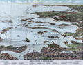 | Details | Finn, W.J. | 1917 |
| Birdseye View of Boston Harbor by Union News Co. |
|
Finn, W.J. |
|
| 1917 |
| LOC:200 |
| $240.00 | Finn--W-J- | Birdseye-View-of-Boston-Harbor-by-Union-News-Co- | Folding antique colored harbor excursion map from ca. 1917 of South Boston, Boston Harbor, Dorchester Bay, Quincy Bay, and Cape Cod Bay to Provincetown. This colorful survivor shows steamship routes to coastal towns and identifies many nearby islands.
<br></br>
This map could have been purchased by passengers aboard any steamboat plying the routes shown on the map including:
<div class="indenttextblock">
<ul style="list-style-type: circle;">
<li>To Europe</li>
<li>To Provincetown</li>
<li>To Plymouth</li>
<li>To Nantasket</li>
<li>To New York</li>
</ul>
</div>
Legend at bottom identifies numerous islands and other features as a sample below illustrates:
<div class="indenttextblock">
<ul style="list-style-type: circle;">
<li>Nixes Mate</li>
<li>Snake Island</li>
<li>Commonwealth Pier</li>
<li>Minots Light</li>
<li>Rowes Wharf</li>
</ul>
</div>
Without the advertisements sometimes found on the cover. Price is noted on the front as "10 cents". |
| 565 |  | Details | Finn, W.J. | 1917 |
| Birds Eye View of Boston Harbor |
|
Finn, W.J. |
|
| 1917 |
| LOC:0 |
| $0.00 | Finn--W-J- | Birds-Eye-View-of-Boston-Harbor | SOLD <br></br>
Folding antique colored harbor excursion map from ca. 1917 of South Boston, Boston Harbor, Dorchester Bay, Quincy Bay, and Cape Cod Bay to Provincetown. Shows steamship routes to coastal towns and identifies many nearby islands. This map could have been purchased by passengers aboard any steamboat plying the routes shown on the attached map. <BR> </BR>
Without the advertisements sometimes found on the cover. Price is noted on the front as "10 cents". |
| 4999 |  | Details | Seaboard Air Line Railway | 1917 |
| WWI map Military Camps Winter Resorts Seaboard Airline Railway Florida |
|
Seaboard Air Line Railway |
|
| 1917 |
| LOC:0 |
| $0.00 | Seaboard-Air-Line-Railway | WWI-map-Military-Camps-Winter-Resorts-Seaboard-Airline-Railway-Florida | This item is sold. Please view the <a href="https://www.rarecharts.com/ShowDetail/Creator/Seaboard-Air-Line-Railway/Title/WWI-map-Military-Camps-Winter-Resorts-Seaboard-Airline-Railway-Carolinas/6648" target="_blank">second example </a> we have handled in twelve years.
<br><br>
Rare patriotic WWI map titled "Military Camps and Nearby Resorts. Winter Near Your Soldier Boy." published by Seaboard Airline Railway and connections, Florida. This full-size folding map shows twenty-eight locations (Army, Navy, and Aero training camps) served by the Seaboard Air Line Railway where a spouse (wife) could travel to spend the winter holidays with her soldier (husband) during 1917, the fourth year of WWI. |
| 6648 |  | Details | Seaboard Air Line Railway | 1917 |
| Military Camps Winter Resorts Map Florida |
|
Seaboard Air Line Railway |
|
| 1917 |
| LOC:150 |
| $800.00 | Seaboard-Air-Line-Railway | Military-Camps-Winter-Resorts-Map-Florida | Rare patriotic WWI map titled "Military Camps and Nearby Resorts. Winter Near Your Soldier Boy." This fine 31 inch long antique map was published by Seaboard Airline Railway in 1917. Outstanding and emotionally evocative graphics on the cover with a fine thematic promotional map on the recto.
<br><br>
<div id="0" align="center">
<a title=""></a>
<img id="6648" src="/ZoomifyImages/SC_6648/SC_6648_cover_detail.jpg" alt="WWI map titled "Military Camps and Nearby Resorts. Winter Near Your Soldier Boy" published by Seaboard Airline Railway Florida." width="100"/> <br><br> <font size="-2">Military Resorts Cover Art</font>
</div><br>
Only one holding is found in WorldCat, at Rutgers. WorldCat's mildly cynical one-line summary of the map reads <b>"War as a tourist industry for elegant ladies & gentlemen."</b> (1)
<br><br>
This full-size folding map shows twenty-eight locations (Army, Navy, and Aero training camps) served by the Seaboard Air Line Railway where a spouse (wife) could travel to spend the winter holidays with her soldier (husband) during 1917, the fourth year of WWI. The camps and stations of the U.S. Army were indicated with red square symbols, those of the Navy with circles, and Aero Stations by triangles. The U.S. Army Air Service, as it was then called, was established after April, 1917 making this map one of the earliest available maps to show Pensacola as an Naval Air Training Station.
<br></br>
These Army, Navy, and Aero training locations, described in the key at bottom right, include Pensacola, Tampa, and Key West, Florida; New Orleans, Louisiana; Charleston, South Carolina; and Port Royal, SC.
<br></br>
Brochure folds to 4" x 9". Printed by Poole Brothers, Chicago and dated within at 8/16/1917.
<br><br>
(1) WorldCat. Online. Accessed: January, 2023 |
| 6807 |  | Details | Innes, Frederick A. | 1917 |
| Map of Oklahoma producing oil and gas fields blueline |
|
Innes, Frederick A. |
|
| 1917 |
| LOC:400 |
| $0.00 | Innes--Frederick-A- | Map-of-Oklahoma-producing-oil-and-gas-fields-blueline | SOLD<br><br>Rare, large comprehensive one-sheet cloth map of producing oil and gas fields in Oklahoma from 1917. Copyright 1917 by F. A. Innes, Tulsa Oklahoma. Published by the Kelley Map Company, Tulsa, Oklahoma.
<br><br>
Manuscript pencil notation at bottom about recorded deeds in 1947. Manuscript red marks below Oklahoma City in Cleveland County possibly reflect sites for the deeds.
<br><br>
The era in which this map was produced was one of rapid growth in Oklahoma oil and gas exploration, driven in part by the demands of WWI. In 1917 Phillips Petroleum Company was incorporated in Bartlesville, Oklahoma. During 1918 the Southwestern Association of Petroleum Geologists, established just one year earlier, became the American Association of Petroleum Geologists (AAPG).
<br><br>
Type of well is denoted on the map using symbols explained in a legend for: <br><br>
<div class="indenttextblocksingle">
<ul style="list-style-type: circle;">
<li>Oil wells</li>
<li>Gas wells</li>
<li>Abandoned wells</li>
<li>Dry holes</li>
<li>Drilling wells</li>
</ul>
</div>
<br>
Photographed in two sections to accommodate size. |
| 713 | 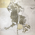 | Details | U.S. Coast and Geodetic Survey | 1918 |
| Mississippi River from the Passes to Grand Prairie Louisiana |
|
U.S. Coast and Geodetic Survey |
|
| 1918 |
| LOC:0 |
| $135.00 | U-S--Coast-and-Geodetic-Survey | Mississippi-River-from-the-Passes-to-Grand-Prairie--Louisiana | Large colorful early 20th century navigation chart of the Mississippi River Delta with the passes into the Gulf of Mexico. Coverage includes the area south of Point Pleasant and Metcalf, Louisiana and Tropical Bend with Breton Island, the Bird Islands, Main Pass, Octave Pass, Baptiste Collett's Bayou, Raphael Pass, and Southwest Pass. Includes Fort Jackson and on the opposite bank- Fort St. Philip. The most southerly habitation shown is Buras, Louisiana and it appears in those days the road ended there.
<br></br>
It is striking in comparing this old map to modern charts to see how much marsh land has been replaced with open water in less that 100 years.
<br</br>
Based on surveys from 1859 to 1918.Bears a blue ink stamp in the bottom margin that states the chart was issued based on corrections made in December 1918. Plate 3614. Number 94. |
| 4894 | 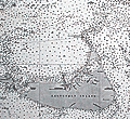 | Details | British Admiralty Hydrographical Office | 1918 |
| Antique Chart of Nantucket Sound and Eastern Approaches |
|
British Admiralty Hydrographical Office |
|
| 1918 |
| LOC:53 |
| $1,350.00 | British-Admiralty-Hydrographical-Office | Antique-Chart-of-Nantucket-Sound-and-Eastern-Approaches | Fine engraved British Admiralty navigation chart (1918) of Nantucket Island, Nantucket Sound and portions of "America" (what Nantucket locals seem to call the mainland U.S.A.). On Nantucket Island the chart shows some of the primary landmarks that guide visitors today: the Sankaty Head Light, Brant Point Lighthouse, Siasconset, Maddaket Harbor and more.
<br></br>
The chart, engraved by Edward Weller, is titled "United States East Coast. Nantucket Sound and Eastern Approaches. From United States Government Charts to 1914."
<br></br>
Notable locations shown on the mainland include Hyannis, Lewis Bay, Monomoy Island, Dennis Port, Harwich Port, and Chatham. Edition of February, 1916 with last corrections in 1918.
<br></br>
London. Published at the Admiralty, January 28, 1896 under the superintendence of Rear Admiral W.J.L. Wharton. C.B., F.R.S. Hydrographer. Sold by J.D. Potter. Chart number 2489. |
| 3607 | 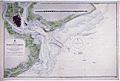 | Details | British Admiralty Hydrographical Office | 1918 |
| Large Chart of Charleston Harbor, South Carolina |
|
British Admiralty Hydrographical Office |
|
| 1918 |
| LOC:53 |
| $1,250.00 | British-Admiralty-Hydrographical-Office | Large-Chart-of-Charleston-Harbor--South-Carolina | Fine British Admiralty chart of Charleston Harbor, South Carolina based on U.S.C.G.S. charts to 1914. This edition with corrections to 1918. Named features Include Folly Island, Morris Island, James Island, Sullivan Island, and the Isle of Palms. From the copper plate engraved by J & C Walker.
<br></br>
Later edition of a British Admiralty chart first engraved and published from London in 1869, and updated with corrections after that.
<br></br>
Bold dark lithographed print retains the cartographic look and style of the late 19th century. Logo of the British Hydrographical Office at top of the title block. Published from London on April 1, 1869 . Number 2324 |
| 5315 |  | Details | Anonymous | 1918 |
| Plat map Halifax Company Lands Ormond Volusia Florida |
|
Anonymous |
|
| 1918 |
| LOC:53 |
| $0.00 | Anonymous | Plat-map-Halifax-Company-Lands-Ormond-Volusia-Florida | SOLD<br><br>A plat map for Halifax Company Lands in Volusia County, Florida. This plat reflects the desire to subdivide the land into smaller lots for residential and commercial use . Shows manuscript crayon notations (in red) "Bunnell 9 mi." and "Rt. 1", for Ridgewood Avenue a stretch of the Dixie Highway, as it turned west to Bunnell, Florida through what is today the Halifax Plantation area.
<br></br>
Rare early cyanotype (blueprint) plat of the subdivision of Halifax in Volusia County, Florida (near Bulow Creek State Park and northwest of Ormond Beach), bounded to the west by the <b>Old King's Road</b>. An updated plat of the area <b>previously platted as the Harwood Subdivision in 1888 by Norman Harwood</b> (see our stock number 5314). In comparison to P. D. Roger's 1888 plat of the same area, this map shows no indication of land use (hammocks, islands, marsh) suggesting that the land was drier by this date.
<br></br>
The plat shows the tomb of James Ormond II who died September 30, 1829 (now Ormond Tomb State Park).
<br></br>
Some of the differences between this plat and the earlier plat of Harwood (1888) include:<br></br>
<div class="indenttextblocksingle">
<ul style="list-style-type: circle;">
<li>Most of the streets are re-named. What is today "the Old Dixie Highway" was named Ridgewood Avenue. The Dixie Highway was constructed between 1915 and 1929.</li>
<li>Bead, Knox & Bead canal is shown entering Bulow Creek.</li>
<li>Many new building sites are platted north of Ormond Tomb on both sides of Ridgewood Avenue.</li>
<li>Plat clearly shows the north and south boundaries of the Ormond Grant.</li>
<li>This plat shows in more detail and names the extent of the Mary Kunner grant.</li>
<li>Harwood Grove Company plot is now labeled Halifax Grove Reservation, reflecting a change in ownership.</li>
</ul>
</div> |
| 5053 | 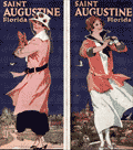 | Details | Anonymous | 1918 |
| Two manuscript maps of St. Augustine, Florida and of the area. |
|
Anonymous |
|
| 1918 |
| LOC:11 |
| $400.00 | Anonymous | Two-manuscript-maps-of-St--Augustine--Florida-and-of-the-area- | Two manuscript maps on a single sheet inserted into a tourism brochure of St. Augustine, Florida after printing. Unusual. Maps show St. Augustine at street-level detail and on verso a smaller-scale map of the area surrounding St. Augustine. Type-written text on one map sheet indicates re-use of a telephone service remittance document for creation of the map. The small scale map of the area around St. Augustine appears only to consider railway lines (F.E.C., A.C.C.) of importance as railways are highlighted in color and stops along each route are identified.
<br></br>
Booklet (folds to 4" x 9") presented with the compliments of the St. Augustine Hotel Association. Fine cover graphics of period clothing. Booklet art work, engraving and printing by the Record Company, St. Augustine. Dated between 1916 and 1919 based on information provided about the Flagler Hospital, under construction at printing, after a fire in 1916 destroyed much of the original structure. |
| 681 |  | Details | Deering, G.G. | 1919 |
| Launch Invitation for the ghost ship Carrol A. Deering |
|
Deering, G.G. |
|
| 1919 |
| LOC:0 |
| $375.00 | Deering--G-G- | Launch-Invitation-for-the-ghost-ship-Carrol-A--Deering | Original folding invitation and menu for the launching of the famous ghost ship Carroll A. Deering in April, 1919. On January 29, 1921 the 5 masted schooner grounded on the outer shoals of Cape Hatteras. The ship was abandoned and the crew, logbooks and navigational equipment were never found. The case of the Carroll A. Deering is one of the top maritime mysteries, along with that of the Mary Celeste.
<br></br>
According to an online article by the National Park Service: <div class="indenttextblock">"On January 29, 1921, the Carroll A. Deering was making a return trip to Hampton Roads, Virginia from Barbados when she passed the Cape Lookout Lightship. According to the lightship keeper, the crew was milling about and a crewman, who did not look or act like an officer, reported that the ship had lost its anchors. The following day, the ship passed the SS Lake Elon southwest of the Diamond Shoals Lightship at approximately 5:45 pm. The Deering seemed to be steering a peculiar course. This was the last report of the ill-fated Deering before she was found run aground and abandoned. At 6:30 am on January 31st, C.P. Brady of the Cape Hatteras Coast Guard Station spotted a five-masted schooner in the morning light, aground and helpless on the shoals…. Upon investigating the ship, it was discovered that all personal belongings, key navigational equipment, certain papers, and the ship’s anchors were missing. Furthermore, food was laid out as if in preparation for a meal. But there was no sign of the crew.
Source: http://www.nps.gov/caha/historyculture/theghostship.htm</div>
<br>
Purchased in 2013 with other Deering memorabilia. Dated April 4, 1919. Cover contains the colored emblem of the G.G. Deering Company flag. Interior contains details of the launching of the Carroll A. Deering including the name of William Merritt, Master and a menu of the lunch served to guests at King Tavern in Bath, Maine. |
| 6563 |  | Details | Deering, G.G. | 1919 |
| Painting on Gold Leaf Ship Marie Sophie of Falmouth |
|
Deering, G.G. |
|
| 1919 |
| LOC:0 |
| $975.00 | Deering--G-G- | Painting-on-Gold-Leaf-Ship-Marie-Sophie-of-Falmouth | Painting on Gold Leaf of the Schooner Ship Marie Sophie of Falmouth on Masonite and housed in an early frame (painted tan). Original brass hangers. Seller noted: "Unsigned but I believe this was done by Carroll A. Deering son of the owner of the G.G. Deering Shipyard at Bath, Maine (later Bath Iron Works)."
<br></br>
Purchased in 2013 with other Deering memorabilia from 1919.
<br><br>
According to an online article by the National Park Service about the ghost-ship Carroll A. Deering (l. 1919). <div class="indenttextblock"> On January 29, 1921, the ship was making a return trip to Hampton Roads, Virginia from Barbados when she passed the Cape Lookout Lightship. According to the lightship a crewman, who did not look or act like an officer, reported that the ship had lost its anchors.
<br><br>
This was the last report of the ill-fated Deering before she was found run aground and abandoned. At 6:30 am on January 31st, C.P. Brady of the Cape Hatteras Coast Guard Station spotted a five-masted schooner in the morning light, aground and helpless on the shoals…. Upon investigating the ship, it was discovered that all personal belongings, key navigational equipment, certain papers, and the ship’s anchors were missing. Food was laid out as if in preparation for a meal. But there was no sign of the crew.
Source: http://www.nps.gov/caha/historyculture/theghostship.htm</div> |
| 4803 |  | Details | Osceola Oil Company | 1919 |
| Osceola Oil Company Gushers in the Great Texas Oil Field |
|
Osceola Oil Company |
|
| 1919 |
| LOC:63 |
| $0.00 | Osceola-Oil-Company | Osceola-Oil-Company-Gushers-in-the-Great-Texas-Oil-Field | SOLD<br><br>Gushers! More gushers! No gushing prose here but dozens of <b>gushing oil wells</b>. Extraordinary! No other copy found anywhere online.
<br></br>
The Great Texas Oil Field: Electra, Clara, Burkburnett, Iowa Park, Holliday, Wichita Falls, Huff, and Dundee, Texas.
<br></br>
Rare cyanotype (blueprint) pictorial map documenting the Texas Oil Boom in north Texas during the period 1919-1921. This persuasive map exuberantly promotes drilling the 200 acre lease held by Osceola Oil Company (now extinct) near Dundee, Texas in Russell A. Richardson's subdivision "Located right on the Dundee Dome and Anticline."
<br></br>
Drawn by Wichita Falls Blueprint and Supply Co.
<br></br>
Names numerous famous oil fields and wells including: the Sunshine Hill Pool, the Ramming Pool, the Burkburnett southwest extension, the Kemp-Munger-Allen field.
<br></br>
<b>Boom Town</b>, a 1940 film starring Clark Gable and Spencer Tracy, was inspired by events around Burkburnett, Texas during the early 20's oil boom. <img src="/PageImages/BoomTown.jpg" alt="Gushers!" width="140" align="left" style="margin: 10px 10px">
<br></br>
The first oil in Burkburnett was discovered in 1912, when a gusher of 2000 barrels a day was brought in on the S.L. Fowler farm. The Burkburnett Townsite Field in Wichita County was discovered in 1918. In 1919 oil was discovered in the Kemp-Munger-Allen field.
<br></br>
Osceola Oil Company was organized in 1919 with corporate officers Russell A. Richardson, President and C.C. Drake, Secretary. With authorized capital of $500,000 and a single leased property of 200 acres "...one mile east of the Waggoner Ranch in Wichita County Texas" the company began seeking investors. By 1922 it was all over but for the crying… Osceola filed a lawsuit against the driller, Stewart Drilling Company, who failed to discover oil with a 2000 foot deep well on the property. (Source: https://books.google.com/books?id=55tDAQAAMAAJ. Page 698.) |
| 5132 |  | Details | J. Walker Pope and Son | 1919 |
| Official Road Map of Polk County Florida, 1919 |
|
J. Walker Pope and Son |
|
| 1919 |
| LOC:87 |
| $265.00 | J--Walker-Pope-and-Son | Official-Road-Map-of-Polk-County-Florida--1919 | Scarce map of Polk County, Florida highways: "Official Road Map of Polk County Florida, 1919 showing the famous 300 mile system of asphalt paved highways. Approved by J. Walker Pope. President Polk County Good Roads Association, Winter Haven." District roads are shown in dark red. According to advertising copy on the map:
<div class="indenttextblocksingle">
Polk County ships over a million boxes of citrus fruits and two thousand car loads of winter vegetable annually -- and furnishes over 40 per cent of the world's output of phosphate."
</div>
<br></br>
The map is printed on the verso of a single-sheet folding advertisement for J. Walker Pope and Son of Winter Haven, Florida. Recto with six half-tone photographs including local orange groves, Mountain Lake Golf Course, Lake Wales, and the offices of J. Walker Pope and Richard D. Pope of Winter Haven, Florida.
<br></br>
J.W. Polk was President of the Polk County Good Roads Association, President of the Winter Haven Motor Club, and Vice-President of the United States Highway Association. |
| 5445 |  | Details | British Admiralty Hydrographical Office | 1919 |
| Chart of the Chesapeake River 1872 1919 |
|
British Admiralty Hydrographical Office |
|
| 1919 |
| LOC:56 |
| $700.00 | British-Admiralty-Hydrographical-Office | Chart-of-the-Chesapeake-River-1872-1919 | Nautical chart of the Potomac River by the British Admiralty after earlier charts by the U.S. Coast Survey. Displayed as 3 charts on a single sheet. Upper left chart contains Washington, DC and Alexandria, Virginia. Aids to navigation are highlighted in orange.
<br></br>
Published July 1, 1872 under the Superintendence of Rear Admiral Richards. London. Numerous large and small corrections are recorded with the last corrections in 1919. Chart number 2857. |
| 779 |  | Details | U.S. Coast and Geodetic Survey | 1919 |
| Cape Hatteras Outer Banks North Carolina |
|
U.S. Coast and Geodetic Survey |
|
| 1919 |
| LOC:0 |
| $0.00 | U-S--Coast-and-Geodetic-Survey | Cape-Hatteras-Outer-Banks-North-Carolina | SOLD<br></br>
Old U.S. nautical chart of Cape Hatteras, and the outer banks in North Carolina. This 96-year old large two-color navigation chart of the barrier islands near Cape Hatteras includes Portsmouth Island, Ocracoke Island, Gull Island, Hatteras Inlet, Ocracoke Inlet, Sandy Bay, and the towns of Portsmouth, Ocracoke, Hatteras, Buxton, and Kinnakeet ( Avon ). On the mainland side of the sound coverage includes the vicinity of Wyesocking ( Wysocking ) Bay, with small towns of Nebraska and Middleton, and also the Middleton Anchorage.
<br></br>
Detailed delineation of lights, buoys, and soundings and emphasis on the numerous reefs and shoals both inside and outside the Hatteras barrier islands. These features include Diamond Shoal, Wimble Shoals, Clam Shoal, Long Shoal, Oliver Reef, Clarks Reef, and dozens more. This area has become known as the 'Graveyard of the Atlantic' because more than 600 ships have sunk in the waters since 1526. The schooner Carrol A. Deering, discussed elsewhere on this site, went aground a few miles from the Cape Hatteras lighthouse in 1921.
<br></br>
Originally published at Washington, D.C. in 1918 this edition sports a purple hand-stamp bearing the date of presumably the last corrections: November 8, 1919. Number 1232. |
| 5022 |  | Details | Maine Forestry Department | 1919 |
| Rare cyanotype Maine map for Double Top Fire Tower |
|
Maine Forestry Department |
|
| 1919 |
| LOC:53 |
| $0.00 | Maine-Forestry-Department | Rare-cyanotype-Maine-map-for-Double-Top-Fire-Tower | SOLD<br></br>
Rare 1919 cyanotype Maine Forest Service fire tower alidade plotting sheet: "View from Double Top Forest Fire Station Maine Forestry Department. 1919." Archie G. Norcross - Engineer. Map is 30" diameter to the outer circle. Next band- a scale from 0 to 360 degrees. Next band- shows an elevation profile matching that of the region in the far distance; flags denote other fire towers. Innermost circle- 24" diameter shows a birds eye view of the local area with the Double Top fire station located dead center in the circle.
<br></br>
From a series of circular fire tower maps commissioned by the Maine Forest Service, these circular maps display aerial and 360 degree panoramic views from many of the mountain top fire tower stations around the State of Maine. Circular map tables were oriented and fastened to the floor of the cabin of each fire tower. On each map table an alidade-type sighting device was attached which enabled the Fire Observer to more accurately pinpoint fires and record the location of a fire on the circular map laid onto the table. (https://www.aarch.org/preserve/fire-towers/)
<br></br>
One source states that the blueprint fire tower maps were used as batch master copies in the creation of multiple blue-line working maps. Of course, the inked trace diagram on tracing cloth would have been the true master copy as it was used to create each blueprint. |
| 6538 |  | Details | Weston, T.W. | 1919 |
| Map of Pinellas County Florida with Fishing Grounds |
|
Weston, T.W. |
|
| 1919 |
| LOC:300 |
| $250.00 | Weston--T-W- | Map-of-Pinellas-County-Florida-with-Fishing-Grounds | Colorful lithographed map (8" x 16") of Pinellas County, Florida in 1919 by T.W. Weston issued in a folding 4" x 9" brochure by the Pinellas County Board of Trade. In addition to the Pinellas County map, the brochure includes a fine small oblique birds-eye view - "Dunedin - a typical coast town" (Fig 1.), a small regional distance chart extending for 1500 miles from Pinellas County (Fig 2.), descriptive text, and numerous photographs. <br><br>
<div id="1" align="center">
<a title="Dunedin, Florida Birds-eye View"></a>
<img id="1" src="/ZoomifyImages/SC_6538/SC_6538_Detail1.jpg" alt="Dunedin, Florida 1919 Birds-eye View" width="320"/> <br><small>Fig. 1 - 1919 Birds-eye View of Dunedin, Florida.</small>
</div><br>
The Pinellas County map shows soil type (coastal beach, Parkwood loam, tidal marsh …) indicated by color overlaid with routes of steam railroads, electric railways, three types of roads, canals, and drainage districts.
<br><br>
<div id="2" align="center">
<a title="Pinellas County Distance Chart"></a>
<img id="2" src="/ZoomifyImages/SC_6538/SC_6538_Detail2.jpg" alt="Distance chart related to Pinellas County Florida." width="250"/> <br><small>Fig. 2 - Statute mile distances from Pinellas County.</small>
</div><br>
Red font denotes species of fish found around Pinellas County (Fig. 3) These fish include tarpon, trout, channel bass (redfish), mackerel, and kingfish.<br><br>
<div id="3" align="center">
<a title="Pinellas County Fish Species"></a>
<img id="3" src="/ZoomifyImages/SC_6538/SC_6538_Detail3.jpg" alt="Detail from Pinellas County Map." width="250"/> <br><small>Fig. 3 - Detail of Pinellas County fish species.</small>
</div> |
| 8052 |  | Details | Connelley, William Elsey | 1920 |
| Lot of two maps Caddoan and Siouan Homelands and Westward Migration |
|
Connelley, William Elsey |
|
| 1920 |
| LOC: |
| $195.00 | Connelley--William-Elsey | Lot-of-two-maps-Caddoan-and-Siouan-Homelands-and-Westward-Migration | Two scarce maps pertaining to the Siouan and Caddoan linguistic families by William E. Connelley. Drawn by August Ross, the maps were published circa 1920.
<br><br>
The first map, titled Map Showing The Possessions Of The Caddoan And Siouan Linguistic Families Of North American Indians Before The Western Migration Of The Siouan's, presents a continental synthesis intended to depict original linguistic homelands rather than fixed political boundaries. The Caddoan family is shown occupying a Mississippi Valley core along the Arkansas, Red, and Platte river systems, while the Siouan family is placed mainly east of the Mississippi River. The enclosed regions represent long-term habitation zones derived from historical tradition, early European accounts, and linguistic comparison. The map establishes the argument that the Siouan peoples were later arrivals to the Plains, displacing an older Caddoan presence.
<br><br>
The second map, Map Showing The Original Caddoan Country After The Intrusion Into It Of The Siouan Linguistic Family, emphasizes movement and territorial contraction. Numbered regions and migration paths depict successive Siouan advances and the resulting fragmentation of Caddoan lands, isolating groups such as the Pawnee and Arikara. River corridors remain central, reinforcing the idea that waterways structured settlement and conflict. In contrast to the first map’s generalized homelands, this sheet focuses on process, showing encroachment, displacement, and the later imposition of reservation boundaries.<br><br> |
| 4944 |  | Details | Adams Engineering Company | 1920 |
| Wildcatters oil-field prospect map for San Juan County, New Mexico |
|
Adams Engineering Company |
|
| 1920 |
| LOC:62 |
| $0.00 | Adams-Engineering-Company | Wildcatters-oil-field-prospect-map-for-San-Juan-County--New-Mexico | SOLD<br><br>Wildcatter's blueprint (cyanotype) oil-field prospect map ca. 1920 for San Juan County, New Mexico. Four corners region near Aztec, Farmington, Shiprock and the Navajo Indian Reservation. The blueprint shows existing and proposed oil wells and oil field leases owned by an anonymous individual or company, annotated with typewritten notes:
<br></br>
"Midwest Oil Co. pool on the Hog Back they just … the 7th well at 690 feet they found sand … this is the most wonderful oil field in the world."
<br></br>
"U.S. Geological Survey of 1916 Professional paper 98-P of the San Juan … I looked this country over carefully for 5 months at the same time trying to get rid of my Rheumatism and [in my] my opinion it will only take development to have an oil field where I have my leases marked in red on this map."
<br></br>
My interpretation of the maps and notes are that the purpose of the map was to persuade investors to invest in the leases marked in red squares (at furthest right center) by reference to other known, producing oil wells (marked with small red dots).
Published by Adams Engineering Company, Oklahoma City, Oklahoma. Drawn by H. Marsh. |
| 5444 |  | Details | U.S. Coast and Geodetic Survey | 1920 |
| Chart of the St. Johns River in Florida From Hibernia to Racy Point 1900 1920 |
|
U.S. Coast and Geodetic Survey |
|
| 1920 |
| LOC:56 |
| $750.00 | U-S--Coast-and-Geodetic-Survey | Chart-of-the-St--Johns-River-in-Florida-From-Hibernia-to-Racy-Point-1900-1920 | Nautical chart of a section of the St. Johns River Florida from Hibernia southward to Racy Point. Hibernia, Florida lies about 22 miles southwest of downtown Jacksonville, on the western side of the St. Johns River, off US 17. Racy Point lies on the east bank of the St. John's River about four miles northwest of Hastings, Florida and 12 miles from Palatka.
<br></br>
Published by the U.S. Coast and Geodetic Survey October, 1900. Reissued December, 1916. Last corrections April, 1920. Chart # 455c. Price when issued was 40 cents. |
| 725 |  | Details | U.S. Coast and Geodetic Survey | 1920 |
| Inside Route Pilot Coast of New Jersey |
|
U.S. Coast and Geodetic Survey |
|
| 1920 |
| LOC:0 |
| $0.00 | U-S--Coast-and-Geodetic-Survey | Inside-Route-Pilot-Coast-of-New-Jersey | SOLD
<br></br>
Old Coast Pilot for New Jersey coast with 3 charts on the "Inside Route", part of what we would today call the Intracoastal Waterway ( ICW ). Covers the inlets and interior waterways on the coast of New Jersey between Sandy Hook and Cape May. Some of the geographic features covered include: Manasquan Inlet, Barnegat Bay, Manahawken Bay, Little Egg Inlet, Brigantine Inlet, Atlantic City, Absecon Bay, Ventnor, Great Egg Inlet, Longport, Wildwood, and Holly Beach.
<br></br>
Text sailing directions of 22 pages plus appendix and index. Three folding charts in very good conditions on thin paper. Length of the 3 charts totals 87 inches: Chart 1 - 28". Chart 2 - 31". Chart 3 - 28". Paper boards. Printed by the Government Printing Office, Washington, DC in 1920. Second Edition. Serial No. 139. |
| 5103 |  | Details | Burgert Brothers | 1920 |
| Lakemont Florida Early Bird's-eye View |
|
Burgert Brothers |
|
| 1920 |
| LOC:11 |
| $125.00 | Burgert-Brothers | Lakemont-Florida-Early-Bird-s-eye-View | Scarce drawn bird's-eye view of Lakemont, Florida ca. 1920 as it was being platted and developed for sale. Below the scene of lots, lakes, and orange groves, a brief description explains the view (shown looking south):
<div class="indenttextblocksingle">
"Lakemont, located between Avon Park and Sebring, Fla., at the crossing of scenic highway and S.A.L.R.R. [Seaboard Air Line Railway]"
</div></br>
Description on the verso reads:
<div class="indenttextblocksingle">
"LAKEMONT, FLA. A new townsite now being developed and destined to become a city within the next few years, located in the Ridge Section at the crossing of scenic highway and new S.A.L. Railroad. Four miles north of Sebring and five miles south of Avon Park, Florida."
</div></br>
Major topographic features include the city of Sebring with Dinner Lake, Lake Jackson, Basket Lake, Bonnet Lake, and Little Red Water Lake.
<br></br>
Folding postal card in two panels. White border (1915-1930). No. 103139. Fl. Fla. Postally unused. Dated with reference to the founding of Sebring, Florida in 1912. Published by Burgert Brothers of Tampa, Florida. |
| 7907 |  | Details | Sebring Board of Trade | 1920 |
| Maps and Views of Sebring Florida |
|
Sebring Board of Trade |
|
| 1920 |
| LOC:500 |
| $350.00 | Sebring-Board-of-Trade | Maps-and-Views-of-Sebring-Florida | In 1920, just nine years after George E. Sebring acquired over 9,000 acres in the Florida Highlands to establish a new town, the Sebring Board of Trade published this substantial promotional pamphlet titled "Sebring, Florida. The City of Health and Happiness." By the time this brochure was circulated, Sebring's population had grown to around 3,000 residents. The historic downtown area of Sebring, which still reflects its 1920s origins, has been recognized as a Historic District on the National Register of Historic Places, acknowledging its significance and the enduring legacy of George E. Sebring's vision for the city.
<br><br>
The pamphlet is packed with text and photographs showcasing nearly every beneficial aspect of life in Sebring. The back cover features a bird's-eye view of the town encircling Lake Jackson, with "Twelve miles of velvet asphalt boulevard surrounding the Twilight Trail." Inside the front cover, another bird's-eye view depicts a fountain nestled among lush trees and meticulously landscaped formal gardens, described as "Sebring's beautiful little park around which the town revolves."
<br><br>
Within the pages, readers will find a map of peninsular Florida highlighting the area around Sebring, accompanied by a table displaying distances to various locations within the state. The pamphlet culminates with a pictorial map of the region immediately surrounding Sebring, illustrating the town's layout with the central park as its focal point, encircled by vast orange groves that stretch out into the surrounding countryside.
<br><br> |
| 4893 |  | Details | British Admiralty Hydrographical Office | 1920 |
| Antique Chart of Key West Harbor, Florida |
|
British Admiralty Hydrographical Office |
|
| 1920 |
| LOC:0 |
| $0.00 | British-Admiralty-Hydrographical-Office | Antique-Chart-of-Key-West-Harbor--Florida | SOLD
<br></br>
Fine engraved British Admiralty navigation chart of the Key West Florida area, from 1920. With Hawk Channel, Key West Harbor, Man of War Harbor, Rock Cay Channel, the Florida Strait and much more extending to the west past Boca Grande Cay, and Man Cay. Edition of February 1916 with last corrections in September 1920. A large, scarce chart of Key West before the Overseas Highway and the Florida land boom of the 1920's changed the face of the Sunshine State.
<br></br>
Shows the Overseas Railroad ("Flagler's Folly") which operated from 1912 to 1935.
<br></br>
Inset charts of North West Channel Bar and Key West Harbor. Inset table of tidal information for Sand Key Bar, Fort Taylor, and the Northwest Channel Bar.
<br></br>
First published at the Admiralty, 19 August 1907 under the superintendence of Rear Admiral A. Mostyn Field, F.R.S. Hydrographer. Sold by J.D. Potter. Engraved by Davies & Company. Chart number 2881. |
| 4770 |  | Details | British Admiralty Hydrographical Office | 1920 |
| Large Antique Chart of The Florida Keys |
|
British Admiralty Hydrographical Office |
|
| 1920 |
| LOC:61 |
| $1,375.00 | British-Admiralty-Hydrographical-Office | Large-Antique-Chart-of-The-Florida-Keys | Fine antique British Admiralty sea chart with cartographic coverage of the islands of the <b>Florida Keys</b>. Hydrographic data on this early 1866 British navigational chart extend past Key West. Though updated to 1920, this scarce survivor retains the appearance of a 19th-century British copperplate-engraved nautical chart, a visual charm more recent charts do not generally possess.
<br></br>
An inset diagram shows an example <b>navigational beacon</b>, made of iron, 36 feet in height and carrying an identifying letter within a moveable vane. These beacons, or day marks, delineated the southern boundary of the Florida Keys. The accompanying note states:
<br></br>
<div class="indenttextblock">
<img src="/PageImages/Beacon for 4770.jpg" alt="Florida keys navigational beacons (day marks)" width="120" align="left" style="margin: 0px 20px">
"The Beacons marking the outer Florida Reefs are distinguished by Letter or Numbers in the vane which each carries, commencing off Key West and proceeding in alphabetical or numerical order toward Cape Florida. With the exceptions of that American Shoal which is brown and that on Fowey Rock which is black, the Beacons are all painted white. These beacons are likely to be washed away."
</div>
<br></br>Manuscript notations in pencil from a previous owner record eight of the beacons as "damaged."
<br></br>
This chart of Lower Matacumbe Cay to Boca Grande Cay should be treasured by anyone with interests in fishing, sailing, or boating in the Florida Keys.
<br></br>
After U.S. Coast Survey charts from the last half of the 19th century. First published by the British Admiralty on July 18, 1866, with several editions and later corrections after, the last correction in 1920. Originally sold by J.D. Potter, agents, London. Chart no. 1098. |
| 8041 |  | Details | Hall, Dick Wick | 1920 |
| Rare Salome Road Map by Dick Wick Hall Los Angeles to Phoenix |
|
Hall, Dick Wick |
|
| 1920 |
| LOC:89 |
| $1,450.00 | Hall--Dick-Wick | Rare-Salome-Road-Map-by-Dick-Wick-Hall-Los-Angeles-to-Phoenix | Very rare unrecorded, hand-drawn road map, issued as a blueprint, of central Arizona and California, west of Phoenix by promoter, humorist, publisher, columnist and entrepreneur Dick Wick Hall. Inset note for aviation landing fields, rare on road maps of this era. Hall's initials D.W.H. at bottom right corner.
<br><br>
<div id="0" align="center">
<a title=""></a>
<img id="8041" src="/ZoomifyImages/SC_8041/SC_8041_Frog.jpg" alt="Dick Wick Hall's Famous Salome Frog." width="300"/> <br><br> <font size="-2">Hall's Famous Salome Frog<br> At the Laughing Gas Station. Salome AZ.</font>
</div><br>
Dick Wick Hall founded Salome, Arizona in 1904 as part of a speculative desert development venture along a proposed railroad route in western Arizona. He soon became the town’s most visible booster, operating a roadside service station, promoting travel through the desert, and cultivating a larger-than-life persona that blended entrepreneurship with humor.
<br><br>
Dated to 1920 based on a very similar map published by Hall in his Salome Sun mimeographed newspaper he published between 1920 and 1926. <div class="indenttextblock"><i>" ... the paper was likely intended to be supplied to service stations, such as the one Hall owned in Salome, or other road stops for the traveler passing through, as each issue contains short quips written by Hall about road trips, Yuma County, stories about the desert and driving in the southwest. The paper also often contains cartoonish illustrations of common southwest wildlife, from snakes to scorpions and cacti, as well as regularly featuring a cartoon frog by the name of the Salome Frog who regularly declares that he cannot swim."</i> </div> (Reference: State of Arizona Research Library. Online. https://azmemory.azlibrary.gov/nodes/view/328579).<br><br> |
| 5291 |  | Details | Parsons, A.F. | 1921 |
| Unrecorded cyanotype plat Beasley Ranch San Luis Obispo, California |
|
Parsons, A.F. |
|
| 1921 |
| LOC:3 |
| $475.00 | Parsons--A-F- | Unrecorded-cyanotype-plat-Beasley-Ranch-San-Luis-Obispo--California | Unrecorded cyanotype (blueprint) cadastral map of the Beasley Ranch in San Luis Obispo County, California. In 1921 the Beasley Ranch was owned by R.K. Smith. Manuscript outline coloring to differentiate the Beasley Ranch in yellow, from property owned by Eckstine in red.
<br></br>
The Beasley Ranch, at the junction of the Nacimiento River and Burnett Creek, was named for William F. Beasley, a native Californian from Mariposa County, CA. Neighboring property is recorded for Joshua Wood, Alice Lynch, Luther Hester, Sands, Harris, Wheeler, Knox, Eckstine, and others.
<br></br>
Survey of the Beasley Ranch was conducted by Austin F. Parsons in October, 1921. Parsons (b. 1853), was San Luis Obispo County Surveyor from 1902 to 1930. Parsons was the Civil Engineer for numerous area bridges including the California Canyon Bridge and San Juan Bridge.
<br></br>
Scale 1" = 40 chains ( 1/2 mile). T.25S R.8E. |
| 5296 |  | Details | Dunwody, William E. | 1922 |
| Earliest map of Charlotte, Glades, Hardee, Highlands counties Florida after DeSoto redivision |
|
Dunwody, William E. |
|
| 1922 |
| LOC:87 |
| $225.00 | Dunwody--William-E- | Earliest-map-of-Charlotte--Glades--Hardee--Highlands-counties-Florida-after-DeSoto-redivision | Map of DeSoto, Charlotte, Glades, Hardee, and Highlands counties in Florida ca. 1922. In 1921 the Florida legislature created the latter four counties out of what had previously been DeSoto County. Possibly the earliest map containing the names of those four new counties. Map is a Fotoprint printed by Foote & Davies Co, Atlanta.
<br></br>
Published by William Elliott Dunwody (1882-1956) a businessman in Arcadia, Florida, the seat of DeSoto County. Dunwody had interests in real estate, ranching, and citrus farming, and was Chairman of the local Selective Service Board from 1941 to 1954.
<br></br>
Interesting in that before this Fotoprint was produced a base plat map was edited in manuscript (by Dunwody ?) to show the new county boundaries and features: roads, railroads, towns, lakes; and type of terrain: swamp and muck, pine, or prairie. This item is a product of that enhancement made just after the new counties were created.
<br></br>
It is ironic that at center left, in one of the marked swampy areas, a manuscript notation is made: <b>"Red dot within green circle represents location your 10 acres."</b> Lucky guy! Key features include the Kissimmee River, Lake Istokpoga, Lake Okeechobee, Charlotte Harbor, and two airbases built in 1917 during early WWI: Carlstrom Field, and Dorr Field. |
| 5031 |  | Details | Bates, Waldron and others | 1922 |
| Path Map of the Eastern Part of Mount Desert Island, Maine |
|
Bates, Waldron and others |
|
| 1922 |
| LOC:53 |
| $0.00 | Bates--Waldron-and-others | Path-Map-of-the-Eastern-Part-of-Mount-Desert-Island--Maine | SOLD<br></br>Scarce map of the eastern portion of Mount Desert Island by Waldon Bates, Edward Rand, and Herbert Jaques after the U.S. Coast Survey. In 1922 Acadia National Park (in green) was known as Lafayette National Park. Includes coastal areas of Mount Desert Island on Frenchman's Bay and Somes Sound.
<br></br>
Waldron Bates began exploring Mount Desert Island in the 1880's. From 1900 to 1909, Bates was chairman of the Path Committee of the Bar Harbor Village Improvement Association (VIA). VIA's in each of the four island towns created most of the Mount Desert Island's trail system we know today, adding twenty-five miles of trails under Bate's leadership, including the Giant Slide, Canon Brook, Gorham Mountain, and Cadillac Cliffs Trails. (Source: https://www.nps.gov/acad/learn/historyculture/waldron-bates-pathmaker.htm)
<br></br>
Bates is well-known for the Bates cairn, a rock-constructed trail indicator which he designed:
<div class="indenttextblocksingle">
"The cairns are built on two base columns of between 2 and 4 rocks, with a lintel stone, or platform, across the two columns and a pointer rock on top. The cairns help orient hikers and steer them in the right direction, while protecting the environment by keeping people on the trail." Over times the Bates cairns suffered damage from human or environmental forces. Starting in 2001, an effort began to rebuild the cairns and to educate the public about their design and importance." (Source: https://acadiaonmymind.com/2016/01/message-rocks-acadia-bates-cairns-new-focus/) </div> |
| 5492 |  | Details | State and City Bank and Trust Richmond VA | 1922 |
| Map NC and SC with principal 1922 crop acreages |
|
State and City Bank and Trust Richmond VA |
|
| 1922 |
| LOC:10 |
| $295.00 | State-and-City-Bank-and-Trust-Richmond-VA | Map-NC-and-SC-with-principal-1922-crop-acreages | Thematic advertising map of North Carolina and of South Carolina with 1922 acreage statistics related to crops, livestock and other agricultural resources. Contains several inset tables of summary statistics:
<div class="indenttextblocksingle">
<ul style="list-style-type: circle;">
<li>Principal SC 1922 crop acreages (Cotton was #1 at nearly 2.2 million acres)</li>
<li>SC 1921 crop and sales value (Cotton #1 at $61M made up nearly half of SC crop output)</li>
<li>NC 1922 Crop acreages.</li>
<li>A marketing schedule for major agricultural crops and livestock: "When Carolina Crops are Marketed"</li>
</ul>
</div>
Lithographed. The maps are based on data provided by the U.S. Bureau of Markets and U.S. Bureau of Crop Estimates. A discreet call to action in inset text at far right: "You need some kind of banking service every day … Banking by Mail is one of our specialties … Our resources exceed $21,500,00." |
| 5244 |  | Details | Nashville Chattanooga and St. Louis Railway | 1922 |
| Early twenties map of the Dixie Route from Chicago to Florida |
|
Nashville Chattanooga and St. Louis Railway |
|
| 1922 |
| LOC:200 |
| $375.00 | Nashville-Chattanooga-and-St--Louis-Railway | Early-twenties-map-of-the-Dixie-Route-from-Chicago-to-Florida | Fine and attractive early map (1922) of the Dixie Route in the center of a twenty-page brochure mostly devoted to Florida sights and cities. Inset map of Cuba. Published by the Poole Brothers on October 2, 1922.
<br></br>
The Dixie Route was a train service that in 1939 operated three passenger trains across several affiliated railroads and their stops to provide passenger service from the Midwest (St. Louis and Chicago) to Florida. |
| 4908 |  | Details | Higgins Tours | 1922 |
| Pre-depression map and brochure for Higgins Tours in New Orleans |
|
Higgins Tours |
|
| 1922 |
| LOC:0 |
| $140.00 | Higgins-Tours | Pre-depression-map-and-brochure-for-Higgins-Tours-in-New-Orleans | Scarce brochure, with a map (9"x16") of Orleans Parish, for tours of New Orleans, Louisiana by Higgins Tours. In 1922 Higgins Tours' office and garage was at 630 Julia Street, part of what later was to become New Orleans's skid row in the 1970's, and today is part of the revitalized warehouse district.
<br></br>
On the back cover an offer for Higgin's Plantation Tour for $2.00 round trip: "30 Miles on LOUISIANA Shell Roads". Oooh, pinch me! Special points of interest on the Plantation Tour included St. Roch's Shrine, famous old Villere Plantation, slave huts and orange groves. Cars left daily from the corner of Canal and St. Charles Street at 10:00 a.m. and 1:30 p.m. daily. "Look for the green cars."
<br></br>
Light card cover and four interior sheets front and back. Fare $1.00. Printed ca. 1922. |
| 586 |  | Details | Belcher Abstract and Title Company | 1922 |
| Belcher's Pocket Map of Humboldt County, California |
|
Belcher Abstract and Title Company |
|
| 1922 |
| LOC:0 |
| $275.00 | Belcher-Abstract-and-Title-Company | Belcher-s-Pocket-Map-of-Humboldt-County--California | Compact folding topographic map of <strong>Humboldt County, California</strong> from 1922. Self-described as "The only accurate map of the County ever made". Contains a detailed record of drainage, railroads, settlements, roads, trails, section and township lines. Copyright 1922. (Note top of map image is in shadow.)
<br></br>
With an attached intact folding greenish-brown card-stock cover. Size when folded is approx. 4 1/2" W x 5 1/2" H. Price when sold $1.00. Compiled by the Belcher Abstract and Title Company of Eureka California. |
| 5208 |  | Details | Astor, William Waldorf | 1922 |
| Maps and auction brochure for Bronx property of William Waldorf Astor |
|
Astor, William Waldorf |
|
| 1922 |
| LOC:88 |
| $1,250.00 | Astor--William-Waldorf | Maps-and-auction-brochure-for-Bronx-property-of-William-Waldorf-Astor | Very rare sales brochure for an auction of a tract of 1669 lots owned by <b>William Waldorf Astor</b> located in the Morris Park area of the Bronx in New York City. Rare- only one other holding located anywhere, an inferior example held by the New York Public Library. Astor died of heart failure in October, 1919 and the auction documented in these artifacts was held to settle Astor's estate less than three years later, in June, 1922.
<br></br>
Brochure (11" x15") includes a fine bird's eye view on the front cover; a map of a portion of New York City with the Bronx showing the tract location in context to subways and roads on the back cover; and a folding plat map enclosed within with lots platted shown on both sides of a large sheet measuring 21" x 30". All in good to very good condition. (Images of the folding plat map are available on request.)
<br></br>
William Waldorf Astor (1848-1919), was the only child of John Jacob Astor III, an attorney, politician, philanthropist, and newspaper publisher. W.W. Astor's great-grandfather father, John Jacob Astor, made a fortune in the fur trade and was the wealthiest man in the U.S. in 1848. |
| 5392 |  | Details | Miami Chamber of Commerce | 1923 |
| Advertising Brochure for Miami, Florida Winter Tourist Season |
|
Miami Chamber of Commerce |
|
| 1923 |
| LOC:11 |
| $235.00 | Miami-Chamber-of-Commerce | Advertising-Brochure-for-Miami--Florida-Winter-Tourist-Season | Folding brochure from the Miami Chamber of Commerce, published in 1923, for the Miami, Florida winter tourist season, November to May. <br></br>
With two maps, each 8" x 9":
<div class="indenttextblocksingle">
<ul style="list-style-type: circle;">
<li>"Miami in the Tropical Zone of Florida. Where Winter is Turned to Summer."</li>
<li>"Greater Miami and Vicinity</li>
</div>
The brochure Includes a 30" long foldout page covered with photographs of Miami Hotels and Miami area attractions and numerous pages with test and photographs surrounded by colorful scenes of Miami, Florida leisure activities.
<br></br>
An inset text block on the second page summarizes Miami's winter attractions:<br>
<strong>MIAMI in the Tropical Zone of Florida where winter is turned to summer.</strong>
<div class="indenttextblocksingle">
<ul style="list-style-type: circle;">
<li>The Tourist's Delight</li>
<li>The Motorist's Mecca</li>
<li>The Fisherman's Paradise</li>
<li>The Golfer's Wonderland</li>
<li>The Polo-player's Pride</li>
<li>The Surf-bather's Joy</li>
<li>The Aviator's Dreamland</li>
<li>The Yachtsman's Rendezvous</li>
</ul>
</div>
Copyright 1923, Miami Chamber of Commerce. Designed, engraved and printed by the Record Company. St. Augustine, Florida. Folds to 4" x 9". |
| 5337 |  | Details | Sanford, W. D. | 1923 |
| Manuscript Map Norfolk and Western Railway and Connections |
|
Sanford, W. D. |
|
| 1923 |
| LOC:53 |
| $225.00 | Sanford--W--D- | Manuscript-Map-Norfolk-and-Western-Railway-and-Connections | Attractive original pen and ink manuscript map of the lines of the Norfolk and Western Railway signed by W. D. Sanford (bottom right corner) and dated within at January 25, 1923. Shows lines of the Chesapeake and Ohio, Hocking Valley, Richmond, Fredericksburg & Potomac (Washington-Southern) and two other lines now faded but the Virginian Railway; and the Carolina, Clinch River … Some lines and text (especially red ink) faded from cleaning. With the Norfolk and Western logo.
<br></br>
At the end of 1925,the Norfolk and Western Railway had conducted freight traffic of 13,684 million net ton-miles across 2,241 miles of route on 4,429 miles of track. Over time the N&W merged with several of the connecting lines including the Virginian Railway (VGN) in 1959. |
| 5091 |  | Details | Board of Commissioners of the Port of New Orleans | 1923 |
| Early Map of New Orleans Inner Harbor Navigation Canal |
|
Board of Commissioners of the Port of New Orleans |
|
| 1923 |
| LOC:3 |
| $250.00 | Board-of-Commissioners-of-the-Port-of-New-Orleans | Early-Map-of-New-Orleans-Inner-Harbor-Navigation-Canal | Scarce early promotional map in an advertisement for the New Orleans Inner Harbor Navigation Canal (the Industrial Canal), a 5 1/2 mile waterway linking Lake Ponchartrain to the Mississippi River. Published from New Orleans, Louisiana by the Board of Commissioners of the Port of New Orleans in 1923, the year the canal opened.
<br></br>
At center right is shown a "possible location of deep-sea connection", a concept that was later, in 1965, to become the Mississippi River Gulf Outlet (MRGO) providing a shorter link for shipping traffic from New Orleans to the Gulf of Mexico.
<br></br>
Published in the May 12, 1923 edition of The Traffic World Magazine by the Traffic Service Corporation. Volume XXXI No. 19. P. 1090. |
| 6658 |  | Details | Mount Tamalpais and Muir Woods Railroad | 1923 |
| Birds eye view Map of the Pacific Coast in the vicinity of San Francisco |
|
Mount Tamalpais and Muir Woods Railroad |
|
| 1923 |
| LOC:3 |
| $295.00 | Mount-Tamalpais-and-Muir-Woods-Railroad | Birds-eye-view-Map-of-the-Pacific-Coast-in-the-vicinity-of-San-Francisco | An attractive original antique four-panel bird's eye view / map of the California Pacific coast in the vicinity of San Francisco Bay and San Pablo Bay from 1923.
<br><br>
Elevation is shown in relief. The view stretches from Mount Shasta at top left to the Farallon Islands at the bottom right and extends from Lake Lagunitas at bottom left to Mount Hamilton. Includes towns ranging around San Pablo Bay and San Francisco Bay: San Jose, San Francisco, Palo Alto, Oakland, Sausalito, Napa, Sonoma, and Walnut Creek. At bottom left is a table of air line distances from the summit of Mt. Tamalpais. Sacramento is 73 miles distant and Mt. Shasta a long 237 mile crow-flight from Mt. Tamalpais.
<br><br>
The map comprises four of eight panels of a brochure issued by the Mount Tamalpais and Muir Woods Railroad. Printed by Leighton Press, San Francisco, California. Dated in the plate at 1923. Verso includes photos and text. |
| 4731 |  | Details | Fugate, H.C. | 1923 |
| Authentic old map of Palm Beach County, Florida |
|
Fugate, H.C. |
|
| 1923 |
| LOC:0 |
| $0.00 | Fugate--H-C- | Authentic-old-map-of-Palm-Beach-County--Florida | SOLD<br></br>
Authentic old map of <b>Palm Beach County, Florida</b> made in a slower time but presaging the large scale development to follow. Numerous features of historical interest include the Lake Worth Casino (Lake Worth Casino and Baths opened in 1922), <b>Central Dixie Highway</b>, the Hanson Grant, the Gomez Grant, and Big Mound.
<br></br>
In 1815, the King and Queen of Spain and the Governor of Florida awarded Don Eusebio Gomez a Royal Land Grant of roughly 12,000 acres known as the <b>“Gomez Grant”</b>. The huge plot surrounded the Loxahatchee and Indian Rivers, as well as a narrow strip of barrier island between the St. Lucie Inlet and the Jupiter Inlet.
<br></br>
<b>Big Mound City</b> is the site of a complex of Native American earthworks built in the Lake Okeechobee Basin area of southeastern Florida circa 1000 A.D.
<br></br>
On the Atlantic Ocean, coverage extends from Boca Ratone (Boca Raton) at the south to Stuart at the north end and includes Port Sewall, Bon Air Beach, Olympia, Jupiter Inlet, Palm Beach, Lake Worth, Boynton, Delray, and Ferncliff. Numerous golf links are noted
<br></br>
Compiled and drawn for publication in 1923 by Fugate Engineering. Co. 119 N. Olive Street. West Palm Beach, Florida. Useful legend at bottom left corner. Numerous depth soundings and course-to-steer shown within Lake Okeechobee. Price when issued 60 cents. Horizontal and vertical scale based on township and range notation. Scale 4 miles to one inch. |
| 5087 |  | Details | Tampa Board of Trade | 1923 |
| Tampa the Strong Box in the Treasure House of Florida |
|
Tampa Board of Trade |
|
| 1923 |
| LOC:11 |
| $250.00 | Tampa-Board-of-Trade | Tampa-the-Strong-Box-in-the-Treasure-House-of-Florida | Pre-depression advertising map promoting Tampa and Hillsborough County as: "The Strong Box in the Treasure House of Florida". Beneath the map an explanation describes the benefits to be found in Hillsborough County:
<div class="indenttextblock">
"Containing lands, rich and of infinite variety, adapted for fruit raising, agriculture in all its phases, trucking, poultry farming, stock raising, and all those novelty lines for which Florida is famous. The marketplace of practically all of South and West Coast Peninsular Florida, with over fifty miles of salt water shoreline. Look us over."
</div>
Unusual and scarce. 1923.
<br></br>
Map image with strong graphics is inside the front cover of 44-page brochure ( 9" x 6") about Tampa, Florida. Brochure wraps covered with images of local leisure activities for Tampa (front) and Hillsboro County (rear). On both covers images of bi-planes cruising aloft attest to the importance of Tampa, Florida as an early aviation center. |
| 5257 |  | Details | Johnson, W.L. | 1923 |
| Map Pinehurst Golf Country Club North Carolina |
|
Johnson, W.L. |
|
| 1923 |
| LOC:200 |
| $650.00 | Johnson--W-L- | Map-Pinehurst-Golf-Country-Club-North-Carolina | Rare. Original, 1923 map of Pinehurst Country Club in Pinehurst, North Carolina. Includes the Club House, putting greens, tennis courts, polo fields 1 and 2 as well as courses 1,2,3, and 4, each 18 hole golf courses. Courses designed by important golf-course architect Donald J. Ross. Excellent condition for a map near 100 years old.
<br></br>
Insets with tables of distance between holes in yards for each course and hole. Lithograph on thin paper. Engraved by W.L. Johnson. |
| 7958 |  | Details | Stuart Commercial Club | 1923 |
| Antique map of Stuart Florida |
|
Stuart Commercial Club |
|
| 1923 |
| LOC:86 |
| $225.00 | Stuart-Commercial-Club | Antique-map-of-Stuart-Florida | An unrecorded halftone map of Stuart, Florida produced by the Stuart Commercial Club ca. 1923. H.C. Whipple artist.
<br><br>
Inset map of the area surrounding Rock Road. Shows the course of the St. Lucie River Regatta, the Dixie Highway, and the Northwest portion of the Hanson Grant (1). Includes the small towns of Jensen, Salerno, Gosling, Florida and a portion of the Stuart-Okeechobee Canal (2).
<br><br>
Text on verso with key facts on Stuart, Florida including harbor facilities, fishing, agriculture, society, boating, and yacht club.
<br><br>
` |
| 5386 |  | Details | Holly Hill Grove and Fruit Company | 1923 |
| Fine brochure for Holly Hill Groves Davenport Florida with maps and views |
|
Holly Hill Grove and Fruit Company |
|
| 1923 |
| LOC:11 |
| $240.00 | Holly-Hill-Grove-and-Fruit-Company | Fine-brochure-for-Holly-Hill-Groves-Davenport-Florida-with-maps-and-views | Fine brochure for Holly Hill Groves in Davenport, Polk County, Florida with a map, views, and numerous 2-color photographs.
<br>
<div class="indenttextblocksingle">1) A colorful view titled "<b>Diagram of Holly Hills Groves</b>" . With an inset view "A Five Acre Grove". 18" W x 6.5" H.<br>
2) An index or context map shows the location of Davenport, Florida in the center of the state. "<b>Map of Florida Showing Location of Davenport and Polk County."</b> 6.5" W x 9" H.</div>
Photos are of the orange groves in various states of completion as well as of the Holly Grove Inn, located along the Dixie Highway. Published during the early 1920's during Florida's real estate boom.
<br></br>
The Holly Hill Grove and Fruit Company, with over 5,000 acres, was a subsidiary of Wilson and Toomer Fertilizer Company, owned by Lorenzo A. Wilson. The brochure was published as a marketing tool to promote sales of five-acre plots of the grove. <br></br>
32 pages. Soft covers. Folds to 5" W x 7" H. Printed by The Record Company, St. Augustine, Florida.
<br></br> |
| 5305 |  | Details | Searsce, F. W. | 1924 |
| Flagler Tribune Map Flagler County, Florida |
|
Searsce, F. W. |
|
| 1924 |
| LOC:87 |
| $400.00 | Searsce--F--W- | Flagler-Tribune-Map-Flagler-County--Florida | Map of Flagler County, Florida with overlay in red for drainage canals and drainage district boundaries. By F. W. Searsce. Includes the towns of Volusia, Harwood, Flagler Beach and parts of St. John's, Fulham, and Volusia counties. Shows about a 20 mile long stretch of the Old Kings Road north of Ormond. Land is shown surveyed using the Township and Range system.
<br></br>
TITLE: "The Flagler Tribune Map. Flagler County, Florida showing County Commissioners Districts and general information. Compiled in Office of F. W. Searsce. Bunnell, Florida."
<br></br>
Dated within at January, 1924. Scale about 1 inch - 2 miles.
<br></br>
In 1917 Flagler County was formed out of St. Johns and Volusia Counties. The Flagler Tribune was published weekly from 1917 to 1981 from Bunnell, Florida. On January 1, 1924 the paper was sold to Alexander Martin (Duke) McDaniel and Melvin Blanchard Fuller. Ownership remained unchanged until March 1939, when McDaniel sold his interest to Fuller. Sold in 1981, the paper is now known as the Flagler/Palm Coast News-Tribune. |
| 1397 |  | Details | Norfolk City Planning Commission | 1924 |
| Large 1921 Planning Commission Map of Norfolk, Virginia and Vicinity |
|
Norfolk City Planning Commission |
|
| 1924 |
| LOC:2001 |
| $1,000.00 | Norfolk-City-Planning-Commission | Large-1921-Planning-Commission-Map-of-Norfolk--Virginia-and-Vicinity | Impressive huge lithographed folding map of Norfolk in the Commonwealth of Virginia. Boundary lines mark the city's boundary with Norfolk County and to its east Norfolk County's boundary with Princess Anne County. This 1924 edition is the first revision of the original 1921 Norfolk City Planning Commission map (other revisions were in 1928 and 1939). Compiled by Paul F. Mueller C.E., who worked for Sanborn Map Co. until 1906. (Norfolk Virginia: Evolution of a City in Maps. Berent, Irwin M. Norfolk History Publihers. 2013. pp. 23-25. <a href="https://books.google.com/books?id=sQsvAQAAQBAJ&pg=PA25&lpg=PA25&dq=Norfolk+and+Vicinity,+City+Planning+Commission+map+1921&source=bl&ots=BHr35I7PFg&sig=qOBa1pA-rTOpTKgYZ26zxMS-_3w&hl=en&sa=X&ved=0ahUKEwjE_L-p5oTYAhVR1IMKHSIWCXEQ6AEIRzAJ#v=onepage&q=Norfolk%20and%20Vicinity%2C%20City%20Planning%20Commission%20map%201921&f=false" target="_blank">Online.</a>)
<br></br>
Numerous printed notes of historical interest, for example: "Near this spot was the "Mother Church" of Elizabeth River Parish. See Book 4, Page 175, 3 January 1684." Key features on this map include Willoughby Bay, Boush Creek, Mason Creek, Little Creek, Elizabeth River, Lafayette River, Craney Island, and Port Norfolk.
<br></br>
Pencil annotation for Ward's Corner.
<br></br>
Norfolk is located at the heart of the Hampton Roads metro area. Named for the large natural harbor of the same name located at the mouth of Chesapeake Bay, Norfolk It is one of nine cities and seven counties that constitute the Hampton Roads metro area. The city has a long history as a military and transportation hub. The largest Navy base in the world, Naval Station Norfolk, is located in Norfolk, Va.
<br></br>
With label for C.S. Wertsner & Sons, Maps and Mounting, 50 North 13th Street, Philadelphia, Pa. Lithographed by A. Hoen and Co., Baltimore. |
| 6755 | 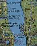 | Details | Oppenlander, J. H. and H. F. | 1924 |
| Fine and rare map of the Columbia River Portland to the Dalles |
|
Oppenlander, J. H. and H. F. |
|
| 1924 |
| LOC:400 |
| $2,000.00 | Oppenlander--J--H--and-H--F- | Fine-and-rare-map-of-the-Columbia-River-Portland-to-the-Dalles | A very fine and very long (67") folding map of the Columbia River from Portland to the Dalles, Oregon- a straight-line distance of approximately 71 miles as the Google flies. North oriented to the left. Legend at far left end.
<br><br>
<div id="0" align="center">
<a title=""></a>
<img id="6755_1" src="/ZoomifyImages/SC_6755/SC_6755_Detail_1.jpg" alt="Detail of Portland, Oregon region from the Oppenlanders' 1924 map of the Columbia River." width="340"/> <br><br> <font size="-2">Portland, Oregon detail.</font>
</div><br>
As a collector, beyond all the hachured topography and meticulous colored detail, the map highlights are the numerous Lewis and Clark native-American place names, camps locations, and notes overlaid on the Oppenlanders' 1924 plan of the area.
<br><br>
<div id="0" align="center">
<a title=""></a>
<img id="6755_3" src="/ZoomifyImages/SC_6755/SC_6755_Detail_3.jpg" alt="Detail of Dalles region from Oppenlander's map of the Columbia River, 1924." width="340"/> <br><br> <font size="-2">The Dalles region detail, 1924.</font>
</div><br>
The map is carefully folded into a thirty-nine page booklet with text and photographs. From the Penland Guide Series' "The Columbia River Guide and Panorama- from Portland to the Dalles. Myths Legends - History- Geology - Lewis and Clark Notations - Vancouver Expedition Notes". Copyright 1924 by J. H. and H. F. Oppenlander, Portland, Oregon.
<br><br>
<div id="0" align="center">
<a title=""></a>
<img id="6755_2" src="/ZoomifyImages/SC_6755/SC_6755_Detail_2.jpg" alt="Panoramic photo looking east from Crown Point. Taken from Oppenlander's map of the Columbia River, 1924." width="340"/> <br><br> <font size="-2">Looking East from Crown Point.</font>
</div>
<br><br>
Six institutional holdings are noted in WorldCat (Washington and Oregon) but apparently quite rare on the market. |
| 6586 |  | Details | Anonymous | 1924 |
| Map of City of Palo Alto Santa Clara County California |
|
Anonymous |
|
| 1924 |
| LOC:59 |
| $150.00 | Anonymous | Map-of-City-of-Palo-Alto-Santa-Clara-County-California | Map of Palo Alto, California in Santa Clara County dated within to November, 1924. At map bottom, below Alma Street, is Stanford Park, the Palo Alto Stock Farm, Palo Alto Union High School, and Stanford University and stadium.
<br><br>
The map of Palo Alto shows tract numbers, and the location of numerous tracts, subdivisions and developments including Clara Vista, Alba Park Addition, the Alcorn tract, and Ravenswood.
<br><br>
Palo Alto city limits in 1924 are shown with a dotted line. |
| 4786 |  | Details | Davison, J. A. and Son | 1924 |
| 1924 cadastral plat of Sanibel Shores Subdivision, Sanibel Island, Florida |
|
Davison, J. A. and Son |
|
| 1924 |
| LOC:0 |
| $0.00 | Davison--J--A--and-Son | 1924-cadastral-plat-of-Sanibel-Shores-Subdivision--Sanibel-Island--Florida | SOLD
<br></br>
Folding cadastral map of a proposed subdivision "Sanibel Shores" on the southeast end of Sanibel Island, Florida platted with several hundred lots and over 3500 linear feet of Gulf frontage. With a smaller-scale inset map of the island placing the development in geographic context relative to the entire island. Surveyor's written location description states:
<div class="indenttextblock">
"Being a subdivision of Government lots 6-7-8 and that portion of lot 2 and the west 618.2 ft. of lot 1 that lies between the Gulf of Mexico and a bayou which is parallel with about 1800 feet from the meanders of the Gulf of Mexico, Section 30 T. 46 SR 23 E."
</div>
<BR/>
Today, Sanibel Shores would occupy a space roughly bounded to the south by the Gulf of Mexico; to the east by Nerita Street; to the north by Junonia Street, and to the west by Old Middle Gulf Drive. That area encompasses what has become the Sanibel Island Golf Club and a large portion of Beachview Country Club Estates. Major feeder road was Donax Street.
<br></br>
Frank P Bailey & C.R. Bailey Owners and Developers. Map based on survey by J.A. Davison & Son, Engineers, Fort Meyers, Florida Dec. 1924. Del. (drawn by) A.P. Vaughn.
<br></br>
Reybold & Gates Exclusive Sales Agents, Fort Meyers, Florida.
<br></br>
The old cadastral map is from the estate of the Mitchell C. Lilley family. The Lilley family owned an Gulf-front lot in this Sanibel Island subdivision, an un-numbered double-sized lot which is marked "Exception" on map. The Baileys are one of Sanibel's most notable families who arrived on the Island in the Mid-1890's. Frank and Ernest Bailey began farming on the Island and started the Sanibel Packing House in 1899 which became the Bailey General Store.
<br></br>
Scale 200 ft. to an inch. North oriented to upper right. |
| 5181 |  | Details | Krenn and Dato | 1924 |
| Krenn and Datos Dempster Street Evanston Chicago |
|
Krenn and Dato |
|
| 1924 |
| LOC:62 |
| $200.00 | Krenn-and-Dato | Krenn-and-Datos-Dempster-Street-Evanston-Chicago | Rare cyanotype, or blueprint, maps related to the lots for sale in the Dempster Street 'L' terminal addition, in northern Chicago, Illinois. Produced by Krenn and Dato, Subdividers. Interesting depictions of local commuter trains including the Elevated Extension or "L" and the Chicago and Northwestern Railroad.
<br></br>
Krenn and Dato are here self-described as "subdividers" operating from 600 N. Michigan Avenue, Chicago, Illinois. In a contemporaneous print for Edward A. Dato, the firm is listed as Krenn & Dato, Engineering, Consulting, and Service Company, Exclusive Agent for Mrs. Rockefeller's McCormick Properties.
<br></br>
Cyanotype engineering drawing is by G. I. Silander, Land Surveyor, Chicago. Dated within to 5-1924. Sheer 255. Evanston interest. |
| 7960 |  | Details | Taylor, Jack and Joe King Realtors | 1924 |
| Lake Knowles Terrace |
|
Taylor, Jack and Joe King Realtors |
|
| 1924 |
| LOC:86 |
| $350.00 | Taylor--Jack-and-Joe-King-Realtors | Lake-Knowles-Terrace | Rare sales-oriented plat map for the Lake Knowles Terrace subdivision of Winter Park, Florida printed when the development was first offered for sale ca. 1924. Streets shown include Chestnut Avenue, Walnut Avenue, Sunset Drive, Temple Drive, Phelps Avenue, and Lake Shore Boulevard. North oriented to left. The plat also shows Lake Knowles and Lake Willbar slightly to the east of it.
<br><br>
Verso with text and a small scale map of the Winter Park and Orlando area.
<br><br>
Lake Knowles Terrace was established during Florida’s 1920s real-estate boom. When its second phase opened in 1925, the demand was intense—65 lots sold in a single day, reflecting the speculative enthusiasm of the period. The neighborhood developed with the architectural fashions of the time, featuring Bungalow/Craftsman, Colonial Revival, and Mediterranean-inspired homes that continue to shape its character today.<br> |
| 7941 |  | Details | Hagelstein, G. and C. | 1924 |
| Map of Lake Medina Highlands lodge and camp sites, San Antonio |
|
Hagelstein, G. and C. |
|
| 1924 |
| LOC:41 |
| $0.00 | Hagelstein--G--and-C- | Map-of-Lake-Medina-Highlands-lodge-and-camp-sites--San-Antonio | SOLD<br><br>Cadastral plat map and sales advertisement ("Absolute Auction Sale") of Lake Medina Highlands lodge and camp sites, San Antonio, Texas. Shows a planned recreational and residential development on the shores of Medina Lake in the Texas Hill Country, Bandera County, Texas. Dated within to 1924.<br><br>
Red shading marks lots that were already sold or reserved at the time of printing, a common marketing device for sales maps. A certification block from a Bexar County surveyor confirms the survey’s accuracy and filing with local authorities. The plotted lots are numbered, and circular survey reference marks (with numbers inside) indicate the original survey tracts or blocks.
<br><br>
Medina lake forms a broad crescent stretching west to east, measuring about 18 miles in length and up to 3 miles across at its widest point. It is impounded by Medina Dam at the southern end—a structure that, when completed in 1913, was the largest concrete dam in the United States and the fourth largest dam overall. The dam's significance was recognized in 1976 when it was placed on the National Register of Historic Places.
<br><br>
Verso with a small inset map and details for an auction of the sites by Barry and Austin, Auctioneers. |
| 5016 |  | Details | Silver Springs Transportation Company | 1924 |
| Map of Silver Springs Daylight Route Cruise Ocklawaha River |
|
Silver Springs Transportation Company |
|
| 1924 |
| LOC:11 |
| $295.00 | Silver-Springs-Transportation-Company | Map-of-Silver-Springs-Daylight-Route-Cruise-Ocklawaha-River | Florida 1920's land-boom era map of Silver Springs Daylight Route cruise over the Silver River, Ocklawaha River, and St. John's River Florida, a distance of 135 miles. Map is one page in a folded brochure "Daylight Route Ocklawaha River" produced by the Silver Springs Transportation Company for the 1923-24 season. For more than a century tourism and transportation have both greatly contributed to Florida's growth. The map, supported by the rest of the brochure, details the route, landings, and sights for one of three boats operated by the Silver Springs Transportation Company the "City of Ocala", "Silver Springs", and "Wekiwa".
<br></br>
During the season two trips were offered daily, six days a week with one boat traveling from Silver Springs to Palatka and the other from Palatka to Silver Springs. Map identifies important points along the trip including Gore's Landing, Hell's Half Acre, Forty Feet Cliff, Fort Brooks, McBride's landing and many more. |
| 7932 |  | Details | Kenyon Company | 1924 |
| Bankers Life Radio Map of the United States |
|
Kenyon Company |
|
| 1924 |
| LOC:41 |
| $300.00 | Kenyon-Company | Bankers-Life-Radio-Map-of-the-United-States | In 1924, American broadcasting was new enough to map. This Radio Map of the United States, engraved and published by the Kenyon Company of Des Moines with compliments of the Bankers Life Company, plots cities through their call signs. It is a document from the first radio boom, two years before the major networks formed, when individual stations defined the medium and listeners learned the geography of the air by call letters alone.
<br><br>
The design is simple and utilitarian. Time zone lines and numbered radio districts divide the country. Cities host their stations without decorative effects. The emphasis is informational: where a station is, what it is called, and how federal administration overlays the national map.
<br><br>
As advertising, the piece is direct. Bankers Life, calling itself the largest life insurer west of the Mississippi, links its presence to the spread of broadcasting. The sober printing and neat index give the map the tone of a directory while keeping the sponsor in view.
<br><br>
The call letters also tell a regulatory story. After 1912 the United States used the leading letters K, W, N, and A. For broadcasting, officials split K and W geographically and finalized the Mississippi River divide in 1923. New stations west of the river took K, those east took W, but early assignees kept their calls. That is why KDKA and KQV appear in Pittsburgh, east of the line. The 1924 sheet shows the new rule with the older exceptions still present.
<br><br>
A partial list of stations include:
<br><br> |
| 5415 |  | Details | Standard Blueprint Map and Engineering Company | 1924 |
| Oilfield cadastral map of Borden County, Texas |
|
Standard Blueprint Map and Engineering Company |
|
| 1924 |
| LOC:300 |
| $0.00 | Standard-Blueprint-Map-and-Engineering-Company | Oilfield-cadastral-map-of-Borden-County--Texas | SOLD<br><br>Scarce, unrecorded 1920's blue-line oilfield map of Borden County, Texas from the early Texas oil boom that started with the Spindletop discovery near Beaumont, Texas in 1901. This antique thematic map shows land owners and locations for petroleum exploration in Borden County. Manuscript outlining of tracts and pencil notations of lessee names.
<br></br>
Scale 4.5" = 5 miles.
<br></br>
A legend at upper right explains the types of oil exploration sites as:
<div class="indenttextblocksingle">
<ul style="list-style-type: circle;">
<li>Location</li>
<li>Rig Up</li>
<li>Drilling</li>
<li>Producing</li>
<li>Gas</li>
<li>Abandoned</li>
<li>Dry Hole</li>
</ul>
</div>
Map was printed on heavy paper by the Standard Blueprint Map and Engineering Company 515 Main Street, Fort Worth Texas. Does not show the Shreveport office address, as on other maps therefore presumed a bit earlier than 1925. |
| 6421 |  | Details | Edwards, Robert | 1924 |
| Scarce pictorial 1st ed map of Greenwich Village New York |
|
Edwards, Robert |
|
| 1924 |
| LOC:300 |
| $365.00 | Edwards--Robert | Scarce-pictorial-1st-ed-map-of-Greenwich-Village-New-York | Scarce presumed 1st edition map of Greenwich Village, New York copyrighted by Robert Edwards in 1924. More that 50 locations in Greenwich Village are identified numerically and correspond to an included advertising section "Mr. Quill's Guide" where advertisers could feature their establishments for one dollar per line per month. According to the guide <b>"Places marked with a double asterisk ** sell booze to anybody."</b>
<br><br>
Locations identified on the map include:
<div class="indenttextblocksingle">
<ul style="list-style-type: circle;"></li>
<li>The Green Goat -- 97 West 3rd Street "Booze, gambling, and murders committed to order."</li>
<li>The Jolly Friars </li>
<li>Joseph Kling -- 3 Christopher Street. "International book shop. Rarest prints and originals."</li>
<li>The Four Trees -- 4 Christopher Street. "Soft music that inspires synthetic moonlight, glamour, charm and romance fortified by delicious food. Here the editor dines and dances."</li>
<li>The Blue Horse.</li>
<li>Cherry Lane Theater.</li>
<li>De Pamphilis Press -- 51 Greenwich Avenue. "The cheesy printer who makes this nifty book."</li>
<li>MacDougal Alley.</li>
</ul>
</div>
Robert "Bobby" Edwards (1879-1948) attended Chase Art School and later moved to Greenwich Village New York where he had a career as an artist, writer, performer, and maker of Ukuleles. Edwards advertised himself as <br>
<div class="indenttextblocksingle">
“Maker of the Ukalyptos, Second Cousin of the Ukulele. Painting, Poetry, Movie Acting, Music, Singing, Illustrating and General Art Work Neatly Done. Also Contracts Taken to Make Restaurants Famous. Terms for Singing at Parties on Application. Also Portrait Photography.”
</div>
Bobby Edwards edited the Greenwich Village magazine, The Quill and contributed songs, gossip, verse and this early pictorial map. Price includes complete "The Quill". Vol 15. July 1924. No. 1. Light card cover. 31 pages.
<br><br> |
| 608 | 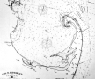 | Details | Eldridge, George W. | 1924 |
| Massachusetts Bay and Coast from Chatham to Gloucester |
|
Eldridge, George W. |
|
| 1924 |
| LOC:0 |
| $0.00 | Eldridge--George-W- | Massachusetts-Bay-and-Coast-from-Chatham-to-Gloucester | SOLD
<BR> </BR>
Extra-large old nautical chart of <b>Cape Cod</b>, Massachusetts Bay, and the Massachusetts coast from Chatham north past Boston. Created by George Washington Eldridge (d. 1914) and published by Eldridge's widow, Sydna Eldridge a decade after George's passing. Coverage includes the coastal margins near the towns of Provincetown, Truro, Wellfleet, Brewster, Yarmouth, Plymouth, Scituate, Cohasset, Marblehead, Salem, Gloucester, and the town and harbor of <b>Boston</b>, Massachusetts.
<br></br>
Printed on thin, rolled paper, this nautical chart was probably destined to be backed with linen which would have provided the strength needed to withstand rigors of day to day use at sea. This chart is a survivor, perhaps one of the last copies of a chart whose origins extends back at least 30 years.
<br></br>
G.W. Eldridge was the son of well-known cartographer and hydrographer George Eldridge, whose first charts were of the area off Chatham, Mass. including Pollock Rip and the sandbars from Stone Horse to Handkerchief Shoals<sup>1</sup>. This chart carries a warning notation at the Chatham Bar: <dir class="indenttextblock" > "Chatham Bars are rapidly extending seaward and should be approached with caution at night."</dir>
<br>
Copyright Sydna Eldridge, Vineyard Haven, 1924. Published by Wilfrid O. White, Boston Massachusetts in 1924. Drawing by A.N. Houghton, Boston, Mass.<br></br>
<sup>1</sup> (Nickerson, Joseph A. and Geraldine Nickerson, "Chatham Sea Captains in the Age of Sail". Google Books. 2008.) |
| 4808 | 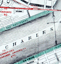 | Details | George W. Walker Lithograph and Publishing Co | 1925 |
| Attractive lithographed map of Boston, Mass |
|
George W. Walker Lithograph and Publishing Co |
|
| 1925 |
| LOC:53 |
| $180.00 | George-W--Walker-Lithograph-and-Publishing-Co | Attractive-lithographed-map-of-Boston--Mass | Fine lithographed map of Boston, Massachusetts by Walker Lithographers and Publishers, 400 Newbury Street, Boston. In a style easily recognizable as Walker's. Attractive appearance with variously-shaped red and green lines identifying surface lines, subway lines, elevated lines, and tunnels , all explained in a key at the bottom right corner. Parks and common lands are identified with solid green.
<br></br>
Shows the beginnings of a municipal airport ("airplane landing field") on the East Boston Flats where Logan's Field now stands. Map contains two helpful lists: "places of amusement" and "places of historical and general interest." Includes numerous piers and docks along with significant portions of South Bay, the Charles River, the Mystic River and Chelsea River.
<br></br>
Folding pocket map folds to a simple brown card-stock cover 3" x 5". Cover states this as "Walker's Vest Pocket Map of Boston" with an address as 390 Newbury Street, different from the address on the map at 400 Newbury Street.
<br></br>
Undated but based on known dates for the airport construction and some of the subway stations, the estimated publishing date for this piece is ca. 1925. |
| 4900 |  | Details | Anonymous | 1925 |
| Cyanotype Heath Robinson contraption goat-powered torpedo |
|
Anonymous |
|
| 1925 |
| LOC:62 |
| $650.00 | Anonymous | Cyanotype-Heath-Robinson-contraption-goat-powered-torpedo | You will likely never see another one of these. From the Roaring Twenties- a cyanotype (blueprint) Heath Robinson style contraption- a goat-powered torpedo. The satirical proposed device shows advanced knowledge of torpedo design and function. (e.g. bulkheads).
<br></br>
Early Newport, RI colonists used Goat Island as a goat pasture. In 1925 the U.S. Navy operated a torpedo manufacturing, development and testing station on Goat Island.
<br>
<div class="indenttextblock">The anonymous author explained:
"The torpedo is made in three sections, the head, the midship section and after body. The drawing shows the mechanism at rest. The operation is as follows: When the torpedo is fired from the tube the trigger comes in contact with a lug which causes the trigger arm to displace the cobble with falls on the Bermuda onion and crushes it. The onion gases thus released cause the goat to weep copiously. The tears are caught in the funnel on the top of the sal-ammoniac pin. These tears dissolve the sal-ammoniac pin. Thereby releasing the spring rod and prodder. This unit moves smartly forward, engaging the port quarter of the goat, thereupon the goat steps out and operates the asbestos tread mill, which is connected to the gear train that operates the propellers. A gaff and boom rig operated by the gear train, operates a spur gear which revolves rapidly on the goats back guaranteeing the continuance of the motion started by the goat prodder, the derby on the goat prevents him from catching cold while the torpedo is in the tube. It is obvious that if he should catch cold he would be rendered useless as an onion weeper. The hat also serves as a cut-off in the following manner; after a certain speed has been attained the goat has a desire to take off his hat and be comfortable, so he therefore tosses it to the rear where it falls in the gear train and jams it. Any torpedo expert will explain this to you if the above elucidation is not perfectly clear.
</div> |
| 4939 | 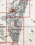 | Details | G.M. Hopkins Company | 1925 |
| Hopkins' plat book of Greater Miami Florida and Suburbs 1925 |
|
G.M. Hopkins Company |
|
| 1925 |
| LOC:0 |
| $0.00 | G-M--Hopkins-Company | Hopkins--plat-book-of-Greater-Miami-Florida-and-Suburbs-1925 | SOLD<br/><br/>
Original plat book of Greater Miami, Florida and Suburbs from official records, private plans, and actual surveys. Compiled under the direction of and published by G.M. Hopkins Co. Civil Engineers … 1925.
<br/><br/>
In two sections: Greater Miami, Florida and Suburbs (list of revisions; street index; 2 index maps; and 41 sheets of plats) and City of Miami Beach (with six sheets containing plats labeled B-G; Sheet "A" missing.) Verso of each sheet is blank.
<br/><br/>
Earliest of three plat books of Miami by the Hopkins Co, the latter two being 1936 and 1957.
G.M. Hopkins Company was a map-making publishing company founded in 1865 in Philadelphia, Pa., by brothers G.M. and Henry Hopkins. The name of the company was changed to G.M. Hopkins Company in 1902. The company was bought by the Franklin Survey Company of Philadelphia in 1943, which continued to issue maps and atlases under the G.M. Hopkins name. |
| 4818 | 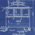 | Details | Market Street Railway Company | 1925 |
| Fillmore Hill "Dinky" Streetcar Blueprint |
|
Market Street Railway Company |
|
| 1925 |
| LOC:62 |
| $600.00 | Market-Street-Railway-Company | Fillmore-Hill-"Dinky"-Streetcar-Blueprint | Rare find! An original, authentic blueprint diagram from 1925 for a <b>Market Street Railway Company streetcar</b>. That is a San Francisco, Ca. streetcar, number 649!
<br></br>
The blueprint still carries the MS index number, 755, in red crayon, that would have been used to uniquely identify the blueprint and to tie it to a set of specifications. This type of streetcar was known to have a rough ride because unlike larger cars, "single-truck" streetcars had only one set of four wheels.
<br></br>
Rectangular purple ink stamp on verso for "Market Street Railway Company | Aug 29, 1925 | Blue Print Room". Number M.M. 3013.
<br></br>
Title reads: "Market Street Railway Company. M.M. Department. Body Dimensions of Fillmore Hill Cars after Reconstruction. Overall length 26' 3.5". <br> Overall Width 8' 0" ". 8/24/25.
<br></br>
<img src="/ZoomifyImages/SC_4818/MarketStreetCar621.jpg" alt="Market Street Railway Co. "Dinky" Fillmore Hill streetcar.")" width="300" align="left" style="margin: 0px 20px"> </img>
<br />
<br />
Some of the literature refers to this 26 foot long diminutively-sized street-car as a "Dinky". In its general dimensions and rolling equipment, our blueprint is very similar to car 578, built in 1896, one of the first generation of San Francisco's electric streetcars. Today, number 578 is stated to be the, "world’s oldest streetcar still on the active roster of an urban transit agency."
<br></br>
The Market Street Railway Company began on July 4, 1860 with a steam railway. After a series of mergers and sales, the company was acquired by Standard Gas & Power Company in late 1925.
<br></br>
Sources:
https://www.kalw.org/post/how-muni-s-oldest-streetcar-survived-122-years-become-san-francisco-s-sweetheart#stream/0
<BR/>
Vielbaum, Hoffman, Ute, Townley. San Francisco's Market Street Railway. Charleston. Arcadia Pub. 2004. |
| 4819 |  | Details | Market Street Railway Company | 1925 |
| San Francisco Streetcar Blueprint |
|
Market Street Railway Company |
|
| 1925 |
| LOC:62 |
| $375.00 | Market-Street-Railway-Company | San-Francisco-Streetcar-Blueprint | An original, authentic blueprint diagram from 1925 for a <b>Market Street Railway Company</b> "double-truck" (2 sets of wheels) streetcar. San Francisco, California. Scarce. The blueprint still carries the manuscript engineering index number, 907, in red crayon, that would have been used to uniquely identify the blueprint and to tie it to a set of specifications.
<br></br>
Title reads: "Market Street Railway Company. M.M. Department. Body Design & Seating Arrangement of Cars 266-285, 286-305, 779-808. Drawing number M.M. 3005. 8/24/25." Overall length including bumpers was 47'.
<br></br>
<figure>
<img src="/ZoomifyImages/SC_4819/Market_Street_Railway_Co_car_285.jpg" alt="Market Street Railway Company 47' streetcar number 285)" width="300" align="left" style="margin: 0px 20px">
<figcaption>
<div style="text-align:center;font-size: 80%">Streetcar number 285.</div>
</figcaption>
</figure>
<br></br>
The Market Street Railway Company began operating on July 4, 1860 with a steam railway. After a series of mergers and sales, the company was acquired by Standard Gas & Power Company in late 1925.
<br></br>
Source: Vielbaum, Hoffman, Ute, Townley. San Francisco's Market Street Railway. Charleston. Arcadia Pub. 2004. |
| 5353 |  | Details | Standard Blueprint Map and Engineering Company | 1925 |
| Oilfield cadastral map of Bowie County, Texas |
|
Standard Blueprint Map and Engineering Company |
|
| 1925 |
| LOC:300 |
| $0.00 | Standard-Blueprint-Map-and-Engineering-Company | Oilfield-cadastral-map-of-Bowie-County--Texas | Scarce, unrecorded 1920's blue-line oilfield map of Bowie County, Texas from the early Texas oil boom that started with the Spindletop discovery near Beaumont, Texas in 1901. |
| 5354 |  | Details | Standard Blueprint Map and Engineering Company | 1925 |
| Oilfield cadastral map of Atascosa County, Texas |
|
Standard Blueprint Map and Engineering Company |
|
| 1925 |
| LOC:300 |
| $0.00 | Standard-Blueprint-Map-and-Engineering-Company | Oilfield-cadastral-map-of-Atascosa-County--Texas | SOLD
<br></br>
Large, scarce, unrecorded 1920's blue-line oilfield map of Atascosa County, Texas from the period of the early Texas oil boom that started with the Spindletop discovery near Beaumont, Texas in 1901. This antique thematic map shows land owners and locations for petroleum exploration in Atascosa County, Texas. Noted towns include Pleasanton, Campbellton, Ditto, Poteet, Amphion, Somerset and Gallinas. Includes several manuscript notations about oil wells in pencil and red crayon.
<br></br>
Note: Due to the large size the posted image is a composite of two photographs stitched together. Some misalignment or fuzziness may appear at the center join line as a result of this process.
<br></br>
A legend explains the types of oil exploration sites as:
<div class="indenttextblocksingle">
<ul style="list-style-type: circle;">
<li>Location</li>
<li>Rig Up</li>
<li>Drilling</li>
<li>Producing</li>
<li>Gas</li>
<li>Dry Hole</li>
<li>Abandoned Well</li>
<li>Abandoned Location</li>
</ul>
</div>
Map was printed on heavy paper by the Standard Blueprint Map and Engineering Company 515 Main Street, Fort Worth Texas in the mid-1920s. Bears several owner's red ink hand stamps that read: "Return to H. N. Harris, Fort Worth Nat'l Bank Building Fort Worth, Texas." Several lawsuits of the period reference a H.N. Harris, possibly associated with H.N. Harris Company or Inland Oil Company. |
| 5414 |  | Details | Rowlett, C. | 1925 |
| Oilfield map of Colbert Ranch Shackelford Texas |
|
Rowlett, C. |
|
| 1925 |
| LOC:300 |
| $0.00 | Rowlett--C- | Oilfield-map-of-Colbert-Ranch-Shackelford-Texas | SOLD<br><br>Colorful, blue-line geological oil-field map of Colbert Ranch in Shackelford County, Texas. Lessee's denoted by color. Heavy paper.
<br></br>
Field work by R. Rowlett. Elevations taken from massive limestone beds in the Permian. Scale: 1" = 1000'.
<br></br>
Lessee's noted on the map include
<div class="indenttextblocksingle">
<ul style="list-style-type: circle;">
<li>Phillips Petroleum Company</li>
<li>Marland Oil Company</li>
<li>C. Rowlett</li>
<li>Cosden & Company</li>
<li>Midwest</li>
<li>Humble Oil Co. and Refining (became ExxonMobil)</li>
</ul>
</div> |
| 5412 |  | Details | Irvin, R. B. | 1925 |
| Oilfield map Menard County, Texas to J. C. Barnett |
|
Irvin, R. B. |
|
| 1925 |
| LOC:300 |
| $0.00 | Irvin--R--B- | Oilfield-map-Menard-County--Texas-to-J--C--Barnett | SOLD<br><br>Colorful blue-line cadastral oil-field map of an area in Menard County, Texas that was leased during the 1920's to J. C. Barnett. Created by R. B. Irvin, Civil Engineer from Brownsville, Texas during the mid-1920's Texas oil boom.
<br></br>
Includes a key at upper left presumably relating lessee's to leased sections by color. Scale: 2.4 in. = 1 mile. |
| 6647 |  | Details | Douglas County Abstract Company | 1925 |
| Cadastral map Township No. 28 near Roseburg, Oregon |
|
Douglas County Abstract Company |
|
| 1925 |
| LOC:89 |
| $100.00 | Douglas-County-Abstract-Company | Cadastral-map-Township-No--28-near-Roseburg--Oregon | Blueprint cadastral map of lands southeast of Roseburg, Oregon. Date c. 1920's. |
| 6580 |  | Details | Scheuerle, Joseph G. | 1925 |
| Pictorial Map of Glacier National Park |
|
Scheuerle, Joseph G. |
|
| 1925 |
| LOC:68 |
| $675.00 | Scheuerle--Joseph-G- | Pictorial-Map-of-Glacier-National-Park | Striking pictorial map of Glacier National Park from 1925 by Joseph G. Scheuerle (1873-1948). Published by the Great Northern Railway. This pictorial map documents Blackfoot Glacier, Harrison Glacier, Pumpelly Glacier, Sperry Glacier, Red Eagle Glacier, Carter Glacier, Dixon Glacier, Sexton Glacier Grinnell Glacier, Ahern Glacier, and Iceberg Lake (1).
<br><br>
Glacier National Park in 1925 was a popular destination for tourists who were seeking adventure, breathtaking scenery, and a chance to experience the great outdoors- hiking, by pack train, or by car. The Going-to-the-Sun Road was completed in 1932, but construction began in 1919. In 1925, visitors could drive part of the road, which offered stunning views of the park's glaciers, mountains, and valleys.
<br><br>
The Many Glacier Hotel was completed in 1915, but it underwent extensive renovations in the early 1920s. By 1925 the hotel had been transformed into a luxurious mountain retreat with modern amenities such as electricity, running water, and telephones.
<br><br>
Around 1873 Joe Scheuerle, moved to Ohio, where he eventually studied at the Cincinnati Art Academy. Best known for his portraits of Native Americans, beginning in 1909, Scheuerle made many visits to Indian reservations in Montana and across the West. He produced "more than 200 exceptional portraits of native American's" (2). One need only look at the title cartouche to understand that Scheurle's portraits greatly influenced this map.
<br><br> |
| 1350 |  | Details | British Admiralty Hydrographical Office | 1925 |
| Old Authentic Admiralty Nautical Chart of the West Indies or Caribbean |
|
British Admiralty Hydrographical Office |
|
| 1925 |
| LOC:0 |
| $0.00 | British-Admiralty-Hydrographical-Office | Old-Authentic-Admiralty-Nautical-Chart-of-the-West-Indies-or-Caribbean | SOLD
<br></br>
Authentic British Admiralty nautical chart of the West Indies including Florida and the Gulf Coast. 1925.
<br></br>
Fine British Admiralty chart engraved and published from London first in 1903, this example with corrections to 1925. This bold, dark, engraved print retains the cartographic look and style of the late 19th century. More recent charts do not display the character of this beauty. Oval logo of the British Hydrographical office at lower left. Sold by J.D. Potter. Chart number 3273. |
| 4972 |  | Details | Council, D.P. | 1925 |
| Map of Lake Worth and Lake Worth Heights Palm Beach County Florida |
|
Council, D.P. |
|
| 1925 |
| LOC:0 |
| $0.00 | Council--D-P- | Map-of-Lake-Worth-and-Lake-Worth-Heights-Palm-Beach-County-Florida | Sold <br></br>
Folding sales brochure from Florida's 1920's land boom with photographs including <b>Lake Worth Heights</b> entrance and The Royal Poinciana "fronting on beautiful Lake Worth". On the verso a lot plan or map of Lake Worth and Lake Worth Heights, in Palm Beach County, Florida. Printed by D.P. Council Owner & Developer Lake Worth, Fla.
<br></br>
Cute manuscript notation on the outer row of homes along Lake Worth, an "X" next to a small rectangle, filled in with pencil as on an S.A.T. exam, and the proud words in neat script: "Our Bungalow". Awwww.
<br></br>
Inset map on lower right with a "Key Map Showing Locations of Lake Worth Heights" relative to other features such as The Breakers, Royal Poinciana, Lantana, Lake Osborne Park, and West Palm Beach.
<br></br>
The copy on the last page of the brochure nicely sums up the offering:
<div class="indenttextblock">
The Key Map on the inside page has been accurately compiled to give you an indelible picture of the important developments between the world-famed Palm Beaches and the Wonder City of Lake Worth, and the close relation of Lake Worth Heights in the ultimate unity of those two cities.<br></br>
…
<br></br>
With the attractive, rustic entrances, the wide avenues and boulevard parked with the tropical Australian pins, cleared of unsightly undergrowth. Lake Worth Heights commands the attention of those anxious to locate in a restricted residential section enjoying the advantages of spacious building estates, uniform building lines, building and residential restrictions, making a high-class development for attractive homes.
</div>
On November 19, 1920, Model Land Company a portion of the lands they owned to D.P. Council, who platted in into Lake Worth Heights Subdivision. |
| 5050 |  | Details | Lovett Company | 1925 |
| Rare, early map of Nela Isle Subdivision Orlando Florida. |
|
Lovett Company |
|
| 1925 |
| LOC:11 |
| $0.00 | Lovett-Company | Rare--early-map-of-Nela-Isle-Subdivision-Orlando-Florida- | SOLD<br></br>Early, pre-construction map of the Nela Isle Subdivision on Lake Conway at Orlando, Florida in Orange County. Rare. Map on verso of a four-panel folding brochure. Dated within at August, 1925.
<br></br>
By The Lovett Company 118 S. Orange Avenue, Orlando, Florida. Map drawn by M. Klein, Cleveland, Ohio. With an inset large-scale context map showing Nela Isle in the larger Orlando, Lake Conway, Pine Castle area.
<br></br>
Verso with title and a fine two-panel Artist's Conception of the New Bridge to Nela Isle. According to the brochure:
<div class="indenttextblocksingle">
"Plans are being developed by the Florida Associated Engineers--- The Bridge will soon be a Reality. Watch Nela Grow." </div>
MS signature of Geo[rge] W. Ireland 1897 (likely the phone number). Scale 1" = 200'. |
| 4747 |  | Details | Edward E. Manning Company | 1925 |
| Cyanotype map of north Chicago and Evanston, IL |
|
Edward E. Manning Company |
|
| 1925 |
| LOC:62 |
| $320.00 | Edward-E--Manning-Company | Cyanotype-map-of-north-Chicago-and-Evanston--IL | Authentic hand-colored cyanotype (blueprint) Chicago-area map from ca. 1925. A fine, unique early 20th-century artifact that should appeal to collectors or others with interests in Evanston or Chicago, Illinois and its expansion into the suburbs. Cyanotype maps are generally scarce.
<br></br>
Coverage begins at W. Lawrence Avenue and extends north to Lake Avenue in Evanston, Illinois. Our map is bounded to the east by Lake Michigan and to the west a few blocks past Harlem Avenue. Shows the location of Northwestern University along Lake Michigan. Includes by name Morton Center, Edison Park, Rogers Park, and the town of "Niles Center", now Skokie, Il.
<br></br>
In the 19th century blueprints (cyanotype prints) were generally scarce as blueprinting had only been invented in the 1870's. By 1899 the cyanotype process was beginning to become widely adopted as a quick method of reproducing maps, plans, and architectural diagrams. Blueprinting was a well-accepted business tool in 1925.
<br></br>
Produced by the Edward E. Manning Company, 55 W. Wacker, Drive, Chicago. |
| 4735 |  | Details | Lake Shore Realty Co. | 1925 |
| Cyanotype Sales Map of Howard Avenue Subdivision No. 2 Chicago |
|
Lake Shore Realty Co. |
|
| 1925 |
| LOC:88 |
| $350.00 | Lake-Shore-Realty-Co- | Cyanotype-Sales-Map-of-Howard-Avenue-Subdivision-No--2-Chicago | Authentic cyanotype (blueprint) Chicago-area map from 1925 with interesting illustrations of local transportation including an electrified trolley and coal-fired steam locomotive. A fine, unique early 20th century artifact that should appeal to advertising collectors or others with interests in Evanston or Chicago, Illinois and the expansion into the suburbs. Dated within to 5/28/25. Drawn by J.R.W.A.
<br></br>
Right-hand side of this neat piece shows a large scale map with major streets centered on the Howard Ave Subdivision No 2. Concentric circles drawn at one mile intervals for 3 miles total radius. Left hand large-scale map of the Subdivision with side streets Jonquil Terrace, Lehigh Ave., Dobson Street, and North Meade Ave. Lots already sold are highlighted with dark red pencil.
<br></br>
The new subdivision was located at the intersection of Gross-Point Road and Howard Ave (now Street). Also crossing that intersection is a proposed trolley car line on Howard Ave. and the Chicago, Milwaukee and St. Paul R.R. with a locomotive drawn heading northbound pulling a freight car and four passenger cars.
<br></br>
Text describes restrictions, title guarantor, and contact details for the Lake Shore Realty Co. at Consumer's Building Room 1716. 220 State Street. Phone Wabash9180.
<br></br>
Restrictions were: " Howard Ave is restricted to business buildings of stone or brick construction, two or more stories high. Balance is restricted to residence or apartment buildings of stone or brick construction." Titles guaranteed by Chicago Title & Trust Co.
<br></br>
In the 19th century blueprints (cyanotype prints) were generally scarce as blueprinting had only been invented in the 1870's and by 1899 the process was beginning to become widely adopted as a quick method of reproducing maps, plans, and architectural diagrams. Blueprinting was a well-accepted business tool in 1925 but no other copy of this map is found online. |
| 4796 |  | Details | Barker, Curtis M. | 1925 |
| Fine antique cyanotype map of Corita Vineyard, Palo Alto California |
|
Barker, Curtis M. |
|
| 1925 |
| LOC:62 |
| $0.00 | Barker--Curtis-M- | Fine-antique-cyanotype-map-of-Corita-Vineyard--Palo-Alto-California | SOLD
<br></br>
Rare and desirable original cyanotype (blueprint) topographic survey map of the <b>Corita Vineyard</b>, then located in Los Altos Hills, about 4 miles south of Stanford University and Palo Alto, California. The map is dominated by Page Mill Road and by Moody Road; a course table is inset for each thoroughfare. Dated within at 1905 but later, developed from a well-worn surveyor's trace. Little information is available online on Corita Vineyard, consistent with the apparent scarcity of this old cartographic artifact.
<br></br>
Title reads:
<b>"Map of the Corita Vineyard. Being lots 3 & 4 of the Briones Partition of the la Purissima Conception Rancho the property of A.B. Blanco Surveyed in Feb. and Mar. 1905. Curtis M. Barker, Surveyor and C.E. San Jose, Cal."</b> 547 acres. Scale: 3600:1 . Contour interval: 25 feet.
<br></br>
<div class="indenttextblock">
<b>La Purissima Conception Rancho</b> - 4439 acre Mexican land grant given in 1840 by Governor Juan Alvarado to José Gorgonio and his son José Ramon. In 1844 Gorgonio sold the one square league Rancho La Purísima Concepción to Juana Briones de Miranda. <BR/>
<b>Briones Partition</b> - Juana Briones (b. 1802) sold about three quarters of her rancho in 1861 to Martin Murphy Jr. of Sunnyvale, who had come to California with the Stephens-Townsend-Murphy Party in 1844. Briones gave the remaining 1,130 acres (4.6 km2) of her rancho to her children, who bore their father’s name, Miranda. Until it was demolished in 2011, the Juana Briones home, a California registered landmark, stood at 4155 Old Adobe Road.<BR/>
<b>A.B. Blanco</b> - owner of the Corita Vineyard in 1905.<BR/>
<b>Curtis M. Barker</b> - Licensed surveyor and Civil Engineer (b. 1861). Employed as assistant civil engineer by Leland Stanford University in 1885-1893. Surveyor and civil engineer in San Jose, CA from 1894.</b>
</div> |
| 4996 |  | Details | Young, George F. | 1925 |
| St Petersburg Florida map issued by the CoC |
|
Young, George F. |
|
| 1925 |
| LOC:87 |
| $325.00 | Young--George-F- | St-Petersburg-Florida-map-issued-by-the-CoC | Map of St Petersburg, Florida drawn by engineer George F. Young and issued by the St. Petersburg Chamber of Commerce in 1925. Verso with an oblique birds-eye photo view of St. Petersburg, Florida looking toward land from offshore. Scarce.
<br></br>
George F. Young, Inc. is one of the oldest Florida engineering and surveying companies, established in 1919. Today G.F. Young, Inc. has professional offices located in St. Petersburg, Tampa, Lakewood Ranch, Gainesville, and DeBary, Florida
<br></br>
Shows the Coffee Pot Golf Club. In 1920, St. Petersburg developer, C. Perry Snell opened a 9-hole golf course along Coffee Pot Bayou called the <b>“Coffee Pot Golf Club.”</b> In 1926, Snell hired golf architects, Wayne Stiles and John van Kleek to build a modern 18-hole golf course. It was renamed the Snell Island Golf Course. In 1948, , known as Sunset Golf and Country Club, the operation was purchased by the Alsonett Hotel Corporation, and re-named the <b>Vinoy Golf Club.</b>
<br></br>
During February, 2019 Vinoy Golf Club was featured as Florida Historic Golf Trail Course of the Month by the Florida Department of State.
<br></br>
Publisher's colophon reads : "Map prepared in office of G.F. Young Civil and Landscape Engineer Drafting and Blueprints 633 Central Ave. St. Petersburg Fla." [FL. Fla.] |
| 4886 |  | Details | Nirenstein, Nathan | 1925 |
| Nathan Nirensteins 100 Percent Locations Atlantic City New Jersey |
|
Nirenstein, Nathan |
|
| 1925 |
| LOC:53 |
| $400.00 | Nirenstein--Nathan | Nathan-Nirensteins-100-Percent-Locations-Atlantic-City-New-Jersey | Map of business locations in Atlantic City, New Jersey. From the first edition of Nathan Nirenstein's "One Hundred Percent Preferred Real Estate Locations" 1925. Shows hundreds of business locations along the boardwalk and almost 2 miles of Atlantic beachfront.
<br></br>
A native of Russia, Nathan Nirenstein (1890-1973) emigrated to the United States as a boy. Nirenstein entered the real estate business and in 1925 established the Nirenstein National Realty Map Company (1925-1958). Nirenstein's map company published high-quality real estate maps of locations throughout the United States, mostly of southern states and states east of the Mississippi River. He was also involved in several other companies, including the Kellogg Buildings Realty Trust Company and the Harrison Realty Corporation.
<br></br>
Copyrighted by Nathan Nirenstein Springfield, Massachusetts, 1925. Scale 1 inch = 80 feet. |
| 4885 |  | Details | Nirenstein, Nathan | 1925 |
| Nathan Nirensteins 100 Percent Locations Hartford Connecticut |
|
Nirenstein, Nathan |
|
| 1925 |
| LOC:0 |
| $400.00 | Nirenstein--Nathan | Nathan-Nirensteins-100-Percent-Locations-Hartford-Connecticut | Map of business locations in Hartford Connecticut. From the first edition of Nathan Nirenstein's "One Hundred Percent Preferred Real Estate Locations" 1925.
<br></br>
A native of Russia, Nathan Nirenstein (1890-1973) emigrated to the United States as a boy. Nirenstein entered the real estate business and in 1925 established the Nirenstein National Realty Map Company (1925-1958). Nirenstein's map company published high-quality real estate maps of locations throughout the United States, mostly of southern states and states east of the Mississippi River. He was also involved in several other companies, including the Kellogg Buildings Realty Trust Company and the Harrison Realty Corporation.
<br></br>
Copyrighted by Nathan Nirenstein Springfield, Massachusetts, January, 1925. Cobb, Beesley Mills, Engineers. Scale 1 inch = 80 feet. |
| 5333 |  | Details | Howell and Graves | 1925 |
| Early blueprint plat map for Muscle Shoals, Alabama |
|
Howell and Graves |
|
| 1925 |
| LOC:53 |
| $275.00 | Howell-and-Graves | Early-blueprint-plat-map-for-Muscle-Shoals--Alabama | Rare blueprint map of Muscle Shoals Center Number Twelve Colbert County, Alabama. The map was part of a large development planned for the area.
<br><br>
Produced ca. 1925 by A. L. Howell and C. T. Graves Owners and Developers. Detroit, Michigan. Executive Office 350 Madison Avenue, New York, N. Y.
<br><br> |
| 6769 |  | Details | Milner, P. S. | 1925 |
| Blueprint map Industrial Plant Gate Addition Muscle Shoals Nitrate Plant 2 |
|
Milner, P. S. |
|
| 1925 |
| LOC:130 |
| $250.00 | Milner--P--S- | Blueprint-map-Industrial-Plant-Gate-Addition-Muscle-Shoals-Nitrate-Plant-2 | Scarce blueprint plat map for the Industrial Plant Gate Addition located near the main gate to the U.S. Government's Nitrate Plant #2 at Muscle Shoals, Alabama. Dated withing to April 27, 1925. The nitrate was used for producing gunpowder. An ugly reminder of the racism that was endemic one-hundred years ago is that one of the three building restrictions listed was "Caucasian Race Only."
<br><br>
Inset smaller-scale map of the greater Muscle Shoals district drawn by W. A. Dealy. The map shows the location of Nitrate Plants #1 and #2 in relationship to Sheffield, Florence, and Tuscumbia, AL.
<br><br>
Please see our other blueprint cadastral plat maps for the 1920's Muscle Shoals land boom from Keane Development Corp., Howell and Graves, and others. These proposed additions include Huston Heights, Lakeside Highlands, and Muscle Shoals Center. |
| 5316 |  | Details | Stuart, C.W. | 1925 |
| Antique cadastral plat for Moundgrove Fruit Company Ormond Florida |
|
Stuart, C.W. |
|
| 1925 |
| LOC:87 |
| $0.00 | Stuart--C-W- | Antique-cadastral-plat-for-Moundgrove-Fruit-Company-Ormond-Florida | SOLD
<br></br>
Blueline plat map, with MS additions, of agricultural lands in Volusia County northwest t of Ormond Beach, Florida. The plat was created by surveyor C. W. Stuart during the 1920's Florida land boom.
<br></br>
The lands, in several tracts, were owned primarily by the Moundgrove Fruit Company and the Halifax Grove Company. From a lot of plats related to the Wetumpka Fruit Company. Shows Halifax Avenue at the west and John Anderson Highway spanning Moundgrove Fruit Company lands at bottom center. Other landholders include George Beed, H. T. Cook, W. R. McElroy; Raymond and Anita Tassinari.
<br></br>
Dated within at September, 1925. North oriented to the upper left corner.
<br></br>
With red ink stamp for the office of Alex D. Littlefield Realtor, 416 Seabreeze Blvd. Daytona Beach, Florida.
<br></br>
Lands shown on this plat are bounded to the west and south by Bulow Creek and to the east by the Intracoastal Waterway and Smith Creek. |
| 5450 |  | Details | F.A. Bennett | 1925 |
| Rare view Fairyland Point Fleetwood Hotel Ormond-on-the-Bay and Muriel Estates |
|
F.A. Bennett |
|
| 1925 |
| LOC: |
| $350.00 | F-A--Bennett | Rare-view-Fairyland-Point-Fleetwood-Hotel-Ormond-on-the-Bay-and-Muriel-Estates | Rare, unrecorded antique 1920's panoramic birds-eye view of Ormond-on-the-Bay and Muriel Estates, Florida with the Fleetwood Hotel. Photograph of a painting showing Ormond-on-the-Bay and Muriel Estates both promoted by F.A. Bennett Developments. Inset of the Fleetwood Hotel. Probably a postal card. Framed.
<br></br>
The Fleetwood Hotel was a planned 300-room 15-story resort hotel with a casino, tennis courts, pool, ballroom on what is now part of Tomoka State Park. The Fleetwood Hotel, promoted by a developer called "Commodore" J. Perry Stoltz, was to embody the luxury and decadence synonymous with the Roaring Twenties.
<br></br>
[1] Jarmusz, T.S. Did Ormond Beach pillars mark a fantasy hotel that never materialized?. Daytona Beach News-Journal. January 7, 2009. Accessed Online. |
| 5227 |  | Details | McDowell, L. N. | 1925 |
| Rare Cyanotype Cadastral Map Beverly Hills Wilshire Boulevard California |
|
McDowell, L. N. |
|
| 1925 |
| LOC:300 |
| $375.00 | McDowell--L--N- | Rare-Cyanotype-Cadastral-Map-Beverly-Hills-Wilshire-Boulevard-California | Rare, previously unknown and fascinating cyanotype strip map of Wilshire Boulevard in Beverly Hills, California ca. 1925 by L. N. McDowell. This 10.5 foot-long blueprint map stretches eastward from South Lasky Drive, past Rodeo Drive and Beverly Drive, and terminates to the west at San Vincente Blvd, a total linear distance of 2.25 miles. With numerous blue over-colored 'erasures', stamped bungalow pictograms, and MS notations (1940's and 1950's) documenting usage of the map well after 1926. (Note: Contact us for complete photographs.)
<br></br>
The map reflects the early history of Beverly Hills. It shows Preuss Road before renaming to Robertson Boulevard in 1926 (1) and Realtor Road before renaming to Arnaz Drive (2). El Camino Drive is recorded as "Speedway Drive" with "El Camino" in MS pencil. Between 1919 and 1924 the Beverly Hills Speedway occupied a tract of land at Wilshire and Beverly that now includes the Beverly Wilshire Hotel which was built in 1928.
<br></br>
Date is based on an LA Times article which fixes the date that Preuss Road was renamed as 'Robertson Road':
<div class="indenttextblocksingle">
"In 1926, the city of Los Angeles agreed to rename its section of Preuss Road as Robertson Boulevard to honor developer George Robertson. Beverly Hills also voted to rename its stretch of road after Robertson." (1)
</div></br>
Title: "Business and Residential Income Properties Fronting on Wilshire Boulivard [sic] in the City of Beverly Hills. Compiled by L.N. McDowell - 559087 -"
<br></br>
Scale 1" = 100'.
<br></br>
(1) https://www.latimes.com/archives/la-xpm-2006-dec-10-me-then10-story.html</br>
(2) ibid. Named not in honor of Desi Arnaz, but for Don Jose de Arnaz, a landholder in 19th century Los Angeles. |
| 5387 |  | Details | Simpson and Pope | 1925 |
| Map and marketing brochure for Ortona, Florida |
|
Simpson and Pope |
|
| 1925 |
| LOC:11 |
| $150.00 | Simpson-and-Pope | Map-and-marketing-brochure-for-Ortona--Florida | Scarce sales brochure ca. 1925 for the Ortona, Florida development located on Florida's east coast in Volusia County just south of Ormond, Florida. Cover of the brochure shows several cottages and bungalows built in the Ortona neighborhood in the early 1920's. Note: this location is NOT the town of Ortona, Florida in Glades County.
<br></br>
The map shows Ortona bounded at the west by the Halifax River and at the east by the [Daytona] Auto Race Course on the beach. To the south, in 1925 Ortona was bounded by the "Clarendon Golf Links" and Seabreeze. The towns of Seabreeze, Daytona Beach, and Daytona are shown as platted and developed.
<br></br>
TITLE: "Ortona, On the Finest Ocean Beach in America, For Your Winter Home". Single sheet, folded. |
| 7868 |  | Details | Howell and Graves | 1925 |
| Muscle Shoals, Alabama City of Unlimited Opportunity |
|
Howell and Graves |
|
| 1925 |
| LOC:130 |
| $450.00 | Howell-and-Graves | Muscle-Shoals--Alabama-City-of-Unlimited-Opportunity | Muscle Shoals, Alabama, a small city nestled along the Tennessee River, is perhaps best known today for its outsized influence on American music. The iconic "Muscle Shoals Sound," born in the city's legendary recording studios, has left an indelible mark on genres ranging from soul and R&B to rock and country.
<br><br>
But a century ago, Muscle Shoals was the epicenter of a different kind of boom - one fueled by grand industrial ambitions and the promise of a brighter future.
<br><br>
In the 1920s, automotive pioneer Henry Ford set his sights on transforming the sleepy Alabama town into a bustling metropolis to rival Detroit (1). The centerpiece of this vision was the Wilson Dam, a hydroelectric marvel that would provide cheap, abundant power to fuel the growth of industry.
<br><br>
Sensing an opportunity, New York City developers Howell and Graves began heavily promoting Muscle Shoals as the "City of Unlimited Opportunity." This advertising brochure, circa 1925, with a rare birds-eye view map showcases their grand plans. The map, which stretches from Seven Mile Island to the Wilson Dam, depicts a thriving industrial landscape, with the Tennessee River winding majestically in the background.
<br><br>
At the time, nitrate plants were the region's biggest employers, and the promise of readily available electricity was expected to lure even more manufacturers to the area. Howell and Graves themselves invested heavily in the city's future, constructing the first City Hall, homes, and the Howell and Graves Jr. High School, which still stands today as a Board of Education building.
<br><br>
However, the grand vision for Muscle Shoals was not to be. Much of the infrastructure built by Howell and Graves went unused as the Great Depression stifled the city's growth. The promised industrial boom never materialized, and Muscle Shoals settled into a quieter existence.
<br><br> |
| 6689 |  | Details | Colonial Land Company | 1925 |
| Pinewood Florida |
|
Colonial Land Company |
|
| 1925 |
| LOC:86 |
| $0.00 | Colonial-Land-Company | Pinewood-Florida | SOLD<br><br>Plat for a development- "Pinewood" in Fort Pierce, Florida, 1925. Shows usage in the real-estate trade by the presence of manuscript color probably to track sales of each lot. Streets include the New Dixie Highway / South Fourth Street, Indian River Drive, Georgia Avenue, Park Way, Coconut Drive, Sunrise Boulevard and many more.
<br><br>
At bottom sample elevation profiles of trendy 1920's Florida bungalows (1).
<br><br>
The neighborhood was owned and developed by Colonial Land Company of Trenton, N. J. with offices in Fort Pierce and West Palm Beach, Florida. Robb & Buchanan, Engineers. Fort Pierce, Florida. Dated within at June 8, 1925 and signed by N. C. Buchanan.
<br><br>
<div id="0" align="center">
<a title=""></a>
<img id="6689" src="/ZoomifyImages/SC_6689/SC_6689_detail_2.jpg" alt="Bungalows on a 60' street cross section for a development- "Pinewood" in Fort Pierce, Florida, by Colonial Land Company in 1925." published by Seaboard Airline Railway Florida." width="320"/> <br><br> <font size="-2">Bungalows at Pinewood. A 60' street cross section.</font>
</div><br>
(1) The bungalow is a type of housing unit that emerged in the late 19th century. It is a one-story or one-and-a-half-story house that is typically small in size and has a low-pitched roof with wide eaves that often extend to form a porch.
<br><br>
In the United States, the bungalow style became popular in the early 20th century, particularly in the western states where it was seen as a way to adapt to the climate and terrain of the region. Bungalows were often built in neighborhoods where land was relatively cheap and could be subdivided into small lots. The bungalow style continued to evolve throughout the 20th century, with many variations and adaptations, including the California bungalow, the Chicago bungalow, and the Craftsman bungalow. |
| 6676 |  | Details | Coolidge, P.T. | 1926 |
| Manuscript forest stand map south Allen's Island St George Maine Wyeth |
|
Coolidge, P.T. |
|
| 1926 |
| LOC:86 |
| $350.00 | Coolidge--P-T- | Manuscript-forest-stand-map-south-Allen-s-Island-St-George-Maine-Wyeth | Rare pen and ink manuscript forestry stand map of the south part of Allen's (Allen) Island, Maine. The map was created to represent the vegetation type, stand density and species distribution for South Allen Island in 1924. A century ago spruce predominated at the south end with pasture and scrub growth surrounding an old farm near island center.
<br><br>
Allen Island is a 450-acre private island located in St. George, Knox County, Maine. Situated near the southeastern end of Muscongus Bay, it is the largest island of a small cluster, with Benner Island to the northwest and Burnt Island to the east.
<br><br>
According to historical records, the island was first granted to William Allen, a prominent businessman and politician in Massachusetts, in the mid-18th century. Allen used the island primarily for fishing and hunting, and it remained in his family for several generations. In 1979, the island was purchased by Betsy Wyeth, wife of painter Andrew Wyeth. Prior to their ownership, the island had become a seasonal home for two fishing families living in decaying houses on the fringe of a fast-encroaching spruce forest.
<br><br>
<div id="0" align="center">
<a title=""></a> <img id="3" src="/zoomifyimages/SC_6676/SC_6676_Island.jpg" alt="Allen Island, Maine." width="300"/> <br><small>Allen Island, Maine courtesy Colby College.</small>
</div><br>
Wyeth was drawn to the island's stark natural beauty and solitude, which he found to be a perfect place for inspiration and artistic creation. He spent much of his time on the island, painting the landscape as well as the old decaying houses and structures that dotted the island's coastline. Many of his paintings featuring the island's landscape are considered to be among his most iconic works. |
| 4820 |  | Details | Anonymous | 1926 |
| Rare Plan of the Carissa Gold Mine, South Pass, Wyoming |
|
Anonymous |
|
| 1926 |
| LOC:200 |
| $400.00 | Anonymous | Rare-Plan-of-the-Carissa-Gold-Mine--South-Pass--Wyoming | Rare cyanotype (blueprint) gold mine plan and section of the <b>Carissa Mine</b>, South Pass City, Wyoming.
<br></br>
During the late 1860s, miners discovered gold near South Pass City and the Carissa mine quickly became the most productive of all mines in the Sweetwater Mining District. After nearly 100 years, the Carissa Mine finally ended operations permanently in 1954.
<br></br>
Dated with reference to a similar, more detailed map of 1926 made during a detailed assay of the entire mine. (Hausel, W. Dan .The Carissa Gold Mine, South Pass Wyoming-A Sleeper. ICMJ. Prospecting and Mining Journal. July, 1999)
<br></br>
Three drawings are included: Longitudinal Section; Plan of the Third Fourth and Fifth Levels; and Claims Comprised in the Carissa Group.
</div>
Claims included the "Lucky Strike Placer", "Hermit Placer", "Chas. Dickens" and "Jeanette 183."
<br></br>
<a href="https://www.southpasscity.com/carissa-tours" target="_blank">South Pass City</a>
today is operated as a Wyoming state historic site with 40 historic buildings, one of the best-preserved gold mining towns in the American West:
<div class="indenttextblock">
"The State of Wyoming bought the 200-acre Carissa Mine site and began a ten-year restoration and reconstruction project. The interior was restored to the post–World War II period, when the mine and mill were most productive and milled approximately sixty tons of ore per day in three round-the-clock shifts. The reinstalled equipment is now fully functional. The State of Wyoming runs the Carissa Mine as part of the South Pass City State Historic Site, with tours of the mill that include demonstrations of the mid-twentieth-century milling equipment in operation."
<b>Samantha Ford, “Carissa Mine” [Lander, Wyoming], SAH Archipedia, eds. Gabrielle Esperdy and Karen Kingsley, Charlottesville: UVaP, 2012—, http://sah-archipedia.org/buildings/WY-01-013-0097.</b>
</div> |
| 1076 |  | Details | British Admiralty Hydrographical Office | 1926 |
| Antique British Chart of the Caribbean Sea and West Indies |
|
British Admiralty Hydrographical Office |
|
| 1926 |
| LOC:61 |
| $750.00 | British-Admiralty-Hydrographical-Office | Antique-British-Chart-of-the-Caribbean-Sea-and-West-Indies | Spectacular large and original early twentieth-century nautical chart of south Florida and the Caribbean. Points in the USA include towns south of Orlando: Tampa, Cape Canaveral, Key West , Lake O-kee-cho-bee, and much more. Includes the islands of Jamaica, Cuba, Hispaniola, the Bahamas, Turks and Caicos. Hundreds of soundings and navigational hazards are identified.
<br></br>
Later edition of a British Admiralty chart first engraved and published from London in 1876. This bold, dark print retains the cartographic look and style of the late 19th century with updated hand-coloring by a professional map colorist. More recent charts do not display the character of this beauty.
<br></br>
Oval logo of the British Hydrographical office at upper right. Price when sold was three shillings. Chart number 761. Sold by J.D. Potter. |
| 3662 |  | Details | Frick, W.P. | 1926 |
| Birdseye view of Mount Diablo, California |
|
Frick, W.P. |
|
| 1926 |
| LOC:0 |
| $0.00 | Frick--W-P- | Birdseye-view-of-Mount-Diablo--California | SOLD<br></br>
Folding birdseye view of the area stretching from Sacramento to Hayward, California including Mount Diablo and Oakland, California. Copyright 1915 by Worthington Gates.
<br></br>
Part of a folding brochure for tourists issued by the Mount Diablo Scenic Boulevard Company in 1926. At the time of issue (March, 1926) the Mount Diablo Scenic Boulevard was operated as a toll road with a charge of 75 cents per car and 25 cents per passenger. View includes San Pablo Bay, Berkeley, Alameda, Suisun Bay, and in the far background, the Sierra Nevada Mountains. Front of brochure with a scene of a Model A Ford climbing a very scenic country road. |
| 6653 | 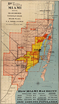 | Details | A.C. Douglass Printing Company | 1926 |
| 1926 Map of the City of Miami and Environs with Estimated Expansion |
|
A.C. Douglass Printing Company |
|
| 1926 |
| LOC:89 |
| $600.00 | A-C--Douglass-Printing-Company | 1926-Map-of-the-City-of-Miami-and-Environs-with-Estimated-Expansion | Interesting and prescient original lithographed map of the City of Miami and the nearby surrounding area made during the Miami land boom. The map shows forecasted expansive development between the period 1925 - 1935. Scarce.
<br><br>
Show Miami's historic growth from 1910 - 1925 and forecasts development to 1935 with projected future boundaries shown. Miami's boundary shows rapid population growth from 5,470 people in 1910, to 29,571 in 1920, and 225,000 in 1926, with the population projected to reach 1,000,000 by 1935.
<br><br>
Compiled and drawn by Sauer and Seghy. Printed by A.C. Douglass Printing Co., (2907 N.W. 12th Ave., Miami) in 1926.
<br><br>
Along with the usual suspects the map captures several lesser known historical features:
<div class="indenttextblocksingle">
<ul style="list-style-type: circle;">
<li>Irons Manor subdivision: The Irons Manor development was platted by developer V. Earl Irons in 1926 following the principles of the City Beautiful movement. </li>
<li>Miami Jockey Club: established in 1924 by James Bright, Glenn Curtis, and Joseph Smoot. </li>
<li>Hanson's avocado grove established by Edgar F. Hanson in 1922 was the largest in the world with over 30,000 avocado trees.</li>
<li>King Cole Hotel, with 60 rooms was completed in 1925.</li>
<li>Future site of the University of Miami, opened in fall 1926.</li>
</ul>
</div> |
| 6860 | 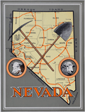 | Details | Anonymous | 1926 |
| Unrecorded Pictorial Map of Nevada and Calendar |
|
Anonymous |
|
| 1926 |
| LOC:89 |
| $350.00 | Anonymous | Unrecorded-Pictorial-Map-of-Nevada-and-Calendar | A very fine pictorial advertising map of Nevada from the Virginia City Bank of Virginia City, Nevada. With a complete calendar for 1926 at bottom. Includes unused metal hanger at top. A rare survivor in excellent condition. Map size 9.5" x 12.5". Overall, about 12" x 23".
<br><br>
<div id="0" align="center">
<a title=""></a>
<img id="6860" src="/ZoomifyImages/SC_6860/SC_6860_detail1.jpg" alt="Unrecorded Pictorial Map of Nevada with Calendar from 1926" width="240"/> <br><br> <font size="-2">1926 Virginia City Bank Advertising Map</font>
</div><br>
Virginia City, Nevada, was a historic mining town that experienced a significant boom in the mid-19th century due to the discovery of the Comstock Lode, a large deposit of silver ore. By 1926, however, the city had long passed its heyday and was in a state of decline. In 1926, the population was estimated to be around 1,500 people, a far cry from the 25,000 residents during the height of the mining boom.
<br><br>
In the early 20th century Virginia City began to shift its focus towards tourism. Efforts were made to embrace, preserve and promote the town's rich mining history and Wild West character to attract visitors. This map reflects that sentiment. |
| 5077 | 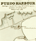 | Details | British Admiralty Hydrographical Office | 1927 |
| Chart of Harbours and Anchorages in the Hawaiian or Sandwich Islands 1927 |
|
British Admiralty Hydrographical Office |
|
| 1927 |
| LOC:59 |
| $1,350.00 | British-Admiralty-Hydrographical-Office | Chart-of-Harbours-and-Anchorages-in-the-Hawaiian-or-Sandwich-Islands-1927 | Bold, engraved chart with harbor plans in the Hawaiian Islands first published by the British Admiralty in 1891 but 1927. Retains the distinctive appearance of antique British nautical charts. "Harbours and Anchorages in the Hawaiian or Sandwich Islands from Surveys of the Hawaiian Government". Engraved by Edward Weller. Excellent topographic detail for mountains and hills.
<br></br>
Apparently, quite scarce. No record of a sale in AMPR and only one copy in WorldCat.
<br></br>
Published at the Admiralty, London, February 5, 1891 under the superintendence of Captain W. J. L. Wharton, Hydrographer. This edition: 1912. Last correction in 1927. Sold by J.D. Potter.
<br></br>
Includes large-scale harbor and anchorage plans for 12 locations in Hawaii:
<div class="indenttextblocksingle">
<ul style="list-style-type: circle;">
<li>Waimea Bay, Kauai</li>
<li>Hanamaula Bay, Kauai</li>
<li>Kapueokahi Bay, Maui</li>
<li>Kaanapali Anchorage, Maui</li>
<li>Lahaina Roads, Maui</li>
<li>Pukoo Harbor, Molokai</li>
<li>Kaunakakai Harbor, Molokai</li>
<li>Kamalo Harbor, Molokai</li>
<li>Waimea Bay, Oahu</li>
<li>Waianae, Oahu</li>
<li>Waialua Bay, Oahu</li>
<li>Kawaihae Bay, Hawaii</li>
<li>Mahukona Harbor, Hawaii</li>
</ul>
</div> |
| 1144 |  | Details | George W. Walker Lithograph and Publishing Co | 1927 |
| Birds-eye View of Boston Harbor ca. 1927 |
|
George W. Walker Lithograph and Publishing Co |
|
| 1927 |
| LOC:0 |
| $295.00 | George-W--Walker-Lithograph-and-Publishing-Co | Birds-eye-View-of-Boston-Harbor-ca--1927 | Bird's-eye map of Boston Harbor and surrounding region to the east. This folding pocket map is Walker's earliest view of Boston with the new airport, constructed in 1923, that would eventually become Logan International Airport. At far upper right are the yards of the <b>Fore River Ship and Engine Company</b> with two vessels shown under construction.
<br></br>
Numerous steamers, sailboats, and sailing ships are shown underway in the waters offshore Boston, Massachusetts; Winthrop and Spectacle Island. This edition of Walker's map only shows steamer routes for the <b>Nantasket Beach Line Steamers</b> to Nantasket Beach and other points to the east.
<br></br>
The map extends from the coastal area of East and South Boston across the water to the main ship channel and the Boston Light. It locates Winthrop, Thompson's Island, Moon Island, Deer Island, Nahant, Green Island, the Brewster Islands, Strawberry Hill, Fort Warren, Hough's Neck and much more. Several key streets are identified within Boston: Atlantic Avenue, Freeport, Summer Street, Broadway, Dorchester Street, and State Street to name a few.
<br></br>
Copyright Walker Lithograph and Publishing Company, Boston.
<br></br>
Single-color chromolithograph. The bird's eye map folds into manilla board cover titled "Boston Harbor" in manuscript. Map is attached to the cover as issued. Cover apparently made by the seller whose stamp appears on the cover in red ink: "H.A. Shepard and Company. Stationers 50 - 52 Cornhill Boston". Price in manuscript: 15 cents. An unusual find! |
| 5005 | 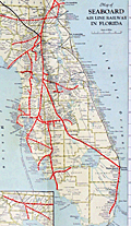 | Details | Seaboard Air Line Railway | 1927 |
| Map of Seaboard Airline Railway and Connections |
|
Seaboard Air Line Railway |
|
| 1927 |
| LOC:61 |
| $425.00 | Seaboard-Air-Line-Railway | Map-of-Seaboard-Airline-Railway-and-Connections | Map of Seaboard Airline Railway and Connections. Covers the route along the United States East Coast from Virginia, through the Carolinas to Florida. Verso blank.
<br></br>
Folds into card stock folder with a List of Stations and Index to locations on map. Issued by the Freight Traffic Department, Norfolk, Virginia. June, 1927.
<br></br>
Printed by the Whitney Graham Co. Inc. Buffalo and New York City. |
| 6472 | 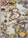 | Details | Shurtleff, Elizabeth | 1927 |
| Rare pictorial map of the Isle of Shoals |
|
Shurtleff, Elizabeth |
|
| 1927 |
| LOC:53 |
| $2,100.00 | Shurtleff--Elizabeth | Rare-pictorial-map-of-the-Isle-of-Shoals | Very rare original full-color lithographed pictorial map of the Isle of Shoals from 1927 designed and drawn by Elizabeth Shurtleff. Copyright by Jessie E. Donahue (1927). Beautiful, saturated colors. With verse by Celia Thaxter and Frederick T McGill.
<br><br>
Only two copies of Elizabeth Shurtleff's 1927 map of the Isle of Shoals were found in WorldCat. No record of a sale of the map was found online. A later much-revised edition of the Shurtleff's map was copyrighted and published in 1960 by Edward Rowe Snow.
<br><br>
Captain John Smith discovered the Isle of Shoals in 1664 lying about seven miles offshore on the border of what are today the states of New Hampshire and Maine. |
| 5297 |  | Details | Armstrong, Edward Robert | 1927 |
| Armstrong Seadrome map Floating airstrips Atlantic repeater station |
|
Armstrong, Edward Robert |
|
| 1927 |
| LOC:1405 |
| $750.00 | Armstrong--Edward-Robert | Armstrong-Seadrome-map-Floating-airstrips-Atlantic-repeater-station | Very rare cyanotype (blueprint) engineering diagrams from 1927 and a Seadrome route map related to Edward Robert Armstrong's Seadrome System, a proposed system of floating airports. Armstrong's Seadrome was the first major concept for a stable floating structure at sea. Its design influenced the later development of the semi-submersible drilling rig. [1]. Armstrong's Seadrome Map (center of sheet) shows locations of repeater structures and airports planned to be anchored in the Atlantic Ocean. Only available original map of the Seadrome concept signed by Armstrong.
<br></br>
In the late 1920's aircraft did not have the capacity to carry passengers non-stop across the Atlantic. Armstrong's Seadrome System was designed to anchor huge landing fields in the Atlantic Ocean at 375 mile intervals, enabling short-range aircraft to hop across the Atlantic.
<br></br>
Signed at bottom right corner "E.R. Armstrong 5/16/27."
<br></br>
This diagram shows Armstrong's Seadrome semi-submersible concept, modified and adapted for use as a repeater station for trans-Atlantic cable traffic. The repeater stations were conceived in order to increase the bandwidth of cables across the Atlantic, which in the late 1920's was limited to a single telephone conversation. Through the use of Armstrong's semi-submersible repeater stations and two cables Bell Telephone engineers calculated that eight circuits across the Atlantic Ocean might be achievable. In the end, the floating repeater station idea was scrapped as it was believed impractical. [2]
<br></br>
[1] Pease, F. T. The Armstrong Seadrome: World's First Semi-Submersible Design ??? The Society of Naval Architects and Marine Engineers. 13th Offshore Symposium, 24 February, Houston, Texas. January 21, 2004.
[2] Jacobs, O.B. Bell Laboratories Record. Vol XXXV. Number 6. June 1957. p. 207.
[3] https://sites.google.com/site/richardarthurnorton/edwardr.armstrong |
| 5026 |  | Details | Carr and McFadden, Inc. | 1927 |
| Map and Brochure for Palm Beach Regatta 1927 |
|
Carr and McFadden, Inc. |
|
| 1927 |
| LOC:87 |
| $365.00 | Carr-and-McFadden--Inc- | Map-and-Brochure-for-Palm-Beach-Regatta-1927 | Map (9" x 12") and booklet for the Washington's Birthday Regatta on Lake Worth. Palm Beach Yacht Club, 1927. Florida. Map shows the course of the Regatta races. Very scarce.
<br></br>
33 pages with advertisements, race rules, race history, and members of the Palm Beach Regatta Association.
<br></br>
Map drawn by Carr & McFadden, Inc. Civil Engineers in West Palm Beach Florida. |
| 2510 |  | Details | Puget Sound Navigation Company | 1927 |
| Puget Sound Birdseye View |
|
Puget Sound Navigation Company |
|
| 1927 |
| LOC:0 |
| $300.00 | Puget-Sound-Navigation-Company | Puget-Sound-Birdseye-View | Original 1927 birds-eye view of Puget Sound. This very fine view includes Vancouver, Port Townsend, Bellingham, Seattle, Everett, Puyallup, Tacoma, Olympia, Anacortes, and Guemes Island. North is oriented to the right.
<br></br>
Includes inset map showing major regional highways, and another inset with brief written descriptions of five "Short, enjoyable outings": the Hood Canal country; the Olympic Peninsula country; Vancouver Island; the San Juan Islands; and Whidby Island.
<br></br>
Verso contains information of interest to commuters or vacationers and photos, descriptions, and timetables for numerous local ferries and steamships. Entire brochure unfolds to 29" W x 16" H. |
| 5062 |  | Details | St. Augustine Green Cove Springs Bridge Company | 1928 |
| Map of Shands Bridge over the St. Johns River |
|
St. Augustine Green Cove Springs Bridge Company |
|
| 1928 |
| LOC:11 |
| $180.00 | St--Augustine-Green-Cove-Springs-Bridge-Company | Map-of-Shands-Bridge-over-the-St--Johns-River | Map of the first Shand's Bridge over the St. Johns River in Florida from 1928. Map in folding brochure 18" x 6" with information on the Shand's Toll Bridge in the year of its opening. The bridge was conceived, financed and built privately by the St. Augustine Green-Cove Springs Bridge Company.
<br></br>
Title: "Shands Bridge over the St. Johns River connecting scenic highways St. Augustine and Green Cove Springs: Florida's longest single span bridge Open April 10, 1928."
<br></br>
In 1928 the bridge was a toll bridge of wooden construction, except for the draw span. The current bridge, located just south of the old bridge, opened in 1963. |
| 5355 |  | Details | Woodruff, S.H. | 1928 |
| First large format subdivision map of Dana Point California |
|
Woodruff, S.H. |
|
| 1928 |
| LOC:300 |
| $0.00 | Woodruff--S-H- | First-large-format-subdivision-map-of-Dana-Point-California | SOLD<br></br>
First large format subdivision map of Dana Point, in Orange County, California. Only other two known copies; one copy at Yale. This remarkable map was made less than 90 years after Richard Henry Dana Jr. first described the area:
<div class="indenttextblocksingle">
"San Juan [Dana Point] is the only romantic spot in California. The country here for several miles is high table-land, running boldly to the shore, and breaking off in a steep hill, at the foot of which the waters of the Pacific are constantly dashing." (Dana, R.H. Jr., Two Years Before the Mast. 1840.)
</div>
<br></br>
Sheet size 33" W x 26" H. |
| 4981 |  | Details | Architects and Engineers Supply Company | 1928 |
| Rare Key Map Canoe Routes in Minnesota Ontario Lakes Region |
|
Architects and Engineers Supply Company |
|
| 1928 |
| LOC:200 |
| $0.00 | Architects-and-Engineers-Supply-Company | Rare-Key-Map-Canoe-Routes-in-Minnesota-Ontario-Lakes-Region | SOLD<br></br>
Very rare cyanotype (blueprint) key map / advertisement, by C. & S. map, showing the coverage of 15 larger-scale sectional maps of canoe routes in the Minnesota and Canadian wilderness including the Superior National Forest. No copy of this key map is found online and the associated sectional maps (blue-line) are seldom found individually.
<br></br>
C. & S. canoe maps became so treasured and scarce that a cloth replica of C. & S.'s smallest-scale map is now offered online under the name "Greggar's Map" .
<div class="indenttextblocksingle">
<i>"Greggar's Map is a cloth replica map of the 1928 Canoe Country Map, which is a unique remnant of navigating what we now know as the BWCAW and Quetico Provincial Park In its original form, the 1928 cloth map includes hand drawn lakes and written information like portages, rapids and unique author notes." </i> (https://www.truenorthmapco.com/shop/Greggars-Map-1928-Canoe-Country-p142448343)
</div>
</br>
Title reads:
<div class="indenttextblocksingle">
"Announcing our new map of The Greatest Canoe Route Country in America 'In the Heart of the Wilderness.' "
</div>
</br>
Printed by Architects and Engineers Supply Company of Duluth, Minnesota. Sectional maps could be purchased individually for $0.85 on paper or $1.25 on cloth. Only one sectional map was found online attributed to C. & S. map and AESC, a blue-line print.</br> (Source: https://photos.bwca.com/l/LMILLER3129-120419-200203.JPG).
<br></br>
A. Bernard Gustfason (b. 1893) founded Architects and Engineers Supply Company in 1917 to provide quick production of blue prints, blue line prints, and black line prints to architects, engineers, draftsmen and surveyors in the Duluth, Minnesota area. |
| 5108 |  | Details | Lake Worth Herald Press | 1928 |
| 1927 Florida State Road Map |
|
Lake Worth Herald Press |
|
| 1928 |
| LOC:87 |
| $125.00 | Lake-Worth-Herald-Press | 1927-Florida-State-Road-Map | Road map for the entire state of Florida in a ten-panel folding brochure published during the 1920's Florida land boom, prior to the Great Depression. The brochure is titled: "Greeting Nobles, Oases of Lake Worth welcomes you. This road guide will assist you in your tour of Florida while attending the Shrine Convention at Miami, May 1, 2, 3, 1928."
<br></br>
Cover with logo for the Shriner organization. Verso captioned "Lake Worth Greets You" and filled with text descriptions and half-tone photographs of Lake Worth's attractions including the Municipal Recreational Center, the Gulf Stream Hotel, and its fine schools.
<br></br>
Published by the Lake Worth Herald Press. |
| 4872 |  | Details | Smith, Eugene R. | 1928 |
| Cadastral Map Fair Harbor Development Fire Island New York |
|
Smith, Eugene R. |
|
| 1928 |
| LOC:13 |
| $200.00 | Smith--Eugene-R- | Cadastral-Map-Fair-Harbor-Development-Fire-Island-New-York | Seldom seen cadastral map of one section (2) of a new development platted in 1928 for sale on Fire Island in New York. Map of Fair Harbor Property of Fair Harbor Development Co., Inc. Fire Island Beach, Suffolk Co. N.Y. Section 2.
<br></br>
Coverage includes Fifth Avenue, Holly Walk, Oak Walk, and Pine Walk streets and their alleys between the Atlantic Ocean and Great South Bay on Fire Island. The section lies between the Fair Harbor Ferry Dock and the Dunewood Ferry Dock. Rare.
<br></br> |
| 517 | 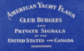 | Details | Lloyd's Register | 1928 |
| American Yacht Flags |
|
Lloyd's Register |
|
| 1928 |
| LOC:0 |
| $0.00 | Lloyd-s-Register | American-Yacht-Flags | SOLD<br></br>
Colorful compendium of yacht flags produced by <b>Lloyd's Register of American Yachts</b> in 1928. Contains 14 colored plates of yacht club burgees and 53 colored plates of private signals of yachtsmen. Plates are organized by color and style to make it easier to lookup a flag graphically. Includes a full alphabetical index by first and last name to all the flags followed by more than a dozen pages of advertisements. |
| 5081 | 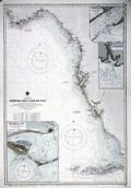 | Details | British Admiralty Hydrographical Office | 1929 |
| Antique chart of Florida Tortugas Cays to Cap San Blas |
|
British Admiralty Hydrographical Office |
|
| 1929 |
| LOC:61 |
| $0.00 | British-Admiralty-Hydrographical-Office | Antique-chart-of-Florida-Tortugas-Cays-to-Cap-San-Blas | SOLD<br><br>
Bold original British Admiralty nautical chart 1890 (1928) of the southwest coast of Florida along the Gulf of Mexico: "Tortugas Cays to Cape San Blas from the latest United States Coast Surveys". Includes extensive coastal detail with St. Andrews Sound, Cape San Blas, Apalachicola, Sea Horse Reef, Anclote Key, Tampa Bay, Punta Gorda, Cape Romano, Cape Sable, Key West, and the Tortuga Bank.
<br></br>
Published at the Admiralty, London on January 24, 1890 under the superintendence of Captain W. J. L. Wharton, Hydrographer. This is the edition of 1915 with last correction in 1929. Chart number 1274. Engraved by Davies and Company.
<br></br>
Includes three large inset charts of Florida ports and Harbors:
<div class="indenttextblocksingle">
<ul style="list-style-type: circle;">
<li>Apalachicola Bay: West Pass. 1911.</li>
<li>St. Marks River. 1909.</li>
<li>St. George Sound: East Pass. 1914.</li>
</ul>
</div> |
| 5184 | 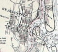 | Details | U.S. Coast and Geodetic Survey | 1929 |
| Florida Inside Route St. Augustine to Titusville |
|
U.S. Coast and Geodetic Survey |
|
| 1929 |
| LOC:61 |
| $180.00 | U-S--Coast-and-Geodetic-Survey | Florida-Inside-Route-St--Augustine-to-Titusville | Chart of a portion of what is today known generally as the Intracoastal Waterway: "Florida Inside Route St. Augustine to Titusville." South of the Matanzas Inlet, a portion of the inside route opposite Flagler Beach is labelled "Florida East Coast Canal." In the 1920's portions of the Inside Route were maintained by private entities who paid for canal maintenance by charging a toll for use of the waterway. As many as six toll stations existed in those days from Jacksonville to Hallandale, Florida.
<br></br>
First published by the U. S. Coast and Geodetic Survey, Washington D. C. in September 1928. Chart # 3258. Stamped October 17, 1929. |
| 6540 | 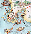 | Details | White, Ruth Taylor | 1929 |
| Pictorial Western Air Express route map by Ruth Taylor White |
|
White, Ruth Taylor |
|
| 1929 |
| LOC:78 |
| $135.00 | White--Ruth-Taylor | Pictorial-Western-Air-Express-route-map-by-Ruth-Taylor-White | Pictorial airline route map or cartograph by famed illustrator Ruth Taylor White for Western Air Express published in 1929, just three and one-half years after the airline was founded. Inset half-tone images of an early seaplane and of Avalon Harbor on Catalina. <br><br>
<div id="1" align="center">
<a title="Western Air Express 1929 Seaplane"></a>
<img id="1" src="/ZoomifyImages/SC_6540/SC_6540_Seaplane.jpg" alt="Western Air Express 1929 Seaplane" width="300"/> <br><small>Western Air Express 1929 Seaplane, LA to Catalina</small>
</div><br>
This map include two routes flown from Los Angeles by Western Air Express:
<div class="indenttextblocksingle">
<ul style="list-style-type: circle;"></li>
<li><b>Los Angeles to Catalina.</b> 45 miles - 30 minutes. "Over land and sea. The first air passenger service in the United States.<br>
<b> Los Angeles to Tia Juana or Agua Caliente".</b> 116 miles - 1 hour.</li>
</div>
<div id="2" align="center">
<a title="Ruth Taylor White LA to Catalina route map details"></a>
<img id="2" src="/ZoomifyImages/SC_6540/SC_6540_Detail.jpg" alt="Ruth White map details" width="300"/> <br><small>Ruth Taylor White LA to Catalina route map detail</small>
</div><br>
The Western Air Express Corporation, later Western Airlines, began its first passenger service in 1926 touting speed, comfort, and dependability. By 1928, employing Fokker Super Tri-motor passenger aircraft capable of transporting twelve passengers at a blistering 125 MPH, the airline "carried about eighteen percent of all inter-city passengers in the United States." In 1928 the company initiated a seaplane route from Catalina Island, California to Los Angeles, California. Publication date: October, 1929. |
| 6455 |  | Details | White, Ruth Taylor | 1929 |
| Six early pictorial airline route maps by Ruth Taylor White |
|
White, Ruth Taylor |
|
| 1929 |
| LOC:14 |
| $1,200.00 | White--Ruth-Taylor | Six-early-pictorial-airline-route-maps-by-Ruth-Taylor-White | Rare and fine eleven-page brochure for Western Air Express published in 1929, just three and one-half years after the airline was founded. Includes six pictorial airline route maps or cartographs by famed illustrator Ruth Taylor White. </b> Maps with inset half-tone images of aircraft and flight operations.
<br><br>
The Western Air Express Corporation, later Western Airlines, began its first passenger service in 1926 touting speed, comfort, and dependability. By 1928, employing Fokker Super Tri-motor passenger aircraft capable of transporting twelve passengers at a blistering 125 MPH, the airline "carried about eighteen percent of all inter-city passengers in the United States." In 1928 the company initiated a seaplane route from Catalina Island, California to Los Angeles, California. Maps include:
<div class="indenttextblocksingle">
<ul style="list-style-type: circle;"></li>
<li><b>San Francisco - Los Angeles.</b> 365 miles, 3 hours. "The Worlds Model Air Line." Two facing sheets, each 7.5" x 8"</li>
<li><b>Los Angeles - Kansas City.</b> 1,417 miles - 12 hours. First and fastest all Daylight Passenger Airway." Two facing sheets each 7.5" x 8".</li>
<li><b>Los Angeles to Catalina.</b> 45 miles - 30 minutes. "Over land and sea. The first air passenger service in the United States. Single center-fold sheet 15" x 8".<br>
<b> Los Angeles to Tia Juana or Agua Caliente".</b> 116 miles - 1 hour. With above. </li>
<li><b>Los Angeles - Salt Lake City.</b> 600 miles - 6 hours. "Over the Old Mormon Trail". Two facing sheets each 7.5" x 8".</li>
<li>Map of the USA showing expected travel-time zones, indicated by color legend. No title. One half sheet.</li>
<li>B&W inset map showing location of the Western Air Express Terminal south of San Gabriel. No title.</li>
<li>Cover 8" x 9" showing all included passenger routes for Western Air Express.</li>
</ul>
</div>
Publication date noted within as October, 1929. Folds down to 4" x 9". |
| 5129 |  | Details | U.S. Army Engineers | 1929 |
| Port of Pensacola, Florida scarce photomosaic and two maps |
|
U.S. Army Engineers |
|
| 1929 |
| LOC:0 |
| $300.00 | U-S--Army-Engineers | Port-of-Pensacola--Florida-scarce-photomosaic-and-two-maps | Small booklet of 66 pages that includes 3 cartographic artifacts related to Pensacola, Florida.
<div class="indenttextblocksingle">
<ul style="list-style-type: circle;">
<li>Mosaic Composed of Aerial Photographs Pensacola Florida. Made by Air Service, U.S. Army 4th Photo Section. Dec. 22, 1922.</li>
<li>Origin of Imports and Destination of Exports Pensacola, Fla. 1928. Quantities expressed in cargo tons of 2240 lbs. and shown thus. 1929.</li>
<li>Port Facilities at Pensacola, Fla. 1929.</li>
</ul>
</div>
Along with many data tables and additional photographs the contents of the entire booklet include:
<div class="indenttextblocksingle">
<ul style="list-style-type: circle;">
<li>Port and Harbor Conditions</li>
<li>Port Customs and Regulations</li>
<li>Port Services and Charges</li>
<li>Fuel and Supplies</li>
<li>Port and Harbor Facilities</li>
<li>Communications</li>
<li>The freight rate situation</li>
<li>Commerce of the port</li>
<li>The territory tributary to the port</li>
<li>General</li>
</ul>
</div>
War Department Corps of Engineers and United States Shipping Board Port Series No. 3 Part 2 THE PORT OF PENSACOLA, FLORIDA.
Printed by the U.S. Government Printing Office, Washington, D.C. 1929. Price when issued 30 cents. |
| 5427 |  | Details | Anonymous | 1929 |
| Map of the University Pool oilfield in Pecos County, Texas |
|
Anonymous |
|
| 1929 |
| LOC:300 |
| $0.00 | Anonymous | Map-of-the-University-Pool-oilfield-in-Pecos-County--Texas | SOLD<br><br>Large anonymous oilfield cadastral map of the University Pool oilfield in Pecos County, Texas ca. 1929. An unintentional found work of abstract art- a 38" x 30" blueline map with hand color of leased tracts by pencil with similar ownership designated by coloring.
<br></br>
Across the center of entire map are simply the words: <strong>"State University Land."</strong>
<br></br>
Numerous lessees are noted on the map with many large and small oil companies including:
<div class="indenttextblocksingle">
<ul style="list-style-type: circle;">
<li>Tower & McKanna</li>
<li>Dixie</li>
<li>Shell</li>
<li>Humble</li>
<li>Tidal</li>
<li>Transcontinental</li>
<li>Tay-Link</li>
<li>California</li>
<li>W.R. Jones</li>
</ul>
</div>Large manuscript crayon filing notation on the verso reads "Rowan-Tong Area, Pecos County." |
| 4903 |  | Details | Florida Motor Lines | 1929 |
| Map Brochure for a Circle Tour of Florida $37.50 |
|
Florida Motor Lines |
|
| 1929 |
| LOC:0 |
| $0.00 | Florida-Motor-Lines | Map-Brochure-for-a-Circle-Tour-of-Florida-$37-50 | SOLD<br></br>
A Circle Tour of Florida brochure with map, printed during the Florida land boom of the late 1920's. Tour duration could last "Four days to four months depending upon the stopovers." By Florida Motor Lines, later the first subsidiary of Greyhound Bus Lines.
<br></br>
With locations and telephone numbers for bus stations and terminals including Miami, where the phone number was "8888". Folds to 3" x 9".
<br></br>
<div class="indenttextblock">
"FLORIDA MOTOR LINES, INC. was formed in January 1926 by the firm Stone and Webster by buying and consolidating Florida Motor Transportation Company and White Stage Line Company. Based in Orlando, Florida, the company owned 150 coaches and ran some 1,290 route miles. On October 24, 1929 “a Certificate of Public Convenience and Necessity was issued to Florida Motor Lines to operate motor busses for compensation in transporting passengers on all the highways of the state then being operated upon by the applicant, and especially over State Highway No. 4, between Jacksonville and Miami.” In 1933 the company moved its office to Jacksonville. In January 1946 Florida Motor Lines was sold to The Greyhound Corporation, which renamed it Florida Greyhound Lines. The new Florida Greyhound Lines was the first wholly owned subsidiary of The Greyhound Corporation." (Online: https://transitbadges.com/def/)
</div> |
| 4990 |  | Details | Fort Wayne Printing Company | 1929 |
| Florida map and calendar for Palm Beach Mercantile Company, Florida |
|
Fort Wayne Printing Company |
|
| 1929 |
| LOC:0 |
| $0.00 | Fort-Wayne-Printing-Company | Florida-map-and-calendar-for-Palm-Beach-Mercantile-Company--Florida | Sold <br></br>
Rare Florida map and calendar for the Palm Beach Mercantile Company, Florida published in 1929, the first year of the Great Depression (the stock market crash began in October, 1929). Established in 1896, by 1929 the Palm Beach Mercantile Company was Palm Beach County's largest and oldest hardware and furniture store. Published by the Fort Wayne Printing Co. of Fort Wayne, Indiana.
<br></br>
Map is Clason's Road Map of Florida with an inset map of the western end of the state. Map # R-240 AA.
<br></br>
The Palm Beach Mercantile Company is a historic site in West Palm Beach, Florida located at 206 Clematis Street. On January 28, 1994, it was added to the U.S. National Register of Historic Places. The Palm Beach Mercantile Company Building, was built as a single story, 2-room structure in Vernacular style in 1902. Three additional floors were added in 1916 and the partial sixth floor was added in 1923. The structure had the Palm Beach's first elevator. The Palm Beach Mercantile Company, the first large business block in the city, went out of business in the late 1950's. Today the site is known as the Harris Building.
<br></br> |
| 5078 |  | Details | British Admiralty Hydrographical Office | 1929 |
| Fine harbor chart of Port Townsend, Washington and Kilisut Harbor |
|
British Admiralty Hydrographical Office |
|
| 1929 |
| LOC:68 |
| $790.00 | British-Admiralty-Hydrographical-Office | Fine-harbor-chart-of-Port-Townsend--Washington-and-Kilisut-Harbor | Bold original harbor chart of Port Townsend / Kilisut Harbor, Washington drawn and published from London in June, 1893 by the British Admiralty under the superintendence of Captain W. J. L. Wharton, Hydrographer. Chart data are after the U.S. Coast Survey chart of 1892 (1929). Scarce.
<br></br>
The chart is a key historical record of Port Townsend’s late-19th-century ambitions, capturing the town at the height of its expectation to become the dominant Pacific Northwest port. The detailed street grid, wharves, anchorages, and shoreline infrastructure are set against meticulously rendered bathymetry and shoreline topography, revealing how urban development was constrained and shaped by navigational realities during the steamship era.<br><br>
Fine topographic contour lines and details on this old nautical chart. Points of interest include Port Hadlock, Irondale, Chimikim Creek, Mystery Bay, Oak Bay, Marrowstone Island, and Fort Townsend.
<br></br>
Sold by J.D. Potter. Chart number 1792. Engraved by Edward Weller. Scale: 1 / 24,361. Last correction 1929. |
| 4861 |  | Details | Edwards, Ham | 1929 |
| Antique Map Catalina Island, California Depression-era |
|
Edwards, Ham |
|
| 1929 |
| LOC:13 |
| $150.00 | Edwards--Ham | Antique-Map-Catalina-Island--California-Depression-era | Fine pre-depression-era brochure with a bright pictorial map of Catalina Island in the Pacific Ocean, off the coast of Long Beach, California. Published by Wilmington Transportation Company who offered steamer services from the Catalina Steamer Terminal to Catalina Island from Los Angeles, Long Beach, and Pasadena.
<br></br>
Included in a six-page brochure with things to do, rates for trips and ferry service, photographs, and advertisements for local hotels including the "Largest one floor hotel in the world with 1250 rooms." Map predates the Great Crash of October 1929 by three months.
<br></br>
Drawn by "Ham" Edwards - Art Services. |
| 6506 |  | Details | Dummer, H. Boylston | 1929 |
| Rare unrecorded pictorial historical map Boston South Shore |
|
Dummer, H. Boylston |
|
| 1929 |
| LOC: |
| $450.00 | Dummer--H--Boylston | Rare-unrecorded-pictorial-historical-map-Boston-South-Shore | Unrecorded and very scarce <strong>pictorial map of Boston's South Shore</strong> including the towns of Hingham and Cohasset. The map includes the locations of Bumkin Island, Weir River, World's End, Planters Hill, Sandy Beach, and Hominy Point. Inset illustrations of historical structures including the Garrison House, "Old Ship Church" and "The Old Ordinary" as well as named homes of local families including Ulman, Beal, Reilly, Donovan, Bolles, Foss and the entrance to the estate of Mrs. Thomas J. Plant and Mrs. E.R. Thayer's Weir River Farm.
<br><br>
No examples of the map in WorldCat, OWA, or AMPR. No other copies found online. An online search turned up another map by Dummer in a very similar style and format: "Points of Interest in Quaint Marblehead, published by the Marblehead Craft Shop.
<br></br>
Signed, and dated within to August 4, 1929, |
| 6869 |  | Details | Title Insurance and Trust Company Los Angeles | 1929 |
| Rare Map Old Spanish and Mexican Ranchos of Los Angeles County |
|
Title Insurance and Trust Company Los Angeles |
|
| 1929 |
| LOC:78 |
| $1,350.00 | Title-Insurance-and-Trust-Company-Los-Angeles | Rare-Map-Old-Spanish-and-Mexican-Ranchos-of-Los-Angeles-County | "The Old Spanish and Mexican Ranchos of Los Angeles County" is apparently the first advertising map of that title published by the Title Insurance and Trust Company of Los Angeles, just one year after the firm was incorporated in 1928. Compared to later editions this earliest 1929 edition appears as though it was produced more quickly, fitting for a company that was just beginning to take advertising seriously. The 1929 edition is smaller, more colorful, and much less elaborately executed than two later maps by the same name that the firm published in 1930 and 1937.
<br><br>
Rare. Not found in Rumsey or WorldCat.
<br><br>
Compared to the 1930 edition the 1929 edition lacks the elaborate compass rose and distance scale, the Spanish missions are drawn more simply and they lack the founding dates found in the 1930 edition. In the 1930 edition the artist has labeled public lands as such, and has filled the Pacific Ocean with a sailing ship, flying fish, and sea monsters, familiar scenes that cartographers have used for hundreds of years.
<br><br>
Title Insurance Building. 433 So. Spring Street. Los Angeles. Copyright 1929.
<br><br> |
| 8051 |  | Details | Cole, C. C. | 1929 |
| Scarce early tourists map of Brownsville Texas |
|
Cole, C. C. |
|
| 1929 |
| LOC:13 |
| $0.00 | Cole--C--C- | Scarce-early-tourists-map-of-Brownsville-Texas | SOLD<br><br>This pictorial tourist map, drawn by C. C. Cole ca. 1929, presents Brownsville, Texas as a civic and recreational destination, combining a rectilinear street grid with illustrated landmarks, river scenery, and playful vignettes of fishing, boating, and wildlife along the Rio Grande and resaca waterways (1). Key sites are keyed in a numbered legend and include Fort Brown, the municipal airport, parks, cemeteries, schools, churches, rail depots, and cross border connections to Matamoros and Santa Cruz, Mexico. Produced in a hand drawn, chamber of commerce style, the map emphasizes accessibility, leisure, and modern amenities while still foregrounding the river, levees, and ship channel that defined Brownsville’s geographic and economic setting.<br><br> The map can be dated to the late 1920s, most plausibly around 1929, based on multiple internal clues. The inclusion of a municipal airport places it no earlier than the late 1920s, while the continued identification of Fort Brown with the 12th Cavalry reflects a period before the post cavalry drawdowns of the early 1930s. References such as Mexican National Lines, the Porfirio Diaz home as a tourist landmark, and the absence of later port and industrial expansions further support a pre 1930s context. The overall booster tone, pictorial style, and civic focus are consistent with chamber of commerce tourist maps produced during the interwar years, pointing to a narrow window just before the Great Depression reshaped local promotion and infrastructure. |
| 6466 |  | Details | Ambler, Edward Vassar | 1930 |
| Pictorial map of the Cape Ann Trail |
|
Ambler, Edward Vassar |
|
| 1930 |
| LOC:150 |
| $150.00 | Ambler--Edward-Vassar | Pictorial-map-of-the-Cape-Ann-Trail | Original 1930 pictorial map of the Cape Ann Trail, Massachusetts in a folding brochure (now flattened) published by the Gloucester, Massachusetts Chamber of Commerce. Attributed to Edward Vassar Ambler but the map is signed within the plate by "Mons". Copyright by Cottage Services, Inc. Text and cover on verso.
<br><br>
The map includes numerous pictograms highlighting key locations along the Cape Ann Trail. The border is filled with vignettes and text that provides detail about each feature. These features include:
<div class="indenttextblocksingle">
<ul style="list-style-type: circle;"></li>
<li>Norman's Woe</li>
<li>Five and Ten Pound Islands</li>
<li>Bass Rocks</li>
<li>Thatcher's Island</li>
<li>The Carillon Church</li>
<li>Ravenswood Park</li>
<li>Mother Ann</li>
<li>Rocky Neck</li>
</ul>
</div> |
| 6845 |  | Details | Fairchild Aerial Surveys Inc. | 1930 |
| Scarce view of Hollywood Stars Homes Beverly Hills |
|
Fairchild Aerial Surveys Inc. |
|
| 1930 |
| LOC:89 |
| $400.00 | Fairchild-Aerial-Surveys-Inc- | Scarce-view-of-Hollywood-Stars-Homes-Beverly-Hills | Scarce, early photographic oblique "airplane" birds-eye view of Beverly Hills, California annotated with numerals keyed to homes of Hollywood stars. These movie stars include Buster Keaton, Tom Mix, Mary Pickford, Douglass Fairbanks, Charles Chaplin, Marlene Dietrich, and Will Rogers. The view probably dates between 1926 and 1933 based on the marriage duration of King Vidor and Eleanor Boardman (Home # 22) . By Fairchild Aerial Surveys, N.Y.C. Published in an unknown magazine. Verso with glamour photographs of period stars.
<br><br>
The view looks roughly north with the Beverly Hills Hotel, established 1912, slightly to the left of the center. This item may be the earliest published aerial photograph of Photomap of Beverly Hills to locate the homes of movie stars and likely predates Landacre's "Newe Mappe of the Heavens."
<br><br><div class="indenttextblocksingle">
"When Wallace Beery flies back from his island camp, or when Ben Lyon volplanes down home to see Bebe and the baby, this is where the magic carpet of Hollywood looks to the returning wanderers of the sky."
</div><br> |
| 5341 |  | Details | Goodrich, James J. | 1930 |
| Cyanotype map of oilfields north of Round Rock Austin Texas |
|
Goodrich, James J. |
|
| 1930 |
| LOC:88 |
| $0.00 | Goodrich--James-J- | Cyanotype-map-of-oilfields-north-of-Round-Rock-Austin-Texas | SOLD
<br></br>
Original cyanotype (blueprint) map of "massive beds of buda limestone" and associated oil wells drilled in the area between 1915 and 1925. The blueprint map "Reconnaissance Map of Part of Williamson, Texas" covers an area extending north from Round Rock, Texas, terminating at Georgetown, Texas a distance of approximately 8 miles.
<br></br>
Owners of the tracts of land shown on this map include: Francis A, Hudson, B. C. Low, A. L. Eaves, N. B. Anderson, and Thomas Glasscock.
<br></br>
From 1854 to 1882, the Texas state legislature gave each railroad company 16 sections of land out of its public domain for every mile of railroad constructed and put into use anywhere in the state. The map shows the lines for two railways: the International and Great Northern Railroad (I. & G. N. R. R.) and the Missouri, Kansas, and Texas Railroad (M. K. & T. R. R. ) which encircle the area covered in this map.
<br></br>
Signed within by H. B. Goodrich, Petroleum Geologist. Tulsa, Oklahoma. June 18, 1930. |
| 6561 | 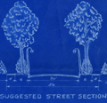 | Details | Howell and Graves | 1930 |
| Florence Alabama Lakeside Highlands Blueprint Plat Map Muscle Shoals |
|
Howell and Graves |
|
| 1930 |
| LOC:53 |
| $300.00 | Howell-and-Graves | Florence-Alabama-Lakeside-Highlands-Blueprint-Plat-Map-Muscle-Shoals | Rare original blueprint plat map of the Lakeside Highlands subdivision on the east side of Lake Wilson in the Muscle Shoals District at Florence in Lauderdale County, Alabama. With a small scale inset context map (1 inch = 1 mile): "Muscle Shoals District Showing Location of Lakeside Highlands." G.P. Nicolopoolos Owner and Developer. Date ca. 1930.
<br><br>
Drawn by W.A. Dealy, the map includes insets of a suggested tree-lined street section and a suggested business section designed by landscape architect Frank M. Button ("The highest type of Architecture is our aim.") Streets shown include the existing Lee Highway and Wilson Dam Highway (South Wilson Dam Road), and the proposed Center Drive, Shoals Boulevard, and Lakeside Drive, East Lakeside Drive and two bridle paths.
<br><br> |
| 1453 |  | Details | Baltimore Bureau of Harbors | 1930 |
| Bureau of Harbors Huge Map of Baltimore Harbor |
|
Baltimore Bureau of Harbors |
|
| 1930 |
| LOC:2001 |
| $350.00 | Baltimore-Bureau-of-Harbors | Bureau-of-Harbors-Huge-Map-of-Baltimore-Harbor | 5 foot wide chart of Baltimore Harbor, Marylandwith insets of numerous shipping terminals. Second Edition.
<br></br>
Key features include: Sparrows Point Terminal, Fort Howard, Western Maryland Railway Port, Covington Terminals, Logan Field, Patapsco River.
Insets include Canton Company and Canton Railroad Terminal; Upper Basin; and New Coal Pier and Old Coal Pier, |
| 5204 |  | Details | British Admiralty Hydrographical Office | 1930 |
| Nautical chart of St. Andrew Sound to St. John River, Florida |
|
British Admiralty Hydrographical Office |
|
| 1930 |
| LOC:61 |
| $0.00 | British-Admiralty-Hydrographical-Office | Nautical-chart-of-St--Andrew-Sound-to-St--John-River--Florida | SOLD
<br><br>
This scarce original British Admiralty sea chart of the Florida east coast retains the look and feel of a fine late 19th-century chart. Chart coverage stretches southward from St. Andrew Sound, near Jekyll Island and Cumberland Island Georgia, to the St. John River, near Jacksonville, Florida. Includes the Cumberland Sound, St. Mary River, Amelia Island, Nassau River, and Jacksonville.
<br></br>
This fine nautical chart of the Florida coast was published at the Admiralty April 22, 1879 under the superintendence of Captain F.J. Evans. Sold by J.D. Potter. Engraved by Edward Weller. Chart number 853. Edition of 1916. Last minor correction in 1930. |
| 5058 |  | Details | Anonymous | 1930 |
| Lane Park Cottages Lake Harris Tavares, Florida |
|
Anonymous |
|
| 1930 |
| LOC:11 |
| $50.00 | Anonymous | Lane-Park-Cottages-Lake-Harris-Tavares--Florida | Small map of Lane Park Cottages on Lake Harris, three miles southwest of downtown Tavares, Florida ca. 1930's. Lane Park is named for Captain A.J. Lane who as early as 1883 had plans for developing a peninsula that extended into Lake Harris. Map is on a postcard with two photographs of the cottages.
<br></br>
These cottages were likely the same as those attributed to Robert Kleiser:
<div class="indenttextblock">
"Kleiser's Fish Camp was established in 1918 on an island located in the middle of Lake Harris. Robert Forest Kleiser acquired the island and built six cottages, several boat sheds, and a pier. Several years later, Kleiser disassembled the cottages and moved the camp to Lane Park." (Grenier, Bob. Images of America: Tavares. Arcadia Publishing. 2011)
</div>
</br>
Printed by the County Seat Printers, Tavares, Florida. |
| 6854 |  | Details | Garden Club of Palm Beach | 1930 |
| The Plan of Palm Beach |
|
Garden Club of Palm Beach |
|
| 1930 |
| LOC:2001 |
| $0.00 | Garden-Club-of-Palm-Beach | The-Plan-of-Palm-Beach | SOLD<br><br>
Rare book containing "The Plan of Palm Beach", Florida commissioned and funded by the Garden Club of Palm Beach (1). This was the first plan for Palm Beach and it was not until 1970 that the town adopted a revised plan. The plan was approved by the Palm Beach town council on December 19, 1929 as a guide for future public improvements in light of the rapid growth the area was then experiencing. The original drawings contained in the book were hung in the Palm Beach Town Hall.
<br><br>
<div class="indenttextblocksingle"><i>"One attractive and well managed public bath and beach, the concentration of general traffic upon a limited number of streets, beautification without especial reference to main arteries of travel and a system of leisurely and convenient by-ways free from automobiles, punctuated by gardens: this is a plan which will localize recreation-seeking crowds, discourage trespassing, and provide safety and quiet for residents of Palm Beach."</i>
</div>
<br>
Rare. The only copy we could locate is in the Palm Beach Town Hall. Not in WorldCat. Contains more than one dozen illustrations plus aerial photographs and photographic vignettes. Twenty-six pages. List of Garden Club members.
<br><br>
<div id="0" align="center">
<a title=""></a>
<img id="6648" src="/ZoomifyImages/SC_6854/SC_6854_detail1.jpg" alt="Very rare first plan of Palm Beach, Florida. 1930." width="300"/> <br><br> <font size="-2">Rare Presentation Plan for Palm Beach, Florida</font>
</div><br>
This thin limited-edition book, number 272 of 400, was printed by the Lakeside Press, R.R. Donnelly & Sons Company. Chicago. Copyright 1930 by The Garden Club of Palm Beach. Bennet, Parsons, Frost. Consulting Architects. Chicago.
<br><br> |
| 4877 |  | Details | Parker, Charles | 1930 |
| Parker's Scenic Motor Boat Trip on the Juanita. Bar Harbor. |
|
Parker, Charles |
|
| 1930 |
| LOC:77 |
| $250.00 | Parker--Charles | Parker-s-Scenic-Motor-Boat-Trip-on-the-Juanita---Bar-Harbor- | Fine wood-block print map of Mount Desert Island, Maine showing the course of a scenic motor boat cruise aboard the "Juanita" a 21 passenger motor boat, leaving from Bar Harbor, Maine. Rare, no other copy found online.
<br></br>
Map covers the verso of a small rare brochure for Parker's Scenic Motor Boat Trip on the Juanita with additional details for a deep sea fishing trip. The scenic trip left Parker's Pier at the foot of Main Street in Bar Harbor, Maine three times daily at 10:30, 2:30 and 4:30. Cost was $1.00 per person.
<br></br>
As the brochure explained the route:
<div class="indenttextblocksingle">
"The 'JUANITA' passes close to the principle [sic] water-front estates and continues to follow the shore to the 'ovens' (a peculiar rock formation) then makes its return trip back across the bay, giving a wonderful panoramic view of the mountains of ACADIA NATIONAL PARK and goes as far along the ocean side of the PARK as weather and time permits."
</div>
<br />
Captain Parker served as head mechanic for the Fabbri Brothers, builders of a radio station formerly located on Ocean Drive. Parker entered into the boating business about 1925 as a Yacht Agent and was responsible for bringing the first speed boat to Bar Harbor. (Source: Online: Bar Harbor Times. September 11, 1941). In 1938 for $1.00 Parker offered a four-hour "Naturalist's Sea Cruise" with Captain Parker and a U.S. Park Ranger sharing the guide role aboard the "Narmada". (Sullivan Maurice. Naturalist Cruises of Acadia. National Park Service Review. Vol 1. No 5. November, 1938.) |
| 5182 |  | Details | Goodson and Wilson | 1930 |
| Cyanotype blueprint map Evanston Illinois Niles Center Rogers Park |
|
Goodson and Wilson |
|
| 1930 |
| LOC:62 |
| $175.00 | Goodson-and-Wilson | Cyanotype-blueprint-map-Evanston-Illinois-Niles-Center-Rogers-Park | Original cyanotype or blueprint map including Evanston, Illinois with Niles Center, Rogers Park, and Edgewater neighborhoods ca. 1930. Includes a significant portion of Lake Michigan shoreline. Key noted features include West Moreland Golf Course, Northwestern University, Calvary Cemetery, Bryn Mar Golf Club, Edgewater Golf Club, and the Tam O'Shanter Country Club.
<br></br>
Blueprint shows usage to the master trace employed to create the print.
<br><br>
By Goodson and Wilson 35 W. Wacker Drive (the Jeweler's Building) , Chicago. Documentation online from 1931 shows a Goodson and Wilson Mortgage Company at 55 E. Wacker.
<br></br>
Thirty-five East Wacker Drive was originally designed and built in the 1920's as a high tech office tower for jewelers. The lower 23 floors were serviced by automobile elevators that transported the tenant, their jewels, and their car directly up to the office floor. |
| 6680 |  | Details | National Highway Roller Map co. | 1930 |
| Highway 1 Roller Strip Map Maine to Miami Florida |
|
National Highway Roller Map co. |
|
| 1930 |
| LOC: |
| $0.00 | National-Highway-Roller-Map-co- | Highway-1-Roller-Strip-Map-Maine-to-Miami-Florida | SOLD<br><br>
Before Google Maps and Apple Maps there were Roller Maps. This boxed hand-held rotating roller map, copyright 1930, is stated to be 19 feet long x 2 3/4 inches high (1). The roll on this unusual roller road strip map traces the route of Highway 1 from Maine to Miami, Florida. In a heavy windowed cardboard box with two wooden spool handles for each axle. Based on an entry to the Catalog of Copyright Entries the item is dated to March, 1930. Apparently scarce.
<br><br>
Highway 1, also referred to as the Eastern Seaboard Highway, is a significant highway that runs along the East Coast of the United States. It stretches for almost 2,400 miles, from Maine to Florida. The highway passes through several major cities, including Boston, New York City, Philadelphia, Washington D.C., and Miami. Highway 1 has a rich history, as it was originally established in the early 20th century as a network of small roads that connected coastal towns and cities.
<br><br>
Box has a circular steel disc attached to the back. The disc mostly likely was used to attach the roller map to a dashboard holder magnetically.
<br><br>
Similar in function to the metal-cased Rota-ray Map of New York at the David Rumsey Collection (2) but the cardboard roller map probably had much lower manufacturing cost than the Rota-ray roller map. Scarce. Only one copy found in WorldCat, at the Library of Congress. Oh, I just got it- rotary!
<br><br>
Produced by the National Highway Roller Map Company, Augusta, Georgia.
<br><br>
(1) https://www.davidrumsey.com/. Search term: "Rota Ray".<br>
(2) Catalogue of Copyright Entries. Online. Google. New Series Volume 27, No. 1, 1930. page 588. |
| 4824 |  | Details | Martin, Edward W. | 1930 |
| Map of Washington D.C. advertising the Lee House Hotel. |
|
Martin, Edward W. |
|
| 1930 |
| LOC:88 |
| $125.00 | Martin--Edward-W- | Map-of-Washington-D-C--advertising-the-Lee-House-Hotel- | Interesting advertising map of Washington D.C. with numerous points of interest identified by number in two inset legends. Published for the Lee House Hotel, then at 15th and L Streets. Not dated but based on photographs of the automobiles on verso date is estimated as circa 1930. Mentions the American Automobile Association National Headquarters but no advertisement for the A.A.A. unlike a similar edition of the map.
<br></br>
Even at this early date traffic in Washington D.C. was an issue; the black lines on the map represent the proposed best automobile routes into the city, terminating at the Lee House Hotel. Verso with photographs and text describing the Lee House's Reduced Summer Rates (Room for two persons with bath for $3.00 - $3.50 and dinner staring at $ .75.)
<br></br>
Copyright by E.W. Martin. |
| 8059 |  | Details | General Council of Mennonites | 1930 |
| Native Americans Map of Mennonite Missions Interwar Period |
|
General Council of Mennonites |
|
| 1930 |
| LOC:141 |
| $0.00 | General-Council-of-Mennonites | Native-Americans-Map-of-Mennonite-Missions-Interwar-Period | SOLD<br><br>A sigular cyanotype blueprint map issued by the General Conference of Mennonites (GCM) in the late 1920s or early 1930s, this map titled AM. Indian Mission Fields was created as an institutional planning and promotional tool rather than a conventional geographic survey. The map shows roads, towns, GCM fields, and GCM missions in three states: Montana, Arizona, and Montana. An inset map of the United States shows the relative locations of the GCM missions within the United States. Tribes located on the map include the Hopi, Leupp, Cheyenne, the Cheyenne Arapaho, and Navajo.
<br><br>
The map translates complex Indigenous homelands into legible service areas, emphasizing responsibility, access, and administration. What it includes, and what it leaves out, reflects the priorities of the organization that produced it, revealing how Native American lands were visually redefined to support religious outreach and oversight rather than Indigenous sovereignty.<br><br>
Infrastructure plays a central role in this reframing. The map is organized around highways, including the newly established U.S. numbered routes of the late 1920s, transforming Native space into a network of reachable points connected by automobile travel. Roads function here not simply as transportation features but as the map’s underlying logic, normalizing mobility, circulation, and regular visitation. In doing so, the map aligns missionary work with the broader integration of Native regions into national systems of movement and administration during the Route 66 era.<br><br> |
| 6781 |  | Details | The Scenic Highlanders, Inc. | 1930 |
| Advertising Map Note Card for Florida's Scenic Highlands |
|
The Scenic Highlanders, Inc. |
|
| 1930 |
| LOC:14 |
| $75.00 | The-Scenic-Highlanders--Inc- | Advertising-Map-Note-Card-for-Florida-s-Scenic-Highlands | Florida ephemera advertising map / note card promoting Florida's Scenic Highlands. Produced by The Scenic Highlanders, Inc. Lake Wales, Florida (no online information is available about the firm). Florida's Scenic Highlands included the towns of Haines City, Lake Hamilton, Dundee, Lake of the Hills, Lake Wales, Highland Park, Babson Park, Frostproof, Avon Park, Sebring, and Lake Placid.
<br><br>
<div id="6781" align="center">
<a title=""></a>
<img id="6781" src="/ZoomifyImages/SC_6781/SC_6781_400x300.jpg" alt="Florida ephemera advertising map note card for Florida's Scenic Highlands." width="340"/> <br><br> <font size="-2">Florida Highland's Map</font>
</div><br>
Address for further contact "The Scenic Highlanders, Inc. Lake Wales, Florida" lacks a telephone number and an address code thus early. Undated but ca. 1925 - 1930. Statement at top of the maps urges the reader to "Make a note of Florida's Scenic Highlands 90 miles of hills, lakes, and orange groves." |
| 6577 |  | Details | Langwith, A. L. | 1930 |
| Langwiths Pictorial Map of Minnesota |
|
Langwith, A. L. |
|
| 1930 |
| LOC:400 |
| $0.00 | Langwith--A--L- | Langwiths-Pictorial-Map-of-Minnesota | SOLD
<br><br>
Fine lithographed pictorial map of the State of Minnesota ca. 1930 from the golden-age of pictorial maps. Rare.
<br><br>
Prominent advertisement for "Webb's high-test antiknock gasoline with tetraethyl" at upper right.
<br><br>
<img src="/ZoomifyImages/SC_6577/SC_6577_title.gif" alt="Key West navigational beacons (day marks)" width="300" align="center" style="margin: 0px 20px 0px 20px">
<br><br>
Copyright by A.L. Langwith, Minneapolis, Minnesota. Published by Langwith Map Company. Price when sold: $2.50. Folding map/mailer. Printing on verso. |
| 8026 |  | Details | Leverett, Frank | 1931 |
| Map of the Pensacola Sea in Florida |
|
Leverett, Frank |
|
| 1931 |
| LOC: |
| $0.00 | Leverett--Frank | Map-of-the-Pensacola-Sea-in-Florida | SOLD<br><br>Original 1931 geological map of Florida showing the extent of the so-called "Pensacola Sea," prepared for the Florida State Geological Survey under State Geologist Herman Gunter and drawn by glacial geologist Frank Leverett. Issued as a folding plate from Bulletin No. 7, "The Pensacola Terrace and Associated Beaches and Bars in Florida", the sheet covers the entire state by counties, with coastal lowlands along the Gulf of Mexico and Atlantic Ocean shaded in blue to indicate areas thought to have been drowned during a late Pleistocene high stand of sea level, approximately 75,000 to 125,000 years ago.
<br><br>
Printed at a scale of 1:1,615,680, the map includes county boundaries, major rivers, and principal towns. As an early statewide synthesis of old beaches, Leverett's map documents how Florida geologists in the 1930s interpreted ancient shorelines and coastal plains, linking modern settlement patterns to former shorelines now stranded well above present sea level.
<br><br> |
| 6643 |  | Details | White, Ruth Taylor | 1931 |
| Pictorial map of the Island of Oahu in Hawaii |
|
White, Ruth Taylor |
|
| 1931 |
| LOC:89 |
| $200.00 | White--Ruth-Taylor | Pictorial-map-of-the-Island-of-Oahu-in-Hawaii | Fine lithographed cartograph or pictorial map of the island of Oahu, Hawaii by Ruth Taylor White. In 1931 White produced four maps of individual islands for the Hawaii Tourist Bureau: Kauai, Maui, Hawaii, Oahu, and one map of the entire Hawaiian Island chain. Printed by the Honolulu Star-Bulletin.
<br><br>
Locations and features that White captured on her map of Oahu include:"
<div class="indenttextblocksingle">
<ul style="list-style-type: circle;"></li>
<li>Waimea Falls</li>
<li>Kaneohe Bay</li>
<li>Kailua Bay</li>
<li>Diamond Head</li>
<li>Waikiki Beach</li>
<li>Honolulu</li>
<li>Pearl Harbor</li>
<li>Koko Head</li>
</ul>
</div> |
| 6644 |  | Details | White, Ruth Taylor | 1931 |
| Pictorial map of the island of Maui in Hawaii |
|
White, Ruth Taylor |
|
| 1931 |
| LOC:89 |
| $250.00 | White--Ruth-Taylor | Pictorial-map-of-the-island-of-Maui-in-Hawaii | Fine lithographed cartograph or pictorial map of the island of Maui, Hawaii by Ruth Taylor White. In 1931 White produced four maps of individual islands for the Hawaii Tourist Bureau: Kauai, Maui, Hawaii, Oahu, and one map of the entire Hawaiian Island chain. Printed by the Honolulu Star-Bulletin.
<br><br>
Locations and activities that White featured on her map of Maui include:"
<div class="indenttextblocksingle">
<ul style="list-style-type: circle;"></li>
<li>Lahaina</li>
<li>Kaanapali</li>
<li>Kahului Harbor</li>
<li>Hana</li>
<li>Kipahuhu</li>
<li>Molokini</li>
<li>Makena</li>
<li>Wailuku</li>
</ul>
</div> |
| 6645 | 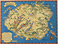 | Details | White, Ruth Taylor | 1931 |
| Pictorial map of the island of Kauai in Hawaii Polynesia |
|
White, Ruth Taylor |
|
| 1931 |
| LOC:89 |
| $250.00 | White--Ruth-Taylor | Pictorial-map-of-the-island-of-Kauai-in-Hawaii-Polynesia | Fine lithographed cartograph or pictorial map of the Polynesian island of Kauai, Hawaii by Ruth Taylor White. In 1931 White produced four maps of individual islands for the Hawaii Tourist Bureau: Kauai, Maui, Hawaii, Oahu, and one map of the entire Hawaiian Island chain. Printed by the Honolulu Star-Bulletin.
<br><br>
Locations and activities that White featured in her map of the Island of Kauai include:"
<div class="indenttextblocksingle">
<ul style="list-style-type: circle;"></li>
<li>Barking Sands</li>
<li>Napali Coast</li>
<li>Hanalei Beach</li>
<li>Moloaa</li>
<li>Nawiliwili Harbor</li>
<li>Port Allen</li>
<li>Ruins of Russian Port</li>
<li>Waimea</li>
</ul>
</div> |
| 6646 |  | Details | White, Ruth Taylor | 1931 |
| Pictorial map of the Island of Hawaii |
|
White, Ruth Taylor |
|
| 1931 |
| LOC:89 |
| $200.00 | White--Ruth-Taylor | Pictorial-map-of-the-Island-of-Hawaii | Fine lithographed cartograph or pictorial map of the island of Hawaii by Ruth Taylor White. In 1931 White produced four maps of individual islands for the Hawaii Tourist Bureau: Kauai, Maui, Hawaii, Oahu, and one map of the entire Hawaiian Island chain. Printed by the Honolulu Star-Bulletin.
<br><br>
Locations and features that White featured in her map of Hawaii include:"
<div class="indenttextblocksingle">
<ul style="list-style-type: circle;"></li>
<li>Mauna Kea</li>
<li>Mauna Loa</li>
<li>Kilauea</li>
<li>Hilo</li>
<li>Kealakekua Bay</li>
<li>Kailua</li>
<li>Upolu Point</li>
<li>Hookena</li>
<li>Hoopuloa</li>
</ul>
</div> |
| 1421 |  | Details | Johst, Paul Spener | 1931 |
| South Carolina Pictorial Map |
|
Johst, Paul Spener |
|
| 1931 |
| LOC:41 |
| $85.00 | Johst--Paul-Spener | South-Carolina-Pictorial-Map | Pictorial map of the State of South Carolina in a cartoon-like style. Depicts transportation (mules), agriculture (tobacco, rice, watermelon, cotton, corn) for the State of South Carolina in an exaggerated, stereotyped manner. A decorative legend at bottom left identifies four locations within South Carolina: Charleston, Columbia, Greenville, and Spartanburg. Page 57.
<br></br>
Verso with text extolling the virtues of South Carolina geography and natural wonders.
<br></br>
From "Picture Map Geography of the United States" by Vernon Quinn. With Picture Maps by Paul Spener Johst. Publisher: Frederick A. Stokes Company. New York. 1931. Some picture maps in the book contain depictions that today might be considered politically incorrect or even racist. |
| 1420 |  | Details | Johst, Paul Spener | 1931 |
| Florida Pictorial Map |
|
Johst, Paul Spener |
|
| 1931 |
| LOC:0 |
| $0.00 | Johst--Paul-Spener | Florida-Pictorial-Map | SOLD
<br></br>
Pictorial map of the State of Florida in a cartoon-like style. Depicts transportation (dog sledding) , nature palm trees, alligators, turtles) and recreations (auto racing, sailing) for the State of Florida in an exaggerated, stereotyped manner. The Florida keys are signified by door keys. A decorative legend identifies six locations within Florida: Jacksonville, Miami, Tallahassee, St. Augustine, Key West, and Palm Beach. Page 65.
<br></br>
Verso with text extolling the virtues of Florida's resorts and natural wonders, its swamps, and its 30,000 lakes.
<br></br>
From "Picture Map Geography of the United States" by Vernon Quinn. With Picture Maps by Paul Spener Johst. Publisher: Frederick A. Stokes Company. New York. 1931. Some picture maps in the book contain depictions that today might be considered politically incorrect or even racist. |
| 6584 |  | Details | Held, John Jr. | 1931 |
| Pictorial Map of Lower Manhattan or Broadway Butterfly's Map |
|
Held, John Jr. |
|
| 1931 |
| LOC:89 |
| $200.00 | Held--John-Jr- | Pictorial-Map-of-Lower-Manhattan-or-Broadway-Butterfly-s-Map | John Held, Jr., (1889-1958) was a cartoonist, illustrator, printmaker and author. Held's cartoons satirized and epitomized the United States' “Jazz Age” of the 1920s. Here, Held's cartoon for "Broadway Butterflys" satirizes the fast life of the New York elite with its focus on Wall Street, Broadway, Fifth Avenue, and Park Avenue. Shows the Jefferson Market Night Court, now the Jefferson Market Branch of the New York Public Library and the morgue, "end of the Primrose Path." Presumably Held included the image to illustrate his story, “Broadway Butterfly,” in Held's second published collection of short stories, Dog Tales (1930).
<br><br>
Verso with an engraving by Held: "When the Theatre was Fraught with Romance."
<br><br>
Held was apparently a VERY popular cartoonist before the Depression. According to New York's Center Gallery: <div class="indenttextblocksingle">"He lived in the era of cartoonists as national heroes. In 1927, Vanity Fair named Held to its “Hall of Fame” alongside international luminaries of the decade. The Hearst newspapers paid him $250,000 a year (nearly $4,000,000 today, adjusted for inflation) for his cartoon strip, Oh! Margy, and his drawings sold for up to $5,000 each, roughly the price of a house." (1)
</div><br>
(1) Online. Retrieved December, 2022. https://www.centergallerynyc.org/exhibitions/johnheldjr |
| 1422 |  | Details | Johst, Paul Spener | 1931 |
| North Carolina Pictorial Map |
|
Johst, Paul Spener |
|
| 1931 |
| LOC:0 |
| $0.00 | Johst--Paul-Spener | North-Carolina-Pictorial-Map | SOLD
<br><br>
Pictorial map of the State of North Carolina in a cartoon-like style. Depicts industry (textile mills, furniture) and agriculture (tobacco, peanuts, cotton, corn) for the State of North Carolina in an exaggerated, stereotyped manner.
<br></br>
A decorative legend at bottom left identifies four locations within North Carolina: Charlotte, Winston Salem, Greensboro, and Raleigh. Coastal locations of Pamlico Sound, Albemarle Sound, Cape Hatteras, Cape Lookout, and Cape Fear are identieid in small type. Page 53.
<br></br>
Verso with text extolling the virtues of North Carolina geography and natural wonders.
<br></br>
From "Picture Map Geography of the United States" by Vernon Quinn. With Picture Maps by Paul Spener Johst. Publisher: Frederick A. Stokes Company. New York. 1931. Some picture maps in the book contain depictions that today might be considered politically incorrect or even racist. |
| 6551 |  | Details | Johst, Paul Spener | 1931 |
| Johst pictorial maps of Alabama and Georgia |
|
Johst, Paul Spener |
|
| 1931 |
| LOC: |
| $135.00 | Johst--Paul-Spener | Johst-pictorial-maps-of-Alabama-and-Georgia | SOLD
<br><br>
Two pictorial maps of the states of Alabama and of Georgia in a pictorial cartoon-like style.
<br><br>
From "Picture Map Geography of the United States" by Vernon Quinn. With Picture Maps by Paul Spener Johst. Publisher: Frederick A. Stokes Company. New York. 1931. Some picture maps in the book contain depictions that today might be considered politically incorrect or even racist. |
| 5052 |  | Details | Rice, George T. | 1931 |
| Map of Key West Florida |
|
Rice, George T. |
|
| 1931 |
| LOC:11 |
| $250.00 | Rice--George-T- | Map-of-Key-West-Florida | Scarce map of Key West Florida in booklet "Fifth Annual Tourists Sight Seeing Guide of Key West Florida 1933 Courtesy of Key West Business People". Locations identified numerically on the map appear not to correspond to numbered locations in the booklet. It is informative to compare this map with a very similar sightseeing map (1945-1948) in the Touchton Map Library. Numerous changes to Key West related to WWII are apparent, especially the construction of Meacham Field.
<br></br>
Booklet 3.5" x 7" with advertisements for local Key West businesses including: The Artman Press, The Key West Citizen, Gardner's Pharmacy, Columbia Laundry, The Key West Colonial Hotel and more. With a list of facts about Key West and a description of a tour of local sights including the "turtle crawls":
<div class="indenttextblocksingle">
"3. Visit the turtle crawls where turtles weighing over two hundred pounds may be seen swimming by dozens in pens while waiting to be slaughtered. Turtles have been caught near Key West weighing over one thousand pounds. This is a sight to remember. Located: Dock at North end of Margaret street."
</div></br>
The map was compiled under the direction of George T. Rice, Captain 13th C.A. (Coast Artillery). Drawn by A.D. Shirk, Staff Sergeant, 13th C.A. July 10, 1931. |
| 1419 | 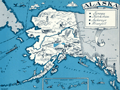 | Details | Johst, Paul Spener | 1931 |
| Alaska Pictorial Map |
|
Johst, Paul Spener |
|
| 1931 |
| LOC:41 |
| $85.00 | Johst--Paul-Spener | Alaska-Pictorial-Map | Pictorial map of the State of Alaska in a cartoon-like style. Depicts transportation (dog sledding) , nature (bears and igloos) and recreations for Alaska in an exaggerated, stereotyped manner. Legend identifies four locations within Alaska: Juneau, Ketchikan, Anchorage, and Wrangell. Kodiak Island, British Columbia and the Yukon are identified by name. Page 193.
<br></br>
Verso with text extolling the virtues of Alaska's natural wonders and its mountains; and bears.
<br></br>
From "Picture Map Geography of the United States" by Vernon Quinn. With Picture Maps by Paul Spener Johst. Publisher: Frederick A. Stokes Company. New York. 1931. Some picture maps in the book contain depictions that today might be considered politically incorrect or even racist. |
| 1418 | 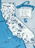 | Details | Johst, Paul Spener | 1931 |
| California Pictorial Map |
|
Johst, Paul Spener |
|
| 1931 |
| LOC:20 |
| $85.00 | Johst--Paul-Spener | California-Pictorial-Map | Pictorial map of the State of California in a cartoon-like style. Depicts transportation, chief industries (film-making, asparagus farming), nature, and recreations for the state in an exaggerated, stereotyped manner. Legend identifies 5 locations within California: Yosemite National Park, San Francissco, Oakland, Los Angeles, and San Diego. Catalina Island is identified by name. Page 181.
<br></br>
Verso with text extolling the virtues of California's natural wonders and its agriculture.
<br></br>
From "Picture Map Geography of the United States" by Vernon Quinn. With Picture Maps by Paul Spener Johst. Publisher: Frederick A. Stokes Company. New York. 1931. Some picture maps in the book contain depictions that today might be considered politically incorrect or even racist. |
| 5274 | 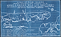 | Details | Pepin, A. L. | 1931 |
| Map Plum Island Annie H. Brown Wild Life Sanctuary |
|
Pepin, A. L. |
|
| 1931 |
| LOC:10 |
| $550.00 | Pepin--A--L- | Map-Plum-Island-Annie-H--Brown-Wild-Life-Sanctuary | An unrecorded cyanotype (blueprint) map of Plum Island from 1931 related to early conservation efforts on the Massachusetts coast. The map shows the location of land purchased for the Annie H. Brown Wildlife Sanctuary and several adjacent properties proposed for purchase.
<br></br>
Plum Island is a New England barrier island that lies on the coast of Massachusetts about two miles from Newburyport, Mass. Plum Island, 11 miles in length, is named for the beach plum shrubs that grow in the dunes. The North Point of the island is located at the mouth of Newburyport Harbor, where the Atlantic Ocean meets the Merrimack River.
<br></br>
Legend at bottom describes seven numbered tracts of land on the map:
<div class="indenttextblocksingle">
<ul style="list-style-type: circle;">
<li>300 acres - Annie H. Brown Wildlife Sanctuary.</li>
<li>110 acres - Land of Knobbs Beach Associates.</li>
<li>225 acres - Land of Woodworth.</li>
<li>90 acres - Land of Stafford.</li>
<li>75 acres Land of Clement.</li>
<li>400 acres - Land of Bar Island realty Company.</li>
<li>3 acres - Land of Small.</li>
</ul>
</div>
Annie Hamilton Brown, a resident of Stoneham, willed a sum of between $15,000 and $25,000 to the Federation of the Bird Clubs of New England in 1929. Working with the Massachusetts Audubon Society, the federation was able to purchase most of the southern end of Plum Island for a wildlife sanctuary. In 1943, the Audubon Society sold the 1,600 acre sanctuary to the Federal Government who merged the land into the Parker River National Wildlife Refuge. This item includes the original fund-raising transmittal letter and return envelope from the Federation of the Bird Clubs of New England, Inc. Laurance B. Fletcher, Secretary; Boston, Massachusetts.
<br></br> |
| 6714 | 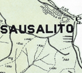 | Details | Northwestern Pacific Railroad | 1931 |
| Hiking Map Marin County California |
|
Northwestern Pacific Railroad |
|
| 1931 |
| LOC:68 |
| $375.00 | Northwestern-Pacific-Railroad | Hiking-Map-Marin-County-California | Original Hiking Map of Marin County California copyrighted and first issued by the Northwestern Pacific Railroad Company (NWPRR) in 1925 [1931]. Shows both hiking trails and fire trails with the greatest concentration around the area of Mt. Tamalpais, Muir Woods, Lagunitas Lake, and Alpine Lake. Scarce on the market. Only 5 institutional holdings of the map are listed in WorldCat.
<br><br>
Includes an inset detail map of Mill Valley with an approx. 1/2 mile walking route from the NWPRR station to the trailhead of the Pipeline Trail. No contour lines but the map does show the elevation at many points. The map shows many identified hiking trails including:
<br>
<div class="indenttextblocksingle">
<ul style="list-style-type: circle;"></li>
<li>Boot Jack Trail</li>
<li>Rock Spring Trail</li>
<li>Hidden Lake Fire Trail</li>
<li>Cataract Trail</li>
<li>Bolinas Ridge Trail</li>
<li>Woodacre Fire Trail</li>
<li>Lagunitas Fire Trail</li>
<li>Indian Fire Trail</li>
</ul>
</div>
This a revised edition from 1931. Edward Denny & Co. Publishers, San Francisco. Manuscript marginal note: "1939."
<br><br> |
| 6818 | 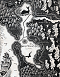 | Details | Landacre, Paul Hambleton | 1932 |
| The Gold Fields |
|
Landacre, Paul Hambleton |
|
| 1932 |
| LOC: |
| $0.00 | Landacre--Paul-Hambleton | The-Gold-Fields | This Item Is no longer in our inventory. Please enquire about other examples.
<br><br>
A beautiful map of west-central California after a wood-block print by acclaimed wood-block engraver Paul Landacre: "The Gold Fields". Based on my research, I have been able to discover only two cartographic works attributed to Landacre, the other is the very rare "Cinema Heaven" produced by Landacre in 1932. This map was issued in 1933.
<br><br>
From the book "A Gil Blas in California" (1) where Landacre provided not only this fine map, but also the wood-block engraved chapter vignettes. The book, by Alexander Dumas, author of The Count of Monte Cristo and The Three Musketeers, describes a Frenchman's voyage to San Francisco and his disappointing attempt to get rich prospecting for gold near Stockton, California during the 1849 gold rush. <br><br>
<div id="0" align="center">
<a title=""></a>
<img id="6818" src="/ZoomifyImages/SC_6818/SC_6818_detail_1.jpg" alt="" width="150"/> <br><br> <font size="-2">Chapter vignette by Paul Landacre.</font>
</div>
<br>
(1) A Gil Blas in California. Alexander Dumas. Translated by Marguerite Eyer Wilbur. Primavera Press. Los Angeles. 1933. |
| 6753 |  | Details | Landacre, Paul Hambleton | 1932 |
| Rare Pictorial Map of Beverly Hills with homes of the stars |
|
Landacre, Paul Hambleton |
|
| 1932 |
| LOC:89 |
| $0.00 | Landacre--Paul-Hambleton | Rare-Pictorial-Map-of-Beverly-Hills-with-homes-of-the-stars | SOLD <br><br> Rare lithographed pictorial map of Beverly Hills, California, 1932, with homes of movie stars by California artist and printmaker Paul Landacre. Should be a foundational item for Landacre collectors as it is his most ambitious known single work of commercial advertising and is the earliest and only the second cartographic creation of Landacre I have found (1). Signed in the plate by Landacre. Key at bottom references movie stars by name to homes on the map. These stars include Douglas Fairbanks, Buster Keaton, Marion Davies, Mary Pickford, Lionel Barrymore, Stan Laurel, Jack Warner, and Charles Chaplin. The map is after a wood-block engraving, by Landacre "Cinema Heaven", now cracked and held in the Clark Memorial Library at UCLA.
<br><br>
Reviewing numerous online images by Landacre it is apparent that the map is a departure from Landacres' usual output of landscapes, still life's, nudes, and abstractions. However, in 1932 the U.S. was in the depth of the Great Depression and Landacre was probably pleased to have the income from this commercial commission.
<br><br>
Verso with the Francis Nicholl Pictograph Guide of Los Angeles, including Pasadena, Culver City, Brentwood, Long Beach, and San Pedro. Includes alphabetic list of movie stars with their addresses.
<br><br>
No examples of "Cinema Heaven" or this publication of Landacre's "Newe Mappe" map is found online. No record of a sale found on WorthPoint.
<br><br>
(1) Landacre, Paul. The Gold Fields. 1933.<br>
Reference: https://www.themagazineantiques.com/article/paul-landacres-world/ |
| 6728 |  | Details | Anonymous | 1932 |
| Child's pencil box pictorial map United States |
|
Anonymous |
|
| 1932 |
| LOC:13 |
| $125.00 | Anonymous | Child-s-pencil-box-pictorial-map-United-States | Lithographed uncommon pictorial map ca. 1932 of the United States by the Joseph Dixon Crucible Company (DCC). Inset maps for the Philippine Islands, Alaska, Hawaiian Islands, Panama, and Porto Rico. Map interior is the standard cotton, cattle, and cactus and the seas are filled with the scene of a whaleboat capsized by its quarry, a fierce WWI-era battleship, a passenger liner, and a single-deck ship-of-the-line, possibly the Constitution. Following restoration that began in 1925, the Constitution sailed on a 90-port tour along United States' coasts by late 1931.
<br><br>
The DCC is also credited with the publication of Dixon's Mickey Mouse Map of the United States ca. 1936. That 10"x14" map was designed for inclusion in a set of child's pencils.
<br><br>
The Dixon Crucible Company was established by Joseph Dixon in Jersey City, NJ in 1847. Dixon (1799-1869) invented the Dixon Ticonderoga pencil, which was made by mixing graphite with clay and water and pressing it into grooved cedarwood. The company was taken over by Dixon's son-in-law, Orestes Cleveland, who established it as a highly regarded brand for mass production. The company suffered financial setbacks due to Cleveland's malfeasance, but it was saved by Edward F.C. Young and eventually came under the control of his son-in-law George T. Smith. The manufacturing complex was later converted into the Dixon Mills, a mixed-use apartment complex. In 2005, Dixon-Ticonderoga was acquired by the Italian-based FILA Group, a manufacturer in Mexico and China. |
| 6471 |  | Details | White, Ruth Taylor | 1932 |
| Ruth Taylor 1932 pictorial map cartograph Monterey Bay Region |
|
White, Ruth Taylor |
|
| 1932 |
| LOC:78 |
| $0.00 | White--Ruth-Taylor | Ruth-Taylor-1932-pictorial-map-cartograph-Monterey-Bay-Region | SOLD<br><br>Fine original pictorial map or cartograph of the Monterey Bay Region by Ruth Taylor (1932). Later Ruth would sign her many maps with her married name, Ruth Taylor White. The map represents some of Ruth's earliest work, just three years after she drew four beautiful route-map cartographs for Western Air Express' newly inaugurated passenger service (1929). First edition, lacking the black redaction of the 2nd edition.
<br><br>
<div id="0" align="center">
<a title="Ruth Taylor White 1929 cartograph for Western Air Express"></a>
<img id="3" src="/ZoomifyImages/SC_6455/SC_6455_CaliRoutes.jpg" alt="Ruth Taylor White 1929 cartograph for Western Air Express" width="330"/> <br><small>Ruth Taylor White 1929 cartograph for Western Air Express.</small>
</div><br>
The cartograph was probably published by the Chamber of Commerce of the Pajaro Valley as the verso text promoting Watsonville, California refers to the map on the recto as "the marvelously scenic Monterrey Bay Region (pictured on the reverse side.)" |
| 5057 |  | Details | Florida East Coast Railway | 1933 |
| Map of Florida East Coast Railway the St. Augustine Route |
|
Florida East Coast Railway |
|
| 1933 |
| LOC:200 |
| $250.00 | Florida-East-Coast-Railway | Map-of-Florida-East-Coast-Railway-the-St--Augustine-Route | Colorful folding map of Henry Flagler's Florida East Coast Railway, the St. Augustine Route. Includes the Key West extension and the route from Key West to Havana, Cuba of the Peninsular and Occidental Steamship Company.
<br></br>
Interesting and seemingly out-of-place notations for two fishing camps on the Keys: Pirates Cove fishing camp and Long Key fishing camp. Printed by the Record Company, St. Augustine, Florida. Map is in the center of a folding brochure of 15 pages. |
| 6607 |  | Details | Noville, George O. | 1933 |
| Antarctic Little America Aviation and Exploration Club Map |
|
Noville, George O. |
|
| 1933 |
| LOC:65 |
| $0.00 | Noville--George-O- | Antarctic-Little-America-Aviation-and-Exploration-Club-Map | SOLD<br><br>Apparently scarce polar map of Antarctica created and copyrighted by George O. Noville and published by the Tide Water Oil Company in 1933. Little America was a series of Antarctic exploration bases from 1929 to 1958, founded by Admiral Richard E. Byrd. Little America I and II were located south of the Bay of Whales on the Ross Ice Shelf.
<br><br>
<div class="indenttextblocksingle">
"… promotional map was issued with the claim that was used exclusively by Byrd on both his Antarctic Expeditions. Members of the Little America Aviation and Exploration Club received reports on expeditions, so that they could plot their progress on the map. Only the known, explored parts of the continent are depicted. Shaded areas indicate land permanently covered by ice and snow while white areas indicate unexplored land." (1)
</div>
<br>
No sales of this map are recorded in AMPR and only two institutional holdings are noted in WorldCat.
<br><br>
George Otto Noville (1890-1963), winner of the Distinguished Flying Cross, was an aviation pioneer who served with Admiral Byrd during Byrd's first and second expeditions to Antarctica.
<br><br>
(1) Online. Accessed 1/23. https://oshermaps.org/exhibitions/to-the-ends-of-the-earth/section-8 |
| 5188 |  | Details | Los Angeles and Salt Lake RR | 1933 |
| Map of the Los Angeles and Salt Lake Railroad |
|
Los Angeles and Salt Lake RR |
|
| 1933 |
| LOC:62 |
| $200.00 | Los-Angeles-and-Salt-Lake-RR | Map-of-the-Los-Angeles-and-Salt-Lake-Railroad | Rare, large blue-line route map for the <b>Los Angeles and Salt Lake Railroad</b> (LA&SL). With an inset map of Los Angeles stops and the Central Office. A decorative historic item dating from 1933 before those rail lines were incorporated into the Union Pacific System in 1936 as the Caliente, the Sharp, and the Lynndyl divisions.
<br></br>
Shows the route extending west from Salt Lake City, through Las Vegas, Nevada and Utah to Los Angeles, California and the stops in between the two end points. The LA&SL was known for its depot buildings, many of which were in the Mission Revival architectural style, inspired by early Spanish missions in California.
<br></br>
Produced during the Great Depression by the Chief Engineer's Office. Omaha, Nebraska. February 1, 1933. |
| 6730 |  | Details | Gaffney, Walter M. | 1933 |
| Pictorial advertising map for the Cape Cod Creamery |
|
Gaffney, Walter M. |
|
| 1933 |
| LOC:13 |
| $550.00 | Gaffney--Walter-M- | Pictorial-advertising-map-for-the-Cape-Cod-Creamery | Historical pictorial map for Cape Cod Creamery ca. 1933 by Walter M. Gaffney. An unrecorded advertising piece for Cape Cod Creamery, associated with Noble's milk. On heavy card stock. Maps numerous historical and geographic locations including Pilgrim Monument, the Highland Light, Pleasant Bay, the Sandy Neck Light, the Cape Cod Canal. Scattered in each corner is a logo for Noble's milk, the map shows several delivery trucks labeled "Noble's that's good milk", and the large compass rose with a bottle of milk arranged at the center. Small piece of contiguous card stock apparently fashioned into a print hanger suggests the piece may have been trimmed into this shape by a previous owner.
<br><br>
Includes Buzzards Bay, Duxbury Bay, Provincetown Harbor, Wellfleet Harbor, Barnstable Harbor, Pleasant Bay, and a portion of Nantucket Sound.
<br><br>
<div class="indenttextblocksingle">
"Wellfleet or Whalefleet as it was originally called undoubtedly surpassed other towns. In 1843 a whale was captured near the end of the Cape and estimated to contain 200 barrels of oil and 2000 pounds of bone. Only 125 barrels of oil and 300 lbs. of bone were saved but with this waste it netted $10,000."
</div>
<br><br>
Gaffney is also credited with a larger pictorial map of Cap Cod 1932, in a different style, less historically oriented. |
| 6326 |  | Details | Keane Development Corporation | 1933 |
| Blueprint plat map for Huston Heights Muscle Shoals, Alabama |
|
Keane Development Corporation |
|
| 1933 |
| LOC:53 |
| $250.00 | Keane-Development-Corporation | Blueprint-plat-map-for-Huston-Heights-Muscle-Shoals--Alabama | Rare unrecorded cyanotype (blueprint) plat map of the Huston Heights development near <b>Muscle Shoals</b>, Alabama which was incorporated in 1923.</b> Inset at upper left is a fine context map of the Tri-cities area of Florence, Sheffield, and Muscle Shoals compiled by T.J. Evans showing the locations of the Huston Heights development. Features the Wilson Dam on the Tennessee River and two nitrate plants. Dated within at February, 1933.
<br></br>
The plat encompasses an area in Muscles Shoals bounded by and including Ford Highway, Washington Drive, Henry Street and Sheridan Drive. |
| 4826 |  | Details | Union Pacific Railroad | 1933 |
| Map Oregon Washington Railroad and Navigation Company |
|
Union Pacific Railroad |
|
| 1933 |
| LOC:62 |
| $550.00 | Union-Pacific-Railroad | Map-Oregon-Washington-Railroad-and-Navigation-Company | Original cyanotype map (blueprint) of Oregon, Washington, and Idaho with the rail lines and stops of the Oregon-Washington Railroad and Navigation Company ca. 1933. Shows large and small railways some of which are now abandoned.
<br></br>
This map could be of interest for anyone with an interest in the Rails to Trails Conservancy or the Great American Rail-Trail initiative (a coast-to-coast multi-use trail of over 3,700 miles). Portions of this map includes abandoned tracks that are incorporated into that coast-to-coast trail including the Chicago, Milwaukee, St. Paul & Pacific Railroad (C. M. St. P and P.), now a part of the <b>Palouse to Cascades State Park Trail</b>.
<br></br>
Great detail and names of mountains in the Cascades Range including Mount Rainier, Mount St. Helens, Mount Adams, and Mount Hood. Coverage extends past Seattle to Everett, Washington.
<br></br>
The Oregon Railroad and Navigation Company operated from 1896 after a consolidation of several smaller railroads. Union Pacific (UP) purchased a majority stake of the line in 1898. In 1910 the line became a subsidiary of UP titled the <b>Oregon–Washington Railroad and Navigation Company.</b> Union Pacific formally absorbed the smaller railway into its system in 1936.
<br></br>
Dated 1933 based on 2 other similar items purchased in the same lot, each from the Chief Engineer's Office.
<br></br>
In the 1930's, minor abandonments of the company's Oregon lines included the partial abandonment of the line to Homestead, as well as joint operation with the Spokane, Portland & Seattle of the Oregon Trunk railroad line from the Columbia River south to Bend.
<br></br>
Drawn by REB. Published by the office of the Chief Engineer, Portland, Oregon. |
| 5266 |  | Details | Anonymous | 1933 |
| Advertisement with map for Lake County, Florida |
|
Anonymous |
|
| 1933 |
| LOC: |
| $175.00 | Anonymous | Advertisement-with-map-for-Lake-County--Florida | Map of Lake County, Florida on an advertising brochure from the Lake County Chamber of Commerce. Fine graphics focused on the agricultural bounty available in a fertile and water-rich Florida. Shows numerous cities in central Florida including Altoona, Eustis, Howey, Clermont, Tavares, Sanford, and Orlando. Inset half-tone black and white illustrations of scenes typical to the area.
<br></br>
Brochure was issued by the Lake County Chamber of Commerce in Tavares, Florida to registrants at the Florida Exhibit during the Century of Progress Exhibition in Chicago (the 1933-34 Chicago World's Fair). |
| 5242 |  | Details | Zulch, Herman C. | 1934 |
| Maps of the Mossback Gold Mine near Oatman Arizona |
|
Zulch, Herman C. |
|
| 1934 |
| LOC:62 |
| $550.00 | Zulch--Herman-C- | Maps-of-the-Mossback-Gold-Mine-near-Oatman-Arizona | Scarce lot of six hand-colored blue-line mine maps of the Mossback Mine near the town of Oatman in Mohave County, Arizona. Five of the six maps show a distinctive tunnel, or level, of the mine (levels 100-400 (12" x 17") and level 700 (17" x 46")). The sixth and most interesting map is the "Cross Section Through Mossback Shaft" (18" x 26") which shows the Ritter Vein and the Mossback Vein, reported to be a rich source of gold ore. From a geological perspective the map projects the potential position of the Mossback Vein as it was shifted by the Mossback Fault.
<br></br>
According to the Arthur Lakes Library at the Colorado School of Mines the tunnel maps and cross-section map are scarce:
<div class="indenttextblocksingle">
"Most mining maps show a mining district or region. . . Most of mine maps in our collection show only the location of the claims, not the tunnels. Very few maps show cross-sections of a mine." [1]
</div></br>
The Mossback Mine, at an altitude of 2,400 feet, was first discovered in 1863 by Garry Mining Company. Past operations took place as late as 1933 to 1935, but the mine is now closed. The Mossback vein extended nearly half a mile in length and was 23 feet in width at the surface, widening to 40 feet at the bottom. The ore contained up to $2,000 in gold per ton (100 ounces per ton). [2]
<br></br>
Traced by mining engineer Herman Zulch at Oatman, Arizona. Herman Charles Zulch graduated from the Colorado School of Mines in May 1908.
<br></br>
Sources include:
</br>
[1] https://libguides.mines.edu/maps/mining</br>
[2] https://thediggings.com/mines/6530 |
| 6598 |  | Details | Dietemann, C.A. | 1934 |
| Scarce Pictorial Map Denver and Rio Grande Western Railroad |
|
Dietemann, C.A. |
|
| 1934 |
| LOC:400 |
| $250.00 | Dietemann--C-A- | Scarce-Pictorial-Map-Denver-and-Rio-Grande-Western-Railroad | C. A. Dietemann's scare pictorial map: Denver and Rio Grande Western (D&RGW) Railroad Scenic Line of the World spans four panels of a six-panel promotional brochure for the railroad featuring the Royal Gorge Route and the James Peak Route with the Moffat Tunnel, cutting through the Continental Divide. The map, dating from the mid 1930's features a wide expanse of the west including portions of New Mexico, Colorado, Utah and Arizona. From Salt Lake City to Denver, this fine map of routes for the Denver and Rio Grande Railroad entices the viewer to visit some of the West's greatest attractions including Mesa Verde National Park, Pikes Peak, Santa Fe, and Rocky Mountain National Park.
<br><br>
Dietemann's pictograms on this lithographed pictorial map feature numerous outdoor activities such as hiking, tennis, skiing, hunting, tobogganing, and fishing.
<br><br>
The D&RGW entered bankruptcy in 1935 and was not able to emerge from that status until 1947.
<br><br>
Only five holdings od Dietmann's pictorial map are found in WorldCat. No copies appear for sale on the market at this moment (01/23). |
| 5350 |  | Details | Speck, Rose M. | 1934 |
| Mississippi River paddleboat cruise to New Orleans broadside |
|
Speck, Rose M. |
|
| 1934 |
| LOC:9 |
| $625.00 | Speck--Rose-M- | Mississippi-River-paddleboat-cruise-to-New-Orleans-broadside | Rare original 1934 broadside for a two week Mississippi River cruise aboard the paddleboat Cape Girardeau. The event, limited to 100 passengers, was planned to depart New York on March 31, 1934 and was sponsored by Rose M. Speck of New York City.
<br></br>
<b>"Two weeks of Adventure on the Lower Section of the Mighty Mississippi -- Aboard the picturesque steam packet "Cape Girardeau"-- Monarch of the River"</b>
<br></br>
The $139 fare included a pullman train from New York to Memphis, Tennessee complete with a recreation car. Aboard the riverboat, passengers could plan on a two-day layover in New Orleans along with onboard entertainment including:
<div class="indenttextblocksingle">
<ul style="list-style-type: circle;">
<li>"Darkey spiritual singers"</li>
<li>Square dances</li>
<li>Costume balls</li>
<li>Masquerades</li>
<li>Deck sports</li>
<li>Sun baths</li>
<li>Swimming in the Gulf of Mexico</li>
</ul>
</div> |
| 1333 |  | Details | U.S. War Department | 1934 |
| Old War Department Map of New Orleans Area 1934 |
|
U.S. War Department |
|
| 1934 |
| LOC:1401 |
| $450.00 | U-S--War-Department | Old-War-Department-Map-of-New-Orleans-Area-1934 | Large, original War Department / U.S. Corps of Engineers blueprint index map from 1934 for south-eastern Louisiana including New Orleans, Donaldsonville, Baton Rouge, Mandeville, Slidell and Bay St. Louis. Names railways, numerous waterways and bodies of water, but does not show roads or highways. Includes the Bonnet Carre Floodway (completed 1931), the Harvey Locks, portions of the Intracoastal Canal (later called the Gulf Intracoastal Waterway or ICWW), Lake Borgne, Lake Ponchartrain, Barataria Bay, Atchafalaya Bay, and the Mississippi River as far south as Venice, Louisiana. Perfect for the man cave.
<br></br>
On this map the route shown for the Intracoastal Canal passes through Lockport, Louisiana and Bayou Terrebonne. The segment of the canal from Larose to Bourg, Louisiana to was not completed until 1949.
<br></br>
Dated within at bottom right to 1934. Drawn by L. Lecaze. |
| 6402 |  | Details | Broms, Allan | 1934 |
| Broms Star Guide Planisphere |
|
Broms, Allan |
|
| 1934 |
| LOC:300 |
| $995.00 | Broms--Allan | Broms-Star-Guide-Planisphere | Broms Star Guide (1934), a very rare planisphere created during the depth of the Great Depression. This planisphere is the only example of Broms Star Guide known to exist (per Internet search). It contains much peripheral information about astronomy that are not found on other planispheres, e.g. moon phases, meteor calendar, the Greek alphabet, and a moon map.
<br><br>
Model AN, for the Northern Hemisphere. Published by the Graphex Company, New York.
<br><br>
This planisphere was created by Allan (Allen) Strong-Broms (1886-1965), draft resister, Leavenworth prisoner, author, inventor, lecturer, businessman and "not a professional astronomer". As a result of his pacifism and resistance Broms told his son that he “had seen the inside of twenty-two jails.” [2]
<br><br>
No copies located online and no holdings recorded in WorldCat. The only mention of Broms Star Guide is the LOC copyright catalog. Allan Broms was granted a patent for the Star Guide on November 20, 1934.
<br><br> |
| 5499 |  | Details | New Hampshire State Planning and Development Comm | 1935 |
| Scarce Map or Poster of New Hampshire Ski Trails |
|
New Hampshire State Planning and Development Comm |
|
| 1935 |
| LOC:150 |
| $365.00 | New-Hampshire-State-Planning-and-Development-Comm | Scarce-Map-or-Poster-of-New-Hampshire-Ski-Trails | Very scarce original lithographed skiing map / poster for the State of New Hampshire from 1935 when the state was the heart of skiing in the United States.
<div class="indenttextblocksingle">
"New Hampshire was the first place in America to have many things you see now at every ski resort. New Hampshire was the first to have trails cut just for downhill skiing. The Granite State was the first to have overhead wire-rope ski tows and an aerial tramway. Many famous races and styles of racing took place in New Hampshire. Professional ski patrols and ski schools began in New Hampshire. These new ideas, plus ski villages, started a whole new tourism industry." [1]
</div>
<br>
Inset tables of distances between cities, status (active/inactive) of airports during the winter season, and a list of approximately seventy member clubs of the U.S. Eastern Amateur Ski Association that included:
<div class="indenttextblocksingle">
<ul style="list-style-type: circle;">
<li>Appalachian Mountain Club. Boston, Mass.</li>
<li>Dartmouth Outing Club</li>
<li>Winnipesaukee Ski Club</li>
<li>Woodstock Ski Club</li>
<li>Nansen Ski Club</li>
<li>Lake Placid Ski Club</li>
</ul>
</div>
A rare record of club and commercial skiing in New Hampshire published by the New Hampshire State Planning and Development Commission in Concord, New Hampshire. Unlike another example of this ski map that we have in stock from a decade later in 1945, this map only lists individual ski trails, organized by region and very few of these trails have mechanical assistance to bring the skier up the mountain, such as tow ropes, chair lifts or trams (the first chairlift was built in New Hampshire. in 1937).
<br></br>
Verso contains text and statistics describing ski trails across the state. Copyright General Drafting Company, New York, N.Y.
<br></br>
[1] New Hampshire Ski History. Online. 2016. http://newenglandskimuseum.org/new-hampshire-ski-history-for-4th-graders/ |
| 6797 |  | Details | Appleton, LeRoy H. | 1935 |
| New Deal allegorical pictorial map Federal Water Shed |
|
Appleton, LeRoy H. |
|
| 1935 |
| LOC:89 |
| $225.00 | Appleton--LeRoy-H- | New-Deal-allegorical-pictorial-map-Federal-Water-Shed | A stunningly-executed allegorical persuasive map on the subject of the New Deal by LeRoy Appleton. The intent of the map was to argue against FDR's New Deal policies.
<br><br>
The New Deal was a series of economic programs and reforms implemented by President Franklin D. Roosevelt in the United States during the 1930s in response to the Great Depression. It aimed to provide relief, recovery, and reform to address the severe economic crisis and high unemployment rates of that time. It was implemented between 1933 and 1939.
<br><br>
Appleton uses water as a symbol to represent money, with rivers and wells as sources of that money later stored behind a dam, a symbol for the "reservoir of revenue."
<br><br>
Other allegorical imagery was used during that era to explain specific New Deal programs. For example, the symbol of the "Three Little Pigs" was employed to illustrate the different types of economic recovery measures. The first pig represented the ineffective, weak measures of the past, while the second pig symbolized temporary relief efforts. The third pig, who built his house with sturdy bricks, represented the New Deal programs that aimed to provide long-term economic stability and reform. By employing such storytelling devices, FDR and his administration aimed to create a sense of unity, hope, and support for the New Deal programs among the American people. Found in an issue of Fortune Magazine in 1935.<br> |
| 2502 | 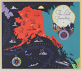 | Details | Chase, Francis J. | 1935 |
| The Last Frontier |
|
Chase, Francis J. |
|
| 1935 |
| LOC:10 |
| $350.00 | Chase--Francis-J- | The-Last-Frontier | Colorful and fun pictorial map of Alaska with pictures of flora, fauna, and native peoples. Prominently features the Japanese Current. Key named locations include Seattle, Bristol Bay, Aleutian Islands, Point Hope, and Point Barrow. Oceans colored black, with whales, local ships, a compass rose, iceberg, and rising sun. Rope-bordered cartouche decorated with nautical subjects, fishermen, float plane, and a totem pole.
<br></br>
Designed by J. Francis Chase. Copyright 1935 by Abbott Laboratories, North Chicago, Ilinois, producers of Abbott's Haliver Oil, a nutritional supplement derived from the liver of the halibut. |
| 6451 |  | Details | U.S. Geological Survey | 1935 |
| Fine large Geologic Map of Colorado |
|
U.S. Geological Survey |
|
| 1935 |
| LOC: |
| $500.00 | U-S--Geological-Survey | Fine-large-Geologic-Map-of-Colorado | Original large folding Geologic Survey Map of Colorado [1] from 1935, dissected and laid to linen. With an inset index map of Colorado. Includes an impressive table of the principal sources of geologic data that were used to compile the map of Colorado, USA. Published by the Department of the Interior, U.S. Geological Survey.
<br><br>
Scarce in this format. Type of rock (igneous, metamorphic, sedimentary) is indicated by color keyed to an extensive index scattered across the right side of the map.<br><br>
[1] Geologic Map of Colorado by the United States Geological Survey W. C. Mendenhall Director in cooperation with the Colorado State Geological Survey Board and Colorado Metal Mining Fund 1935. |
| 8030 |  | Details | Crowder, Cyril C. | 1935 |
| Crowder Variable Expansion Propeller Design Drawings |
|
Crowder, Cyril C. |
|
| 1935 |
| LOC:130 |
| $300.00 | Crowder--Cyril-C- | Crowder-Variable-Expansion-Propeller-Design-Drawings | These three manuscript drawings are a striking artifact of early aviation ingenuity, capturing a bold experimental idea that never left the drafting table. Their meticulously rendered telescoping blades, mechanical sections, and handwritten annotations reveal a level of detail and ambition rarely seen in surviving 1930s aeronautical work. As a display piece, it stands at the intersection of engineering art and aviation history: visually compelling, technically imaginative, and representing a line of research that was too impractical for its time or even for today. Framed, it becomes not just a engineering drawing but a cool conversation piece about the inventive spirit of early flight and the folly of some inventors.
<br><br>
Crowder's variable expansion propellor was designed by Cyril C. Crowder of Hollywood, California. No information is found online about the designer nor is any patent found for the design.<br><br> |
| 5114 |  | Details | Poole Brothers, Inc. | 1935 |
| Map Dixie Route rail service to Florida |
|
Poole Brothers, Inc. |
|
| 1935 |
| LOC:11 |
| $200.00 | Poole-Brothers--Inc- | Map-Dixie-Route-rail-service-to-Florida | Map (8" x 15") within a twenty-two page folding brochure for <b>The Dixie Route</b>, a train service that in 1939 operated three passenger trains across several affiliated railroads and their stops to provide passenger service from the Midwest (St. Louis and Chicago) to Florida. The railway companies contributing to the brochure included:
<div class="indenttextblocksingle">
<ul style="list-style-type: circle;">
<li>Chicago and Eastern Illinois Railway</li>
<li>Louisville and Nashville Railroad</li>
<li>Nashville, Chattanooga, and St. Louis R.Y</li>
</ul></div>
Daily Dixie Route trains to Florida were The Dixieland (with overnight service to Florida) , The Dixie Flyer, and The Dixie Limited.
<br></br>
Copyright 1935 by publishers Poole Brothers, Inc. Published October 1939 (dated within).
<div class="indenttextblocksingle">
Poole Brothers was a publishing company founded in 1870 by George Amos and William H. Poole. The company was the largest printing house in the country that catered to transportation companies. According to The Inland Printer, "practically every railroad in the country used Poole Brothers materials." [1] </div>
</br>
[1] Source: https://en.wikipedia.org/wiki/Poole_Brothers |
| 5047 |  | Details | Dornbush, Adrian | 1935 |
| Depression era pictorial brochure 1st Edition map The Coral Isle of Key West |
|
Dornbush, Adrian |
|
| 1935 |
| LOC:500 |
| $300.00 | Dornbush--Adrian | Depression-era-pictorial-brochure-1st-Edition-map-The-Coral-Isle-of-Key-West | Two scarce maps of Key West, Florida in a visitor's guide booklet simply titled "Key West" published by the Key West Administration in 1935. The booklet is a product of the Public Works of Art Project (PWAP) during the New Deal that was succeeded by the Federal Art Project of the Works Progress Administration (WPA).
<div class="indenttextblocksingle">
"Public Works of Art Project artists from other parts of the country were brought in and put to work creating paintings, murals or public places, and other projects, such as tourist brochures and postcards." [1]
</div>
</br>
The brochure includes a fine 1st edition pictorial map (9" x 6") of Key West, Florida: "The Coral Isle of Key West" by artist Adrian Dornbush, 1935. The map (first edition) was engraved on a "miraculous" scale and shows key landmarks such as Duval Street, the lighthouse, the Martello Towers, and the yacht basin. Other FERA artists who contributed works to the brochure include Edward Bruce, Richard Sargeant, Avery Johnson, Klir Beck, and Richard Jansen.
<br></br>
At center of the brochure is an anonymous two-sheet "Map of the Lower Florida Keys or the Key West Archipelago" (18" x 6") containing a smaller inset map of the Caribbean region.
<br></br>
Printed by Orange Publishing Co. St. Cloud, Florida.
<br></br>
[1] https://keysarts.com/public_art/wpa.html <br>
[2] <a href="https://www.rarecharts.com/ShowDetail/Creator/Dornbush--Adrian/Title/Depression-era-pictorial-brochure-with-variant-2nd-Edition-map-Coral-Isle-of-Key-West/5493" target="_blank">See the second edition here.</a> |
| 5493 | 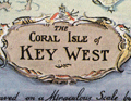 | Details | Dornbush, Adrian | 1935 |
| Public Works of Art Project brochure variant 2nd Edition map Coral Isle of Key West |
|
Dornbush, Adrian |
|
| 1935 |
| LOC:500 |
| $285.00 | Dornbush--Adrian | Public-Works-of-Art-Project-brochure-variant-2nd-Edition-map-Coral-Isle-of-Key-West | Two scarce maps including a rare presumed 2nd. "The Coral Isle of Key West" Florida in a visitor's guide booklet simply titled "Key West" published by the Key West Administration after 1935. The booklet is a product of the Public Works of Art Project (PWAP) during the New Deal that was succeeded by the Federal Art Project of the Works Progress Administration (WPA).
<div class="indenttextblocksingle">
"Public Works of Art Project artists from other parts of the country were brought in and put to work creating paintings, murals or public places, and other projects, such as tourist brochures and postcards." [1]
</div><br>
<div id="3" align="center">
<a title="Key West Booklet"></a>
<img id="3" src="/ZoomifyImages/SC_5493/SC_5493_Cover_400x300.jpg" alt="Dornbush pictorial map The Coral Isle of Key West." width="240"/>
</div>
<br />
Other FERA artists who contributed works to the brochure include Edward Bruce, Richard Sargeant, Avery Johnson, Klir Beck, and Richard Jansen.<br>
</br>
The brochure includes a fine 9" x 6" pictorial map of Key West, Florida: "The Coral Isle of Key West" by artist Adrian Dornbush, 1935. Second edition. This map is most interesting in that it is an <b>unrecorded substantial revision of Dornbush's original map of Key West.</b> This edition contains numerous changes from the first edition including:
<div class="indenttextblocksingle">
<ul>
<li>For the first time, an airport is noted in the location of Meacham Field, now Key West International Airport (EYW)</li>
<li>Seaplane ramps at Trumbull Point (labeled "Key West Airways") are replaced with ship docks. </li>
<li>Radio towers are now shown located at the island's west side near Duval Street.</li>
</ul>
</div>
The map was engraved on a "miraculous" scale and shows key landmarks such as Duval Street, the lighthouse, the Martello Towers, and the yacht basin.
<br></br> |
| 5464 | 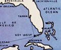 | Details | Dornbush, Adrian | 1935 |
| Depression-era pictorial map of The Coral Isle of Key West |
|
Dornbush, Adrian |
|
| 1935 |
| LOC:0 |
| $0.00 | Dornbush--Adrian | Depression-era-pictorial-map-of-The-Coral-Isle-of-Key-West | <b>SOLD</b>, but see <a href="https://www.rarecharts.com/ShowDetail/Creator/Dornbush--Adrian/Title/Depression-era-pictorial-brochure-1st-Edition-map-The-Coral-Isle-of-Key-West/5047" target="_blank">another Dornbush item</a> now in stock.
<br></br>
Two scarce maps of Key West, Florida in a visitor's guide booklet simply titled "Key West" published by the Key West Administration in 1935. The booklet is a product of the Public Works of Art Project (PWAP) during the New Deal that was succeeded by the Federal Art Project of the Works Progress Administration (WPA).
<div class="indenttextblocksingle">
"Public Works of Art Project artists from other parts of the country were brought in and put to work creating paintings, murals or public places, and other projects, such as tourist brochures and postcards." [1]
</div>
</br>
The brochure includes a fine pictorial map (9" x 6") of Key West, Florida: "The Coral Isle of Key West" by artist Adrian Dornbush, 1935. The map was engraved on a "miraculous" scale and shows key landmarks such as Duval Street, the lighthouse, the Martello Towers, and the yacht basin. |
| 6677 |  | Details | Anonymous | 1936 |
| About and Roundabout Tucson pictorial map Arizona botanical interest |
|
Anonymous |
|
| 1936 |
| LOC:86 |
| $250.00 | Anonymous | About-and-Roundabout-Tucson-pictorial-map-Arizona-botanical-interest | Neat pictorial map of Tucson, Arizona, filled with historical facts and illustrated with simple sketches related to the city's long and colorful history. Bernice Walkley Porter, a Vassar graduate, is credited with creating a map "About and Roundabout Tucson" in 1936 (1). Though untitled, the map here is apparently Porter's and was issued as an folded untitled insert in a guide book by the same name that was published by the Junior League of Tucson in 1936. Verso with a road map of the state of Arionna.
<br><br>
During the 1930s, Bernice Walkley and Rutger Porter operated Desert Gardens Nursery on the same property as their small adobe house in Tucson. Rutger's love for desert plants earned him the nickname "Kactus Kid". Together Bernice and Rutger expanded their home and created the garden surrounding it. Over the years, their garden evolved into a beautiful oasis of winding walks, adobe walls, fountains, and greenery that reflected the sturdier choices for the Tucson climate.
<br><br>
The Porters closed their Desert Gardens Nursery in 1958. However, Bernice had a dream of turning their beloved property into a public garden, and donated it to the City of Tucson in 1968. By the early 1970s, the Tucson Botanical Gardens and the Porter property became a reality, with the City passing a resolution to develop the property into a horticultural center, sanctuary for wild birds, and a center for education. The Porter's adobe house now serves as the Gift Shop for the Tucson Botanical Garden
<br><br>
Many of the original plants from the Porter estate, including citrus, roses, privet, and jasmine, are still preserved in the Historical Garden, which represents the oasis style typical of large Tucson gardens dating from the 1920s to the mid-1960s.
<br><br>
(1) Griffin, Dori. Mapping Wonderlands: Illustrated Cartography of Arizona, 1912–1962. United States, University of Arizona Press, 2013. p. 192. |
| 4994 | 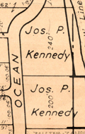 | Details | Brockway, George S. | 1936 |
| Lot of 3 maps Palm Beach Atlas Florida MS notes |
|
Brockway, George S. |
|
| 1936 |
| LOC:11 |
| $525.00 | Brockway--George-S- | Lot-of-3-maps-Palm-Beach-Atlas-Florida-MS-notes | Lot of three (3) scarce cadastral maps from the Palm Beach, Florida Atlas ca. 1936 by Civil Engineer George S. Brockway. Data printed on each sheet include tract/development name, deed reference location, lot dimensions, street names and lot number.
<br></br>
Sheets may contain manuscript pencil notations (ca. 1947 / 1948) with additional property owner names, property prices and indications of whether there was a structure on the property. Verso of each sheet contains Brockway's ink-stamped disclaimer of legal responsibility.<br></br>
<b>Details for the three atlas plates include</b>
<div class="indenttextblocksingle">
<ul style="list-style-type: circle;">
<li>Sheet 5: Covers an area bounded by Merrain Road (N), La Puerta Way (S), Lake Worth (W), Atlantic Ocean (E). Developments include the Bello Lido, Alto Lido and Mockingbird Trail tracts. </li>
<li>Sheet 6: Covers and area bounded by La Puerta Way (N), Orange Grove Road (S) - Lake Worth (W) Atlantic Ocean (E). Includes developments of Palm Beach Shores, Gregory Addition and the New Siears tracts. Shows the former <b>Kennedy Estate with two lots owned by Joseph P. Kennedy</b> totaling 440 feet of ocean frontage.</li>
<li>Sheet 15-A: Bounded by Seminole Ave (N), Royal Poinciana Way (S), Lake Worth (W), North County Road (E) Includes the Flagler Memorial Bridge, old <b>Biltmore Hotel and the Beach Club</b>. Developments include Ocean Park, Floral Park, and Bungalow Park.</li>
</ul>
</div> |
| 6589 | 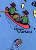 | Details | W. A. Fisher Company | 1936 |
| Pictorial map of Kabetogama Lake Minnesota |
|
W. A. Fisher Company |
|
| 1936 |
| LOC:59 |
| $325.00 | W--A--Fisher-Company | Pictorial-map-of-Kabetogama-Lake-Minnesota | Scarce original pictorial map of Kabetogama Lake, Minnesota. Kabetogama means "rough waters" in Chippewa. Created by Frank M. Antoncich. Published by the W. A. Fisher Company, Virginia, Minnesota. Date of 1936 from the example in the Rumsey Collection. Price when issued was 25 cents.
<br><br>
Along with and cute cartographs including bears and Native Americans the map is filled with useful navigational information and historical facts. Portages, trails and roads are laid out. Many canoes.
<br><br>
Notes and observations about the area include:<br>
<div class="indenttextblocksingle">
<ul style="list-style-type: circle;"></li>
<li>an "Indian Village",</li>
<li>"Funeral Island Burial Ground"</li>
<li>the "Yates Resort",</li>
<li>"Mrs. McCaw- first white woman and homestead here",</li>
<li>"Good duck hunting", and</li>
<li>"Impassable in low water".</li>
</ul>
</div> |
| 5390 |  | Details | English, Robert B. | 1936 |
| Unrecorded maps on development of Florida counties 1831 to 1935 WPA |
|
English, Robert B. |
|
| 1936 |
| LOC:11 |
| $240.00 | English--Robert-B- | Unrecorded-maps-on-development-of-Florida-counties-1831-to-1935-WPA | Original photostat copy of a document with a time-series of ten maps on the development, boundaries, and naming of counties in the State of Florida from 1831 to 1935. White print on black background. Contains detailed textual data on Dade County including population and historical notes. With documentation of the sources for information about Dade County.
<br></br>
Unrecorded. No copy of this document is found online. Assembled by the Historical Records Survey and the State Archives survey- local office, District 3, 3041 Grand Avenue, Coconut Grove, Florida. Dr. Robert B. English, Compiler. Natalie Newell, del. October 1, 1936. WPA.
<br></br>
A substantially different version of this work from 1936, covering the years 1820 - 1936 is attributed to the Works Progress Administration, Florida. That version, from a single online source appears at https://www.floridamemory.com/items/show/322986. |
| 5154 |  | Details | Edwards, Parker | 1937 |
| Dole Pictorial Map of the Hawaiian Islands 1937 |
|
Edwards, Parker |
|
| 1937 |
| LOC:63 |
| $1,100.00 | Edwards--Parker | Dole-Pictorial-Map-of-the-Hawaiian-Islands-1937 | Iconic pictorial map of the Hawaiian Islands drawn by Parker Edwards and published by the Hawaiian Pineapple Co., Ltd. In 1937. Includes the original, franked (4 cent) cardboard mailing tube. This extremely decorative 3-foot wide map is very desirable and somewhat scarce in this excellent A+ condition.
<br></br>
Top of the sheet contains a decorative border featuring a colorful assortment of local plant life. Lower border displays many of the bright, exotic fish that inhabit the waters around the islands of Hawaii.
<br></br>
Title:
<div class="indenttextblocksingle">
<ul style="list-style-type: circle;">
The Dole Map of the Hawaiian Islands U.S.A. being a Descriptive Portrayal of the History, Transportation, Industries and Geography of the Territory of Hawaii, U.S.A.
</ul>
</div> |
| 6727 |  | Details | Anonymous | 1937 |
| The Meridian Highway Main Street of North America |
|
Anonymous |
|
| 1937 |
| LOC:13 |
| $0.00 | Anonymous | The-Meridian-Highway-Main-Street-of-North-America | SOLD<br><br>Attractive, scarce, lithographed 1937 map of U.S. Highway 81 "The Meridian Highway, the Main Street of North America", Hadley Sumner, Selling Agent. Apparently a promotional insert as the bottom states: "For complete information inquire Chamber of Commerce at address on other side." Insert illustrations of the International Bridge at Laredo, Texas, the Meridian Bridge on the Missouri River as well as commercial exports: wheat, corn, cattle. and a lake.
<br><br>
The Meridian Highway was established in 1911-12 as a major north-south route through the Great Plains from Canada to Mexico, following the land division grid parallel to the sixth principal meridian. Originally known as the Meridian Road, it primarily served as a farm-to-market road, passing through each county seat along the way. The Meridian Highway Association was formed in 1911 to promote and map the highway, consisting of representatives from the states, counties, and cities along the route. The completion of the Meridian Highway Bridge in 1924 at the Missouri River between Yankton, South Dakota, and Nebraska marked a significant evolution of the route into a modern highway. Today, the Meridian Highway is the foundation of one of the busiest and most significant transportation corridors in the nation, crossing over 800 miles of Texas and passing through major cities such as Wichita Falls, Fort Worth, Waco, Austin, San Antonio, and Laredo.
<br><br>
Verso is blank. Executed by Epsten Litho. Co. Omaha. |
| 7866 |  | Details | Borden Milk Company | 1937 |
| Bordenland Rare Pictorial Map New York |
|
Borden Milk Company |
|
| 1937 |
| LOC:89 |
| $0.00 | Borden-Milk-Company | Bordenland-Rare-Pictorial-Map-New-York | SOLD<br><br>Bordenland is a very rare pictorial map of New York City and the surrounding area produced by the Borden Milk Company in 1937, near the end of the Great Depression. The map shows cities and towns where Borden's branches were located throughout the New York area identified on banners within a pictorial map of the New York City area.
<br><br>
This rare example of an advertising map is not found in WorldCat. Only one example is known to have been sold in the last 12 years.
<br><br>
Compiled by Borden's Farm Products Division of the Borden Company.
<br><br>
Verso with phone numbers of all Borden's branches and subsidiaries. Includes an extensive list of places where Borden's milk was delivered. |
| 5107 |  | Details | Clegg, Ernest | 1937 |
| Chart of the Waters between Newport Block Island and Marthas Vineyard |
|
Clegg, Ernest |
|
| 1937 |
| LOC:88 |
| $0.00 | Clegg--Ernest | Chart-of-the-Waters-between-Newport-Block-Island-and-Marthas-Vineyard | SOLD<br></br>
Decorative chart of the waters between Newport, Rhode Island, Block Island, & Marthas Vineyard, Massachusetts for the America's Cup races in 1937, after Ernest Clegg. Contains historical information and boat images for previous America's Cup races. Side panel with an explanation of the chart. Ropework outline. Reduced size, not engraved and printed by Beck.
<br></br>
Ernest Clegg (1876-1954) was a yachtsman, calligrapher, graphic designer, and cartographer. Among numerous other works, Clegg designed a series of three decorative charts recording the America's Cup Races off Newport, RI in 1930, 1934 and 1937.
<br></br>
From the August 7, 1937 issue of the Illustrated London News. |
| 1067 |  | Details | Mount Hope Bridge Corporation | 1937 |
| 1937 Pictorial Map of Newport, RI and Ten Mile Drive |
|
Mount Hope Bridge Corporation |
|
| 1937 |
| LOC:0 |
| $0.00 | Mount-Hope-Bridge-Corporation | 1937-Pictorial-Map-of-Newport--RI-and-Ten-Mile-Drive | SOLD
<br></br>
Charming pictorial maps of the topography, key features, and residences around Narragansett Bay, the Sakonet River, Buzzards Bay and Vineyard sound, on front and back of a folding pamphlet. Folds into a compact 4.5" x 9". Six vertical folds and one horizontal fold, as issued.
<br></br>
Consists of 4 maps total plus a description of the area and a title page. Two significant maps are of most interest:
<ul>
<li style="margin:2em; list-style-type: circle; line-height: 1.2em;">The largest map, a full 25" x 17", shows numerous points of interest in and near Newport, Portsmouth, Tiverton and Bristol, RI; New Bedford, Dartmouth, Onset, Bourne, and Falmouth, MA with Martha's Vineyard at bottom right.</li>
<li style="margin:2em; list-style-type: circle; line-height: 1.2em;">On the verso, a half-page detailed map of the 10-mile drive titled: "Newport's Famous Ten Mile Drive Along the Oceanfront" shows the "beautiful summer residences of many prominent people". Coverage includes Aquidneck Island with Newport and Portsmouth.</li>
</ul>
Arranged by historian John W. Haley and designed by H.W. Hetherington of Newport Rhode Island. The lithograph was published by the J.C. Hall Company of Providence, RI. Copyright 1937 by Mount Hope Bridge Corporation. |
| 6788 |  | Details | Jordan, T. M. | 1938 |
| First map after incorporation of Myrtle Beach South Carolina |
|
Jordan, T. M. |
|
| 1938 |
| LOC: |
| $0.00 | Jordan--T--M- | First-map-after-incorporation-of-Myrtle-Beach-South-Carolina | Sold<BR><BR>Long folding map of Myrtle Beach, South Carolina published during 1938, the year Myrtle Beach was incorporated as a town . The map was compiled in July, 1938 by Civil Engineer T. M. Jordan, an early resident of the area. North is oriented to the upper right. |
| 5325 |  | Details | Anonymous | 1938 |
| Rare plat map of Sunset Islands, Miami, Dade Florida |
|
Anonymous |
|
| 1938 |
| LOC:61 |
| $0.00 | Anonymous | Rare-plat-map-of-Sunset-Islands--Miami--Dade-Florida | SOLD<br><br>Rare original blueline plan and plat map of the four Sunset Islands in Miami, Dade County, Florida. Contains a inset location sketch, or context map of the islands, at a scale of 1" - 2640 feet. This plat map would have been used in the post-Depression era when sales on the Sunset Islands were rebounding. Date included for each lot to be sold included lot dimensions and price.
<br></br>
Note this an original 1938 one-of-a-kind blueline plat. It is not a modern reprint, copy, facsimile or giclee. Guaranteed.
<br></br>
Sunset Islands (I,II,III,IV) are four man-made islands located in Biscayne Bay and are home to some of Miami's richest and best known residents.
<br></br>
The Sunset Islands were developed by the Sunset Islands Company, headed by Steven. A. Lynch (1882-1969), President of Paramount Pictures. The islands were first platted in 1925. The Sunset Canals were dredged in 1926. Just as the Great Depression struck, Lynch finished filling the islands.
<br></br>
Despite Lynch's early start during the Florida 1920's land boom, construction of new homes on The Sunset Islands did not start in earnest until a decade later, in part because of delaying tactics employed by rival Miami developer Carl Fisher and also due to the slowdown in development during the land-boom crash of the Great Depression. Lynch built a residence on the southwest corner of Sunset Island II named "Sunshine Cottage."
<br></br>
The Sunset Islands were among the last man-made islands created in Biscayne Bay. This plat of the Sunset Islands from 1938 shows only about 25% of the lots with homes on them and almost 50% of the lots left unsold at that time Prices ranged from as low as $2,000 for small interior lots to $29,000 or even $30,000 for a .85 acre lot with 183 feet of waterfront on Sunset Island II. |
| 5373 |  | Details | Board of Park Commissioners San Francisco | 1938 |
| Blueprint plan of the San Francisco Aquatic Park |
|
Board of Park Commissioners San Francisco |
|
| 1938 |
| LOC:53 |
| $1,200.00 | Board-of-Park-Commissioners-San-Francisco | Blueprint-plan-of-the-San-Francisco-Aquatic-Park | Very rare design blueprint for the San Francisco Aquatic Park. The Park lies on the north west shore of San Francisco due south of the island of Alcatraz.
<br></br>
Original blueprint (cyanotype) plan of the San Francisco Aquatic Park ca. 1938 issued by the Board of Park Commissioners for San Francisco, California. The plan features the Bath Pavilion addition, built in 1939 by the Works Projects Administration (WPA).
<br></br>
Today the Aquatic Park Historic District is a National Historic Landmark- the San Francisco Maritime National Historic Park. The Bath Pavilion is home to the San Francisco Maritime Museum.
<br></br>
WPA project no. 2175. Sheet A-0. |
| 6487 |  | Details | Anonymous | 1938 |
| Roadside attraction flyer for mythical Hidden City South Dakota |
|
Anonymous |
|
| 1938 |
| LOC:78 |
| $135.00 | Anonymous | Roadside-attraction-flyer-for-mythical-Hidden-City-South-Dakota | Very scarce advertising flyer ca. 1938 with map for the long-forgotten <strong>Hidden City</strong>, a roadside attraction in South Dakota's Black Hills; Admission 25 cents.
<br><br>
<div id="ll" align="center">
<a title="Hidden City, SD"></a>
<img id="ii" src="/ZoomifyImages/SC_6487/SC_6487_DinoSign.jpg" alt="1940s sign for Hidden City Roadside Attraction" width="260"/> <br><small>1940s road sign for Hidden City <br>(not included)</small>
</div><br>
The recto teases "Did Alley Oop ? ? ? ? ? ." "Prehistoric Walls, Cross Walls, Arches and Pavements with Hieroglyphics. Lost City?" and includes a crude drawing of 1930s artist's concept of a caveman, complete with loincloth and club.
<br><br>
</ul>
</div>
<div id="1z" align="center">
<a title="Hidden City, SD"></a>
<img id="3" src="/ZoomifyImages/SC_6487/SC_6487_Detail.jpg" alt="" width="300"/> <br><small>Hidden City, South Dakota Roadside Attraction</small>
</div><br>
Verso with a road map of South Dakota highlighting the location of a number of area attractions, both large and small. The less well-known of these attractions include:
<div class="indenttextblocksingle">
<ul style="list-style-type: circle;"></li>
<li>Black Hills Rock Museum</li>
<li>Black Hills Sugar Factory, Belle Fourche</li>
<li>Stage Barn Caverns</li>
<li>Water Carnival and Race Meet</li>
<li>Nameless Cave</li>
<li>Strato Bowl</li>
</ul>
</div>
Earl Brockelsby, who later started another attraction in 1937, Reptile Gardens, worked as a tour guide at Hidden City. |
| 5430 |  | Details | Anonymous | 1938 |
| Detailed map Railroads Interchanges, and Terminals New Orleans Louisiana |
|
Anonymous |
|
| 1938 |
| LOC:1401 |
| $900.00 | Anonymous | Detailed-map-Railroads-Interchanges--and-Terminals-New-Orleans-Louisiana | Original unrecorded blueprint (cyanotype) map of the railroad network in New Orleans in 1938. At a high level, the map shows the ownership and location of railroad tracks, interconnections (Interchanges) between railroad lines, and input/output points to the rail system (Terminals). Includes parts of the West Bank communities of Avondale, Westwego, Marrero, Harvey, Gretna, and Algiers. Also clearly shows the Industrial Canal (opened 1923) [1] and the New Orleans Lakefront Airport, then the Shushan Airport (opened 1934).
<br></br>
Shows the West End (remember Brunings? Fitzgerald's?) and the <strong> New Basin Canal</strong>, now long filled.
<br></br>
For many years New Orleans was a key seaport. Its location allowed access to large ships (cutting edge technology at that time) from across the world and provided a water route into the heart of the United States that favored movement of bulk goods and people.
<br></br>
At extreme upper left is a numerical index to key streets and locations in New Orleans (e.g. Julia Street, N.O. Cooperative Butchers Abattoir, and the Cotton Warehouse and Elevator). Below that is an index to the location of railroad interchanges and to support locations for railroad logistics operations: Engine Houses, Train Yards, Freight Depots, and Passenger Depots.
<br></br>
[1] More correctly known as the Inner Harbor Navigation Canal (IHNC). The IHNC connects the Mississippi River with Lake Ponchartrain. |
| 7949 |  | Details | Crawford, Helen | 1938 |
| Manuscript Pictorial map of Wyoming |
|
Crawford, Helen |
|
| 1938 |
| LOC:41 |
| $0.00 | Crawford--Helen | Manuscript-Pictorial-map-of-Wyoming | SOLD<br><br>
“Wonderful Wyoming,” drawn by Helen Crawford, is a mid-century manuscript pictorial map that captures the frontier spirit of the state with humor and affection. Rendered in soft blue and brown tones, the map transforms Wyoming’s broad landscapes into a lively stage of cartoonish mountains, tipis, and cowboys. Around the border, the repeated phrase “Wonderful Wyoming” gives the composition a rhythmic frame, as if to remind the viewer that the state’s rugged charm deserves celebration. <br><br>
Across its hand-drawn expanse, Crawford places familiar landmarks—Yellowstone and Teton Parks in the northwest, the Big Horn Mountains, and the oil fields and cattle country near Casper and Cheyenne. The Oregon Trail winds through covered wagons, while Alcova Dam, fossil beds, and elk refuges mark modern and ancient layers of Wyoming’s identity. Each vignette balances history and industry, suggesting a state caught between its mythic past and its mid-twentieth-century progress.
<br><br>
Little is known of Helen Crawford herself, but her work belongs to a distinctly American moment when tourism, optimism, and regional pride converged on paper. Like other pictorial maps of the 1930s and 1940s, her “Wonderful Wyoming” invites viewers not just to locate a place but to feel it—to trace its highways and histories in inked gestures that are both informative and endearing.
<br><br>
This pictorial map of Wyoming is dated ca. 1938 based on the drawing on the Alcova Dam, comparing it to known photographs.<br><br> |
| 6637 |  | Details | Larter, H.C. Jr. | 1939 |
| Pictorial Map of the Lake Champlain Region by Larter |
|
Larter, H.C. Jr. |
|
| 1939 |
| LOC:89 |
| $80.00 | Larter--H-C--Jr- | Pictorial-Map-of-the-Lake-Champlain-Region-by-Larter | An historical pictorial map of the Lake Champlain area surrounded on three sides by vignettes of historical events in the region. Four panels of an 8-panel brochure on Lake Champlain Bridges, specifically the Rouse's Point Bridge and the Lake Champlain Bridge. Published in 1939 by the States of New York and Vermont, Lake Champlain Bridge Commission, Crown Point, N.Y. The New York World's Fair was held in 1939 as well.
<br><br>
Verso with an eight-panel traditional driver's road map of the wider area extending from Boston at lower right to Ottawa at upper left. Printed by The National Survey, Chester, Vermont. National Survey published maps from 1912 until 2000 when they were acquired by Universal Map. |
| 6595 |  | Details | Hayden, Walter Emmet | 1939 |
| Olancha to Sierraville tourists driving map Bullocks advertisement |
|
Hayden, Walter Emmet |
|
| 1939 |
| LOC:89 |
| $275.00 | Hayden--Walter-Emmet | Olancha-to-Sierraville-tourists-driving-map-Bullocks-advertisement | 1939 Two-sided black and white edition of the Hayden Map Company's Olancha to Sierraville tourist's auto map sponsored in part by Bullock's Sporting Goods. Interesting inset large-scale detailed maps of the Reno, Nevada Business District, Bridgeport Business District, Leevining Business District, and a very unusual inset circular 360 degree mileage chart of points south and east of Tahoe City. Includes Lake Tahoe, Truckee, Reno.
<br><br>
Map # 825419. Copyright 1939. No price.
<br><br>
Inset small-scale context map of California.
<br><br> |
| 4982 |  | Details | Heckman, Ruehl Frederick | 1939 |
| Aviation Advertising Dawn of a New Age Manhattan Sample Calendar |
|
Heckman, Ruehl Frederick |
|
| 1939 |
| LOC:200 |
| $215.00 | Heckman--Ruehl-Frederick | Aviation-Advertising-Dawn-of-a-New-Age-Manhattan-Sample-Calendar | Fine 1939 Art Deco sample calendar by artist Ruehl Heckman (1890-1942). This aviation-related calendar "Dawn of a New Age" shows a four-engine aircraft cruising above Manhattan as the sun breaks through the morning clouds to the east. The 'dawn' could be considered to be the end of the Great Depression which started with the stock market crash in October, 1929 and ended in the late 1930's.
<br><br/>
This original calendar was printed by the Thomas D. Murphy Company of Red Oak, Iowa "The Birthplace of Art Calendars." With a single unmarked calendar sheet for January 1939. New York City.
<br></br>
Heckman had homes in Pasadena and Laguna Beach, California until 1942 when he died in an auto accident. |
| 5419 |  | Details | McLaughlin, James F. | 1939 |
| Tercentary Map of Barnstable Massachusetts |
|
McLaughlin, James F. |
|
| 1939 |
| LOC:53 |
| $295.00 | McLaughlin--James-F- | Tercentary-Map-of-Barnstable-Massachusetts | Scarce copy of the Tercentary Map of Barnstable, Massachusetts a pictorial map designed and drawn by James F. Mc Laughlin, Hyannis. Published in 1939. Tables at top left show members of the tercentenary committee (McLaughlin was Chairman) and a list of some of the first Non-Native American settlers in the region.
<br></br>
Contains native American place names such as Skonkonet, Wequaquet, Santuit, and Moskeehtickgut.
Includes the seal of the town of Barnstable, Mass and below, two small circular inset maps: "Old England" and "New England."
<br></br>
WorldCat list only two institutional holdings of this Tercentary Map of Barnstable, Massachusetts.
<br></br> |
| 4914 | 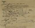 | Details | Anonymous | 1939 |
| Large fold-out tourist handbill with map Saint Augustine, Florida |
|
Anonymous |
|
| 1939 |
| LOC:0 |
| $0.00 | Anonymous | Large-fold-out-tourist-handbill-with-map-Saint-Augustine--Florida | SOLD<br></br>
Scarce tourists' handbill with a map from St. Augustine Florida, ca. 1938. On very thin paper almost certainly designed to be discarded, hence a rare survivor.
<br /><br />
Recto filled with information about points of interest on the map including the:
<div class="indenttextblocksingle">
<ul style="list-style-type: circle;">
<li>Fort Marion National Monument</li>
<li>Indian Burial Ground</li>
<li>Llambias House</li>
<li>Slave Market</li>
<li>Plaza de la Constitution</li>
<li>St. Augustine Ostrich-Alligator Farm</li>
<li>Marine Studios</li>
</ul>
</div>
Verso with facts and statistics about St. Augustine, and St. John's County, Florida. |
| 6823 |  | Details | Harris, Charles E. | 1939 |
| Rare Pictorial Map of Hyannis, Massachusetts Homes of Sea Captains in 1854 |
|
Harris, Charles E. |
|
| 1939 |
| LOC:87 |
| $395.00 | Harris--Charles-E- | Rare-Pictorial-Map-of-Hyannis--Massachusetts-Homes-of-Sea-Captains-in-1854 | A very rare unrecorded historical map of the village of Hyannis, Massachusetts in 1854 showing the locations of sea captains' homes. Copyrighted in 1939 by Dr. Charles E. Harris.
<br><br>
No copies are recorded in WorldCat, nor were any copies found online as of August, 2023.
<br><br>
Includes a alphabetical indexed table of names of sea captains tied numerically to locations Harris has identified on the map. A brief glance at the captains' names makes it apparent that command of Hyannis-based vessels during that time period was largely a familial occupation. Families with the most numerous seafarers included the surnames: Baker (10), Baxter (9) Bearse (23), Crowell (17), Hallett (22), and Lothrop (8). A legend above the table identifies each name with the type of maritime trade each captain was associated with: coastal, deep water, lighthouse service, canal boat, pilot, steamer, and living.
<br><br>
Dated January 1, 1939. Data collected and assembled by Dr. Charles E. Harris. Map courtesy of James F. McLaughlin C.E. Drawn by Walter M. Gaffney. |
| 5012 |  | Details | Atlantic Coastline Railroad Company | 1939 |
| Lot of 2 very rare Atlantic Coastline Railroad Florida Track Charts |
|
Atlantic Coastline Railroad Company |
|
| 1939 |
| LOC:0 |
| $950.00 | Atlantic-Coastline-Railroad-Company | Lot-of-2-very-rare-Atlantic-Coastline-Railroad-Florida-Track-Charts | Lot of two rare condensed books of profile maps, or track charts providing unique, detailed data for a cross-section of Florida traversed by the Atlantic Coastline Railway. The two books were intended for use only within the railway system and include:
<div class="indenttextblocksingle">
<ul style="list-style-type: circle;">
<li>Northbound and southbound mainline of the Atlantic Coast Line Railroad Company between Richmond, Virginia and Jacksonville, Florida.</li>
<li>Track charts of A. C. L. R. R. feeder lines including Dunnellon to Wilcox, Trilby to St. Petersburg, Uceta to Tampa, and other routes.</li>
</ul>
</div>
By the Office of the Chief Engineer for the Atlantic Coast Line Railroad Company ca. 1938. Profiles are printed via the cyanotype process (blueprint). Numerous manuscript edits in red to maintain track profiles and routes current over time.
<br></br>
Provides a mile by mile detailed record of the path of the A.C.L.R.R. as it made its way south along the Atlantic Coast region and within Florida, for the routes noted above. Most of the data provided in these profiles are unavailable elsewhere and include:
<div class="indenttextblocksingle">
<ul style="list-style-type: circle;">
<li>Track weight per linear foot and year track was laid</li>
<li>Milepost number</li>
<li>Direction of the line via compass heading for sub-segments of the line</li>
<li>Slope of the grade for each sub-segment</li>
<li>Details about every opening beneath the railway including drainage pipes, bridges, arches, and boxes</li>
<li>County boundaries</li>
<li>Town and village names</li>
<li>Locations of railway infrastructure (freight depots, passenger stations, and signals) </li>
</ul>
</div>
Charts are paginated in booklet format. Charts are blank on verso. |
| 6436 |  | Details | Monterey California Planning Commission | 1939 |
| 1939 Master Plan with 4 maps City of Monterey California |
|
Monterey California Planning Commission |
|
| 1939 |
| LOC:300 |
| $2,400.00 | Monterey-California-Planning-Commission | 1939-Master-Plan-with-4-maps-City-of-Monterey-California | A landmark in planning for the city of Monterey, California, an early master plan to conserve local historic buildings and landscape features. A significant feature of those conservation efforts was Emerson Knight's establishment of a Ring Route (Map D.) that “links together most of the historic houses and makes broad suggestions for street tree and vacant lot planting." [1]
<br><br>
Rare <b>Master Plan for the City of Monterey, California</b> published May 24, 1939 by the Monterey California Planning Commission. 31 pages and acknowledgements, five maps, (4 detached), more. 8 1/2" x 11". Leather-like embossed card cover, string binding.
<br><br>
Contents include text, 15 photographic images (high quality; one color), small format master plan for the City of Monterey regional sketch map. 8" x 5".
<br><br>
Back section with sleeve containing four separate detached folding maps by Emerson Knight, City Planning Advisor, in top unused condition on fine thin paper. Maps printed by Modern Printing Company, Monterey, CA:
<div class="indenttextblocksingle">
<ul style="list-style-type: circle;"></li>
<li>Map A. Conservation including protection of bay and beach frontage with proposed promenade. Emerson Knight. March 1939. 21" x 13". </li>
<li>Map B. Parks parkways and recreation showing publicly owned lands, all lands to be publicly acquired for parks, parkways, public buildings & streets also proposed promenade, bath house, and pedestrian ways. Emerson Knight. March 1939. 8" x 21". </li>
<li>Map C. Streets and highways existing traffic volumes proposed increase in traffic facilities. Emerson Knight. March 1939. 21" x 13". </li>
<li>Map D. Preservation of historic values including historic buildings and sites also showing historic ring route and proposed planting along course. Emerson Knight. March 1939. 21" x 13". </li>
</ul>
</div> |
| 5293 |  | Details | Brockway, George S. | 1940 |
| Promotional street map of Palm Beach Florida |
|
Brockway, George S. |
|
| 1940 |
| LOC:87 |
| $325.00 | Brockway--George-S- | Promotional-street-map-of-Palm-Beach-Florida | Promotional street map of Palm Beach, Florida from the Chamber of Commerce ca. 1940. A simplified map for visitors; limited in scope, this edition lacks detailed coverage of West Palm Beach and does not include either a key to street names or names of the inhabitants found in other similar maps by Brockway. Dated with reference to "Island no. 17" which is labeled "Pinner's Island" in Brockway's 1942 edition.
<br></br>
Verso is blank but with a blue ink stamp: "Courtesy of the Palm Beach Chamber of Commerce."
<br></br>
The map spans an area of southern Palm Beach from the Southern Boulevard Bridge (now Bingham Island Bridge) at north, past the Lake Worth Bridge, and terminating past the Lantana Bridge near the north corporate limits of Manalapan. By George S. Brockway, Engineer.
<br></br>
Features on the map include:
<div class="indenttextblocksingle">
<ul style="list-style-type: circle;">
<li>Lake Worth Municipal Golf Course</li>
<li>Phipps Ocean Park</li>
<li>Ibis Isle</br>
<li>Lake Worth Municipal Casino and Pool</li>
<li>South Ocean Club</li>
<li>WWPG radio broadcasting station</li>
<li>Island 17 and Island 18</li>
<li>Ambassador Hotel Villas</li>
<li>Hypoluxo Island</br>
</ul>
</div>
<br>
Two manuscript notations in pencil apparently for additions of Clifton and Corley Streets.
<br></br>
North oriented to right. Scale 1 inch = 1 mile. |
| 6868 |  | Details | Anonymous | 1940 |
| Pictorial Map Metropolitan Oakland California Pre-war |
|
Anonymous |
|
| 1940 |
| LOC:89 |
| $300.00 | Anonymous | Pictorial-Map-Metropolitan-Oakland-California-Pre-war | Scarce unattributed pictorial map of the metropolitan Oakland, California. Likely dates to circa 1940 based on the aircraft style in one of the photographic vignettes and the fact that the Oakland Bay Bridge, built 1936, appears on the map. Unsigned and undated. |
| 5226 |  | Details | Sonman Shaft Coal Company | 1940 |
| Unrecorded cyanotype map Sonman Mine Explosion Portage PA |
|
Sonman Shaft Coal Company |
|
| 1940 |
| LOC:62 |
| $0.00 | Sonman-Shaft-Coal-Company | Unrecorded-cyanotype-map-Sonman-Mine-Explosion-Portage-PA | SOLD<br></br>
Unrecorded cyanotype (blueprint) map of the Sonman Mine disaster in Portage Township near Portage, Pennsylvania. On July 15, 1940 sixty-three miners were killed as the result of a methane explosion in the Sonman "E" mine. Some of the miners suffocated slowly after the explosion; a few had time to write notes to their families before they expired.
<br></br>
The trace used for this blueprint map was produced by the Sonman Shaft Coal Company on July 31, 1940, a short two weeks after the explosion. From the presentation of the artifact, it was generated from the trace at some point after July 1940 (shows evidence the trace was torn and folded).
<br></br>
The map shows locations of the miners' bodies and notes numerous other items found and the status of the mine in many locations, all providing clues as to the cause of the explosion. Bodies of numerous mules are shown, a reminder of their importance in mining operations a bit more than eighty years ago.
Among the numerous notes are:
<div class="indenttextblocksingle">
<ul style="list-style-type: circle;">
<li>"8 sticks explosives undisturbed in box"</li>
<li>"2 shirts blown in bye not burnt"</li>
<li>"Hangers broken off. Trolley wire thrown on run-a-way switch lever considerable coke around lever"</li>
<li>"Distance from broken light to trolley wheel is 7.5 feet. Trolley was resting on sleeve..."</li>
<li>"C.H4 = 0.05 at cave" [CH4 is the chemical compound Methane]</li>
</ul>
</div>
Scale 1" = 100' . No. F-649. Drawn and traced 7-31-40 by J.M.B.
<br></br>
A cyanotype or blueprint map is produced by overlaying an inked trace map over a piece of specially treated blueprint paper and exposing to sunlight for up to 20 minutes. The paper is then washed, and any areas that have not been exposed to sunlight (like lines and print) wash clean, revealing the white base of the paper. All areas that were exposed to sunlight turn a shade of blue. |
| 5144 |  | Details | Zorsky, Joseph | 1940 |
| Map from Cactus Terrace Cottages First Motel in Key West |
|
Zorsky, Joseph |
|
| 1940 |
| LOC:11 |
| $0.00 | Zorsky--Joseph | Map-from-Cactus-Terrace-Cottages-First-Motel-in-Key-West | SOLD<br></br>
Map of the Florida Keys ca. 1940 from Cactus Terrace Cottages and Motel which was the first motel built in Key West, in the 1930's. The Cactus Terrace was located on Highway 1 across from the Catholic Church. With a larger scale inset map showing roads and location of the motel on the island of Key West.
<br></br>
In the 1930's Joseph Zorsky (1894 - 1971) founded the Cactus Terrace Motor Court on land that formerly contained Key West Mayor Walter Maloney's fruit orchard, as well as the historic Maloney House, built in 1854.. In 1971 Zorsky was killed during a robbery attempt and eventually the property was renamed Key Lime Village (now Key Lime Inn).
<br></br>
Verso with faint half-tone images of the hotel and properties which include an early bird's-eye photograph of the Cactus Terrace Motel and of "the largest collection of cactus east of the Mississippi." |
| 7865 |  | Details | Suchy, Arthur Bartholomew | 1940 |
| Stunning Map Cayo Hueso Key West Florida Collectors Edition |
|
Suchy, Arthur Bartholomew |
|
| 1940 |
| LOC:141 |
| $0.00 | Suchy--Arthur-Bartholomew | Stunning-Map-Cayo-Hueso-Key-West-Florida-Collectors-Edition | SOLD<br><br>
Large original Arthur Suchy pictorial birds-eye map of Cayo Hueso or Key West, Florida. Printed in black ink. Designed, executed, produced and first copyrighted by Arthur Suchy ca. 1938. Purchased from Suchy's estate liquidation. Watermarked "Linweave TEXT Made in USA". Rarely have we seen a map of this age in such pristine condition.
<br><br>
Suchy identifies alphabetically and numerically over 70 locations that surround the view including:
<div class="indenttextblocksingle">
<ul style="list-style-type: circle;"></li>
<li>Cigar factories</li>
<li>P.A.A. Airport</li>
<li>Turtle crawls</li>
<li>Fish market</li>
<li>Warbler (helpful tug)</li>
<li>Pepe's coffee shop</li>
<li>Delmonico's</li>
<li>Key West radio station</li>
</ul>
</div>
Arthur Bartholomew Suchy (1901 - 1995) produced two editions of his famous map of Cayo Hueso- this, the first larger-size Collectors Edition was produced in a limited quantity of 100 copies dated to 1940. As Suchy received orders for the maps he would hand color each map before shipment.
<br><br>
The second and smaller edition was printed in red ink to 1941. [1] Includes numerous historical notes about Key West.
<br><br>
Suchy was issued a copyright for the Collectors Edition on Dec. 14, 1938.
<br><br>
[1] David Rumsey Map Collection at Stanford University Libraries |
| 8088 |  | Details | Suchy, Arthur Bartholomew | 1940 |
| Stunning Map Cayo Hueso Key West Florida Collectors Edition |
|
Suchy, Arthur Bartholomew |
|
| 1940 |
| LOC:141 |
| $875.00 | Suchy--Arthur-Bartholomew | Stunning-Map-Cayo-Hueso-Key-West-Florida-Collectors-Edition | Large original Arthur Suchy pictorial birds-eye map of Cayo Hueso or Key West, Florida. Printed in black ink. Designed, executed, produced and first copyrighted by Arthur Suchy ca. 1938. Purchased from Suchy's estate liquidation. Watermarked "Linweave TEXT Made in USA". Rarely have we seen a map of this age in such pristine condition.
<br><br>
Suchy identifies alphabetically and numerically over 70 locations that surround the view including:
<div class="indenttextblocksingle">
<ul style="list-style-type: circle;"></li>
<li>Cigar factories</li>
<li>P.A.A. Airport</li>
<li>Turtle crawls</li>
<li>Fish market</li>
<li>Warbler (helpful tug)</li>
<li>Pepe's coffee shop</li>
<li>Delmonico's</li>
<li>Key West radio station</li>
</ul>
</div>
Arthur Bartholomew Suchy (1901 - 1995) produced two editions of his famous map of Cayo Hueso- this, the first larger-size Collectors Edition was produced in a limited quantity of 100 copies dated to 1940. As Suchy received orders for the maps he would hand color each map before shipment.
<br><br>
The second and smaller edition was printed in red ink to 1941. [1] Includes numerous historical notes about Key West.
<br><br>
Suchy was issued a copyright for the Collectors Edition on Dec. 14, 1938.
<br><br>
[1] David Rumsey Map Collection at Stanford University Libraries |
| 5250 |  | Details | Anonymous | 1940 |
| Cyanotype map of Annapolis, Maryland and Naval Academy |
|
Anonymous |
|
| 1940 |
| LOC:10 |
| $0.00 | Anonymous | Cyanotype-map-of-Annapolis--Maryland-and-Naval-Academy | SOLD
<br></br>
Rare anonymous blueprint or cyanotype map of Annapolis, Maryland. Coverage includes the Severn River, Spar Creek, College Creek and the grounds of the United States Naval Academy. Includes an area of "proposed extension of Academy grounds." Dated within to 1940.
<br></br>
Scale 1" = 2000 feet. Drawn by E.W.H. |
| 6405 |  | Details | Atherton, Jack Bonney | 1940 |
| Rare Original Historical Map of Haverhill Massachusetts LeBaron-Bonney |
|
Atherton, Jack Bonney |
|
| 1940 |
| LOC:77 |
| $750.00 | Atherton--Jack-Bonney | Rare-Original-Historical-Map-of-Haverhill-Massachusetts-LeBaron-Bonney | Fine original antique pictorial map of Haverhill, Massachusetts dated within to 1940. Map was compiled by the Haverhill Historical Society, copyrighted and published by the LeBaron-Bonney Company of Bradford, Mass.
<br><br>
Apparently quite scarce. WorldCat shows only one institutional holding, at the Peabody Essex Museum.
<br><br>
Inset key to 38 historical locations identified numerically on the map. Some of those 39 locations with historical significance are depicted in inset graphic sketches including Buttonwoods, the old covered bridge, Kimball Tavern, the old Haverhill Academy, John Ward house, and the first post office.
<br><br>
This pictorial or picture map of Haverhill was designed by Jack Atherton and printed on paper with a light brown tint. Lee (LeBaron) Atherton and Jack (Bonney) Atherton opened the LeBaron-Bonney Co. as a bicycle rental business on Cape Cod in 1938, and expanded into a direct mail business offering pictorial and historic maps. |
| 6412 |  | Details | Uren, Edward Clement | 1940 |
| Mining claim map Grover Murphy Nevada City California |
|
Uren, Edward Clement |
|
| 1940 |
| LOC:10 |
| $250.00 | Uren--Edward-Clement | Mining-claim-map-Grover-Murphy-Nevada-City-California | Plat map of the Grover Murphy Claims Nevada City, California from 1940 by Edward Clement Uren M.E. (1873 - 1861). The gold claim was near Indian Flat Road about 1.8 km WNW of Nevada City.
<br><br>
At upper left the circular professional stamp of Edw. C. Uren, Registered Civil Engineer.
<br><br>
Little is known about the life of E. C. Uren. In 1912 Uren quit his job as superintendent of the Champion mine in Nevada City, CA to start a practice as a civil and mining engineer. |
| 5349 |  | Details | Phelps, Donald | 1940 |
| Pre-WWII design and topographic layout for a system to protect airfields |
|
Phelps, Donald |
|
| 1940 |
| LOC:9 |
| $250.00 | Phelps--Donald | Pre-WWII-design-and-topographic-layout-for-a-system-to-protect-airfields | One-of-a-kind cyanotype or blueprint conceptual design document for a system of electrically-controlled hydraulic rams designed to protect airfields from unwanted landings.
<div class="indenttextblocksingle">
"Air field protection columns can be raised or lowered at will thus allowing landing of friendly planes, and within 1 or 2 minutes raised as protection against landing of enemy planes or gliders."
</div>
</br>
The blueprint includes a detailed design drawing of a single protection column and a topographic layout of the airfield protection system including the airfield protection columns, central control station, compressor pits and electrical control cables.
<br></br>
By Donald Phelps of Highland Park, Illinois. Dated September 7, 1940.
<br></br>
With a letter (and envelope) dated March 30, 1942 from Donald Phelps to the National Inventor's Council at the U.S. Department of Commerce seeking advice as to whether the system would be of value to the U.S. or British governments. Phelps was associated with the Phelps Agency, Steamship and Vessel Agents of Chicago, Illinois. |
| 6858 |  | Details | Graham County Arizona Chamber Commerce | 1940 |
| Pictorial Map of Gila Valley, Arizona |
|
Graham County Arizona Chamber Commerce |
|
| 1940 |
| LOC:89 |
| $315.00 | Graham-County-Arizona-Chamber-Commerce | Pictorial-Map-of-Gila-Valley--Arizona | Rare, humorous pictorial map of Gila Valley, Graham County, Arizona- The Valley of Smiles, circa 1940, drawn by artist Hal Empie. The map, on the verso of a folding brochure, shows pictograms reflecting Western culture all designed to attract visitors to the Gila Valley. At upper right the Gila Cliff Dwellings. Contains an interesting compass rose composed of Native American Indian Artifacts.
<br><br>
Towns included along Hwy. 70 as it follows the Gila River include: Bylas, Geronimo, Fort Thomas, Ashurst, Glenbar, Pima, Thatcher, and Safford, the seat for Graham County.
<br><br>
There were apparently two editions of this brochure, only one copy of the other (earlier ?) brochure with map was found online. No copy of this map or brochure found in WorldCat. |
| 488 |  | Details | Haffenreffer, R.F. | 1940 |
| Yachts by Herreshoff |
|
Haffenreffer, R.F. |
|
| 1940 |
| LOC:0 |
| $150.00 | Haffenreffer--R-F- | Yachts-by-Herreshoff | Promotional book by the Herreshoff Manufacturing Company, Bristol, Rhode Island ca. 1940. Contains eight color reproductions of America's Cup race winners built by Herreshoff, after drawings by R.F. Paterson. These classic vessels designed by Nathanael G. Herreshoff or W. Starling Burgess include the Vigilant, Defender, Columbia (2), Reliance, Resolute, Enterprise and Rainbow. A "Roll of Honor" for these successful America's Cup defenders on page 47 shows that the boats were owned by many of the business leaders of the early 20th century including Cornelius Vanderbilt, Vincent Astor, Alfred Sloan, J.P. Morgan, and Walter Chrysler, among others.
<BR> </BR>
With numerous other black and white photographs of Herreshoff-built boats and manufacturing processes. Contains plans and specifications on glassine paper for eight smaller Herreshoff one-design class offerings from 11 to 31 feet. Table of Contents and Registry of Owners.
<BR> </BR>
Number 8741 presented to J.G. Sheldon. 53 pages as issued. |
| 6614 |  | Details | San Francisco Harbor Commission Board | 1940 |
| Detailed Map of San Francisco Waterfront 1940 |
|
San Francisco Harbor Commission Board |
|
| 1940 |
| LOC:1403 |
| $650.00 | San-Francisco-Harbor-Commission-Board | Detailed-Map-of-San-Francisco-Waterfront-1940 | A 55 inch long detailed planning map of the Harbor of San Francisco, California dated 1940. Produced by the Board of State Harbor Commissioners for San Francisco Harbor, Frank White, Chief Engineer. Rare.
<div><img src="/ZoomifyImages/SC_6614/SC_6614_title_detail.jpg" alt="Close-up detail from the title of the Map of the Waterfront of San Francisco 1940 by SF Harbor Commissioners" width="300" align="center" style="margin: 20px 0px 20px 20px"/>
</div>
Documents harbor development in 1940 in minute detail. Coverage sweeps along San Francisco Bay from the South Basin westward and then northward past the Aquatic Park and Fort Mason. Delineates the extent of both the pier head line and the waterfront line. Details each wharf and shows measurements of every space along the waterfront with pier lengths and pier slip widths as well as the very extensive railroad yards and rail lines connected to each dock. Most of these railroad tracks do not exist today.<div><img src="/ZoomifyImages/SC_6614/SC_6614_wharf_detail.jpg" alt="Close-up detail of the waterfront piers near Fisherman's Wharf in San Francisco, California in 1940." width="300" align="center" style="margin: 20px 0px 20px 20px"/>
</div>
Photo-lithograph on a 55" long rolled sheet of thin translucent paper. |
| 6522 |  | Details | Cockrell, Monroe F. | 1941 |
| Cyanotype 1st ed Military Campaigns of Nathan Bedford Forrest |
|
Cockrell, Monroe F. |
|
| 1941 |
| LOC:130 |
| $375.00 | Cockrell--Monroe-F- | Cyanotype-1st-ed-Military-Campaigns-of-Nathan-Bedford-Forrest | Cyanotype or blueprint map - "The Military Campaigns of Nathan Bedford Forrest" based on Forrest's cavalry campaigns in Tennessee, Alabama and Mississippi during the Civil War. The map was copyrighted in 1907 and published by Monroe F. Cockrell in 1941. Cockrell developed the map originally in 1907 when he was at V.M.I. based on information on N.B. Forrest from John Allen Wyeth's Life of Forrest (1900). Drawn by Emery L. Ring. September 18, 1941.
<br><br>
Rare. Only one copy of this map found online and this, the earliest known edition. A later 1944 printed edition is found online with citation at lower right to R.S. Henry's 1944 work "First with the Most - Forrest". The citation is lacking in this 1941 edition.[1]
<br><br>
Nathan Bedford Forrest (1821- 1877) was a <strong>Confederate cavalry commander </strong>during the U.S. Civil War. "His command was responsible for the massacre of African American Union troops stationed at Fort Pillow, Tennessee, in April 1864, and he served as the first grand wizard of the Ku Klux Klan in the early years of Reconstruction." [2]
<br><br>
A similar cyanotype map by Cockrell on Stonewall Jackson is also found online- " The Military Campaigns of Stonewall Jackson based on Henderson's Life of Jackson. June 1, 1940. [1]
<br><br>
[1] Tennessee Virtual Archive. Online: https://teva.contentdm.oclc.org <br>
[2] Glaze, Robert L. Nathan Bedford Forrest Confederate general. Britannica. Online: https://www.britannica.com/biography/Nathan-Bedford-Forrest |
| 6591 |  | Details | Hayden, Walter Emmet | 1941 |
| Mono County Hayden Fishermans Paradise Map 1941 |
|
Hayden, Walter Emmet |
|
| 1941 |
| LOC:89 |
| $0.00 | Hayden--Walter-Emmet | Mono-County-Hayden-Fishermans-Paradise-Map-1941 | SOLD<br><br>
Early, scarce, 1941 edition of the Hayden Map Company's Fisherman's Paradise map for Mono County, California. Map # 818415. South oriented at upper left. Copyright 1941. Verso blank.
<br><br>
Shows numerous and substantial advertiser differences from the 1952/1955 edition at the Rumsey Map Collection and several topographic and road changes including but not limited to:
<div class="indenttextblocksingle">
<ul style="list-style-type: circle;">
<li>Lake Crowley covers a greater area in the 1941 edition, with the eastern portion of the lake extending past Chalk Bluff. Global warming? </li>
<li>In the 1955 edition Hayden extended map coverage to the northwest by approximately 4 miles and included Saddlebag Lake, perhaps to make room for additional advertisements.</li>
<li>The 1955 edition shows a new road linking U.S. 395 in the vicinity of Birchim Canyon to a feeder road and following the Owens River Road.</li>
<li>The 1955 edition no longer shows the road from rock creek Lake as extending along the Little Lakes Valley all the way to Lang Lake</li>
<li>In the 1955 edition upper right contains a price for the map of 25 cents, the price not included in the earlier edition.</li>
</ul>
</div> |
| 6638 |  | Details | G.M. Hopkins Co. | 1941 |
| Pictorial Map of the Southwest United States |
|
G.M. Hopkins Co. |
|
| 1941 |
| LOC:89 |
| $75.00 | G-M--Hopkins-Co- | Pictorial-Map-of-the-Southwest-United-States | A fine decorative pictorial map of the United States Southwest that plays to many of the stereotypes of the era for that region. One interesting feature near the center of Texas is a depiction of an airplane taking off from "West Point of The Air". West Point of The Air was the name of a 1935 American movie about pilot training at Randolph Field, about 15 miles northeast of San Antonio, Texas. Between October 1931 and March 1935, more than 2,000 candidates reported for pilot training at Randolph Field.
<br><br>
At upper right an inset "Transportation Map of the Picturesque Southwest. With legend showing routes used by aircraft, railroads, and automobile.
<br><br>
Anonymous author, but signed illegibly in the plate at bottom right.
<br><br>
Published in Picturesque Southwest by Picturesque Publications, November, 1941. |
| 8085 |  | Details | Beech-Nut Packing Company | 1941 |
| Persuasive Map of Beech Nut Gum Radio Advertising |
|
Beech-Nut Packing Company |
|
| 1941 |
| LOC: |
| $350.00 | Beech-Nut-Packing-Company | Persuasive-Map-of-Beech-Nut-Gum-Radio-Advertising | Unrecorded large-format persuasive advertising map of the United States issued by Beech-Nut for the 1941-1942 radio season, boldly presenting the company’s national broadcast coverage. The country is rendered in bright yellow, overprinted with station call letters in red, while surrounding text proclaims that Beech-Nut advertising combines Red, Columbia, Blue, and Mutual stations "not possible to obtain on any single network." The sheet emphasizes scale and power, noting 172 stations, 38 of them 50,000-watt outlets, and nearly 1,000 Beech-Nut Gum and Beechies ads every week. The result is a striking visual inventory of American radio geography on the eve of World War II.<br><br>
The language makes clear that this was not intended for the general public. Instead, it was designed to persuade wholesalers, grocery chains, druggists, and regional distributors that Beech-Nut’s campaign reached every part of the country at night when radio audiences were largest. By highlighting 50,000-watt clear-channel stations in red and stressing multi-network placement, the map argues that Beech-Nut’s coverage exceeds what any single network could provide. It is, in effect, a sales instrument aimed at convincing the trade that consumer demand was being nationally manufactured and that retailers should stock accordingly.<br><br>
As an artifact, the piece documents a transitional moment in American broadcast advertising, when sponsors strategically assembled cross-network station lists to maximize reach. The map translates invisible airwaves into cartographic form, making corporate media strategy tangible. Combining commercial ephemera with radio history, it stands as an unusual and compelling intersection of cartography, marketing, and early 1940s national media infrastructure. |
| 4993 |  | Details | Perone, Frank T. | 1941 |
| WWII FDR Patriotic Pictorial Map Photo with Perrone MS signature |
|
Perone, Frank T. |
|
| 1941 |
| LOC:0 |
| $125.00 | Perone--Frank-T- | WWII-FDR-Patriotic-Pictorial-Map-Photo-with-Perrone-MS-signature | One-of-a-kind WWII FDR patriotic pictorial map of the United States with creator's manuscript dedication and MS signature of Frank T. Perone. A photographic copy from the original. No other copy of this map was found.
<br></br>
Similar to, but different from, a 10" x 14" colored version of Perone's map published by Allied Printing of Atlantic City titled "Remember Pearl Harbor" (of which no known examples were found in institutional collections). Probably an earlier concept design by Perone.
<br></br>
Includes several scenes and features found in the (presumed later) colored version including the association of freedom, defense, and recovery with the initials FDR.
<br></br>
Differs from the colored version as follows:
<div class="indenttextblocksingle">
<ul style="list-style-type: circle;">
<li>Our map is not set upon a flag background, rather the flags appear at the image sides.</li>
<li>Our map shows FDR as a much older man, not the youthful FDR found in the colored version.</li>
<li>Our map shows engines and a top gunners-turret on the airplane.</li>
<li>Perhaps most interesting is our map includes an image of a four-finned rocket in flight that is missing from the colored version.</li>
</ul>
</div>
Copyright May 1, 1941; K 4907, 47908. |
| 6597 |  | Details | McClelland S.W. Kincaid R.L. et al | 1941 |
| Cyanotype (blueprint) map of the Route of Jefferson Davis in Spring 1865 |
|
McClelland S.W. Kincaid R.L. et al |
|
| 1941 |
| LOC:3 |
| $200.00 | McClelland-S-W--Kincaid-R-L--et-al | Cyanotype-(blueprint)-map-of-the-Route-of-Jefferson-Davis-in-Spring-1865 | Unrecorded and interesting cyanotype map of the route of Confederate General Jefferson Davis as he fled south after the Civil War from Charlotte, North Carolina to the city of Irwinville, Georgia where he hoped to escape to a foreign country. The map shows key rivers crossed and locations where Jefferson Davis stopped along the route.
<br><br>
Creators were Dr. S.W. McClelland, Dr. R.L. Kincaid, Dr. J.M. Nicholson, and C.P. Williams in August. 1941. This blueprint map is yet another scarce example of how an early photographic reproduction technology allowed individuals to disseminate their own unique works, bypassing traditional publishing technologies and institutions. |
| 6579 |  | Details | Deering, Roger L. | 1941 |
| Unrecorded pictorial map Portland Maine by Maine artist Roger Deering |
|
Deering, Roger L. |
|
| 1941 |
| LOC:3 |
| $575.00 | Deering--Roger-L- | Unrecorded-pictorial-map-Portland-Maine-by-Maine-artist-Roger-Deering | Unrecorded pictorial map of Portland, Maine copyrighted in 1941 by Maine artist Roger Deering.
<br><br>
Roger L. Deering (1904-1980) is best known for his paintings of Maine and is credited with creation of a series of small black and white prints for the Maine Bonding and Casualty Company of Portland, Maine.
<br><br>
Tri-fold brochure. Recto with text and black and white images explaining why the reader should "Make your headquarters in Portland". No reference found anywhere to "Playground Metropolis." |
| 6423 |  | Details | Suchy, Arthur Bartholomew | 1941 |
| Cayo Hueso or Key West Florida Second Edition |
|
Suchy, Arthur Bartholomew |
|
| 1941 |
| LOC:87 |
| $375.00 | Suchy--Arthur-Bartholomew | Cayo-Hueso--or-Key-West-Florida-Second-Edition | Stunning original second-edition pictorial birds-eye map of Cayo Hueso or Key West, Florida. Printed as designed in red ink. Designed, executed, produced and copyrighted by Arthur Suchy ca. 1941. Excellent detail on over 70 key locations that Suchy identifies alphabetically and numerically on a key that surrounds the view including:
<div class="indenttextblocksingle">
<ul style="list-style-type: circle;"></li>
<li>Cigar factories</li>
<li>P.A.A. Airport</li>
<li>Turtle crawls</li>
<li>Fish market</li>
<li>Warbler (helpful tug)</li>
<li>Pepe's coffee shop</li>
<li>Delmonico's</li>
<li>Key West radio station</li>
</ul>
</div>
Arthur Bartholomew Suchy (1901 - 1995) produced two editions of his famous map of Cayo Hueso- the first edition, larger and with full hand color was produced in a limited edition of 100 copies dated to 1940 and the second and smaller edition printed in red ink to 1941. [1] Includes numerous historical notes about Key West.
<br><br>
Suchy was issued a copyright for the collectors edition on Dec. 14, 1938. He filed a renewal application on Nov. 17, 1966.
<br><br>
[1] David Rumsey Map Collection at Stanford University Libraries |
| 4853 |  | Details | Hampton Yacht Club | 1941 |
| Hampton Yacht Club Regatta Cyanotype Map |
|
Hampton Yacht Club |
|
| 1941 |
| LOC:13 |
| $250.00 | Hampton-Yacht-Club | Hampton-Yacht-Club-Regatta-Cyanotype-Map | Unusual self-published cyanotype (blueprint) course map of the Hampton Yacht Club 14th Annual Regatta July 5 and 6 at Hampton, Virginia, complete with a sketch of an undulating sea serpent (rarely found on a cyanotype) and another small cartoon at the Hampton Bar. The course chart shows the coast outline with the offshore one-fathom line and the beacons and buoys marking the course.
<br></br>
This pre-war cartographic artifact is sold with two included documents:
<div class="indenttextblocksingle">
<ul style="list-style-type: circle;">
<li>A printed summary of the Regatta's sailing event with notes on prizes, courses, starting signals, rules for resolving protests, and a schedule of sailing events. For a map of the course the summary states: "See chart no. 400 and blueprint copies of part of the same which will be available at the clubhouse."</li>
<li> A one-page type-written set of Racing Rules for Warwick One Design Dinghies.</li>
</ul>
</div>Top left corner "H.K.S. 7/3/41" |
| 609 | 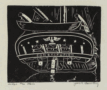 | Details | Bowling, Jack F. | 1942 |
| Under the Stern |
|
Bowling, Jack F. |
|
| 1942 |
| LOC:50 |
| $0.00 | Bowling--Jack-F- | Under-the-Stern | SOLD<br></br>
Original mid 20th-century nautical linocut print of the stern of the 18th century warship USS Constitution ( "Old Ironsides" ) by Admiral (USN retired) Jack Bowling. Signed by the artist. Probably pre 1942.
<br></br>
The Pennsylvania Historical and Museum Commission posts this brief biography of Admiral Bowling:
<dir class="indenttextblock">"Born in Bonham, Texas, Jack F. Bowling (1903-1979) graduated from the United States Naval Academy in 1927 and was named a Commanding Ensign in the United States Navy that same year. During World War II he served on the staff of Admiral King and also commanded the Anti-submarine Task Force in the North Atlantic from 1944-1945. Bowling graduated from the United States Naval War College in 1945, retiring from the Navy in 1947 with the rank of Rear Admiral. Prior to the War, Bowling had already achieved an international reputation as an engraver and printmaker. During the war, he taught himself the art of metal working and in 1958 became a silversmith in Philadelphia..."</dir> (Pennsylvania Historical and Museum Commission, 2013. "http://www.phmc.state.pa.us/bah/dam/mg/mg392.htm") |
| 610 |  | Details | Bowling, Jack F. | 1942 |
| Constitution |
|
Bowling, Jack F. |
|
| 1942 |
| LOC:0 |
| $0.00 | Bowling--Jack-F- | Constitution | SOLD
<br></br>
Original mid 20th-century nautical linocut print of the port bow of the 18th century warship USS Constitution ( "Old Ironsides" ) by Admiral (USN retired) Jack Bowling. Signed by the artist. Probably pre 1942.
<br></br>
The Pennsylvania Historical and Museum Commission posts this brief biography of Admiral Bowling:
<dir class="indenttextblock">"Born in Bonham, Texas, Jack F. Bowling (1903-1979) graduated from the United States Naval Academy in 1927 and was named a Commanding Ensign in the United States Navy that same year. During World War II he served on the staff of Admiral King and also commanded the Anti-submarine Task Force in the North Atlantic from 1944-1945. Bowling graduated from the United States Naval War College in 1945, retiring from the Navy in 1947 with the rank of Rear Admiral. Prior to the War, Bowling had already achieved an international reputation as an engraver and printmaker. During the war, he taught himself the art of metal working and in 1958 became a silversmith in Philadelphia..."</dir> (Pennsylvania Historical and Museum Commission, 2013. "http://www.phmc.state.pa.us/bah/dam/mg/mg392.htm") |
| 6516 |  | Details | Barnes, Myra Zimmerman | 1942 |
| Pictorial plan of New Orleans French Quarter of Vieux Carre |
|
Barnes, Myra Zimmerman |
|
| 1942 |
| LOC: |
| $375.00 | Barnes--Myra-Zimmerman | Pictorial-plan-of-New-Orleans-French-Quarter-of-Vieux-Carre | Very attractive lithographed pictorial map of the Vieux Carre (French Quarter) in New Orleans, Louisiana. Rolled with no folds. Barnes based the overall scope of her map and details on the walls surrounding the Vieux Carre on plans produced by surveyors Carlos Trudeau and Joseph Pilie from 1794 through 1808. Over this early framework Barnes has illustrated local architecture and history with elements of contemporary culture from the early 1940s .
<br><br>
The border is surrounded by vignettes of New Orleans and Louisiana history and culture as it existed in 1942 when Barnes created the map, as well as important key events such as two fires in 1788 and 1794 that destroyed many of the early wooden French structures in the city.
<div class="indenttextblocksingle">
<ul>
<li>The Southern Yacht Club</li>
<li>The Fairgrounds</li>
<li>The Bonnet Carre Spillway</li>
<li>Cutting sugar cane</li>
<li>Suicide Oak</li>
</ul>
</div> |
| 6488 |  | Details | Pittsburgh Sun Telegraph | 1943 |
| WWII Japanese Invasion Scare Map |
|
Pittsburgh Sun Telegraph |
|
| 1943 |
| LOC:90 |
| $0.00 | Pittsburgh-Sun-Telegraph | WWII-Japanese-Invasion-Scare-Map | SOLD<br><br>
Newsprint map published on August 22, 1943 by the Pittsburg Sun-Telegraph in the Pictorial Review section detailing potential Japanese war plans to attack the US mainland.
<br><br>
<div class="indenttextblocksingle">
<strong>"JAPAN EXPECTS TO WIND UP HER WAR</strong> with occupation of Western United States to the Rocky Mountains, and with capture of the Panama Canal and all of Central America. That is indicated by a 1941 Tokyo war map stolen by a Korean cabin boy from a Japanese army officer traveling as a tourist to the United States. The map is represented on two pages herewith."
</div>
<br>
Even before the attacks on Pearl Harbor in December, 1941, and on the Aleutian Islands in August, 1942 the Los Angeles Examiner published a pictorial map by Howard Burke that detailed a potential invasion strategy that tracked fairly well to Japan's early moves in the Pacific.
<br><br>
In August, 1943 the Pittsburg Sun-Telegraph Pictorial Review, along with other newspapers, published this map, supposedly stolen by a Korean nationalist agent Kilsoo Haan, in 1941. A very similar map actually had been published in Japan during 1935 and detailed a plan to invade the United States and to occupy the West Coast. Although American military intelligence discounted the possibility of a full-scale invasion by Japan, news outlets published the map playing on the invasion fears of the public.
<br><br> |
| 5384 |  | Details | G.M. Hopkins Co. | 1943 |
| Real Estate Plat-book of the City of Miami Beach Florida |
|
G.M. Hopkins Co. |
|
| 1943 |
| LOC: |
| $0.00 | G-M--Hopkins-Co- | Real-Estate-Plat-book-of-the-City-of-Miami-Beach-Florida | SOLD<br></br>
Rare real estate atlas or plat-book of the City of Miami Beach, Florida. Miami Beach was incorporated on March 26, 1915. The city is located on Florida's southeast coast in Miami-Dade county on natural and man-made barrier islands between the Atlantic Ocean and Biscayne Bay.
<br></br>
Index sheet and 26 linen-backed plat sheets each 34" W x 23" H.
<br></br>
Published during WWII (1943) by G. M. Hopkins Co. 328 Chestnut Street, Philadelphia, PA. Between 1870 and 1940, the G. M. Hopkins Co. produced more than 175 atlases and real estate plat maps including cities, counties, and townships in 18 different states and the District of Columbia. Revisions and additions to the atlases could be ordered from the G.M. Hopkins Company and then pasted over the original map plates. |
| 6547 |  | Details | Gist, Gilman Jr. | 1943 |
| A Soldier's Guide to Palo Alto Pictorial WWII Era Map |
|
Gist, Gilman Jr. |
|
| 1943 |
| LOC:300 |
| $1,250.00 | Gist--Gilman-Jr- | A-Soldier-s-Guide-to-Palo-Alto-Pictorial-WWII-Era-Map | <br><br>
<div class="indenttextblocksingle">
"This cartoon guide makes it as easy as "Squads Right" to find that <b>place</b> you're looking for and right here within reach of all. If you want to splurge or just "gold-brick" away an evening this will show you just what you want and how to get there."
</div>
<br><br>
Rare pictorial map of Palo Alto, California by Gilman A. Gist Jr. (d. 1960) published in a 1943 issue of the Stanford Chaparral. The Stanford Chaparral or <i>Chappie</i> is a humor magazine published by students of Stanford University since 1899, the third oldest continually published humor magazine in the world.
<br><br>
Inset maps of Menlo Park, El Camino Real, and a stretch of Bayshore Highway. Includes light-hearted images of area restaurants, clubs, theaters and other businesses that a WWII G.I. might want to visit while on leave, as well as transportation. These fine establishments include:
<div class="indenttextblocksingle">
<ul style="list-style-type: circle;"></li>
<li>Bill and Walt Collins Club</li>
<li>Fat Boy Barbecue</li>
<li>O'Neil's Stanford Bowl</li>
<li>Dinah's Shack - real suthen chicken!</li>
<li>Varsity Theater</li>
<li>Stanford Theater</li>
<li>Clarence's Smoke Shop</li>
<li>Grab-a-bite</li>
</ul>
</div> |
| 5027 |  | Details | Wholesale Radio Laboratories | 1943 |
| Radio Reference Map of the United States |
|
Wholesale Radio Laboratories |
|
| 1943 |
| LOC:11111 |
| $400.00 | Wholesale-Radio-Laboratories | Radio-Reference-Map-of-the-United-States | Interesting, large WWII-era (1943) map of monitoring stations and the territory of the nine radio call-sign zones that existed in the United States during that time. At bottom, the map is filled with four inset maps of the USA showing locations of broadcast stations for the chief networks of the period: The Blue Network, Mutual Broadcasting System, Columbia Broadcasting System (CBS), and National Broadcasting Company (NBC). Includes tables of radio-related data: List of Standard (AM) Broadcast Stations, World Leading Shortwave Stations, and Experimental Frequency Modulation (FM) Stations.
<br><br>
Published for Wholesale Radio Laboratories, by Omaha native Leo Meyerson (d. 2011) during WWII. Meyerson founded Wholesale Radio Laboratories in Council Bluffs, Iowa in 1935, later renamed 'World Radio Labs' after WWII, 'WRL Manufacturing' in 1953 and to 'Globe Electronics' in 1958 The company became one of the world's largest manufacturers and distributors of amateur radio equipment.
<br><br>
During WWII all amateur radio stations were forbidden to transmit, although shortwave listening was still permitted. After the war amateur radio broadcasts were permitted by the government. This probably explains why a slightly older post-war edition of this map from 1947, in the Rumsey Map Collection prominently features a photograph of Myerson in his very impressive radio 'shack' where the earlier edition does not.
<br><br>
Another interesting difference between the two editions is that here Meyerson's amateur call sign, or unique identifier, is W9GFQ, where in Rumsey's 1947 edition his call sign is W0GFQ. The system of amateur radio call districts in the United States originally started with nine districts. This changed to ten districts in 1947. The 10th call district, '0', was added to accommodate the increasing number of amateur radio operators in the Midwest, especially in the Chicago area. |
| 7963 | 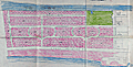 | Details | Sederlund, C. | 1944 |
| Map of the Cabanas Tract at Boca Raton Florida |
|
Sederlund, C. |
|
| 1944 |
| LOC:61 |
| $365.00 | Sederlund--C- | Map-of-the-Cabanas-Tract-at-Boca-Raton-Florida | Fascinating plat related to the development of Boca Raton, Florida south of the Boca Raton inlet in the immediate post-WWII era.
<br><br>
We offer an unrecorded tract map for the "Cabanas Tract Unit 1" in Boca Raton, Florida, located just south of the Boca Raton Inlet. Four major developers owned that land over time, Mizner, Geist, Schine, and Davis (1). Based on the plat's style and execution as well as street names, it seems that the Cabanas Tract plat is likely a J. Myer Schine proposed development plat dating between 1944 and 1956. (J. Meyer Schine purchased the Boca Raton Club and the Spanish River Land Co. in 1944.
He owned it until 1956, when Arthur Vining Davis/ Arvida acquired the property and associated land holdings.)
<br><br>
One interesting feature is that the lot sizes on the plat are much larger than those found in that area today. Also, the green area, likely a proposed park, does not exist. Today Spanish River Road (then Palm Drive) extends all the way from E. Camino Real to E. 31st Street.
<br><br>
Based on the scale the hand-colored portion of our Cabanas Tract encompasses approximately 130 acres and extends southward from Via Cabana Drive to Bel Air Road (Now SE 31st), street a distance about 3600 linear feet.
<br><br>
Drawn by C. Sederlund. Scale 1 inch = 200 feet.
<br><br> |
| 5194 |  | Details | Pitner, L. E. | 1944 |
| Illustrated Octovue Map on Pitner's Projection |
|
Pitner, L. E. |
|
| 1944 |
| LOC:53 |
| $350.00 | Pitner--L--E- | Illustrated-Octovue-Map-on-Pitner-s-Projection | Rare and unusual world map on the Pitner projection. First edition. Illustrated with hundreds of small drawings of flora, fauna, native tribes, buildings, transportation and landmarks. With 5 inset maps on the Mercator and other more common projections. Card covers with map still attached.
<br></br>
The Illustrated World Octovue Projection Edited by Harold B. Ward Ph. D. F.R.G.S. Designed and Published by L.E. Pitner 229 W. Mineral Street, Milwaukee, Wis. Copyright November 3, 1944 by L.E. Pitner
The Octovue map was one of the few maps to use the Pitner map projection. The Pitner projection is explained as:
<div class="indenttextblocksingle">
"The globe is divided into eight uniform spherical triangular sections: four North and four South of the equator…. each transposed onto a flat surface. … the first map ever made to transpose the round world onto a flat sheet without distortion or exaggeration of shapes, sizes, and distances."
</div>
An earlier version of the Pitner projection map was published in 1943 on a single-sided sheet as the "Air Age Octovue Map of the World". Again edited by Ward with a 1943 copyright by Pitner. That version of the map lacks the illustrations and some of the map elements from the verso of our map are on the recto of the 1943 version.
<br></br>
The Pitner projection was similar to the Lambert Azimuthal Equal-area projection.
<br></br> |
| 4806 |  | Details | Wilcox and Follett Co. | 1944 |
| Advertisement for Octovue Map on Pitner's Projection |
|
Wilcox and Follett Co. |
|
| 1944 |
| LOC:88 |
| $350.00 | Wilcox-and-Follett-Co- | Advertisement-for-Octovue-Map-on-Pitner-s-Projection | Scarce color brochure from 1944 explains and promotes Wilcox and Follet Co's Octovue map, their <b>New Air Age Educational -- Indispensable! WORLD MAP.</b> All on one single folding sheet printed front and back with 8 pages total in color. Folded size 5" x 8".
<br></br>
The Octovue map was one of the few maps to use the Pitner map projection. According to this brochure with the Pitner projection:
<div class="indenttextblock">
"The globe is divided into eight uniform spherical triangular sections: four North and four South of the equator…. each transposed onto a flat surface. … the first map ever made to transpose the round world onto a flat sheet without distortion or exaggeration of shapes, sizes, and distances."
</div>
<br></br>
Last page details what the U.S. Coast and Geodetic Survey in <i>Elements of Map Projections</i> consider to be the "Ideal Map" and provides reasoning for consideration of the Octovue map over all others.
<br></br>
Copyright 1944 by L.E. Pitner. Brochure edited by Harold B. Ward Ph.D. F.R.G.S. |
| 7974 | 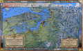 | Details | Kroll Map Company | 1944 |
| Evergreen Playground View of Pacific Northwest First State |
|
Kroll Map Company |
|
| 1944 |
| LOC:130 |
| $250.00 | Kroll-Map-Company | Evergreen-Playground-View-of-Pacific-Northwest-First-State | This pictorial map, titled The Evergreen Playground, (first state with the Tacoma Narrows Bridge lacking a deck) was published in 1944 by the Kroll Map Company of Seattle. It presents a detailed bird’s-eye view of western Washington, extending from Olympia and Tacoma northward through Seattle and Everett to Bellingham and Vancouver, B.C., and eastward to the Cascade Mountains. The map highlights major highways, railways, ferry routes, and points of interest, emphasizing the transportation network and recreational attractions of the Pacific Northwest at mid-century. Drawn by Ed Poland.
<br><br>
Insets along the borders depict regional scenery, industry, and Native American–inspired motifs. The lower right legend identifies the “Unequaled Transportation Facilities” that connect the area by train, highway, and ferry service. The title panel describes the region as unique in North America for combining sea, forest, and mountain environments within a compact area. Printed in full color with topographic shading and decorative borders, this map reflects the Kroll Company’s skill in cartographic illustration and mid-20th-century regional promotion.
<br><br>
Ed (Edwin) Poland was a long-time chief cartographer at the Seattle-based Kroll Map Company, active from at least the 1930s through the postwar era. Poland’s work for Kroll is characterized by dense place-name coverage, promotional vignettes, and clear drafting that made the firm’s Pacific Northwest maps popular for decades. |
| 6793 | 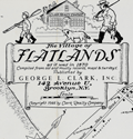 | Details | Nelson, Catherine and E. Theodore | 1944 |
| Pictorial, historical, advertising map of the Village of Flatlands in 1870 |
|
Nelson, Catherine and E. Theodore |
|
| 1944 |
| LOC:89 |
| $275.00 | Nelson--Catherine-and-E--Theodore | Pictorial--historical--advertising-map-of-the-Village-of-Flatlands-in-1870 | Fine historical pictorial promotional map of The Village of Flatlands, as it was in 1870 - compiled from "old and musty maps, records and surveys" by Catherine & Theodore Nelson. The map was commissioned, copyrighted, and published in 1944 by George L. Clark, Inc., "A complete real estate institution", 142 Avenue "U" Brooklyn, N.Y.
<br><br>
Rare. Only two copies recorded in WorldCat.
<br><br>
This historical map of Flatlands encompasses the area of Canarsie, extending eastward from Ocean Avenue to Fresh Creek and northward from Jamaica Bay to Hunters Fly Road. The map provides a detailed representation of the region, showcasing the names of various property owners, as well as the locations of important landmarks such as dams, hotels, schools, shops, public buildings, cemeteries, and churches. Additionally, the map also features the route of the Brooklyn and Rockaway Branch Railroad, which played a significant role in the development and connectivity of the area.
<br><br>
George L. Clark, Inc., formerly Clark Realty Co., is a family real estate firm founded in 1870 that spans five generations of Clarks. John J. Clark began the family business on Long Island in 1870. His son, Patrick L. Clark, relocated the business to Brooklyn in 1907. George L. Clark Sr. joined the family business in 1919 and served the Brooklyn community as a Realtor for 67 years. Clark was active on many New York real estate organizations and was President of the Brooklyn Board of Realtors, the Bay Ridge Real Estate Board and the Flatbush Real Estate Board.
<br><br> |
| 5357 | 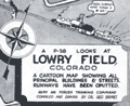 | Details | Grimes, George | 1944 |
| Pictorial map of Lowry Field Denver Colorado |
|
Grimes, George |
|
| 1944 |
| LOC:77 |
| $275.00 | Grimes--George | Pictorial-map-of-Lowry-Field-Denver-Colorado | A very scarce pictorial map of Lowry Field, at the eastern edge of Denver, Colorado, from the first issue of the Lowry Field Information Handbook [1] in November, 1944. Lowry field was activated in February, 1938 as the site of the Army Air Forces Training Command [2]. From the 1980’s, Lowry Air Force Base was one of Colorado’s largest employers. Lowry AFB employed nearly 10,000 military and civilian men and women, providing an economic impact annually approaching $1 billion [3].
<br></br>
<div class="indenttextblocksingle">
[1] Earliest publication was November, 1944 with a later edition of February, 1945. On the later map a telephone icon is added and locations of the telephone shelter house and telephone lounges are colored orange.<br>
[2] Information Handbook Lowry Field (AAF Training Command). Mountain States Telephone and Telegraph Company. Denver. 1944. Online.<br>
[3] https://wingsmuseum.org/about/history/. Online
</div> |
| 6795 |  | Details | Delkin, James Ladd | 1944 |
| WWII-era Map of San Francisco, California |
|
Delkin, James Ladd |
|
| 1944 |
| LOC:89 |
| $195.00 | Delkin--James-Ladd | WWII-era-Map-of-San-Francisco--California | Original WWII-era street map of San Francisco, California with sketches of local life including a cable car, a machine-gun emplacement near the Golden Gate Bridge, and a sailor carrying a duffel bag. War housing projects scattered across the city are outlined in red. The map was originally attached within a small brochure published ca. 1944 by James Ladd Delkin: "All About San Francisco, Illustrated Map and Guide."
<br><br>
Verso with a map of Golden Gate Park and Panhandle by the San Francisco Board of Park Commissioners Division of Engineering and Landscape Design.
<br><br>
During World War II, San Francisco experienced significant changes in its housing landscape to accommodate the needs of the military. The city experienced a surge in population due to the influx of military personnel and defense workers, leading to a severe housing shortage. To address the housing shortage, the federal government, in collaboration with local authorities, initiated several public war housing projects. Projects highlighted in red on this map include:
<div class="indenttextblocksingle">
<ul style="list-style-type: circle;">
<li>Hunters Point Annex: The Hunters Point Annex, located in the southeastern part of San Francisco near the Hunters Point Naval Shipyard, was a housing development constructed for defense workers. It provided temporary housing during the war years.</li>
<li>Sunnydale Housing Development: Situated in the Visitacion Valley neighborhood of San Francisco.</li>
<li>Potrero Terrace and Annex: Built in the Potrero Hill neighborhood of San Francisco. </li>
<li>Oakdale</li>
<li>Candlestick Cove</li>
</ul>
</div> |
| 6622 |  | Details | Sundberg, Edwin L. | 1944 |
| Thematic Map of the World's population WWII era |
|
Sundberg, Edwin L. |
|
| 1944 |
| LOC:300 |
| $125.00 | Sundberg--Edwin-L- | Thematic-Map-of-the-World-s-population-WWII-era | WWII-era thematic Coloroto (1) or color rotogravure map by Edwin Sundberg presenting statistics on the relative population density of the world's nations in 1944.
<br><br>
(1) Coloroto is a trade name for a rotogravure used to print multiple colors. According to Google a rotogravure printing system uses a rotary press with <b>intaglio cylinders</b>, typically running at high speed and used for long print runs of magazines and stamps. (Google Oxford languages dictionary. Online).
<br><br> |
| 6623 |  | Details | Sundberg, Edwin L. | 1944 |
| Thematic Map Pulse of the Nation for U.S. Death Rates |
|
Sundberg, Edwin L. |
|
| 1944 |
| LOC:300 |
| $0.00 | Sundberg--Edwin-L- | Thematic-Map-Pulse-of-the-Nation-for-U-S--Death-Rates | SOLD<br><br>
This colorful map presents statistics for the relative death rate by state for six diseases in 1942:
<div class="indenttextblocksingle">
<ul style="list-style-type: circle;"></li>
<li>Heart diseases</li>
<li>Cancer and other malignant tumors</li>
<li>Intracranial lesions of vascular origins</li>
<li>Nephritis</li>
<li>Pneumonia</li>
<li>Tuberculosis</li>
</ul>
</div>
A WWII-era thematic Coloroto (1) or color rotogravure map by Edwin Sundberg dated within to January, 1945. Legend at bottom right uses color to indicate the death rate for each U.S. state per 1,000 population. Boxes within each state show detailed statistic by disease.
<br><br>
(1) Coloroto is a trade name for a rotogravure used to print multiple colors. According to Google a rotogravure printing system uses a rotary press with <b>intaglio cylinders</b>, typically running at high speed and used for long print runs of magazines and stamps. (Google Oxford languages dictionary. Online).
<br><br> |
| 5220 |  | Details | Women's Army Corps | 1944 |
| Stand-up Poster for WAC Topographic Draftsman |
|
Women's Army Corps |
|
| 1944 |
| LOC:13 |
| $225.00 | Women-s-Army-Corps | Stand-up-Poster-for-WAC-Topographic-Draftsman | Among the key events impacting the women's movement was World War II. With men away at war, tens of thousands of women entered the workforce to meet the demands of the war for labor. Among the most well-known was "Rosie the Riveter". Here we might have an advertisement to fill the job of "Carrol the Cartographer".
<br></br>
A table-top, stand-up World War II recruitment poster printed on heavy card stock for the Women's Army Corps (WAC) depicting a woman drawing on a map with pencil and protractor. The job specialty promoted is Topographic Draftsman, part of the Army Ground Forces.
<br></br>
With a black ink over-stamp for the U. S. Army Recruiting Station, Room 217 New Post Office Building, Utica N. Y. Illustration is signed but unreadable. |
| 2539 |  | Details | Miller and Jones | 1944 |
| Map of New Orleans Storyville Jazz and Red-Light District |
|
Miller and Jones |
|
| 1944 |
| LOC:0 |
| $0.00 | Miller-and-Jones | Map-of-New-Orleans-Storyville-Jazz-and-Red-Light-District | SOLD<br></br>
Map of Storyville jazz and red-light district in the Faubourg Treme neighborhood of New Orleans, Louisiana. Redrawn from an earlier map. Storyville was a 38-block area of New Orleans in which prostitution was tolerated between 1897 and 1917. The streets bounding the Storyville district were Iberville, Basin, St. Louis, and North Robertson streets.
<br></br>
Redrawn by Paul Edward Miller and Richard M. Jones from an earlier edition. |
| 447 |  | Details | Justus, Roy Braxton | 1944 |
| Your fleet guarantees freedom (WWII lobby card) |
|
Justus, Roy Braxton |
|
| 1944 |
| LOC:0 |
| $0.00 | Justus--Roy-Braxton | Your-fleet-guarantees-freedom-(WWII-lobby-card) | <BR> </BR>
SOLD
<BR> </BR>
Medium-sized WWII Navy Day lobby card by Minneapolis Star editorial cartoonist Roy B. Justus (1901-1983). Titled "Your Fleet Guarantees Freedom. Navy Day, October 27, 1944" the item depicts a naval fleet and numerous aircraft circling the globe. No other examples of this smaller lobby card are found online but two larger format (28x40) posters are located in museums. This card was printed less than 4 months after the Allied forces landed in Normandy, France while the wars in Europe and Japan were still in progress. <BR> </BR>
Navy Day was first celebrated in 1922. October 27 was selected because it was the birthday of Theodore "Teddy" Roosevelt, President of the United States from 1901 - 1909.<BR> </BR>
At bottom: ORDER NO. 83 / NAVPERS-NRB-44115-6 SEP 44-90M. On medium-weight card stock. |
| 726 |  | Details | San Francisco Bar Pilots | 1944 |
| San Francisco Bar Pilots Tide Tables 1944 |
|
San Francisco Bar Pilots |
|
| 1944 |
| LOC:41 |
| $90.00 | San-Francisco-Bar-Pilots | San-Francisco-Bar-Pilots-Tide-Tables-1944 | Very cool pocket reference book issued by the San Francisco Bar Pilots in 1944, while the U.S.A. was still deeply involved in WWII. Card stock cover with photos of two of three pilot vessels working that port, both with sails: California #7, and the well-known schooner Gracie-S. #3. The Gracie-S was built by Union Iron Works of San Francisco and delivered to her original owners in December 1893 . She was 86 gross tons and 83 ft in length at the waterline, a rather large vessel for a pilot boat, but strong and comfortable with a total of twelve berths. This booklet shows she was still in service more than 50 years later. (Source: Pilots: Pilot Schooners of North America and Great Britain. Tom Cunliffe Ed. Wooden Boat publications. Brooklin, Maine. 2001. pp. 225-229.)
<br></br>
Contents include information on: sunrise and sunset times, pier locations in San Francisco, bridge heights, distances between ports, whistle calls and telephone numbers for harbor tug, tow boat, customs office, etc., names, addresses and home telephone numbers for all the bar pilots, tide tables, and a map at the center showing the channel back into San Pablo Bay and Suisun Bay.
<br></br>
The <a href="http://sfbarpilots.com/">San Francisco Bar Pilots web site</a> notes that the pilots of that organization have performed a demanding job guiding vessels in that challenging environment for more than 1.5 centuries:
<div class="indenttextblock">For more than 160 years, the San Francisco Bar Pilots have been guiding the world’s largest ships through some of North America’s most difficult waterways. Every day, the state-licensed Bar Pilots navigate commercial ships to and from the nine ports within San Francisco Bay and the Port of Monterey… With extreme care, the Bar Pilots deliver passengers, agricultural products, manufactured goods and hazardous materials throughout the Bay as far south as Redwood City, and as far inland as the Ports of Stockton and Sacramento.</div> |
| 4870 |  | Details | U.S. Navy Office of Naval Research | 1944 |
| WWII three-dimensional weather map training simulator. |
|
U.S. Navy Office of Naval Research |
|
| 1944 |
| LOC:0 |
| $300.00 | U-S--Navy-Office-of-Naval-Research | WWII-three-dimensional-weather-map-training-simulator- | From the U.S. Navy Office of Naval Research Special Devices Center, a set of three, three-dimensional pilot training weather simulators (Device 12-K-2a) produced during WWII. This device is noteworthy for its connection to Rear Admiral Luis de Florez (1889-1962) who established the Special Devices Desk at the U.S. Navy during WWII.
<br></br>
De Florez, an MIT graduate, was inducted into the Hall of Fame by the National Center for Simulation in 2014.
<div class="indenttextblocksingle">
"As both an active duty and a retired U.S. Navy Admiral, de Florez was influential in the development of early flight simulators, and was a pioneer in the use of virtual reality to simulate flight and combat situations in World War II."
<br></br>
"In 1941 ... Commander de Florez became head of the new Special Devices Desk in the Engineering Division of the Navy’s Bureau of Aeronautics. De Florez championed the use of synthetic training devices and urged the Navy to undertake development of such devices to increase readiness."
<br></br>
During World War II, he was subsequently promoted to captain and then to Flag rank, becoming a rear admiral in 1944.In 1944, de Florez was awarded the Robert J. Collier Trophy for 1943 for his work in training combat pilots and flight crews through the development of inexpensive synthetic devices. (https://www.simulationinformation.com/hall-of-fame/members/luis-de-florez)
</div>
<BR />
Set of 3 folding weather map models on heavy card stock that present a three-dimensional view of typical cyclonic storms:
<div class="indenttextblocksingle">
<ul style="list-style-type: circle;">
<li>Map 1. Early Stage of Development</li>
<li>Map 2. Cold-Front type occlusion</li>
<li>Map 3. Warm front type occlusion</li>
</ul></div>
Each model depicts a single storm through a series of eight slices or sections representing storm development across a front of 800 miles and a depth of 1000 miles at a single point in time. |
| 6765 |  | Details | St. Johns County Florida Chamber of Commerce | 1945 |
| St. Johns County blueprint style pictorial map |
|
St. Johns County Florida Chamber of Commerce |
|
| 1945 |
| LOC:89 |
| $0.00 | St--Johns-County-Florida-Chamber-of-Commerce | St--Johns-County-blueprint-style-pictorial-map | SOLD<br><br>Scarce ephemera. Interesting blueprint style pictorial map of St. John's County on the east coast of Florida. Drawn by Sam Hubbard. Issued by the St. John's County Chamber of Commerce ca. 1945. A broadside, on a larger sheet with printing on both sides 23" x 14". Contains a cute compass rose incorporating a fishing rod into the graphic.
<br><br>
<div id="6765" align="center">
<a title=""></a>
<img id="6765" src="/ZoomifyImages/SC_6765/SC_6765_400x300.jpg" alt=blueprint style pictorial map of St. John's County, Florida ca, 1965." width="300"/> <br><br> <font size="-2">Broadside with map of St. John's County, Florida.</font>
</div><br> |
| 5498 |  | Details | New Hampshire State Planning and Development Comm | 1945 |
| Ski Map or Poster for New Hampshire State |
|
New Hampshire State Planning and Development Comm |
|
| 1945 |
| LOC:150 |
| $275.00 | New-Hampshire-State-Planning-and-Development-Comm | Ski-Map-or-Poster-for-New-Hampshire-State | Decorative lithographed skiing map / poster of the State of New Hampshire published by the New Hampshire State Planning and Development Commission in 1945.
<br></br>
This medium-sized thematic pictorial poster of New Hampshire uses an unusual two-part icon design to signify locations in New Hampshire for skiing, snowmobiling (skimobile) and ice skating for these regions:
<div class="indenttextblocksingle">
<ul style="list-style-type: circle;">
<li>Monadnock Region</li>
<li>White Mountains Region</li>
<li>Dartmouth, Lake Sunapee Region</li>
<li>Lakes Region</li>
<li>Merrimack Region</li>
<li>Seacoast Region</li>
</ul>
</div>
The poster shows numerous, mostly small ski-areas, many no longer in operation including:<a href="http://www.nelsap.org/nh/epping.html" target="_blank">Epping Tow</a>, <a href="http://www.allroutes.to/berlin/skijump/" target="_blank">Nansen Ski Jump (Berlin, N.H.)</a>, and <a href="http://www.nelsap.org/nh/drummer.html" target="_blank">Drumalock Hill / Drummer Hill Tow (Keene, N.H.</a> and many more [1].
</br>
Recto contains text and statistics describing ski locations across the State of New Hampshire, organized alphabetically by town within region.
<br></br>
[1] New Hampshire's lost ski areas. Online. http://www.nelsap.org/nh/nh.html
<br></br>
[ NH ] |
| 7920 |  | Details | Motion Picture Industry Guide Service | 1945 |
| Star Home Map Beverly Hills |
|
Motion Picture Industry Guide Service |
|
| 1945 |
| LOC:131 |
| $170.00 | Motion-Picture-Industry-Guide-Service | Star-Home-Map-Beverly-Hills | Printed “Star Home Map” issued by the Motion Picture Industry Guide Service of Beverly Hills, identifying more than one hundred homes of motion-picture stars in Beverly Hills and the western Hollywood Hills. Numbered locations correspond to an index naming Clark Gable, Gary Cooper, Judy Garland, Tyrone Power, Loretta Young, and a young Elizabeth Taylor. Taylor’s inclusion—following her 1944 breakthrough in National Velvet—places this edition around 1944–45.
<br><br>
Printed in blue on yellow stock with whimsical patriotic artwork, the map reflects the early days of Hollywood tourism when visitors sought celebrity homes using printed street guides. An appealing survivor of mid-1940s film-era ephemera that captures the glamour and geography of the movie colony at its wartime peak.
<br><br>
Published by Motion Picture Industry Guide Service, Beverly Hills, California.
Ted Ambrose, Acting Director, Santa Monica Mountains Estate.
Issued under the auspices of I.S.O.M.P.A. (International Screen and Motion Picture Association). |
| 6565 |  | Details | Lockwood, Ward | 1945 |
| Scarce pictorial map of Taos New Mexico by Ward Lockwood |
|
Lockwood, Ward |
|
| 1945 |
| LOC:89 |
| $325.00 | Lockwood--Ward | Scarce-pictorial-map-of-Taos-New-Mexico-by-Ward-Lockwood | Scarce mid-century pictorial map of Taos New Mexico by Ward Lockwood. This fine, humorous map of Taos comprises three panels in a folding brochure issued by the Taos Chamber of Commerce circa 1945.
<br></br>
<div class="indenttextblock">
<img src="/ZoomifyImages/SC_6565/SC_6565_Title.jpg" alt="Pictorial map of Taos New Mexico by Ward Lockwood, 1945" width="300" align="left" style="margin: 0px 20px">
</div>
<br></br>
Taos artist Ward Lockwood (1894-1963) attended the University of Kansas. Based in Taos (NM), Lockwood taught at the University of Texas (1938-49) and UC Berkeley (1949-61). |
| 6520 |  | Details | MIT | 1946 |
| Campus map and handbook Massachusetts Institute of Technology |
|
MIT |
|
| 1946 |
| LOC:300 |
| $150.00 | MIT | Campus-map-and-handbook-Massachusetts-Institute-of-Technology | MIT campus map and handbook Massachusetts Institute of Technology. June, 1946. |
| 6497 |  | Details | Skacel, Bill | 1946 |
| Pictorial Cartoon map of Wyoming |
|
Skacel, Bill |
|
| 1946 |
| LOC:90 |
| $250.00 | Skacel--Bill | Pictorial-Cartoon-map-of-Wyoming | Original, uncommon pictorial map of the State of Wyoming by artist Bill Skacel. The humorous, historical "Cartoon Map of Wyoming" was produced ca. 1946 as a folded nine-panel tourist-oriented mailer with the verso containing space for an address as well as facts and photos of the state of Wyoming.
<br><br>
Geographic coverage includes the towns of Jackson Hole, Cheyenne, Laramie, Kemmerer, Casper, and Cody as well as Yellowstone National Park.
<br><br>
Skacel's illustrations include moose, a horned dinosaur, Buffalo Bill, two devils, and a native-American maiden with teepee.
<br><br>
Copyright by E.C. Kropp Co. Milwaukee, Wis. C.M. 27. |
| 6507 |  | Details | Skacel, Bill | 1946 |
| Pictorial Cartoon map of Vieux Carre New Orleans by Bill Skacel |
|
Skacel, Bill |
|
| 1946 |
| LOC:90 |
| $400.00 | Skacel--Bill | Pictorial-Cartoon-map-of-Vieux-Carre-New-Orleans-by-Bill-Skacel | Original, scarce pictorial map of the Vieux Carre or French Quarter in New Orleans, Louisiana by artist Bill Skacel ca. 1946. The humorous, historical "Cartoon Map of Vieux Carre in New Orleans" was produced ca. 1946 as a folded nine-panel tourist-oriented mailer with the verso containing space for an address as well as facts and photos of the New Orleans Vieux Carre.
<br><br>
Skacel takes a humorous angle at depicting Vieux Carre locations and culture in the post-WWII era. Two cartoon are puzzling- 1) four images of a young girl with pigtails wearing a sweatshirt bearing the letter "K" , that could possibly, represent a Catholic girl's school student or someone close to Skacel, and 2) at bottom right a matron crocheting a rug? with steel wire.
These cartoons include locations of:
<div class="indenttextblocksingle">
<ul style="list-style-type: circle;"></li>
<li>The Absinthe House, now the Old Absinthe House</li>
<li>Pirates Alley</li>
<li>Tabarry (Tabary) Theater</li>
<li>Napoleon House</li>
<li>A pelican</li>
<li>Blacksmith shop of Jean Lafitte</li>
<li>Cabildo prison</li>
</ul>
</div> |
| 6526 |  | Details | Skacel, Bill | 1946 |
| Pictorial Cartoon map of Florida Bill Skacel |
|
Skacel, Bill |
|
| 1946 |
| LOC:300 |
| $200.00 | Skacel--Bill | Pictorial-Cartoon-map-of-Florida-Bill-Skacel | Original, scarce pictorial map of the State of Florida by artist Bill Skacel ca. 1946. The humorous, historical cartoon map of Florida was produced ca. 1946 as a folded nine-panel tourist-oriented mailer with the verso containing space for an address as well as facts and photos of Florida
<br><br> |
| 5201 |  | Details | Barnes, Carroll | 1946 |
| Mt. Rainier National Park Willy Nilly Map |
|
Barnes, Carroll |
|
| 1946 |
| LOC:88 |
| $0.00 | Barnes--Carroll | Mt--Rainier-National-Park-Willy-Nilly-Map | SOLD<br></br>Pictorial mailer map of Mt. Rainier National Park from 1946, a Willy Nilly Map by C. Barnes, Cartographer. Locations on the map include Paradise Valley, Narada Falls, Longmire Springs, Yakima Park, Ohanapecosh and many more. Barnes also produced Willy Nilly mailer maps for Sequoia, Yosemite, and Yellowstone National Parks.
<br></br>
Sixty locations are listed in an index on the verso with numbers that correspond to locations on the map. Verso also with room for a mailing address and a stamp, which along with a closeable tab, turn the map into a large mailer.
<br></br>
Originally from North Carolina, Carroll Barnes (1906-1997) made his home in Three Rivers, California.
Barnes studied at Washington DC's Corcoran School of Art, and with Carl Milles in the Cranbrook Academy of Art in Bloomfield Hills, Michigan 'Barnes embarked on a 16 ½-foot-tall version of Paul Bunyan, a project which, interrupted by service in the Army, preoccupied him for seven years. Carved from a 2,000-year-old Sequoia tree, (over the actual time of 18 months) the mammoth statue gained distinction as the world’s largest wood carving and earned Barnes a legendary status among sculptors.' (Source Online: https://cranbrookartmuseum.org/artwork/carroll-barnes/) |
| 1010 |  | Details | U.S. Coast and Geodetic Survey | 1946 |
| Lakes Pontchartrain and Maurepas, Louisiana |
|
U.S. Coast and Geodetic Survey |
|
| 1946 |
| LOC:0 |
| $0.00 | U-S--Coast-and-Geodetic-Survey | Lakes-Pontchartrain-and-Maurepas--Louisiana | SOLD
<br></br>
Modern 70 year-old chart of South Louisiana focused on Lake Pontchartain and New Orleans. Key features are the chart's fine unblemished condition and the absence of the Lake Ponchartrain Causeway Bridge. A series of lighted bouys extends from the south shore in Metairie to the north shore near Mandeville. Little development shown in Metairie as expected.
<BR></BR>
Published in 1943 but this edition was published with corrections in 1946. |
| 6828 |  | Details | West, Beatrice | 1946 |
| Rare humorous pictorial map of Texas |
|
West, Beatrice |
|
| 1946 |
| LOC: |
| $0.00 | West--Beatrice | Rare-humorous-pictorial-map-of-Texas | Sold<BR><BR>Rare humorous pictorial map of Texas titled "The United States as seen through the eyes of Texas" by Beatrice West, Dallas, Texas. West's map depicts the State of Texas as occupying about a third of the area of the United States, with comic place names. The Pacific Ocean, Gulf of Mexico, and Atlantic Ocean are called Nimitz' River, Texas' Ocean, and Eisenhower's Lake respectively. Copyright 1946.
<br><br>
Only two examples of the map are recorded in WorldCat, one at LOC. No copies found on the Internet.
<br><br>
The Catalog of Copyright Entries shows an entry for January 28, 1947 at a size of 29 1/2 cm x 40 cm, precisely matching the dimensions of our example.
<br><br>
In 1948 West issued a similar copyrighted linen postal card containing significant changes in content, particularly in the text. (1)
<br><br>
Note: any fuzziness or misalignment in the displayed image is an artifact solely due to the joining of two photo images.
<br><br>
(1) Online. https://texashistory.unt.edu/ark:/67531/metapth121616/m1/1/ |
| 5002 |  | Details | Dolph, Frank B. | 1946 |
| Dolph's Subdivision and Zoning Atlas of Miami, Florida 1946 |
|
Dolph, Frank B. |
|
| 1946 |
| LOC:0 |
| $0.00 | Dolph--Frank-B- | Dolph-s-Subdivision-and-Zoning-Atlas-of-Miami--Florida-1946 | SOLD<br><br>
Dolph's Subdivision and Zoning Atlas of Miami, Florida. Includes Miami Shores Village, Biscayne Park, and El Portal. Published in 1946 by Frank B. Dolph Company 861 N.E. Third Street Fort Lauderdale and 307 N.W. Second Avenue, Miami, Florida. Includes a subdivision index and an index map to the City of Miami, Florida 1946.
<br></br>
Numerous manuscript updates, notations, and changes, along with a few pasted clippings and plans reflecting many years of productive use. Maps have been re-ordered but are all present.
<br></br>
Pages 1 - 48 all present. |
| 5324 |  | Details | Anonymous | 1947 |
| Birdseye view of Johnston Island Atoll Pacific Ocean |
|
Anonymous |
|
| 1947 |
| LOC:300 |
| $295.00 | Anonymous | Birdseye-view-of-Johnston-Island-Atoll-Pacific-Ocean | One of a kind humorous birdseye view of the U. S. base at Johnston Island (also Johnston Atoll) in the Pacific Ocean. The author was clearly a member of the U. S. Armed Forces, probably Navy ("X.O.","yeomen", "chief"), who created this view as a memento or souvenir for others. Focus is one the off-hour entertainment and leisure activities on the island: Johnston Island Little Theater, Officer's Club, Ear Banger's Bar and Grill, J.I. Distillery, fishing, hobby shop, etc.
<br></br>
The date of this item is unclear but probably from the years immediately after WWII. Shows the troops engaged in construction activities. Quonset huts, four-engine propeller driven aircraft, and an airstrip apparently not paved and requiring watering to reduce the dust. No trace of heavy armament, or mention of the enemy, which would surely have been a major concern in the middle of the Pacific Ocean. The Navy operated Johnston Island from 1934 to 1948 when the Air Force took over. The site was used for high-altitude nuclear tests in the 1950s and 1960s.
<br></br>
Reproduced with a diazo process. |
| 6832 |  | Details | Rentola, Esko | 1947 |
| Pictorial map of the Hood Canal Area |
|
Rentola, Esko |
|
| 1947 |
| LOC: |
| $700.00 | Rentola--Esko | Pictorial-map-of-the-Hood-Canal-Area | Rare pictorial map of the Hood Canal Area in Washington State by artist Esko Rentola. Rentola was closely associated with the Quilette Indian tribe and this map reflects this attachment.
<br><br>
Other maps by Rentola produced between 1957 and 1964 include Camano Island (1957), Forks Washington and Vicinity, West End Washington, and Grayland, North Cove, Tokeland, all approximately 13.5" x 17" in size.
<br><br>
Rare. None of Esko Rentola's maps, including this one, are referenced in WorldCat and only no reference to this map is found online. Dated to 1957 by comparison to the Camano Island map (online) with a similar float-line border and address. |
| 6863 |  | Details | Requa | 1947 |
| Very Rare Attractions Map of Florida |
|
Requa |
|
| 1947 |
| LOC:86 |
| $200.00 | Requa | Very-Rare-Attractions-Map-of-Florida | Fine lithographed pictorial map of Florida highlighting its numerous attractions and State Parks. Seems to be very scarce and generally unavailable.
<br><br>
Several of the attractions on the map have either been sold to developers, renamed, or closed. These include:
<div class="indenttextblocksingle">
<ul style="list-style-type: circle;">
<li>McKee's Jungle Gardens</li>
<li>Turner's Sunken Gardens</li>
<li>Ringling Art Museum</li>
<li>Marineland</li>
<li>Ravine Gardens</li>
<li>Oriental Gardens (closed in 1954)</li>
<li>Dupree Gardens</li>
<li>Everglades Reptile Gardens (now Everglades Wonder Gardens)</li>
</ul>
</div>
Lithographed and published by Macdonald Publishers of Tampa, Florida in 1947 two years before the establishment of the Florida Attractions Association (1949). |
| 4971 |  | Details | Withers, James Harlan | 1947 |
| Humorous map of Texas from a Texan perspective |
|
Withers, James Harlan |
|
| 1947 |
| LOC:63 |
| $700.00 | Withers--James-Harlan | Humorous-map-of-Texas-from-a-Texan-perspective | Scarce original blue-line, politically incorrect, map of the state of Texas from the 'humorously' distorted perspective of a Texan looking outward at the rest of the country. Believed to be the earliest recorded version of later similar 'humorous' maps of Texas inspired by Wither's design. Only one holding is found online, at the University of Texas, Arlington, where it is described:
<div class="indenttextblocksingle">
Map shows distortion of boundaries of the state of Texas in comparison to its U.S. neighbors with humorous bragging and derogatory relabeling. Relief shown by hachures. (Source: https://texashistory.unt.edu/ark:/67531/metapth252139/)
</div>
<br></br>
The Catalog of Copyright Entries for 1947 records a copyright for "A Texan's Map of U.S.A.", held by James Harlan Withers of San Angelo , Texas. Predates by two years the derivative but substantially different "A Texan's Map of the United States" by Frank Oliver published in 1949 for TexOak flooring.
<br></br>
The blue-line, or diazo process is a chemical method of document reproduction that fell out of use in the early 2000's. |
| 6702 |  | Details | Mathis, George | 1947 |
| Scarce pictorial map of the Feather River Basin |
|
Mathis, George |
|
| 1947 |
| LOC:87 |
| $325.00 | Mathis--George | Scarce-pictorial-map-of-the-Feather-River-Basin | A boomer-era 'cartogravure' of the Feather River Basin by George Mathis on the verso of a folding brochure for Gray Eagle Lodge in Blairsden, Plumas County, California. Dated within at 1955 in a hand-stamp on the recto. Coverage includes the Feather River, Long Lake, Gold Lake, Mud Lake, Smith Lake, Mt. Elwell, Frazier Falls, Mohawk Creek, Mills Peak and more.
<br><br>
The Feather River is a major river in Northern California, USA, with a length of about 71 miles. It is a tributary of the Sacramento River and is known for its scenic beauty, recreational opportunities, and historic significance.
<br><br>
During the California Gold Rush of the mid-19th century, the Feather River became an important source of gold. Miners used hydraulic mining techniques to extract gold from the riverbed, which caused significant environmental damage and siltation of the river. The discovery of gold in the Feather River contributed to the growth of several nearby towns, including Oroville and Marysville.
<br><br>
In the early 20th century, the Feather River became a focal point of water development projects aimed at supplying water to the growing population and agricultural needs of California. The Oroville Dam, completed in 1968, is the tallest dam in the United States and forms Lake Oroville, a major reservoir that stores water from the Feather River. |
| 6735 | 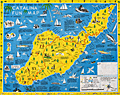 | Details | Ramsey, George | 1947 |
| Scarce pictorial fun map of Santa Catalina Island |
|
Ramsey, George |
|
| 1947 |
| LOC:89 |
| $295.00 | Ramsey--George | Scarce-pictorial-fun-map-of-Santa-Catalina-Island | <br><div class="indenttextblocksingle"><b>For a lasting remembrance of a grand vacation!</b> Keep this souvenir fun-map and mark the points you visit and the dates. Trace the routes of your travels on Catalina. Send copies to friends</div>
<br><br>
Where to go - What to see Santa Catalina Island fun map. A post-WWII pictorial map of Catalina Island, California. Copyright by George Ramsey. Published 1947 by Recreation Publishing Company, Los Angeles, CA. Price when issued 25 cents. Features include: Location of Ling-Ho Chinese junk movie set; Seal Rocks; submarine gardens; Chicago Cubs Ball Park and training grounds; the Catalina Visitors Country Club and much more.
<br><br>
Verso with map for Avalon Town |
| 7934 |  | Details | Ferran, Arch | 1947 |
| Humorous pictorial map of Concord, Massachusetts |
|
Ferran, Arch |
|
| 1947 |
| LOC:41 |
| $200.00 | Ferran--Arch | Humorous-pictorial-map-of-Concord--Massachusetts | This pictorial map of Concord, Massachusetts and Vicinity was created by Arch Ferran in 1947 and distributed as a complimentary map by the South Bridge Boat House, Inc. The design captures the charm of postwar New England tourism with stylized illustrations of landmarks, forests, and waterways surrounding Concord. The map celebrates both Concord’s rich Revolutionary War history and its literary heritage, presenting the town as a place of reflection, recreation, and natural beauty. Artistic vignettes of trees, bridges, canoes, and historic homes lend a storybook quality to the region’s geography.
<br><br>
The composition balances historic Concord’s landmarks—such as the Old North Bridge, the Minute Man Statue, and the Old Manse—with the scenic rivers and countryside that made the area famous among writers like Emerson and Thoreau. Roads radiate outward toward neighboring towns including Bedford, Carlisle, Sudbury, and Lincoln, creating a sense of exploration beyond Concord’s borders. The inclusion of small figures, animals, and recreational scenes reflects the local popularity of canoeing, hiking, and sightseeing, all centered on the South Bridge Boat House, a long-standing hub for outdoor activities on the Assabet and Sudbury Rivers.
<br><br>
At the upper right, the cartographer cleverly distinguishes True North and Magnetic North, acknowledging the map’s playful yet practical intent. The legend identifies key cultural and natural attractions, helping tourists locate historic homes, churches, and mills. Issued at a time when automobile tourism was flourishing, this map served both as a navigational aid and as a souvenir, capturing mid-century nostalgia for Concord’s enduring role in America’s founding and literary imagination.
<br><br> |
| 5399 | 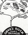 | Details | Michaels, Lawrence | 1947 |
| Map of the Halifax River Port Orange Florida Dave's Dock |
|
Michaels, Lawrence |
|
| 1947 |
| LOC:11 |
| $195.00 | Michaels--Lawrence | Map-of-the-Halifax-River-Port-Orange-Florida-Dave-s-Dock | Rare map of the Halifax River area near Port Orange, Florida ca. 1947. The map is on the verso of a folding postal card featuring Dave's Dock (currently Aunt Catfish's since ca. 1979), about five miles south of Daytona, Florida. Unfolds to 3.5" x 11".
<br></br>
In addition to channels and fishing areas, noted features on the chart include:
<div class="indenttextblocksingle">
<ul style="list-style-type: circle;">
<li>Location of the old Port Orange Bridge.</li>
<li>Pelican Island</li>
<li>Freeman Oyster bar</li>
<li>Rose Bay</li>
<li>Wilbur Bay</li>
<li>Daggett's Island</li>
<li>Peter Johnson's Point</li>
<li>Fozzard, Sutton, Sharpe's and Mill's Creeks</li>
<li>Half Dollar Island</li>
</ul>
</div>
Dave’s Dock was built before 1938. Lawrence “Mike” Michaels, bought Dave’s Dock in the mid 1940's and retained ownership until 1959. Front of the card shows fishing and pleasure boats tied up at Dave's 600' long dock and a Coca Cola sign on the front of the office.
<br></br>
Name the owner was modified to read " L. Michaels" on the camera-ready copy by a quick 'copy and paste' before printing. That must mean that this is a second edition of Dave's Dock card. The scene shown may reflect a much earlier date, perhaps as early as 1938 when the dock was first built. |
| 6465 | 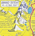 | Details | Lindgren, Jolly | 1948 |
| Pictorial map of the Jackson Hole country and Grand Teton National Park |
|
Lindgren, Jolly |
|
| 1948 |
| LOC:90 |
| $600.00 | Lindgren--Jolly | Pictorial-map-of-the-Jackson-Hole-country-and-Grand-Teton-National-Park | "A hysterical map of the Jackson Hole country and Grand Teton National Park slightly cockeyed" a fine pictorial map of the area around Jackson Hole, Wyoming. "Made on purpose" by artist Jolly Lindgren, Spokane, Washington.
<br><br>
In addition to numerous mountains identified by name and height Lindgren's many features include Jackson Lake, Jenny Lake, Jackson Hamburgers, Resor Ranch, Church of the Transfiguration, the Federal Elk Refuge, and numerous dude ranches identified by large western-style hats. |
| 5251 |  | Details | Hutson, H.H. | 1948 |
| Humorous map of the world from a Texans perspective |
|
Hutson, H.H. |
|
| 1948 |
| LOC:200 |
| $125.00 | Hutson--H-H- | Humorous-map-of-the-world-from-a-Texans-perspective | A humorous map of the world explained by pictorial illustrations related to Texas features and exaggerations. Distributed as a paper placemat for Long Champ restaurant in Amarillo, Texas - Homer Rice, Owner. Copyright 1948 by H.H. Hutson. Only one recent sale recorded, scarce. |
| 2505 | 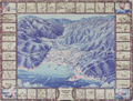 | Details | Lister, James Wren | 1948 |
| Pictorial map of Avalon Town on Catalina Island, California |
|
Lister, James Wren |
|
| 1948 |
| LOC:0 |
| $0.00 | Lister--James-Wren | Pictorial-map-of-Avalon-Town-on-Catalina-Island--California | SOLD<br></br>
Very cool pictorial mid-century birds-eye view of the town of Avalon on Catalina Island off the coast of Los Angeles, California. This original view of Avalon contains numerous named roads including Pebbly Beach Road, Wrigley Road, Chimes Road, Whittley Ave., and Metropole. Key facilities noted include a casino; Chimes Tower; the steamer pier and pleasure pier; Christian Science Church; country club; bird park; ballpark; and post office. Map is surrounded by vignettes typical to the area including ships, flying fish, a seaplane, and numerous recreational activities.
<br></br>
Verso contains a two-page directory of Catalina island businesses with telephone numbers and a large map of the entire island of Santa Catalina, CA. A sampling of the businesses listed includes: "Archie's Sip and Bite", "Scari's Cocktail Lounge", "Amphibian Air Transport", "Las Casitas Bungalows" and "Catalina Pin-Ups". The town directory is surrounded by small images of the signs of local business.
<br></br>
James Wren Lister (1897-1952) was born in England but settled in Los Angeles in 1925. Published by the L.C.B. Co. P.O. Box 146, Avalon, California. |
| 4711 | 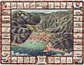 | Details | Lister, James Wren | 1948 |
| Avalon, Catalina Island, California Pictorial Map |
|
Lister, James Wren |
|
| 1948 |
| LOC:88 |
| $0.00 | Lister--James-Wren | Avalon--Catalina-Island--California-Pictorial-Map | SOLD
<br></br>
Very cool pictorial mid-century birds-eye view of the town of Avalon on Catalina Island off the coast of Los Angeles, California. This original view of Avalon contains numerous named roads including Pebbly Beach Road, Wrigley Road, Chimes Road, Whittley Ave., and Metropole. Key facilities noted include a casino; Chimes Tower; the steamer pier and pleasure pier; Christian Science Church; country club; bird park; ballpark; and post office. Map is surrounded by vignettes typical to the area including ships, flying fish, a seaplane, and numerous recreational activities.
<br></br>
Verso contains a two-page directory of Catalina island businesses with telephone numbers and a large map of the entire island of Santa Catalina, CA. A sampling of the businesses listed includes: "Archie's Sip and Bite", "Scari's Cocktail Lounge", "Amphibian Air Transport", "Las Casitas Bungalows" and "Catalina Pin-Ups". The town directory is surrounded by small images of the signs of local business.
<br></br>
James Wren Lister (1897-1952) was born in England but settled in Los Angeles in 1925. Published by the L.C.B. Co. P.O. Box 146, Avalon, California. |
| 945 |  | Details | Lister, James Wren | 1948 |
| Pictorial map of Avalon Town |
|
Lister, James Wren |
|
| 1948 |
| LOC:0 |
| $0.00 | Lister--James-Wren | Pictorial-map-of-Avalon-Town | SOLD but see another example now in stock.<br></br>
Interesting pictorial 40's birds-eye view of the town of Avalon on Catalina Island. |
| 6450 |  | Details | Gluck, Jay | 1948 |
| Cartoon cutaway view of UC Berkeley dormitory life |
|
Gluck, Jay |
|
| 1948 |
| LOC:1 |
| $1,000.00 | Gluck--Jay | Cartoon-cutaway-view-of-UC-Berkeley-dormitory-life | With the premiere of the IMAX biopic "Oppenheimer" (1) less than one week away (7/18/2023) we offer "Oppy's Flop House", a rare and culturally insightful 1948 cartoon cutaway elevation view of a dormitory at the University of California at Berkeley, where Oppenheimer taught physics from 1929 to 1943.
<br><br>
<div id="0" align="center">
<a title=""></a>
<img id="6450" src="/ZoomifyImages/SC_6450/SC_6450_detail_1.jpg" alt=" Rare, culturally insightful 1948 cartoon cutaway elevation view of a dormitory at the University of California at Berkeley, where Oppenheimer taught physics from 1929 to 1943." width="300"/> <br><br> <font size="-2">Oppy's Flop House- Oppenheimer Caricature Detail</font>
</div><br>
Oppy's Flop House was published in the 1948 annual "Mad Engineer" issue of "California Engineer", a student publication of the University of California at Berkeley.
<br><br>
The title "Oppy's Flop House" refers to Robert Oppenheimer [2], one of the key researchers on the Atomic Bomb that had been dropped on Japan less than three years earlier. Cartoons and sight gags include a slide rule used as a fishing device and as a guitar, chem lab equipment used to brew coffee, students using radar to peer into the room of a bathing coed, a robot, a device based on compressed air to raise the skirts of coeds, and many scenes that include engineering book gags.
<br><br>
[1] https://www.oppenheimermovie.com/<br>
[2] Physicist <strong>Robert Oppenheimer</strong> (1904-1967) was Project Director for the <strong>Manhattan Project</strong>. Oppenheimer taught at UC Berkeley from 1929 - 1943. "With the rise of the Nazi party in Germany, the University quickly became a hub for atomic weapons development. By the outbreak of World War II, Oppenheimer, his students, and several notable physicists probed atomic theory on the top floor of Le Conte Hall." |
| 6525 |  | Details | Lindgren, Jolly | 1948 |
| Pictorial hysterical puzzle map of Utah and parks |
|
Lindgren, Jolly |
|
| 1948 |
| LOC:300 |
| $175.00 | Lindgren--Jolly | Pictorial-hysterical-puzzle-map-of-Utah-and-parks | Unused pictorial puzzle map of the State of Utah- "A hysterical map of Utah which includes Zion, Bryce Canyon, Cedar Breaks & Stinking Springs". "Made in broken English" by artist Jolly Lindgren, Spokane, Washington. Includes the original puzzle mailer with a transparent front. Lindgren-Turner Company.
<br><br>
A humorous tourist-oriented puzzle featuring the State of Utah and many of its numerous natural attractions including:
<div class="indenttextblocksingle">
<ul style="list-style-type: circle;"></li>
<li>Dinosaur National Monument</li>
<li>Zion National Park</li>
<li>Bryce Canyon</li>
<li>Escalante Desert</li>
<li>Natural Bridge</li>
<li>Arches National Monument</li>
<li>Skull Valley</li>
<li>Canyon de Chelly, Arizona</li>
</ul>
</div> |
| 8079 |  | Details | Sink, John | 1948 |
| Scarce pictorial map of western North Carolina |
|
Sink, John |
|
| 1948 |
| LOC:41 |
| $450.00 | Sink--John | Scarce-pictorial-map-of-western-North-Carolina | Western North Carolina: a vacationist's map and guide is a colorful mid-20th century pictorial map ca. 1948 illustrated by John Sink, a commercial artist known for lively regional tourist imagery. The map presents the Blue Ridge and Great Smoky Mountains as a continuous mountain chain extending from the Tennessee line eastward across western North Carolina ending at the Sauratown Mountains with Hanging Rock State Park.<br><br>
Peaks, gaps, and valleys are shown in bold, sculptural relief, while towns such as Asheville, Boone, and Bryson City anchor the geography. Cartoon figures hiking, skiing, fishing, and sightseeing animate the landscape, emphasizing recreation and leisure ("The Fun") rather than precise navigation.<br><br>
Designed as both a guide and a promotional image, the map combines expressive illustration with practical travel information. Major highways and scenic routes, including the Blue Ridge Parkway, trace the mountain ridges, while airplanes, automobiles, and roadside signage reflect the postwar rise of leisure travel by car and air. An inset conventional road map ("The Hiways") at lower right shows a detailed network of highways serving western North Carolina, reinforcing the sheet's function as both a souvenir image and a usable tourist guide.
<br><br>Text on verso with twelve proposed routes for scenic tours throughout the region. |
| 5422 |  | Details | Douglas, Jack | 1948 |
| Rare blueprint prospectors map of California gold lodes |
|
Douglas, Jack |
|
| 1948 |
| LOC:90 |
| $550.00 | Douglas--Jack | Rare-blueprint-prospectors-map-of-California-gold-lodes | Very rare cyanotype (blueprint) self-published gold mining map of California by Jack Douglas (d. 1956)- "The Old Prospector's Lode Map of California." At a scale of one inch = 32 miles the map shows areas in California known to have produced gold, shown as shaded areas.
<br></br>
The map includes crude decorative images of gold panning equipment and of an old prospector at work. At bottom left a list of other gold lode district maps for sale at $1.00 each includes Alaska, Arizona, British Columbia, Idaho, Montana, Nevada, New Mexico, Oregon, Utah, Washington, and Wyoming. These could be purchased along with blueprint assembly instructions for mining equipment by Jack Douglas at Box 21, Dutch Flat, California.
<br></br>
No holdings found in WorldCat and no mention of the map is found online.
<br></br>
Text at right discusses gold mining in several California mining districts. Verso is blank. Map no. 153.
<br></br>
Jack Douglas was the founder of the United Prospectors Organization (1947), originally targeted at professionals who made their livelihood by prospecting and mining. Douglas published a journal- Panning Gold- the first issue of which was issued in 1947. United Prospector's was incorporated on November 29, 1949 with Jack Douglas as President. Other officers at the time of incorporation included Walter Robertson, Stockton, CA; Tylar Jack, Reedy, CA; Speed Freeman, Olympia Field, IL; Louis Borde, Eugene, OR; Harold Mitchell, Umatilla, OR; and Glen Houston, Lodi, CA. Today UPI is "the oldest gold, gems, and minerals prospecting group of its kind."
<br></br>
<div>
<img src="/ZoomifyImages/SC_5422/Doodle_Bug.jpg" alt="" width="200" align="left" style="margin: 0px 10px"/>
<span style="vertical-align: middle;">
Note: Price includes an additional rare blueprint (shown here) for Jack Douglas' "Doodle Bug" wet concentrator. Copyright 1944.
</span>
</div>
<br></br> |
| 6695 |  | Details | Sink, John | 1949 |
| Pictorial Map Eastern North Carolina Vacationist's Guide Sink |
|
Sink, John |
|
| 1949 |
| LOC: |
| $0.00 | Sink--John | Pictorial-Map-Eastern-North-Carolina-Vacationist-s-Guide-Sink | SOLD<br><br>Rare and nicely lithographed folding pictorial map "Eastern North Carolina Vacationist's Guide" by John Sink ca. 1949. Also, Sink is credited with a similar map: "Western North Carolina and vacationists map and guide."
<br><br>
WorldCat records only five institutional holdings of this map.
<br><br>
Very interesting pictorial map. On the verso the description of some of the coast's less well-travelled areas is priceless.
<br>
<div class="indenttextblocksingle">
"Down the Outer Banks of North Carolina, from junction of road with US 158 to Hatteras. 60 miles. This tour is recommended for the adventurous and only the <b>good sand driver</b> should attempt it in his own car. Much of the route is without benefits of highways, and often the inexpert driver is <b>stalled in the sand.</b> Generally, best driving is on the beach at low tide (it should not be attempted on an incoming tide). All the villages are on the Sound side, however, and to reach them, motorists must drive across the top of the beach, usually through soft sand. Take a can of extra water... There are coast guard stations along the way where help may be obtained. There are no facilities or dwellings between villages."
<br><br>
" ... junction of a paved road (L) with US 158 at the so-called Whalebone site. Turn left on this road which is paved for only a mile, and down either the "inside" set of sand ruts or the beach. The route runs along an undeveloped beach section, with here and there the remains of old wrecks. At 05.0 on R is Bodie Island (pronounced body) lighthouse. It first was erected in 1848, rebuilt in 1859 and destroyed during the Civil War. While the present tower was under construction five sailing vessels were wrecked on the beach. Rebuilt in 1872, the structure is 162 feet high, has a 160,000 candlepower beam visible 19 m. "
</div>
<br> |
| 5272 |  | Details | Bennett, Philip A. | 1949 |
| Earliest U.S. Government map television stations and networks |
|
Bennett, Philip A. |
|
| 1949 |
| LOC: |
| $1,250.00 | Bennett--Philip-A- | Earliest-U-S--Government-map-television-stations-and-networks | The earliest official large-format map of U.S. television stations and networks from the infancy of TV advertising. By U.S. Department of Commerce Industrial Economist Philip A. Bennet and printed by the U.S. Coast and Geodetic Survey in July, 1949. At the time of publication in 1949 the map clearly shows that numerous states were without a single operating TV station including: Nevada, Idaho, Montana, Colorado, Kansas, North Dakota, South Dakota, Nebraska, South Carolina, Vermont, New Hampshire, and Maine.
<br></br>
This map is scarce outside of institutional holdings. No copy of the map or record of the sale of this television map is found online. Price when issued 35 cents.
<br></br>
In January 1948, less than 200,000 TV sets existed in the U.S. This map documents the early distribution of broadcast TV stations, pre-dating the phenomenal growth of the industry. The map was and is important because the geographical distribution of TV stations impacted the size of the television market while TV networks served to lower the cost of content production.
<br></br>
Shows the 75 existing and 42 prospective analog broadcast television stations and <b>network routes</b> in the United States. Compiled and printed by the U.S. Coast and Geodetic Survey (Department of Commerce) to the specifications of Philip A. Bennet, General Products Division of the Office of Domestic Commerce.
<br></br>
See also Gould in NYT: https://timesmachine.nytimes.com/timesmachine/1949/04/24/93542916.html?pageNumber=299 |
| 6428 |  | Details | Anonymous | 1949 |
| Cartoon map of UC Berkeley engineering underground radiation nuclear laboratory |
|
Anonymous |
|
| 1949 |
| LOC:300 |
| $850.00 | Anonymous | Cartoon-map-of-UC-Berkeley-engineering-underground-radiation-nuclear-laboratory | Original centerspread 1949 cartoon pictorial map, "Underground Campus", the campus of the University of California Berkeley, specifically the engineering underground tunnels and facilities including the Radiation Lab. Scientists at the UC Radiation Laboratory, now the Lawrence Berkeley National Laboratory, discovered berkelium (atomic number 97) in 1949 using a 60-inch cyclotron.
<br></br>
<div id="3" align="center">
<a title="California Engineer smoking weed?"></a>
<img id="3" src="/ZoomifyImages/SC_6428/SC_6428_SmokingWhat.jpg" alt="Early depiction of a Berkeley Engineer with roach clip." width="240"/>
</div><br>
The California Engineer began in 1903 as the California Journal of Technology. It was the first college magazine in the west to specialize in the area of science and technology. In January, 1923, after a hiatus of ten years, the magazine was revived and renamed "California Engineer" by the Student Engineers Council (1).
<br></br>
The comical map is centered around Sather Tower with a cutaway view of the subterranean network below the halls at the University of California at Berkeley. Includes Sather tunnel, Leconte Hall, Gilman Hall, Wheeler Auditorium, The Radiation Laboratory housed the research at UC Berkeley during WWII under the Manhattan Project. Note the IBM punch card machine gag at bottom left.
<br></br>
The comical map is from the January 1949 issue of <b>California Engineer</b>, the annual "Mad Issue". 36 pages. Price when issued 25 cents. Published at the University of California, Berkeley, California by the Associated Students of the University of California. |
| 5179 |  | Details | Coconut Grove Citizen's Committee | 1949 |
| Broadside with map of the Re-zoning Plan for Coconut Grove Florida Colored Town |
|
Coconut Grove Citizen's Committee |
|
| 1949 |
| LOC:0 |
| $0.00 | Coconut-Grove-Citizen-s-Committee | Broadside-with-map-of-the-Re-zoning-Plan-for-Coconut-Grove-Florida-Colored-Town | SOLD<br></br>
<br></br>
<div style="text-align: center;font-size:140%;">
Citizens Take Initiative for First Time in Miami's History
</div>
<br>
Broadside (10" x 16") by the Coconut Grove Citizens' Committee for Slum Clearance, Inc. Includes a map of the "Re-zoning Plan Coconut Grove Colored Town" a neighborhood in Miami, Florida. With an <b>article by Marjorie Stoneman Douglas</b> reviewing the history of a Coconut Grove slum ("colored town") from over-development and the efforts to enact a zoning plan that the Committee believed would benefit the community rather than solely benefit developers. Published Feb 24, 1949. |
| 4898 |  | Details | International Correspondence Schools | 1949 |
| Radio. Radio. |
|
International Correspondence Schools |
|
| 1949 |
| LOC:41 |
| $100.00 | International-Correspondence-Schools | Radio--Radio- | From "Radio and Electronics: Training for Today's Opportunities". A cover from an early mad-man era brochure that combines the iconography of cartography and of electronics with simple bold graphics to persuade readers to set their lives in a new direction through an electronics training course. Further, the user could fine-tune his education through careful selection of courses. Brochure of 32 pages published by International Correspondence Schools of Scranton, Pennsylvania. Content is careers, benefits, courses and subjects taught. With an inserted application form.
<br></br>
On the face of a what would be a radio dial, the artist has cleverly used familiar compass directions rather than the expected frequency indicators one would see on a radio. Jagged lighting bolts, used instead of rhumb lines, reinforce the impression of the single-word title "Radio". Overall, the message is "Radio and electronics can set your life in a new direction." That is a lot of words to describe what the graphic was intended to convey at a glance.
<br></br>
<div class="indenttextblock">
"... the strength of the ICS system lay in its ability to introduce, in relatively simple language, subjects that its students may have thought were beyond their intellectual reach and then build gradually to mastery of fields like electrical or chemical engineering. In essence, ICS and other correspondence schools attempted to demystify industrial technology and science, to bring them down from their pedestals at the same time that Americans were barraged by and frightened by technological advances and yearned to understand and embrace them."(Watkinson, James D. Education for Success: The International Correspondence Schools of Scranton, Pennsylvania. Penn. Mag of History and Biography. Vol CXX No. 4. October, 1996. P. 364.)
</div> |
| 5084 | 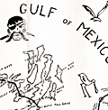 | Details | Oldacre, Ann | 1949 |
| Pictorial map of Key West, Florida with pirates |
|
Oldacre, Ann |
|
| 1949 |
| LOC:11 |
| $0.00 | Oldacre--Ann | Pictorial-map-of-Key-West--Florida-with-pirates | SOLD
<br></br>
Pictorial folding map of Key West, Florida with pirates, Indians, and sailing ships in "Major and Minor Keys of the Florida Reef", a 56-page illustrated booklet (5" x8"). Fourth printing, 1949 by Riviera Publishing Company, Coral Gables, Florida. Booklet by Mary Helm Clarke.
<br></br>
Map includes the Overseas Highway from Miami to Key West and the Tamiami trail to Naples, Florida. Map attached inside rear cover. |
| 6367 |  | Details | Leisen, Theodore | 1949 |
| Theodore Leisen Pictorial Map of Key West Florida |
|
Leisen, Theodore |
|
| 1949 |
| LOC: |
| $225.00 | Leisen--Theodore | Theodore-Leisen-Pictorial-Map-of-Key-West-Florida | Scarce medium-format pictorial map of Key West, Florida by Theodore Leisen Jr. The map of Key West map is undated but ca. 1949 based on Leisen's population estimate of 20,000 at publication. The population of Key West in 1950 is recorded as 21,792 persons excluding military personnel [1].
<br></br>
The map / brochure published by the Key West Chamber of Commerce contains a legend with numerous points of interest in Key West. Recto with map of the "World Famous Overseas Highway" from Key Largo to Key West. Key West translates to Cayo Hueso in Spanish.
<br></br>
[1] Wilkinson, Jerry. History of Key West. Online: http://www.keyshistory.org/keywest.html |
| 6408 |  | Details | Lister, James Wren | 1949 |
| Pictorial map of Laurel Canyon Hollywood Sunset Boulevard |
|
Lister, James Wren |
|
| 1949 |
| LOC:87 |
| $0.00 | Lister--James-Wren | Pictorial-map-of-Laurel-Canyon-Hollywood-Sunset-Boulevard | SOLD
<br><br>
Very rare and desirable Wren Lister pictorial map of <b>Laurel Canyon</b> This is a rare cartographic record of the Canyon and the Hollywood Hills before they became the haunt and home to 70's counterculture figures and music stars such as Joni Mitchel, James Taylor, Jim Morrison, Neil Young, and Brian Wilson.
<br><br>
A California cartographic rarity, no holdings of Wren's map are found anywhere including in WorldCat, AMPR, or the Internet. Only one record of a past sale of this item.
<br><br>
Laurel Canyon is a mountainous neighborhood in the Hollywood Hills of the Santa Monica Mountains, near Los Angeles, California.
<br><br>
Artist James Wren Lister (1897-1952) was born in England but settled in Los Angeles in 1925. Lister is also credited with a fine, colorful birds-eye view of <b>Avalon Town on Santa Catalina Island California</b> in 1948, a year before this item was created. |
| 6763 |  | Details | National Company | 1949 |
| Map of the World in Azimuthal Projection Centered on Malden Mass USA |
|
National Company |
|
| 1949 |
| LOC:89 |
| $250.00 | National-Company | Map-of-the-World-in-Azimuthal-Projection-Centered-on-Malden-Mass-USA | Scarce "Map of the World in Azimuthal Projection Centered on Malden, Mass USA". Presumed first edition lacking the more elaborate title cartouche found on the 2nd. No copies located in WorldCat.
<br><br>
Malden was home to the National Company, a heavyweight in the manufacturing of radio equipment. The legacy of this enterprise and the town's distinctive place in radio history were immortalized in a unique piece of advertising - this world map centered on this otherwise little-known Massachusetts town.
<br><br>
This ingeniously designed cartographic promotional map was part of a strategy tailored to captivate the attention of amateur radio enthusiasts. It underscored the awe-inspiring power of radio communication, visualizing the potential of the most potent transmitters of the time. One glance at this map made it crystal clear: with the right equipment, you could quite literally tap into the global conversation.
<br><br>
A feature that makes the azimuthal projection stand out among other cartographic methods is its fidelity to directions. Any line drawn from the center point to another location on the map accurately represents the real-world direction. This attribute, where all points appear radially symmetrical around the center, makes it an invaluable tool in aeronautical charts.
<br><br> |
| 6567 |  | Details | Anonymous | 1949 |
| Castles Inc. map of Hollywood and Los Angeles |
|
Anonymous |
|
| 1949 |
| LOC:3 |
| $750.00 | Anonymous | Castles-Inc--map-of-Hollywood-and-Los-Angeles | Clean, single-sided pictorial advertising map of Hollywood and the surrounding area circa 1948 published by Castle's Camera Store, 1529 Vine Street, Hollywood 28, California. Scarce. Price when issued 5 cents.
<br></br>
Castle's Camera Store operated from a small storefront across from the streamline-moderne style NBC Radio City office and studios at the corner of Sunset and Vine streets. <br></br>
<div>
<img src="/ZoomifyImages/SC_6567/Castles Camera Shop.jpg" alt="Castle's Camera Store Hollywood Storefront" width="300" align="left" style="margin: 0px 20px"/>
Karl Breneman was brother to radio personality Tom Breneman who operated Tom Breneman's restaurant from a location at 1525 North Vine Street, a few doors from brother Karl's Castle's Camera Shop.
<br></br>
Key landmarks on the map include:
<div class="indenttextblocksingle">
<ul style="list-style-type: circle;">
<li>Don Lee Mutual Broadcasting Studios (1313 North Vine Street opened August 1948)</li>
<li>Beverly Hills</li>
<li>Republic Studios</li>
<li>Grauman's Egyptian Theater</li>
<li>Hollywood Ball Park</li>
<li>a television studio</li>
<li>Earl Carrol's</li>
<li>Santa Monica, Ocean Park, and Venice piers</li>
<li>American Legion Stadium</li>
</ul>
</div> |
| 5268 |  | Details | Anonymous | 1950 |
| Small Mid-20th Century blueprint map Memphis Railroad Terminal |
|
Anonymous |
|
| 1950 |
| LOC:13 |
| $135.00 | Anonymous | Small-Mid-20th-Century-blueprint-map-Memphis-Railroad-Terminal | Small unrecorded cyanotype (blueprint) map of Memphis, Tennessee related to the railway lines, rail yards, and railroad depots in the Memphis area. Would have provided a high-level condensed overview of the railways in the Memphis area.
<br></br>
Key features on the map include:
<div class="indenttextblocksingle">
<ul style="list-style-type: circle;">
<li>Union Station</li>
<li>Central Station</li>
<li>Paine Yard</li>
<li>Frisco Yale Yard</li>
<li>Forrest Yard</li>
<li>North Yard</li>
<li>South Yard</li>
<li>Johnston Yard</li>
<li>Motor Car shop</li>
<li>Mississippi River</li>
<li>President's Island</li>
</ul>
</div>
Dated within at May 1950. MS annotation on verso: "V. W. White." [Tenn. , TN] |
| 1068 |  | Details | Down-East Sportcraft | 1950 |
| Birds-eye View of Casco Bay, Portland, Maine and Surroundings |
|
Down-East Sportcraft |
|
| 1950 |
| LOC:41 |
| $99.00 | Down-East-Sportcraft | Birds-eye-View-of-Casco-Bay--Portland--Maine-and-Surroundings | Large, detailed, panoramic view of coastal Maine north of Portland, including Casco Bay. Neat, 1950's re-print of a view first published by Walker Lithograph at the end of the 19th century, and reproduced in the mid-1950's. This folding birds-eye view highlights dozens of islands, coves, lighthouses, railroad, ferry routes, and other points of nautical interest. Shows the locations of Fort Williams, Portland Head, Fort Preble, Fort Leavitt, Ft. McKinley, Casco Castle, Freeport Landing, and the Portland Yacht Club. Folds to 3 1/2" x 6 1/2".
<br></br>
Named features include Cape Elizabeth, Portland Head light, Cushing Island, Great Diamond Island, Long Island, Great Chebeague Island, Presumpscot River, Mt. Washington, Sebago Lake, Falmouth, Underwood, Harraseeket River, Cousins Island, Bailey's Island, Harpswell Harbor, Merriconeag Sound, Maquoit Bay, Freeport Landing, Brunswick and Lewiston. Routes of the Casco Bay Lines shown in solid black.
<br></br>
Simple, green cardboard cover with blue title printing. |
| 6437 |  | Details | Flachmann, Chuck | 1950 |
| Pictorial or cartoon map of St. Louis Missouri |
|
Flachmann, Chuck |
|
| 1950 |
| LOC:90 |
| $350.00 | Flachmann--Chuck | Pictorial-or-cartoon-map-of-St--Louis-Missouri | Pictorial map of St. Louis, Missouri. Specifically, the Anheuser-Busch variant edition of Chuck Flachman's Cartoon Map of St. Louis, 1950. Two prominent identifying features distinguish the Anheuser-Busch variant edition from Flachman's pictorial "Mound City Pride of the Mississippi Valley" edition: 1) The Busch Budweiser logo appears at bottom left rather than the compass rose and 2) the lettering surrounding the map reflects its Mound City moniker. Additionally, the Busch brewery and Clydesdale horses are featured on the map in the Busch edition. Both editions are dated 1950.
<br><br>
Scarce, the Busch-Budweiser variant is much less common on the market in our experience. |
| 5046 |  | Details | City of West Palm Beach | 1950 |
| 50s pictorial map of West Palm Beach Florida. Tropical Florida's First Resort. |
|
City of West Palm Beach |
|
| 1950 |
| LOC:0 |
| $0.00 | City-of-West-Palm-Beach | 50s-pictorial-map-of-West-Palm-Beach-Florida---Tropical-Florida-s-First-Resort- | SOLD<br></br>
Fine stylized pictorial map ca. 1950 of Lake Worth, the Intracoastal Waterway, Hypoluxo Island, Loxahatchee River, and West Palm Beach, Florida. With mention of Boca Raton, Boynton, Delray Beach, and the northerly communities in the Palm Beaches: Jupiter, Juno, etc. Each Florida locality is represented by a series of pictorial icons representing the business and recreational activities significant to the area. The brochure describes the map:
<div class="indenttextblocksingle">
"A pictorial pleasure map gives you thumbnail impressions of life in tropical Florida's first resort area, with interesting characteristics of West Palm Beach and her sister communities."
</div>
</br>
Mentions the auto production of the B.S. Cunningham Company (est. 1950) in West Palm Beach, Florida.
<br></br>
Folds to 4" x 9". Remainder of booklet is packed with photographs and text about the area, complemented by attractive color images sketched in the same breezy, informal style as the map. 16 pages. Published by the City of West Palm Beach in cooperation with the West Palm Beach Chamber of Commerce. |
| 6660 |  | Details | Mundorff, Ted | 1950 |
| Scarce pictorial map of Oahu, Hawaii |
|
Mundorff, Ted |
|
| 1950 |
| LOC:86 |
| $195.00 | Mundorff--Ted | Scarce-pictorial-map-of-Oahu--Hawaii | Scarce original pictorial map of Oahu, Hawaii by Ted Mundorff on light-ish weight paper. An insert road map from a book "Around Oahu with Moki: A trip around the Island of Oahu as seen through the versatile camera of Fred Maxwell." The map is annotated with location numbers keyed to Maxwell's book. Published by Maxwell from Honolulu in 1950.
<br><br>
Verso is blank.
<br><br>
Interesting cartoon-like drawings featuring cab driver Moki at bottom left lend a relaxed air to the prospective journey around Oahu including:
<div class="indenttextblocksingle">
<ul style="list-style-type: circle;">
<li>A hula-dancing rabbit on Rabbit Island.</li>
<li>Waialae Golf Club</li>
<li>A barber giving a shave at Barber's Point.</li>
<li>Healing stones</li>
<li>Manoa Valley</li>
<li>King Kamehameha</li>
<li>Schofield Barracks</li>
<li>Haleiwa and Kahuku</li>
</ul>
</div> |
| 5339 |  | Details | Somberg, Seymour I. | 1950 |
| Blueprint plat map of Cedar Grove Plantation St. Paul South Carolina |
|
Somberg, Seymour I. |
|
| 1950 |
| LOC:1401 |
| $900.00 | Somberg--Seymour-I- | Blueprint-plat-map-of-Cedar-Grove-Plantation-St--Paul-South-Carolina | Unrecorded blueprint or cyanotype plat map of <b>Cedar Grove Plantation</b> or Smythe Plantation, <b>St. Paul / Summerton, South Carolina</b> in Clarendon County with Robert Adger Smythe (1871-1962) , Manager. The blueprint was created ca. 1950 and signed by Seymour. I. Samberg L.S. (Land Surveyor) with property lines taken from an earlier plat by Bushner and Rutledge dated May 30, 1914. North oriented to lower left.
<br></br>
Robert Adger Smythe was born in Charleston, S.C. in 1871 and graduated from the Citadel in 1890. He founded the Lambda Chapter fraternity at the Citadel. Smythe spent most of his business years in cotton brokerage in Atlanta. Robert Smythe did not live at Cedar Grove, but visited often, conducting his business through manager Joe. H. King.
<br></br>
The earliest record of Cedar Grove Plantation dates to 1796 when Jack Lawson laid out a plantation of 2,160 acres between Jack's Creek and Taw-Caw. In the mid-1800's the plantation had grown to over 5,000 acres.
Nearby features on this plat map include Jack's Creek, Highway 15, Manning Turnpike, Lake Marion, Nelson's Ferry Road, and St. Paul.
<br></br>
Legend at bottom right includes the signature of Seymour Somberg. In 1953 Seymour I. Somberg was listed as President of Forestry Aids (forestry - surveying) in Manning, South Carolina. [1]
<br></br>
[1] Eller, Robert C. ed. Surveying and Mapping. Volume XIII, No. 1 January - March, 1953. p. 252. (Online) |
| 6529 |  | Details | Green, Walter O. | 1951 |
| Western style pictorial map of the Colorado Rocky Mountains |
|
Green, Walter O. |
|
| 1951 |
| LOC: |
| $375.00 | Green--Walter-O- | Western-style-pictorial-map-of-the-Colorado-Rocky-Mountains | Interesting and scarce pictorial folding motor-tour map of a portion of Colorado near the Rocky Mountain National Park from 1951. Includes Boulder, Estes Park and much more in a western style complete with horse-riding cowboys, bucking broncos, and wizened prospectors. A serious map, not a hint of humor. Issued by the Rocky Mountain Motor Company, Denver, Colorado in 1951. Map by Walter O. Green.
<br><br>
Towns and cities on the map include:
<div class="indenttextblocksingle">
<ul style="list-style-type: circle;"></li>
<li>Denver</li>
<li>Evergreen</li>
<li>Golden</li>
<li>Boulder</li>
<li>Granby</li>
<li>Grand Lake</li>
<li>Estes Park</li>
<li>Fort Collins</li>
<li>Greely</li>
<li>Longmont</li>
<li>Lyons</li>
</ul>
</div>
Verso with color photographs, text, and motor tour schedules.
<br><br>
Green also identifies numerous geographical features
<div class="indenttextblocksingle">
<ul style="list-style-type: circle;"></li>
<li>Big Thompson Canyon</li>
<li>Iceberg Lake</li>
<li>Grand Lake</li>
<li>Arapaho Peak Elev. 13506 Ft.</li>
<li>Longs Peak Elev. 14255 Ft.</li>
<li>Red Rocks</li>
<li>Mount Evans Elev. 14360 Ft.</li>
<li>Berthoud Pass</li>
</ul>
</div> |
| 5109 |  | Details | Winter Park Board of Realtors | 1951 |
| Mid-century map of Winter Park Florida |
|
Winter Park Board of Realtors |
|
| 1951 |
| LOC:87 |
| $115.00 | Winter-Park-Board-of-Realtors | Mid-century-map-of-Winter-Park-Florida | Map of the city of Winter Park, Florida and vicinity published by the Winter Park Board of Realtors (1952) in a 12-panel folding format. Lakes shown boldly in green. Key at bottom left with road reference locations in Orlando, Eatonville, Maitland, and Winter Park. One section of road highlighted in red. Small manuscript notation in pencil.
<br></br>
Verso titled "Maps and facts about Winter Park Florida <b>City of Homes</b>." Full of text and photographs related to Winter Park, particularly to Rollins College and to the history behind Winter Park's appellation as the "City of Homes." With logo for the National Association of Real Estate Boards at bottom right. Border with alpha-numeric location index indicators.
<br></br>
Shows more than a dozen lakes of all sizes including Lake Fairview, Lake Killarney, Lake Maitland, Lake Osceola, Lake Corrine, and Lake Rowena.
<br></br>
Copyright 1952 by James T. Ellis. Interesting compass rose style unknown logo by Ellis' name. |
| 5066 | 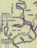 | Details | Anonymous | 1951 |
| Route Map of the Municipal Transit System St. Petersburg, Florida |
|
Anonymous |
|
| 1951 |
| LOC:87 |
| $150.00 | Anonymous | Route-Map-of-the-Municipal-Transit-System-St--Petersburg--Florida | Scarce route map of the Municipal Transit System in St. Petersburg, Florida (not to scale). On thinnish yellow paper a fourteen-panel folding sheet folds to 3" x 8". Includes an inset plan for downtown St. Petersburg revised October, 1951. The Yellow Issue published Dec 3, 1951. |
| 5054 | 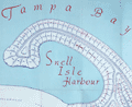 | Details | Green, John B. | 1951 |
| Map brochure for Brightwaters Snell Isle Harbour St. Petersburg Florida |
|
Green, John B. |
|
| 1951 |
| LOC:87 |
| $400.00 | Green--John-B- | Map-brochure-for-Brightwaters-Snell-Isle-Harbour-St--Petersburg-Florida | Scarce original plat map of <b>Snell Isle Harbor</b> in St. Petersburg, Florida ca. 1951, by John B. Green, a local realtor. Includes red manuscript notes about lots previously sold. With an inset photograph of the area surrounding Brightwaters Snell Isle. Shows the outline of property for Clark's Sunset Golf Course and a block reserved as a business center. North is oriented to left bottom. Plat includes Snell Isle Boulevard, Cordova Boulevard, Toledo Way, Miramar Blvd., and Brightwaters Boulevard. Verso with information and a fine bird's eye view of the planned development.
<br></br>
Now one of St. Petersburg’s most upscale and desirable neighborhoods, Snell Isle was once nothing more than a low-lying mangrove swamp. When C. Perry Snell, a Kentucky pharmacist, came to visit the area in 1899, he envisioned a residential waterfront enclave and invested in the property of what is now Coffee Pot Bayou and Snell Island. In 1911, he began developing Snell Island.
<br></br>
In 1926, Snell opened the Coffee Pot Bayou Golf Club, now the 18-hole Vinoy Renaissance Resort Golf Club on Snell Isle. A few years later in 1928, he gifted land to the St. Petersburg Woman’s Club which still stands today on Coffee Pot Bayou and is on the U.S. Register of National Historic Places.
<br></br>
Snell Isle is completely residential, with several apartment communities, two schools, and two churches. Many original homes from the 1920s still exist today, with charming European and Spanish architecture. More than 80 percent of homes on Snell Isle enjoy waterfront views, some of the Bay and others on interconnected waterways. |
| 5099 | 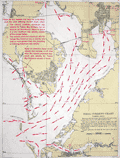 | Details | U.S. Coast and Geodetic Survey | 1951 |
| Tampa Bay Tidal Current Chart Book |
|
U.S. Coast and Geodetic Survey |
|
| 1951 |
| LOC:0 |
| $200.00 | U-S--Coast-and-Geodetic-Survey | Tampa-Bay-Tidal-Current-Chart-Book | Scarce 1951 tidal chart book on card stock with 12 (front and back) charts of Tampa Bay, Florida showing the direction and velocity of tidal flow across Tampa bay for each hour of its semi-daily tidal cycle.
<br></br>
Price when issued 35 cents; when sold 50 cents. U.S. Government Printing Office. Serial no.743. |
| 5253 |  | Details | James River Ceramics Club | 1951 |
| Jamestown James River Ceramics Club Field Trip |
|
James River Ceramics Club |
|
| 1951 |
| LOC: |
| $350.00 | James-River-Ceramics-Club | Jamestown-James-River-Ceramics-Club-Field-Trip | Unrecorded and hand-colored pictorial route map for the James River Ceramics Club. Mid 20th-century birds-eye perspective map of the area surrounding the James River near Jamestown, Virginia, location of the first permanent English settlement in North America.
<br></br>
Made for the occasion of the first annual field trip of the James River Ceramics Club to the Jamestown Island Archaeological Laboratory and to James O'Donnell Pottery on Sunday, August 12, 1951. Shows the towns of Williamsburg, Hilton Village, Benn's Church, Bacon's Castle, Surry, Burrowsville and more. With the logo for the James River Ceramics Club. |
| 6492 | 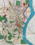 | Details | Dubuque City Planning Commision | 1951 |
| Master Plan for the City of Dubuque Iowa |
|
Dubuque City Planning Commision |
|
| 1951 |
| LOC:400 |
| $400.00 | Dubuque-City-Planning-Commision | Master-Plan-for-the-City-of-Dubuque-Iowa | Very large, scarce 1951 master plan map of the City of Dubuque, Iowa by the Dubuque City Planning and Zoning Commission, J.M. Wolfe, Chairman. Justin R. Hartzog, City Planner. A fine record of the city and its ambitions in the mid 20th-century.
<br><br>
Two matching legends at bottom right and left show symbols and coloration used for mapped features under existing conditions and for the Commission's planning proposals respectively. These details include streets, railroads, intersections, city boundaries, parks, playgrounds, schools and other land uses. North oriented to top. |
| 6556 |  | Details | Anonymous | 1952 |
| Pictorial map New Orleans area near Bayou Gardens Lacombe Louisiana |
|
Anonymous |
|
| 1952 |
| LOC:3 |
| $150.00 | Anonymous | Pictorial-map-New-Orleans-area-near-Bayou-Gardens-Lacombe-Louisiana | Pictorial map (1952) of the New Orleans area to promote the Bayou Gardens attraction in Lacombe, Louisiana. The map spans the back two panels of a promotional brochure titled: "Bayou Gardens Lacombe, La. Beauty Spot of the Bayou Country."
<br><br>
Bayou Gardens was a 25-acre gardening attraction located north of New Orleans between Mandeville and Slidell. Bayou Gardens was founded in the late 1940's by convicted felon and former Louisiana Governor Richard W. Leche (1898-1965). In addition to a commercial nursery, swimming pool and a museum, according to the brochure "The Gardens contain one of the nation's outstanding Camelia collections, numbering hundreds of varieties."
<br><br>
Two-panel folding brochure with text on the recto. |
| 6711 |  | Details | Newton, Art | 1952 |
| Outer Banks Pictorial Map Carteret County North Carolina |
|
Newton, Art |
|
| 1952 |
| LOC:86 |
| $0.00 | Newton--Art | Outer-Banks-Pictorial-Map-Carteret-County-North-Carolina | SOLD<br><br>Rare pictorial post-war map of Carteret County, North Carolina and the Outer Banks. Inset large-scale map of Bogue Sound and the coast near Morehead City and Beaufort, NC. Found on the verso of a two-sided 12-panel folding brochure. Designed by Art Newton and published by Celeste Gold in 1952. Printed by Wilmington Printing Company.
<br>
A few of the key features that Newton included are:
<div class="indenttextblocksingle">
<ul style="list-style-type: circle;"></li>
<li>Copeland's salt water fishing pond</li>
<li>Edgewater Lodge</li>
<li>Fort Macon State Park</li>
<li>Hummock House</li>
<li>Ocracoke Lighthouse</li>
<li>Mailboat Atlantic to Ocracoke</li>
<li>Cedar Island pier fishing</li>
<li>Cape Lookout Lighthouse</li>
</ul> |
| 6439 |  | Details | Sprague, R. B. | 1952 |
| Big Game pictorial map San Francisco Oakland Berkeley Bowl |
|
Sprague, R. B. |
|
| 1952 |
| LOC: |
| $0.00 | Sprague--R--B- | Big-Game-pictorial-map-San-Francisco-Oakland-Berkeley-Bowl | SOLD <br><br>
An absorbing pictorial map of the San Francisco Bay Area by R. B. Sprague. Supports the "Big Game" [1]. Packed with sophomoric cartoons, puns ("fisherman's barf"), graphic exaggerations, and post-WWII references. Some of the references could only be appreciated by someone familiar with local geography and/or early 1950s Bay Area college culture.
<br><br>
Not drawn to scale and limited only by Sprague's imagination, the cartoonish map depicts local highways snaking from the California Redwoods at top left (decorated with Christmas ornaments), to Lake Mead, down past the Bay Area ("sighted sub, sank same"), to Palo Alto, Watsonville, Mt. Hamilton with a final road sign at bottom right pointing to the Rose Bowl.
<br><br>
Published 1952 in the Stanford Chapparal magazine. The Stanford Chaparral is a humor magazine published by students of Stanford University since 1899. In 1952 the Big Game was played at Berkeley where the California Golden Bears shut out Stanford 26 - 0.
<br><br>1952
[1] The Big Game is the oldest college football rivalry. Dating back to 1892, the Big Game pits the University of California Berkeley Golden Bears football team against the Stanford University Cardinals. |
| 7964 |  | Details | Sanborn Map Company | 1952 |
| West Palm Beach Florida Sanborn Atlas Two Volume Set |
|
Sanborn Map Company |
|
| 1952 |
| LOC: |
| $0.00 | Sanborn-Map-Company | West-Palm-Beach-Florida-Sanborn-Atlas-Two-Volume-Set | SOLD <br><br>A scarce two-volume indexed set of colored fire insurance maps for <b>West Palm Beach, Florida</b> by the Sanborn Map Company. Issued for the insurance industry’s internal use, Sanborn maps were the most comprehensive commercial record of fire risk and urban building characteristics in the U.S. before aerial photography and digital databases transformed insurance underwriting practices.
<br><br>
A fine set of maps reflecting the post WWII, baby-boom era in West Palm Beach. The original volumes were issued in 1952 and new pages were added up to 1957 to reflect changes in the buildings represented. The maps record West Palm Beach ca. 1957 as it issued an $18-million bond to modernize sewers and extend fire-protection systems west of downtown, capturing a pivotal moment when the pre-war resort grid gave way to a growing suburban city.
<br><br>
These original Sanborn Fire Insurance Atlases for West Palm Beach, Florida (1952–1957) document the city at the height of its post-war expansion. Streets, blocks, and individual buildings are shown in full color, coded for construction type, height, and occupancy, with every hydrant, stairwell, and fire wall marked for underwriters.
<br><br>
<div id="0" align="center">
<a title=""></a>
<img id="6450" src="/ZoomifyImages/SC_7964/Sanborn_Map_Symbols_400w.jpg" alt="Sanborn Map Company map legend" width="300"/> <br><br> <font size="-2">Sanborn Map Company map legend</font>
</div> |
| 6384 |  | Details | Lepper, Ruth Rhoads | 1952 |
| Pictorial map of Western, Central, and Eastern Maine |
|
Lepper, Ruth Rhoads |
|
| 1952 |
| LOC:87 |
| $650.00 | Lepper--Ruth-Rhoads | Pictorial-map-of-Western--Central--and-Eastern-Maine | A Map of Western, Central, and Eastern Maine made and published in 1952 by Ruth Rhoads Lepper, West Southport, Maine. The prominent and colorful compass rose topped by a fleur-de-lis is a signature feature of Ruth Lepper pictorial maps. Coverage includes the entire coast of the state of Maine extending from New Hampshire to Canada.
<br><br>
Two sides of the map include historical facts about Maine as well as drawings of some of the more famous old Maine buildings including:
<div class="indenttextblocksingle">
<ul style="list-style-type: circle;"></li>
<li>Blaine House, the Executive Mansion of Augusta</li>
<li>Portland Observatory</li>
<li>Old Lincoln County Jail, Wiscasset</li>
<li>Marie Antoinette House, North Edgecomb</li>
<li>Symphony House, Bangor</li>
<li>Farnsworth Homestead and Art Museum, Rockland</li>
</ul>
</div>
<strong>"Maine built ships have sailed the seven seas in peace and war since 1607"</strong>
<br><br>
Maine has a long history of seafaring and ship-building. The bottom of the map and the area of the Atlantic Ocean includes depictions of some of the more famous Maine-built ships. These ships span four centuries and include:
<div class="indenttextblocksingle">
<ul style="list-style-type: circle;"></li>
<li>The U.S.S. Mitscher, launched at Bath in 1952.</li>
<li>An early 17th century English merchant ship.</li>
<li>Ship Commodore, bult at Yarmouth in 1879.</li>
<li>The Red Jacket, built at Rockland in 1853.</li>
<li>The pinnace Virginia, the first boat built by the English in America.</li>
<li>U.S.S. Kearsarge, built at Kittery in 1861.</li>
<li>Privateer brig Grand Turk, built at Wiscasset.</li>
</ul>
</div> |
| 6592 |  | Details | Hayden, Walter Emmet | 1952 |
| West Walker River Topaz Lake Directory Fishing Hunting Map 1952 |
|
Hayden, Walter Emmet |
|
| 1952 |
| LOC:89 |
| $350.00 | Hayden--Walter-Emmet | West-Walker-River-Topaz-Lake-Directory-Fishing-Hunting-Map-1952 | 1959 revised edition of the Hayden Map Company's Hunter's and Fisherman's map for the Topaz Lake / West Walker River area of Mono County, California. Map # 598141. Copyright 1952. Verso blank.
<br><br>
Very fine detail, printed in blue, ink based on surveys from 1923 to 1952.
<br><br>
Scarce today. Price was 50 cents when issued.
<br></br> |
| 4977 | 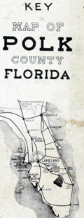 | Details | Dolph, Frank B. | 1952 |
| Land-atlas for Polk County, Florida by Dolph |
|
Dolph, Frank B. |
|
| 1952 |
| LOC:0 |
| $0.00 | Dolph--Frank-B- | Land-atlas-for-Polk-County--Florida-by-Dolph | Sold <br></br>
A original large land ownership atlas for Polk County, Florida. Published and copyrighted, Fort Lauderdale, Florida by Frank B. Dolph, 1952.
<br></br>
Scarce. With 1 key map of Polk County, Florida and 39 plat maps as called for, clean. No tears or condition issues. |
| 5063 |  | Details | Oil and Gas Journal | 1952 |
| Journal-Guide to Oil Basins of the United States |
|
Oil and Gas Journal |
|
| 1952 |
| LOC:65 |
| $680.00 | Oil-and-Gas-Journal | Journal-Guide-to-Oil-Basins-of-the-United-States | A large special data and cartography supplement in the Oil and Gas Journal 1952 titled: "Journal-Guide to Oil Basins of the United States." The insert includes a map of United States Oil basins and a Formation Correlator (tabular data relating geographical region to era, period, rock system and group. At right cross sections of the major oil basins including the Permian Basin. Cross sections through each basin are shown schematically on the map.
<br></br>
Supplement to The Oil and Gas Journal. Volume 50 No. 46. Compiled and drawn by the editorial staff. The Oil and Gas Journal Copyright 1952. The Petroleum Publishing Company. Tulsa, Oklahoma. |
| 1371 |  | Details | Butler, Lowell | 1952 |
| Fine Baby-Boom Era Pictorial Map of California |
|
Butler, Lowell |
|
| 1952 |
| LOC:0 |
| $155.00 | Butler--Lowell | Fine-Baby-Boom-Era-Pictorial-Map-of-California | Large, attractive poster-size map of California's historical sites created during the post-war baby-boom era of the early 1950s. Numerous sites are numbered on the map. Includes extensive notations on the verso related to a whopping 496 sites in California. Cartography By Lowell Butler.
<br></br>
Verso contains textual descriptions related to the precise location and a brief history of each of the 496 sites.
A few examples of the sites include: <br><br/>
<hr>
<ul>
<li><strong>1-- Customs House. Alvarado, Main and Scott Streets, Monterrey.</strong><i> The port of entry for vessels and cargo reaching California during the days of Spanish and Mexican occupation...</i></li>
<li><strong>411-- Campo Store. Campo, San Diego County</strong><i> A frontier trading post and border fort built by Luman H. and Silas E. Gaskill who settled here in 1868.</i></li>
<li><strong>190-- Painted Rock. 7 miles southeast of Corona on State Highway No 71, Riverside County. </strong><i>A boulder with Indian pictographs applied (probably of Louiseno origin), registered and marked in 1927. What the pictographs mean has not been determined.
<hr></i></li>
</ul>
According to David Rumsey "The sites are identified by whether they are from the Spanish-Mexican Period, Years of the Gold Rush, Agricultural Era or Commercial and Industrial Expansion era. . With insets: San Francisco Bay; Monterey sites; Los Angeles and vicinity sites; San Diego sites; Mother lode sites. On verso: 'A note of explanation by Phil Townsend Hanna'; descriptive list of historical sites with color drawings, numbered to correspond with sites on map."
<br></br>
Compiled from the official registrations of the California State Department of Natural Resources. By Phil Townsend Hanna and William Webb. Copyright 1952 by the Automobile Club of Southern California. Published by Westways, Vol. 44, No. 12. |
| 6679 |  | Details | Glaubke, Bob | 1952 |
| Wild Bill Hickok Treasure Map pictorial thematic map |
|
Glaubke, Bob |
|
| 1952 |
| LOC:40 |
| $125.00 | Glaubke--Bob | Wild-Bill-Hickok-Treasure-Map-pictorial-thematic-map | 1950's pictorial thematic map, the "Wild Bill Hickok Treasure Map, of the United States, created by Bob Glaubke and published by Rand McNally in 1952. This map was a promotional item created by Rand McNally to advertise their line of maps and atlases.
<br><br>
The Wild Bill Hickok Treasure Map was a colorful and fanciful depiction of the American West, with illustrations of cowboys, Indians, and other Wild West icons. The map purported to show the locations of hidden treasures that were supposedly buried by the legendary gunslinger Wild Bill Hickok.
<br><br>
The Hickok map identifies numerous locations with some connection to mythical lost treasure including
<div class="indenttextblocksingle">
<ul style="list-style-type: circle;">
<li>Pensacola: Five large Spanish Treasure ships were wrecked...</li>
<li>Apalachicola: The pirate Billy Bowlegs ran his ship aground here...</li>
<li>Savannah: Th pirate John Hint is thought to have buried his treasure...</li>
<li>Murrell's Inlet: ...the pirate Murrell took shelter and buried treasure in the marshes here. </li>
</ul>
</div>
Wild Bill Hickok was a famous figure in the Old West, known for his prowess as a gunfighter and gambler. There are several legends surrounding him, including a supposed treasure map that he left behind. According to the legend, Hickok buried a treasure he won in a poker game, gold and other valuables, in the Black Hills of South Dakota before his death in 1876. He allegedly entrusted a treasure map to a friend, but the exact location of the treasure and the authenticity of the map are both widely disputed. |
| 5024 |  | Details | Borrego Springs Land and Development Company | 1953 |
| Scarce Borrego Springs California Sales Map |
|
Borrego Springs Land and Development Company |
|
| 1953 |
| LOC:400 |
| $550.00 | Borrego-Springs-Land-and-Development-Company | Scarce-Borrego-Springs-California-Sales-Map | Scarce tract map of lots for sale in Borrego Springs, California ca. 1953 before construction was completed on the Catholic Church. With an inset smaller-scale humorous pictorial map of the region around Borrego Springs, in San Diego County.
<br></br>
Today Borrego Springs is designated as a Dark Sky Community, the only community in California with that designation and one of only 22 locations in the world to have the designation. Not dated, not attributed. |
| 6483 | 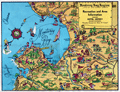 | Details | Sandefur, John Courtney | 1954 |
| Scarce pictorial cartograph or map Monterey Bay Hotel Jeffery |
|
Sandefur, John Courtney |
|
| 1954 |
| LOC:87 |
| $150.00 | Sandefur--John-Courtney | Scarce-pictorial-cartograph-or-map-Monterey-Bay-Hotel-Jeffery | Rare folding pictorial map of the Monterey Bay Region in California by John Courtney Sandefur. Sandefur's pictograms show the obvious influence of an earlier cartograph of the Monterey Region by Ruth Taylor White.
<br><br>
The map was published by Hotel Jeffery ca. early 1950s, then conducting business in Salinas, California for over 90 years. Colorful compass rose bearing a dog's image and the motto of the Hotel Jeffery- "Friendly."
<br><br>
Verso with text about the recreational activities and resources available in the Monterey Bay Area and the Salinas Valley including Pacific Grove, Carmel, Fort Ord, Santa Cruz, and Watsonville.
<br><br>
The Jeffery Hotel in Salinas, California was opened in 1888 at the corner of Alisal and Main Streets by William "Bill" Jeffery. In the 1970’s the original three-story Jeffery Hotel was demolished.<br><br>
<div id="0" align="center">
<a title="Hotel Jeffery, Salinas, California."></a>
<img id="3" src="/ZoomifyImages/SC_6483/SC_6483_HotelJeffery.jpg" alt="Photo of Hotel Jeffery, Salinas, California circa 1960" width="300"/> <br><small>Hotel Jeffery. <i>Courtesy U. California: https://calisphere.org/</i></small>
</div><br> |
| 4929 | 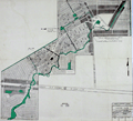 | Details | Mosby Engineering Associates | 1954 |
| Warm Mineral Springs Venice Florida Master Plan 1954 |
|
Mosby Engineering Associates |
|
| 1954 |
| LOC:0 |
| $0.00 | Mosby-Engineering-Associates | Warm-Mineral-Springs-Venice-Florida-Master-Plan-1954 | SOLD<br></br>
The 1954 master development plan for Warm Mineral Springs. With manuscript notations related to access road conditions and to existing construction as far in the past as 1949. Based on the notations it appears that in 1954 the site was in the very early stage of development, with only a few structures existing.
<br/><br/>
Warm Salt Springs, Inc. later Warm Mineral Springs, Inc. controlled 748 acres with ownership by Leo and Margarete Scharf , Dr. J.A. Mease and H.W. Meyer. In order to enhance the property and expedite its development the Scharfs approached Dr. Mease concerning the possibility of constructing a therapeutic clinic on-site. In 1954 Dr. Mease, agreed that for a share in the corporation he would build a clinic on land granted to him near the springs and that he should have "exclusive use of the waters for therapeutic purposes." The clinic's proposed location lies at the southeast corner of the main spring, labeled "Warm Mineral Springs".
<br/><br/>
Dated within at 7-19-54 for Mr. Leo. Scharf of Venice, Florida. By Mosby Engineering Associates, 2190 Ringling Blvd. Sarasota, Florida. Drawn by C.G. Scale: 1 inch= 300 feet.
<br/><br/>
Source online: ( Mease v. Warm Mineral Springs, Inc., 128 So. 2d 174 (Fla. Dist. Ct. App. 1961)
https://www.courtlistener.com/opinion/1923999/mease-v-warm-mineral-springs-inc/ ). |
| 4984 |  | Details | West Coast Airlines | 1954 |
| Pictorial Map of Washington State by West Coast Airlines |
|
West Coast Airlines |
|
| 1954 |
| LOC:88 |
| $300.00 | West-Coast-Airlines | Pictorial-Map-of-Washington-State-by-West-Coast-Airlines | Scarce, colorful, pictorial map of airline routes across Washington, Oregon, and Idaho flown by West Coast Airlines. Statement at bottom of the map reads: "Paul Bunyan's Empire Cut to Travel Size".
<br></br>
West Coast Airlines (WCA), founded in 1941, was based at Boeing Field in Seattle. WCA began scheduled passenger service in 1946 with a fleet of Douglas DC-3s. Table at upper right contains a list of Key Points of Interest across the three-state area. Dated within at 1954. Verso with text and photo images from across the region.
<br></br>
Apparently the map was updated and re-issued again in 1962. |
| 6594 |  | Details | Hayden, Walter Emmet | 1954 |
| Northern Mono County Bridgeport Fishing Hunting Map |
|
Hayden, Walter Emmet |
|
| 1954 |
| LOC:89 |
| $350.00 | Hayden--Walter-Emmet | Northern-Mono-County-Bridgeport-Fishing-Hunting-Map | 1954 edition of the Hayden Map Company's Hunter's and Fisherman's Map and Resort Directory of Northern Mono County with Bridgeport, California. Map # 1162954. Copyright 1954. Verso blank. No price.
<br><br>
Inset small-scale context map of California. North oriented to bottom. |
| 6441 |  | Details | King, Samuel A. | 1955 |
| God's Country Picto-historical map of Central Pennsylvania |
|
King, Samuel A. |
|
| 1955 |
| LOC:90 |
| $250.00 | King--Samuel-A- | God-s-Country-Picto-historical-map-of-Central-Pennsylvania | Scarce second-edition example of Samuel King's pictorial historical map "God's Country - Pennsylvania's Last Frontier..." First published in 1951 this example is the revised edition of September 1955 [bottom center above the neatline]. Copyrighted by Samuel A. King, 510 First Street, Du Bois, PA.
<br><br>
The map covers a geographic area in central Pennsylvania from roughly Lock Haven to DuBois and north. Verso with ink stamps "GOD’S COUNTRY” and "Clearfield Sporting Goods Co." WorldCat records only four institutional holdings of the 1955 edition.
<br><br>
Samuel Albert King was a local historian and for many years taught at a local university.
<br><br>
In all Samuel King produced at least eight picto-historical maps of Pennsylvania, some maps with several editions in the 1950's and 1960's. "Gods Country" was King's first map. Seven of his later maps are reproduced and sold online by the Clearfield County Historical Society, but "God's Country" is not among the list. Titles of these other seven maps by King are:
<br><br>
<div class="indenttextblocksingle">
<ul style="list-style-type: circle;">
<li>Cornplanter's Kingdom, 1951</li>
<li>Heart of the Alleghenies, Central Pennsylvania's Vacationland, 1953</li>
<li>Forest County for rest from urban fatigue, 1957</li>
<li>Lore of the Last Frontier in Pennsylvania, 1960</li>
<li>A Vacation Map of Potter County and Ole's Black Forest, 1973</li>
<li> Freestone Fishing for Mountain Trout in northern Pennsylvania, 1977</li>
<li>A Fun-roving Map of Pine Creek the Grand Canyon of Pennsylvania</li>
<li>More of God's Country, 1968</li><br>
Note: Maps produced in the late 1960's and the 1970's credit King's wife gale as co-author.
</ul>
</div> |
| 6387 | 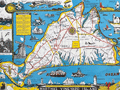 | Details | Parker, Larry | 1955 |
| Pictorial Map of Martha's Vineyard Island, Massachusetts |
|
Parker, Larry |
|
| 1955 |
| LOC:87 |
| $750.00 | Parker--Larry | Pictorial-Map-of-Martha-s-Vineyard-Island--Massachusetts | Original, scarce, 1950's Martha's Vineyard Island, Massachusetts pictorial map by Larry Parker. This lithographed tourist map features bright, bold colors, inset pictorial images of island life, and text blocks of historical facts, all hallmarks of a tourist souvenir map. Slight gloss to the paper finish as typical.
<br></br>
Remarkable condition.
<br></br>
This 1950's era edition is based on Parker's earlier 1935 black and white map of Martha's Vineyard Island. Not only does the new edition feature vivid lithographed color, several changes were made to the content including below the rope-wrapped bollard where the text "Edgartown Harbor" does not appear directly below the bollard. On this colored edition of Parker's map the area is blank. |
| 6564 |  | Details | McCarty, Lea | 1955 |
| Scarce pictorial map of Sonoma County |
|
McCarty, Lea |
|
| 1955 |
| LOC:89 |
| $350.00 | McCarty--Lea | Scarce-pictorial-map-of-Sonoma-County | Fun, activity-oriented cartograph or pictorial map of Sonoma County, California by artist Lea McCarty. From a folding brochure "Fascinating Sonoma County in California's Redwood Empire Wonderland" issued in 1955 by the Sonoma County Board of Supervisors and Associated Chambers of Commerce of Sonoma Valley Inset context map withing a colorful compass rose shows Sonoma County in relationship to San Francisco and other nearby counties in California.
<br></br>
Coverage on this amusing map of Sonoma County includes portions of the surrounding counties: Napa County, Mendocino County and Marin County as well as numerous Sonoma County highlights to include:
<div class="indenttextblocksingle">
<ul style="list-style-type: circle;"></li>
<li>Bodega Bay</li>
<li>Bohemian Grove</li>
<li>Stewarts Point</li>
<li>Healdsburg</li>
<li>Digger Indian Reservation</li>
<li>Petrified Forest</li>
<li>Burbank Gardens, and</li>
<li>Petaluma</li>
</ul>
</div> |
| 4988 |  | Details | Florida State Road Department | 1955 |
| Lot of 8 Florida County General Highway and Transportation Maps |
|
Florida State Road Department |
|
| 1955 |
| LOC:0 |
| $0.00 | Florida-State-Road-Department | Lot-of-8-Florida-County-General-Highway-and-Transportation-Maps | Sold <br></br>
Lot of eight (8) transportation maps of Florida, published by the Florida State Road Department, Traffic Planning Division in coordination with the U.S. Department of Commerce Bureau of Public Roads. Mid 20th-century.
<br></br>
<b>Five General Highway and Transportation Maps:</b>
<div class="indenttextblocksingle">
<ul style="list-style-type: circle;">
<li>De Soto County. 1936 / 1955</li>
<li>Osceola County . 1936. Revised 1954. (Sheet 2 of 2)</li>
<li>Osceola County . 1936. Revised 1954? (Sheet 1 of 2)</li>
<li>Hendry County. 1936. Revised 1955</li>
<li>Taylor County. 1936. Revised 1955</li>
</ul>
</div>
<b>Three General Highway Maps:</b>
<div class="indenttextblocksingle">
<ul style="list-style-type: circle;">
<li>Broward County (Sheet 2 of 2). 1948. Revised 1956.</li>
<li>Palm Beach County. (1949) </li>
<li>Okeechobee County 1954. Revised 1956.</li>
</ul>
</div> |
| 5025 |  | Details | Florida State Road Department | 1955 |
| Lot of 14 Florida County General Highway and Transportation Maps |
|
Florida State Road Department |
|
| 1955 |
| LOC:0 |
| $900.00 | Florida-State-Road-Department | Lot-of-14-Florida-County-General-Highway-and-Transportation-Maps | Lot of fourteen (14) transportation maps of Florida, published by the Florida State Road Department, Traffic Planning Division in coordination with the U.S. Department of Commerce Bureau of Public Roads. Mid 20th-century.
<br></br>
<b>General Highway and Transportation Maps:</b>
<div class="indenttextblocksingle">
<ul style="list-style-type: circle;">
<li>Lafayette County. 1936 Revised 1956. </li>
<li>Madison County. 1936 Revised 1955.</li>
<li>Suwannee County. 1936 Revised 1956.</li>
</ul>
</div>
<b>General Highway Maps:</b>
<div class="indenttextblocksingle">
<ul style="list-style-type: circle;">
<li>Baker County. 1955.</li>
<li>Palm Beach County. 1949. 3 of 4 sheets. </li>
<li>Bay County. 1956. 2 of 2 sheets. </li>
<li>Calhoun County. 1949.</li>
<li>Bradford County. 1951 / 1956. </li>
<li>Dade County. 1952 / 1956. Supplemental sheet.</li>
<li>Flagler County. 1948. </li>
<li>Union County . 1951 / 1956. </li>
<li>Liberty County. 1953. </li>
<li>Escambia County. 1956. Supplemental sheet. </li>
<li>Washington County. 1951 / 1956. </li>
</ul>
</div> |
| 8037 |  | Details | Conrad, Maynard | 1955 |
| Ye Olde Charte Of Gull Lake Kalamazoo County Michigan |
|
Conrad, Maynard |
|
| 1955 |
| LOC:130 |
| $375.00 | Conrad--Maynard | Ye-Olde-Charte-Of-Gull-Lake-Kalamazoo-County-Michigan | Mid twentieth century blueprint pictorial map of Gull Lake in Kalamazoo and Barry Counties, Michigan, with hand-drawn shorelines, compass rose, and whimsical period lettering. The sheet captures the resorts, parks, beaches, and cottages that once ringed this deep spring-fed lake north of Kalamazoo, documenting the area as a regional leisure destination. The artist, Dr. Maynard Conrad (d. 1998) uses simple white linework on blue background to present an engaging portrait of the lake at a time when summer colonies, canoe clubs, and motor launches were beginning to reshape the shoreline.
<br><br>
The map highlights a tight cluster of neighboring lakes that define the Gull Lake region. Little Long Lake and Miller's Lake appear to the northwest, while Grassy Lake is shown just beyond the isthmus that separates Gull Lake from its smaller companions. These lakes form part of a distinctive kettle-lake chain created by the region's glacial geography, a landscape that helped establish Gull Lake as one of the most celebrated inland waters of southwest Michigan. The sheet also notes well known features of the day, including Idlewild, Ross Township Park, Island Park, Crescent Beach, the Country Club grounds, and the string of cottages along Lover's Lane.
<br><br>
This pictorial blueprint serves equally as a regional souvenir and a record of community identity around Gull Lake. Resorts such as Bayberry Inn, Hickory Point, and Walnut Inn, together with family parks, bird sanctuaries, and boat landings, illustrate a thriving recreational culture. Surviving large format blueprints of local lakeside development are scarce, and this example offers collectors an attractive combination of graphic charm, local history, and early twentieth century Michigan cartographic style. |
| 3629 |  | Details | Nickerson, K.F. | 1955 |
| Manuscript chart of Cape Cod, Massachusetts Bay, Provincetown |
|
Nickerson, K.F. |
|
| 1955 |
| LOC:200 |
| $450.00 | Nickerson--K-F- | Manuscript-chart-of-Cape-Cod--Massachusetts-Bay--Provincetown | An interesting manuscript chart of Cape Cod and Cape Cod Bay in black and red ink. Not only does the chart have a different look than a printed chart but the item raises questions as to why so much care was placed on its creation. Signed by K.F. Nickerson and dated to February 1955.
<br></br>
Detailed mid 20th-century manuscript chart of Cape Cod, Massachusetts Bay and Cape Cod Bay. The MS chart is drawn on the verso of an earlier chart from 1935. Nickerson apparently cannibalized an old chart simply to create his chart on the back. We don't know why Nickerson spent so much time on the chart but it is evident he spent hours meticulously copying from an unknown source. Perhaps the map was constructed for sale as a tourist keepsake. More likely it had some utility to Nickerson in his occupation, because the chart detail is at a granular level that could be used for navigation.
<br></br>
Contains info on radio beacons, depth soundings, maritime hazards, aids to navigation and much more. Scale 1/2 inch = 1 mile. |
| 4932 |  | Details | Mosby Engineering Associates | 1955 |
| Lake Sarasota Florida Unit 10 Plat and Survey |
|
Mosby Engineering Associates |
|
| 1955 |
| LOC:0 |
| $0.00 | Mosby-Engineering-Associates | Lake-Sarasota-Florida-Unit-10-Plat-and-Survey | SOLD<br></br>
Plat and survey for Unit 10 of the Lake Sarasota Subdivision at Lake Sarasota, Florida.
<br/><br/>
By Mosby Engineering Associates, 2190 Ringling Blvd. Sarasota, Florida. |
| 4876 |  | Details | Allyn, Rube | 1955 |
| 2nd ed. Map Lake Seminole Florida Fresh Water |
|
Allyn, Rube |
|
| 1955 |
| LOC:61 |
| $0.00 | Allyn--Rube | 2nd-ed--Map-Lake-Seminole-Florida-Fresh-Water | SOLD <br><br>
Scarce <b>second edition</b> [1] of Rube Allyn's Authentic Fishing Map (ca. 1955), for Boca Ciega Bay and Lake Seminole, Florida. When multiple editions of Allyn's fishing map exist for the same area, they may provide a good source of information about changes over time to the aquatic environment and to fish populations. Allyn's chart # 1B.
<br></br>
Clearly shows the immediate effect of a new dam across Long Bayou built in the 1940's at Park Blvd. N., then Oakhurst. The dam was intended to turn part of a salt-water estuary into a freshwater lake, Lake Seminole, with water level controlled by a weir along the south side of the lake. When this fishing chart is compared to Allyn's first edition made before the dam was constructed, it is clear chart that the dam was a huge success. Lake Seminole is shown swollen with water, and Allyn notes abundant fresh-water fish rather than the trout and redfish that previously inhabited the salt-water Long Bayou.
<br></br>
<img src="/ZoomifyImages/SC_4876/SC_4876_Detail.gif" alt="Comparison Photographs of Allyn's Seminole Lake" width="350px" align="left" style="margin: 0px 0px">
<br></br>
As is often the case with projects that change the environment, after decades they bring about unexpected consequences. Today, water quality is a concern on Lake Seminole because of the low volume of water flowing into the lake, coupled with excess nutrients and pollution runoff from the surrounding urban areas. The Lake Seminole Restoration Project will dredge 900,000 cubic yards of accumulated organic sediment from the lake to include 54 tons of phosphorus and 311 tons of nitrogen. (Source: http://www.pinellascounty.org/publicworks/pdf/lake-seminole-restoration-project.pdf)
<br></br>
[1] Rube Allyn's Authentic Fishing Map (Upper) Boca Ciega Bay and Gulf Beaches. 1st ed. Touchton Map Library. Tampa Bay History Center. 2016.010.002 . |
| 4883 |  | Details | Allyn, Rube | 1955 |
| 2nd ed. Fishing Map Upper Tampa Bay |
|
Allyn, Rube |
|
| 1955 |
| LOC:0 |
| $0.00 | Allyn--Rube | 2nd-ed--Fishing-Map-Upper-Tampa-Bay | SOLD
<br></br>
Scarce presumed <b>second edition</b> [1] of Rube Allyn's Authentic Fishing Map (ca. 1955), for upper Tampa Bay, Florida. Changes made on the 2nd edition not on the 1st edition include:
<div class="indenttextblocksingle">
<ul style="list-style-type: circle;">
<li>A "nice beach" and a new (dredged?) channel in Tampa Bay, both in the vicinity of Sky Harbor Airport</li>
<li>Several new additions to the Gandy Blvd. west peninsula including two new boat launches and a TV tower.</li>
<li>Reclassification of spoil banks as Treasure Island and Lookout Island.</li>
</ul>
</div>
The changes on this second edition are easily identifiable from the different font used to the new / changed items. The newer changes appear to have been made by pasting typewritten location names to the 1st edition master copy before reproduction.
<br></br>
When multiple editions of Allyn's fishing map exist for the same area, as in this case, they may provide a good source information about the effects of development and changes over time to the aquatic environment and to fish populations. Allyn's chart # 1C.
<br></br>
[1] Rube Allyn's Authentic Fishing Map Upper Tampa Bay. 1st ed. Touchton Map Library. Tampa Bay History Center. 2016.010.003. |
| 955 |  | Details | Davison, Harry K. | 1955 |
| Estero Island, Fort Meyers Beach, Lee County Florida |
|
Davison, Harry K. |
|
| 1955 |
| LOC:0 |
| $0.00 | Davison--Harry-K- | Estero-Island--Fort-Meyers-Beach--Lee-County-Florida | SOLD<br></br>
Nine foot long cadastral map of Estero Island, Florida from the heyday of island land development, the 1950's. The map is based on an original blue-line printed plat map by surveyor Harry K. Davison. Davison, a Civil Engineer, conducted some of the earliest surveys of Estero island and built a beachfront home on Fort Meyers beach in 1921. Today that cottage has been moved to 161 Bay Road in Fort Meyer's beach where it serves as the headquarters of the Estero Island Historic Society Museum and Nature Center.
<br></br>
Map is marked up with numerous manuscript notations and property line marks related perhaps to zoning, taxation and or property sales. Map is rolled on two wooden rollers probably contemporary with its use. Some of the notable features are the bridge across Matanzas Pass, Estero Boulvevard extends the length of the island (dates map to after 1950) and the absence of a bridge at the island's south end (dates the map to before July 1965). Named features include Estero Bay, Big Carlos Pass, Matanzas Pass, Mangrove Key, the Gulf of Mexico, Laguna Shores and many other subdivisions, numerous government lots, and individual land holdings.
<br></br>Attribution block reads: "Compiled from public records and private surveys by Harry K. Davison, CE. Fort Meyers, Fla." Emerging from the large smudge at bottom is the bow of an old-style powerboat with flag flying in the breeze.
<br></br>
IMAGE NOTE: Because of its long size the photograph of Davison's map has been pieced together electonically from three photographs. The map is one solid straight length of paper. Some anomalies shown in the photo are artifacts only of that photographic re-combination. |
| 6340 |  | Details | Johnson, W.R. | 1955 |
| Plan of the Atomic Tunnel 1950's attraction near Daytona Beach |
|
Johnson, W.R. |
|
| 1955 |
| LOC:11 |
| $199.00 | Johnson--W-R- | Plan-of-the-Atomic-Tunnel-1950-s-attraction-near-Daytona-Beach | Lithographed plan / view of the <i>"World's Most Unusual</i> Atomic Tunnel". A four-panel <strong>Florida roadside-attraction</strong> brochure from the early 1950s. An atomic age wonder! The illustrator is unknown but his interpretation of Happy the Walking Fish is a high point in mid-century illustration with Happy dressed to the nines in bow tie, top hat, and tuxedo and carrying a cane.
<div class="indenttextblocksingle">
" … it was a long, white concrete building in the shape of a meandering tube, studded with 824 "port holes" (variously shaped small windows) that was designed primarily as a showcase and shop for exotic orchids. It also featured tropical birds, a monkey, and "Happy, the walking fish," a typical Southeast Asian "walking" catfish that could be prodded into flipping its way across a short dry connection from one tank to another." (1)
</div>
<BR />
<div id="1" align="center">
<a title="Atomic Tunnel">
<img id="TunnelPlan" src="/ZoomifyImages/SC_6340/SC_6340_Happy_400x300.jpg" alt="Atomic Tunnel" width="240"
/>
</a>
</div>
<div id="2" align="center">
<a title="Atomic Tunnel">
<img id="TunnelPlan" src="/ZoomifyImages/SC_6340/SC_6340_400x300.jpg" alt="Atomic Tunnel" width="300"
/>
</a>
</div>
<br />
<u>Verso</u> contains two reverse-profile portraits of "Happy, the Walking Fish" and also two fold-in panels showing a map and plan of the Atomic Tunnel with happy visitors strolling along walkways. The illustrator cleverly uses two different levels of scale on this work, at top a linear representation with mile boards of HWY 1 stretching from Daytona Beach, Florida through Port Orange to the Atomic Tunnel and below on the same page a plan view of the Atomic Tunnel's tunnels, rooms and walkways at a large scale. The <u>recto</u> shows detailed photographs of the rooms including the Fish room, Bird room and Cactus room. |
| 5283 |  | Details | Torrey, Bill Sr. | 1956 |
| Rare privately published map of Ossabaw Island, Georgia |
|
Torrey, Bill Sr. |
|
| 1956 |
| LOC:10 |
| $750.00 | Torrey--Bill-Sr- | Rare-privately-published-map-of-Ossabaw-Island--Georgia | Rare, a privately-published first edition map of Ossabaw Island, Georgia from 1956 with roads, woods, ponds, marsh, and artesian wells as the chief focus. Contains an inset map showing the generalized coastline from Savannah to Brunswick, Georgia. Just behind the Egg Islands, at the north end of Ossabaw Island, Torrey's Landing is simply labeled "Boat House". Two additional maps on the verso.
<br></br>
The map was created and privately published by William F. "Bill" Torrey Sr., the son of Henry Torrey and Nell Ford Torrey who purchased the island in 1924. Bill Torrey Sr. ran a timber operation and a cattle business, Circle T. Ranch, on Ossabaw Island in the 1950's. The cattle business Torrey operated was no doubt the reason that the location of artesian wells on the island was considered as a key data point.
<br></br>
Together the three maps were designed for use by visitors to the island, providing route details from the DeSoto hotel in Savannah, GA to the Torrey Dock at Vernon View (verso); then from the dock to St. Catherine's Sound and Ossabaw Sound (verso). Once visitors had docked at Torrey Landing boat house the map (recto) served as a guide to the entire island. This map, by Torrey who knew the island well, is the reference source for place names and island locations on more recent maps. Source (DuBose, Elizabeth. Executive Director, Ossabaw Island Foundation. June, 2020. Personal communication.)
<br></br>
Ossabaw Island is Georgia's third largest barrier island, with 26,000 acres total - 9,000 acres of high ground. Ossabaw is bounded by the Atlantic Ocean to the east; the Bear River/ Florida Passage of the Intracoastal Waterway to the west; the Ogeechee River to the north; and, St. Catherine’s Sound to the south. |
| 6750 |  | Details | Nicholson, George F. | 1956 |
| Unrecorded Marina del Rey Economic Study |
|
Nicholson, George F. |
|
| 1956 |
| LOC:2001 |
| $950.00 | Nicholson--George-F- | Unrecorded-Marina-del-Rey-Economic-Study | Unrecorded, detailed analytical economic report "Marina del Rey Economic Study" produced March 5, 1956 by George F. Nicholson, C.E. Consulting Engineer.
<br><br>
A detailed report by Nicholson bound with transmittal letter and six-page summary from Nicholson to J.A. Lambie, Los Angeles County Engineer. Hard cover. 79 pages text. Table of Contents. Three maps. One site photograph. Four tables. Manuscript signature inside cover for Walt Petty.
<br><br>
Rare. No copy of this report is found anywhere online. |
| 5229 |  | Details | Hoff, P. J. | 1956 |
| Early Television Weather Map P. J. Hoff Chicago WBBM Channel 2 |
|
Hoff, P. J. |
|
| 1956 |
| LOC:53 |
| $0.00 | Hoff--P--J- | Early-Television-Weather-Map-P--J--Hoff-Chicago-WBBM-Channel-2 | SOLD
<br></br>Rare manuscript television weather map for the Chicago, Illinois area from Friday, September 14, 1956, "a treasure of broadcasting history" (1). A cartoon-like map with a very unusual mechanical enhancement (string) for animating the map that foreshadows later computer-generated animation of TV weather maps.
<br></br>
No maps by P.J. Hoff are found in WorldCat.
<br><br>
This manuscript map was drawn during the early days of television by P. J. Hoff, one of Chicago's best known TV's personalities, at WBBM Channel 2. Hoff was known for his large weather maps drawn with a black wide-tipped marker and populated with two-dimensional cut-outs representing weather features: clouds, raindrops, umbrellas, suns, and an assortment of cartoon characters including Nanook North Wind, Susanna South Wind, and "The Vice President in Charge of Looking Out the Window."
<br></br>
Here the "V.P." is fashioned with two strings to permit the character to be pulled though a wringer with a bucket at the bottom labeled "H 2 0". All in fun to illustrate the forecast for rain. At right, a Chinese character promises more of the same weather in the eastern part of the weather area: "Allee Samee Okley You Sneeze." Today that stereotype would be considered politically incorrect.
<br></br>
With an ink MS dedication by Hoff to David Rowley.
<br></br> |
| 6509 |  | Details | Smiley, Russ | 1956 |
| Regal Beer edition of Russ Smileys Fishing Map of Miami and the Florida Keys |
|
Smiley, Russ |
|
| 1956 |
| LOC:400 |
| $0.00 | Smiley--Russ | Regal-Beer-edition-of-Russ-Smileys-Fishing-Map-of-Miami-and-the-Florida-Keys | SOLD<br><br>
A scarce mid-20th century pictorial fishing map: "Russ Smiley's Fishing Map of Miami and the Florida Keys", ca. 1956. Scarce advertising variant edition of Smiley's map for Regal Beer packed with information. "Enjoy fishing more, take along ice-cold Regal Premium Beer. Available anywhere and throughout the Florida Keys."
<br></br>
Includes several tables with long lists of fishing guides for Marathon, Key West. and Islamorada, Florida.
<br></br>
Folding brochure with photographs and text on verso. Green tones with note at bottom that a "deluxe edition" was available for $1.00. More fishing areas are identified on this edition of the chart than other Smiley charts we have seen.. |
| 5043 |  | Details | Smiley, Russ | 1956 |
| Variant edition of Russ Smileys Fishing Map of Miami and the Florida Keys |
|
Smiley, Russ |
|
| 1956 |
| LOC:61 |
| $0.00 | Smiley--Russ | Variant-edition-of-Russ-Smileys-Fishing-Map-of-Miami-and-the-Florida-Keys | SOLD <a href="https://www.rarecharts.com/ShowDetail/Creator/Smiley--Russ/Title/Regal-Beer-edition-of-Russ-Smileys-Fishing-Map-of-Miami-and-the-Florida-Keys/6509" target="_blank"> but please see another example of Smiley's map we just added to our inventory</a>
<br></br>
Russ Smiley's Fishing chart of Miami and the Florida Keys ca. 1956. Scarce advertising variant edition for Regal Beer packed with information. |
| 5343 |  | Details | Kidden, R. U. | 1956 |
| Humorous blueprint for a nuclear powered ship |
|
Kidden, R. U. |
|
| 1956 |
| LOC:55 |
| $600.00 | Kidden--R--U- | Humorous-blueprint-for-a-nuclear-powered-ship | One-of-a-kind, striking, original humorous cyanotype or blueprint diagram of a nuclear powered ship drawn in the era immediately after WWII when two hydrogen bombs helped end the war with Japan. In 1955, the United States commissioned the world's first nuclear powered vessel, the submarine U.S.S. Nautilus. The world's first nuclear-powered surface ship, the cruiser Long beach, was not commissioned into service until September, 1961.
<br></br>
Almost every feature on the ship has something wrong with it such that anyone familiar with ship design would find it amusing, yet the overall structure of the engineering drawing with the title block and sections for revisions and specifications, made the drawing seem plausible from a distance. Includes humorous mis-spellings and a crazy network of piping.
<br></br>
One of the key features is that many of the ship's features are labeled in Russian as well as English, reflecting the Cold-war competition between the two powers. Revision E3 explains "Added Russian translation applying to complete ship to save time when prints are stolen." Other funny bits include:
<br></br><div class="indenttextblocksingle">
<ul style="list-style-type: circle;">
<li>Outhouse on the stern is piped into the crew's forward supply tanks.</li>
<li>Floatplane on an upper deck has its floats mounted backwards.</li>
<li>Split-level crow's next is comprised of two stacked birdhouses.</li>
<li>Captains balls mounted on a upper guy wire (they belong on the compass)</li>
<li>Mid 19th-cenutury cannon part of the armament mounted on the bow.</li>
<li>The propeller is misshapen and dinged up.</li>
<li>The vessel is 100 feet long but 75 feet wide.</li>
<li>The plans are checked and approved by R. U. Kidden and I. M. Nuts.</li>
<li>Large pipe for radioactive waste flows into the crew's quarters.</li>
<li>Sickbay is shown stacked with caskets .</li>
</ul>
</div> |
| 6508 |  | Details | Moss, Ira | 1957 |
| Pictorial Sportsmen's Fishing Map United States and Neighboring Waters |
|
Moss, Ira |
|
| 1957 |
| LOC:141 |
| $275.00 | Moss--Ira | Pictorial-Sportsmen-s-Fishing-Map-United-States-and-Neighboring-Waters | Scarce original 1957 fisherman's map of the United States and Neighboring Waters designed by Ira Moss and produced by Barry, Moss, and Shore. Border is decorated with numerous images of fishing flies and saltwater fishing lures.
<br><br>
Saltwater fish, freshwater fish. Swordfish, bonefish, weakfish, flounder. Whitefish, bluefish, jewfish, croaker. No redfish but "channel bass" with a spot. Wahoo !
<br><br>
Includes small inset maps of the USA showing where a few specific species are most prevalent. Several inset tables: lists of saltwater fish, and freshwater fish; list of states and locations keyed to fish species,
<br><br>
Copyright 1957. Published by Shorewood Press, Fine Arts Publishers, New York. |
| 5491 |  | Details | Eldredge, Everett R. | 1957 |
| Pickwick Ale Massachusetts Salt Water Guide Fishing Map |
|
Eldredge, Everett R. |
|
| 1957 |
| LOC:150 |
| $1,450.00 | Eldredge--Everett-R- | Pickwick-Ale-Massachusetts-Salt-Water-Guide-Fishing-Map | Very rare large original fishing map / advertising poster published and copyrighted by Haffenreffer Brewery, Boston, Massachusetts in 1957. No copies of this map are recorded anywhere online.
<br></br>
At bottom left, the map contains a photo and facsimile signature of Capt. Everett "Gunny" Eldredge holding a can of Pickwick Ale. Below the photo Eldredge is described as "Skipper of the Gannett II, Salt Water Sports Fishing Expert, Chatham, Mass."
<br></br>
Haffenreffer Brewery, established in 1870, was a former brewer in Jamaica Plain, Massachusetts. The Haffenreffer Brewery closed in 1965 and their brands, including Pickwick Ale, were sold to Narragansett Brewing Company.
<br</br>
Everett R. ‘Gunny’ Eldredge (1909 - 1999) was born in Boston and raised in Chatham, Mass. During World War II he served in the Merchant Marine. Eldredge was a licensed charter boat captain, a taxidermist, artist, and a respected naturalist and teacher. He was the builder, owner and director of a nature day camp for boys, and later of Camp Malabar Sea Camp for boys from 1936 to 1951. He built and owned Eldredge Marine Basin at Oyster River, now the Chatham Yacht Basin. Eldredge was the author of the Pickwick Ale Massachusetts's Sportsman's Guide. |
| 6411 |  | Details | Overly, Charles H. | 1957 |
| 1st ed. Block Island Town of New Shoreham Rhode Island |
|
Overly, Charles H. |
|
| 1957 |
| LOC:89 |
| $450.00 | Overly--Charles-H- | 1st-ed--Block-Island-Town-of-New-Shoreham-Rhode-Island | Very nice original pictorial map of Block Island, Rhode Island lying in Block Island Sound by Charles H. Overly. First edition map printed in 1957. The map is printed on laid paper with a light brown tint throughout to simulate age.
<br><br>
Esta Gray operated a gift shop in Old Harbor, Block Island- Esta's Gifts of Distinction. In 1957 Esta commissioned Charles H. Overly to draw the map of Block Island to sell to tourists visiting her shop. This edition contains Esta' Grays 1957 copyright notice and a double decorative rope-work border.
<br><br>
Charles H. Overly (1908-1970) was a University of Vermont graduate and artist. Returning home after a long tour of Europe, Overly began the Charles H. Overly Studio in 1938. He is best known for sketches and paintings of New England historical landmarks. |
| 5255 |  | Details | Anonymous | 1958 |
| Pictorial Map of Sanlando Springs attraction near Longwood, Florida |
|
Anonymous |
|
| 1958 |
| LOC: |
| $125.00 | Anonymous | Pictorial-Map-of-Sanlando-Springs-attraction-near-Longwood--Florida | Colorful pictorial map of the Sanlando Springs tourist attraction in Central Florida. Map is surrounded with drawings of family-oriented activities available at Sanlando: Jungle Cruise, outdoor cooking, dancing on the patio. Based on the postal rate of 3 cents this item probably dates to the late 1950's. Folding map, verso with space for a stamp and address as well as a pre-written letter in script touting the many things to do at Sanlando.
<br></br>
Sanlando Springs, along with nearby Rock Springs, Wekiwa Springs and Palm Springs, form the headwaters of the Wekiva River.
<br></br>
The spring, originally Hoosier Springs, was used for recreation as far back as the 1880's. The location was renamed as Sanlando by Altamonte Mayor J.F. Haithcox who developed the location as an amusement park in the 1920's. (Source: https://studiohourglass.blogspot.com/2013/06/giving-new-life-to-sanlando-springs.html). |
| 5097 |  | Details | Withers, James Harlan | 1958 |
| A Texan's Map of U.S.A. |
|
Withers, James Harlan |
|
| 1958 |
| LOC:0 |
| $500.00 | Withers--James-Harlan | A-Texan-s-Map-of-U-S-A- | A Texan's Map of U.S.A. A derivative edition of a classic pictorial "humorous" map with more than a whiff of the intolerance that some believe permeates the state of Texas today. Tablecloth-sized map of the United States on Indian Head cloth [1] based on a design copyrighted by J.H. Withers in 1947 and branded with the imprint of Lackland Air Force Base in San Antonio, Texas.
<br></br>
Wither's distinctive design elements include a revised shape for Texas which extends to the west coast to provide Texas with a space for a "future seaport" and the appellation "damm' Yankee territory" for most of the northeast U.S.A.
<br></br>
The Catalog of Copyright Entries for 1947 records a copyright for "A Texan's Map of U.S.A.", held by James Harlan Withers of San Angelo, Texas. Wither's 1947 pictorial map is the earliest documented example of a genre of pictorial map with many derivative versions that begin with the fact that Texas was, at the time, the largest state in the U.S. and extend that simple premise to exaggerate the importance and quality of the state of Texas over the every other state in the U.S.A.
<br></br>
Early 50's date is supported by the fact that neither Alaska nor Hawaii, which both attained statehood in 1959, are mentioned on the map.
<br></br>
[1] Indian Head cloth was not manufactured after 1962. Indian Head Cloth Permanent Finish Sanforized stamping on a single line is associated with cloth produced from the late 1940s to early 1950s. (Source: http://info.fabrics.net/indian-head-remembered-revisiting-an-american-institution/) |
| 5118 |  | Details | Coker, Broward | 1958 |
| Sebring Endurance Race Official Safety and Communications Card |
|
Coker, Broward |
|
| 1958 |
| LOC:11 |
| $125.00 | Coker--Broward | Sebring-Endurance-Race-Official-Safety-and-Communications-Card | Official safety and communications card for the 12-Hour Florida International Grand Prix of Endurance. This 12-hour endurance race for the Amoco Trophy was held at the Sebring Air Terminal on March 22, 1958, the seventh year the race was run. A Ferrari 250 TR 58, driven by Phil Hill and Peter Collins won the race.
<br></br>
Map shows the course layout among the runways and taxiways of the air terminal. The card documents radio communications procedures and protocols for ambulances and fire trucks during the race.
<br></br>
Sebring International Raceway, America’s oldest road racing track, evolved from Hendricks Field, a World War II airbase used to train B-17 combat crews. Sebring is well known for celebrity participation. Steve McQueen, James Brolin, Paul Newman, Gene Hackman and even journalist Walter Cronkite have competed in the race. (Source: https://www.sebringraceway.com/track-info/about-sir) |
| 708 |  | Details | U.S. Navy Hydrographic Office | 1958 |
| Straits of Florida and Bahama Islands |
|
U.S. Navy Hydrographic Office |
|
| 1958 |
| LOC:0 |
| $0.00 | U-S--Navy-Hydrographic-Office | Straits-of-Florida-and-Bahama-Islands | SOLD
<br></br>
Decorative and colorful mid 20th-century U.S. naval chart of the southern Florida peninsula, cape Canaveral, Florida Keys, Marquesas Keys, northern Cuba, and Bahama Islands. Covers Miami, Biscayne Bay, West Palm Beach, and stretches as far north as Titusville Florida on the Atlantic coast. On the west Florida coast Cape Sable, Fort Meyers, and Tampa Bay. Other notable features covered by this old naval chart include Havana, Cuba; Crooked Island, Rum Cay, Long Island, San Salvador, Cat Island, Eleuthera, Andros Island, Great Abaco Island, and Grand Bahama Island.
<br></br>
The chart was printed during the cold-war period shortly after the Soviet Union launched its Sputnik satellite in 1957. In response to that perceived threat, during 1958 President Dwight Eisenhower signed the National Aeronautics and Space Act, which established NASA. Although Cape Canaveral became identified with NASA and best-known as the launch site for the U.S. space exploration program, the area had been used as a launch site for the early U.S. rocket program as far back as 1950 with the test of a V-2 rocket.
<br></br>
Because Cape Canaveral juts into the Atlantic Ocean and is in an area of swift currents it was the landing place for explorers and many shipwrecked mariners including the famous English privateer John Hawkins. Hawkins ship sank off Cape Canaveral in 1564. It is ironic that the same location that saw the end of many sailing voyages should be used as the launch site for a new mode of exploration many centuries later.
<br></br>
With the circular logo of the Department of the Navy Hydrographic Office. Bottom right in margin is a blue rubber-stamp ink impression stating that this sheet was corrected to August 2, 1958. Scale 1:875,960. Number 944. Price when issued $1.05. |
| 6651 |  | Details | Macdonald, John Ross | 1958 |
| Birds Eye View of Cape Cod Nantucket Marthas Vineyard |
|
Macdonald, John Ross |
|
| 1958 |
| LOC:89 |
| $400.00 | Macdonald--John-Ross | Birds-Eye-View-of-Cape-Cod-Nantucket-Marthas-Vineyard | Original Map of Cape Cod and the Islands including Nantucket and Martha's Vineyard by John Ross McDonald, 1958. Apparently Macdonald, a local artist, published this map of Cape Cod himself after a painting he created. The map is notable for its photo-realistic appearance. Includes Nantucket Sound, The Atlantic Ocean, Vineyard Sound, Buzzard's Bay, and Cape Cod Bay. |
| 6716 | 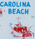 | Details | Greater Wilmington Chamber of Commerce | 1958 |
| New Hanover County Pictorial Fishing Map Mid century |
|
Greater Wilmington Chamber of Commerce |
|
| 1958 |
| LOC:86 |
| $175.00 | Greater-Wilmington-Chamber-of-Commerce | New-Hanover-County-Pictorial-Fishing-Map-Mid-century | Pictorial fishing map from 1958 of New Hanover County, NC. Drawn by Art Newton. Shows pictorially many locations for public fishing piers, surf fishing spots, wrecks, charter boats, boat launches and more. Soundings are provided near the beach and numerous inlets are identified including Carolina Beach Inlet, Masonboro Inlet, Moore Inlet, and Rich Inlet. Decorated with local fish: Flounder, Dolphin, Amberjack, Barracuda, Sailfish, and Bonito.
<br><br>
Copyrighted and published by the Greater Wilmington Chamber of Commerce, 1958. Printed by the Wilmington Printing Company, Wilmington, North Carolina.
<br><br> |
| 5245 |  | Details | Brindle, Melbourne | 1958 |
| Authentic Treasure Map of the Eastern Seaboard |
|
Brindle, Melbourne |
|
| 1958 |
| LOC:88 |
| $200.00 | Brindle--Melbourne | Authentic-Treasure-Map-of-the-Eastern-Seaboard | Scarce mid 20th-century decorative <b>treasure map</b> by artist Melbourne Brindle of Bridgewater Connecticut. A chart of shipwrecks along the East Coast of the United States from Sandy Hook, NJ past Long Island and Block Island Sound as far as Horseneck Beach, Massachusetts. With an inset map of Delaware Bay and another inset map of the waters off Cape Cod, Nantucket and Martha's Vineyard. No holdings of this map recorded in WorldCat. Lacks attached sheet of wreck locations.
<br></br>
Map copyrighted 1958 by United States Treasure Maps, Litchfield, Connecticut.
<br></br>
Ewart Melbourne Brindle (1904 – 1995) was an Australian-American illustrator and painter who in mid-career became for his automobile illustrations. In 1958 Brindle published another similar map: "An authentic map of Florida, the Gulf of Mexico, and the Caribbean Sea, showing locations of sunken treasure." |
| 7884 |  | Details | Chase, Francis J. | 1959 |
| Pictorial Map of Alaska, the 49th State |
|
Chase, Francis J. |
|
| 1959 |
| LOC: |
| $295.00 | Chase--Francis-J- | Pictorial-Map-of-Alaska--the-49th-State | Ernest Dudley Chase's "A Pictorial Map of Alaska, the 49th State" is a fascinating visual representation of Alaska's history and its journey to statehood. The map, created in 1959, celebrates Alaska's admission to the Union as the 49th state on January 3 of the same year. Chase's signature style, combining attractive illustrations with geographical information, provides a unique perspective on this momentous event in American history.
<br><br>
The Chase's map incorporates an alphanumeric grid system to help users easily locate specific points of interest. Surprisingly, the map retains its original advertising sticker, prominently displayed in the upper left corner, bearing a price of 50 cents. The presence of the sticker serves as a testament to its authenticity, further enhancing its overall value and desirability.
<br><br>
The map showcases various aspects of Alaskan life, including its natural resources, industries, and cultural heritage. Chase depicts the state's diverse landscapes, from the rugged coastlines to the majestic mountain ranges, highlighting the beauty and vastness of America's last frontier.
<br><br>
Chase's map also chronicles the historical events leading up to Alaska's statehood, such as the purchase of Alaska from Russia in 1867, known as "Seward's Folly," and the discovery of gold in the late 19th century, which led to the Klondike Gold Rush. The map portrays the development of Alaska's major cities, including Anchorage, Fairbanks, and Juneau, as well as the growth of its industries, such as fishing, mining, and logging.
<br><br> |
| 8064 |  | Details | Anonymous | 1959 |
| Mid century scarf Eglin Air Force Base Florida |
|
Anonymous |
|
| 1959 |
| LOC: |
| $365.00 | Anonymous | Mid-century-scarf-Eglin-Air-Force-Base-Florida | This scarce and colorful mid-20th-century souvenir textile celebrates Eglin Air Force Base, Florida, presenting the installation as a principal proving ground of American air power during the early Cold War. A pictorial map of Florida labeled “Air Proving Ground Command” anchors the design, surrounded by illustrations of jet aircraft, test pilots, target vehicles, and specialized facilities. The textile combines cartographic imagery with promotional aviation art, adapting a souvenir-scarf format widely used for U.S. Air Force bases in the 1950s.<br><br>
The aircraft depicted represent the forefront of U.S. Air Force technology in the supersonic transition era. Shown at mid-left is a B-52 Stratofortress, identifiable by its long straight wings and eight-engine configuration, symbolizing strategic bomber testing. At upper left appears a Lockheed F-104 Starfighter, recognizable by its needle-like fuselage and extremely short wings, while at upper right is a Convair F-102 Delta Dagger, distinguished by its pure delta wing and nose intake. Also depicted is a Republic F-84F Thunderstreak, a swept-wing fighter-bomber widely used in weapons and systems evaluation during the mid-1950s. Additional imagery of test pilots and supersonic tow targets reinforces Eglin’s testing mission.<br><br>
The dating of the textile is supported by both the aircraft selection and the prominent reference to the Climatic Hangar, a facility completed at Eglin in 1954 and widely promoted in subsequent years for extreme-environment testing. The inclusion of the F-102, operational from 1956, and the F-104, which entered U.S. Air Force service in 1958, establishes a firm late-1950s timeframe, while the F-84F reinforces a mid-to-late 1950s context. The absence of later aircraft types or space-age imagery associated with the 1960s further supports an early Cold War date. These elements place the textile most convincingly in the late 1950s, circa 1958 to 1960.<br><br> |
| 4962 |  | Details | Hayden, T.A. | 1959 |
| Huge Unrecorded Map of the Salt River Project Phoenix Arizona |
|
Hayden, T.A. |
|
| 1959 |
| LOC:1409 |
| $2,500.00 | Hayden--T-A- | Huge-Unrecorded-Map-of-the-Salt-River-Project-Phoenix-Arizona | Large, very rare map of the first Federal hydroelectric energy project, updated to show hydrological improvements and issued revised 8-7-1959. An untitled birds-eye view map of the Salt River Project by T.A. Hayden, centered near Phoenix, Arizona. Similar to, but covering a larger area, than a small format map of the region by Hayden from 1934, now housed at Arizona State University.
<br><br>
Blue-line print hand-colored and enhanced with small red paste-on stickers and larger, manuscript lettering for cities. Shows the rivers, dams, reservoirs, lakes, and canals . Particular interest is indicated for reservoirs and canals as they have been hand colored in white and bright blue respectively.
<br></br>
The beginning of federal production of electric power occurred on the Salt River Project when Congress, in 1906, authorized the Reclamation Service to develop and sell hydroelectric power from the project. The map is significant because it was updated in 1959 when the original name "Salt River Dam #1" was changed to the name in use today: Roosevelt Dam.
<br></br>
Coverage is bound to the west by Gila Bend and to the east by Superior, AZ. Northern coverage ends above Prescott, Arizona, and to the south the map extends as far as Casa Grande.
<br></br>
The map has an interesting orientation with North oriented about 35 degrees to the left and that with the birdseye perspective, the large size, and the township and range grid of the Public Lands Survey System all give the map a commanding appearance.
<br></br>
In the 1930's T.A. Hayden was the Chief Assistant Engineer with the Salt River Valley Water User's Association, Phoenix. Copyrighted 1932 and Revised 1934 by T.A. Hayden. Final revision 1959. Phoenix, Arizona. |
| 6329 | 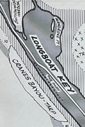 | Details | Allyn, Rube | 1960 |
| Allyn's Fishing Map 2E Sarasota Bay |
|
Allyn, Rube |
|
| 1960 |
| LOC:61 |
| $135.00 | Allyn--Rube | Allyn-s-Fishing-Map-2E-Sarasota-Bay | Original Rube Allyn's Authentic Fishing Map (ca. 1960), for Sarasota Bay, Florida. Key features include Sister Key, Sleepy Lagoon, Dream Island, Buttonwood Harbor, Longboat Key, Sarasota, Ringling Isles and Big Sarasota Pass.
<br></br>
Map # 2E. Ca. 1960. Copyright Rube Allyn, St. Petersburg, Florida. Lithographed by MacDonald, Tampa. |
| 4933 | 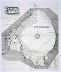 | Details | Allyn, Rube | 1960 |
| Scarce Rube Allyns Authentic Fishing Map Lake Okeechobee Florida |
|
Allyn, Rube |
|
| 1960 |
| LOC:61 |
| $0.00 | Allyn--Rube | Scarce-Rube-Allyns-Authentic-Fishing-Map-Lake-Okeechobee-Florida | SOLD
<br></br>
Scarce, presumed first edition of Rube Allyn's Authentic Fishing Map (ca. 1960), for Lake Okeechobee, Florida. Drawn by Erland M. Larson. Published by the Great Outdoors Association, Pier 63, Central Basin, St, Petersburg, Fla. Price when issued 25 cents.
<br/><br/>
Includes Moore Haven, Clewiston, Lake Harbor, Pahokee. Much interesting local detail such as Peanut Shirling's Camp, Dewey's Camp, Fish Eating Creek, Bill Johnson's Fishing Camp, Slim's Fish Camp, Port Mayaca, and the cross-state waterway. |
| 5125 |  | Details | Nowotny-Burrell Company | 1960 |
| Pictorial Map of Texas and the Loyal Colonies Sometimes Referred to as the United States |
|
Nowotny-Burrell Company |
|
| 1960 |
| LOC:200 |
| $0.00 | Nowotny-Burrell-Company | Pictorial-Map-of-Texas-and-the-Loyal-Colonies-Sometimes-Referred-to-as-the-United-States | SOLD<br></br>
Souvenir scarf printed with a humorous pictorial "Map of Texas and the Loyal Colonies Sometimes Referred to as the United States." Somewhat similar in concept to Wither's "A Texan's Map of U.S.A." but the humor is much more likely to brag about Texas than to make fun of their neighboring states with derogatory labeling. Copyright 1956 by Nowotny-Burrell Company (bottom left corner). Scarce.
<br></br>
Contains a direction indicator near upper right that was copyrighted by Nowotny-Burrell and Company, San Antonio on July 31, 1952. The copyright is for a "Texan's direction Indicator. Five pointed star indicating, north, east, south, Texas, and west." The history of cartography took a great leap forward with the invention of this novel and humorous compass rose.
<br></br>
100 percent rayon. Made in Japan. Probably a later edition of the map ca. 1960, not a silk and rayon blend. Green edging. |
| 5049 | 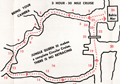 | Details | Jungle Queen Tours | 1960 |
| Route Map Jungle Queen Sightseeing Cruises Fort Lauderdale |
|
Jungle Queen Tours |
|
| 1960 |
| LOC:11 |
| $80.00 | Jungle-Queen-Tours | Route-Map-Jungle-Queen-Sightseeing-Cruises-Fort-Lauderdale | Map of the routes followed by the "World Famous Original" Jungle Queen Sightseeing Cruises ca. 1960. Two cruises were offered on the New River by the operator departing from the Jungle Queen Docks in Bahia Mar, Fort Lauderdale, Florida. One option, the 3-hour Circular Jungle and Everglades Tour, was highlighted by a stop at the Seminole Indian Village (including alligator wrestling). For passengers desiring a later start, at 7:00 p.m. the Jungle Queen II departed with as many as 250 passengers for their Bar-B-Q and Shrimp Dinner cruise followed by a vaudeville review and dancing under the stars.
<br></br>
Three-panel folding brochure closes to a compact 4" x 9".
<br></br>
Tourism has been an important part on the Florida economy for more than 100 years. For many decades operators have offered boat tours as a way of showing off the many attractions of Florida to large numbers of customers. From glass-bottomed boats to mail boats to today's high-speed thrill rides the enthusiasm of tourists for excitement and entertainment on the water has not diminished. |
| 5034 | 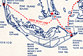 | Details | Ladd's Mail Boat | 1960 |
| Map of route Ladd's mail boat Santiva Cape Coral Sanibel Captiva Florida |
|
Ladd's Mail Boat |
|
| 1960 |
| LOC:11 |
| $0.00 | Ladd-s-Mail-Boat | Map-of-route-Ladd-s-mail-boat-Santiva-Cape-Coral-Sanibel-Captiva-Florida | SOLD<br><br>On December 9, 1963 the last mail boat in the U.S. made it’s final trip. Ladd's Mail Boat "Santiva" operated from Fort Meyers, Florida by Captain Palmer Ladd of Ladd Boat Line was the last in a series of vessels to provide water-borne mail service to Captiva and Sanibel Islands. The Santiva followed the Dixie, the Gladys, the stern-wheelers Success and Grey Eagle, and numerous sailing vessels that brought ice, fresh meat, livestock, and building materials to the islands. On the return trips the vessels carried away fresh produce including prized Sanibel tomatoes. Since 1938 the mail route was combined with a sightseeing tour . (Source: Sanibel-Captiva Record, Dec 12, 1963). |
| 6707 |  | Details | Allyn, Rube | 1960 |
| Allyns Fishing Map Hillsboro Bay 2B Tarpon |
|
Allyn, Rube |
|
| 1960 |
| LOC:0 |
| $165.00 | Allyn--Rube | Allyns-Fishing-Map-Hillsboro-Bay-2B-Tarpon | DESCRIPTION: Original Rube Allyn's Authentic Fishing Map (ca. 1960), for lower Hillsboro Bay south of St. Petersburg, Florida. Features include McKay Bay, Black Point, Gadsden Point, Coon Hammock Creek, the Kitchen, East Tampa, Alafia River, and Delaney Creek. Shows an astounding number of locations to catch Tarpon!
<br></br>
Map # 2B. ca. 1960. Copyright Rube Allyn, St. Petersburg, Florida. Research by Doc Howe. Drawn by Jack Meyer. |
| 6328 |  | Details | Allyn, Rube | 1960 |
| Allyns Fishing Map 2C Lower Tampa Bay |
|
Allyn, Rube |
|
| 1960 |
| LOC:61 |
| $0.00 | Allyn--Rube | Allyns-Fishing-Map-2C-Lower-Tampa-Bay | SOLD<br></br>
DESCRIPTION: Original Rube Allyn's Authentic Fishing Map (ca. 1960), for lower Tampa Bay - Manatee River, Florida. Key features include Terra Ceia Bay, Snead Island, McGill Island, Anna Maria Key, Perico Island, Palma Sola Bay, Bradenton Beach, Cortez, the Holmes Yacht Basin and the northern-most point of Sister Key.
<br></br>
Map # 2C. Ca. 1960. |
| 6708 |  | Details | Allyn, Rube | 1960 |
| Allyns Fishing Map Lemon Bay 2G |
|
Allyn, Rube |
|
| 1960 |
| LOC:0 |
| $175.00 | Allyn--Rube | Allyns-Fishing-Map-Lemon-Bay-2G | DESCRIPTION: Original Rube Allyn's Authentic Fishing Map for Lemon Bay, Florida (ca. 1960). Drawn by Charlie Allyn and Barbara Hagerman. Points of interest include Gasparilla Sound, Coral Creek, Little Gasparillo Pass, Stump Pass, Stanford's Fishing Resort, Manasota Key, Englewood, and Alligator Creek.
<br></br>
Map # 2G. ca. 1960. Copyright Rube Allyn, St Petersburg, Florida. Great Outdoors Association. Pier 63, Central Basin, St. Petersburg, Florida. |
| 6709 |  | Details | Allyn, Rube | 1960 |
| Rube Allyn's Fishing Map Little Sarasota Bay Venice Florida 2F |
|
Allyn, Rube |
|
| 1960 |
| LOC:0 |
| $175.00 | Allyn--Rube | Rube-Allyn-s-Fishing-Map-Little-Sarasota-Bay-Venice-Florida-2F | DESCRIPTION: Original Rube Allyn's Authentic Fishing Map for the Little Sarasota Bay / Venice, Florida area. Key locations and features Allyn has noted include: Casey Key, Vamo, Osprey, Sarasota Beach, Midnight Pass, Tamiami Trail, Lyons Bay, and Roberts Bay. Perhaps the most interesting feature is a rock shelf (avg. depth 28 feet) that sinuously snakes its way just offshore the beach. Chart #2F.
<br></br>
Copyright Rube Allyn, St. Petersburg, Florida |
| 5029 |  | Details | Anonymous | 1960 |
| Map and Brochure New Uncle Sam Cruise Tour Biscayne Bay Florida |
|
Anonymous |
|
| 1960 |
| LOC:11 |
| $80.00 | Anonymous | Map-and-Brochure-New-Uncle-Sam-Cruise-Tour-Biscayne-Bay-Florida | Brochure for a 2.5 hour touristic cruise of Biscayne Bay, Miami Beach, Florida aboard the glass-enclosed motorboat Uncle Sam. With a map of the path of the cruise (in red) around Biscayne Bay.
<br></br>
The diesel-powered 84-passenger Uncle Sam departed Pier 10 at the Miami Yacht Basin in Bayfront Park and passed the Venetian Islands, the Flagler Memorial, Fisher's Island then crossed the Rickenbacher Causeway. On the return to the yacht basin the Uncle Sam passed the bayfront estates of James Deering (Villa Viscaya), Charles Coryell, Damon Runyon, and more.
<br></br>
Detailed inset map of access roads and parking for the Uncle Sam cruise. Multi-lingual brochure ca. 1960's with key details translated and targeted to appeal to a Spanish-speaking audience: "Mostrando especialmente las mansiones de Cubanos y Portorriquenos en la zona residential…"
<br></br>
Printed on both sides and folds to 4" x 9". |
| 5056 |  | Details | Anonymous | 1960 |
| Map Seven Seas Sightseeing Miami and Miami Beach Cruise |
|
Anonymous |
|
| 1960 |
| LOC:11 |
| $85.00 | Anonymous | Map-Seven-Seas-Sightseeing-Miami-and-Miami-Beach-Cruise | Brochure for a 2.5 hour lectured cruise of North Biscayne Bay, Miami Beach, Florida aboard the double-decked motorboat Seven Seas. With a map of the cruise route (in red) around North Biscayne Bay.
<br></br>
Unlike other cruises on south Biscayne Bay (e.g. Uncle Sam cruise) the Seven Seas cruise was operated in<b> North Biscayne Bay</b>, departing from Pier 8 at the Miami City Yacht Basin twice daily. The cruise passed the Venetian Causeway, passed the Charles Deering estate, and sailed past the 79th street causeway, retiring past Mt. Sinai Hospital and making a circle in Sunset Lake before docking 2 1/2 hours later. Other points of interest included the Goodyear Blimp Base, Flagler Memorial Monument, Little River, and Indian Creek Village.
<br></br>
Printed on both sides and folds to 4" x 9". |
| 5032 |  | Details | Allyn, Rube | 1960 |
| Lot of six river charts Suwannee River and Withlacoochee |
|
Allyn, Rube |
|
| 1960 |
| LOC:0 |
| $0.00 | Allyn--Rube | Lot-of-six-river-charts-Suwannee-River-and-Withlacoochee | SOLD
<br></br>
Lot of six Rube Allyn's river charts for the Withlacoochee and Suwanee Rivers copyrighted by the Great Outdoors Association ca. 1960's.
<br></br>
As described on the envelope covering the exterior of the chart, Allyn sold his Withlacoochee and Suwanee River charts in sets of three and four sheets:
<div class="indenttextblock">
"<b>Suwannee River</b>, with 210 miles of romance and delight, completely charted in four large maps. … Beautiful springs, delightful camping places. At some villages, modern air-conditioned motels."
<ul style="list-style-type: circle;">
<li>S1- Cedar Keys to Manatee Springs/Oldtown</li>
<li>S2 - Manatee Springs/Oldtown to Branford</li>
<li>S3 - Branford to White Springs</li>
</ul>
"<b>Withlacoochee River</b>, one of Florida's most beautiful and fishable streams. … 14 fishing resorts accurately placed and more that 100 secret fishing spots revealed."
<ul style="list-style-type: circle;">
<li>W1- Gulf of Mexico to Backwaters (Gulf to Dunnellon) </li>
<li>W2 - Dunnellon to Panasoffkee (Dunnellon to Inverness)</li>
<li>W3 - Panasoffkee to Headwaters (Inverness to St. Catherine)</li>
</ul>
</div>
Note: Chart titles on the Withlacoochee River Series differ between the folders and the charts.
</div> |
| 6710 |  | Details | Allyn, Rube | 1960 |
| Rube Allyn's Fishing Map Boca Ciega Bay Clearwater 1B |
|
Allyn, Rube |
|
| 1960 |
| LOC:0 |
| $175.00 | Allyn--Rube | Rube-Allyn-s-Fishing-Map-Boca-Ciega-Bay-Clearwater-1B | DESCRIPTION: Original Rube Allyn's Authentic Fishing Map ca. 1960. for upper Boca Ciega Bay and Gulf Beaches. Locations and features that Allyn chose to include are: Clearwater Harbor, Reddington Beach, Upper Boca Ciega Bay, Madeira Beach, Long Bayou, Jungle Estates, Sunset Beach, Devil's Elbow, Blind Pass, and St. John's Pass.
<br></br>
Copyright Rube Allyn, St. Petersburg, Florida. Chart #1B. Drawn by Jack Meyer. |
| 5061 |  | Details | U.S. Army Engineers | 1960 |
| Two maps of recreation facilities on the Okeechobee Waterway. |
|
U.S. Army Engineers |
|
| 1960 |
| LOC:87 |
| $150.00 | U-S--Army-Engineers | Two-maps-of-recreation-facilities-on-the-Okeechobee-Waterway- | Two charts of recreation facilities on the Okeechobee Waterway stretching across the state from East Florida to West Florida. Recto with a map of recreation facilities including locks and dams along the Caloosahatchee River from Pine Island Sound to Moore Haven on Lake Okeechobee. Includes the Ortona Lock and Dam and the Franklin Lock and Dam.
<br></br>
Verso with a map of Lake Okeechobee and the Okeechobee waterway outlet to the Atlantic Ocean at Stuart, Florida. Published by the U.S. Army Corps of Engineers, Jacksonville District. |
| 6593 |  | Details | Hayden, Walter Emmet | 1960 |
| June Lake Lee Vining Directory Map Fishing Hunting Map |
|
Hayden, Walter Emmet |
|
| 1960 |
| LOC:89 |
| $160.00 | Hayden--Walter-Emmet | June-Lake-Lee-Vining-Directory-Map-Fishing-Hunting-Map | 1960 revised edition of the Hayden Map Company's Hunter's and Fisherman's map for the June Lake / Lee Vining area of Mono and Inyo Counties, California. Map # 61912. Copyright 1952. Verso blank.
<br><br>
Price was 50 cents when issued. Printed in bright blue ink.
<br><br>
Inset small-scale context map of California. |
| 5346 | 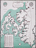 | Details | Kellogg, Charles W. | 1960 |
| Pictorial Map of Seats on Talbot County Waterways |
|
Kellogg, Charles W. |
|
| 1960 |
| LOC:53 |
| $480.00 | Kellogg--Charles-W- | Pictorial-Map-of-Seats-on-Talbot-County-Waterways | Scarce pictorial thematic map with more than 80 historic estates (seats) near Chesapeake Bay in Talbot County, Maryland. Each estate is numbered and keyed to a list with the names of their owners. Small elevation drawings of each estate provide a rough idea of how the estate looked in 1960. The map includes some old historic points of interest in Talbot County such as the old Wye Church and Friends Meeting House.
<br></br>
The large waterways shown on this estate map include the Wye River, Miles River, Harris Creek, Broad Creek, Tred Avon River, and Choptank River. Smaller waterways include among others, Goldsborough Creek, Leeds Creek, Island Creek, and Trappe's Creek. Towns in Talbot County include St. Michaels, Easton, Oxford, Queen Anne, and Trappe.
<br></br>
Map Title: "Seats on Talbot County Waterways Chesapeake Bay." By Charles W. Kellogg. Updated edition from 1960 of a map that Kellogg first published in 1949. Charles Kellogg's own estate on Skipton Creek, numbered as #1 was "Langshaws".
<br></br>
Several of the seats listed in Talbot County in 1960 are found today in the National Register of Historic Places.
<div class="indenttextblocksingle">
<ul style="list-style-type: circle;">
<li>The Anchorage: Easton. Robert L. Kemp</li>
<li>Compton: Trappe. Charles F.C. Arensberg</li>
<li>Otwell: Oxford. J. E. Jackson</li>
<li>Troth's Fortune: Easton. Frederick S. Thomas</li>
<li>Wye House. Easton. Morgan B. Schiller</li>
</ul>
</div> |
| 5380 |  | Details | Royal Palm Harbor, Inc. | 1960 |
| Naples, Florida sales plat for Royal Harbor subdivision |
|
Royal Palm Harbor, Inc. |
|
| 1960 |
| LOC:90 |
| $250.00 | Royal-Palm-Harbor--Inc- | Naples--Florida-sales-plat-for-Royal-Harbor-subdivision | Scarce lithographed plat of lots for sale during 1960 in the Royal Harbor subdivision of Naples, Florida. The shaded areas consist of lots sold before October 1, 1960.
<br></br>
Originally developed in the 1960’s-1970’s, Royal Harbor is a waterfront community consisting of over 600 plus single family homes and condominiums located on the Eastern shore of Naples Bay. Royal Harbor is located near the heart of Naples, across the bay from Port Royal.
<br></br>
Published by Royal Palm Harbor, Inc. 1650 Curlew Avenue Naples Florida. |
| 7984 | 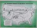 | Details | Howells, Rulon S. | 1961 |
| Map of The Mormon Exodus to the Rocky Mountains |
|
Howells, Rulon S. |
|
| 1961 |
| LOC: |
| $300.00 | Howells--Rulon-S- | Map-of-The-Mormon-Exodus-to-the-Rocky-Mountains | Scarce mid-20th-century educational wall poster depicts the westward migration of the Mormon pioneers from the eastern United States to the Great Salt Lake Valley. The map traces multiple overland and sea routes—from early settlements in New York, Ohio, and Illinois across Iowa, Nebraska, and Wyoming to Utah—with fine line work and green-toned shading that visually emphasizes the journey’s progression.
<br><br>
Illustrations along the route show covered wagons, handcarts, and pioneer figures, while smaller vignettes depict scenes such as the Mormon Battalion’s march and seaborne emigrant routes from Europe. At lower left, a narrative block summarizes the migration’s history, noting Brigham Young’s leadership and the founding of the Great Salt Lake settlement in 1847.
<br><br>
Printed in green and black on white stock, the map carries the imprint: “A Teaching Aid – The Mormon Story – Teaching Aids, Inc., Highland Park, Illinois.” This poster was likely used in classrooms and religious education settings during the 1960s, part of a broader trend toward illustrated historical maps as visual teaching tools. An attractive and informative example of mid-century American educational cartography.
<br><br>
Published by Bookcraft, Inc, 1961. |
| 5086 |  | Details | Winters, David and Irene | 1961 |
| Map route Ranger III sightseeing tour Mullet Key Treasure Island Bradenton Florida |
|
Winters, David and Irene |
|
| 1961 |
| LOC:11 |
| $0.00 | Winters--David-and-Irene | Map-route-Ranger-III-sightseeing-tour-Mullet-Key-Treasure-Island-Bradenton-Florida | SOLD
<br></br>
Chart of the routes for sightseeing tours by the vessel Ranger III from St. Petersburg, Florida ca. 1961. The cruises all departed at 10:30 a.m. six days a week from slip 8 at Vinoy Basin. The chart shows the prospective route for cruises to Mullet Key, to Treasure Island, and to Bradenton Florida. Each cruise aboard the 64 foot diesel-powered tour boat carried up to one-hundred passengers at $2.00 per person.
<br></br>
In January 1961, three vessels operated excursions out of the St. Petersburg Yacht Basin: the Florida Queen, the Miss Florida III and the Ranger III. In 1961 aboard the Ranger III on a tour to Mullet Key, Captain Winters provided commentary on the local sights and Charlie Holdsworth, an ex-vaudevillian, entertained sightseers with his banjo and singing. (Branch, Dave. "Is this the day for a boat ride down the bay?" St. Petersburg Times. January 1. 1961. p. 41.).
<br></br>
The Ranger III route chart occupies 2 panels on a 4-panel folding brochure. Verso with photographs and a description for each of the three cruise options. |
| 5111 | 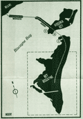 | Details | Key Biscayne Chamber of Commerce | 1961 |
| Street map of Key Biscayne, Florida from 1961. |
|
Key Biscayne Chamber of Commerce |
|
| 1961 |
| LOC:11 |
| $0.00 | Key-Biscayne-Chamber-of-Commerce | Street-map-of-Key-Biscayne--Florida-from-1961- | SOLD
<br></br>
Street map of Key Biscayne, Florida from 1961. Published by the Key Biscayne Chamber of Commerce with a 17-point key to points of interest on the island including the Cape Florida Lighthouse on the southernmost tip of the island. |
| 5055 |  | Details | Anonymous | 1962 |
| Lot of six (6) scarce Fin Fishing Charts Lemon Bay to Tarpon Springs Florida |
|
Anonymous |
|
| 1962 |
| LOC:40 |
| $180.00 | Anonymous | Lot-of-six-(6)-scarce-Fin-Fishing-Charts-Lemon-Bay-to-Tarpon-Springs-Florida | Lot of six scarce "Fin Fishing Charts" for Florida coastal areas in the vicinity of Tampa Bay, Florida. Charts folded as issued.
<br></br>
All charts fit inside a point-of-sale envelope/folder printed with an index map of southern Florida showing all available Fin Fishing charts and highlighting these specific charts from Lemon Bay to Tarpon Springs: W7, W8, W9, W10, W11, W12.
<br></br>
Hot fishing spots are highlighted with red dots and tide table adjustments are included for several locations. Several marinas and other business establishments are noted in red on the charts, probably locations that sold these charts or that paid for the advertisement. Ink stamp on the folder carries a date of March 6, 1962. Creator of the charts is unattributed and very few, if any, of these charts are available on the market. |
| 5381 |  | Details | Smith Kline and French | 1962 |
| Thematic map of the USA allergy season by state |
|
Smith Kline and French |
|
| 1962 |
| LOC:88 |
| $220.00 | Smith-Kline-and-French | Thematic-map-of-the-USA-allergy-season-by-state | Decorative thematic advertising map of the continental United States showing the months during which three types of pollen are prevalent. The map, by Smith, Kline, and French Laboratories (SKF) was created to support sales of Teldrin Spansules, SKF's brand name for chlorpheniramine maleate, an antihistamine. This mid 20th-century map shows the pollen season for grass pollen, tree pollen, and ragweed pollen.
<br></br>
Philadelphia. October 1962. |
| 5222 |  | Details | Paine, Howard E. | 1963 |
| Lot of 3 manuscript design options for Round Earth on Flat Paper NGS |
|
Paine, Howard E. |
|
| 1963 |
| LOC:62 |
| $1,200.00 | Paine--Howard-E- | Lot-of-3-manuscript-design-options-for-Round-Earth-on-Flat-Paper-NGS | Three manuscript sketches, design options by Howard Paine (1) for The Round Earth on Flat Paper used on the inside back cover of the National Geographic Society's first Atlas of the World. <i>(National Geographic Society. 1963.)</i>. From the estate of Howard Paine, Art Director at National Geographic until 1990.
<br><br>
Note: The first image of the four displayed, is from the 1963 NGS Atlas and is for comparison only. Not included.
<br><br>
The booklet "The Round Earth on Flat Paper: Map Projections Used by Cartographers" by Wellman Chamberlin was first published by the National Geographic Society in 1947. In 1963 Chamberlin and Paine collaborated on the design of the inside back and front covers for National Geographic's first <b>"Atlas of the World"</b>: <i>The Earth in Space and The Round Earth on Flat Paper</i>. For <i>The Round Earth on Flat Paper</i> Paine sketched several alternate options. The influence of Paine's early designs are evident in the final design selected for the atlas. |
| 5309 |  | Details | Dade County Planning Department | 1963 |
| Land Use Master Plan Miami Dade County Florida with maps |
|
Dade County Planning Department |
|
| 1963 |
| LOC:400 |
| $0.00 | Dade-County-Planning-Department | Land-Use-Master-Plan-Miami-Dade-County-Florida-with-maps | SOLD <br><br>
Proposed long-term master land use plan for Dade County, Florida published in October, 1963. The plan was prepared for the Board of County Commissioners of Dade County by the Metropolitan Dade County Planning Advisory Board and the Metropolitan Dade County Planning Department.
<br><br>
Very scarce on the market.
<br><br> 8 institutional holdings in WorldCat.
<br><br>
Folding document with 16 panels printed on both sides of a single sheet.
<br><br>
<b>Includes three large multicolored maps of Dade County, FL.</b>
<div class="indenttextblocksingle">
<ul style="list-style-type: circle;">
<li>Generalized existing land use for 1,080,000 population - 1963 estimate<br>
Metropolitan Dade County, Florida.</li>
<li>Proposed general land use master plan for 2,500,000 population - 1985 estimate<br>
Metropolitan Dade County, Florida. </li>
<li>Elements of the general plan.<br>
Population, Distribution, Major Traffic Generators and Transportation System</li>
</ul>
</div>
<b>Additional smaller inset maps include:</b>
<div class="indenttextblocksingle">
<ul style="list-style-type: circle;">
<li>Future urban form</li>
<li>Residential Development</li>
<li>Major Industry and Tourism</li>
<li>Major Parks and Recreation Areas</li>
<li>Major Commercial and Service Centers</li>
<li>Major Transportation Facilities</li>
</ul>
</div> |
| 5089 |  | Details | WBOP Radio | 1963 |
| WBOP All-Negro AM Radio Pensacola Florida Coverage Map |
|
WBOP Radio |
|
| 1963 |
| LOC:11 |
| $0.00 | WBOP-Radio | WBOP-All-Negro-AM-Radio-Pensacola-Florida-Coverage-Map | SOLD<br><br>Coverage contour map for AM radio station WBOP in Pensacola, Florida from September 1963. Map compiled by Bill Lee of WLAK Electronics Service, Lakeland, Florida. With consumer marketing data for the black population in the WBOP market area. African-American interest. Station coverage extends as far north as South Flomaton and as far east as Foley, Florida. |
| 6596 |  | Details | Brunswick Golden Isles Chamber of Commerce | 1963 |
| Treasure Map Brunswick and Golden Isles Georgia |
|
Brunswick Golden Isles Chamber of Commerce |
|
| 1963 |
| LOC:89 |
| $120.00 | Brunswick-Golden-Isles-Chamber-of-Commerce | Treasure-Map-Brunswick-and-Golden-Isles-Georgia | Ye Olde Treasure Map Brunswick and the Golden Isles of Georgia is a fact-filled pirate-themed pictorial map of Brunswick and the Golden Isles of Georgia. Includes Jekyll Island, Saint Simons Island, and Sea Island. At right, an inset large-scale context map of the United States East Coast.
<br><br>
Blackbeard says hoist your wallet and heave your doubloons on this one before she sails away. Arrgh! |
| 6464 |  | Details | Suyeoka, George | 1964 |
| VI-Daylin Natural History Map and National Heritage Map |
|
Suyeoka, George |
|
| 1964 |
| LOC:90 |
| $250.00 | Suyeoka--George | VI-Daylin-Natural-History-Map-and-National-Heritage-Map | Scarce pictorial map advertisement for Vi-daylin vitamins as a Natural History Map of the United States (recto). Verso with similar pictorial map but a National Heritage Map.
<br><br>
Not found online. Not in WorldCat.
<br><br>
Cartographs created by textbook illustrator, inventor, and commercial artist George Suyeoka (1926- 2015). Copyrighted and published in 1964 by Abbot Laboratories, North Chicago, Illinois. |
| 6685 |  | Details | Clarke, Dorothy Linscott | 1964 |
| Pictorial Map New Hampshire Coast |
|
Clarke, Dorothy Linscott |
|
| 1964 |
| LOC:68 |
| $950.00 | Clarke--Dorothy-Linscott | Pictorial-Map-New-Hampshire-Coast | Dorothy Linscott Clarke's desirable lithographed 1964 pictorial map of "New Hampshire's Famous Seacoast Region". Only 1 copy in WorldCat. Rare.
<br><br>
Unlike some artists' pictorial maps, Clarke doesn't attempt cheap humor or resort to demeaning stereotypes in her pictograms. The visual theme throughout could be described as old-fashioned Yankee Nautical as Clarke combines selected history and geography with nautical imagery to produce a map that reflects the nautical past and present of New Hampshire's Coast. Nautical symbols Clarke used include:
<div class="indenttextblocksingle">
<ul style="list-style-type: circle;">
<li>Anchor: The anchor is a symbol of stability, security, and hope. It represents the idea of being grounded and rooted, and being able to weather storms and challenges.</li>
<li>Ships wheel: The ship's wheel, also known as the helm, is a symbol of leadership, guidance, and control. It represents the idea of being able to steer a course through difficult waters.
<li>Whale: The whale is a symbol of strength, power, and the natural world. In maritime culture, whales were often seen as formidable creatures that commanded respect and awe.
<li>Sailor: The sailor is a symbol of adventure, courage, and freedom. Sailors were often seen as brave and resourceful individuals who were willing to venture out and face danger and uncertainty.</li>
<li>Rope: A rope can be seen as a symbol of connection, safety, or security, as it is often used to tie ships to docks or to other vessels.</li>
</ul>
</div>
Other pictorial maps by Dorothy Clarke include:
<div class="indenttextblocksingle">
<ul style="list-style-type: circle;">
<li>A map of Mother-Goose Land. 1933.</li>
<li>A map showing the locations of some of the houses at Strawberry Banke restoration at Portsmouth, N.H. 1965.</li>
<li>Historical picture map of Vermont, "The Green Mountain State." 1939.</li>
<li>A picture map of Noah's Ark for children. Circa 1930.</li>
</ul>
</div> |
| 5379 |  | Details | General Electric | 1964 |
| Map of General Electric support locations for Apollo Space Program |
|
General Electric |
|
| 1964 |
| LOC:55 |
| $275.00 | General-Electric | Map-of-General-Electric-support-locations-for-Apollo-Space-Program | Rare unrecorded map of locations in the United States for teams created by General Electric Corporation to provide engineering services to the Apollo Spaceflight Program- the "Apollo Support Department" (ASD) in the mid 1960s.
<br></br>
Two of the Apollo Support Department's seven locations are located in Florida; the headquarters in Daytona Beach, and another in Cocoa Beach, Florida. Other ASD locations included Houston, Texas; Huntsville, Alabama; Syracuse, New York; and Washington, D.C. The ASD was part of the Command Systems Division of G.E.
<br></br>
No copies of this map are found online.
<br></br>
Verso with signature: "M. Williams". |
| 6654 |  | Details | Phillips, Augustus D. and Son | 1965 |
| Pictorial Trail Map of Baxter State Park Maine |
|
Phillips, Augustus D. and Son |
|
| 1965 |
| LOC:53 |
| $0.00 | Phillips--Augustus-D--and-Son | Pictorial-Trail-Map-of-Baxter-State-Park-Maine | SOLD<br><br>
Fine pictorial map of Baxter State Park, Maine by Augustus D. Phillips & Son - Northeast Harbor Maine, dated within to 1965 and presumed first edition. As a dedication below the title Phillips wrote:
<br><br><div class="indenttextblocksingle"> For the heritage of this Mighty, Mountained, Wilderness Park the People of this State of Maine and their Children's Children will Forever be Grateful to the Honorable Percival P. Baxter, Governor of Maine ~ 1921 - 1924 ~ Who Conceived it and Gave the 201,018 Acres of Land for it."
</div>
<br>
<div id="0" align="center">
<a title="TITLE HERE"></a> <img id="3" src="/zoomifyimages/SC_6654/SC_6654_Detail
.jpg" alt="Gus Phillips pictorial map of Baxter State Park, Maine from 1965." width="300"/> <br><small>Baxter State Park map detail..</small>
</div>
<br>
Scarce, only 3 holdings are recorded in WorldCat but the map was apparently issued three times, in 1965, 1970, and 1972. |
| 6385 |  | Details | Lepper, Ruth Rhoads | 1965 |
| Pictorial Map of the Maine Coast from Rockland Schoodic Corea |
|
Lepper, Ruth Rhoads |
|
| 1965 |
| LOC:87 |
| $600.00 | Lepper--Ruth-Rhoads | Pictorial-Map-of-the-Maine-Coast-from-Rockland-Schoodic-Corea | Fine, bright, pictorial map of the Maine Coast from Rockland, through Schoodic to Corea by Ruth Rhoads Lepper, West Southport, Maine. Second Edition ca. 1965. Printed by the Spaulding-Moss Company, Boston, Massachusetts. Inset map of the Schoodic Peninsula. Filled with numerous historical facts and notes.
<br><br>
David Rumsey estimates the date of a later, third edition at 1970.
<br><br> |
| 5122 |  | Details | Ramrod Investments, Inc. | 1965 |
| Scarce map and sales brochure for Cutthroat Harbor Estates Cudjoe Key Florida |
|
Ramrod Investments, Inc. |
|
| 1965 |
| LOC:87 |
| $120.00 | Ramrod-Investments--Inc- | Scarce-map-and-sales-brochure-for-Cutthroat-Harbor-Estates-Cudjoe-Key-Florida | Plat of the first addition to Cutthroat Harbor Estates on the ocean side of Cudjoe Key, Florida. Plat is in a folding ten-panel sales brochure offering lots for sale in Cutthroat Harbor from $1,990 bordering Sacarma Bay, eighteen miles from Key West on U.S. Highway 1. Dated within to 1965, the brochure includes a small-scale map of the development in relationship to the southern portion of Cudjoe Key, and an aerial photograph of the same area.
<br></br>
The brochure includes a table of annual average weather conditions, photographs of construction work at the area, local fishing and boating activities, and the Key West International Airport. |
| 5020 |  | Details | Bailey, John | 1965 |
| Map and guide of Palatka, Florida |
|
Bailey, John |
|
| 1965 |
| LOC:0 |
| $0.00 | Bailey--John | Map-and-guide-of-Palatka--Florida | SOLD<br></br>
Fine printed brochure with a map of Palatka Florida, by commercial artist John Bailey ca. 1965 . Printed from hand laid up and hand-lettered copy, giving this scarce artifact very much a folk-art feeling.
<br></br>
With business advertisements including Mathew's Moving and Storage, the Exchange Bank of Palatka and Middleton Realty Company. In 1948 Clyde D. Littleton Jr. graduated from high school in Palatka, FL. After several years in the Navy and Coast Guard, during the decade of the 1960's Middleton developed several properties in central Florida such as Big Scrub Campsites, Hog Valley, Woods and Lakes and many others.
<br></br>
Another ad for Frank Hancock Insurance Agency. Frank M. Hancock (1912-2007) owned Hancock Insurance Agency in Palatka for 39 years (1950-1989) and he was mayor of Palatka for two terms. |
| 6452 |  | Details | Utz, Thornton | 1965 |
| 60s Pictorial map of Sarasota Florida |
|
Utz, Thornton |
|
| 1965 |
| LOC:87 |
| $300.00 | Utz--Thornton | 60s-Pictorial-map-of-Sarasota-Florida | Pictorial map of Sarasota, Florida and surrounding areas ca. 1965. Designated the Official Chamber of Commerce map, it shows a single span of the old Sunshine Skyway bridge. Copyrighted and published by Thornton Utz as the Limited Gift Edition, this printing of Utz's Map of Sarasota was presented as a service by the Sarasota bank and Trust Company.
<br><br>
<div id="1" align="center">
<a title="Sarasota Florida Pictorial Map"></a>
<img id="3" src="/ZoomifyImages/SC_6452/SC_6452_Detail.jpg" alt="1960s Pictorial Map of Sarasota, Florida by Utz" width="340"/> <br><small>Detail from Utz's Map of Sarasota, Florida</small>
</div><br>
Utz included sketches of numerous commercial and recreational activities in his map including:
<div class="indenttextblocksingle">
<ul style="list-style-type: circle;"></li>
<li>Siesta Key and Longboat Key</li>
<li>Sarasota Jungle Gardens</li>
<li>Chicago White Sox training camp</li>
<li>Bradenton Art Center</li>
<li>Camp Flying Eagle Boy Scout camp</li>
<li>Crescent Beach and Lido Beach</li>
<li>Forest Lakes County Club</li>
<li>Ringling Museum</li>
</ul>
</div>
Based on the $3.00 price stated for an mail-order autographed copy of the map, it appears to predate the version of the map held at the Touchton Map Library which carries a $5.00 price and lacks the reference in the title cartouche to Sarasota Bank and Trust. |
| 6618 |  | Details | Holm, Bill | 1965 |
| Old West style pictorial map of the Permian Basin Texas New Mexico |
|
Holm, Bill |
|
| 1965 |
| LOC:89 |
| $350.00 | Holm--Bill | Old-West-style-pictorial-map-of-the-Permian-Basin-Texas-New-Mexico | Original Old-West-style pictorial map of the Permian Basin, Texas and New Mexico, created by Bill Holm and copyrighted circa 1965. This scarce pictorial map was compiled by the Permian Basin Chamber of Commerce Tourist Committee and published by Holm and West Texas Office Supply. The map retains the graphic and illustrative character typical of promotional region maps from the mid-20th century and was originally issued as part of an eight-panel folding brochure titled Ride the Permian Basin, The Official Guide to the History Lands of the Southwest. <br><br>
The map is centered on Odessa, Texas, and extends across the Permian Basin region of West Texas and southeastern New Mexico. It shows towns, roads, highways, and trails, along with pictorial figures and symbols representing Native Americans, buffalo, cowboys, and topographic features such as mesas and escarpments. A legend at right includes historic and overland routes such as the California Trail, overland stage paths, and the Comanche war trail. Named locations include Big Spring, Fort Lancaster, Midland, Fort Stockton, the McDonald Observatory, Guadalupe Peak, Carlsberg Caverns State Park, the Llano Estacado, and Castle Gap. <br><br>
This pictorial map is of interest to collectors of Western Americana, historical travel ephemera, and regional cultural cartography due to its representation of mid-20th century tourism promotion and its depiction of historic routes and landmarks in the Permian Basin. The original brochure format and illustrative style reflect local efforts to interpret and market the history and geography of the American Southwest during the 1960s. |
| 7896 |  | Details | Webb, Del | 1966 |
| Mid-century Plat Map Sun City Arizona |
|
Webb, Del |
|
| 1966 |
| LOC:86 |
| $250.00 | Webb--Del | Mid-century-Plat-Map-Sun-City-Arizona | Early plat map for Sun City, Arizona. Sun City, Arizona is a census-designated place and unincorporated community located in Maricopa County, about 20 miles northwest of Phoenix. It was founded in 1960 by entrepreneur Del Webb as the first active adult community in the United States, designed specifically for retirees.
<br><br>
Webb had the vision to create a community specifically designed for active adults aged 55 and older, offering a lifestyle filled with leisure activities and social opportunities. He purchased 20,000 acres of land in the Arizona desert, about 20 miles northwest of Phoenix, to build his dream retirement community.
<br><br>
On January 1, 1960, Del Webb opened the first model homes in Sun City, attracting over 100,000 visitors in the first three days. The homes were priced between $8,500 and $11,750, which was considered affordable for many retirees at the time. The initial phase of development included five model home designs, a shopping center, a recreation center, and a golf course. The first residents began moving into Sun City in late 1960.
<br><br>
By 1965, the community had grown to over 5,000 residents, and more amenities were added, including additional golf courses, swimming pools, and recreation centers. As of 1970, Sun City had a population of approximately 13,000 residents and was continuing to grow and evolve to meet the needs and preferences of its active adult population. The Sun City community also began to establish various clubs and organizations tailored to the interests of its residents, such as arts and crafts, sports, and social clubs.
<br><br>
By the end of the decade, Sun City had become a well-known and thriving retirement community. Its success inspired Del Webb to develop more age-restricted communities across the United States, and it served as a model for many other developers who sought to create similar retirement communities. |
| 5376 |  | Details | Runyan and Whitman | 1966 |
| Mid-century map of the Seventeen Mile Drive Carmel, Monterey golf |
|
Runyan and Whitman |
|
| 1966 |
| LOC:13 |
| $135.00 | Runyan-and-Whitman | Mid-century-map-of-the-Seventeen-Mile-Drive-Carmel--Monterey-golf | A perfect gift for the golfer! Fine pictorial map of the Seventeen Mile Drive snaking along Monterey Peninsula in California. Features found on this colorful map include Carmel, the Navy school in Monterey, Del Monte Shopping Center, Coast Highway No. 1, and the Pebble Beach Gun Club.
<br></br>
Verso contains descriptions of twenty-two numbered locations identified on the map including The Monterey Peninsula Country Club, Spanish Bay, Cypress Point, Crocker Grove, and the Pebble Beach Golf Links.
<br></br>
Date of the artifact is based on the fact that the brochure refers to the Spyglass Hill Golf Course as "A new 18 hole course". The Spyglass Hill course, designed by Robert Trent Jones Sr., opened in Pebble Beach during March 1966. |
| 5334 |  | Details | National Aeronautics and Space Administration | 1966 |
| NASA glossy publicity photo of J . F. K. Space Center map |
|
National Aeronautics and Space Administration |
|
| 1966 |
| LOC:11 |
| $100.00 | National-Aeronautics-and-Space-Administration | NASA-glossy-publicity-photo-of-J---F--K---Space-Center-map | An original NASA unclassified glossy black and white publicity photograph of a NASA birdseye view map of the John F. Kennedy Space Center and the surrounding area in eastern and central Florida. Dated on verso to 8/8/66.
<br></br>
The photograph shows a map, apparently tacked to a bulletin board, ranging in coverage as far as Orlando, Oak Hills, and Eau Galle, Florida. Key points of interest shown include: McCoy Air Force Base, Patrick Air Force Base, Cocoa Beach, the St. Johns River, Indian River, Banana River, and Mosquito Inlet. At the lower left corner is a key or context map showing the location of the map relative to the entire state of Florida.
<br></br>
When the photo was published in August, 1966 NASA was winding down the last two of 19 Gemini program missions to place a capsule with two astronauts into Earth orbit. The final two launches in the Gemini program were:
<br></br>
<div class="indenttextblocksingle">
<ul style="list-style-type: circle;">
<li>Pete Conrad and Richard Gordon. Launched September 12, 1966</li>
<li>Jim Lovell and Buzz Aldrin. Launched November 11, 1966</li>
</ul>
</div> |
| 6493 |  | Details | Ohio Department of Highways | 1966 |
| Large pictorial map of the State of Ohio |
|
Ohio Department of Highways |
|
| 1966 |
| LOC:400 |
| $185.00 | Ohio-Department-of-Highways | Large-pictorial-map-of-the-State-of-Ohio | Large pictorial map of the State of Ohio. Copyrighted and published in 1966 by the Ohio Department of Highways.
<br><br>
<div id="3" align="center">
<a title="Detail from See the Wonderful World of Ohio map."></a>
<img id="3" src="/ZoomifyImages/SC_6493/SC_6493_Detail.jpg" alt="The Ohio River, 455 miles of water wonderland." width="360"/> <br><small>The Ohio River, 455 miles of water wonderland.</small>
</div><br>
Verso with additional road map, text, and photographs. |
| 1071 |  | Details | Smiley, Russ | 1966 |
| Mid 20th-century Pictorial Map of The Islands of the Bahamas |
|
Smiley, Russ |
|
| 1966 |
| LOC:0 |
| $0.00 | Smiley--Russ | Mid-20th-century-Pictorial-Map-of-The-Islands-of-the-Bahamas | SOLD
<br></br>
Retro-style pictorial fishing map/print of the Bahama Islands. A very decorative nautically themed work that would make a great gift for any fisherman of yachtsman with an interest in the Bahamas.
<br></br>
The map is a nautical chart of the area from Miami, Florida at center left encompassing the Great Bahama Bank and extending to Grand Inagua Island at bottom right. The map is surrounded by an array of fishes of the area, many of them listed with their common name beside them. These fishes include permit, jack, hogfish, queen triggerfish, nassau grouper, yellowfin tuna, sailfish, and blue marlin.
<br></br>
Hundreds of noted features include: Miami, Lucaya Freeport, Spanish Wells, Biscayne Bay, Andros Island, Grand Bahama Island, Man of War Channel, North and South Bimini, Crooked Island Passage, and Rum Cay.
<br></br>
Created by Miami, Florida artist Russ Smiley and published by the Miami Post Publishing Company in 1966.
Currently this item is framed in an old 1/2" wide black frame with chips, and will be shipped framed if desired (only within the USA). Outside the USA, frame is not included. Not examined out of frame |
| 6612 |  | Details | Fenner, Marie | 1967 |
| Rare 1960's Pictorial Map of Charleston South Carolina Queen City |
|
Fenner, Marie |
|
| 1967 |
| LOC:500 |
| $0.00 | Fenner--Marie | Rare-1960-s-Pictorial-Map-of-Charleston-South-Carolina-Queen-City | SOLD<br><br>Rare, overlooked 1967 original historic-pictorial map of Charleston, S.C. by artist Marie Fenner, Olde South Galleries, Charleston, South Carolina. Of the six historic-pictorial maps of South Carolina towns that are attributed to Fenner, this item (1967) is the earliest.
<br><br>
A tourist-oriented map of Charleston, the Queen City, full of sketches of local architecture and interesting details of the city. The map's border is surrounded with drawings of local and regional historical scenes including:
<div class="indenttextblocksingle">
<ul style="list-style-type: circle;">
<li>Willtown Bluff- Edisto Island c. 1807</li>
<li>Seed from Madagascar, Carolina Rice Paddies - 1680</li>
<li>Charles Town - The Port City - c. 1800</li>
<li>The Old Citadel- Charleston's Arsenal</li>
<li>Arming the Hunley Submarine February 17, 1864</li>
<li>Volunteer Firefighters Organized 1736</li>
<li>Charleston Museum Organized 1773</li>
<li>Lining House - First Weather Observatory 1738</li>
</ul>
</div>
Only one copy is found online, in WorldCat, at the University of South Carolina, Columbia SC.
<br><br>
Copyright 1967 by Old South Galleries. 2nd printing. This second printing ca. 1967 adds the Gallery's Charleston address next to the copyright date at bottom left: 64 Society Street, Charleston, S.C. 29401. The address is absent in the 1st printing copy held by the University of South Carolina.
<br><br>
Created by offset lithography in 1967 using the halftone process (1). Bottom right corner: Charleston Lithographing Co. On 20th century laid paper with an illegible watermark. Verso is blank
<br><br> |
| 6393 |  | Details | Anonymous | 1967 |
| San Francisco Protest March map, route instructions and monitors armband. |
|
Anonymous |
|
| 1967 |
| LOC:78 |
| $275.00 | Anonymous | San-Francisco-Protest-March-map--route-instructions-and-monitors-armband- | April 15, 1967 San Francisco, California protest march map, monitor instructions, and a crude cloth armband for a march monitor. Rare.
<br><br>
On April 15, 1967 amidst growing opposition to the U.S. war in Vietnam, large-scale anti-war protests were held in New York, San Francisco, and many other cities.
<br><br>
Numerous "monitor's notes" including:
<br><br>
"So far we have had good relations with the police and we would like to keep it that way".
"Above all -keep cool; <b>the armband as a symbol of authority will handle most situations by itself</b>". |
| 4997 |  | Details | Kocab, Al | 1968 |
| 1970s Pictorial Florida Map Attractions pre-Disney |
|
Kocab, Al |
|
| 1968 |
| LOC:61 |
| $0.00 | Kocab--Al | 1970s-Pictorial-Florida-Map-Attractions-pre-Disney | SOLD
<br></br>
Fine and scarce pictorial map of Florida by businessman Al Kocab: "Florida Attractions in Florida's Vacation Regions".
<br></br>
Kocab is known to have authored one additional map for the Florida Development Commission: "Florida Four-star Attractions."
<br></br>
Only two institutional holdings of the map are recorded in WorldCat.
<br></br>
Al Kocab (1930 - 1994) was part owner and interior designer of the award-winning La Vielle Maison in Boca Raton and The Down Under and Go Fish! restaurants in Fort Lauderdale. Mr. Kocab, who arrived in Ft. Lauderdale in 1960, was a founding partner in Waterway Restaurants Inc., which owned three restaurants. In 1994 La Vielle Maison, with country French decor, was the only restaurant in Florida to be awarded a five-star rating by the Mobil Travel Guide. Kocab was co-author of "Restaurants & recipes of New York, New Jersey, Connecticut." (Research Unlimited. 1964) |
| 6632 |  | Details | Fenner, Marie | 1968 |
| Rare 1968 Savannah, Georgia Sovereign City Pictorial Map by Marie Fenner |
|
Fenner, Marie |
|
| 1968 |
| LOC:500 |
| $695.00 | Fenner--Marie | Rare-1968-Savannah--Georgia-Sovereign-City-Pictorial-Map-by-Marie-Fenner | An attractive, tourist-oriented historic-pictorial map of Savannah, Georgia full of sketches of local architecture and interesting details of the city. At top center Fenner has drawn an image of James Edward Oglethorpe, the first Governor of Georgia.
<br><br>
As with other maps Fenner created in the late 1960's the map's border is surrounded with drawings of local and regional historical scenes including:
<div class="indenttextblocksingle">
<ul style="list-style-type: circle;">
<li>Fort Pulaski</li>
<li>Tybee Light- 18th Century</li>
<li>Cathedral of St. John the Baptist</li>
<li>Forsyth Park</li>
<li>The City Hall- Griffin Park</li>
<li>Davenport House</li>
<li>Monterey Square- General Pulaski Monument</li>
<li>Fort Jackson, and Fort Wayne</li>
</ul>
</div>
Only one copy is found online, in WorldCat, at the University of South Carolina, Columbia SC.
<br><br>
Copyright 1968 by Old South Galleries.
<br><br>
Printed in 1968 using the halftone process (1). Bottom right corner: Charleston Lithographing Co. On 20th century laid paper with an illegible watermark. Verso is blank |
| 5059 |  | Details | Rikers Trip Tour Guide | 1968 |
| Map of Greater Palm Beach County and Lake Okeechobee by Rikers |
|
Rikers Trip Tour Guide |
|
| 1968 |
| LOC:87 |
| $0.00 | Rikers-Trip-Tour-Guide | Map-of-Greater-Palm-Beach-County-and-Lake-Okeechobee-by-Rikers | SOLD
<br></br>
Pictorial map of Greater Palm Beach County and Lake Okeechobee, Florida. This colorful late 1960's map is on Riker's Trip Tour Guide. In this pictorial map the cartography is ringed with images, not with saints or with dignitaries but ringed with paid advertisements for area businesses like the Sailfish Center Marina Motel and the Kentucky Fried Chicken in Lake Worth. Map is on verso of a folding brochure titled: "Riker's Trip Tour Guide, A Scenic Recreational Map West Palm Beach - Lake Okeechobee"
<br></br>
Copyright 1968 by H. Riker. Illustrated and Designed by H. Riker. Published by Riker's Scenic Map Company. Historical, Scenic, and Recreational Maps. P.O. Box 3006, West Palm Beach, Florida.
<br></br>
Seller's black ink stamp: Forrest Shontz, Dixie "66" Service, 3515 South Dixie, West Palm Beach, Florida. |
| 6418 |  | Details | Leon, Eli | 1968 |
| Unreleased fish-eye birds-eye view poster 1968 California Berkeley Centennial |
|
Leon, Eli |
|
| 1968 |
| LOC:87 |
| $0.00 | Leon--Eli | Unreleased-fish-eye-birds-eye-view-poster-1968-California-Berkeley-Centennial | SOLD<br><br>Very rare and extremely fine 60's-era poster view of the campanile and campus of the University of California Berkeley, a dizzying birds-eye view taken with a fish-eye lens. This masterful poster was designed by Eli Leon and printed in 1968 for the centennial of Berkeley's founding. According to the Oakland Museum of California's web site, who owns the only other known copy of this poster: <br><br>
<div class="indenttextblocksingle">
"According to the artist, this poster was commissioned by U.C. Berkeley <u>but never released</u>. [LMC] [1]"
</div>
<br>
Robert Stanley Leon (1935-2018) was best known as a collector of African American quilts, but is credited with the creation of this rare poster despite having no known training in the visual arts.
<div class="indenttextblocksingle">
"Eli Leon was an Oakland-based collector, scholar, and champion of African American quiltmakers whose gift of nearly 3,000 quilts to BAMPFA <i>[UC Berkeley Art Museum and Pacific Film Archive]</i> has made possible an inspiring future of scholarship and presentation here in Berkeley. In addition to collecting artwork, Leon also compiled a massive–and unruly–collection of raw materials and textiles." [2]
</div>
<br><br>
Sources:
<br><br>
[1] Eli Leon ~ artist. 2022. Online: http://collections.museumca.org/?q=collection-item/201054808<br>
[2] BAMPFA. From the Estate of Eli Leon: Textile Improvisations. Online: "https://bampfa.org/event/estate-eli-leon-textile-improvisations |
| 6631 |  | Details | Fenner, Marie | 1969 |
| Original Pictorial Map of Columbia SC Beautiful Capital City by Fenner |
|
Fenner, Marie |
|
| 1969 |
| LOC:500 |
| $595.00 | Fenner--Marie | Original-Pictorial-Map-of-Columbia-SC-Beautiful-Capital-City-by-Fenner | Now virtually unobtainable historic-pictorial map of Columbia, South Carolina "surveyed and delineated by Marie Fenner in 1968-69 A.D.". Olde South Galleries. The map's border is surrounded with drawings of local Columbia and regional South Carolina historical scenes including:
<div class="indenttextblocksingle">
<ul style="list-style-type: circle;">
<li>Confederate printing plant 1864</li>
<li>Palmetto Armory and Iron Works - 1850</li>
<li>Ainsley Hall Mansion</li>
<li>The Fisher-Bachman House</li>
<li>The Horry-Guinard House 1818</li>
<li>The Governor's House</li>
</ul>
</div>
Only one copy of Fenner's Historic Savannah found online, in WorldCat, at the University of South Carolina, Columbia SC. No sales recorded in AMPR.
<br><br>
Copyright 1969 by Old South Galleries. 1st Printing.
<br><br>
Created by offset lithography in 1969 using the halftone process (1). On 20th century laid paper. Verso is blank |
| 5193 |  | Details | Anonymous | 1969 |
| Centennial Pageant Poster for Pecatonica Illinois |
|
Anonymous |
|
| 1969 |
| LOC:53 |
| $175.00 | Anonymous | Centennial-Pageant-Poster-for-Pecatonica-Illinois | Poster for the Pecatonica, Illinois Centennial Pageant to be held at the Winnebago County Fairgrounds on June 13 and 14, [1969]. Colorful view of settlers battling native Americans. Pecatonica, in Winnebago County, was incorporated in March 1869, after a period of growth when the railroad first started service through the area. |
| 6635 |  | Details | Lee, Eric and George Crowe | 1969 |
| Alaska Pictorial Flight Planning Map Published by Plan-a-Flight Pub |
|
Lee, Eric and George Crowe |
|
| 1969 |
| LOC:89 |
| $0.00 | Lee--Eric-and-George-Crowe | Alaska-Pictorial-Flight-Planning-Map-Published-by-Plan-a-Flight-Pub | SOLD<br><br>A very scarce original pictorial flight planning map for Alaska bush pilots complete with point-to-point routes, radio frequency and call sign for each airport. Compiled and Drawn by Eric Lee and George Crowe. Not in WorldCat or elsewhere online.
<br><br>
The area outside the route planning map is filled with sketches of aircraft and notes about early Alaskan bush pilots who flew them and their achievements in Alaska aviation history. <br>
<div class="indenttextblocksingle">
<ul style="list-style-type: circle;"></li>
<li>Lockheed Vega - Wilkins and Eielson - First trans-polar flight - 1928 </li>
<li>Fairchild - "Glacier Pilot" Bob Reeves</li>
<li>de Haviland - Ben Eielson - First airmail flight in Alaska - 1924</li>
<li>Cessna 180</li>
<li>Piper Super Club</li>
<li>"Jenny" - First flight- Fairbanks - 1923</li>
<li>Standard (Hisso Powered) - Noel Wain- first to cross the Arctic Circle and land on the north side of Alaska - 1925</li>
</ul>
</div>
This "Alaska Flight Planning Map" was published in 1969 by Plan-a-Flight Publishing. In 1968 Plan-a-Flight published a book- "Plan-a-Flight to Alaska- a complete flight guide book to the Alaska Highway." with a fold-out sequence map of airports and emergency airstrips along the Alaska Highway route. There are several institutions that hold the Plan-a-Flight guide book, while no holdings of this Alaska Flight Planning Map are found anywhere on the Internet.
<br><br>
Verso with a suggested survival equipment list, organized by season; mountain flying rules; and more than three dozen airport diagrams. |
| 5155 |  | Details | Texas Street Guide Service | 1969 |
| Rare map of Toledo Bend Reservoir with beauty pageant contestants 1969 |
|
Texas Street Guide Service |
|
| 1969 |
| LOC:63 |
| $0.00 | Texas-Street-Guide-Service | Rare-map-of-Toledo-Bend-Reservoir-with-beauty-pageant-contestants-1969 | SOLD
<br></br>
A classic bait-shop fishing-map poster for Toledo Bend Reservoir, containing photographs of contestants for a beauty pageant swimsuit competition, almost certainly the Miss Toledo Bend pageant. The map provides a documentary record of the numerous businesses that dotted the roads and highways along the shores and approaches to the Toledo Bend Reservoir in 1969, the year that the power plant at the Toledo Bend Dam (northeast of Burkeville) began operating.
<br></br>
Hundreds of businesses and other points of interest are identified in circular call-outs. The locations include:
<div class="indenttextblocksingle">
<ul style="list-style-type: circle;">
<li>Catfish House Motel and Cafe</li>
<li>Chambers Bait House Welding</li>
<li>Shamrock Marina</li>
<li>Huxley Bay Marina</li>
<li>Starlight Motel</li>
<li>Ford's Camp Boats, Bait and Tackle</li>
<li>Hook's Fishing Camp</li>
<li>Kickapoo No. 1 Café, Station, and Grocery</li>
</ul>
</div>
Toledo Bend Reservoir is located on the Sabine River spanning the border between Texas and Louisiana. The Toledo Bend Project, with an area of 185,000 acres and shoreline of 1,200 miles, was constructed primarily for the purposes of water supply, hydroelectric power generation, and recreation.
<br></br>
Published by Bill Hydrick, owner of the Texas Street Guide Service, P.O. Box 1043, Marshall, Texas. Map number 11. Map revised February 1969 (dated within). |
| 5436 |  | Details | Crabb, Earl and Shubb, Rick | 1969 |
| Humbead's Revised Map of the World with List of Population |
|
Crabb, Earl and Shubb, Rick |
|
| 1969 |
| LOC:87 |
| $285.00 | Crabb--Earl-and-Shubb--Rick | Humbead-s-Revised-Map-of-the-World-with-List-of-Population | Original 1969 second-edition offset-lithograph counter-culture map of the "world". The first edition of Humbead's Revised Map of the World was created in 1968 based on a concept by Earl Crabb and drawn by artist Rick Shubb. Two subsequent editions were released in 1969 and 1970. |
| 5441 | 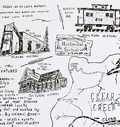 | Details | Morse, Russell A. | 1969 |
| Rusty's historical map of Clear Creek and Gilpin Counties Colorado pictorial |
|
Morse, Russell A. |
|
| 1969 |
| LOC:10 |
| $325.00 | Morse--Russell-A- | Rusty-s-historical-map-of-Clear-Creek-and-Gilpin-Counties-Colorado-pictorial | An original 1969 example of the first historical pictorial map produced by Rusty's Maps: Clear Creek and Gilpin Counties, Colorado. Small icons are used to represent key locations related to mining, railroads, and cultural history of those two counties. Important locations included the Argentine Pass, Silver Plume, Georgetown, Idaho Springs, East Portal, and Idaho Springs, Colorado and many more.
<br><br>
Measures 17 3/8" x 22 3/8" as called for as the 1969 first edition of 1000 on white offset stock. [1]. Published January 24, 1969.
<br><br>
Russell A. Morse (Rusty's Maps) began in 1969 with the publication of five historical maps that reflected Rusty's interest in old Ghost Towns: (1) Clear Creek and Gilpin Counties; (2) Western San Juan's; (3) Boulder-Estes Region; (4) Teller and West El Paso Counties, Colorado; (5) Summit and East Eagle Counties, Colorado. Though most prolific in the 1970's and 1980's, Rusty continued publishing maps and posters into the 1990s with a series for the National Western Stock Show and several posters of Colorado Gold Mining Regions.
<br></br>
[1] Online. 1669-1999. Listing of Rusty's Maps and related publications. https://rustysmaps.com/ |
| 5434 |  | Details | Crabb, Earl and Shubb, Rick | 1970 |
| Counterculture Cartography Humbead's Revised Map of the World |
|
Crabb, Earl and Shubb, Rick |
|
| 1970 |
| LOC:87 |
| $285.00 | Crabb--Earl-and-Shubb--Rick | Counterculture-Cartography-Humbead-s-Revised-Map-of-the-World | Original 1970 third-edition offset-lithograph counter-culture map of the "world". The first edition of Humbead's Revised Map of the World was created in 1968 based on a concept by Earl Crabb and drawn by artist Rick Shubb. Two subsequent editions were released.
<br></br>
Copyright 1970 by The Great Humbead. |
| 7983 |  | Details | Hip Products | 1970 |
| Mid-Century Pop Art Peace Poster One Peace Missing |
|
Hip Products |
|
| 1970 |
| LOC:130 |
| $175.00 | Hip-Products | Mid-Century-Pop-Art-Peace-Poster-One-Peace-Missing | Vividly designed in the bold graphic style of the late 1960s, this unrecorded original black light poster features a stylized Earth composed of interlocking puzzle pieces, with one section shaped like a dove removed from the globe. The missing “piece” appears above, transformed into a green dove bearing a black peace symbol, carrying a cartoon-like figure in a space helmet. At lower right, the caption reads in block lettering: “THE WORLD IS A PUZZLE WITH ONE PEACE MISSING.”
<br><br>
This imaginative image reflects the optimism and visual wit of the 1960s counterculture art scene, combining Pop-Art color, psychedelic simplicity, and the peace iconography that became synonymous with the era’s anti-war movement. The use of flat, saturated color fields—blue, green, and brown—echoes mid-century silkscreen printing aesthetics.
<br><br>
Likely issued in the late 1960s or early 1970s, this poster exemplifies the visual language of the global peace movement, pairing humor and idealism in a single, striking composition. An excellent example of period graphic design appealing to collectors of mid-century poster art and peace memorabilia. |
| 4965 | 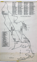 | Details | Major H.D. Moorman | 1970 |
| Map of Big Pine Key Florida |
|
Major H.D. Moorman |
|
| 1970 |
| LOC:0 |
| $0.00 | Major-H-D--Moorman | Map-of-Big-Pine-Key-Florida | SOLD<br></br>
Large rolled map of Big Pine Key, Florida prepared by Major Henry Dean Moorman for Big Pine Key Civic Association ca. 1970. Obviously locally prepared, the map contains a large list of streets and a list of 50 local businesses and locations on Big Pine Key that appears to be based on typewritten copy.
<br></br>
A history of the island (http://www.keyshistory.org/bigpinekey.html) states that Les Cunningham and Dwight Pettit operated the Big Pine Key Glassworks at the west end of the island from 1967 - 1973. Our map shows the glassworks as location #20 on the index of 50 key locations. |
| 5165 |  | Details | Keeth, Shirley Marshall | 1970 |
| Map Rancho Santa Fe San Diego County California |
|
Keeth, Shirley Marshall |
|
| 1970 |
| LOC:10 |
| $150.00 | Keeth--Shirley-Marshall | Map-Rancho-Santa-Fe-San-Diego-County-California | Map of the Rancho Santa Fe development in San Diego County , California ca. 1970. With an inset index map of the California coast showing the location of Ranch Santa Fe. By Shirley Keeth Real Estate, P.O. Box 865, Rancho Santa Fe. Inset map at top right shows the area surrounding the Shirley Keeth Office at the intersection of Paseo Delicias and La Granada. Data on the map include tract number, lot number, and number of acres on each lot.
<br></br>
Printed by Swadell Litho, Escondido, California. |
| 6862 | 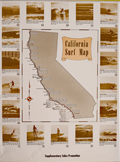 | Details | Anonymous | 1970 |
| California Surf Map |
|
Anonymous |
|
| 1970 |
| LOC:130 |
| $2,000.00 | Anonymous | California-Surf-Map | <br><br>
<div class="indenttextblock" style="text-align: center; font-size: 1.2em;"><b>
Let's go surfin' now<br>
Everybody's learnin' how<br>
Come on and safari with me<br></b>
</div>
<br>
Very rare California Surf Map circa late 1960's to early 1970's. Apparently produced to support a sales promotion. The map at center is surrounded by photo illustrations of popular California surfing locations. Each location contains a brief description of when to expect the best surfing conditions. For example: <div class="indenttextblock">"MISSION BEACH Typical beach surf winter and summer. Less crowded than Pacific Beach. Takes all swells with south and west swells preferred. 2 - 6 feet ht."</div>
<br>
Surfing locations identified on the map include, from bottom right moving clockwise:
<div class="indenttextblocksingle">
<ul style="list-style-type: circle;">
<li>Mission Beach</li>
<li>Pacific Beach</li>
<li>Leucadia</li>
<li>Oceanside</li>
<li>San Clemente</li>
. . .
<li>Manhattan Beach</li>
<li>Malibu</li>
<li>Ventura</li>
<li>Staley's</li>
<li>Rincon</li>
</ul>
</div>
Only one copy was found online, at the archive for surfingheritage.org (1).
<br><br>
(1) http://archive.surfingheritage.org/2015/02/vintage-map-of-california-surf-spots.html |
| 8038 | 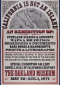 | Details | Anonymous | 1971 |
| Rare California Is Not an Island Oakland Museum Poster |
|
Anonymous |
|
| 1971 |
| LOC:130 |
| $400.00 | Anonymous | Rare-California-Is-Not-an-Island-Oakland-Museum-Poster | An original 1971 exhibition poster “California Is Not an Island,” produced for a special show at the Oakland Museum (Cowell Hall of California History), held May 30 to August 1, 1971. Designed in a bold nineteenth century broadside style with heavy slab-serif lettering in red and black, the sheet advertises an exhibition centered on early documentary materials relating to California’s exploration, overland migration, and Gold Rush-era development. <br><br>At the top is a halftone reproduction of a later embellished edition of Nicolas de Fer's map of California "La Californie ou Nouvelle Caroline", preserving the insular outline and early eighteenth century geographical nomenclature. The reference to Father Eusebio Kino acknowledges the Jesuit explorer whose overland expeditions proved that California was a peninsula, a conclusion directly contradicted by the island form shown here and central to the exhibition’s theme.<br><br>
The body of the poster lists the exhibit’s scope: overland diaries and accounts, maps and drawings, broadsides and documents, rare books, manuscripts, prints, and lithographs. The emphasis on primary sources underscores the museum’s intent to demonstrate how early travelers, scientists, and explorers recorded the region and how these records shaped the narrative of westward movement and the building of the transcontinental railroad. Only two publicly recorded sales of this poster are known.<br><br>
Only two sales of this poster are recorded on the Internet.
<br><br>
The Oakland Museum of California opened during 1969, created from the merger of three older institutions devoted to art, history, and natural science. Housed in a landmark terraced concrete complex by architects Kevin Roche and John Dinkeloo, it was conceived as a new kind of interdisciplinary museum dedicated to the story of California. |
| 6690 |  | Details | Weinstock, Howard | 1971 |
| Exuberant Pictorial Map of Florida |
|
Weinstock, Howard |
|
| 1971 |
| LOC:68 |
| $550.00 | Weinstock--Howard | Exuberant-Pictorial-Map-of-Florida | Exuberant Pictorial Map of Florida dated within at 1971. Designed and illustrated by Howard Weinstock. Copyright 1971 United States Map Company. Los Angeles, California.
<br><br>
<div id="0" align="center">
<a title=""></a>
<img id="6690" src="/ZoomifyImages/SC_6690/SC_6690_detail.jpg" alt="Details of the Florida Keys from the exuberant Pictorial Map of Florida by Weinstock dated within at 1971 " width="330"/> <br><br> <font size="-2">The Florida Keys</font>
</div><br>
<div id="0" align="center">
<a title=""></a>
<img id="6690" src="/ZoomifyImages/SC_6690/SC_6690_detail_1.jpg" alt="Gulf coast details from the exuberant Pictorial Map of Florida by Weinstock dated within at 1971 " width="330"/> <br><br> <font size="-2">Florida Gulf Coast</font>
</div><br>
<div id="0" align="center">
<a title=""></a>
<img id="6690" src="/ZoomifyImages/SC_6690/SC_6690_detail_2.jpg" alt="The Sun from the exuberant Pictorial Map of Florida by Weinstock dated within at 1971 " width="330"/> <br><br> <font size="-2">A happy Florida Sun</font>
</div><br> |
| 7927 |  | Details | Rambo, Ralph | 1971 |
| Santa Clara Valley sample map letter price list of Ralph Rambo |
|
Rambo, Ralph |
|
| 1971 |
| LOC:41 |
| $325.00 | Rambo--Ralph | Santa-Clara-Valley-sample-map-letter-price-list-of-Ralph-Rambo | A group of three artifacts that capture the spirit of California’s “Valley of Heart’s Delight” as seen through the eyes of Ralph Rambo (1894–1990)—the artist, humorist, and historian who chronicled old Santa Clara before it became Silicon Valley. Included is an autograph letter signed “Ralph Rambo” on his personal printed letterhead, dated circa 1971, in which the 76-year-old Rambo discusses his experience designing and selling maps as a “retirement pastime.” Written in his distinctive hand, the letter reflects his entrepreneurial wit and warm tone as he advises a fellow enthusiast on the economics of map publishing: “You are getting the very last of these maps... a handsome profit in map selling IF you have something GOOD with a wide appeal.”
<br><br>
Accompanying the letter are a salesman's' sample of Rambo’s pictorial map, -- Cartoon Pen and Inklings of the Old Santa Clara Valley — and Rambo's original price list for his illustrated works, all housed together in their original mailing envelope bearing Rambo’s Santa Clara return address. Together these three pieces form an evocative snapshot of a regional artist at work, combining correspondence, cartographic art, and period ephemera. An appealing and uncommon ensemble for collectors of California history, pictorial maps, or mid-century American illustration, they provide a glimpse into Rambo the entrepreneur. |
| 5473 |  | Details | Student Mobilization Committee | 1971 |
| Very rare persuasive 1971 antiwar poster with outline map of southeast Asia |
|
Student Mobilization Committee |
|
| 1971 |
| LOC:87 |
| $475.00 | Student-Mobilization-Committee | Very-rare-persuasive-1971-antiwar-poster-with-outline-map-of-southeast-Asia | Rare, student-led anti-war protest poster on card stock with an outline map of SE Asian countries promoting two anti-war activities: A "Student Strike" on November 3 and a "March on Boston" planned for November 6 [1971] .
<br></br>
The text for the Strike and the March are both overlaid on top of an outline image of a map of SE Asia including the countries of North and South Vietnam, Laos, and Cambodia each filled with the letters "USA", "USA", "USA".
<br></br>
No holdings of this poster are found online.
<br></br>
The two protest activities were organized by the Student Mobilization Committee (SMC). 15 Sellers Street, Cambridge, Massachusetts.
<div class="indenttextblocksingle">"The Student Mobilization Committee was formed in 1966 “to coordinate opposition to U.S. involvement in the war in Vietnam among college and high school students.” Originally named The Vietnam Day Committee the SMC organized protests on campuses and in cities in addition to being one of the first groups that included civilians and soldiers alike. Based on a letter from 1969, the SMC had centers in 15 cities around the country but began to disband, like many anti-Vietnam groups in the early 1970s (1973) in conjunction with the U.S. beginning to withdrawing troops from Vietnam." (Brown University, Hall-Hoag Collection. 2015. Online) </div> |
| 5096 |  | Details | Louisville and Nashville Railroad | 1971 |
| Lot of 2 scarce Louisville and Nashville Railroad Florida Track Profile Charts |
|
Louisville and Nashville Railroad |
|
| 1971 |
| LOC:0 |
| $600.00 | Louisville-and-Nashville-Railroad | Lot-of-2-scarce-Louisville-and-Nashville-Railroad-Florida-Track-Profile-Charts | Lot of 2 scarce original Louisville and Nashville Railroad Florida track profile charts for their Pensacola & Atlantic Sub-division and Yellow River Branch lines. First printed in 1930 and revised and redrawn in Mobile, Alabama by R.W.P. in October 1971.
<br></br>
Condensed track profile charts are engineering documents giving mile-by-mile documentation of every aspect of a railroad’s right-of-way and trackwork: track layout, grades, curvature, bridgework, etc. Track profile charts may contain:
<div class="indenttextblocksingle">
<ul style="list-style-type: circle;">
<li>Milepost numbers</li>
<li>Direction of the line via compass heading for sub-segments of the line</li>
<li>Slope of the grade for each sub-segment</li>
<li>Details about culverts, bridges, arches, and boxes</li>
<li>Town names</li>
<li>Locations of railway infrastructure (freight depots, passenger stations, and signals) </li>
</ul>
</div>
First printed in 1930, these two volumes were updated in 1971 by "R.W.P."
<div class="indenttextblocksingle">
<ul style="list-style-type: circle;">
<li>The smaller of the two books (Vol. 1) contains track map profiles for 43 miles of track of the Pensacola Division of the L & N R.R. extending south from Flomaton, Alabama to Pensacola, Florida. Includes two pages of railway symbol conventions and common abbreviations; a list of stations on the route; and layouts for the Pensacola, Goulding, and Flomaton rail yards.</li>
<li>The larger volume (Vol. 2) includes track profiles for the Yellow River Branch of the L & N R.R. from Florala to Crestview, Florida and for the Pensacola and Atlantic Branch of the L & N R.R. extending from Pensacola (Red Bluff), Florida eastward to River Junction, Florida. Includes two pages of railway symbol conventions and common abbreviations; a list of stations on the route; and layouts for the Muskogee Wharf, Pensacola, Pace, and River Junction rail yards and facilities.</li>
</ul>
</div> |
| 4928 |  | Details | Digital Equipment Corporation | 1972 |
| Early Persuasive Map Advertising ARPA Network pre-Internet |
|
Digital Equipment Corporation |
|
| 1972 |
| LOC:88 |
| $0.00 | Digital-Equipment-Corporation | Early-Persuasive-Map-Advertising-ARPA-Network-pre-Internet | SOLD<br><br>I'll see your Timothy Edward Downs and raise you 20.
<br /><br />
Very early pictorial map advertisement for Digital Equipment Corporation or DEC, for their DEC10 Supercomputer as a key part of the ARPA network. With the introduction of the TCP-IP protocols, ARPANET grew rapidly in size and within less than 20 years evolved into the Internet.
<br /><br />
ARPA stands for Advanced Research Projects Agency, a U.S. Defense Department agency responsible for leading-edge technical research. Beginning in 1967, by 1969 the ARPANET network interconnected four supercomputers, in 1970 - 9 supercomputers and by 1972 - 24 supercomputers .
<br /><br />
The ad shows the location of ARPANET supercomputers, generally large universities and research institutions; the interconnections between those supercomputers; and the data exchanged between the computers.
<br /><br />
In the early 1970's networking concepts were poorly understood and the artist uses common pictograms as metaphors as an aid to understanding. Without exception each university/research Supercomputing center is represented by old white men in suits, most with ties (NASA Ames the exception). Names of each institution appears on the outstretched arms of the old white men as they extend into the cube of another institution with an old white man. By Digital Equipment Corporation, Maynard, Massachusetts, run by old white men in the 1970's. |
| 6404 |  | Details | Overly, Charles H. | 1973 |
| Block Island Town of New Shoreham Rhode Island |
|
Overly, Charles H. |
|
| 1973 |
| LOC:87 |
| $185.00 | Overly--Charles-H- | Block-Island-Town-of-New-Shoreham-Rhode-Island | Very nice pictorial map of Block Island, Rhode Island lying in Block Island Sound. A better quality edition after Charles H. Overly's original map first printed in 1957. The map is printed on laid paper with a light brown tint throughout to simulate age. Scarce.
<br><br>
Esta Gray operated a gift shop in Old Harbor, Block Island- Esta's Gifts of Distinction. In 1957 Esta commissioned Charles H. Overly draw the map of Block Island to sell to tourists visiting her shop. This edition of the map is estimated circa 1973 after Charles Overly's map which contained a double decorative border and a 1957 copyright notice among other differences.
<br><br>
Charles H. Overly (1908-1970) was a University of Vermont graduate and artist. Returning home after a long tour of Europe, Overly began the Charles H. Overly Studio in 1938. He is best known for sketches and paintings of New England historical landmarks. |
| 6504 |  | Details | McClure, Jim | 1973 |
| Fine etching of the New Orleans French Market |
|
McClure, Jim |
|
| 1973 |
| LOC:78 |
| $300.00 | McClure--Jim | Fine-etching-of-the-New-Orleans-French-Market | Fine limited-edition etching of life at the French Market in New Orleans, Louisiana. Very nicely and accurately captures the mood and atmosphere of the French Market and French Quarter in the early 1970's. Titled, dated and signed by the artist. No. 105 of 200. |
| 6609 |  | Details | Nillson, Bob | 1974 |
| Map of East New Hampshire Seacoast with Pictorial Scenes of Activities |
|
Nillson, Bob |
|
| 1974 |
| LOC:62 |
| $375.00 | Nillson--Bob | Map-of-East-New-Hampshire-Seacoast-with-Pictorial-Scenes-of-Activities | Window on the Seacoast the Publick Occurrences Guide to Activities in the New Hampshire Seacoast.
An attractive sketched map of the New Hampshire Seacoast region surrounded by smaller sketches of local New Hampshire Seacoast attractions and activities. These include Prescott Park, New Castle, Fuller Gardens, Isle of Shoals, apple orchards, Kingston, Adams Point, UNH, and Route 125.
<br><br>
Copyrighted, conceived, and created by well-known New Hampshire artist, cartoonist, and teacher- Bob Nilson in 1974. Nilson is best known for his two-handed ambidextrous drawing method and, since the 1990's, for his caricature sketches of local Seacoast bands and performers. Here we have one of Nilson's earlier works, probably based on architectural and landscape sketches he submitted to the Portsmouth Herald for a section: Seacoast Sketchbook. (1)
<br><br>
(1) Online. Accessed 1/23. https://www.portsmouthnh.com/where-the-music-is-seacoast-music-scene-through-eyes-of-bob-nilson/ |
| 6605 |  | Details | Black Star Liberation Press | 1974 |
| Astrology and Black People Zodiacal Chart |
|
Black Star Liberation Press |
|
| 1974 |
| LOC:89 |
| $695.00 | Black-Star-Liberation-Press | Astrology-and-Black-People-Zodiacal-Chart | Unrecorded, a bit strange and highly unusual astrological or horoscope poster: "Astrology and Black People" an apparently self-published poster from Berkeley, California in 1974.
<div><img src="/ZoomifyImages/SC_6605/SC_6605_detail.jpg" alt="Title cartouche details for 1974 Astrology and Black People zodiacal chart published by Black Star Liberation Press" width="300" align="center" style="margin: 20px 20px 20px"/>
</div>
The creator's faces, names, astrological sign, and role appear at bottom center in a far-out UFO-style title cartouche: Reggie, layout; Gypsie, astrologer; Detroit, artist; Wayne, details; and Jason, ideas. Black Studies interest.
<br><br>
Published and copyrighted 1974 by Black Star Liberation Press, P.O. Box 3215 Berkeley, California. Verso is blank. |
| 7980 | 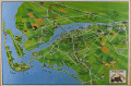 | Details | Metropolitan Fort Meyers Chamber of Commerce | 1975 |
| Pictorial Map of Fort Meyers Florida |
|
Metropolitan Fort Meyers Chamber of Commerce |
|
| 1975 |
| LOC:130 |
| $250.00 | Metropolitan-Fort-Meyers-Chamber-of-Commerce | Pictorial-Map-of-Fort-Meyers-Florida | Pictorial Map of Fort Meyers, Florida. A brightly colored illustrated guide showing the Fort Myers area and nearby islands (Sanibel, Captiva, and Estero Island) extending westward to the Gulf of Mexico and eastward past Lehigh Acres. The Caloosahatchee River flows prominently through the center. Rather than a strict topographic depiction, it’s designed for tourist orientation, highlighting motels, attractions, farms, and local roads.
<br><br>
Verso with black and white advertisements for local businesses. Based on the businesses advertised ChatGPT estimates the age of the map from the early to the mid 1970's era.
<br><br> Published by the Metropolitan Fort Meyers Chamber of Commerce. |
| 1327 |  | Details | Davison, Harry K. | 1975 |
| Estero Island, Fort Meyers Beach, Lee County Florida |
|
Davison, Harry K. |
|
| 1975 |
| LOC:0 |
| $0.00 | Davison--Harry-K- | Estero-Island--Fort-Meyers-Beach--Lee-County-Florida | SOLD<BR></BR>
Nine foot long cadastral map of Estero Island, Florida from ca. 1975. The map is based on an original blue-line printed plat map by surveyor Harry K. Davison. Davison, a Civil Engineer, conducted some of the earliest surveys of Estero island and built a beachfront home on Fort Meyers beach in 1921. Today that cottage has been moved to 161 Bay Road in Fort Meyer's beach where it serves as the headquarters of the Estero Island Historic Society Museum and Nature Center. |
| 5088 |  | Details | Rockford Map Publishers | 1975 |
| Atlas and Plat Book Suwannee County Florida 1975 |
|
Rockford Map Publishers |
|
| 1975 |
| LOC:2001 |
| $200.00 | Rockford-Map-Publishers | Atlas-and-Plat-Book-Suwannee-County-Florida-1975 | Atlas and Plat Book Suwannee County Florida 1975, published by Rockford Map Publishers, Inc. Rockford, Illinois. Sponsored by Daniel Crapps, Realtor, Live Oak, Florida.
<br></br>
Contents contain an index map for Suwannee County; an alphabetized business directory; important facts about land descriptions; detailed maps for each of 23 townships in the index map; a map of the capital city of Suwannee County- Live Oak; a map of the city of Branford; and a reduced general highway map of Suwannee County, Florida. |
| 8024 |  | Details | Paine, Howard E. | 1975 |
| Manuscript conceptual maps for Great Lakes–Midwest region |
|
Paine, Howard E. |
|
| 1975 |
| LOC:130 |
| $500.00 | Paine--Howard-E- | Manuscript-conceptual-maps-for-Great-Lakes–Midwest-region | Unpublished poster-size manuscript conceptual map ca. 1975 by National Geographic Art Director Howard Paine (1) presents a unified Great Lakes–Midwest region extending from Lake Superior to central Kentucky. Rendered in soft colored pencil and wash, the sheet studies regional physiography—rivers, watersheds, and upland structure—without the finished editorial layers of a production map. Paine experiments with state boundaries, drainage patterns, and implied landcover to test how a broad Midwest–Great Lakes treatment might read at atlas scale.
<br><br>
The verso carries a companion terrain study in the same hand, emphasizing elevation, forest cover, and hydrology with Paine’s characteristic, lightly modeled shading. Together the two drawings show the internal design process behind a National Geographic map that was never realized in print, offering a rare look at the developmental artwork that preceded formal cartographic production. They are among the few surviving privately-held examples of Paine’s pre-press regional concept work.<br><br> These conceptual sheets can be securely dated to the late 1960s through the mid-1970s, the period when National Geographic relied on hand-rendered shaded-relief masters and watercolor terrain studies for both its Atlas of the World (6th–8th editions) and the Close-Up U.S.A. series. The green land wash, blue-gray lake treatment, and pencil-modeled hydrology match the Society’s internal cartographic style of roughly 1968–1977, placing Howard Paine’s drafts squarely within that high phase of Nat Geo’s pre-digital map production. |
| 6468 |  | Details | U.S. Coast and Geodetic Survey | 1975 |
| USCGS poster for Aeronautical Charts |
|
U.S. Coast and Geodetic Survey |
|
| 1975 |
| LOC:90 |
| $0.00 | U-S--Coast-and-Geodetic-Survey | USCGS-poster-for-Aeronautical-Charts | SOLD<br><br>Surprisingly scarce poster ca 1970s, originally published in 1959, advertising aeronautical charts sold by the U.S. Coast and Geodetic Survey in Washington, D. C. A later re-issue published by the NOAA, National Ocean and Atmospheric Administration, National Ocean Service. At one time paper copies of the poster were available by order from the NOAA Distribution Branch but by 2013 products were only available in PDF or print-on-demand format.
<br><br>
A map dealer's dream meta-poster!
<br><br>
WorldCat contains only one record of the poster, at the University of Maryland. No example of the original 1959 poster are known to me.
<br><br>
Selected dates useful for dating U.S. Coast Survey charts:
<div class="indenttextblocksingle">
<ul style="list-style-type: circle;"></li>
<li>1807 - President Thomas Jefferson establishes Survey of the Coast.</li>
<li>1836 - Survey of the Coast was renamed U.S. Coast Survey. </li>
<li>1878 - U.S. Coast Survey renamed as Coast and Geodetic Survey.</li>
<li>1970 - Coast and Geodetic Survey included within the NOAA and renamed National Geodetic Survey.</li>
<li>2013 - NOAA ends printing of lithographic charts in favor of PDF.</li>
</ul>
</div> |
| 6330 | 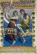 | Details | Burke, John William | 1976 |
| Original S.F. Mardi Gras Carnival Bacchanal Poster |
|
Burke, John William |
|
| 1976 |
| LOC:87 |
| $0.00 | Burke--John-William | Original-S-F--Mardi-Gras-Carnival-Bacchanal-Poster | SOLD<br></br>
Scarce original 12" x 18" poster for the 1976 Mardi Gras Carnival Bacchanal held on March 5, 1976 at the Longshoreman's Hall in San Francisco, California. The benefit concert was sponsored by radio station KPFA.
<br></br>
Copyright 1976 by jb (John Burke) at Rasta Grafix.
<br></br>
Scarce. Only one similar example found online at a smaller size than this fine example. |
| 6533 |  | Details | Fell, April P. | 1976 |
| Plan New Orleans Vieux Carre by April Fell |
|
Fell, April P. |
|
| 1976 |
| LOC:68 |
| $375.00 | Fell--April-P- | Plan-New-Orleans-Vieux-Carre-by-April-Fell | Scarce plan of the Vieux Carre or French Quarter in New Orleans, Louisiana by April P. Fell in 1976. Shows the buildings and street layout of the French Quarter as they existed in 1976. The limits of the Vieux Carre are the Mississippi River, Canal Street, Rampart Street, and Esplanade Avenue.
<br><br>
Todd and April Fell lived in New Orleans beginning in the 70s. They created a travel book called 'The Vignette' that was published until 1987.
<br><br>
Published by The Vignette 240 Rue Chartres. Copyright 1976. |
| 6697 |  | Details | Lepper, Ruth Rhoads | 1977 |
| Pictorial Map Maine Coast Between Casco Bay Penobscot Bay Lepper |
|
Lepper, Ruth Rhoads |
|
| 1977 |
| LOC:87 |
| $450.00 | Lepper--Ruth-Rhoads | Pictorial-Map-Maine-Coast-Between-Casco-Bay-Penobscot-Bay-Lepper | A Map of the Maine Coast Between Casco and Penobscot Bays made and published circa 1977 by Ruth Rhoads Lepper, West Southport, Maine. The prominent compass rose topped by a fleur-de-lis is a signature feature of Ruth Lepper pictorial maps and in this case is uncolored. Geographic coverage includes only those areas of the Maine Coast between Casco Bay and Penobscot Bay.
<br><br>
Map is dated with reference to a very similar larger-scale map held at the Osher Library: The Maine Coast from Kittery to Cape Elizabeth."
<br><br>
Lepper included brief facts on her coastal maps related to local maritime history:
<div class="indenttextblocksingle">
<ul style="list-style-type: circle;">
<li>On September 5, 1813, the U.S. brig. 'ENTERPRISE' captured the British brig. 'BOXER' The battle was fought in these waters. Both captains were killed.</li>
<li>Dixie Bull, the pirate. sailed into Pemaquid- In 1632. He sacked the trading post & dwellings, carrying away booty amounting to 2500.</li>
<li>The Virginia, first ship built by Englishmen on this Continent, was launched at Popham in 1608.</li>
<li>Allen's Island - Aug. 9,1607 Colonists from "Gift of God" & "Mary & John" listen to a sermon of Thanksgiving -the first English service on New England soil.</li>
</ul>
</div> |
| 702 |  | Details | British Admiralty Hydrographical Office | 1977 |
| Yukon River to Point Barrow Alaska |
|
British Admiralty Hydrographical Office |
|
| 1977 |
| LOC:65 |
| $175.00 | British-Admiralty-Hydrographical-Office | Yukon-River-to-Point-Barrow-Alaska | Very decorative 20th century British nautical chart of the Alaskan West Coast that expresses much of the fine character of the older copper-plate engraved navigation charts. Detailed soundings in the Bering Sea from Alaska westward 51 miles to Asia with Cape Dezhnev ( Dezhneva ) in Russia. This large attractive specimen is graced with four splendid inset profile views that show the rugged, snow-capped terrain of the Alaskan coast: At top- a broad view stretching from Cape Thompson to Cape Seppings and Mulgrave Hills fills the width of the chart; lower are profile views of Cape Prince of Wales and Cape York; the Diomede Islands; and Cape Lisburne.
<br></br>
Key features include Kotzebue and Nome, Alaska, the Chuckchi Sea, Bering Sea, Diomede Islands, St. Lawrence Island, mouths of the Yukon River, Norton Bay, Cape Nome, and Cape Prince of Wales. Numerous soundings, navigation hazards, and aids to navigation are noted. Originally published from London in 1907, the chart underwent numerous updates and corrections over the following 70 years as noted in several locations on the chart.
<br></br>
The chart is based on the exploration of the Pacific Coast and Alaska led by Frederick William Beechy aboard the refitted survey ship "Blossom" which had recently been converted from an 24 gun sloop-of-war. During the course of their three-year voyage Beechy's orders were to explore the Bering Strait and to attempt to rendezvous with Parry and Franklin aboard HMS Fury and Hecla, who were searching for a Northwest Passage from the East coast. Beechy is credited with the discovery of Port Clarence, one of the featured insets in this chart.<br></br>
With inset detailed plans: <ul>
<li>"Plan of the Anchorage of Chamisso in Kotzebue Sound"</li>
<li> "Plan of Port Clarence and Grantley Harbor" </li>
<li> the cut between Port Clarence and Grantley Harbor. </li>
</ul>
Number 563. Title cartouche contains the oval logo of the British Hydrographic Office. |
| 5383 |  | Details | Jacksonville Area Planning Board | 1977 |
| St. Johns River Corridor Plan with St. Johns River Study |
|
Jacksonville Area Planning Board |
|
| 1977 |
| LOC: |
| $500.00 | Jacksonville-Area-Planning-Board | St--Johns-River-Corridor-Plan-with-St--Johns-River-Study | Scarce <b>three-panel map</b> of the St. Johns River Corridor Plan in Duval County, Florida (accompanies the Study). The map contains summary recommendations and observations made by the Jacksonville Area Planning Board in their 1977 Study of the St. Johns River. Map 30" W x 10" H. Verso blank.
<br></br>
The planning study by the Jacksonville Area Planning Board (JAPD), is a 174-page environmental and urban study of the 39-mile extent of the St. Johns River found in Duval County, Florida: the <b>St. Johns River Corridor</b>. The study contains over 40 detailed large-scale, sectional geographic maps and thematic maps for land use along the St. Johns River Corridor (e.g. Military, Recreational). Light card cover.
<br></br>
Based on an analysis of five environmental factors the JAPD recommended land usage-intensity levels. They proposed design guidelines, development and improvement proposals, and program recommendations for 21 sections of shoreline along the corridor. Maps incorporate their findings.
<br></br>
Copy of Lynwood Roberts, then President of the Jacksonville City Council. With separate typed transmittal letter from the JAPD to Roberts. |
| 5428 | 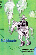 | Details | Anonymous | 1978 |
| Map of the 1978 Marijuana Trail |
|
Anonymous |
|
| 1978 |
| LOC:87 |
| $0.00 | Anonymous | Map-of-the-1978-Marijuana-Trail | SOLD<br></br>Scarce Hippie / Yippie cannabis-related map or a 70's Hippie poster with cartographic interest. An uncommon original pictorial map from 1976 showing gatherings "The Marijuana Trail" planned across the continental United States during the Spring and Summer of 1978.
<br></br>
Interesting iconography used that adapts existing regional stereotypes to a counter-culture cannabis-infused outlook:
<div class="indenttextblocksingle">
<ul style="list-style-type: circle;">
<li>San Francisco- A drunk, be-wigged barrister and a bell-bottom mod smoker.</li>
<li>Ashland, Oregon- Bigfoot getting high</li>
<li>Grand Junction, Colo. Naked hippies with smokie the bear.</li>
<li>Atlanta- Southern gentleman and a banjo-playing hillbilly.</li>
<li>Montreal - a frog, cow, and lumberjack- all smoking</li>
</ul>
</div>
Near Kent, Ohio three citizens are shown holding large signs: REMEMBER | KENT | STATE
<br></br>
For many of the gatherings the provided activity and schedule information could have made this map a fine planning calendar. From A Yipster Times publication. |
| 1136 |  | Details | Wilson, John F. | 1979 |
| Decorative pictorial map of Manteo, North Carolina |
|
Wilson, John F. |
|
| 1979 |
| LOC:52 |
| $225.00 | Wilson--John-F- | Decorative-pictorial-map-of-Manteo--North-Carolina | Interesting pictorial map of downtown Manteo, North Carolina on Roanoke Island along Shallowbag Bay. This very decorative map is packed with features of daily life on Roanoke and provides a street map and birds-eye view of Manteo downtown ringed by pictures reflecting its maritime heritage including boats, sea chests, seagulls, oars, antique furniture, anchors, and foodstuffs.
<br></br>
A number of local historical homes are featured including the George Howard Creef House; the Forbes Nixon House; the Meekins House; the James Bonner House; and "The Old House" or George Washington Creef House, said to be one of the oldest structures then standing in downtown Manteo. Other key features pictured on the map are the Pioneer Theater; the Roanoke Island Volunteer Fire Department; Water Oak at Mother Vineyard; and the Dare County Courthouse.
<br></br>
About the courthouse Wilson notes:
<div class="indenttextblock"> "Erected 1904, replacing a wooden 1873 structure. The land for the building was donated by John Wescott in 1870 when the county of Dare was formed from the counties of Hyde, Tyrrell and Currituck. It was named in honor of Virginia Dare, the first child of English parents born in the New World."
</div>
<br />
Manteo is located on Roanoke Island, part of North Carolina's Outer Banks. Named the seat of government for Dare County in 1870, Manteo incorporated in 1899 and in 2010 had a population of just 1434 persons.
<br></br>
Published by John F. Wilson IV in 1979. |
| 6403 | 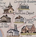 | Details | Rich, Howard L. | 1979 |
| Pictorial Historical Map of Chatham Massachusetts |
|
Rich, Howard L. |
|
| 1979 |
| LOC:87 |
| $225.00 | Rich--Howard-L- | Pictorial-Historical-Map-of-Chatham-Massachusetts | A fine original, first edition, pictorial historical map of Chatham, Massachusetts. Why buy a cheap copy when you can have the original version for a few dollars more?
<br></br>
The map shows numerous historical points of interest, those features no longer existing are shown in green font color. Includes an inset map of Monomoy Island and a smaller inset graphic representing the attack on Fort Fortune during October, 1606. Verso is blank.
<br></br>
Key geographical features on this historical map include Lookout Hill, Stage Harbor, Old Harbor, Great Beach, Strong Island, Great Hill, Morris Island, and Hardings Beach. Among the many historical events and locations that Rich chose to represent are the Mass. Humane Society hut for shipwrecked sailors, Old Harbor Life Saving Station, a ship's block factory, an Indian meeting house and burial ground, and the numerous salt works near Ryder's Cove.
<br></br>
Drawn by Howard L. Rich in 1979. Published by the Chatham Historical Society. |
| 5260 |  | Details | Stanton, Jeffrey | 1979 |
| Large pictorial map of Venice, California |
|
Stanton, Jeffrey |
|
| 1979 |
| LOC:53 |
| $375.00 | Stanton--Jeffrey | Large-pictorial-map-of-Venice--California | Large and amusing pictorial map of Venice, California by Jeffrey Stanton, businessman and artist. First edition.
<br></br>
Copyright 1979. Artwork by C. June Barton and R. Greenway Frager. |
| 6432 | 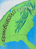 | Details | Konnertt, Jean | 1980 |
| Poster first annual Cajun Bluegrass Festival Escoheag Rhode Island |
|
Konnertt, Jean |
|
| 1980 |
| LOC:87 |
| $355.00 | Konnertt--Jean | Poster-first-annual-Cajun-Bluegrass-Festival-Escoheag-Rhode-Island | Rare original serigraph concert poster for the first annual Rhode Island Cajun - Bluegrass Festival held at the Stepping Stone Ranch in Escoheag, RI in October, 1980. Skillful application of graphic and cartographic elements link Louisiana with Rhode Island.
<br><br>
Numbered 7/100 and signed by artist in pencil. |
| 6475 |  | Details | Prewitt, Jim | 1980 |
| Pictorial advertising map of 6th Street in Austin Texas |
|
Prewitt, Jim |
|
| 1980 |
| LOC:53 |
| $0.00 | Prewitt--Jim | Pictorial-advertising-map-of-6th-Street-in-Austin-Texas | SOLD
<br><br>
Scarce, humorous, pictorial advertising map of <b>6th Street in Austin Texas</b> by Texas graphic artist and illustrator Jim Prewitt. The cheerful map shows Austin's 6th Street as it was more than 40 years ago. Alongside dozens of advertisements for local businesses like Maggie Mae's, Santiago's, and Ravens Garage the detailed map is dotted with interesting cartoons typical to Austin daily life including snakes, armadillos, longhorn cattle, UFO's, and a police chase with dynamite along Interstate 35.
<br><br>
<div id="0" align="center">
<a title="TITLE HERE"></a>
<img id="3" src="/ZoomifyImages/SC_6475/SC_6475_330w.jpg" alt="Pictorial fun map of Austin's 6th Street in 1980." width="300"/> <br><small>6th Street, Austin, Texas. 1980. Jim Prewitt.</small>
</div><br>
With an advertisement for the first Pecan Street Festival held on Saturday and Sunday, May 3rd and 4th, 1980 (left center). Austin's Pecan Street Festival was inaugurated in 1980 by the non-profit Pecan Street Association with the goal of highlighting and beautifying the historical heritage of the district. In 1997 President of the Pecan Street Association Lynn Raridon explained "We like to think that our event was helping to <b>Make Austin Weird</b>, long before it was a trendy catch phrase/bumper sticker!" [1]
<br><br>
Copyright Jim Prewitt Design, 1023 West San Antonio Street, San Marcos, Texas. Printed by Futura Press, Austin Texas. Verso blank.
<br><br>
A local boy, Jim graduated Texas A&M-Kingsville. Other Jim Prewitt pictorial advertising maps of Texas towns include Wimberly, San Marcos, New Braunfels, Kingsville and Corpus Christi. [2]
<br><br>
Sources
<br><br>
[1] Salizar, Marisa. 37th Annual Pecan Street Festival. September 24, 2017. Jim Bowie High School Dispatch. Online.<br>
[2] Walraven, Bill. Cartoonist turns fun maps into profitable venture. January 17, 1985. Online: http://archives.tamuk.edu/uploads/A2019-016.0125E.pdf |
| 6837 |  | Details | Prewitt, Jim | 1980 |
| Jim Prewitts Pictorial map 6th Street Austin Texas |
|
Prewitt, Jim |
|
| 1980 |
| LOC:53 |
| $0.00 | Prewitt--Jim | Jim-Prewitts-Pictorial-map-6th-Street-Austin-Texas | SOLD<br><br>Scarce, humorous, pictorial advertising map of <b>6th Street in Austin Texas</b> by Texas graphic artist and illustrator Jim Prewitt. The cheerful map shows Austin's 6th Street as it was more than 40 years ago. Alongside dozens of advertisements for local businesses like Maggie Mae's, Santiago's, and Ravens Garage the detailed map is dotted with interesting cartoons typical to Austin daily life including snakes, armadillos, longhorn cattle, UFO's, and a police chase with dynamite along Interstate 35.
<br><br>
<div id="0" align="center">
<a title="TITLE HERE"></a>
<img id="3" src="/ZoomifyImages/SC_6837/SC_6837_330w.jpg" alt="Pictorial fun map of Austin's 6th Street in 1980." width="300"/> <br><small>6th Street, Austin, Texas. 1980. Jim Prewitt.</small>
</div><br>
With an advertisement for the first Pecan Street Festival held on Saturday and Sunday, May 3rd and 4th, 1980 (left center). Austin's Pecan Street Festival was inaugurated in 1980 by the non-profit Pecan Street Association with the goal of highlighting and beautifying the historical heritage of the district. In 1997 President of the Pecan Street Association Lynn Raridon explained "We like to think that our event was helping to <b>Make Austin Weird</b>, long before it was a trendy catch phrase/bumper sticker!" [1]
<br><br>
Copyright Jim Prewitt Design, 1023 West San Antonio Street, San Marcos, Texas. Printed by Futura Press, Austin Texas. Verso blank.
<br><br>
A local boy, Jim graduated Texas A&M-Kingsville. Other Jim Prewitt pictorial advertising maps of Texas towns include Wimberly, San Marcos, New Braunfels, Kingsville and Corpus Christi. [2]
<br><br>
Sources
<br><br>
[1] Salizar, Marisa. 37th Annual Pecan Street Festival. September 24, 2017. Jim Bowie High School Dispatch. Online.<br>
[2] Walraven, Bill. Cartoonist turns fun maps into profitable venture. January 17, 1985. Online: http://archives.tamuk.edu/uploads/A2019-016.0125E.pdf |
| 7881 | 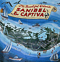 | Details | Hancock, W. Harold | 1980 |
| Pictorial Map Sanibel Captiva Islands Florida |
|
Hancock, W. Harold |
|
| 1980 |
| LOC:130 |
| $195.00 | Hancock--W--Harold | Pictorial-Map-Sanibel-Captiva-Islands-Florida | Attractive pictorial poster map of Sanibel and Captiva Islands in Florida from circa 1980. Drawn by artist William Harold Hancock (1920-2006).
<br><br>
Sanibel Island, a beautiful barrier island located off the coast of Fort Myers in Florida, is known for its stunning beaches, lush wildlife, and laid-back atmosphere. The island is home to the J.N. "Ding" Darling National Wildlife Refuge, a 5,200-acre sanctuary that protects mangrove forests, seagrass beds, and a diverse array of bird species. Visitors can explore the sanctuary by hiking, biking, or taking a guided tour, offering a chance to appreciate the island's natural beauty and observe wildlife in their natural habitat.
<br><br>
The island's marinas, such as Tarpon Bay Marina and Sanibel Marina, serve as gateways to the surrounding waters, providing access to fishing charters, boat rentals, and eco-tours. The Island Belle, a popular excursion boat, offers visitors the opportunity to explore the waters around Sanibel and Captiva Islands, showcasing the area's diverse marine life, including dolphins, manatees, and a variety of fish species.
<br><br>
For those seeking a more luxurious experience, Casa Ybel Resort offers beachfront accommodations, fine dining, and a range of activities, including golf, tennis, and spa treatments. The resort's location on the southern end of Sanibel Island provides easy access to the island's top attractions, such as the Sanibel Lighthouse and the Bailey-Matthews National Shell Museum. With its combination of natural beauty, outdoor activities, and upscale amenities, Sanibel Island is a perfect destination for those looking to escape the hustle and bustle of everyday life and immerse themselves in the tranquility of Florida's Gulf Coast.
<br><br> |
| 6470 |  | Details | Pargeter, Richard Arnold | 1980 |
| Pictorial oblique topographic birds-eye view of the San Juan Islands |
|
Pargeter, Richard Arnold |
|
| 1980 |
| LOC:150 |
| $450.00 | Pargeter--Richard-Arnold | Pictorial-oblique-topographic-birds-eye-view-of-the-San-Juan-Islands | An original fine panoramic relief map of the San Juan Islands in Washington State on an oblique perspective. Copyright 1980 by Richard Pargeter. Printed by University Printing Company, Seattle. Pencil stock number in bottom right margin.
<br><br>
A self-taught cartographic illustrator, Pargeter's output includes similar panoramic relief maps of The Olympic Peaks, the Puget Sound Country, and Washington's Northwest Passages. In 1980, when this map was copyrighted, copies were available by mail-order from the Pargeter Company in Kent, Washington. Pargeter's maps were once available online but all available copies are reported as sold-out.
<br><br>
<div class="indenttextblocksingle">
"Tens of thousands of these maps have been sold over the years. All Pargeter's maps are true oblique projections. No planimetrics. All, but the pre-color-separated Olympic map have been full-color halftone shaded relief illustrations rendered in acrylics and a very fine brush, The renderings are based on U.S.G.S. topo quads with mountain "facial features" derived from aerial oblique angle photos taken by Pargeter". [1]
</div><br>
Source
<br><br>
[1] Online: Panorama maps. Pargeter. Online: http://www.panorama-map.com/pargeter/pargeter.html |
| 6575 |  | Details | Douglass, Richard M. | 1981 |
| Scarce Scientology map, the First Theta Map of North America |
|
Douglass, Richard M. |
|
| 1981 |
| LOC: |
| $0.00 | Douglass--Richard-M- | Scarce-Scientology-map--the-First-Theta-Map-of-North-America | SOLD
<br><br>
Scarce second-edition (1) hand-colored lithographed pictorial "Theta Map of North America" created by Richard M. Douglass and published by the Friends of the Safe Environment Fund in 1981. Signed and numbered below the plate in pencil. Number 54 of 310. Provenance: the estate of Richard M. Douglass.
<br><br>
Outer border of the map is filled with names of contributors to the Friends of the Safe Environment Fund. Printed by Aberdeen Road Graphics.
<br><br>
In the 1970's Scientologists conducted "Operation Snow White", an effort to infiltrate and burglarize government offices, mainly in the United States, including the Drug Enforcement Administration, the Internal Revenue Service, and the Coast Guard, These organizations were considered to be enemies of Scientology. In 1977 the FBI raided Church of Scientology locations in Los Angeles, Hollywood and Washington, D.C. and as a result charged 11 members of Scientology including Mary Sue Hubbard, Cindy Raymond, Gerald Bennett Wolfe, Henning Heldt, Duke Snider, Gregory Willardson, Richard Weigand, Mitchell Herman, Sharon Thomas, Jane Kember, and Mo Budlong. ultimately resulting in jail time for five of the accused. The Friends of the Safe Environment Fund was established to help pay the legal expenses of the accused Scientologists. Signed on the original first monochrome edition by several of the individuals above who were charged by the government (e.g., not manuscript this edition).
<br><br>
Art and Design by Paul Breeden (Credited with artwork for Ability magazine by L. Ron Hubbard in 1961).
Cartography by Pati Armstrong.
<br><br>
(1) No copies of the colored version of Douglass's Theta Map are found online and only two copies of the first edition ( lacking color ) are known to exist. |
| 8017 |  | Details | Douglass, Richard M. | 1981 |
| Rare Scientology map, the First Theta Map of North America |
|
Douglass, Richard M. |
|
| 1981 |
| LOC:68 |
| $0.00 | Douglass--Richard-M- | Rare-Scientology-map--the-First-Theta-Map-of-North-America | SOLD<br><br>Scarce second-edition (1) hand-colored lithographed pictorial "Theta Map of North America" created by Richard M. Douglass and published by the Friends of the Safe Environment Fund in 1981. Signed and numbered below the plate in pencil. Number 54 of 310. Provenance: the estate of Richard M. Douglass.
<br><br>
Outer border of the map is filled with names of contributors to the Friends of the Safe Environment Fund. Printed by Aberdeen Road Graphics.
<br><br>
In the 1970's Scientologists conducted "Operation Snow White", an effort to infiltrate and burglarize government offices, mainly in the United States, including the Drug Enforcement Administration, the Internal Revenue Service, and the Coast Guard, These organizations were considered to be enemies of Scientology. In 1977 the FBI raided Church of Scientology locations in Los Angeles, Hollywood and Washington, D.C. and as a result charged 11 members of Scientology including Mary Sue Hubbard, Cindy Raymond, Gerald Bennett Wolfe, Henning Heldt, Duke Snider, Gregory Willardson, Richard Weigand, Mitchell Herman, Sharon Thomas, Jane Kember, and Mo Budlong. ultimately resulting in jail time for five of the accused. The Friends of the Safe Environment Fund was established to help pay the legal expenses of the accused Scientologists. Signed on the original first monochrome edition by several of the individuals above who were charged by the government (e.g., not manuscript this edition).
<br><br>
Art and Design by Paul Breeden (Credited with artwork for Ability magazine by L. Ron Hubbard in 1961).
Cartography by Pati Armstrong.
<br><br>
(1) Only one copy of the colored version of Douglass's Theta Map is found online (Rumsey) and only two copies of the first edition (lacking color) are known to exist. |
| 6760 |  | Details | Hillam, Corbin | 1981 |
| First Silicon Valley Advertising Pictorial Map |
|
Hillam, Corbin |
|
| 1981 |
| LOC:150 |
| $5,600.00 | Hillam--Corbin | First-Silicon-Valley-Advertising-Pictorial-Map | Original first pictorial advertising map locating "Silicon Valley". In 1981, artist Corbin Hillam unveiled a remarkable pictorial advertising map of Silicon Valley California, an artistic and commercial illustration that inspired a series of more than eighteen similar pictorial advertising maps created by various artists and publishers. Together the maps (1) provide an informative graphical time series of the firms active in Silicon Valley and the Santa Clara Valley Region in the late 20th century.
<br><br>
Analysis: The map is important as it is among the few remaining copies of Hillam's 1981 Silicon Valley map, created in the year IBM introduced its inaugural personal computer or PC, a groundbreaking event that sent ripples of innovation across the business landscape. IBM's PC served as a resounding testament, affirming the tangible reality of personal computing and establishing its enduring presence. 1981 was the year that personal computing won the corporate seal of approval.
<br><br>
Copyright Eclectibles, 1981.
<br><br>
<div id="6760" align="center">
<a title=""></a>
<img id="6760" src="/ZoomifyImages/SC_6760/SC_6760_detail_1.jpg" alt="First Silicon Valley Advertising Pictorial Map. Corbin Hillam. 1981. " width="340"/> <br><br> <font size="-2">Palo Alto detail from "Silicon Valley".</font>
</div><br><br> |
| 8020 |  | Details | White Mountain Graphics | 1981 |
| Illustrated Pictorial Map of Martha’s Vineyard |
|
White Mountain Graphics |
|
| 1981 |
| LOC:130 |
| $300.00 | White-Mountain-Graphics | Illustrated-Pictorial-Map-of-Martha’s-Vineyard | A colorful illustrated poster map of Martha's Vineyard drawn by K. Rinaldo and published in 1981 by White Mountain Graphics. The poster is filled with hundreds of hand-drawn vignettes capturing island towns, harbors, beaches, landmarks, and summer pastimes. The artist uses a cartoonlike style to show ferries approaching Vineyard Haven, sailboats in Katama Bay, lighthouses, beaches, farms, and well-known establishments across Oak Bluffs, Edgartown, and Chilmark. Inset scenes, handwritten labels, humorous details, and decorative border elements give the sheet the character of a personal visual tour rather than a formal cartographic product.
<br><br>
The map functions as a record of Vineyard culture, highlighting cottages, inns, restaurants, bicycle routes, fishing spots, and community traditions that defined the island during the period. Its composition rewards close viewing, with dozens of local references rendered in a bright palette intended to evoke the island's summer energy. A striking pictorial map for collectors of Vineyard ephemera and American resort-town cartography.
<br><br>
White Mountain Graphics was a small New Hampshire-based illustration and design studio active primarily in the late 1970s and early 1980s. Operating out of Jackson, New Hampshire, the firm produced a range of commercially printed posters, pictorial maps, and souvenir-oriented visual materials, often in a hand-drawn style similar to the Martha's Vineyard map.
<br><br> |
| 7973 |  | Details | Wills, David | 1982 |
| Haight Ashbury Psychedelic View |
|
Wills, David |
|
| 1982 |
| LOC:130 |
| $0.00 | Wills--David | Haight-Ashbury-Psychedelic-View | SOLD<br><br>A tribute to the heart of San Francisco’s counterculture, Haight-Ashbury by David Wills captures the spirit and energy of the city’s most iconic neighborhood. This poster of Wills' watercolor, painted in 1982, overflows with color, whimsy, and nostalgia — a view of the Haight’s Victorian architecture, eclectic street life, and musical legacy.
<br><br>
The poster’s subject matter includes references to the Summer of Love, psychedelic art, and the Golden Gate Bridge glimmering in the distance — all rendered in Wills’ distinctive style. Published for the Off the Wall Gallery in San Francisco, this lithographic print was produced by Tea Lautrec Litho press, known for its classic rock and art posters of the 1970s–1980s.
<br><br>
An essential piece for collectors of Bay Area art, psychedelic culture, or vintage San Francisco posters.
<br><br>
Wills describes the map on his WordPress site: "Watercolor rendering of my city block as a castle fortress island, funded by the merchants of Haight Street. 24 x 18, Last poster personally printed by Lavan Moscovian at T-lautrec Litho. 1982."<br><br> |
| 5426 |  | Details | Franzen, Dana | 1982 |
| Poster Ron and Nancy Reagan White House SmokeIn 1982 |
|
Franzen, Dana |
|
| 1982 |
| LOC:300 |
| $295.00 | Franzen--Dana | Poster-Ron-and-Nancy--Reagan-White-House-SmokeIn-1982 | Original, cannabis-related protest poster promoting the White House Smoke-In '82 Washington, D.C. July 2 - 5. Promising free pot, the poster features President Ron Reagan sporting a huge smoldering doob while standing next to an elegant Nancy Reagan, both garlanded with green cannabis leaves. Above that ironic scene, on an arched semicircle, the text reads: <strong>"Pot is an herb. Reagan is a dope." </strong>
<br></br>
Created by Dana Franzen, a frequent contributor to the magazine's centerfold posters..
<br></br>
Offset-lithograph on better-quality newsprint. Measuring 25" on the diagonal this is an original poster from a 1982 issue of A Yipster Times Publication. |
| 6856 |  | Details | Blissberger, Linda | 1982 |
| Coconut Grove Poster Advertising Map |
|
Blissberger, Linda |
|
| 1982 |
| LOC:61 |
| $525.00 | Blissberger--Linda | Coconut-Grove-Poster-Advertising-Map | Scarce advertising poster map of Coconut Grove, Florida by artist Linda Blissberger. 1982.
<br><br>
"Designed by the Blissberger with the able assistance of the Bliss Bear while dodging bulldozers on Florida Ave. Jan. - Feb. '82. Blissberger Art & Airbrush Creations & Gallery of Surprises. 3425c Main Hwy. 445-3146." |
| 4985 |  | Details | Real Estate Data Inc. | 1983 |
| Real Estate Atlas of Monroe County, Florida 19th ed. |
|
Real Estate Data Inc. |
|
| 1983 |
| LOC:0 |
| $0.00 | Real-Estate-Data-Inc- | Real-Estate-Atlas-of-Monroe-County--Florida-19th-ed- | Sold <br></br>
Monroe County, Florida real estate atlas covering the Florida Keys. 19th edition. 418 pages total with index maps and strip maps containing cadastral (land ownership) information for the Florida Keys in 1983. With map of the city of Key West (in five sheets). Map data include subdivision name, street name, lot number, owners' name, lot size and more. Plastic 4-hole binder.
<br></br>
Published by Real Estate Data, Inc. of Miami, Florida. |
| 5429 |  | Details | Price, Matthew | 1983 |
| Historical Map of Duck and Beyond |
|
Price, Matthew |
|
| 1983 |
| LOC:200 |
| $155.00 | Price--Matthew | Historical-Map-of-Duck-and-Beyond | Pictorial map of Currituck Sound, the Atlantic Ocean and the Outer Banks in the vicinity of Duck, Dare County, North Carolina. Created by Matthew Price in 1983.
<br></br>
This "Historical Map of Duck and Beyond" is decorated with scenes typical to the area near Duck, North Carolina (past and present): crabs, whales, wild flowers, shipwrecks, and ducks.
<br></br>
Price shows the street network and notes many points of interest on that narrow strip of land in the Outer Banks including:
<div class="indenttextblocksingle">
<ul style="list-style-type: circle;">
<li>Old Navy bombing range (no bombing allowed during hunting season).</li>
<li>Powder Ridge Gun Club</li>
<li>Caffey's inlet station</li>
<li>Maurice and Bea's Decoy Shops</li>
<li>Home and duck shop of "Pop" Scarborough</li>
<li>Ocean Beach campground</li>
<li>Duck Woods Golf Course</li>
<li>Old site of Martin's Point Club</li>
<li>Carolina Dunes</li>
</ul>
</div> |
| 5100 |  | Details | Youth International Party Information Service | 1983 |
| World Cannabis March on the U.N. Poster |
|
Youth International Party Information Service |
|
| 1983 |
| LOC:88 |
| $0.00 | Youth-International-Party-Information-Service | World-Cannabis-March-on-the-U-N--Poster | SOLD<br></br>
World Cannabis March on the U.N. Poster on good-quality newsprint from a Yipster underground newspaper. The march was sponsored by the 5th Avenue Pot Parade Coalition.
<br></br>
Purpose was to advertise a protest parade in New York City against the Reagan Administration's policies on cannabis. The gathering The march was to start at 11 A.M. May 7, 1983 at Washington Square Park. |
| 5417 |  | Details | Youth International Party Information Service | 1983 |
| Fine 1983 World Cannabis March on the U.N. Poster |
|
Youth International Party Information Service |
|
| 1983 |
| LOC:87 |
| $265.00 | Youth-International-Party-Information-Service | Fine-1983-World-Cannabis-March-on-the-U-N--Poster | Original, scarce, World Cannabis March on the U.N. poster on good-quality newsprint from a Yipster underground newspaper. The "World Cannabis March", sponsored by the 5th Avenue Pot Parade Coalition, featured speakers, a holistic massage workshop, and reggae music.
<br></br>
Purpose was to advertise a protest parade in New York City against the Reagan Administration's policies on cannabis. Reagan's policies diverted funds from the enforcement of hard drug laws to enforcement of the marijuana statutes, considered by many at the time to be a less harmful "soft" drug.
<br></br>
The march was scheduled to start at 11 A.M. May 7, 1983 at Washington Square Park in New York City. |
| 5172 |  | Details | Campbell | 1983 |
| Original manuscript art for Reagan era Central America Game cartoon |
|
Campbell |
|
| 1983 |
| LOC:200 |
| $1,750.00 | Campbell | Original-manuscript-art-for-Reagan-era-Central-America-Game-cartoon | Rare original manuscript art by Campbell for Reagan era "Central America Game" cartoon, 1983. This one-of-a-kind satirical cartoon references decades of United States involvement in attempts to overthrow Central and South American governments (Cuba, Panama, Chile, Venezuela ), some successful.
<br></br>
Set surrounded by sea, spanning a globe, political leaders conduct a dialog above a gameboard emulating the landmass of Central America with Pinochet and Castro as board pieces. Ronald Reagan asks Henry Kissinger about the rules for meddling in the Americas. Dialog:
<div class="indenttextblocksingle">
<b>Ronald Reagan: </b>"How do you win this 'Central America' game Henry?"<br>
<b>Henry Kissinger: </b>"I'm not sure anyone ever has, Mr. President."
</div>
</br>
Pen and ink manuscript sketch with a few edits in white-out. Signed "Campbell Aug 11, 1983."
<br></br> |
| 886 |  | Details | Guthorn, Peter | 1984 |
| U.S. Coastal Charts 1783-1861 |
|
Guthorn, Peter |
|
| 1984 |
| LOC:0 |
| $25.00 | Guthorn--Peter | U-S--Coastal-Charts--1783-1861 | Must-have reference guide for those interested in early nautical cartography of the U.S. coast. Numerous photographs and descriptions of coastal charts including blueback charts by historian Peter Guthorn make this a singular valuable resource for both collectors and researchers.
<br></br>
The Table of Contents includes:
<br></br>
<DL>
<DT><STRONG>The Private Publishers</STRONG>
<DD> > Matthew Clark
<DD> > John and William Norman
<DD> > Thomas Coles
<DD> > Jonathan Price
<DD> > John Strother
<DD> > Samuel Lambert
<DD> > Richard Patten
<DD> > Charles Copley
<DD> > George Eldridge
<DT><STRONG>Charting by the Army</STRONG>
<DT><STRONG>Charting by the Navy</STRONG>
<DT><STRONG>The Coast Survey</STRONG>
</DL> |
| 205 |  | Details | Guthorn, Peter | 1984 |
| United States Coastal Charts 1783-1861 |
|
Guthorn, Peter |
|
| 1984 |
| LOC:0 |
| $0.00 | Guthorn--Peter | United-States-Coastal-Charts--1783-1861 | SOLD <br></br>
Must-have reference guide for those interested in early nautical cartography of the U.S. coast. Numerous photographs and descriptions of coastal charts including blueback charts by historian Peter Guthorn make this a singular valuable resource for both collectors and researchers. 224 pages. Includes dust jacket. |
| 6397 |  | Details | Franzen, Dana | 1984 |
| World Cannabis March on the U.N. Poster 1984 |
|
Franzen, Dana |
|
| 1984 |
| LOC:300 |
| $285.00 | Franzen--Dana | World-Cannabis-March-on-the-U-N--Poster-1984 | Original, scarce and very colorful poster "World Cannabis March on the U.N." from 1984 on heavier and higher-quality newsprint by the 5th Avenue Pot Parade Coalition. Designed by Dana Franzen for A Yipster Times Publication. The poster was a center-fold insert advertising a protest parade in New York City against the Reagan Administration's policies on cannabis. The march was to start at 11 A.M. May 5, 1984 at Washington Square Park.
<br></br>
Verso with a black and white poster for "Rock Against Racism."
<br></br>
Ships folded as issued. |
| 5418 |  | Details | Franzen, Dana | 1984 |
| Fine 1984 World Cannabis March on the U.N. Poster |
|
Franzen, Dana |
|
| 1984 |
| LOC:87 |
| $0.00 | Franzen--Dana | Fine-1984-World-Cannabis-March-on-the-U-N--Poster | SOLD<br></br>
Original, scarce and very colorful poster "World Cannabis March on the U.N." from 1984 on heavier and higher-quality newsprint by the 5th Avenue Pot Parade Coalition. Designed by Dana Franzen for A Yipster Times Publication. The poster was a center-fold insert.
<br></br>
Purpose was to advertise a protest parade in New York City against the Reagan Administration's policies on cannabis. The march was to start at 11 A.M. May 5, 1984 at Washington Square Park.
<br></br>
Verso with a black and white poster for "Rock Against Racism." |
| 7971 |  | Details | Frank, Phil | 1984 |
| Rare Poster 1984 San Francisco Democratic National Convention |
|
Frank, Phil |
|
| 1984 |
| LOC:68 |
| $0.00 | Frank--Phil | Rare-Poster-1984-San-Francisco-Democratic-National-Convention | SOLD<br><br>A lively, detail-packed poster celebrating the 1984 Democratic National Convention (San Francisco, July 16–19). Drawn by beloved Bay Area cartoonist Phil Frank, the image bursts with local landmarks—the Transamerica Pyramid, Ferry Building, Golden Gate & Bay Bridges, Chinatown, North Beach, Ghirardelli Square—and hundreds of witty captions, delegates, and sight gags in Frank’s warm, satirical style. Political figures (e.g., Mondale/Hart/Jackson) appear amid a citywide carnival of balloons, tug boats, and cable cars.
<br><br>
Signed and dated in the image “Phil Frank 1984.” A fine piece of San Francisco ephemera at the intersection of political history, cartoon art, and pictorial city maps. Copyright © 1984 Interprint Publications, San Francisco-Innovative Communications.
<br><br> |
| 8007 |  | Details | Desrocher, Jack | 1984 |
| Poster San Francisco DNC Wizard of Oz |
|
Desrocher, Jack |
|
| 1984 |
| LOC: |
| $0.00 | Desrocher--Jack | Poster-San-Francisco-DNC-Wizard-of-Oz | SOLD<br><br>This rare illustrated poster was produced by the San Francisco Examiner to mark the 1984 National Democratic Convention held in San Francisco from July 16–19. It presents the political season as a narrative journey down the Yellow Brick Road, using the visual structure of The Wizard of Oz to depict the sequence of primaries, debates, and key dates leading to the convention. The timeline is printed directly on the road, providing a detailed month-by-month chronology of events from early spring through July.
<br><br>
At left, the principal Democratic contenders of 1984 appear as Oz characters traveling together toward the convention site. To the right, opposing forces and political obstacles are shown in the manner of Oz antagonists, including a witch figure flying above the path. The Emerald City is reimagined as San Francisco, with identifiable landmarks such as the Transamerica Pyramid, Coit Tower, and the Golden Gate Bridge. A “Welcome to the Emerald City” sign and border of poppies frame the transition from the campaign trail to the convention city<br><br>
The artwork is signed “Desrocher,” identifying the illustrator as Jack Desrocher, a staff artist for the San Francisco Examiner during this period. Posters of this type were typically created as promotional or commemorative items connected with the newspaper’s convention coverage. The piece combines political caricature, timeline documentation, and regional iconography to present a complete visual summary of the 1984 Democratic primary season. |
| 5423 |  | Details | Franzen, Dana | 1984 |
| Poster Bastille Day Marijuana Parade on the Democratic Convention |
|
Franzen, Dana |
|
| 1984 |
| LOC:300 |
| $0.00 | Franzen--Dana | Poster-Bastille-Day-Marijuana-Parade-on-the-Democratic-Convention | SOLD
<br></br>
An artists view of San Francisco, California. Fine, very scarce, original 1984 cannabis-related poster promoting a Bastille Day Marijuana Parade in San Francisco. The event was a march on the Democratic Convention, to be held at the Moscone Center, the largest convention complex in San Francisco. The colorful, imaginative, scene of the march shows cannabis growing like shrubs from every rooftop. The marchers were to assemble at the corner of Oak Street and Cole at 1:00 p.m. and then march to the Moscone Center.
<br></br>
Presumably by Dana Franzen but unattributed. Franzen was the artist on several other similar posters. Offset lithograph. Dated within at 4/29/84. Printed for a Yipster Times Publication.
<br ></br>
A sign above the Moscone Center in San Francisco reads:
<div class="indenttextblocksingle"><i>
"Welcome to Yerba Buena Center and don't forget "Yerba Buena" is Spanish for "Good Weed." Also, "Free the half-billion."
</i>
</div> |
| 7898 |  | Details | Port of San Francisco | 1984 |
| Port of San Francisco The Orient starts from here |
|
Port of San Francisco |
|
| 1984 |
| LOC:141 |
| $0.00 | Port-of-San-Francisco | Port-of-San-Francisco-The-Orient-starts-from-here | SOLD<br><br>Pictorial advertising poster for the Port of San Francisco, California.
<br><br>
Japanese text at the top of the image reads "サンフランシスコの港 東洋はここからはじまる" which translates to "Port of San Francisco - The Orient starts from here".
<br><br>
The depicts view San Francisco as a gateway or starting point to the East/Orient from the perspective of the United States, but in a stylized, somewhat fantastical way. The port and various ships are prominently featured, emphasizing San Francisco's role as a major port city connecting the U.S. to Asia.
<br><br>
The map includes various landmarks and geographic features of the San Francisco Bay Area, such as the Golden Gate Bridge, downtown San Francisco skyscrapers, boats in the bay, and the hilly terrain. However, the proportions and layouts are not geographically accurate.
<br><br>
Interestingly, the hills and mountains are rendered in a colorful, undulating style reminiscent of Japanese ukiyo-e landscape prints. This gives the map a unique artistic interpretation blending American and Japanese aesthetics. The whimsical, simplified style seems designed to engage and orient viewers while capturing the general character of the Bay Area.
<br><br>
Published by the Port of San Francisco in 1984. Artists' signature at bottom right is either Waggoner or Waffoner. |
| 5424 |  | Details | Swartzbeck, Mike | 1984 |
| Iconic Yipster Poster Texas State Reagan Mechanical Bull |
|
Swartzbeck, Mike |
|
| 1984 |
| LOC:300 |
| $200.00 | Swartzbeck--Mike | Iconic-Yipster-Poster-Texas-State-Reagan-Mechanical-Bull | Fine mid-80's original protest-rally poster, an iconic offset-lithographed artifact from the waning days of the Hippy sub-culture. A broadsheet for the more liberal segment of the Baby Boomer cohort, with a Texas accent.
<br></br>
Ronald Reagan is depicted astride a missile-shaped quarter-a-ride mechanical bull emblazoned with the atom symbol, with all set before the shape of the State of Texas, in blazing yellow. Text at the right lays out the rally schedule in Dallas, Texas at the Republican Party Convention from August 11 to August 24, 1984. Activities included a Peace Vigil, religious services, voter registration, and a Rally Against Reagan's Diversion of Dollars from Hard to Soft Drugs. Created by Mike Swartzbeck and apparently paid for by the North American Greens Party, P.O. 392, Canal Street Station, New York City.
<br></br>
Activities planned for Wednesday, August 22 were:
<div class="indenttextblocksingle">
<ul style="list-style-type: circle;">
<li>Morning: Toxic Waste Redeployment</li>
<li>Evening: blockade Convention</li>
</ul>
</div>
Title: "Don't Let Reagan take you For a Ride. Rally and Blockade Dallas G.O.P. Convention, Aug. 11 - 24 [1984]." |
| 8036 |  | Details | Nadon, Paul and Sandi | 1985 |
| Colorful pictorial advertising poster of Seward, Alaska |
|
Nadon, Paul and Sandi |
|
| 1985 |
| LOC:130 |
| $325.00 | Nadon--Paul-and-Sandi | Colorful-pictorial-advertising-poster-of-Seward--Alaska | Colorful pictorial poster map of Seward, Alaska, drawn by Paul and Sandi Nadon and published by New Sensations in 1985. The sheet presents the harbor town of Seward on Resurrection Bay as a busy cartoon landscape, with streets, businesses, and waterfront activity rendered in bright hand drawn vignettes rather than formal cartography. A large vertical Seward banner along the left margin, smiling sun over the Kenai Mountains, and playful notes in the margins firmly place the map in the late twentieth century tourist boom along the Alaska coast.
<br><br>
Within the town grid the artists label motels, cafes, shops, churches, and civic buildings, while the surrounding hills show wildlife, waterfalls, and campgrounds. The harbor is packed with cruise boats, fishing vessels, sailboats, and float planes coming and going from Resurrection Bay, all keyed to short text panels that highlight local attractions such as the Silver Salmon Derby. A puffin shaped compass rose, orcas, sea otters, and seabirds enliven the water, and humorous scenes on land convey the easygoing character of Seward as a working port and visitor destination.
<br><br>
More than a simple street plan, the poster functions as an illustrated directory of mid-1980s Seward, preserving the look of its downtown businesses, harbor facilities, and tourist culture at a particular moment in time. The map should appeal to collectors of Alaska ephemera, pictorial map posters, and American roadside tourism, it is an engaging wall piece that rewards close inspection, with dozens of local references and comic details scattered across the sheet.
<br><br> |
| 7995 |  | Details | Nadon, Paul | 1985 |
| Humorous pictorial map of Breckenridge, Colorado from 1985. |
|
Nadon, Paul |
|
| 1985 |
| LOC:130 |
| $450.00 | Nadon--Paul | Humorous-pictorial-map-of-Breckenridge--Colorado-from-1985- | This colorful pictorial poster map of Breckenridge, Colorado, created and signed by Paul Nadon, presents a detailed illustrated view of the town’s commercial core and surrounding mountain setting as it was in the mid-1980's. The drawing highlights Main Street and nearby blocks through individually rendered storefronts, lodges, restaurants, ski shops, and local businesses, each shown with distinctive architectural and graphic detail. The map functions as a stylized guide to the businesses of the period while offering a snapshot of Breckenridge during the mid-1980s. Copyright New Sensations, 1985.
<br><br>
Across the landscape, Nadon incorporates a wide variety of playful elements—skiers descending the slopes, hikers, wildlife, a hot-air balloon, a rainbow, and humorous scenes referencing local recreation. Hand-lettered notes provide bits of local history and commentary, while decorative banners and figures add to the informal, tourist-friendly tone of the piece. Despite the whimsical aesthetic, the arrangement of streets and buildings follows the real alignment of Main Street, Ridge Street, Park Avenue, and French Street.
<br><br>
Produced at a time when Breckenridge was expanding as a Rocky Mountain ski destination, the map captures the town’s commercial identity at a moment of growth. Its combination of detailed storefront depictions, vibrant illustrations, and personable local character makes it both a practical period guide and a visually engaging souvenir from 1980s Breckenridge.<br><br> |
| 6536 |  | Details | Baeza, Ron | 1985 |
| Pictorial advertising map Conch Republic Key West Florida Ron Baeza |
|
Baeza, Ron |
|
| 1985 |
| LOC:61 |
| $0.00 | Baeza--Ron | Pictorial-advertising-map-Conch-Republic-Key-West-Florida-Ron-Baeza | SOLD
<br><br>
Colorful pictorial advertising map of Key West Florida by Ron Baeza from 1985 in the early formative period of the Conch Republic.
<br><br>
On April 23, 1982 Key West Mayor Dennis Wardlow and the city council declared Key West's independence in response to inconvenient US Border Patrol roadblocks searching for illegal immigrants and narcotics. Local citizens were known for many years as Conchs, and the new "independent nation" became known as the Conch Republic.
<br><br>
<div class="indenttextblocksingle">
"Key West Mayor Dennis Wardlow and several determined Key Conchs went to Federal court in Miami to seek an injunction to stop the federal blockade. When their plea was denied, the Mayor told TV reporters that the following day the Florida Keys would secede from the Union. The next day, as promised, Mayor Wardlow stood in Mallory Square and led the Conch Republic Rebellion which lasted approximately one minute and was followed by a surrender to the US Navy Admiral in Key West." [1]
<br><br>
[1] What is a Key West Conch? Conch Tour Train Internet Site. https://www.conchtourtrain.com/conch.html
</div><br>
<div id="0" align="center">
<a title="TITLE HERE"></a>
<img id="3" src="/ZoomifyImages/SC_6536/SC_6536_Detail.jpg" alt="Pictorial advertising map of the Conch Republic or Key West Florida by Ron Baeza in 1985." width="300"/> <br><small>Conch Republic map detailed view</small>
</div><br>
Advertisers on Baeza's Conch Republic map of Key West include:
<div class="indenttextblocksingle">
<ul style="list-style-type: circle;"></li>
<li>Fast Buck Freddies</li>
<li>Mel Fishers Treasure Exhibit</li>
<li>Moped Hospital</li>
<li>Captain Bob's Shrimp Dock</li>
<li>Billie's Bar and Restaurant</li>
<li>the end on the line kites</li>
</ul>
</div>
Designed and illustrated by Ron Baeza of Solares Hill Design Group in Key West Florida. Copyright White Mountain Graphics, Jackson, New Hampshire. |
| 6537 |  | Details | Weaver, Ron | 1985 |
| Pictorial poster map of Marathon, Florida. |
|
Weaver, Ron |
|
| 1985 |
| LOC:61 |
| $0.00 | Weaver--Ron | Pictorial-poster-map-of-Marathon--Florida- | <b>SOLD</b>, but see <a href="https://www.rarecharts.com/ShowDetail/Creator/Weaver--Ron/Title/Pictorial-poster-map-of-Marathon-Florida/6847" target="_blank">another example of the map</a> now in RareCharts' inventory.
<br><br>
Beautiful pictorial advertising poster map of Marathon, Florida by Ron Weaver in 1985 - "Marathon, the Heart of the Florida Keys." One of the more attractively illustrated Florida advertising maps I have found. The poster contains large illustrations of Florida Keys wildlife- mosquitos, cormorant, manatees, osprey, and fishing/boating activities well integrated into the design. <br><br>
<div id="0" align="center">
<a title="Marathon, Florida, 1985."></a>
<img id="3" src="/ZoomifyImages/SC_6537/SC_6537_Detail.jpg" alt="Pictorial advertising poster map of Marathon, Florida by Ron Weaver in 1985" width="300"/> <br><small>Details from Ron Weaver's Marathon, Florida poster.</small>
</div><br> |
| 6847 |  | Details | Weaver, Ron | 1985 |
| Pictorial poster map of Marathon Florida |
|
Weaver, Ron |
|
| 1985 |
| LOC:61 |
| $0.00 | Weaver--Ron | Pictorial-poster-map-of-Marathon-Florida | SOLD<br><br>
Scarce and beautiful pictorial advertising poster map of Marathon, Florida by Ron Weaver in 1985 - "Marathon, the Heart of the Florida Keys." One of the more attractively illustrated Florida advertising maps I have found. The poster contains large illustrations of Florida Keys wildlife- mosquitos, cormorant, manatees, osprey, and fishing/boating activities well integrated into the design. <br><br>
<div id="0" align="center">
<a title="Marathon, Florida, 1985."></a>
<img id="3" src="/ZoomifyImages/SC_6847/SC_6847_detail1.jpg" alt="Pictorial advertising poster map of Marathon, Florida by Ron Weaver in 1985" width="300"/> <br><small>Details from Ron Weaver's Marathon, Florida poster.</small>
</div><br>
Quite a nice advertisement for Marathon, Florida and the Florida Keys. A few of the many Marathon, Florida area locations Weaver has noted include:
<div class="indenttextblocksingle">
<ul style="list-style-type: circle;"></li>
<li>Key Colony Beach</li>
<li>Fat Deer Key</li>
<li>Grassy Key</li>
<li>Vaca Cut</li>
<li>Marathon Airport</li>
<li>Overseas Highway</li>
<li>Boot Key Harbor</li>
<li>Old 7 Mile Bridge</li>
</ul>
</div>
Design graphics and illustration in a distinctive free-hand style by the talented Ron Weaver. Published by Key Exposure, 1223 Royal Street, Key West. |
| 4799 |  | Details | Glantz, Dale A. | 1985 |
| Bathymetry and landmarks La Jolla, San Diego, California |
|
Glantz, Dale A. |
|
| 1985 |
| LOC:63 |
| $375.00 | Glantz--Dale-A- | Bathymetry-and-landmarks-La-Jolla--San-Diego--California | Original privately-published chart of the La Jolla coast. The most easily attainable chart of La Jolla, California from 1985 to combine bathymetry data from the U.S. Coast and Geodetic Survey with pictorial images of the landmarks and data regarding coverage of the kelp beds offshore. Designed, printed, and copyrighted 1985 by Dale A. Glanz d.b.a. Daleʾs Ink. Detailed countour intervals of one fathom (six feet). No copies in AMPR or online; limited institutional holding.
<br></br>
From 1978 to 2005 Dale Glanz is reported to have been employed by Kelco (now ISP Alginates) as Operations Manager/Senior Marine Biologist. Kelco began near San Diego in the late 1920s, harvesting brown seaweed, or kelp, and extracting the algin that is used in countless pharmaceutical, household and food products.
<br></br>
Shows notable landmarks that could be used to relate one's position to the bathymetry on the chart. Landmarks include a "copper roof mansion", the La Jolla Shores Lifeguard Station, the Summer House Inn, Seville Condominium, Sea World Tower, and Islandia House. Beaches shown include Ocean Beach, Mission Beach, Pacific Beach, Casa Beach, Windandsea Beach. Other noted features include Seal Rock, The Cove, Kellogg Park, Whale View Point, La Jolla Hermosa Park, and the Crystal Pier.
<br></br>
Shows the La Jolla Canyon and the Scripps Canyon that terminate just offshore of the Scripps Institute of Oceanography. Shading denotes areas with an overlaying canopy of kelp. |
| 5408 |  | Details | Franzen, Dana | 1985 |
| Fine 1985 World Cannabis March on the U.N. Poster |
|
Franzen, Dana |
|
| 1985 |
| LOC:87 |
| $275.00 | Franzen--Dana | Fine-1985-World-Cannabis-March-on-the-U-N--Poster | Stunning, scarce, original World Cannabis March on the U.N. poster (1985) on heavier, better-quality newsprint. Designed by Dana Franzen for A Yipster Times Publication. The poster was a center-fold insert.
<br></br>
The intent of the poster was to advertise a protest parade in New York City against the Reagan Administration's strict policies on cannabis. The march was to start "before high noon" on May 4, 1985 at Washington Square Park.
<br></br>
Contains text likely to appeal to members of the counter-culture who understood the double entendre meaning of some of the poster's copy:</br>
"Appeal to a <b>higher power</b>"</br>
"Meet at Washington Sq. Park before <b>high noon</b>" |
| 8000 |  | Details | Exploration Cruise Lines | 1985 |
| Cool pictorial cruise poster of Alaska |
|
Exploration Cruise Lines |
|
| 1985 |
| LOC:130 |
| $365.00 | Exploration-Cruise-Lines | Cool-pictorial-cruise-poster-of-Alaska | Rare possibly unrecorded large format travel poster for Exploration Cruise Lines ca. 1985.
<br><br>
This promotional poster for Exploration Cruise Lines presents a stylized map of Alaska and the Pacific Northwest, built around the slogan “Nobody Gets You Closer to Alaska.” The map combines illustrated geographic features—such as Glacier Bay, Frederick Sound, the Gulf of Alaska, Yakutat Bay, and the Inside Passage—with small icons marking wildlife including bears, eagles, whales, seals, and mountain goats. Port calls and route segments are clearly labeled: Sitka, Juneau, Ketchikan, Wrangell, Petersburg, Seward, Prince Rupert, and other locations appear along color-coded itineraries for the Great Rivers Explorer and Pacific-Northwest Explorer. Insets summarize key regions (“Outside, the Inside Passage,” “Yakutat Bay,” “The Inside Passage and Beyond,” and “Alaska for the Independent Traveler”), highlighting landmarks such as Columbia Glacier, Hubbard Glacier, the Kenai Peninsula, Denali National Park, and the Misty Fiords National Monument.
<br><br>
The lower section features a large depiction of an Exploration Cruise Lines vessel entering Alaskan waters, together with the company’s name and sunburst logo. Text blocks emphasize the line’s focus on remote scenery, wildlife viewing, and smaller-ship access to narrow channels and glacial bays. A sidebar provides a simplified Inside Passage index and distances between ports, reinforcing the company’s claim of operating close-in routes not accessible to larger cruise ships. As a surviving piece of cruise-line ephemera from a short-lived 1980s operator, the poster documents how Exploration Cruise Lines marketed its Alaskan itineraries and presents a period design that blends infographic mapping with illustrative regional imagery. |
| 6422 |  | Details | Troper, William | 1985 |
| Rare 1985 thematic map of Grateful Dead U. S. concert locations |
|
Troper, William |
|
| 1985 |
| LOC:150 |
| $0.00 | Troper--William | Rare-1985-thematic-map-of-Grateful-Dead-U--S--concert-locations | SOLD
<br><br>
Extremely rare 1985 poster map for locations of concerts performed by the legendary rock group the <b>Grateful Dead</b>: "Where the Dead Play: Grateful Dead Concerts Throughout the United States".
<br><br>
Only one copy located in WorldCat, at the Library of Congress. According to the WorldCat LOC entry: " Shows number of concerts performed within 100 miles of the graduated symbol, from spring of 1965 through summer of 1984."
<br><br>
Produced by William Troper in 1985, the map uses differing sizes of the Grateful Dead red and blue lightning skull or, "Steal Your Face", logo [1] to indicate the range of the number of concerts held at cities throughout the continental US, Alaska, and Hawaii. Concert frequency data is credited within to the Hampshire College Grateful Dead Historical Society.
<br><br>
Inset maps of Alaska and Hawaii. Verso blank.
<br><br>
Concert date and publication information are recorded as available in accompanying text (not included). Predates by a decade a more commercially successful and common two-sided glossy wall map and tour guide poster from 1994 that is similar in concept.
<br><br>
[1] Grateful Dead Logo. 2021. Online: https://1000logos.net/grateful-dead-logo/ |
| 3679 |  | Details | British Admiralty Hydrographical Office | 1986 |
| Chart of Eastern North America and Caribbean |
|
British Admiralty Hydrographical Office |
|
| 1986 |
| LOC:65 |
| $180.00 | British-Admiralty-Hydrographical-Office | Chart-of-Eastern-North-America-and-Caribbean | An authentic 20th-century British nautical chart of the east coasts of the U.S. and Canada. Includes Mexico, Central America, the Caribbean Islands, and northern South America.
<br></br>
Bold dark print retains the cartographic look and style of the late 19th century. Logo of the British Hydrographical Office at top of the title block. Published from London on April 9, 1870 (later edition). Last corrections from 1986. Number 2060b. |
| 6430 |  | Details | Anonymous | 1986 |
| Decorative silk-screen poster San Francisco Bay Golden Gate Bridge |
|
Anonymous |
|
| 1986 |
| LOC: |
| $0.00 | Anonymous | Decorative-silk-screen-poster-San-Francisco-Bay-Golden-Gate-Bridge | SOLD<br><br>
Fine decorative nautical-themed limited-edition serigraph poster of San Francisco Bay and the Golden Gate Bridge from the seventh-annual users conference held by Data Design Associates in 1986. Deep rich colors. Signed within (illegible). Number ??? of 600 copies.
<br><br>
Data Design Associates, Inc., was a Sunnyvale, Calif-based developer of mainframe financial software. |
| 6480 |  | Details | Anonymous | 1986 |
| Decorative serigraph poster San Francisco Bay Golden Gate Bridge |
|
Anonymous |
|
| 1986 |
| LOC:1404 |
| $875.00 | Anonymous | Decorative-serigraph-poster-San-Francisco-Bay-Golden-Gate-Bridge | Fine decorative nautical-themed limited-edition silk-screen poster of San Francisco Bay, California and the Golden Gate Bridge from the seventh-annual users conference held by Data Design Associates in 1986. Deep rich colors. Signed within (illegible, maybe Bob Williams ?). Number 127 of 600 copies.
<br><br>
Data Design Associates, Inc., was a Sunnyvale, Calif-based developer of mainframe financial software. |
| 6481 |  | Details | Anonymous | 1986 |
| Decorative serigraph poster City of San Francisco Ferry |
|
Anonymous |
|
| 1986 |
| LOC:1404 |
| $475.00 | Anonymous | Decorative-serigraph-poster-City-of-San-Francisco-Ferry | Fine decorative nautical-themed limited-edition silk-screen poster of San Francisco Bay, California and the ferry "City of San Francisco" from the eighth-annual users conference held by Data Design Associates in 1987. Deep rich colors. Signed within (illegible). Number 579 of 700 copies.
<br><br>
Data Design Associates, Inc., was a Sunnyvale, Calif-based developer of mainframe financial software. |
| 6482 |  | Details | Anonymous | 1986 |
| Decorative serigraph poster San Francisco Bay and Coit Tower |
|
Anonymous |
|
| 1986 |
| LOC:1404 |
| $375.00 | Anonymous | Decorative-serigraph-poster-San-Francisco-Bay-and-Coit-Tower | Fine decorative nautical-themed limited-edition silk-screen poster of San Francisco Bay, California and Coit Tower from the fifth-annual users conference held by Data Design Associates in 1984. Deep rich colors. Signed within (illegible). Number 472 of 500.
<br><br>
Data Design Associates, Inc., was a Sunnyvale, Calif-based developer of mainframe financial software. |
| 6517 |  | Details | Smiley, Russ | 1987 |
| Russ Smiley's Fishing Map South Florida Miami Fort Lauderdale Key West |
|
Smiley, Russ |
|
| 1987 |
| LOC:87 |
| $175.00 | Smiley--Russ | Russ-Smiley-s-Fishing-Map-South-Florida-Miami-Fort-Lauderdale-Key-West | Late 1980's decorative fishing chart of the Everglades, Miami, South Florida, and the Florida Keys surrounded by Smiley's illustrations of colorful fishes. This map is becoming increasingly scare on the market. The chart is overprinted with red dots representing hot fishing spots from Ft. Lauderdale to Key West and with the names of the fishes that might be caught in an area.
<br></br>
Created and published by Miami, Florida artist Russ Smiley, El Portal Florida. Last copyright is from 1987 by Windward Publishing.
<br></br>
Verso with illustrations of South Florida fishes, fishing techniques, and baits. |
| 5075 |  | Details | Smiley, Russ | 1987 |
| Russ Smiley's South Florida Map Ft. Lauderdale to Key West |
|
Smiley, Russ |
|
| 1987 |
| LOC:87 |
| $0.00 | Smiley--Russ | Russ-Smiley-s-South-Florida-Map--Ft--Lauderdale-to-Key-West | This item is sold but see another copy of <a href="https://www.rarecharts.com/ShowDetail/Creator/Smiley--Russ/Title/Russ-Smiley-s-Fishing-Map-South-Florida-Miami-Fort-Lauderdale-Key-West/6517" target="_blank">Smiley's chart now in stock. </a>
<br><br>
Late 1980's very decorative fishing chart of the Everglades, South Florida, and the Florida Keys. |
| 5076 |  | Details | Smiley, Russ | 1987 |
| Russ Smiley's Fishing-Boating Map Cape Sable to Crystal River |
|
Smiley, Russ |
|
| 1987 |
| LOC: |
| $175.00 | Smiley--Russ | Russ-Smiley-s-Fishing-Boating-Map-Cape-Sable-to-Crystal-River | Late 1980's chart of the Everglades, South Florida, and the Florida Keys surrounded by Smiley's illustrations of colorful fishes. Chart is overprinted with dots representing hot fishing spots and with the names of the fishes that might be caught in an area.
<br></br>
Created and published by Miami, Florida artist Russ Smiley. Last copyright is from 1979 by Russ Smiley. Purchased as new old stock. Published by Windward Publishing, Miami.
<br></br>
Verso with illustrations of south Florida fishes, fishing techniques, and baits. |
| 4746 |  | Details | Leary, Pat | 1987 |
| Limited edition print of Amelia Island, Florida |
|
Leary, Pat |
|
| 1987 |
| LOC:61 |
| $0.00 | Leary--Pat | Limited-edition-print-of-Amelia-Island--Florida | SOLD<br></br>
Signed and numbered decorative limited-edition nautical print of the coast near <b>Amelia Island, Florida</b>. This fine modern print features a 20th-century Coast Survey chart of the Atlantic Coast in that area overlaid with a eighteenth-century "Plan of Amelia Island in East Florida" by Fuller/Jefferys. With images of shrimp boats, nets and other artifacts that evoke the laid-back low-country charm of that area.
<br></br>
Signed in pencil and dated within to 1987. Number 399/500.
<br></br>
A fine original gift for those with interests in boating, fishing, or beach recreation in the area near Amelia Island or the Florida Atlantic Coast. |
| 5231 |  | Details | Floyd, Marla | 1987 |
| Original Marla Floyd Pictorial Map Sanibel Captiva Islands Florida |
|
Floyd, Marla |
|
| 1987 |
| LOC:87 |
| $0.00 | Floyd--Marla | Original-Marla-Floyd-Pictorial-Map-Sanibel-Captiva-Islands-Florida | SOLD<br></br>
Original pictorial advertising map of Sanibel and Captiva Islands, on the Gulf Coast of Florida. Drawn and copyrighted by Marla Floyd and published in 1987 by A.C. Graphics of Miami, Florida. This scarce cartoon-like map includes a legend of almost sixty commercial locations on the two islands that appear on Floyd's map including: She Sells Sea Shells, Dairy Queen, Cheeburger Cheeburger, Buttonwood Bar B-Q, and the Chapel Cemetery & Library. Major geographic and touristic features include: Red Fish Pass, Blind Pass, Turner Beach, Bowman's Beach, and Buck Key.
<br></br>
On this interesting slice of Florida history seashells, waterfowl and fish abound along with drawings of local interest such as sea-shell collecting, snorkeling and of raccoons rifling a tin garbage can.
<br></br>
Today Marla Floyd works in the insurance industry in Delray Beach, Florida. Her past accomplishments include writing and illustrating a children's book: The Pink Poodle. Map is not drawn to scale. |
| 7867 |  | Details | Weaver, Ron | 1987 |
| Pictorial Poster Map Key West Florida Conch Republic |
|
Weaver, Ron |
|
| 1987 |
| LOC:61 |
| $0.00 | Weaver--Ron | Pictorial-Poster-Map-Key-West-Florida-Conch-Republic | SOLD
<br><br>
Scarce and beautiful pictorial advertising poster map of Key West, Florida by Ron Weaver in 1987 - "The Conch Republic."
<br><br>
Design graphics and illustration in a distinctive free-hand style by the talented Ron Weaver. |
| 6535 |  | Details | Wright, David Harrison | 1988 |
| Pictorial Map Treasures of Key West Florida |
|
Wright, David Harrison |
|
| 1988 |
| LOC:61 |
| $0.00 | Wright--David-Harrison | Pictorial-Map-Treasures-of-Key-West-Florida | SOLD<br><br>
Pictorial advertising map of Key West ca. 1988 by David Harrison Wright- "Treasures of Key West Florida".
Combines historical facts about the island with small images for paid advertisers.
<br><br>
Copyright by Key Exposure 1223 Royal Street, Key West.<br><br>
<div id="0" align="center">
<a title="TITLE HERE"></a>
<img id="3" src="/ZoomifyImages/SC_6535/SC_6535_Detail.jpg" alt="Compass rose from a pictorial map of Key West by David Harrison Wright" width="300"/> <br><small>Fine compass rose looking north from Key West.</small>
</div><br> |
| 5461 |  | Details | Grant, John A. Jr. | 1988 |
| Official City Map of Lighthouse Point, Florida |
|
Grant, John A. Jr. |
|
| 1988 |
| LOC: |
| $650.00 | Grant--John-A--Jr- | Official-City-Map-of-Lighthouse-Point--Florida | Official City Map of <strong>Lighthouse Point, Florida</strong> prepared by John A. Grant Jr. Registered Land Surveyor 1141 State of Florida. The map was prepared in 1960 and later adopted in 1964. This edition is dated to 1988. No copy is found online.
<br></br>
The seaside community of Lighthouse Point is a suburb of Fort Lauderdale located in northeastern Broward County, Florida, United States. Lighthouse Point was named for the Hillsboro Inlet Lighthouse (map bottom right), located in Hillsboro Beach. In 2010 the population of Lighthouse Point was 10,344.
<br></br>
This map is hand colored to highlight neighborhood names and is colored by hand to represent the local zoning district. Pasted typed and hand-colored paper <strong>zoning legend</strong> at left provides an index to the zoning district designation by color. These districts in 1988 were:
<div class="indenttextblocksingle">
<ul style="list-style-type: circle;">
<li>RM-25 Apartment Districts</li>
<li>RM-16 4-Family Residence</li>
<li>RD-10 2-Family Residence</li>
<li>RS-3 Single Family Residence</li>
<li>B-3 Single Family Residence</li>
<li>B-3A Special Business Districts</li>
<li>B-3 General Business Districts</li>
<li>B-2A Planned Business Districts</li>
<li>B-2 Community Business Districts</li>
<li>B-1 Neighborhood Special Business Districts</li>
</ul>
</div>
<br></br>
Map, matted and framed with plexiglass glazing. Total overall size is 26" W x 37" H.
<br></br>
Price includes packing and shipping, insurance, within the Continental USA. Not shipped internationally due to size. |
| 6331 |  | Details | Rees, Jack | 1988 |
| Large original birds eye view of Sarasota, Florida |
|
Rees, Jack |
|
| 1988 |
| LOC:61 |
| $0.00 | Rees--Jack | Large-original-birds-eye-view-of-Sarasota--Florida | SOLD<br><br>Original pictorial birds-eye view map / poster of Sarasota, Florida. Copyright by Jack Rees (1988).
<br></br>
Includes Siesta Key, Longboat Key, Lido Key, Indian Beach and much more. |
| 7900 |  | Details | Emerald Technologies | 1989 |
| Unix Takes Manhattan Advertising Map Poster |
|
Emerald Technologies |
|
| 1989 |
| LOC:86 |
| $0.00 | Emerald-Technologies | Unix-Takes-Manhattan-Advertising-Map-Poster | SOLD<br><br>Interesting 1989 ca. pictorial map handout poster promoting the Unix operating system for a Manhattan trade fair. Published by Emerald Technologies. Similar in conception to the numerous Silicon Valley advertising poster calendars but here with a focus on the applications of Unix by Manhattan area firms: Dow Jones & Co, Saloman Brothers, Shearson Lehman, Morgan Stanley, the New York Times, etc.
<br><br>
Single-sheet handout produced by Emerald Technologies for the System 3XExpos in New York and Toronto ca. 1989. Text and image advertising for Emerald Technologies on the verso. |
| 7877 |  | Details | Island Funnies | 1990 |
| Cute Pictorial Map Poster of Maui, Hawaii |
|
Island Funnies |
|
| 1990 |
| LOC:130 |
| $195.00 | Island-Funnies | Cute-Pictorial-Map-Poster-of-Maui--Hawaii | <br><br>
Cute pictorial map poster of Maui, Hawaii by Island Funnies (1990) - licensee of Fiesta Cartoon Maps. The map highlights local parks and recreational activities including scuba diving, golf, fishing, sailing, and surfing.
<br><br>
Maui, the second-largest island in Hawaii, has a rich history dating back to ancient Polynesian settlers. The island was first settled by Polynesians who navigated the Pacific Ocean using the stars, arriving in Hawaii around 400-800 AD. These early settlers developed a complex society with a strict social hierarchy and a subsistence economy based on fishing and agriculture.
<br><br>
In the late 18th century, European explorers arrived in Hawaii, with Captain James Cook being the first recorded European to visit Maui in 1778. The island later became a center for the whaling industry and a popular port for ships traveling between North America and Asia.
<br><br>
Lahaina, located on the west coast of Maui, was once the capital of the Hawaiian Kingdom in the early 19th century. It was also a major whaling port and a center of commerce. Today, Lahaina is a popular tourist destination known for its historic buildings, art galleries, and restaurants.
<br><br>
Kapalua, situated on the northwest coast of Maui, was once a plantation growing pineapples and coffee. In the 1970s, the area was transformed into a resort destination featuring world-class golf courses, luxurious accommodations, and pristine beaches.
<br><br>
Haleakala, a massive shield volcano that forms the eastern portion of Maui, is a significant feature of the island. The volcano's crater is a popular destination for hiking, stargazing, and watching the sunrise. In 1916, Haleakala National Park was established to protect the unique volcanic landscape and the endemic species that inhabit the area.
<br><br> |
| 6813 |  | Details | McMillan, | 1990 |
| Dynamic Clearwater Florida Sailing Poster |
|
McMillan, |
|
| 1990 |
| LOC:55 |
| $95.00 | McMillan- | Dynamic-Clearwater-Florida-Sailing-Poster | Dynamic glossy sailing poster for the 1990 Florida Coastal Management Conference: Navigating the Nineties by McMillan. The 1990 Florida Coastal Management Conference was held in Clearwater, Florida during September 26 - 28.
<br><br>
Could be trimmed and framed. Image alone is ~ 12" x 30". |
| 6625 |  | Details | Keane, Bil | 1990 |
| Unrecorded Bil Keane's Arizona an Arizona's Highways Map Pictorial |
|
Keane, Bil |
|
| 1990 |
| LOC:150 |
| $0.00 | Keane--Bil | Unrecorded-Bil-Keane-s-Arizona-an-Arizona-s-Highways-Map-Pictorial | SOLD
<br><br>
Very fine unrecorded copy of "Bil Keane's Arizona an Arizona's Highways Map" by Bil Keane. Despite an extensive search of the Internet including WorldCat, WorthPoint, and the Arizona Highways magazine online archives, no copy of this map is found anywhere. There are numerous copies of a 1989 Arizona Highways coloring book of 32 pages by Bil Keane, but not this fine map. Copyright 1990 Arizona's Highways.
<div><img src="/ZoomifyImages/SC_6625/SC_6625_title_detail.jpg" alt="rare example of 'Bil Keane's Arizona an Arizona's Highways Map' by Bil Keane. " width="300" align="center" style="margin: 20px 0px 20px 20px"/>
<br>
A search of the archives of Arizona's Highways magazine found that Bil Keane's cartoons or articles about Keane appear in more than a dozen issues of Arizona's Highways between 1966 and 1989, but it appears that after 1989 Bil was no longer featured as extensively, perhaps due to advancing age (speculation).
<br><br> |
| 1412 |  | Details | Strickland, R. | 1990 |
| Decorative map of Penobscot Bay, Maine |
|
Strickland, R. |
|
| 1990 |
| LOC:0 |
| $0.00 | Strickland--R- | Decorative-map-of-Penobscot-Bay--Maine | SOLD<br></br>
Very attractive etched map of west and east Penobscot Bay, Maine. On this very fine late 20th-century intaglio engraved print by R. Strickland geographic coverage includes Deer Island, Vinalhaven Island,and North Haven Island, with Camden, Rockport, and Rockland, Maine. The artist features lighthouses, breaching humpback whales, a fine compass rose, and in the upper right a puffing wind head. The Owls Head Light Station a 30-foot tall granite lighthouse built in 1826, marks the southern entrance of Rockland Harbor.
<br></br>
Beautifully conceived, engraved, and printed on heavy art paper resulting in a print of the finest quality. It is difficult to overstate the fine quality of this engraving, a truly beautiful item executed to the highest standards. Number 72 in a limited edition of 100. |
| 2481 |  | Details | Strickland, R. | 1990 |
| Very decorative map of Penobscot Bay, Maine |
|
Strickland, R. |
|
| 1990 |
| LOC:3 |
| $140.00 | Strickland--R- | Very-decorative-map-of-Penobscot-Bay--Maine | Very attractive etched map of west and east Penobscot Bay, Maine. On this very fine late 20th-century intaglio engraved print by R. Strickland geographic coverage includes Deer Island, Vinalhaven Island, and North Haven Island, with Camden, Rockport, and Rockland, Maine. Would make a fine inexpensive gift.
<br></br>
The artist features lighthouses, breaching humpback whales, a fine compass rose, and in the upper right a puffing wind head. The Owls Head Light Station a 30-foot tall granite lighthouse built in 1826, marks the southern entrance of Rockland Harbor.
<br></br>
Beautifully conceived, engraved, and printed on heavy art paper resulting in a print of the finest quality. It is difficult to overstate the fine quality of this engraving, a truly beautiful item executed to the highest standards. Numbered in a limited edition of 100. |
| 6782 |  | Details | City Design | 1991 |
| Pictorial Advertising Map of San Jose, California |
|
City Design |
|
| 1991 |
| LOC:111111 |
| $1,600.00 | City-Design | Pictorial-Advertising-Map-of-San-Jose--California | Scarce pictorial advertising map of San Jose, California at the heart of Silicon Valley. A late 20th-century map produced and copyrighted by City Design of Pleasanton, California, in 1991. Names and phone numbers of sponsoring businesses appear in banners in the general vicinity of the business' address.
<br><br>
<div id="6782" align="center">
<a title=""></a>
<img id="6782" src="/ZoomifyImages/SC_6782/SC_6782_detail_1.jpg" alt="Detail from City Design map of San Jose, California. 1991." width="340"/> <br><br> <font size="-2">Detail from 1991 City Design map of San Jose, CA.</font>
</div><br> |
| 5145 |  | Details | Kiplinger Washington Editors, Inc. | 1991 |
| Florida Population map for 1991 |
|
Kiplinger Washington Editors, Inc. |
|
| 1991 |
| LOC:87 |
| $100.00 | Kiplinger-Washington-Editors--Inc- | Florida-Population-map-for-1991 | Colorful, poster sized, Florida Population Map for 1991 produced for The Kiplinger Florida Letter. The map shows county forecasts for population growth in 1996 and 2001 in the State of Florida. Kiplinger forecast that the population of Florida would grow from 13.2 million to 16 million in 2001, a 21% increase. Kiplinger is a Washington, D.C.-based publisher of business forecasts and personal finance advice.
<br></br>
Includes four population tables and text. Price when issued was $5.00.
<br></br>
Clearly marked as "Not to be used for navigation." |
| 6775 |  | Details | Mikkelsen and Associates | 1991 |
| Silicon Valley Pictorial Advertising Map Spirit of Innovation |
|
Mikkelsen and Associates |
|
| 1991 |
| LOC:150 |
| $4,400.00 | Mikkelsen-and-Associates | Silicon-Valley-Pictorial-Advertising-Map-Spirit-of-Innovation | Pictorial map poster for Silicon Valley, California by Mikkelsen and Associates, 1991. The creator identifies San Jose as the "Capital of Silicon Valley." Very scarce in this version, lacking a calendar.
<br><br>
<div id="0" align="center">
<a title=""></a>
<img id="6775" src="/ZoomifyImages/SC_6775/SC_6775_detail_1.jpg" alt="Pictorial map poster for Silicon Valley, California by Mikkelsen and Associates, 1991" width="340"/> <br><br> <font size="-2"> Capital of Silicon Valley, San Jose, CA.</font>
</div><br>
The poster was commissioned and copyrighted by Access Global Inc. 1992 (1). With the San Francisco skyline visible at upper left, the poster map shows elevation views of local tech firm buildings and other businesses, each identified with the firm's name and logo. These include:
<br><br>
<div class="indenttextblocksingle">
<ul style="list-style-type: circle;">
<li>Mylex</li>
<li>Phase Two Industries</li>
<li>Synoptics</li>
<li>Hitachi Data Systems</li>
<li>Zilog</li>
<li>Sierra Semiconductor</li>
<li>Jabil Circuit</li>
<li>Photronics</li>
</ul>
</div>
(1) Access Global, Inc. Milpitas, California. Access Global, Inc. was incorporated in 1991. That firm's trademark was "Spirit of Innovation. |
| 7864 |  | Details | Holladay, John | 1992 |
| Pictorial Poster View of Los Angeles Submerged After Earthquake |
|
Holladay, John |
|
| 1992 |
| LOC:89 |
| $800.00 | Holladay--John | Pictorial-Poster-View-of-Los-Angeles-Submerged-After-Earthquake | Fine medium-format satirical poster of Los Angeles titled LA Shake and Bake, created in 1992 by illustrator John Holladay. Very rare, with no institutional holdings found in WorldCat and no recorded sales of the poster on the Internet. <br><br>The artwork presents a dramatic cartoon vision of the city shattered by a massive quake, with hills cleaving open, and whole neighborhoods transformed into islands in a rising blue sea. Holladay fills the sheet with humorous detail, from boats navigating through canyon walls to crowds celebrating on newly formed shorelines. The Hollywood Hills, downtown high rises, and coastal districts are all reimagined as fragments of a fractured landscape, creating a lively blend of regional caricature and disaster fantasy that reflects long standing popular myths about California earthquakes.<br><br>
Issued by Holladay Prints independent of the moderately rare F. X. Schmid puzzle edition (in stock 12/25), this poster allows the viewer to appreciate the full composition without the grid of puzzle cuts. The image captures the playful anxiety of early 1990s Los Angeles culture, shaped by real seismic events like the 1992 Landers sequence and by public misconceptions that California might one day fall into the Pacific. With its bright palette, dense pen work, and packed narrative scenes, LA Shake and Bake stands as a memorable example of late twentieth century pictorial satire devoted to one of America’s most iconic urban landscapes. |
| 7875 |  | Details | Holladay, John | 1992 |
| Rare Apocalyptic Los Angeles After Earthquake Puzzle |
|
Holladay, John |
|
| 1992 |
| LOC: |
| $385.00 | Holladay--John | Rare-Apocalyptic-Los-Angeles-After-Earthquake-Puzzle | Scarce and fun 1000 piece pictorial puzzle titled LA Shake and Bake, created in 1992 by illustrator John Holladay and published by F. X. Schmid. Puzzle is unopened in original shrink wrap as issued. <br><br>The puzzle presents a satirical pictorial view of Los Angeles shattered by a massive quake, with districts sliding toward the Pacific Ocean in a dense and humorous cartoon style. The image plays on long standing California earthquake lore. It was also issued by Schmid as an uncut poster. When assembled, the puzzle measures 26.5 by 17.25 inches.<br><br>
Holladay's theme draws on the popular misconception that California might someday break off along the San Andreas Fault, an idea that traces back to public misunderstanding of Andrew Lawson's 1906 report describing lateral motion after the San Francisco earthquake. His phrasing that the Pacific side moved northward relative to the American side echoed for decades, inspiring exaggerated public fears and giving artists like Holladay fertile ground for satirical disaster scenes. The puzzle captures that cultural myth with vivid color and a chaotic, engaging layout.<br><br>
LA Shake and Bake also reflects the long publishing history of F. X. Schmid, founded in Munich in 1860 and best known for toys, cards, and later board games and puzzles. By the 1970s and 1980s the company had expanded internationally, including a U.S. division that produced widely distributed puzzles like this one. Financial pressures in the mid 1990s led to a 1997 merger with Ravensburger, marking the end of Schmid as an independent maker. This puzzle stands as one of the imaginative late period Schmid releases, combining contemporary humor, geological lore, and striking packaging design.
<br><br>
Box size roughly 15.5" x10". |
| 6627 |  | Details | Banana, Joe | 1992 |
| Official Souvenir Map of Treasure Island Florida Pictorial |
|
Banana, Joe |
|
| 1992 |
| LOC:150 |
| $350.00 | Banana--Joe | Official-Souvenir-Map-of-Treasure-Island-Florida-Pictorial | Tourist-oriented pictorial map of coastal Treasure Island, Florida titled "Official Souvenir Map of Treasure Island Florida". Published 1992. Copyright 1993 by Joe Banana Enterprises.
<br><br>
An advertising-supported map designed and illustrated entirely by Joe Banana. Margins include text describing the Treasure Island area with statistics, information about the beaches and the educational institution Admiral Farragut Academy (AFA), a preparatory and boarding school. Among the facts in the margins is a statement that the map took Banana over 300 hours to draw and color. |
| 7999 |  | Details | Landmark Adventures | 1992 |
| Greeville Avenue Dallas Texas Pictorial Map |
|
Landmark Adventures |
|
| 1992 |
| LOC:130 |
| $500.00 | Landmark-Adventures | Greeville-Avenue-Dallas-Texas-Pictorial-Map | This illustrated pictorial promotional poster map titled “Greenville Avenue: A Landmark Adventure – Dallas, Texas” depicts the full commercial corridor of Greenville Avenue using dense line-art drawings of individual businesses, landmarks, and street features. Drawn by Jack B. Weidner. Copyright Landmark Adventures, 1992-1993.
<br><br>The artwork organizes the avenue vertically, with north at the top, and identifies a large number of local establishments including restaurants, bars, boutiques, clubs, real-estate offices, and service businesses. Notable sites shown include the Doubletree Hotel, Old Town Shopping Center, Ada Art Gallery, Rollins, Corinthian Sailing Club, Pepe’s & Mito’s, The Diner, John’s Café, Flip’s, Nick’s Café, and many others. Corporate sponsors such as the Dallas Cowboys, Pepsi, Coors, RE/MAX, American Airlines, 94.5 The Edge, and Landmark Adventures appear within the composition, indicating commercial support at the time of publication. The map also includes playful vignettes—cars, pedestrians, musicians, hot-air balloons, aircraft, and neighborhood scenes—presented in a visually busy style meant to capture the character of the district.
<br><br>
Directional labels (Deep Ellum, McKinney Avenue), street names (Ross Avenue), and inset business directories help orient the viewer, while the border incorporates a decorative pattern consistent with late-20th-century pictorial map design. The poster functions as both a promotional guide and a snapshot of Greenville Avenue’s retail environment at the time it was created, documenting a concentration of independent businesses alongside well-known local institutions. As ephemera, it records the commercial identity of one of Dallas’s most recognizable streets and provides a detailed reference to storefronts and neighborhood culture that may no longer exist in the same form today. |
| 7899 |  | Details | Greenville Avenue Area Business Association | 1992 |
| Pictorial Advertising Map of Greenville Avenue Dallas Texas |
|
Greenville Avenue Area Business Association |
|
| 1992 |
| LOC:141 |
| $300.00 | Greenville-Avenue-Area-Business-Association | Pictorial-Advertising-Map-of-Greenville-Avenue-Dallas-Texas | Large advertising poster of Upper Greenville Avenue, a vibrant neighborhood located in east Dallas, Texas, known for its diverse restaurants, lively entertainment scene, and walkable streets. Situated along Greenville Avenue, the area is home to a wide variety of dining options, ranging from casual eateries to upscale restaurants, as well as live music venues, bars, and pubs.
<br><br>
The neighborhood is surrounded by residential areas, primarily composed of single-family homes and apartments. Upper Greenville also features a mix of local boutiques, vintage stores, and specialty shops, catering to various tastes and interests. The area hosts several annual events, such as the Greenville Avenue St. Patrick's Day Parade and Block Party, which attracts thousands of visitors.
<br><br>
Copyright 1992-1993 Landmark Adventures. |
| 1170 |  | Details | Lochtefeld, John | 1995 |
| On the Back of the Broad Sea |
|
Lochtefeld, John |
|
| 1995 |
| LOC:0 |
| $0.00 | Lochtefeld--John | On-the-Back-of-the-Broad-Sea | NOT AVAILABLE<br><br/> Late 20th or 21st century etching "On the Back of the Broad Sea" by Nantucket artist John Lochtefeld. Signed in pencil by the artist at bottom right. A beautiful piece in Very Good condition.
<br><br/>
In Lochtefeld's dream-like scene two humpback whales glide in the depths below a four-masted sailing ship with all sails set.
<br><br/>
Lochtefeld operates a studio and gallery on the island of Nantucket where he has worked since 1969. Lochtefeld's work is influenced by the architecture, nature and history of Nantucket.
<br><br/>
Number 64 from a series of 260. |
| 5095 |  | Details | Gulf Coast Impressions | 1996 |
| 50th anniversary poster map Pensacola Blue Angels |
|
Gulf Coast Impressions |
|
| 1996 |
| LOC:87 |
| $145.00 | Gulf-Coast-Impressions | 50th-anniversary-poster-map-Pensacola-Blue-Angels | Pictorial poster map of Pensacola, Florida printed for the 50th Anniversary of The Navy Blue Angels Precision Flying Squadron. With advertising for local businesses. Glossy paper.
<br></br>
The Blue Angels were formed in 1946 under the leadership of Admiral Chester Nimitz to increase public interest in naval aviation. Since 1955 the Blue Angels have made Forrest Sherman Field, Naval Air Station Pensacola, Florida their home base during the air show season. |
| 5270 |  | Details | Griffin, J. Eve | 1997 |
| Manuscript map of tribes Massachusetts, Rhode Island |
|
Griffin, J. Eve |
|
| 1997 |
| LOC:10 |
| $280.00 | Griffin--J--Eve | Manuscript-map-of-tribes-Massachusetts--Rhode-Island | Manuscript map, artwork for the book "Two Paths in the Wilderness" by Ellen Eaton Wilson, published in 1997. The book, about King Philip's War, included the Wampanoag Indians of Rhode Island and the first organized resistance of American Indians to English intrusion on their homelands. This map is the first of two similar MS maps in our inventory by Griffin.
<br></br>
The map, drawn by J. Eve Griffin, is reproduced in the book. Map includes the states of Connecticut, Massachusetts, and Rhode Island with the locations shown for native American Indian tribes: Nipmucks, Narragansett, and Wampanoags. |
| 5271 |  | Details | Griffin, J. Eve | 1997 |
| Manuscript map of Connecticut Massachusetts Rhode Island |
|
Griffin, J. Eve |
|
| 1997 |
| LOC:10 |
| $280.00 | Griffin--J--Eve | Manuscript-map-of-Connecticut-Massachusetts-Rhode-Island | Manuscript map, artwork for the book "Two Paths in the Wilderness" by Ellen Eaton Wilson, published in 1997. The book, about King Philip's War, included the Wampanoag Indians of Rhode Island and the first organized resistance of American Indians to English intrusion on their homelands. This map is the second of two similar MS maps in our inventory by Griffin.
<br></br>
The map, drawn by J. Eve Griffin, is reproduced in the book. Map includes the states of Connecticut, Massachusetts, and Rhode Island with several of the small towns identified including Deerfield, Hadley, Marlboro, Mt. Hope, and Simsbury. |
| 6626 |  | Details | Casey-toons | 1997 |
| Pictorial View of Jacksonville Florida Skyline and Jaguars Stadium |
|
Casey-toons |
|
| 1997 |
| LOC:150 |
| $500.00 | Casey-toons | Pictorial-View-of-Jacksonville-Florida-Skyline-and-Jaguars-Stadium | 1997 glossy advertising-oriented poster- a view of the Jacksonville, Florida skyline with a focus on the Jacksonville Jaguars NFL-team stadium, surrounded by Jaguars. Copyright Jacksonville, Jaguars LTD 1997. Produced and distributed by Casey-Toons , II, Inc. An official team illustration.
<br><br>
Above the stadium float blimp-like footballs containing blank scoreboards with the names and date of upcoming Jaguars football games.
<br><br>
Dedicated to Dave and signed in ink by Casey 4-29-97.
<BR><BR>
Includes numerous Jaguars. Here a Jaguar, there a Jaguar. Everywhere ... |
| 6348 |  | Details | s. w. artz inc. | 1998 |
| Key West Map Poster with street legend |
|
s. w. artz inc. |
|
| 1998 |
| LOC:61 |
| $200.00 | s--w--artz-inc- | Key-West-Map-Poster-with-street-legend | Late 20th Century Poster of Key West, Florida by s. w. artz, inc. Copyright 1998 by s. w. artz, inc. as "The Complete Map and Legend of Key West." Map with an inset legend of street names.
<br></br>
Key locations include:<br />
<div class="indenttextblocksingle">
<ul style="list-style-type: circle;">
<li>Wisteria Island</li>
<li>Christmas Tree Island</li>
<li>Fleming Key</li>
<li>Thompson Island</li>
<li>Fort Zachary Taylor State Park</li>
<li>Mallory Square</li>
<li>Simonton Beach</li>
</ul>
</div> |
| 6787 |  | Details | The Original Silicon Valley Map and Calendar | 1998 |
| Silicon Valley Historical Perspective Calendar Labeled Map |
|
The Original Silicon Valley Map and Calendar |
|
| 1998 |
| LOC: |
| $295.00 | The-Original-Silicon-Valley-Map-and-Calendar | Silicon-Valley-Historical-Perspective-Calendar-Labeled-Map | A sponsored calendar listing notable events for the 100 sponsoring firms in the Santa Clara Valley, Silicon Valley, California. Events range over a period from 1891 when Leland Stanford Jr. University opened near Palo Alto, through 1998 when Hexcel Corporation celebrated its 50th anniversary. Satellite photomap of Silicon Valley labeled with a numerical index sourced from the event table at right.
<br><br>
With large advertisement for the map's primary sponsor, Computer Literacy, that offered "computer and electronics books and related services to its customers through its retail stores and online."
<br><br>
Copyright 1997 by The Original Silicon Valley Map and Calendar a division of Amen International, San Jose California. Designed by OnTarget and printed by Benjamin Litho.
<br><br>
Other key events include:
<div class="indenttextblocksingle">
<ul style="list-style-type: circle;">
<li>1970 | Xerox Palo Alto Research Center is founded.</li>
<li>1976 | Wozniak and Jobs found Apple Computer.</li>
<li>1981 | IBM introduces the first IBM PC.</li>
<li>1987 | Microsoft PowerPoint introduced.</li>
<li>1995 | Sun Microsystems introduces Java.</li>
<li>1997 | Apple acquires Next with Steve Jobs.</li>
</ul>
</div> |
| 8022 |  | Details | Civic Pride Inc. | 1999 |
| Y2K Silicon Hills Weird Austin Texas Technology Calendar Map |
|
Civic Pride Inc. |
|
| 1999 |
| LOC:130 |
| $0.00 | Civic-Pride-Inc- | Y2K-Silicon-Hills-Weird-Austin-Texas-Technology-Calendar-Map | SOLD<br><br>Few artifacts from the Y2K period embody Austin’s “Keep Austin Weird” identity as vividly as this eccentric promotional panorama of Silicon Hills at the dawn of Y2K.<br><br>Instead of the clean corporate campuses and tidy geography found on Silicon Valley ecosystem calendar maps, this poster erupts with visual wordplay: cartoon workers being launched skyward at Catapult Systems, janitors mopping an actual interstate near Interstate Building Maintenance, and chip-shaped rockets lifting off with passengers at Rocket Chips. Even the Outernet cluster drifts into sci-fi territory, with tiny figures reaching toward planets and swirling galaxies placed behind the company’s logo.<br><br>The map doubles as a corporate directory and a cartoon stage, with human figures literally acting out company names. Workers climb ladders into the sky, pose as greeters in front of favored start-ups, crowd between competing firms, and interact with floating planets and chip-rockets. These pun-driven scenes have no equivalent in Silicon Valley ecosystem maps, which generally stay anchored in real geography. Here, the illustrator abandons that convention entirely, letting humor and visual wordplay override any sense of place.<br><br>Against this surreal landscape, the Y2K calendar along the bottom edge adds a surprisingly earnest note, grounding the piece in a moment of real technological concern. The dense layering of logos, theatrical human activity, and playful chaos captures Austin’s tech boom at its most unconventional—an ecosystem expanding quickly, behaving unpredictably, and proudly diverging from the slightly more polished, sober aesthetic of its California and Arizona counterparts. |
| 4919 |  | Details | Helman Hurley Charvat Peacock Architects | 1999 |
| Earth Station One - Proposed Development on Florida's Space Coast |
|
Helman Hurley Charvat Peacock Architects |
|
| 1999 |
| LOC:0 |
| $0.00 | Helman-Hurley-Charvat-Peacock-Architects | Earth-Station-One---Proposed-Development-on-Florida-s-Space-Coast | SOLD<br></br>
Florida's theme and amusement parks flourish and serve as attractions for millions of out-of-state tourists: Walt Disney World, SeaWorld, Universal Studios, and many more. This 16"x11" presentation plan represents the proposal for one such theme park that failed to gain traction, Earth Station One (ES-1), a concept from the firm of Helman Hurley Charvat Peacock Architects, Inc.
<br></br>
The ES-1 idea was conceived by Winston W. "Bud" Gardner as way of exploring the potential development of a 345 acre site on Florida's Space Coast near Cape Canaveral. ES-1 was to be a tourist attraction "emphasizing the unique co-existence of nature and technology in the area."
<br></br>
As conceived in the presentation plan, the development would support a mixed use attraction with retail, food, beverage, and lodging.
<div class="indenttextblocksingle">
"Earth Station One is a fictional interplanetary gateway between worlds that allows visitors to be teleported to far away planets and civilizations. The concept focuses on the emphasis and understanding of ecological conditions of the earth through the entertaining exposure to other worlds."
</div>
<br /> Cartographic artifacts include pages containing:
<div class="indenttextblocksingle">
<ul style="list-style-type: circle;">
<li>1. A site location context map of the Space Coast area and a small detail inset map of the site location, all superimposed on a birds-eye view photographic image of the proposed site and nearby roads.</li>
<li>2. A site relationship diagram (map) showing the general location of the key conceptual features of the park including a space concourse, a time share village, parking, a conference center, an eco-adventure zone and more.</li>
<li>3. A master plan with detailed design and landscape for the attraction.</li>
<li>4. A oblique birds-eye view of the proposed development as seen facing west.</li>
</ul>
</div> |
| 6682 | 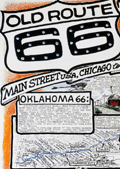 | Details | Waldmire, Robert | 1999 |
| Old Route 66 Pictorial Map Poster Chicago to L.A. 4th Final edition |
|
Waldmire, Robert |
|
| 1999 |
| LOC:300 |
| $140.00 | Waldmire--Robert | Old-Route-66-Pictorial-Map-Poster-Chicago-to-L-A--4th-Final-edition | The "Old Route 66 Main Street U.S.A. Chicago to L.A." poster created by Robert Wildmire is a highly detailed and intricate compilation of maps, historical facts, and drawings related to the famous Route 66 highway that stretches across the U.S. from Chicago to Los Angeles. Includes numerous inset illustrations and larger scale detailed road map fragments. A few of the more unusual locations on the poster, along Route 66 are:<br><br>
<div class="indenttextblocksingle">
<ul style="list-style-type: circle;"></li>
<li>The U-Drop Inn in Shamrock, Texas.</li>
<li>The Blue Swallow Motel in Tucumcari, New Mexico</li>
<li>The Cadillac Ranch, "just West of Amarillo".</li>
</ul>
</div>
First printing 5000 copies, of what Wildmire considered to be the "fourth and final incarnation" of the Route 66 map. According to a note on the poster,
<br><br>
<div class="indenttextblocksingle">"this color map originally appeared in National Parks Magazine (Mar. - Apr. '91). It was subsequently reprinted (in 2 editions, both out-of-print collectibles by now) by Dan Harlow of Rt. 66 Clothing & Goods, by arrangement with the artist."
</div>
<br>
Wildmire explains how this map differs from the three previous editions:<br><br>
<div class="indenttextblocksingle">
"I have added new color drawings & included my set of 8 "66 state postcard strip maps," showing each state's alignment in detail. I have added color to indicate the drivable through stretches (shown in blue) and those stretches on unavoidable Interstate (shown in red). "
</div>
<br>
<div id="0" align="center">
<a title="Baxter Springs"></a>
<img id="3" src="/ZoomifyImages/SC_6682/SC_6682_detail.jpg" alt="Baxter Springs, Kansas. Home of Ruth-anne and Lynn's Biker Bar." width="320"/> <br><small>Drill down view near Baxter Springs, Kansas.</small>
</div><br>
Printed by Frye-Williamson Press Springfield, Illinois Copyright 1999 |
| 6501 | 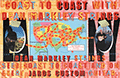 | Details | Anonymous | 2000 |
| Poster and map for Dean Markley Guitar Strings and Jaros Custom Guitars |
|
Anonymous |
|
| 2000 |
| LOC:78 |
| $150.00 | Anonymous | Poster-and-map-for-Dean-Markley-Guitar-Strings-and-Jaros-Custom-Guitars | Unrecorded poster related to a coast-to-coast tour by Jon Butcher and Bruce Gatewood promoting Dean Markley guitar strings and Jaros Custom Guitars ca. 2000. With an inset map of the tour across the United States including photos of Jon and Bruce.
<br><br>
Jaros Guitars was started by the father and son team of Harry and Jim Jaros of Mary Street, Rochester, Pennsylvania in 1996. Dean Markley has produced guitar strings since 1972.
<br><br>
An archived web page about Jaros Custom Guitars from 1999 tells the Jaros story:
<div class="indenttextblocksingle">
"The Jaros Guitar "factory" is a home-based, part-time operation located in the beautiful Pennsylvania countryside. Jim, his wife Patty, and their sons Jason (14), and Taylor (8), live only 100 yards from Jim's folks, Harry and Mary (and coincidentally, Harry's large well-equipped woodshop).The shop is a 30' x 40' pole-barn with 12' ceilings and three work bays." <br> (Dynamic Duo: This father-son team's a good combination. TradeSecrets. Vol. 25. Wayback Machine)
</div> |
| 6581 | 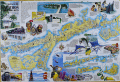 | Details | Mickey, William | 2000 |
| Pictorial map of Marathon and the middle Florida Keys 1st |
|
Mickey, William |
|
| 2000 |
| LOC:130 |
| $250.00 | Mickey--William | Pictorial-map-of-Marathon-and-the-middle-Florida-Keys-1st | Beautifully illustrated and scarce first edition pictorial folding map of the middle Florida Keys including Marathon Key circa 2000. First edition published by William Mickey Art and Design. Map is annotated with names of local businesses.
<br></br>
This original pictorial Map and Guide of Marathon and the Middle Keys is a richly detailed illustrated map of the Florida Keys, centered on Marathon and extending east and west across the Middle Keys. Designed as both a street and harbor guide and a visual souvenir, it presents canals, marinas, bridges, neighborhoods, and waterways alongside bold hand drawn artwork. The combination of practical cartography and colorful illustration makes this map immediately appealing to collectors of Florida Keys maps, Marathon memorabilia, nautical charts, and vintage Florida travel ephemera.<br><br>
The map also serves as an illustrated historical overview of Marathon and its development. Text panels and imagery reference the Calusa Indians, Bahamian fishermen, the arrival of the Overseas Railroad, and the role of Henry Flagler in shaping the Keys as a connected island chain. Historic portraits, early transportation scenes, and descriptive notes provide context for how Marathon evolved from a railroad outpost into one of the largest and most important communities in the Middle Keys. Insets clarify the geography of the islands and emphasize the narrow, linear nature of settlement along the Overseas Highway.<br><br>
Marine life and coastal culture are central to the design, with prominent illustrations of sailfish, marlin, dolphin, reef fish, seabirds, coral, and fishing scenes framing the map. Harbors, channels, beaches, parks, and attractions are clearly labeled, reinforcing the area’s long association with boating, sport fishing, and tourism. |
| 7967 |  | Details | Silicon Maps Inc. | 2001 |
| Silicon Desert 2001 Arizona High-Tech Industry Map and Calendar |
|
Silicon Maps Inc. |
|
| 2001 |
| LOC:52 |
| $0.00 | Silicon-Maps-Inc- | Silicon-Desert-2001-Arizona-High-Tech-Industry-Map-and-Calendar | SOLD<br><br>A scarce 2001 “Silicon Desert” map celebrates Arizona’s emergence as a major technology and semiconductor hub at the dawn of the 21st century. Produced by Silicon Maps Inc. of San Ramon, California, the illustrated map depicts the Phoenix–Tempe–Chandler corridor and Tucson as thriving centers of high-tech industry.
<br><br>
<div id="0" align="center">
<a title=""></a>
<img id="7967" src="/ZoomifyImages/SC_7967/SC_7967_400x300.jpg" alt="Map of Silicon Desert, the Arizona High-Tech Industry Map and Calendar from 2001" width="300"/> <br> <br> <font size="-2">Map of Silicon Desert. Arizona High-Tech Corridor. 2001.</font size.><br><br>
</div>
Dozens of company logos are arranged across a stylized desert landscape featuring Arizona landmarks such as the Grand Canyon, Meteor Crater, and Biosphere II. Major firms including Intel, Motorola, Microchip, ON Semiconductor, Raytheon, and Intuit highlight the state’s strength in electronics, aerospace, software, and defense manufacturing.
<br><br>
Designed as both a promotional artifact and a functional 2001 calendar, the map was sponsored by ON Semiconductor, whose tagline—“Leaders in Broadband and Power Management Solutions”—appears below. The term “Silicon Desert,” echoing “Silicon Valley,” symbolized Arizona’s transition from a resource-based economy to one driven by innovation, research, and technology production. Today, this map stands as a vivid time capsule of Arizona’s booming tech sector at the turn of the millennium, capturing the optimism and industrial energy that defined the era.
<br><br> |
| 8078 |  | Details | Anonymous | 2002 |
| Map of Locations of UFO Sightings in Southwest USA |
|
Anonymous |
|
| 2002 |
| LOC: |
| $0.00 | Anonymous | Map-of-Locations-of-UFO-Sightings-in-Southwest-USA | SOLD<br><br>A boldly graphic, unrecorded, early 21st century persuasive popular culture map titled Map of Locations of UFO Sightings, presenting reported unidentified flying object activity across the southwestern United States. The composition centers on a stylized regional map of the Southwest United States marked with prominent red X symbols indicating areas of concentrated sightings, accompanied by dramatic illustrations of flying saucers, extraterrestrial figures, and cosmic imagery. Prominent geographic references include California, Nevada, Arizona, Utah, Colorado, and New Mexico, with special emphasis on Roswell, reinforcing the enduring mythology surrounding alleged crash sites and government secrecy.<br><br>
Supplementary text panels frame this small map with sensational claims, eyewitness accounts, and references to U.S. Air Force investigations from 1947 to 1996, blending selective historical facts with speculative narrative. Additional vignettes along the lower margin document specific reported sightings from 2002 in California, Florida, Wisconsin, and New York, grounding the imagery in contemporary anecdote. Overall, the piece functions less as a scientific record than as a vivid artifact of modern UFO folklore, Cold War anxiety, and mass-media driven belief, reflecting how cartographic form is used to lend authority and visual coherence to conspiracy culture. |
| 562 | 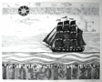 | Details | Lochtefeld, John | 2005 |
| Far Side of The Sea |
|
Lochtefeld, John |
|
| 2005 |
| LOC:0 |
| $0.00 | Lochtefeld--John | Far-Side-of-The-Sea | SOLD<br><br/>Late 20th or 21st century black and white etching "Far Side of the Sea" by John Lochtefeld. Signed in pencil by the author.<br><br/>
Lochtefeld operates a studio and gallery on the island of Nantucket where he has worked since 1969. Lochtefeld's work is influenced by the architecture, nature and history of Nantucket. <br><br/>
Matted and framed. Size with frame is 26" W x 21" H. Number 110 from a series of 200 copies. |
| 563 |  | Details | Lochtefeld, John | 2005 |
| Moon Watch |
|
Lochtefeld, John |
|
| 2005 |
| LOC:0 |
| $0.00 | Lochtefeld--John | Moon-Watch | SOLD<br><br/>Original late 20th or 21st century monochrome serigraph etching "moon Watch" by John F. Lochtefeld. Signed by the author in pencil. <br><br/>
Lochtefeld operates a studio and gallery on the island of Nantucket where he has worked since 1969. Lochtefeld's work is influenced by the architecture, nature and history of Nantucket. <br><br/>
Matted. Number 89 from a series of 100 copies. |
| 564 |  | Details | Lochtefeld, John | 2005 |
| The Whale Fishery |
|
Lochtefeld, John |
|
| 2005 |
| LOC:0 |
| $0.00 | Lochtefeld--John | The-Whale-Fishery | SOLD<BR> </BR>
Original late 20th or 21st century monochrome serigraph etching by John F. Lochtefeld titled "The Whale Fishery". Signed by the author in pencil. <br><br/>
Lochtefeld operates a studio and gallery on the island of Nantucket where he has worked since 1969. Lochtefeld's work is influenced by the architecture, nature and history of Nantucket. <br><br/>
Matted. Number 30 from a series of 50 copies. |
| 6327 |  | Details | Trudeau, Garry B. | 2005 |
| Signed Key West poster by cartoonist Garry Trudeau |
|
Trudeau, Garry B. |
|
| 2005 |
| LOC:87 |
| $355.00 | Trudeau--Garry-B- | Signed-Key-West-poster-by-cartoonist-Garry-Trudeau | Rare limited edition poster by Doonesbury cartoonist Garry Trudeau (1948 - ) promoting the 23rd Annual Key West Literary Seminar, Humor: January 6 - 16, 2005. Number 58 of 100 issued. Signed and numbered by Trudeau.
<br></br>
In 1975 Garry Trudeau became the first comic strip artist to win a Pulitzer Prize, an honor usually awarded to editorial page cartoonists. |
| 6784 |  | Details | Silicon Maps Inc. and Trestria Inc. | 2008 |
| 2008 Pictorial Calendar Map of Silicon Valley California |
|
Silicon Maps Inc. and Trestria Inc. |
|
| 2008 |
| LOC:11111 |
| $600.00 | Silicon-Maps-Inc--and-Trestria-Inc- | 2008-Pictorial-Calendar-Map-of-Silicon-Valley-California | Scarce "Classic Edition" Silicon Valley map and calendar copyrighted 2008 by Silicon Maps Inc. and Testria, Inc. Sponsored by Citrix, 4988 Great America Parkway, Santa Clara, California. Glossy finish as issued. |