| | Thumbnail | | Creator | Date | Title / Author / Date / Location | Price | | | Description |
| 6618 | 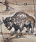 | Details | Holm, Bill | 1965 |
| Old West style pictorial map of the Permian Basin Texas New Mexico |
|
Holm, Bill |
|
| 1965 |
| LOC:89 |
| $350.00 | Holm--Bill | Old-West-style-pictorial-map-of-the-Permian-Basin-Texas-New-Mexico | Original Old-West-style pictorial map of the Permian Basin, Texas and New Mexico, created by Bill Holm and copyrighted circa 1965. This scarce pictorial map was compiled by the Permian Basin Chamber of Commerce Tourist Committee and published by Holm and West Texas Office Supply. The map retains the graphic and illustrative character typical of promotional region maps from the mid-20th century and was originally issued as part of an eight-panel folding brochure titled Ride the Permian Basin, The Official Guide to the History Lands of the Southwest. <br><br>
The map is centered on Odessa, Texas, and extends across the Permian Basin region of West Texas and southeastern New Mexico. It shows towns, roads, highways, and trails, along with pictorial figures and symbols representing Native Americans, buffalo, cowboys, and topographic features such as mesas and escarpments. A legend at right includes historic and overland routes such as the California Trail, overland stage paths, and the Comanche war trail. Named locations include Big Spring, Fort Lancaster, Midland, Fort Stockton, the McDonald Observatory, Guadalupe Peak, Carlsberg Caverns State Park, the Llano Estacado, and Castle Gap. <br><br>
This pictorial map is of interest to collectors of Western Americana, historical travel ephemera, and regional cultural cartography due to its representation of mid-20th century tourism promotion and its depiction of historic routes and landmarks in the Permian Basin. The original brochure format and illustrative style reflect local efforts to interpret and market the history and geography of the American Southwest during the 1960s. |