| | Thumbnail | | Creator | Date | Title / Author / Date / Location | Price | | | Description |
| 6614 | 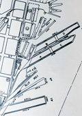 | Details | San Francisco Harbor Commission Board | 1940 |
| Detailed Map of San Francisco Waterfront 1940 |
|
San Francisco Harbor Commission Board |
|
| 1940 |
| LOC:1403 |
| $650.00 | San-Francisco-Harbor-Commission-Board | Detailed-Map-of-San-Francisco-Waterfront-1940 | A 55 inch long detailed planning map of the Harbor of San Francisco, California dated 1940. Produced by the Board of State Harbor Commissioners for San Francisco Harbor, Frank White, Chief Engineer. Rare.
<div><img src="/ZoomifyImages/SC_6614/SC_6614_title_detail.jpg" alt="Close-up detail from the title of the Map of the Waterfront of San Francisco 1940 by SF Harbor Commissioners" width="300" align="center" style="margin: 20px 0px 20px 20px"/>
</div>
Documents harbor development in 1940 in minute detail. Coverage sweeps along San Francisco Bay from the South Basin westward and then northward past the Aquatic Park and Fort Mason. Delineates the extent of both the pier head line and the waterfront line. Details each wharf and shows measurements of every space along the waterfront with pier lengths and pier slip widths as well as the very extensive railroad yards and rail lines connected to each dock. Most of these railroad tracks do not exist today.<div><img src="/ZoomifyImages/SC_6614/SC_6614_wharf_detail.jpg" alt="Close-up detail of the waterfront piers near Fisherman's Wharf in San Francisco, California in 1940." width="300" align="center" style="margin: 20px 0px 20px 20px"/>
</div>
Photo-lithograph on a 55" long rolled sheet of thin translucent paper. |