| | Thumbnail | | Creator | Date | Title / Author / Date / Location | Price | | | Description |
| 5339 | 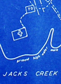 | Details | Somberg, Seymour I. | 1950 |
| Blueprint plat map of Cedar Grove Plantation St. Paul South Carolina |
|
Somberg, Seymour I. |
|
| 1950 |
| LOC:1401 |
| $900.00 | Somberg--Seymour-I- | Blueprint-plat-map-of-Cedar-Grove-Plantation-St--Paul-South-Carolina | Unrecorded blueprint or cyanotype plat map of <b>Cedar Grove Plantation</b> or Smythe Plantation, <b>St. Paul / Summerton, South Carolina</b> in Clarendon County with Robert Adger Smythe (1871-1962) , Manager. The blueprint was created ca. 1950 and signed by Seymour. I. Samberg L.S. (Land Surveyor) with property lines taken from an earlier plat by Bushner and Rutledge dated May 30, 1914. North oriented to lower left.
<br></br>
Robert Adger Smythe was born in Charleston, S.C. in 1871 and graduated from the Citadel in 1890. He founded the Lambda Chapter fraternity at the Citadel. Smythe spent most of his business years in cotton brokerage in Atlanta. Robert Smythe did not live at Cedar Grove, but visited often, conducting his business through manager Joe. H. King.
<br></br>
The earliest record of Cedar Grove Plantation dates to 1796 when Jack Lawson laid out a plantation of 2,160 acres between Jack's Creek and Taw-Caw. In the mid-1800's the plantation had grown to over 5,000 acres.
Nearby features on this plat map include Jack's Creek, Highway 15, Manning Turnpike, Lake Marion, Nelson's Ferry Road, and St. Paul.
<br></br>
Legend at bottom right includes the signature of Seymour Somberg. In 1953 Seymour I. Somberg was listed as President of Forestry Aids (forestry - surveying) in Manning, South Carolina. [1]
<br></br>
[1] Eller, Robert C. ed. Surveying and Mapping. Volume XIII, No. 1 January - March, 1953. p. 252. (Online) |