| | Thumbnail | | Creator | Date | Title / Author / Date / Location | Price | | | Description |
| 6706 | 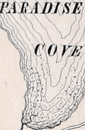 | Details | Taylor, H. E. | 1881 |
| Manuscript topographic map of Roque Island Archipelago, Maine |
|
Taylor, H. E. |
|
| 1881 |
| LOC:9999999 |
| $0.00 | Taylor--H--E- | Manuscript-topographic-map-of-Roque-Island-Archipelago--Maine | SOLD<br><br>
An unrecorded finely-executed pen and ink manuscript map of Roque Island, Maine by surveyor H.E. Taylor of Machias, Maine. A presentation-quality survey with careful lettering and light wash hand-color laid to linen and edged with red selvage.
<br><br>
The survey was probably commissioned by Gilbert Longfellow (1), as it credits assistance from H.W. Longfellow, who was most likely Henry, Gilbert's son. Additionally, the map was made less than a year before the Longfellow family sold Roque Island to the Gardner family. Numerous features are noted including:
<div class="indenttextblocksingle">
<ul style="list-style-type: circle;"></li>
<li>the "old tide mill dam"</li>
<li>"old camp , shell heaps" on Romney Point</li>
<li>"Inspiration Point"</li>
<li>"burial ground"</li>
<li>"Devil's stairway"</li>
<li>"Clam Cove</li>
<li>"Great Beach"</li>
<li>"Roaring Cavern"</li>
<li>"Indian Landing"</li>
</ul>
</div>
This is the earliest large-scale map of the Roque Island Archipelago I have been able to locate. No holdings of this map are recorded in WorldCat or elsewhere online. At Harvard there is another similar map by Taylor from 1881- "Longfellows Island (formerly Shorey's): with adjacent islands and part of Englishmans River Neck".
<br><br>
Note: The full title of the Roque Island map is: "Topographical Map of Roque Island, Maine area 1274 acres and including barred islands 1309.3 acres Surveyed August 1881 with assistance of H.W. Longfellow & J. U. Chandler. By H. E. Taylor Civil Engineer and Surveyor."
<br><br> |