| | Thumbnail | | Creator | Date | Title / Author / Date / Location | Price | | | Description |
| 6589 | 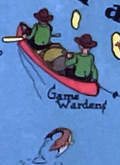 | Details | W. A. Fisher Company | 1936 |
| Pictorial map of Kabetogama Lake Minnesota |
|
W. A. Fisher Company |
|
| 1936 |
| LOC:59 |
| $325.00 | W--A--Fisher-Company | Pictorial-map-of-Kabetogama-Lake-Minnesota | Scarce original pictorial map of Kabetogama Lake, Minnesota. Kabetogama means "rough waters" in Chippewa. Created by Frank M. Antoncich. Published by the W. A. Fisher Company, Virginia, Minnesota. Date of 1936 from the example in the Rumsey Collection. Price when issued was 25 cents.
<br><br>
Along with and cute cartographs including bears and Native Americans the map is filled with useful navigational information and historical facts. Portages, trails and roads are laid out. Many canoes.
<br><br>
Notes and observations about the area include:<br>
<div class="indenttextblocksingle">
<ul style="list-style-type: circle;"></li>
<li>an "Indian Village",</li>
<li>"Funeral Island Burial Ground"</li>
<li>the "Yates Resort",</li>
<li>"Mrs. McCaw- first white woman and homestead here",</li>
<li>"Good duck hunting", and</li>
<li>"Impassable in low water".</li>
</ul>
</div> |