| | Thumbnail | | Creator | Date | Title / Author / Date / Location | Price | | | Description |
| 5394 |  | Details | Whitney, William H. | 1890 |
| Historical map of Watertown |
|
Whitney, William H. |
|
| 1890 |
| LOC: |
| | Whitney--William-H- | Historical-map-of-Watertown | A lot of three (3) artifacts related to William Whitney's unpublished historical map of Watertown.
1) Blueprint map and MS ownership notes after Henry Bond.
2) Blueprint
3) Surveyor's trace "Whitney's Watertown Historical Map" 1000' = 1"
In 1751 Henry Bond published his <strong> Map of the original allotments of land and the ancient topography of Watertown (proper) [1]</strong> Ownership on Whitney's map matches Bond's map but Whitney notes only a fraction of the total of the place names Bond documented. |
| 6814 | 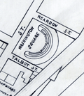 | Details | Whitney, William H. | 1905 |
| Manuscript engineers trace map of Cambridgeport Massachusetts |
|
Whitney, William H. |
|
| 1905 |
| LOC: |
| $500.00 | Whitney--William-H- | Manuscript-engineers-trace-map-of-Cambridgeport-Massachusetts | Original manuscript trace map by the civil engineering firm of William H. Whitey, Boston. A traced pen and ink map on tracing cloth of an area in Cambridgeport, Massachusetts bounded by the Charles River to the south and Erie Street to the North and from Magazine Street at the west to roughly where Briggs Field now stands. This manuscript trace would have been used to create numerous blueprint copies for Whitney's clients. Whitney was a very early adopter of blueprinting to support his map-making and design business.
<br><br>
The map shows the location of the Boston University Bridge across the Charles River then under construction as well as the proposed location for an additional bridge downstream.
<br><br>
Includes Washington Square, a soap works of J. Reardon and Sons, Hastings Square, Morse School, Captain's Island Playground, Baptist home, and Lammson Memorial Building. By William H. Whitney, Boston Civil Engineer. |